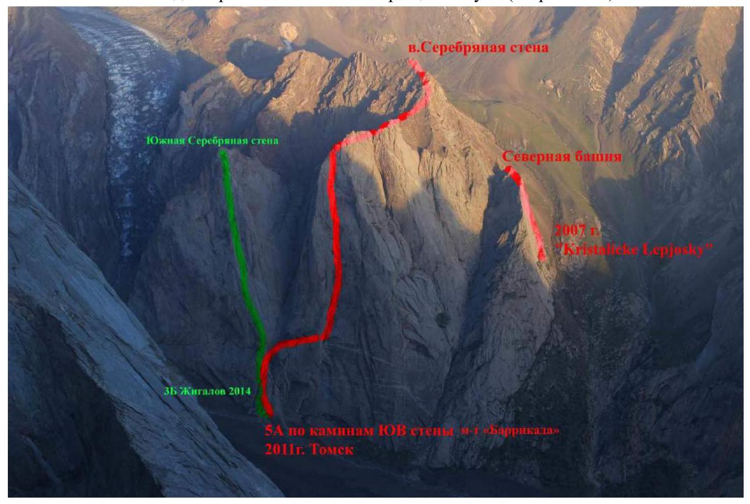
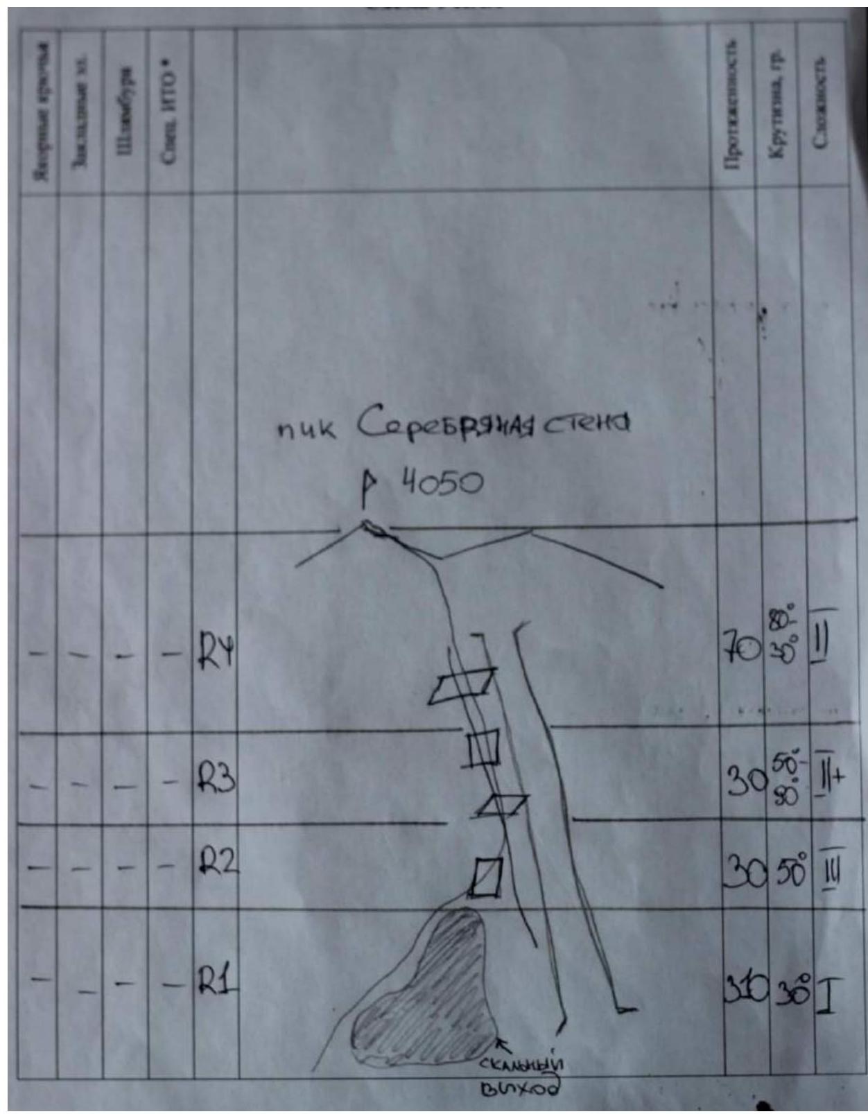
Peak Serebryanaya стена
4050 m.
REPORT
of the Tomsk region team (TFA) on the ascent to Peak Serebryanaya стена via the western slope. "1B", (sc)
Participants:
Temerev I.M., Kopytov F.A.
Nadymova A.I., Temereva E.O., Terekhin V.A.
ASCENT DOCUMENTATION:
-
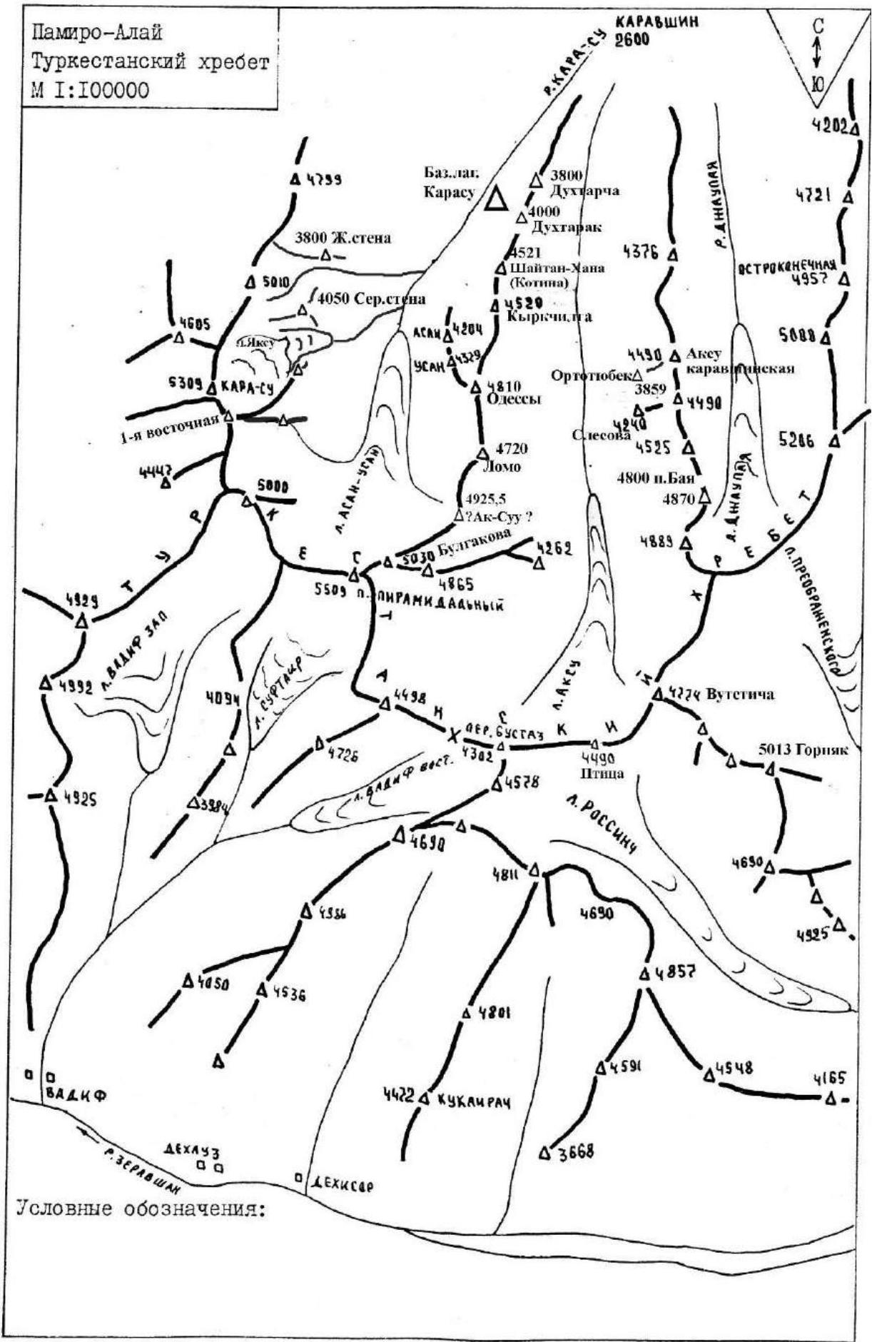
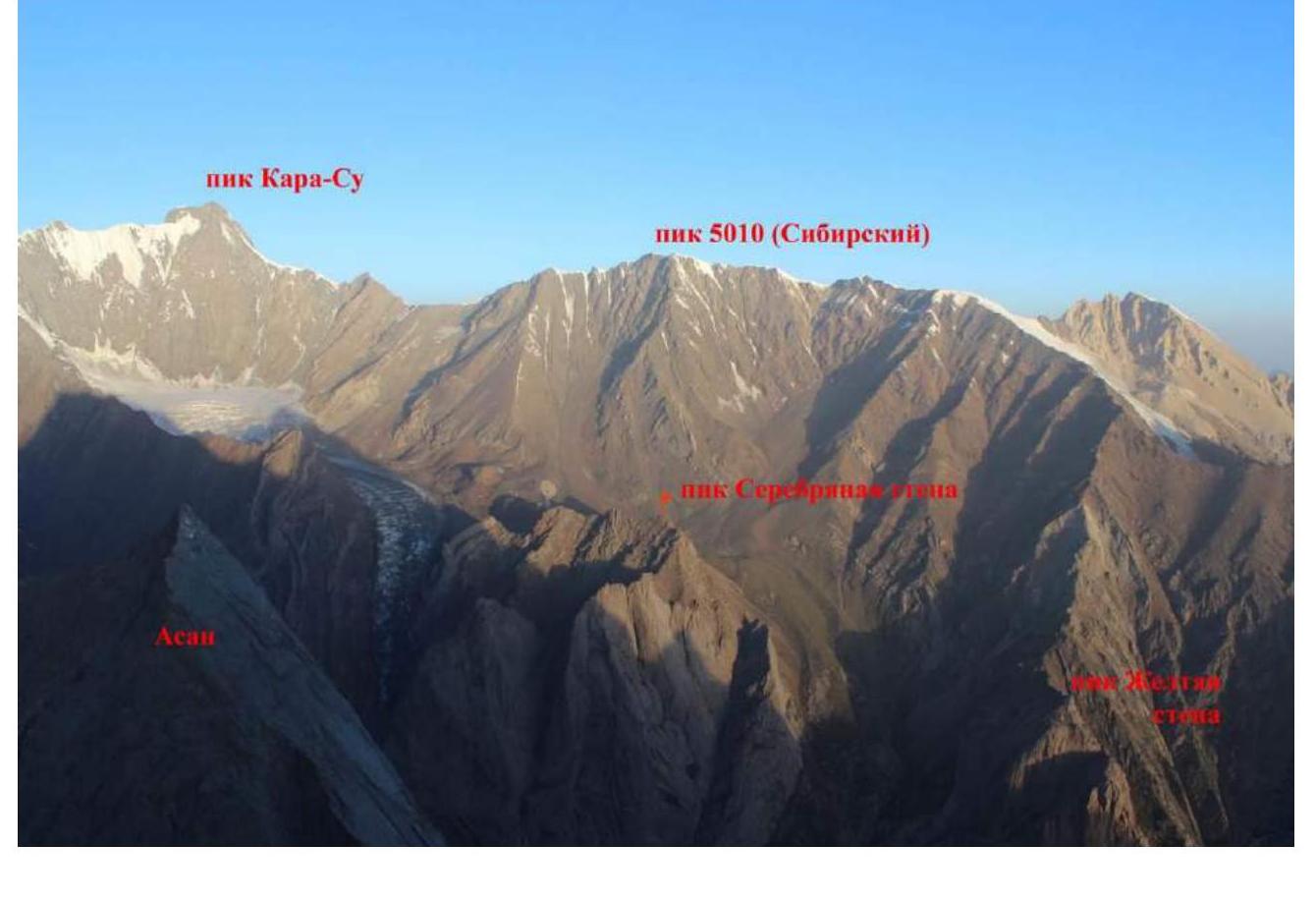
Kyrgyzstan, Pamir-Alay, Karavshin gorge (Kara-Su river valley), 5.4.3.
-
Peak Serebryanaya стена, via the western slope.
-
Proposed category: 1B.
-
Route type: rock climbing.
-
Height difference of the route — 250 m.
Total route length — 420 m. Length of sections:
- category I — 310 m.
- category II — 100 m.
- category III — 30 m.
- Average steepness — 27°
-
Pitons used on the route:
- pitons — 0 pcs;
- protection gear — 0 pcs.
-
Team's climbing hours: 2 hours, 1 day.
-
Leader:
- Temerev Ivan Mikhailovich – MS
Participants:
- Terekhin Vasily Andreevich – MS
- Kopytov Fedor Alexandrovich – MS
- Nadymova Anastasia Igorevna – CMS
- Temereva Elena Olegovna – 2nd sports category
-
Departure from the bivouac under Peak Serebryanaya стена (near the upper destroyed kosh):
15:40, July 22, 2014.
Summit arrival: 17:40, August 22, 2014.
-
Organization: MROO "Tomsk Alpine Federation".
-
Report responsible: Temerev I.M.
E-mail: ivantem@ngs.ru, skype: ivantem1979, phone: 9528823151, 9138480559.
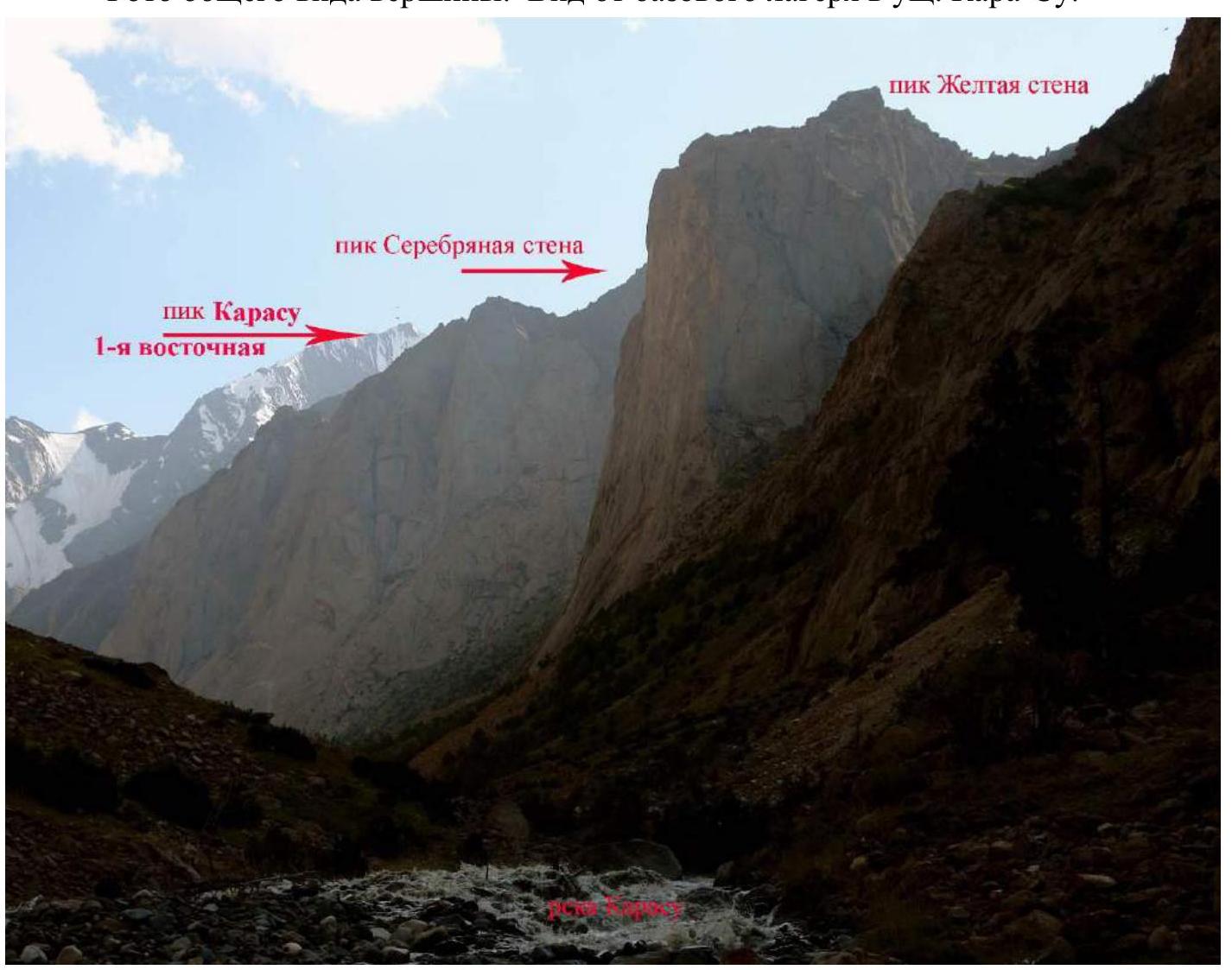
General view of the summit. View from the base camp in the Kara-Su gorge.
View from the summit of 1000-летия Крещения Руси (KyrchilTy).
View from the summit of 1000-летия Крещения Руси (KyrkchilTy).
View from the eastern ridge of Peak 5010 (Sibirsky).
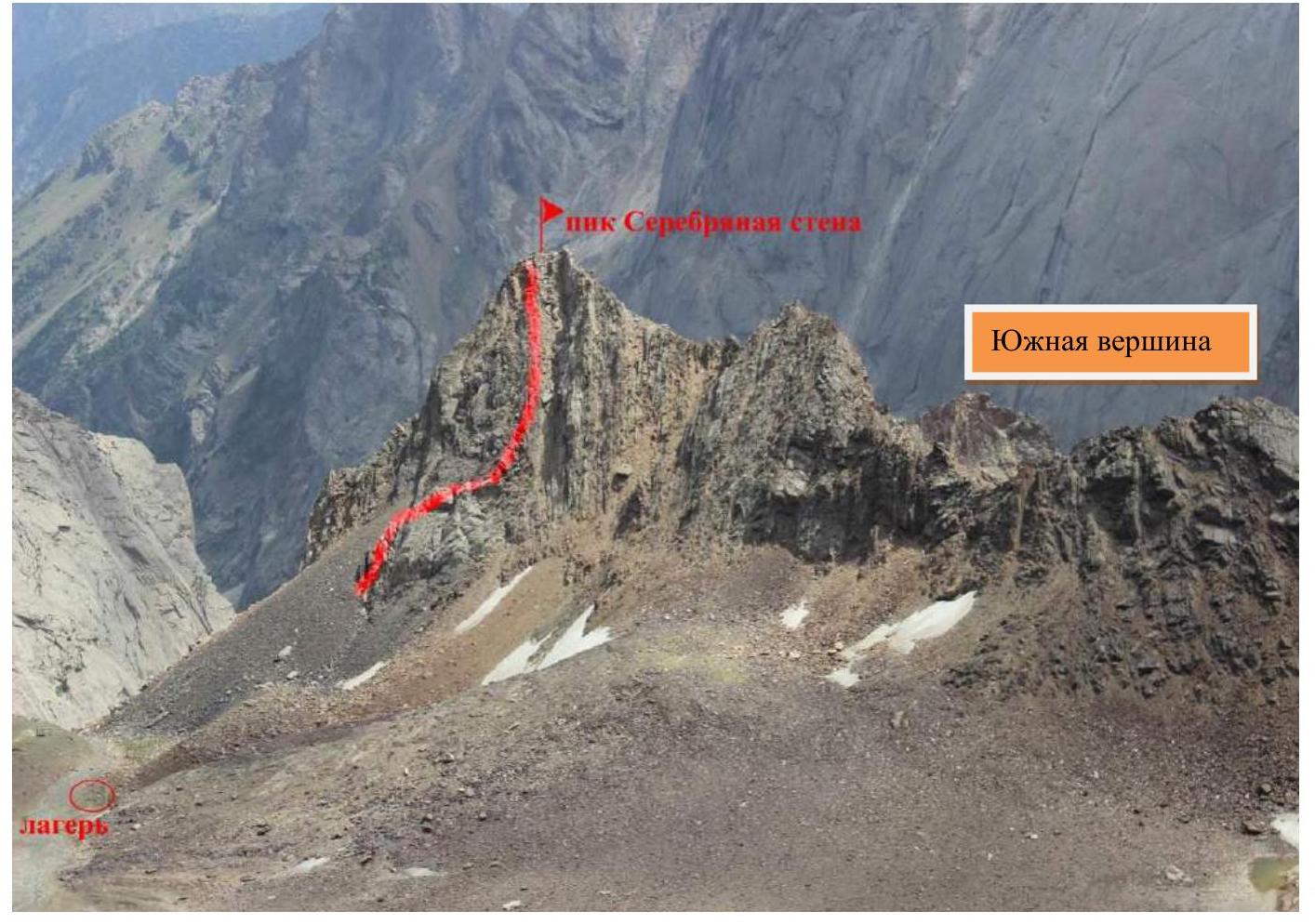
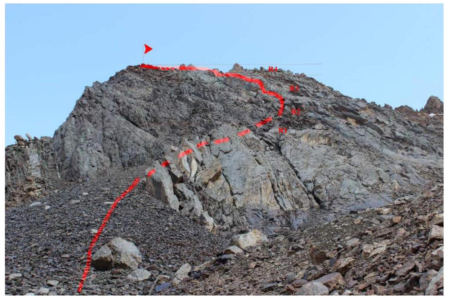
Ascent route diagram in UIAA symbols
Route description by sections
From the site near the destroyed kosh under the slopes of Peak Serebryanaya стена at an altitude of approximately 3700 m, move forward along the western slope of Peak Serebryanaya стена towards the rock massif. Go around it from the left and move along the logical path up and to the right. The scree slope is interspersed with small gentle rock walls:
- 2+, 3
Reach the destroyed ridge and ascend to the summit by simultaneous climbing.
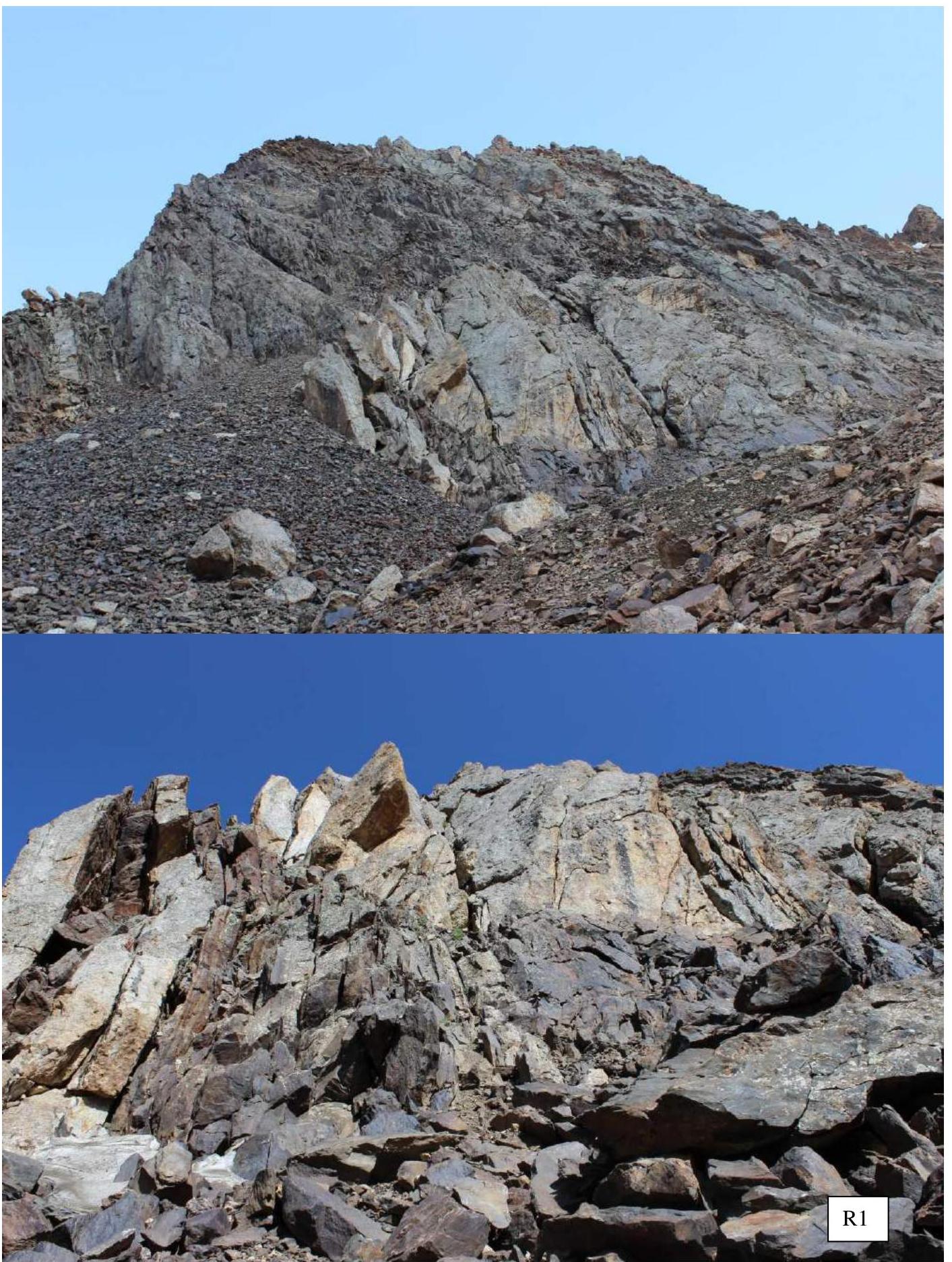
- R1 310 m, 1, 30° To the left of the rock outcrop.
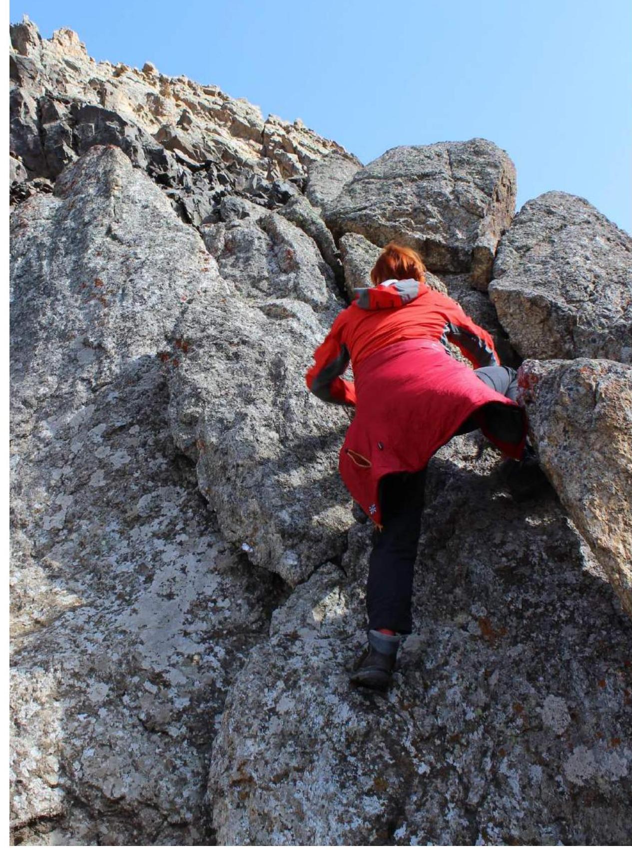
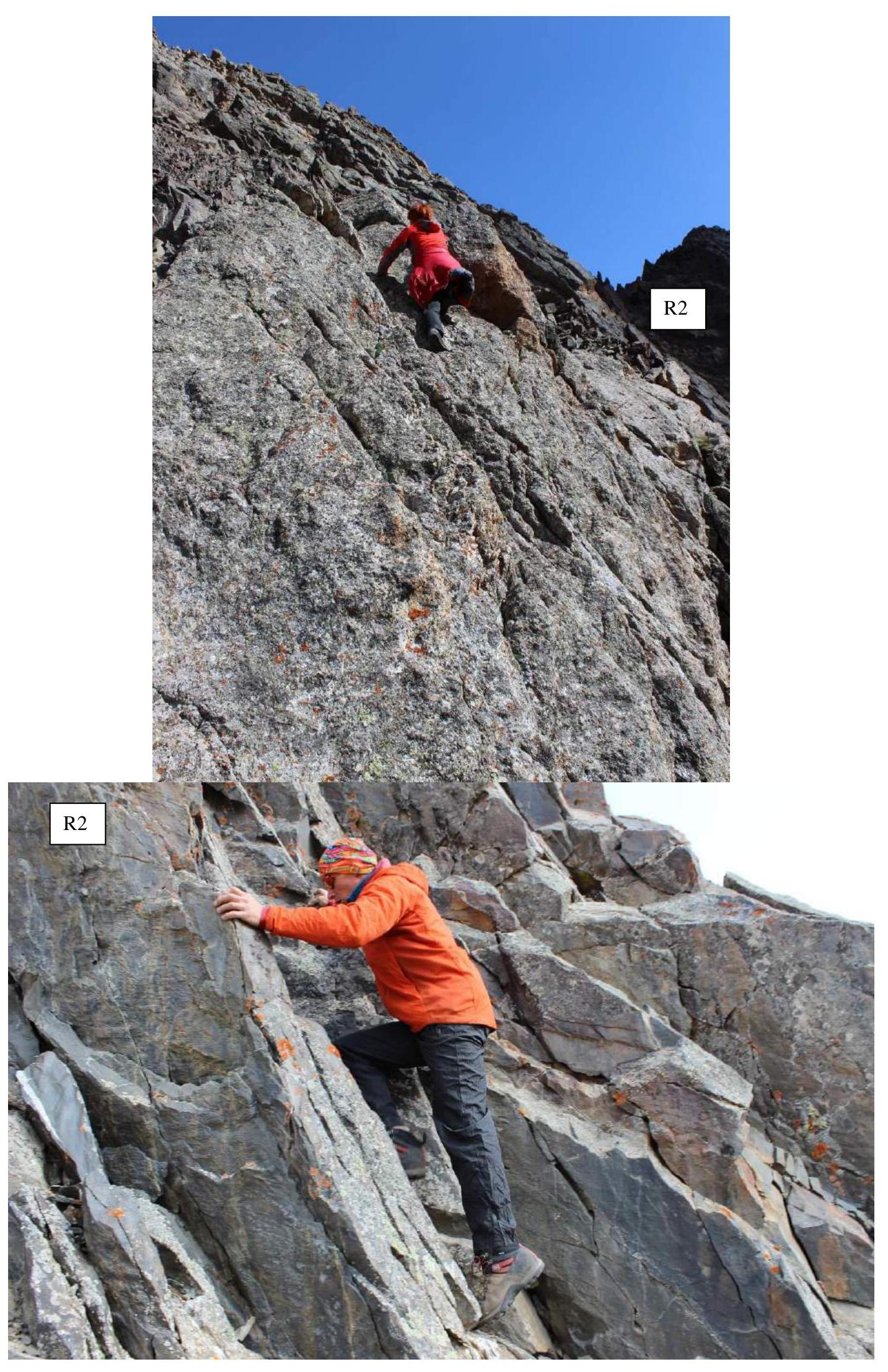
- R2 30 m, 3, 50° Rock wall.
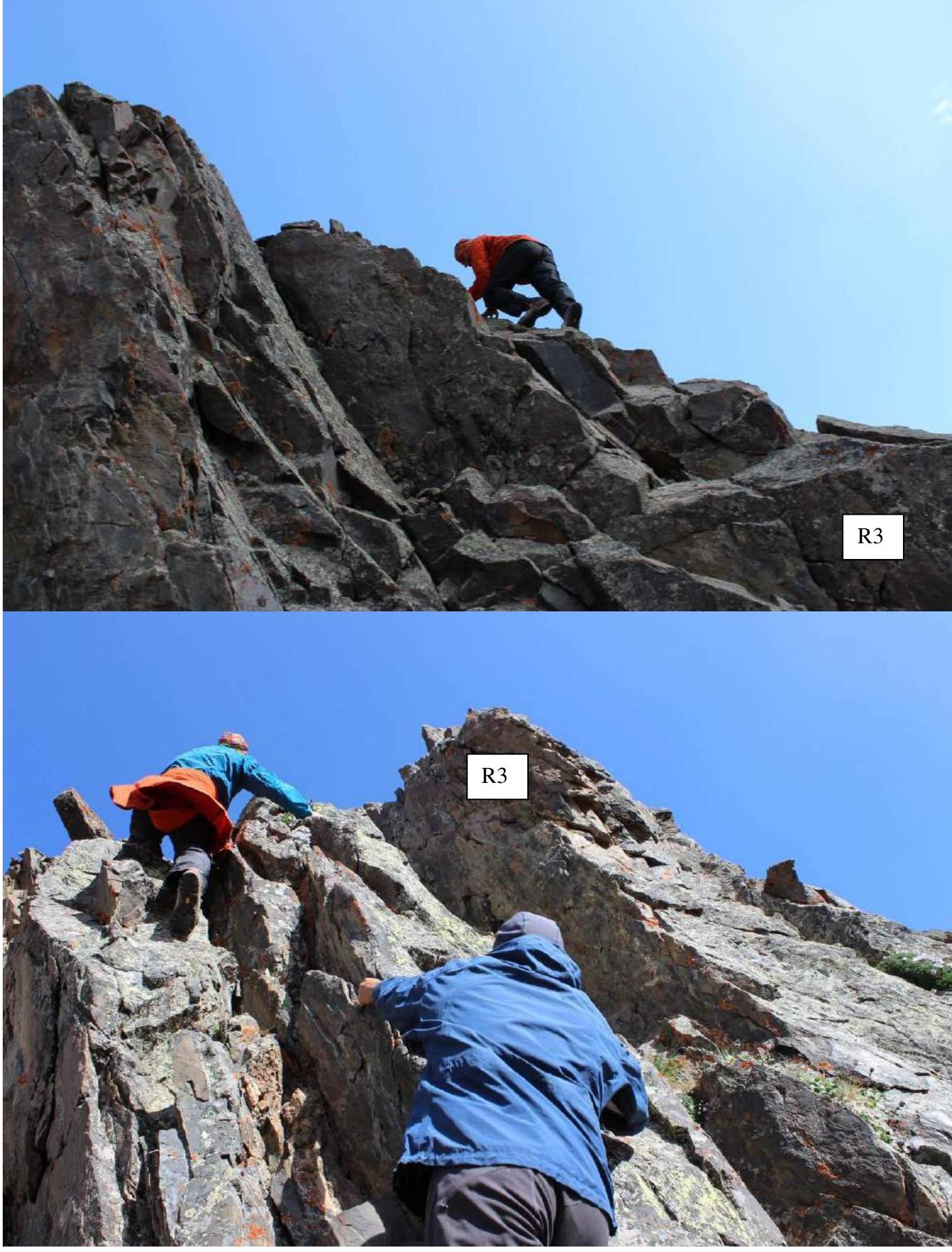
- R3 30 m, 2+, 50–90° Rock wall.
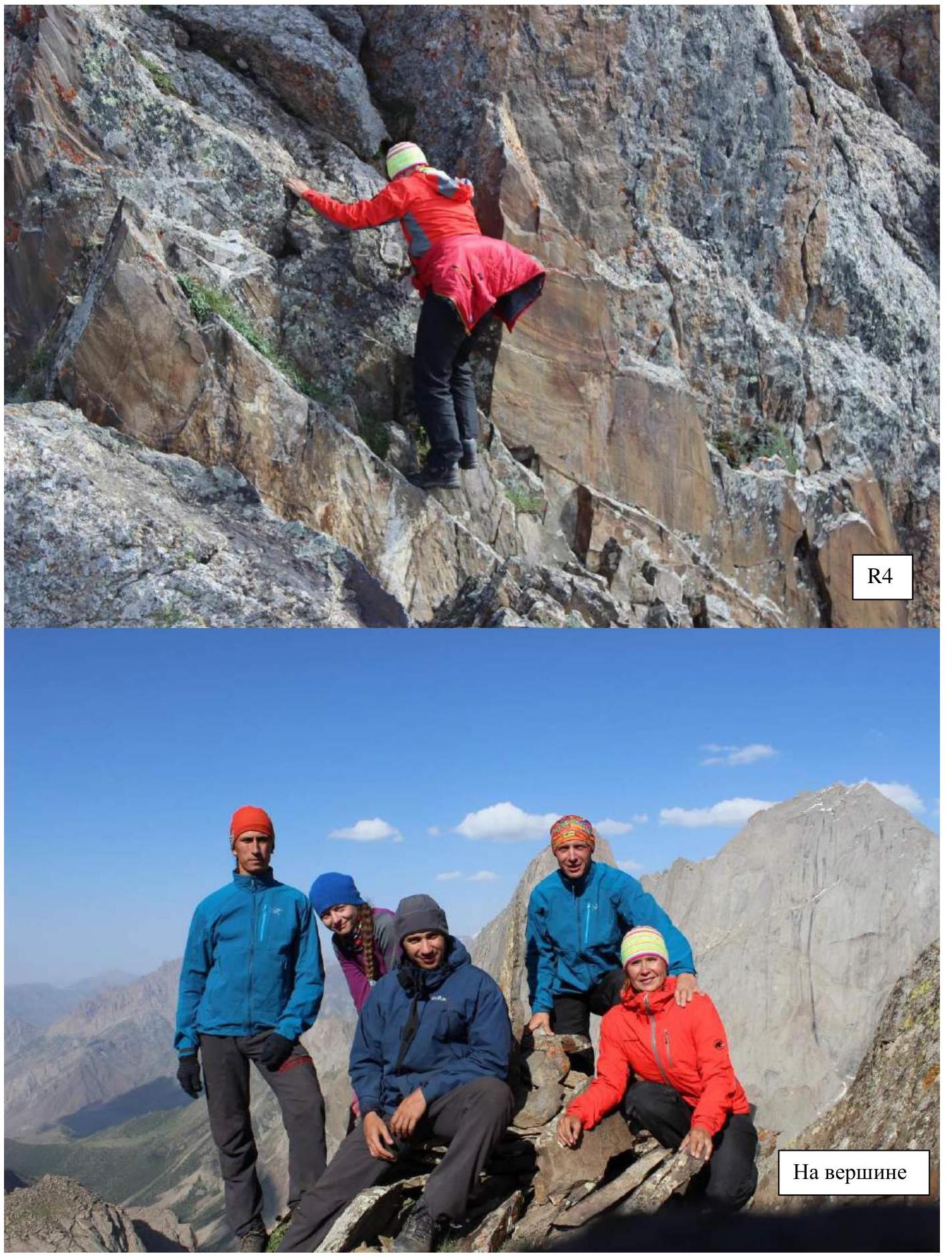
- R4 70 m, 2, 80–30° Rock wall, ridge.
Route thread.
Photographs of route sections.
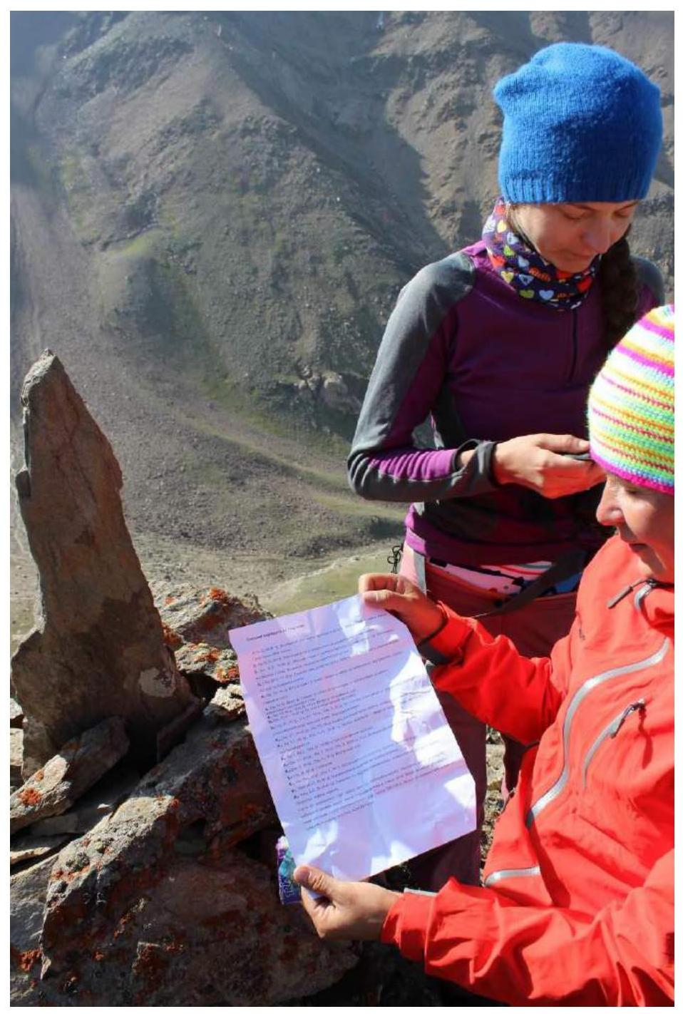
Photograph of the note in the summit cairn (sheet describing sections 5A Temerev "Barrikada")