- Class — technical.
- Pamir-Alai, Turkestan Ridge, Kara-Su gorge.
- Peak 5030 m, via North-Eastern ridge, combined.
- Proposed — 4B category of difficulty, first ascent.
- Height difference — 1270 m, length 1672 m, length of sections 5 — 120 m, average steepness — 50°.
- Pitons driven: rock 4, ice 6, chocks 39.
- Climbing hours — 26, days — 2.
- Overnight stops — I, on the ridge, lying down.
- Leader: Tengiz Aleksandrovich Verulashvili, 1st sports category. Participants:
- Valery Anatolyevich Bogomolov, 1st sports category.
- Viktor Ivanovich Mikhailov, Candidate for Master of Sports.
- Oleg Nikolayevich Fomin, 1st sports category.
- Coach: Yuri Iosifovich Beilin, Master of Sports.
- Departure on the route: June 22, 1988, summit: June 23, return: June 23.
PHOTO OF THE GENERAL VIEW OF THE SUMMIT.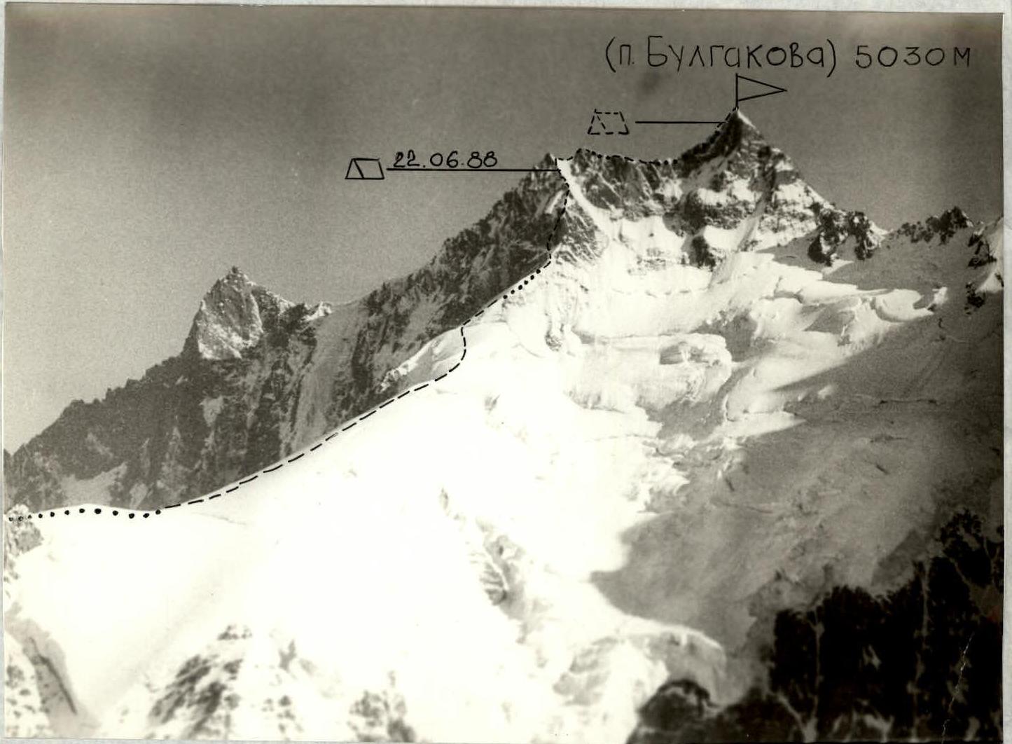
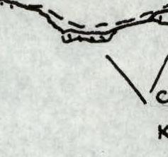
Conventional symbols:
- path of ascent/descent
- overnight stay location
- possible overnight stay locations
Pamir-Alai, Turkestan Ridge M 1:100000
(Bulgakov Peak) 5030 m
| Rock | chocks | ice | ||
|---|---|---|---|---|
| 4 | 39 | 6 | 6 | |
| SNOW CORNICE | ||||
| R6 400 m, 3–4, 45°–50° | 5 | |||
 | ||||
| R5 90 m, 4, 50° | 4 | |||
| 2 | 3 | 2 | ||
| R4 45 m, 3–4, 50° | 3 | |||
| R3 120 m, 1–2, 60° | ||||
| 2 | 25 | 1 | 2 | |
 | ||||
 | 1 | |||
| 5 |  R1 300 m, 3, 50° R1 300 m, 3, 50° |
Description of the approach to the route
Having left the base camp (Kara-Su gorge), walk up the gorge. The trail then leads to the moraine of the Asan-Usan glacier. Moving along the left side (in the direction of travel) of the moraine, approach the steep snowy slope that leads to the saddle between Peak 4925 m and Peak 5030 m.
Explanation for the UIAA scheme
R0–R1 — Steep snowy slope (ice is possible), with ruined rocks at the top, leading to the saddle.
R1–R2 — Bypass the gendarme on the left via large scree and reach the snowy ridge. Along the ridge (snow cornices!), approach the steep ice-snow slope, which abuts a rocky wall intersected by vertical chimneys. Traverse left and upwards along the slope to the start of a narrow rocky couloir, with ice at its base.
R2–R3 — On the right wall of the couloir is a ledge — a belay stance. From the ledge, go up under a cornice, bypassing it on the left, entering a wide chimney (possible ice accretion). The rocks in the chimney are very ruined. Then go up the inner corner to a snowy slope.
R3–R4 — Up the snowy slope towards an inclined rocky slab. On it — a belay stance.
R4–R5 — From the slab, move upwards, leaving a steep rocky wall on the left. Then along the ridge to the overnight stay location. From the start of the route — 16 hours.
R5–R6 — Reach the col and along the ridge, which is a combination of snow and rocks, approach the summit tower. The summit is reached via a 5-meter wall. From the overnight stay — 1.5–2 hours.
As the first ascenders, they named the peak after the Soviet writer M.A. Bulgakov.