Russian Mountaineering Championship
High-altitude technical class
Report
On the ascent of the St. Petersburg team to Peak Odessa (4810 m) via the "Mirror" of the West Face, Rusyaev's route, variant, 6B category of difficulty. Coaches: Odintsov Alexander Nikolaevich, Smirnov Victor Valerievich, Timoshenko Tatiana Ivanovna
St. Petersburg, 2019. Ascent passport
- Region 7.5.2 Karavshin Valley
- Odessa, 4810 m, via the "Mirror" of the West Face
- 6B category of difficulty
- Route type: rock
- Route elevation gain: 1160 m, route length: 1510 m, length of sections with V category of difficulty: 245 m; length of sections with VI category of difficulty: 835 m; distance covered using Intermediate Technical Obstacles (ITO): 200 m.
average route steepness: 66°, average steepness of the wall section: 74°
- Use of protection points:
Total (including for ITO) anchor pitons 53 / 12, camalots 158 / 26, previous climbers' pitons and bolts 25 / 7. No equipment was left on the route.
- Team's total climbing hours: 30
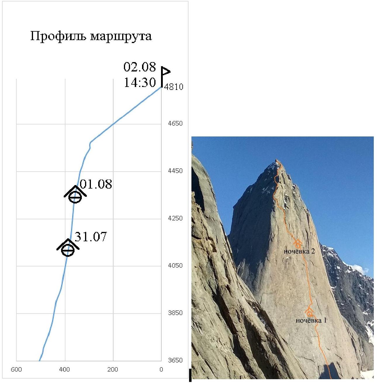
days: 3. Departure for the route: July 30, 2019. Summit ascent: August 2, 2019. All nights spent on comfortable ledges in a tent. Descent to base camp: August 3, 2019, 1:00 AM
- Team leader:
Penyaev Ilya Nikolaevich CMS. Participant: Matinyan Artur Armenovich CMS
- Coaches:
Odintsov Alexander Nikolaevich MSMS, Smirnov Victor Valerievich MS, Timoshenko Tatiana Ivanovna MS
General summit photo

Route profile
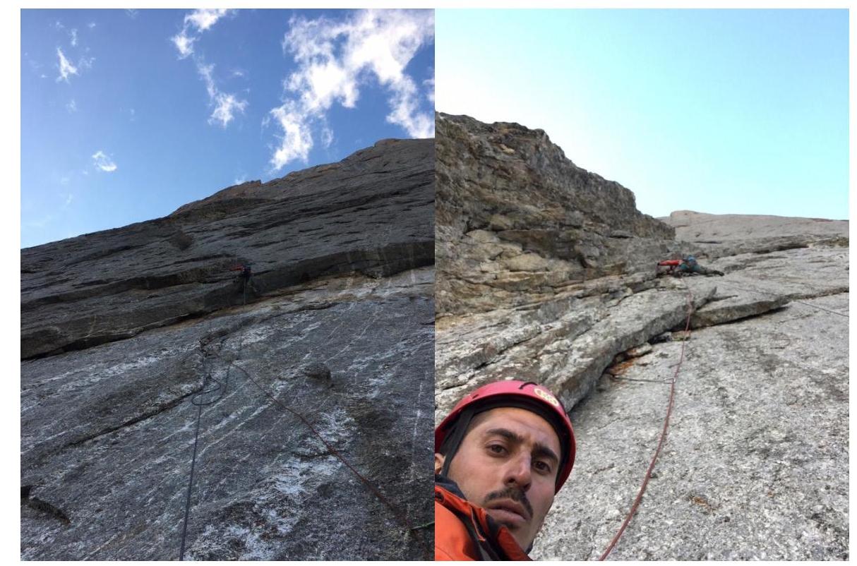
Start of the route photo
Characteristics of the team's actions
This route was chosen for several reasons:
- It is logical and follows the terrain.
- Minimal movement on IBE by "holes".
- Rarely climbed in recent years.
- Information was only available on ascents in the 1990s.
- The first ascents were made by climbers from our alpclub, including our instructors, which is also pleasing.
Team composition: Penyaev I.N. and Matinyan A.A. Both participants had experience on routes with 6B category of difficulty at the time of the ascent. We had reports from only 1988 and 1991, and we had not yet climbed this wall, so a tactical plan was made with the possibility of a non-fast movement. For the ascent, we took two ropes and decided to hang both in the evening to estimate the speed of movement. A Belgian team that descended from the fourth rope of the route told us that they were not ready for such ITO and described a variant at the start of the route, to the right of the first ascenders' line. "Beautiful climbing" — they said, and it was. We started the first rope 10-15 meters from the bolt road along a remarkable crack-notch with an overhanging wall. Penyaev worked first. By the end of the rope, we reached the route. With such terrain, it is absolutely pointless to "sneak" nearby. We started at 16:00 on August 30, 2019. The speed of movement was good, and by 18:00 we were already descending.
The next day, following the example of face-to-face championships, we were ready to climb above the processed section at 6:00 AM. Penyaev continued to work first. By 12:00, we stopped to eat at the level of the "glove" — the planned overnight stay. This ledge is also used by climbers on Kritsuk's route. One rope higher is a ledge with a control turret. We did not find a note, but left our own. By six o'clock, we worked our way to the "breasts" — the second good ledge for an overnight stay on the route, also shared with the neighboring route. At this moment, it started to drizzle, and we settled in for the night without further ado. The precipitation did not stop all night.
The next day, the rock was damp. At 10:00, having removed the note, we started moving further. And from the very first meters — not on the route. We were misled by a bolt eye, hammered eight meters above the ledge. Clearly not from Kritsuk's route. Apparently, it is used to descend to the ledge for an overnight stay, and when leaving the next day, it is freed, so there is no loop or carabiner on it.
After realizing our mistake, not immediately, we spent four hours on 60 meters of rock. But the station was eventually made on the previous climbers' pitons. The speed then increased. Over the next four and a half hours, we climbed 200 meters, hanging one rope above the ledge for an overnight stay.
At 18:30, it started to rain. Matinyan led this day. We did not find a note on the ledge. We left our own on a piton.
On August 2, starting at 7:00 AM, we reached the summit by 14:30. Penyaev worked first. From the summit, we removed a note from a Krasnoyarsk team that had climbed two weeks earlier via Voronov's route.
The upper part of the route, before exiting to the ridge, raises some questions. Out of five reports on this route available on the FAR website:
- Only the first ascenders chose a wall with an additional four ropes of sixth-class climbing.
- Everyone else, including us, exited to the ridge earlier, just like on Kritsuk's route.
It is understandable. This section of the route is justified only to increase the difficulty, but this line is not a logical line of movement.
We decided to descend via the familiar path — 5B Nazarov's route, towards LOMO. We started at 15:30.
We returned to camp at 1:00 AM on August 3, catching a strong rain on the descent that started, as usual, at 18:30.
For the ascent, we took 7 liters of water, counting on snow on the ledges. On the "glove," there was indeed snow, visible from the photos, but the ledges we spent the night on were dry. So the rain in the evenings even made the ascent easier in this regard. Movement was mostly simultaneous, with belays from fixed ropes, except where it was dangerous. During the ascent, there was one fall of a couple of meters while moving with ITO. The line of movement on the route does not raise questions due to its logic and the large number of old pitons, except for the mentioned section. UIAA scheme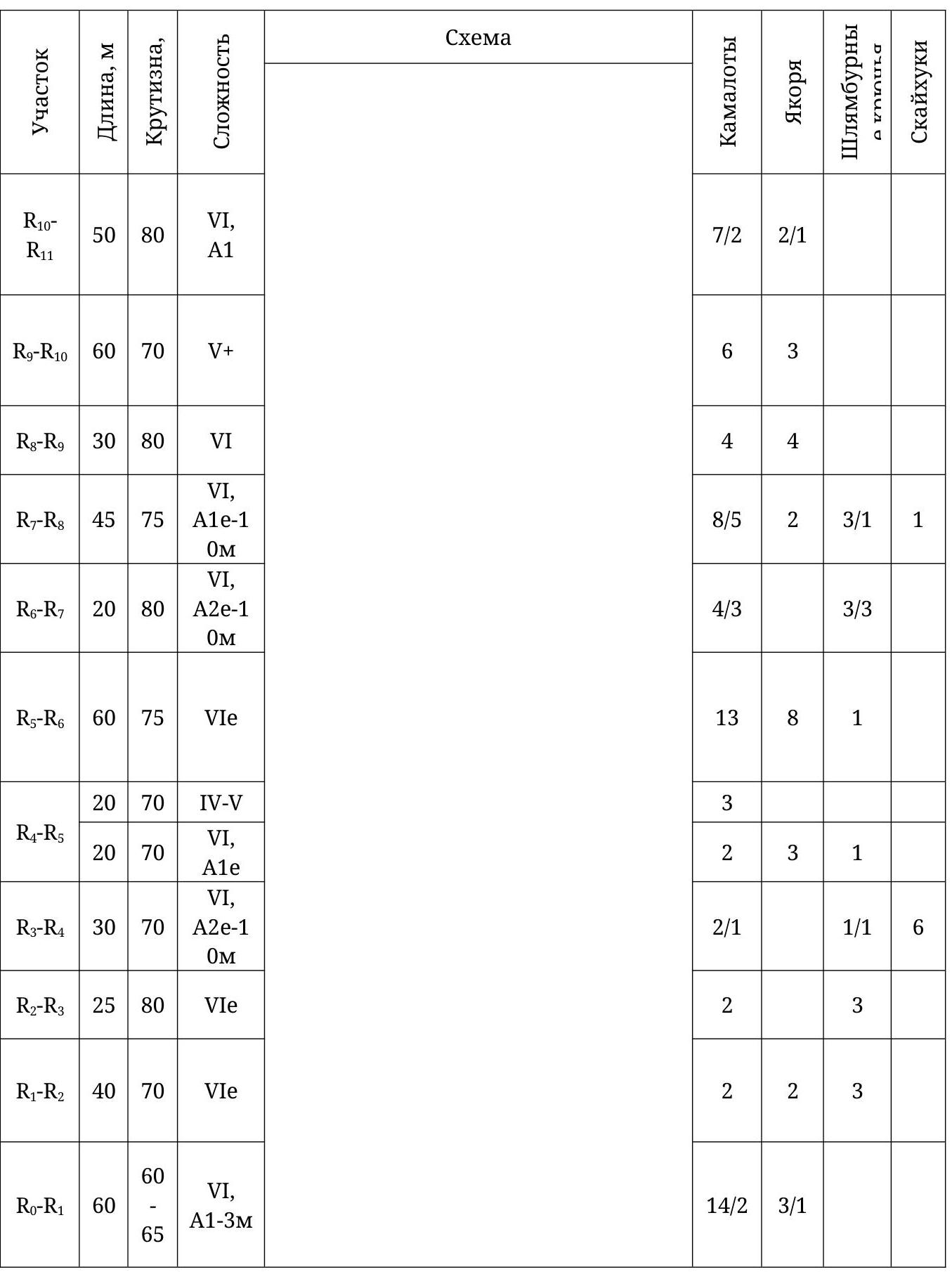
| :--: | :--: | :--: | :--: | :--: | :--: | :--: | :--: | :--: |
| R23–R24 | 20 | 75 | VI | 3 | ||||
| R22–R23 | 55 | 80 | V–VI | 4 | 2 | |||
| R21–R22 | 30 | 85 | V+–VIe | 5 | 5 | 1 | ||
| R20–R21 | 30 | 85 | V+e | 3 | 1 | |||
| R19–R20 | 30 | 85 | VIe | 4 | 3 | 1 | ||
| R18–R19 | 15 | 85 | VI, A1 | 1 | 4 / 2 | |||
| R17–R18 | 45 | 85 | VI, A2e-1 0M | 4 / 1 | 2 | 2 / 2 | 2 | |
| R15–R16 | 30 | 80 | VI, A2 | 6 / 2 | 6 / 2 | |||
| R15–R16 | 30 | 80 | VI, A1 | 3 / 2 | 3 / 2 | |||
| R14–R15 | 40 | 80 | VI | 7 | 1 | |||
| R13–R14 | 15 | 75 | IV–V | 1 | ||||
| 10 | 80 | VI, A2e | 3 | 2 | 5 | |||
| R12–R13 | 30 | 80 | VI, A1-2m | 5 | 3 | 1 | ||
| R11–R12 | 50 | 80 | VI, A1 | 3 / 1 | 2 | |||
| Scheme | ||||||||
| :--: | :--: | :--: | :--: | :--: | :--: | :--: | :--: | :--: |
| Section | ||||||||
| R31–R32 | 40 0 | 30 – 55 | III–IV | |||||
| R30–R31 | 30 | 80 | V+ | |||||
| R29–R30 | 35 | 60 | V | |||||
| R28–R29 | 25 | 70 | VI | |||||
| R27–R28 | 30 | 75 | VIe | |||||
| R26–R27 | 30 | 65 - 90 | IV+e | |||||
| R25–R26 | 30 | 80 | VI, A2 | |||||
| R24–R25 | 30 | 80 | VI, A2 |
Route description
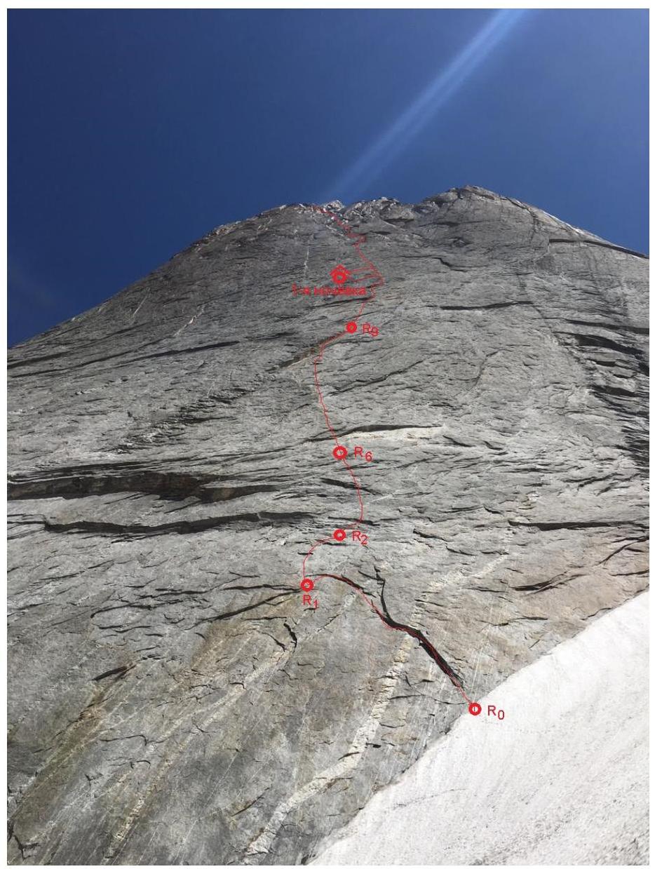
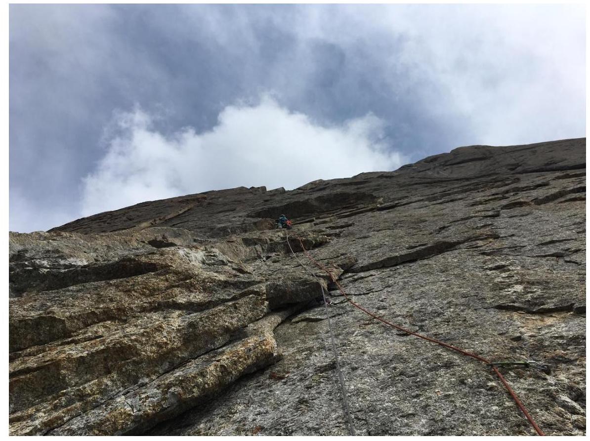
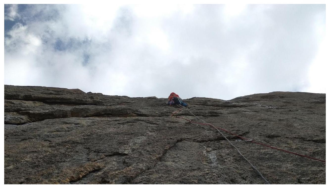
The route starts above the rantkluft along an internal corner — a chip with a crack, with an overhanging right part. The chip pulls to the left in an arc. Five meters to the left of the end of the chip is a station on large camalots (R1). Up and to the right along the line of pitons (R2) under a cornice, which is overcome at the intersection with a quartz vein. On the way, "holes" for skyhooks were noticed but not used. The protection is poor. Above the cornice, at the base of the internal corner, is the R3 station. To bypass the overhang, move along the slabs towards the large oblique corner (R4–R5). Up through the system of internal corners. Towards the next cornice (R6). It is passed with a move to the left, then to the right into the next large internal corner (R7). Further along the corner and its left wall (R8).
The corner ends. To the left, 40 meters away, is the "glove" overnight stay (R9). Another rope up the slab to the control turret (R10). From the left part of the ledge, up the wall, then along the internal corner (R11). Up to the right along the wall, towards the cornice. Caution. The wall consists of a delaminated layer of rock. It is better to move to the right from the start of the rope. Having overcome the cornice, into the internal corner (R12), which ends with another ceiling. Station under it on pitons (R13). Traverse 10 meters on skyhooks, then up the wall (R14). Further along the internal corner to the ledge (R15). The route continues upwards.
To the left, 40 meters away, is a ledge for an overnight stay with a control turret. Here we went wrong, so R₁₆ is off the route, but we returned to the line at R₁₇. This station is 40 meters above R₁₅. You need to move along the slab with flakes towards the overhang. Then, through a series of overhangs and cornices, left-up towards the internal corner (R₁₈). Then, right-up to a flake-chimney, 15 meters away, the chimney ends (R₁₉). Then, along the slab, then along the internal corner, right-up (R₂₀). The overhang is bypassed to the right (R₂₁). Further along the large, not very distinct internal corner under a large cornice. From under it, a pendulum to the left. A little up, and we reach a ledge for an overnight stay (R₂₂) with the third control turret.
From the left part of the ledge, up along the internal corner and the next large corner (R23–R24), under a large red overhang. Station R24 is on a large ledge on an inclined shelf. Traverse to the left behind the bend, then up along the crack. After 50 meters, exit to a ledge (R25–R26). In the first ascenders' description, there is a snowy couloir here. Now all the snow has melted, leaving only ice in the cracks.
Up along the ledges, then left along a vertical chimney (R27). Approximately here, the route converges with Kritsuk's route again. From the chimney, up along the internal corner or the slab with a crack to the right, we chose the second option (R28). Another 30 meters along the internal corner (R29).
At this point, the first ascenders turned right, bypassing a large bastion. The teams of Vinokurov, Ivanov, Parkhachev, Ostanin, and Shabalin, whose reports are on the FAR website, turned left. We also chose the left variant. Along the internal corner to a platform with a place for an overnight stay (R30). Further along a vertical internal corner, another 30 meters to the next ledge (R31). And then along a relatively easy ridge, where it still makes sense to belay, another 2 hours 30 minutes to the summit.
Descent is along the south ridge via 5B route. It's a long way, but only eleven duelfers.
Result
Good preparation and favorable weather allowed us to beat the initial plan by ten hours. From the reliable information we have, this is the fastest passage of the route, although the 2015 championship rating is based on a passage time of 28 hours. We were unable to find out who and when climbed in that time.
Photos:
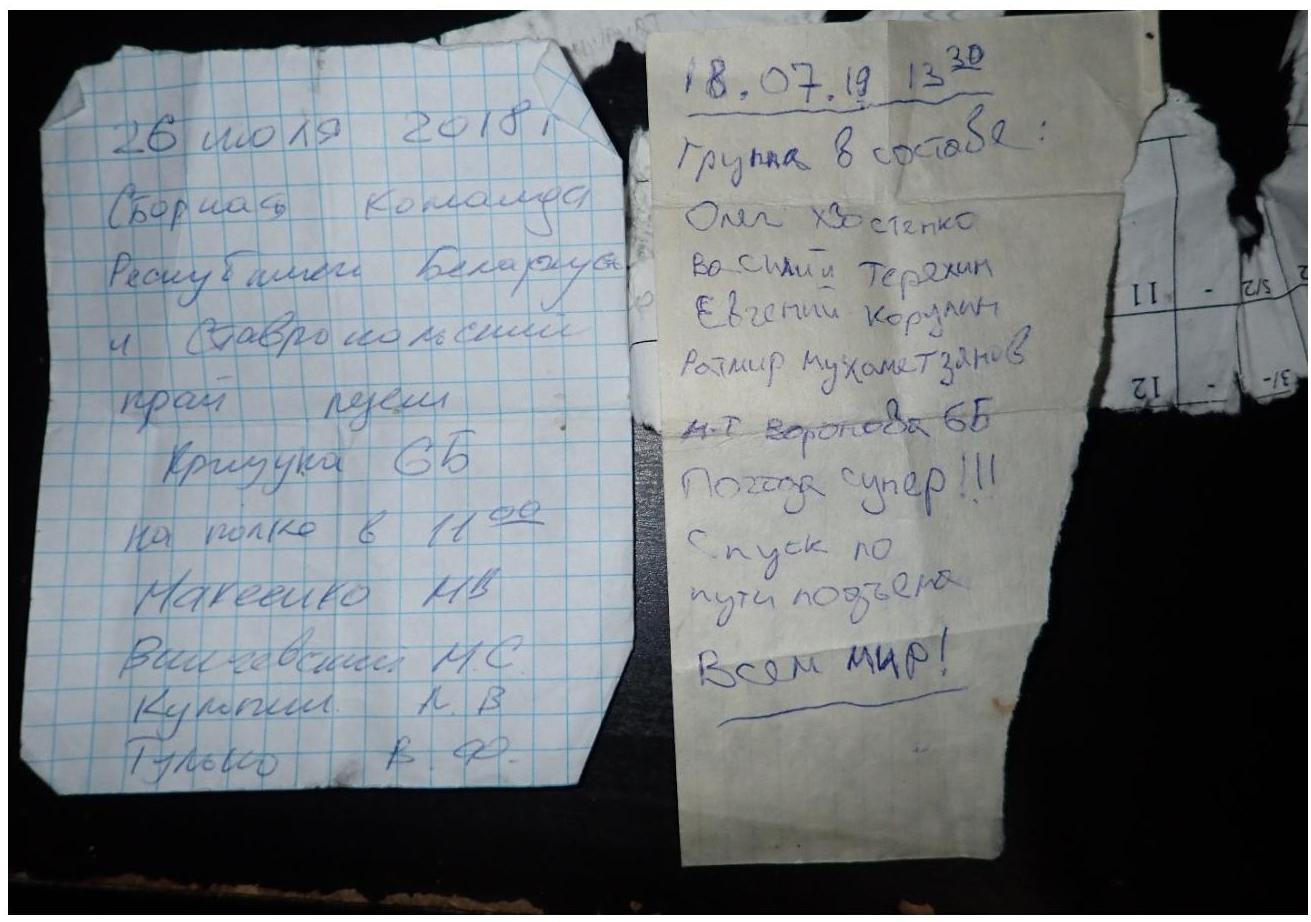
- Notes removed from the second control turret and the
summit.
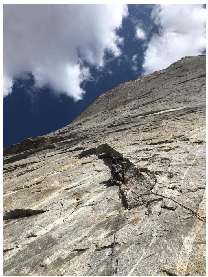
- Start of the
route
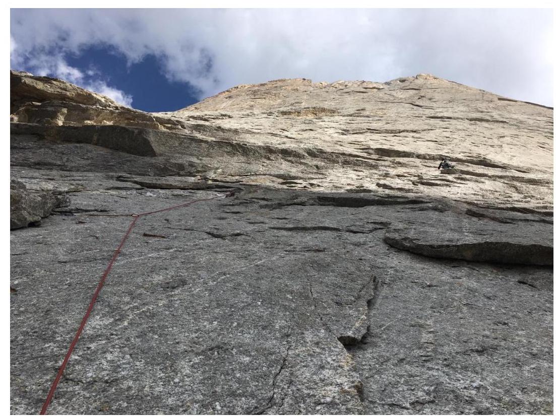
- View from
R1
- View of
R1
- View from R5 up and
down
- R6 and
R8
- View from R12
up
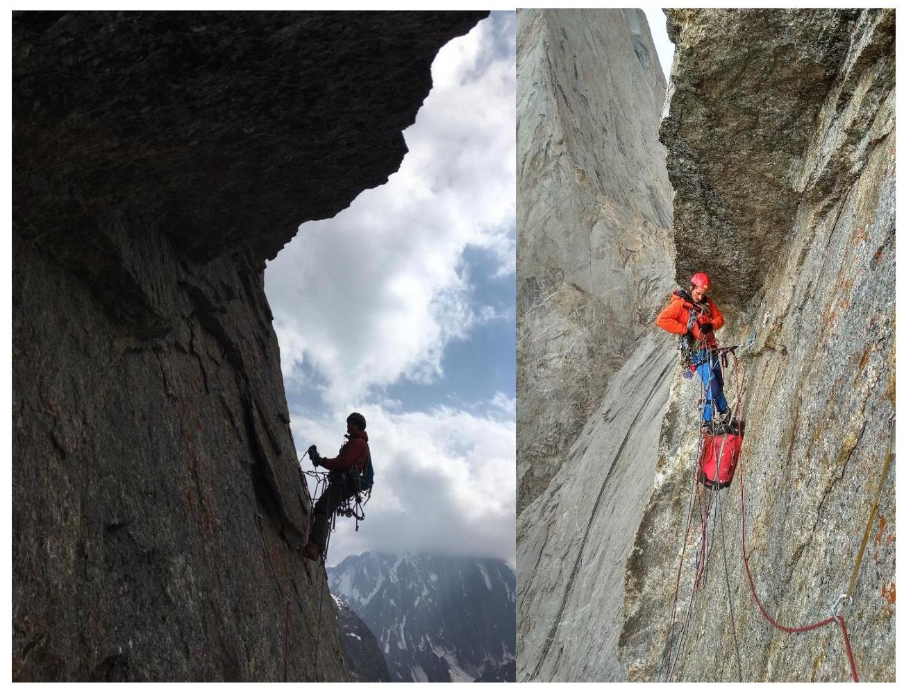
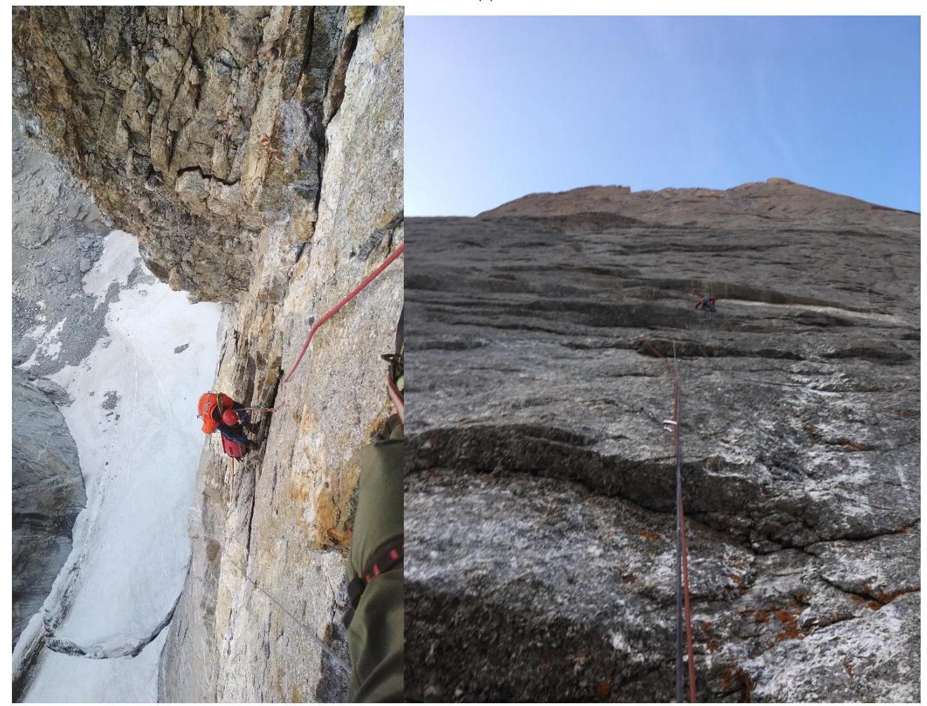
- Traverse on
R13
- R17. Matinyan is
leading
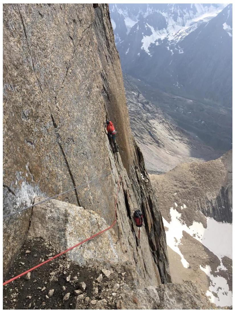
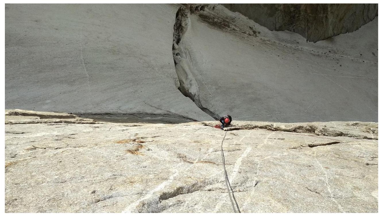
- Ledge for overnight stay after the pendulum
R22
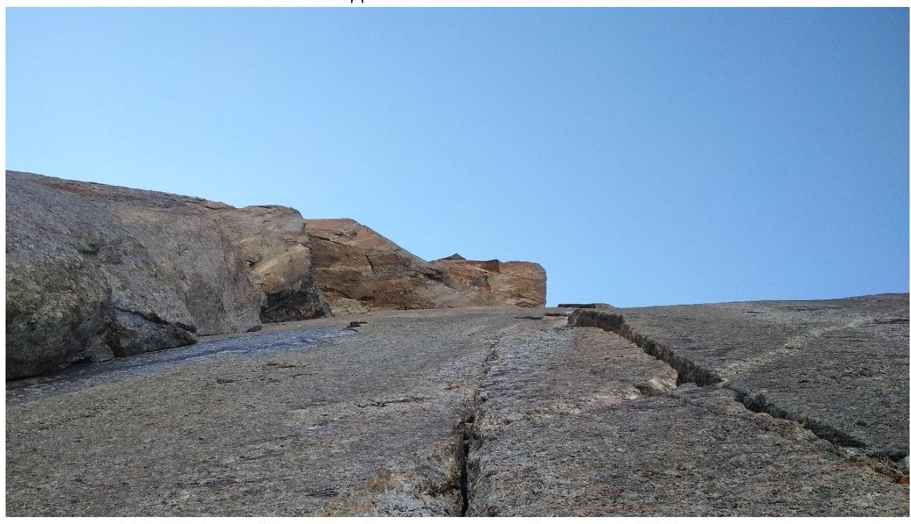
- R25 — the longest but not difficult ITO section on the
route
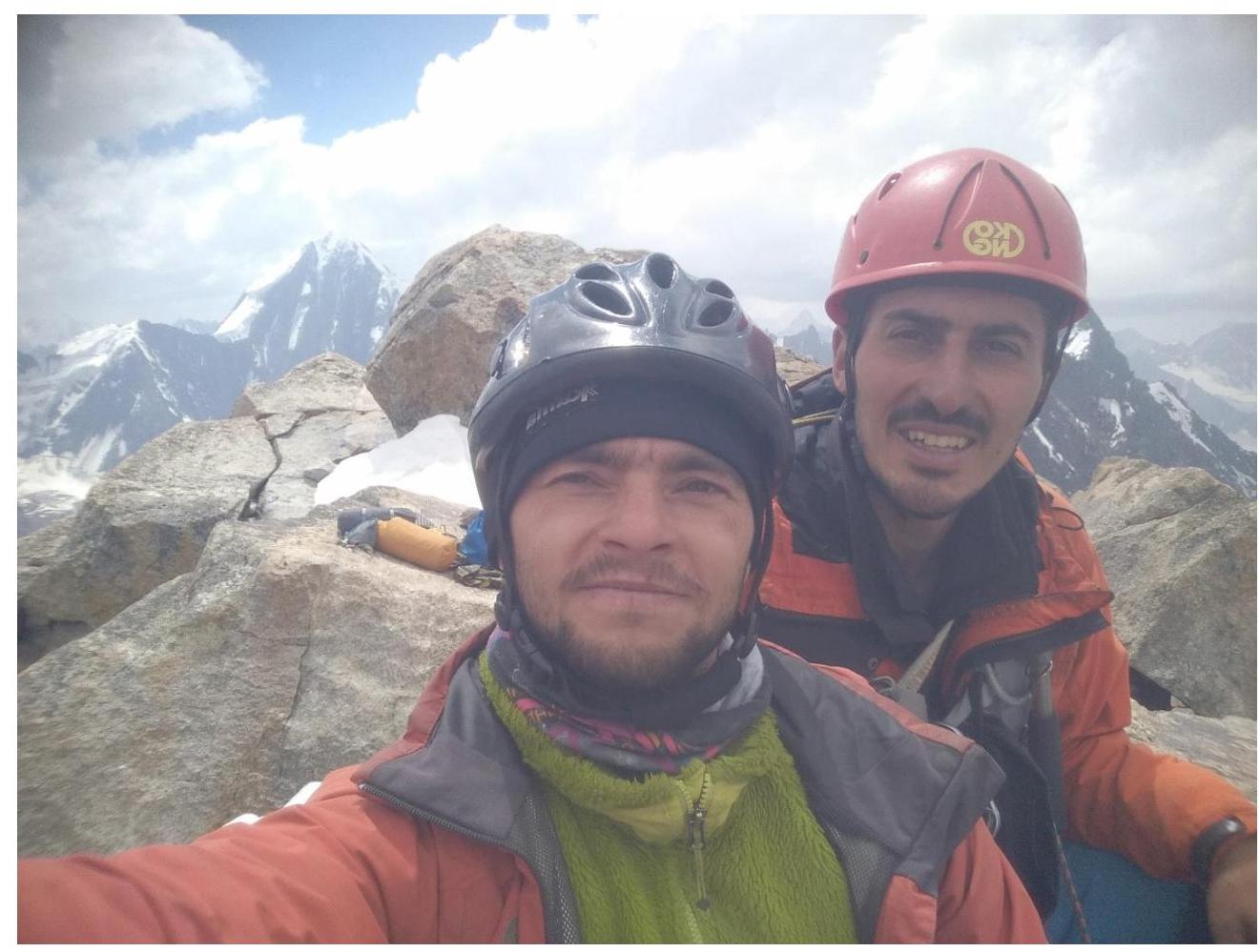
- Summit photo