Peak Odessa (4810)
Route via the Eastern wall (Vedernikov, 1989), 6A cat.
Completed during the 2014 Russia Championship in the full-time technical class in Karavshin
Team from Moscow:
- Yurkin A.V. (Master of Sports)
- Kravets K.V. (1st sports category)
Report compiled by Yurkin A.V.
General information about the route

Photo of peak 4810 from Ortotyubeka
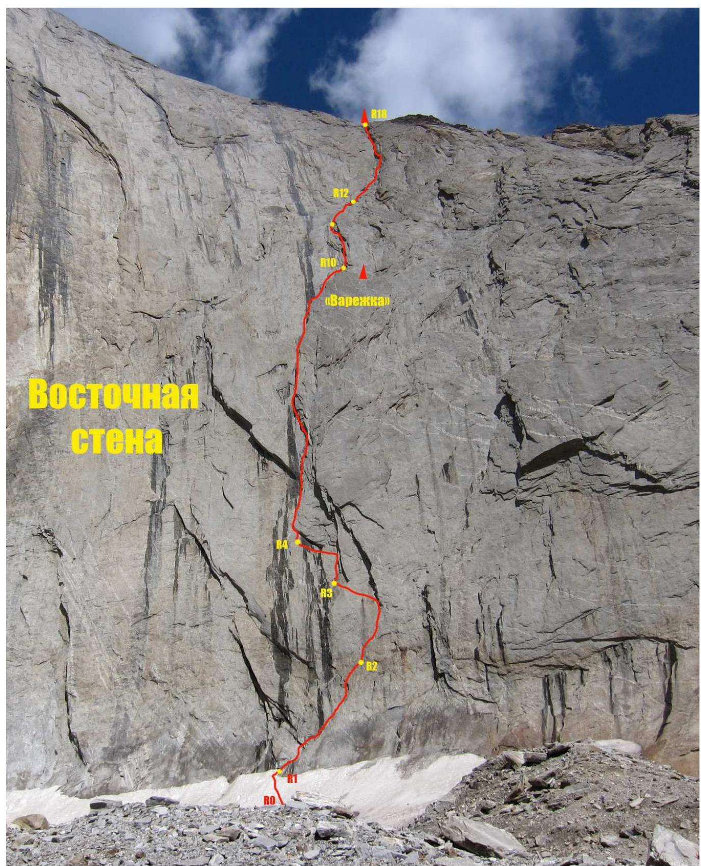
This route was laid on the Eastern wall of peak 4810 by Leningrad climbers in 1989 under the leadership of V. Vedernikov. By 2013, the number of ascents via this route is unknown; apparently, no statistics were kept, and the route was not frequently climbed, likely due to the lack of proper descriptions and the long approach (teams usually base in the Kara-Su gorge, while the Eastern wall requires going to the neighboring gorge). In 2013, a team from Irkutsk, Bashkirtsev—Veretennin, ascended this route via free climbing. It took them 2.5 days (two overnight stays), and the route's condition was fairly good. They rated the maximum free climbing difficulty as 7a (French scale). Their report can be found at: http://www.mountain.ru/article/article_display1.php?article_id=5980↗ From August 1–4, 2014, during the Russia Championship in Karavshin, our team (Yurkin—Kravets) also climbed this route. Here's what we found:
- The route is 32 ropes long (averaging 45 m each) – 1440 m. The Irkutsk team measured 1350 m.
- The route can be divided into two parts: the "wall" and the "shoulder" or "edge".
The "wall" is the most challenging part, spanning 16 ropes. The second rope is the crux. Climbing is rated 7a, with some pre-drilled holes and local pitons, though not frequently encountered. After the second rope, the route follows an internal corner or runs alongside it.
The "shoulder" is a relative term, as it's actually a wall, just slightly gentler than the Eastern wall. Climbing is easier here, with a maximum rating of 6B (mostly 5c–6a). The upper part of the route involves snow and ice. We encountered 3 ropes of relatively straightforward snow and ice.
Possible bivouacs on the route:
- On the "Mitten" – 9th rope. At the top of the "Mitten", one needs to rappel 15 m to the right of the route to a large, comfortable ledge that can accommodate a 3–4 person tent.
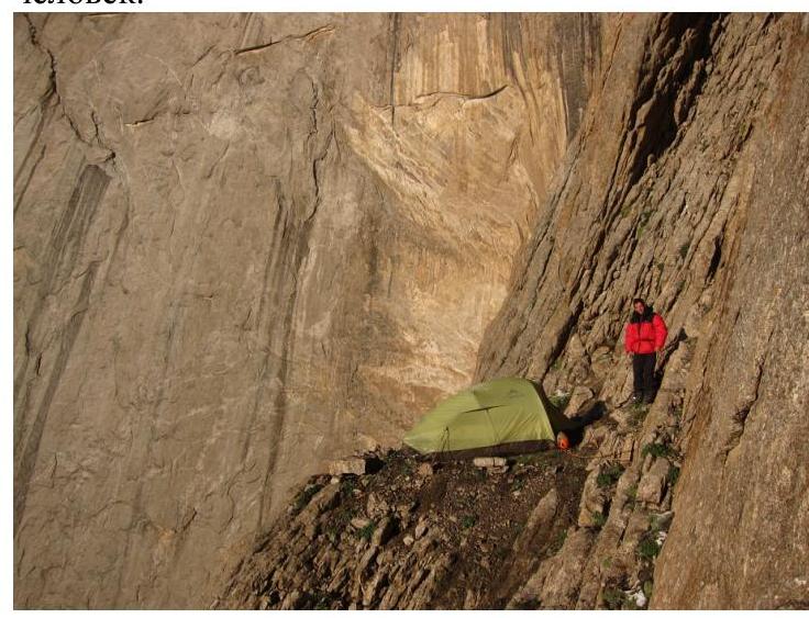
- "Irkutsk bivouacs". A small ledge suitable for a 2-person tent. The ledge is located 2 ropes above the "Mitten". Nearby, there are smaller ledges for single climbers to bivouac.
- On the "shoulder". On the 16th rope, immediately after the end of the wall. A large, flat ledge suitable for a 3–4 person tent.
Further ledges for bivouacs are encountered every 3–4 ropes. 4. On the "summit". A large, comfortable ledge suitable for a 3–4 person tent at the very summit of 4810.
Water on the route:
- On the wall, during good weather in season, there may not be water, aside from daytime streams from melting snowfields above.
- After the Eastern wall, on the "edge", snowfields are common, even after prolonged hot weather, due to the higher elevation and colder temperatures.
Brief technical description of the route
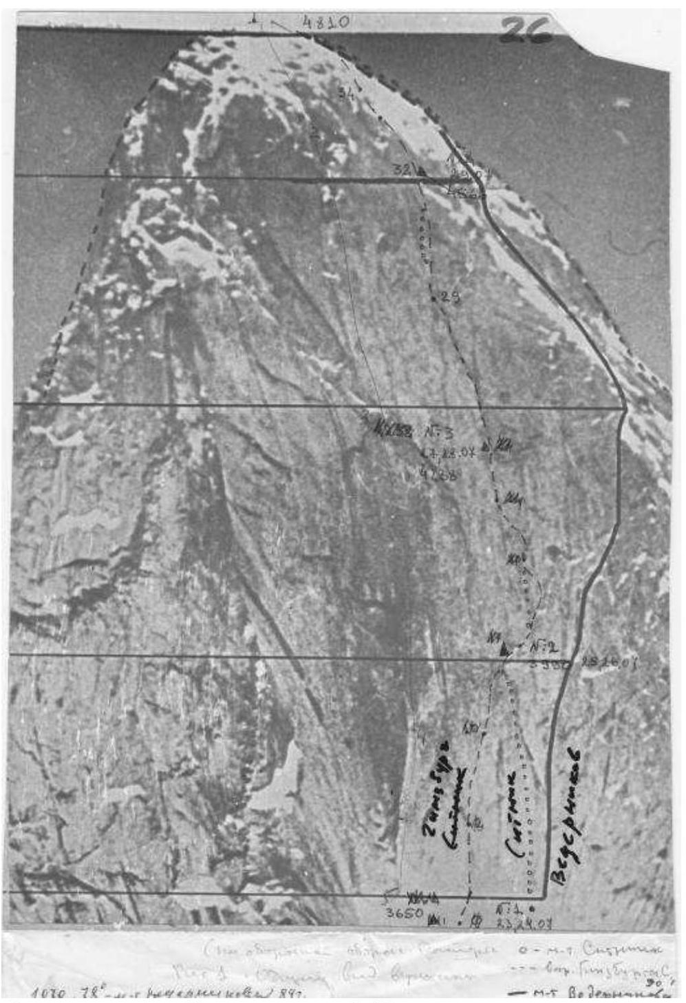
Photo of routes on the East wall from the FAR archives
Peak Odessa (4810) Vedernikov's Route, 6A cat. (7a French), 1440 m
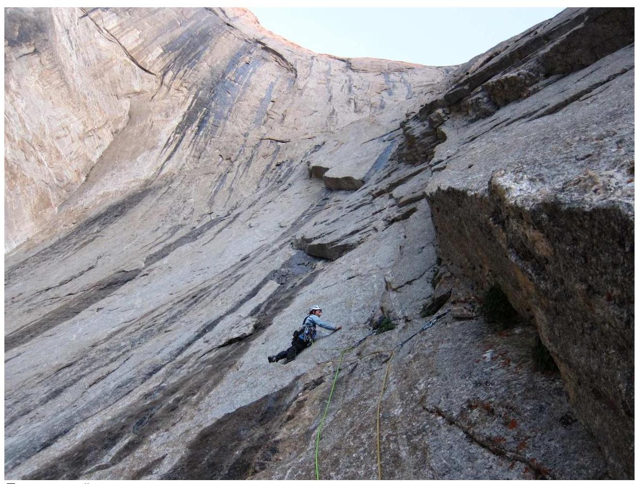
The wall section of the route. Photographed from the eastern cirque of 4810
Breakdown by sections (wall section, 16 ropes)
R0–R1 — a short snow-ice ascent. 20 m, II R1–R2 — from the anchor in a ranklyuft, move right and up, initially on foot, towards a small internal corner ending in a slab. The anchor is on top of the slab. 45 m, V, 70° R2–R3 — climb from the anchor to a bolt, then right via a small traverse to a system of cracks leading to the start of a large slab-overhang. Here, there are old pitons; it's recommended to extend the protection as the direction changes. Continue left and up on friction (initially with anchor protection, then on "confidence"). Reach an internal corner. The anchor is on a good ledge. 50 m, VI, 75°, A2 or 7a (French). R3–R4 — climb the internal corner to a piton at the top, then swing left (there's a piton with a loop and carabiner). Follow a system of cracks left to a good ledge under an overhang (there's a bolt on the anchor). 40 m, VI, 80°. R5–R10 — continue up the internal corner for 6 ropes, each 40–45 m, to the top of the "Mitten". The climbing difficulty maxes out at 6B.
- From the anchor, looking right and down, a large ledge for bivouacking is visible (15 m rappel).
R10–R12 — climb up, initially through simple rock in the internal corner, then under overhanging slabs-feathers, moving up and left. Caution! Climbing requires care to avoid dislodging the slabs. The anchor is on a comfortable ledge after the overhang, continuing up the internal corner to a gentler slope. There's a suitable ledge for a 2-person tent. 100 m, VI, 90°, 6A (French). R12–R18 — from here, five ropes lead to the "shoulder". Move up and right towards the internal corner. The first rope is straightforward (IV). The difficulty increases thereafter. Climb on the left side of the internal corner to a series of chimneys. R17–R18 — the anchor is on a large ledge after a narrow chimney. From R17, there are alternative routes: one is straight up a wet, icy crack, which is more laborious. A better option is to climb up and right through a fold (climbing rated 6B–6C). Beyond the fold, there's a small wall and the start of the "shoulder", where the terrain becomes more manageable. There's a good spot for a bivouac.
The second half of the route follows the "shoulder" (16 ropes):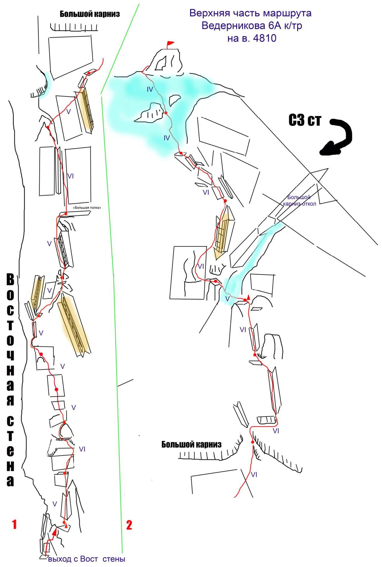
Descent from the route
The descent is classic, following Nazarov's route (5B) towards the saddle with Lomo peak. 300 m on foot along the ridge towards Lomo. After the first rappel, on the next one, descend down towards the Ak-Su gorge. The terrain is extensive and relatively gentle — rappels are "diagonal"; be careful when retrieving ropes! On the 4th rappel, move right onto the wall. The saddle will come into view; keep heading towards it. At the bottom, after the wall, there's another short (25 m) rappel to the talus. Continue down, staying in the middle of the gorge. It's recommended to descend wearing a helmet — the talus is "live" with many loose rocks. The scree is unpleasant; fortunately, it's downhill all the way.
General recommendations for the route
The route is logical and relatively safe; it's possible to climb without a platform — there are ledges for tents. The best time for the ascent is July–August. It's advisable to climb after a few days of good weather. The rock dries out, allowing for entirely free climbing. In the upper part of the route, there's snow and ice — it's recommended to bring appropriate gear. Before the large overhang in the upper part, there are alternative routes depending on the terrain's condition (presence or absence of ice). During our ascent (August 1–4, 2014), we didn't observe any rockfall. In terms of difficulty, this route is among the more challenging of the relatively straightforward routes on 4810, as of 2014. Vedernikov's 6A route is more difficult and longer than Nazarov's 5B and Ovcharenko's 6A. Other 5B and 6A routes (Sitnik's 5B and Skripko's 6A) haven't been climbed in a long time. Existing 6A routes other than Vedernikov's, Sitnik's, and Rusyaev's are essentially "stripped" 6B routes (in fact, after being "stripped," these routes aren't often climbed either). The next category up is 6B.
During the Russia Championship, our team completed the route in 3.5 days (three overnight stays) with preliminary scouting of the first two ropes. The first two days of our ascent coincided with the tail end of bad weather. In the afternoons, after 16:00, it started raining with snow, significantly hindering progress on the route. Climbing sections had to be done with aid due to dampness and cold. Consequently, on those days, we started climbing later and finished earlier than the championship's regulated climbing hours (6:00 to 21:00).
We bivouacked: on the "Mitten", on the first designated bivouac on the "shoulder", and under the summit (4 ropes shy).
Some photos from the route
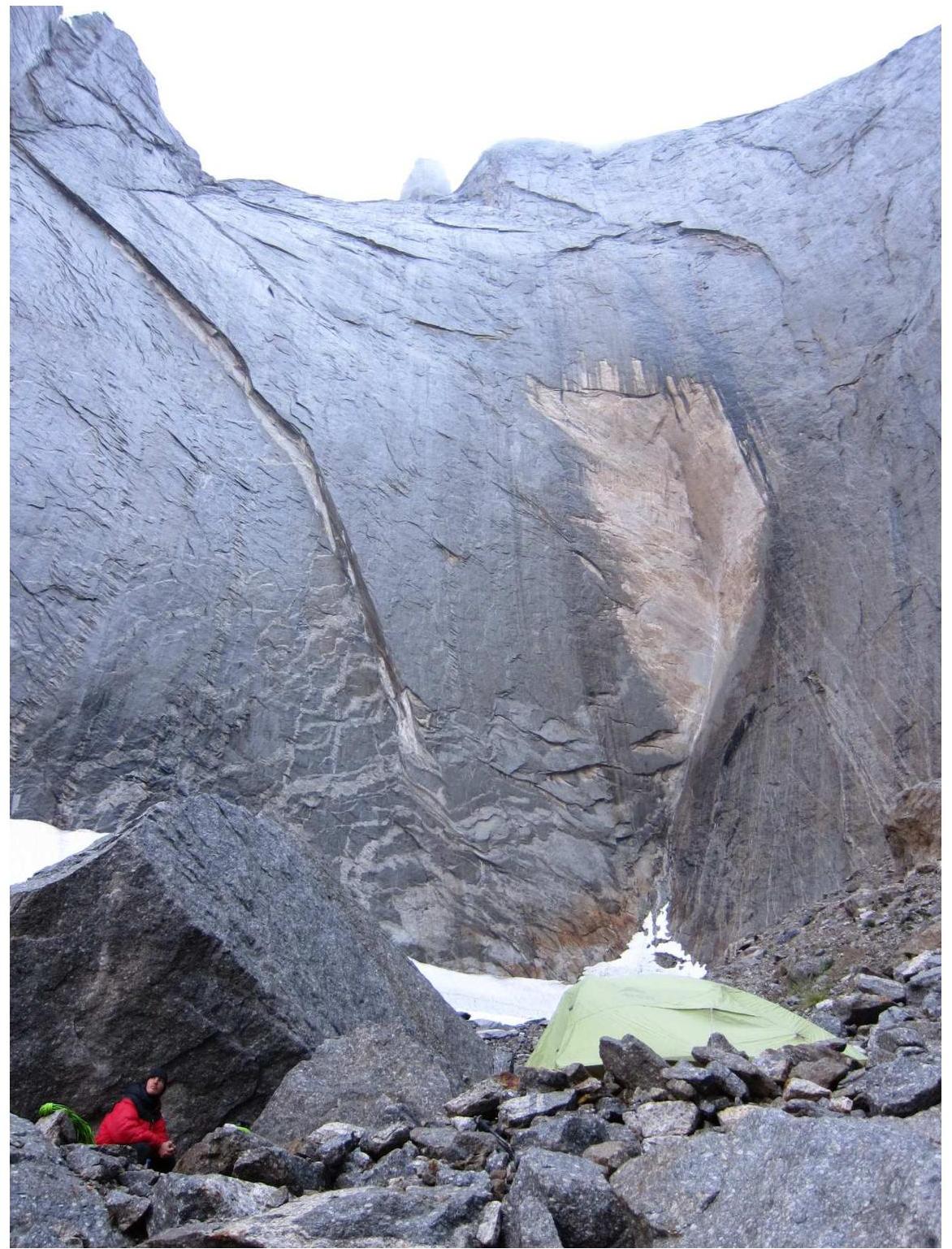
Bivouacs under the Eastern wall of 4810
Third
rope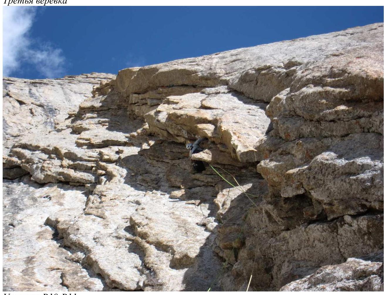
Section
R10–R11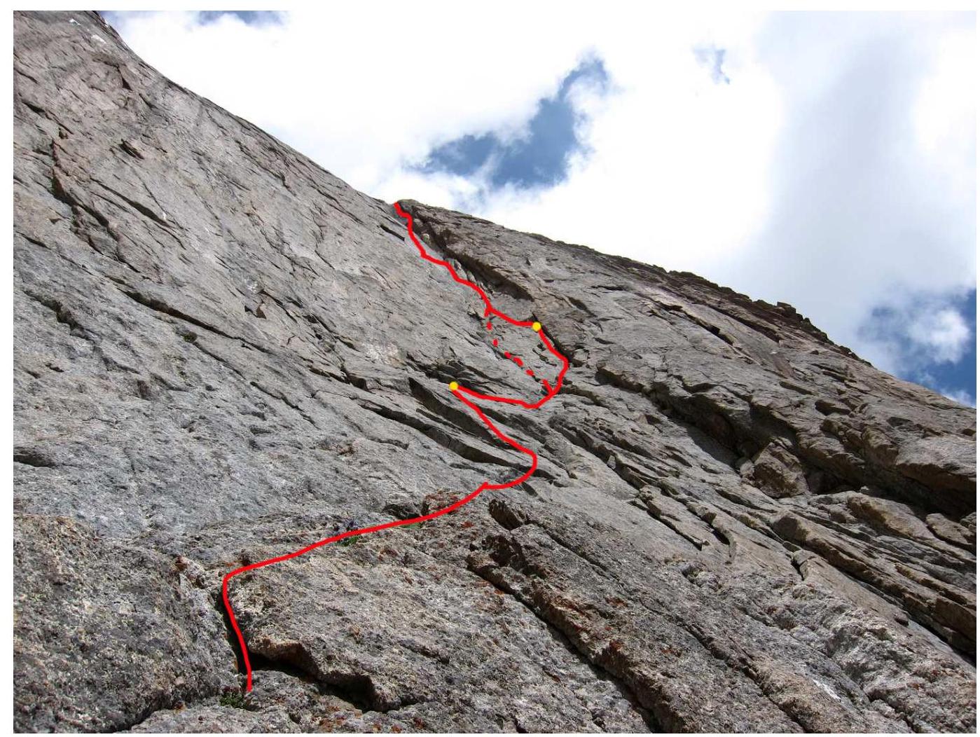
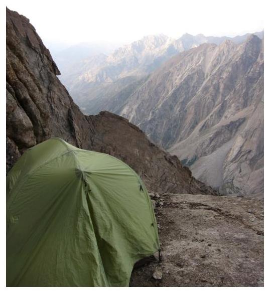
View from "Irkutsk bivouacs" with
R12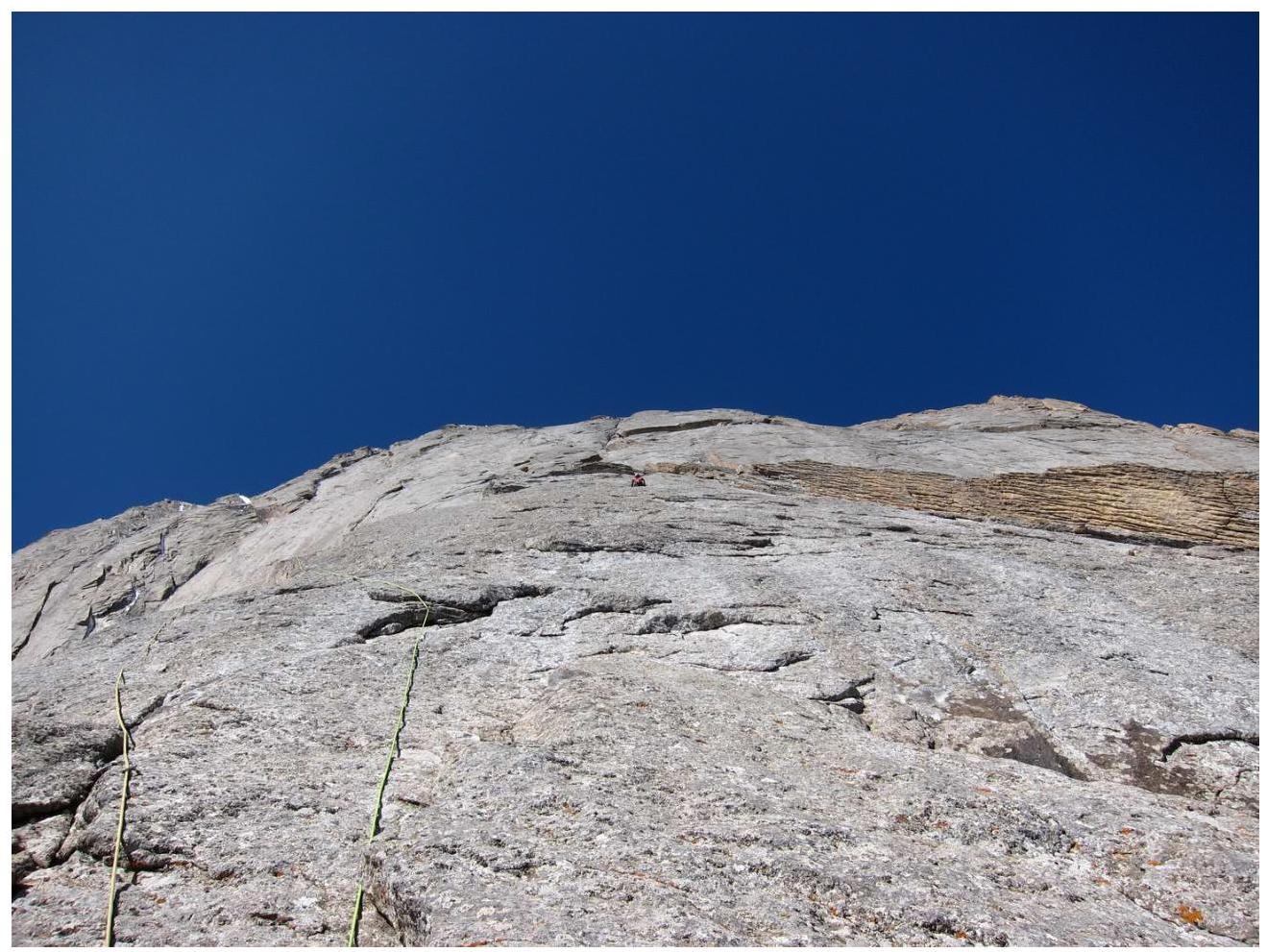 "shoulder"
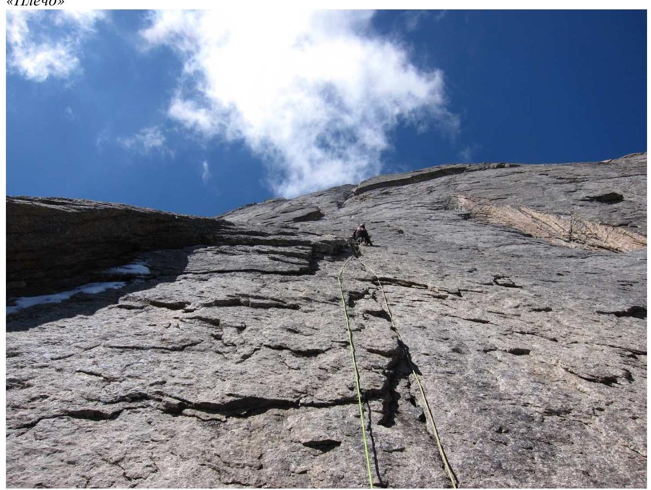
Rope from the "large
ledge"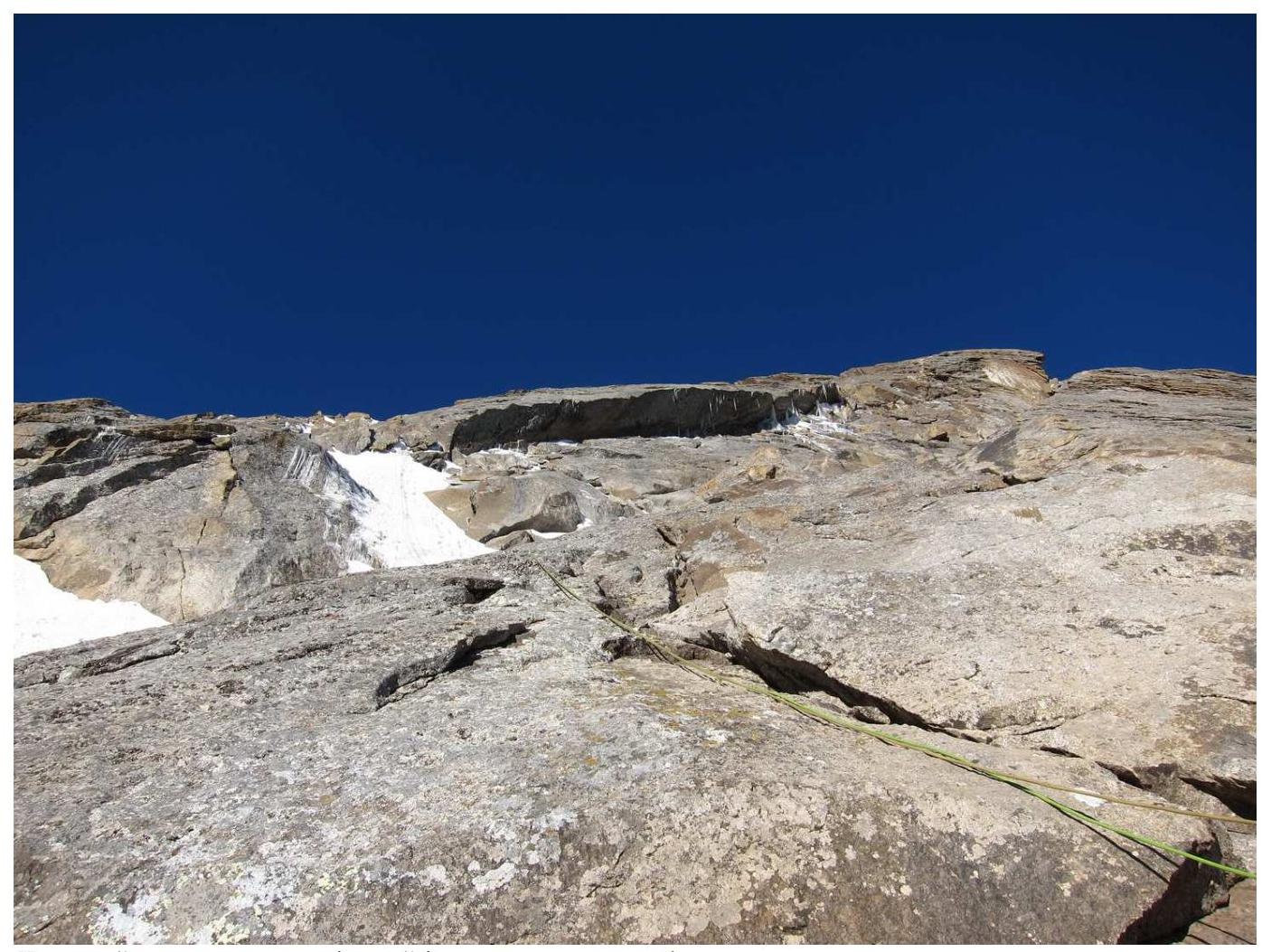
Large slab-overhang extending to the summit ridge. (We bypassed it on the left in the lower
part via
snow)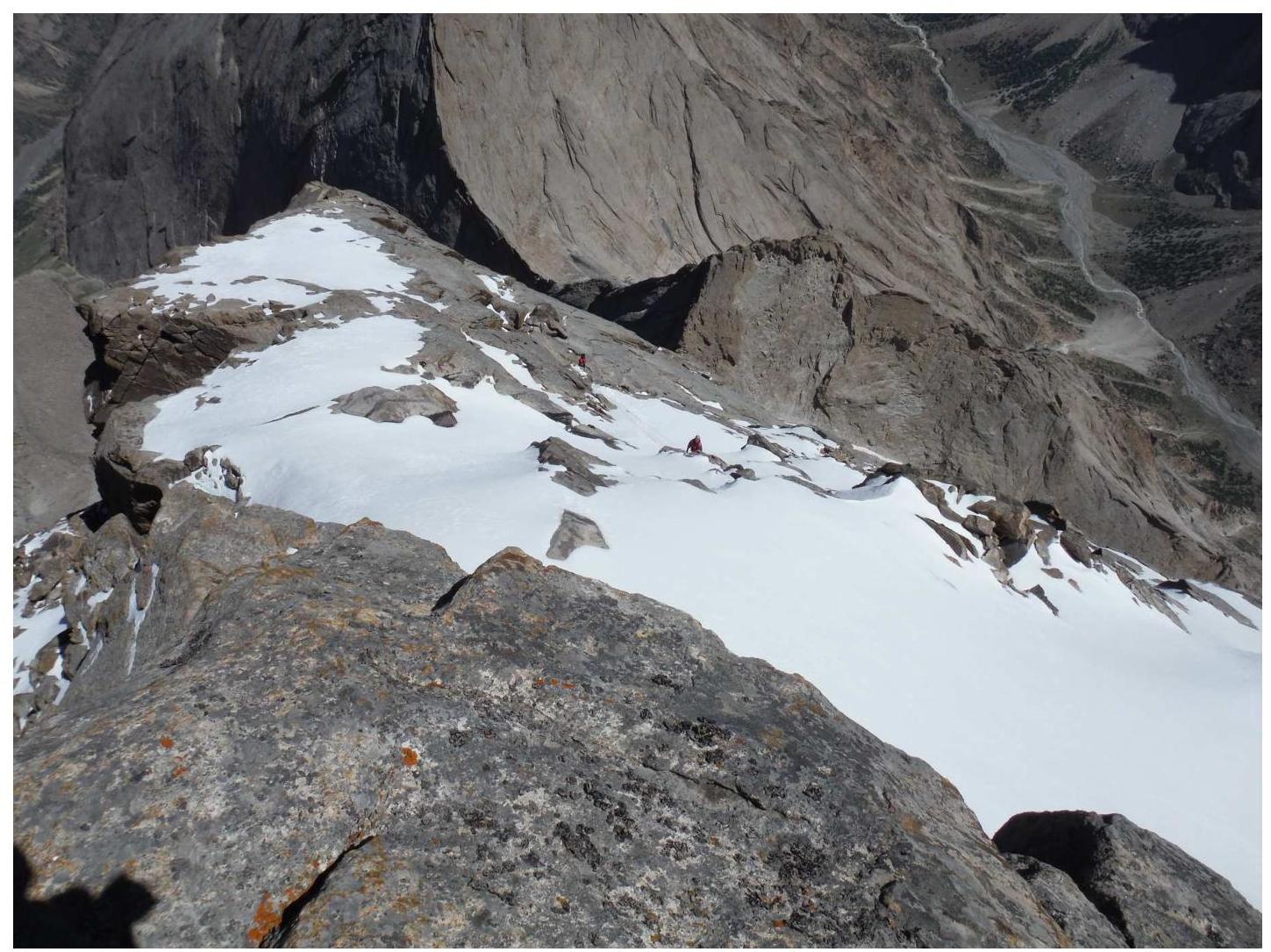
Upper part of the route. Photo from the summit by A. Klepikov. The passage of snow-ice ropes is visible. The NW wall is behind the fold on the left
At the summit of 4810 m