Russian Championship in Alpinism
High-altitude technical category 2016
Report
of the St. Petersburg team on the ascent via the center of the western wall (M. Devi route, 2nd ascent) on Kyrkchilta peak, 4507 m (Karavshin valley, Kyrgyzstan) from 12:00 to 15:00 on August 15, 2016
Ascent Passport
- Category — high-altitude technical.
- Pamir-Alay, Turkestan range, Karavshin valley, 5.4.3.23a
- R20
- 6B category of difficulty, 2nd ascent
- Route type — rock
- Route characteristics:
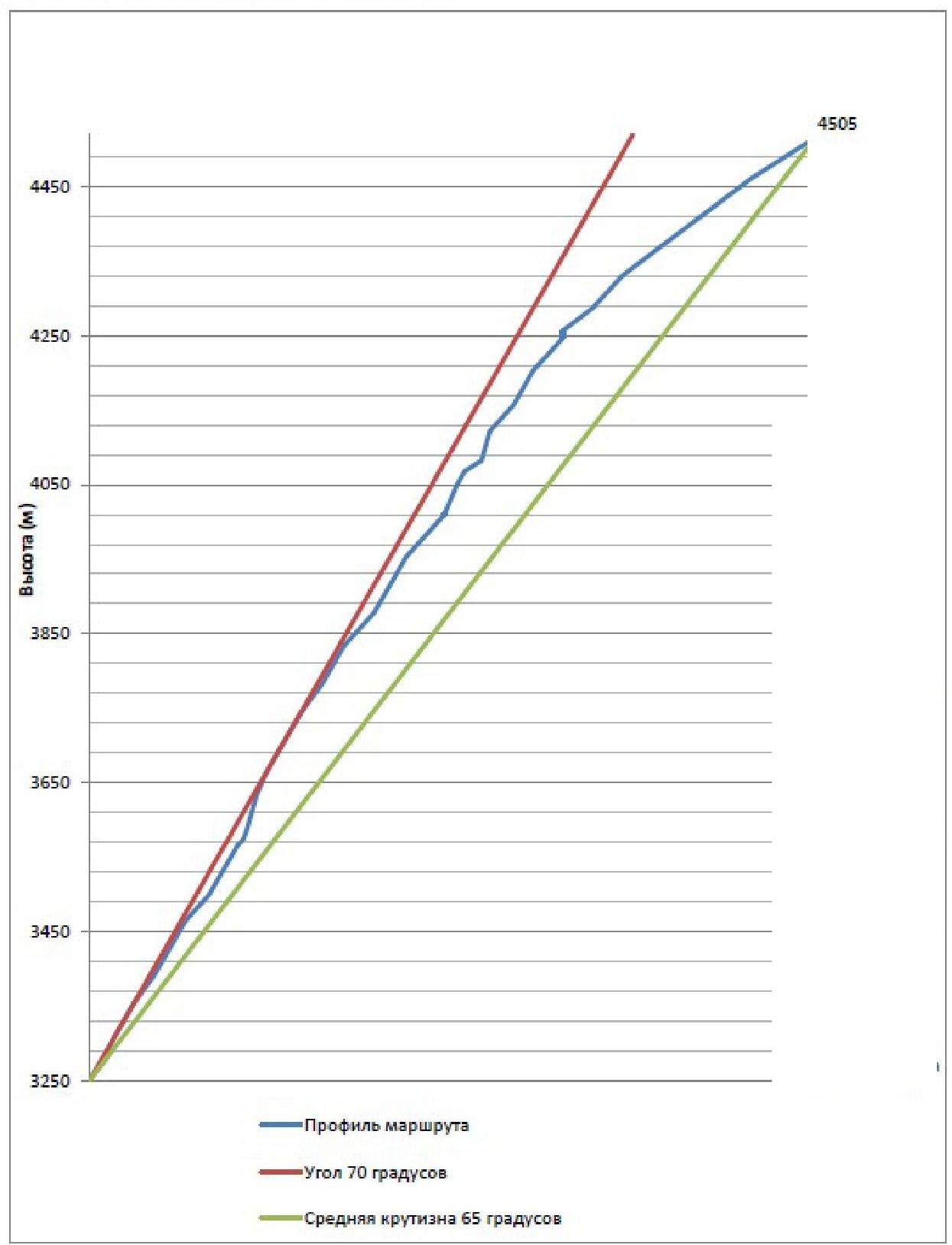
- Height difference — 1250 m
- Route length — 1755 m
- Wall length — 1350 m
- Length of 5-6 pitch sections — 1010 m, including 6 pitch — 595 m
- Average steepness — 65 degrees, main part — 70 degrees
- Pitons used:
- anchor (IT) — 57/17
- camalots (IT) — 196/17
- removable bolt pitons (IT) — 2/1
- skyhooks (IT) — 2/2
- Total: including IT — 290/198
- Pitons left on the route — 0
- Team's climbing hours — 32 hours to the summit; descent — 18 hours
- Route start — August 12, 2016 at 14:00
Reached the summit — August 15, 2016 at 15:30. Descent to Ak-Su valley — August 16, 2016 at 23:55
- Team members: Barabashov Anton (CMS) — leader
Vorobyov Konstantin (CMS), Petrov Anatoly (CMS), Viskov Igor (MS)
Coaches:
- Timoshenko T. I. (MS)
- Semiletkin S. A. (MS)
General photo of the
route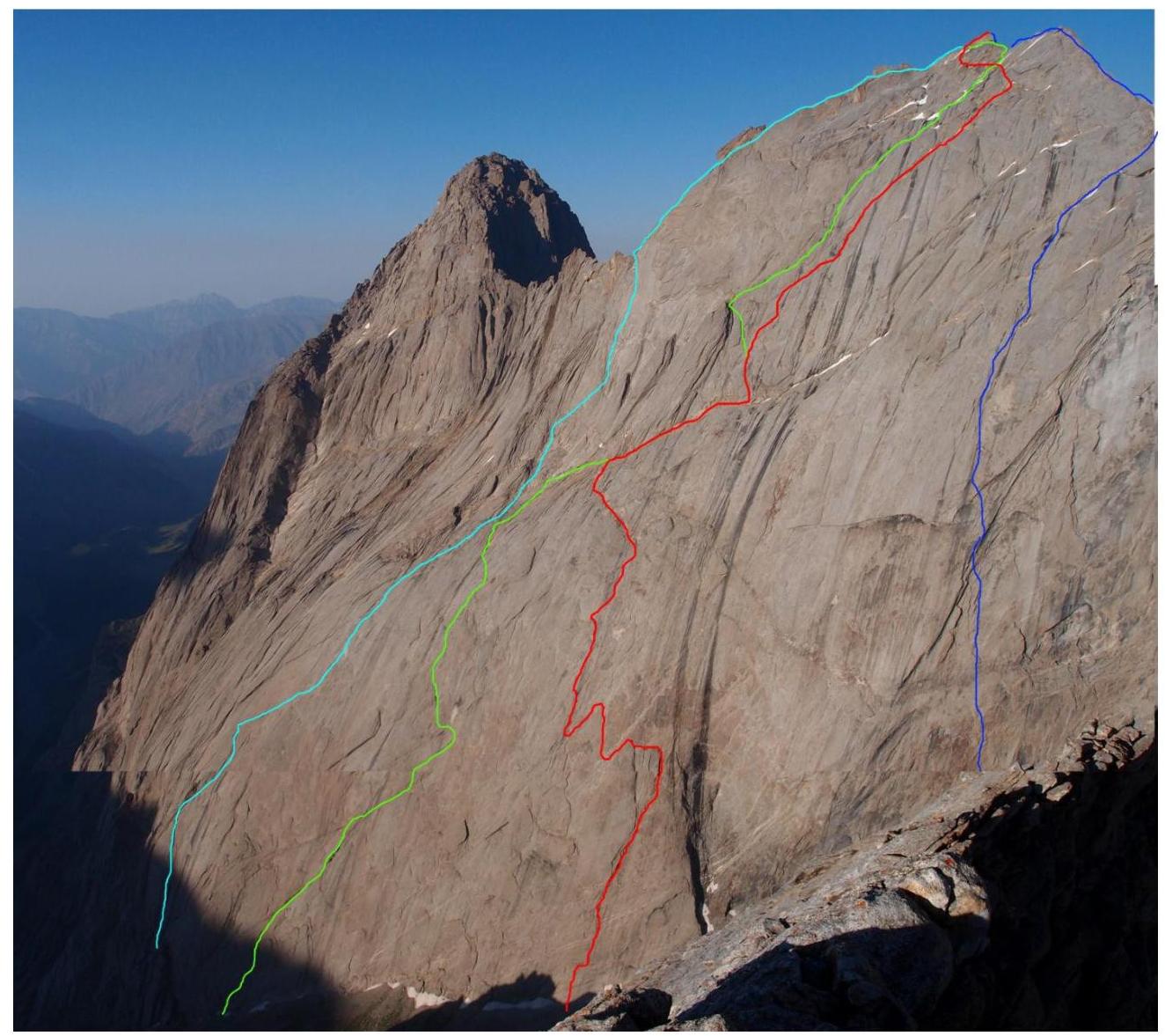
V. Skripko route, 1988; A. Klepikov route, 2015; team route (M. Devi), 2015; V. Igolkin route, 1988.
Technical photo of the
route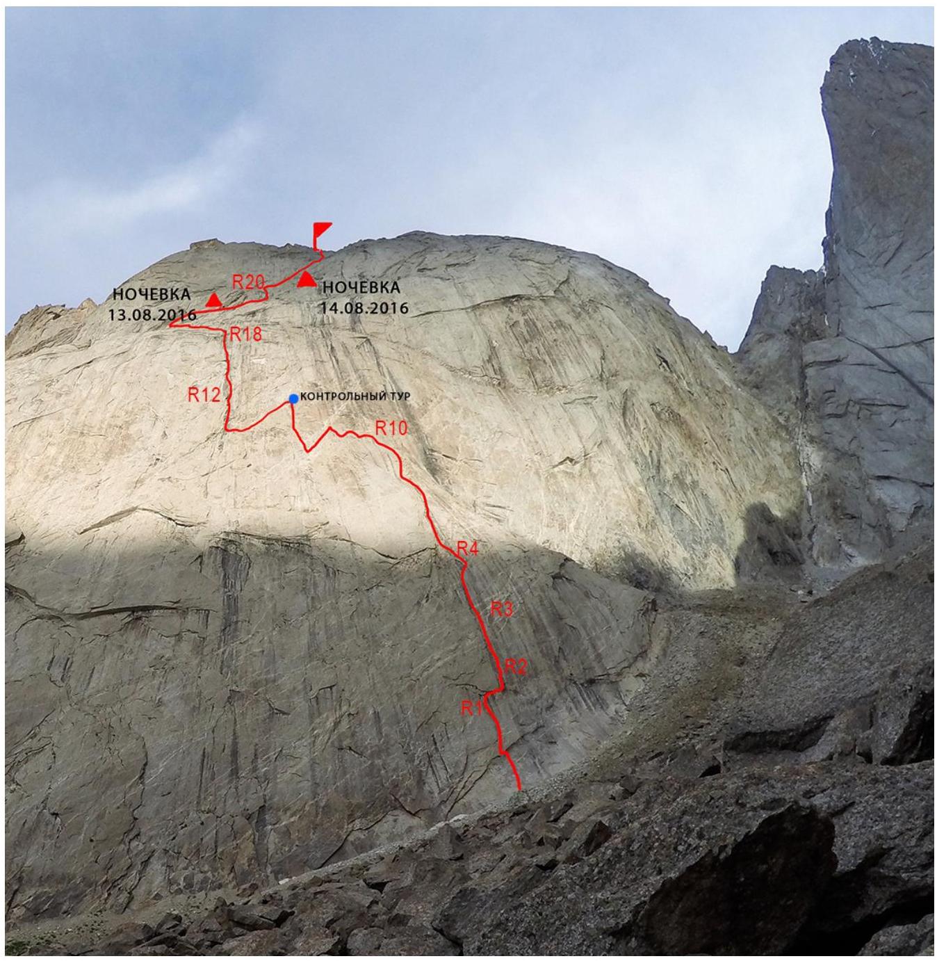
Profile of the route by the first
bastion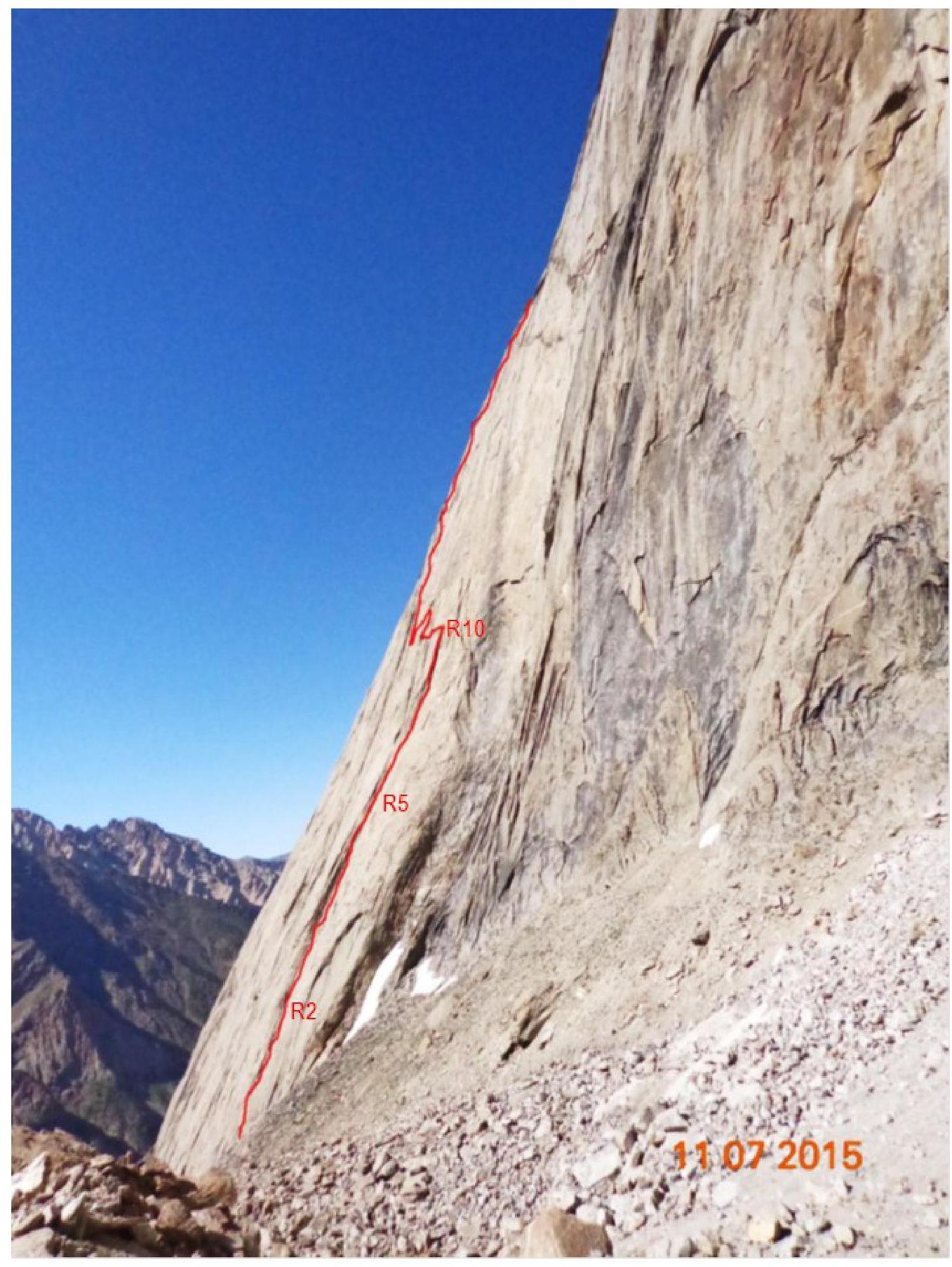 (photo from the first ascendants' report)
Route Profile
Length
UIAA Scheme

| R15 | 40 m | 70 | VI, A3 | 5 camalots, 5 anchors |
|---|---|---|---|---|
| R14 | 30 m | 75 | VI | 7 camalots, 4 anchors |
| R13 | 50 m | 80 | VI | 5 camalots, 6 anchors |
| R12 | On the shelf, first control point | 10 m – 50 m | 75 75 | V–VI |
| R8 | 50 m – 10 m | 80 60 | VI–V | 11 camalots, 10 camalots, –30 m |
| R7 | 10 m | 70 | V | 1 camolot, 5 camalots, 2 anchors |
| R9 | 30 m | 70 | VI | 1 camolot, 8 camalots |
| R8 | 30 m | 70 | VI | 8 camalots |
| R25 | 40 m | 60 | V | 6 camalots, 2 anchors |
| --- | --- | --- | --- | --- |
| R24 | 40 m | 80 | VI | 5 camalots, 5 anchors |
| R23 | 20 m | |||
| 20 m | 45 70 | IV–V | 7 camalots, 4 anchors | |
| R22 | 40 m | 75 | V–VI | |
| A1 | 9 camalots, 3 anchors | |||
| R21 | 20 m | 60 | V | 4 camalots, 2 anchors |
| R20 | 200 m | |||
| 45 m | 20 60 | II–IV | 5 camalots, 4 anchors | |
| R16 | 50 m | 60 | III | 0 |
| R16 | 100 m | 30 | I–II | 0 |
| R17 | 45 | 65 | VI | 0 |
| R16 | 45 | 70 | VI | 10 camalots |
| P. Kyrkchilta, 4507 m | ||||
| --- | --- | --- | --- | --- |
| R34 | 20 m | 45 | III | |
| R33 | 60 m | |||
| 60 m | 45 50 | II–III | ||
| R32 | 60 m | 50 | III | |
| R31 | 50 m | 50 | IV | |
| R30 | 50 m | 60 | IV | |
| R29 | 40 m | |||
| 10 m | 50 90 | IV–V | ||
| R28 | 50 m | 60 | V | |
| R27 | Overnight on a snowy | 50 m | 70 | VI |
| A2 | ||||
| R26 | 60 m | 60 | V |
Movement
schedule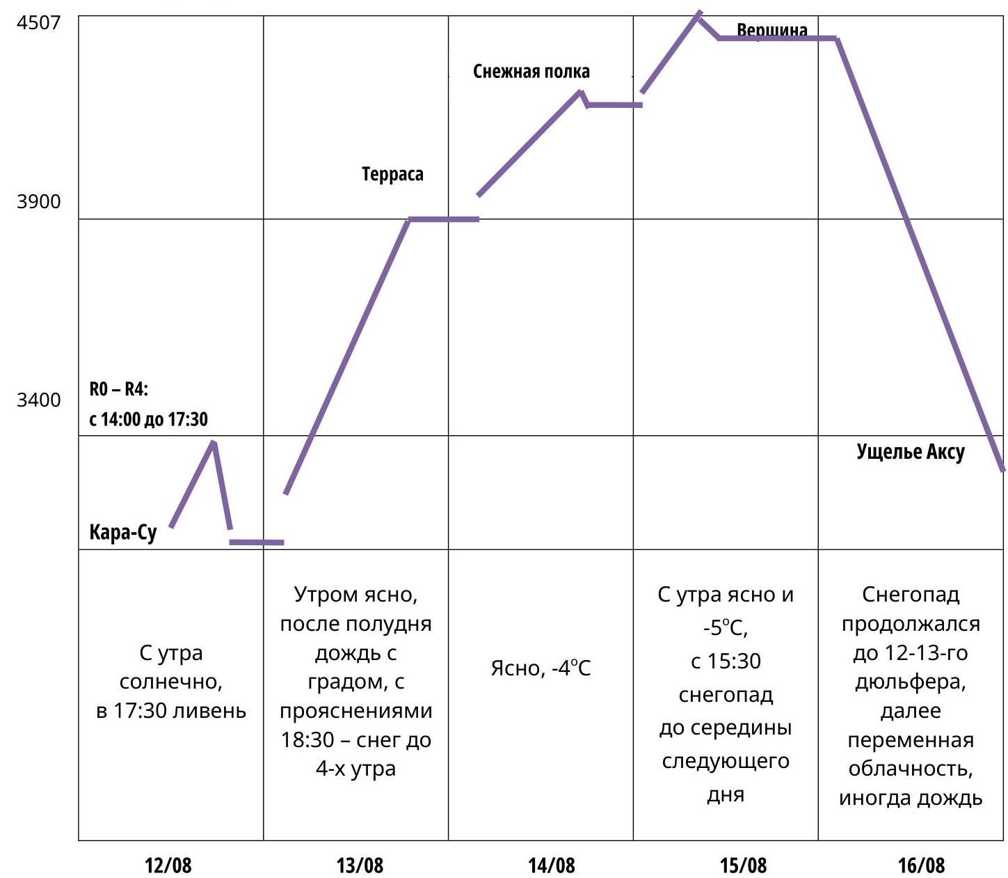
Route Description by Sections
The route is divided into two large sections — the first and second bastions, separated by two terraces.
The route through the first bastion is mainly climbing through debris with sections of climbing on slabs with poor relief. In the middle of the bastion, there are two rappels. The control point is located on a removable bolt before the second rappel.
The second bastion is significantly easier than the first, but due to a sharp deterioration in weather, heavy snowfall, and ice on the wall, our movement tempo was significantly reduced.
R0–R1.
A smooth slab with a cornice, transitioning into a crack. The slab is climbed on friction. Station on camalots.
R1–R2. A crack, abutting a cornice. Under the cornice, a 10 m traverse to the right, with an intermediate station on camalots. Then upwards, complex climbing on a slab and cracks in the direction of debris. Station on camalots and anchors.
R2–R3. Through a small wall into a global debris. Water runs through the debris.
R3–R6. Further up through the debris. On R5, there is a small shelf.
R6–R7.
- The debris ends.
- Through deep cracks to the right and upwards, continuing the debris.
R7–R9. Further up through the debris, exiting onto a large shelf. R9–R10. Along the shelf, a traverse to the left through a small gap onto a simple wall (10 m). Then a rappel to the left, to the next global debris.
R10–R11. Up through the debris for 60 m onto a shelf. On the shelf, a control point on a bolt, from which a rappel is organized to the left and downwards, in the direction of the next debris.
R11–R12. To the debris, a 10 m traverse, then upwards through the debris.
R12–R13. Climbing on a slab with poor relief and deep cracks. Protection on anchors.
R13–R14. Up through a crack, exiting onto a shelf.
R14–R16. From the shelf, on a slab with deep cracks, to the right and upwards. Protection on anchors and one removable bolt.
R16–R17. Through a crack, traversing to the right, exiting onto a quartz "vein," climbing left and upwards, under a cornice. Exit onto the first terrace.
R17–R18. Along the terrace, to the left and upwards, 100 m of simple rock.
R18–R19. Simple climbing straight up, exiting onto the second terrace. Overnight.
R19–R20. Along the terrace, on simple rock, 200 m to the right and upwards.
R20–R21. A short section up a crack onto a small sloping shelf.
R21–R22. Up a crack to an overhanging debris. Through the debris — exit onto a shelf.
R22–R23. To the right, in the direction of the next debris. Then up through the debris and an angle to the right and upwards.
R23–R25. Under an overhanging cornice-debris, on IT with large camalots, upwards. Exit onto a shelf.
R25–R26. Along the shelf, slightly to the right, then upwards on a wall, 40 m to the right and upwards through a crack in the direction of a large internal angle, ending on a shelf, where an overnight was set up.
R26–R27. From the shelf, on a wall with a thin crack, under fifi and anchors on IT, and climbing upwards.
R27–R29. To the right and upwards, in the direction of a large cornice. The cornice is bypassed on the right.
R29–R32. To the right and upwards, in the direction of the right summit gendarme.
R32–R34. Not reaching the gendarme, traverse with descent on scree shelves to the left, through a simple wall, exiting onto the ridge, to the left of the summit.
R34. Along the ridge to the summit, 20 m to the right.
Team Actions
During the stay in the area from August 1, the weather was warm with minimal precipitation. Snowfields on the walls melted, so we took a lot of water, which we poured out after the snowfall began during the ascent to the first terrace. The summit attempt was accompanied by heavy snowfall and wind, continuing until the start of the second half of the descent.
August 12, 1953. Vorobyov and Barabashov approached the route with gear and processed the first ropes in 3.5 hours. Vorobyov led, Barabashov followed on jumars. On R5–R6, they found a broken anchor piton from the first ascendants. The weather was good, but during work on the 5th rope, a downpour started, and they had to descend. Meanwhile, Petrov and Viskov, who left a bit later, brought bivouac gear and set up two RedFox tents on a flat stone behind a moraine near the route start.
August 13. At 6:30 AM, the team started jumaring on the placed ropes. One rope had to be dropped as it was damaged, so they continued on four ropes: one dynamic and three static. The movement scheme was as follows: Vorobyov worked first on two ropes, one of which he used as a belay. Barabashov belayed, then joined Vorobyov on the intermediate or final station with another rope, which he used as a belay for Petrov. Petrov, in turn, joined with a fourth rope, serving as upper protection for Viskov.
The weather changed several times during the day: clear and sunny in the morning, cloudy around noon, with short heavy hail and rain twice, during which they had to stop and wait.
At the control point (a Supradin container) before the second rappel, in the middle of the first bastion, they left their note.
Around 6 PM, as they reached the first terrace, snow started, continuing almost all night. They spent the night in one tent on a small snow-covered area on the second terrace.
The first bastion was climbed mainly by free climbing, practically without using IT, in one working day from 6:30 AM to 8:00 PM (the whole team reached the second terrace), plus 3.5 hours of processing the day before. This was significantly faster than the first ascendants' (M. Devi and A. Cheremnykh) pace. Due to the team's high level of preparation, they managed to climb sections where the first ascendants made pendulum moves in the upper part of the first bastion. They used one skyhook hole on R1–R2 (on a cornice) and a hole on one of the slabs in the upper part of the route, where a removable bolt was placed.
August 14. A lot of snow fell overnight, but the morning was clear. They started moving late, around 11:00 AM, as the wall was under a layer of ice, and they hoped the sun would melt it. The thermometer showed −4°C.
They climbed through knee-deep snow to the wall, which Viskov and then Barabashov started. Their movement was significantly complicated by ice covering the wall, so they had to clear cracks and holds with fifi first.
Around noon, it warmed up, and the wall began to melt. By 1 PM, most of the ice had melted, and Vorobyov started climbing. The wall remained wet throughout the route that day, making progress slower and more complicated.
The second control point, left by the first ascendants, was not found due to snow.
In the evening, they reached a large snowy shelf, where they set up both tents and spent the night comfortably.
August 15. In the morning, they continued moving. Vorobyov worked the first part of the remaining route. The temperature remained negative throughout the day. They regularly stopped to warm their hands and swing their legs. Then, when climbing turned to snowy terrain, Barabashov took over. Just before reaching the summit at 3:30 PM, heavy snowfall resumed. They managed to hang belays on the ridge to the descent loop before deciding to overnight on a platform under the summit, where only one tent fit.
August 16. Snowfall with strong wind continued throughout the remaining day, did not stop during the night, and ended only the next day, when the team had already descended halfway into the Ak-Su valley.
During the descent, they found only an old loop, two loops on the 8th and 10th rappels, and a couple more loops at the end. For the descent, they used their points and 7 mm rappel cord, and when it ran out, part of the damaged static rope.
Petrov led first, followed by Barabashov, Vorobyov, and Viskov.
The descent took 18 hours (22 rappels), and they reached the river around midnight.
At the bottom of the Ak-Su valley, they were met by:
- Andrey Baranov
- Andrey Kerov
They brought dry clothes and food and helped carry the gear to the base camp in the Kara-Su valley.
Used gear:
- 1 dynamic rope (60 m)
- 3 static ropes (70 m) Tendon 9.8
- 10 Ocun 60 cm loops
- 5 Ocun and Vento 120 cm station loops
- Ocun and Vento camalots and simple carabiners
- two Black Diamond camalot sets
- Vento and Camp stoppers
- 10 Dmitrienko anchors and fifi
- 2 Ural-Alp removable bolt pitons
- 1 Talon BD skyhook
- jumars, T-Block, and Gri-Gri
- Krukonogi.com ladders and hook sticks
- 2 RedFox two-person tents
- sleeping bags and quilts
- Jetboil
Photos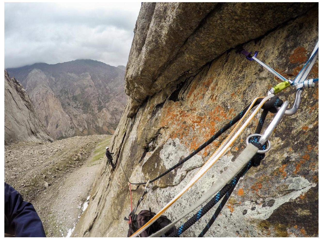
Cornice on
R1–R2.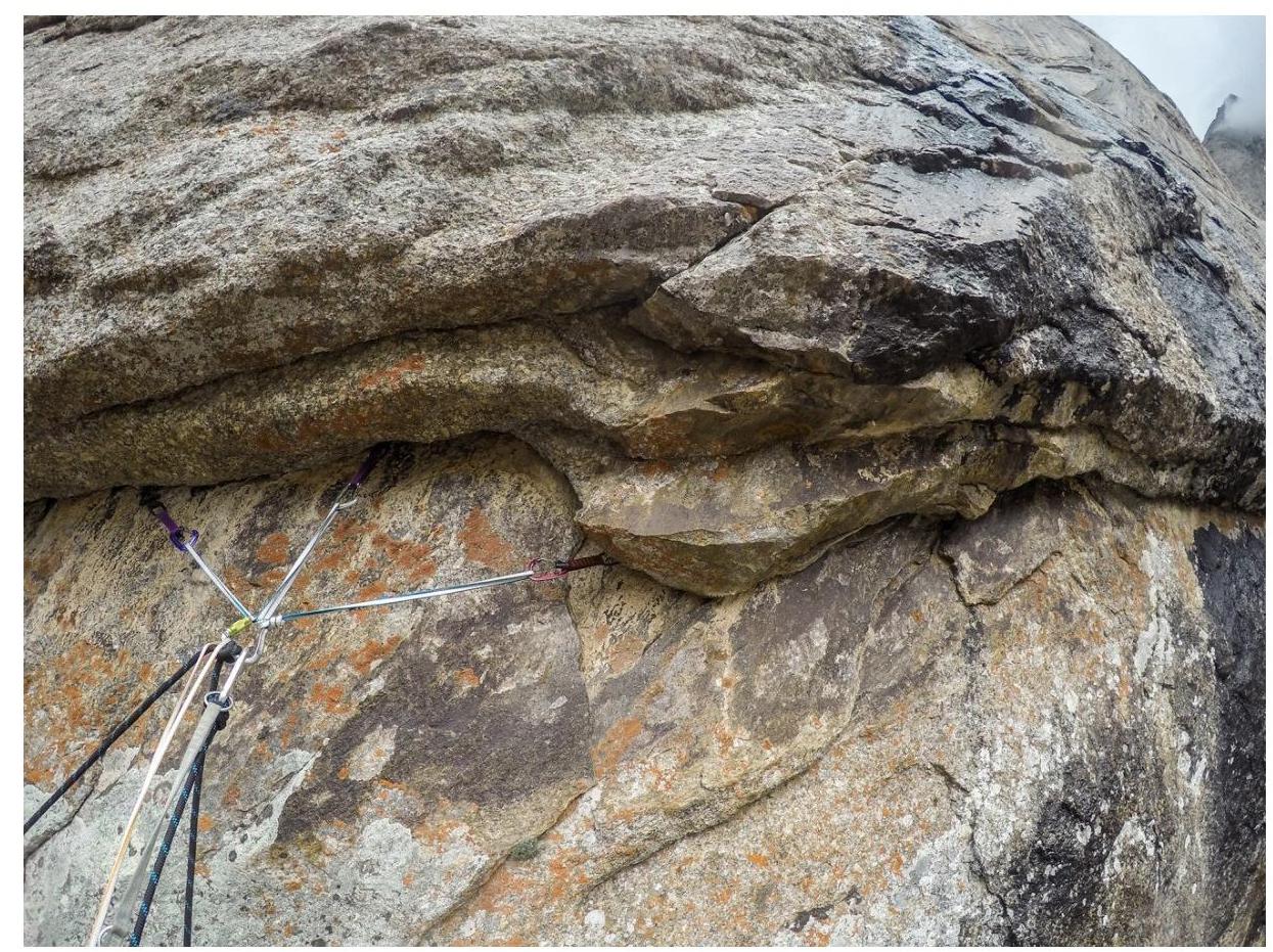
Intermediate station under the cornice on
R1–R2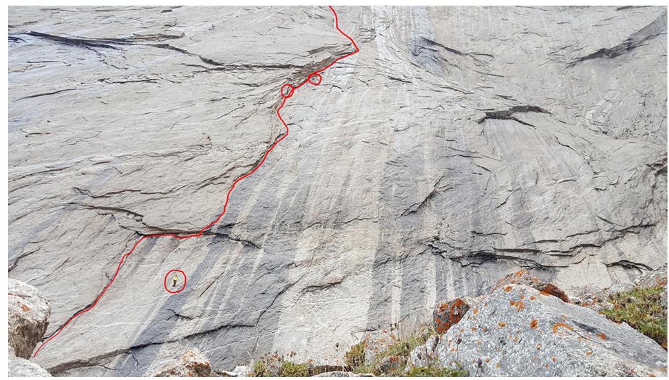
Working on
belays.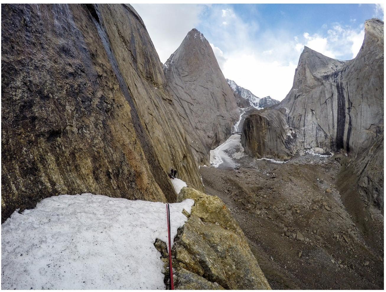
Shelf on
R9–R10.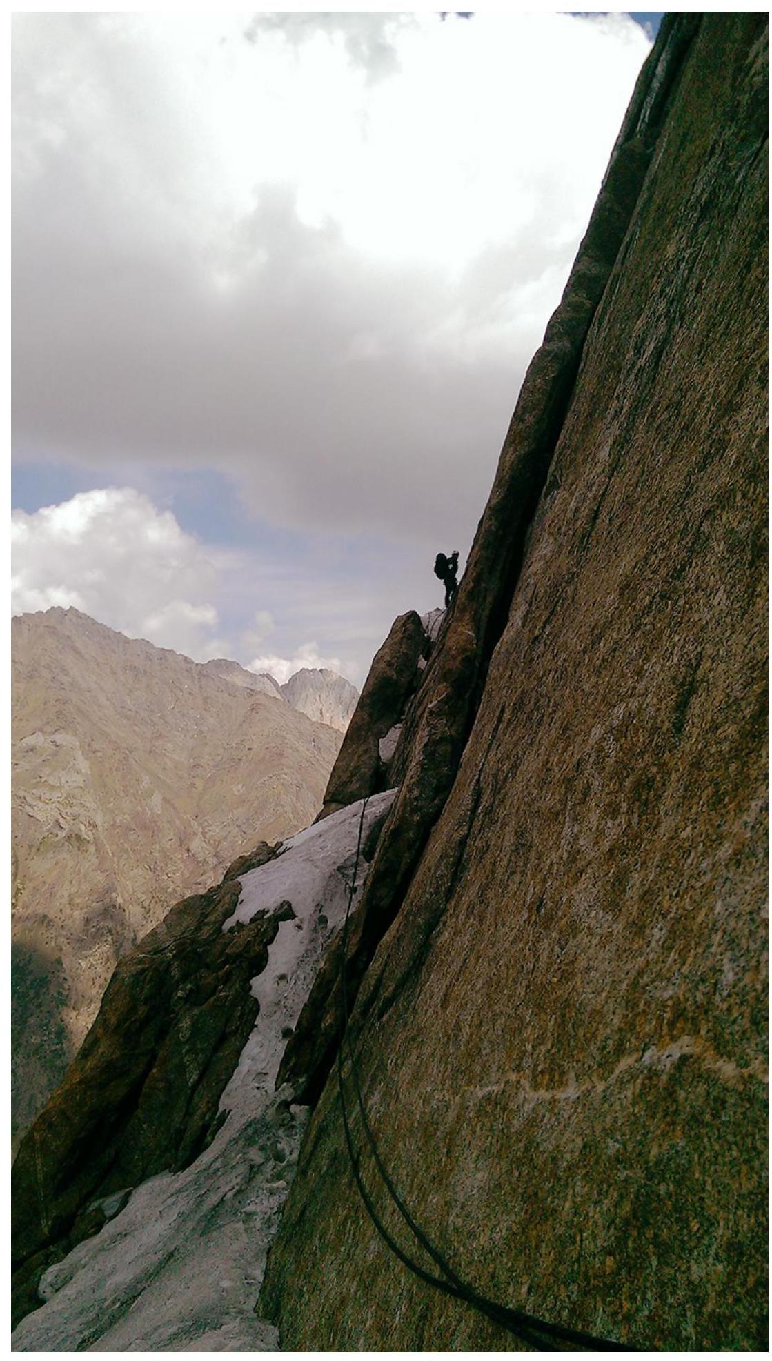
Shelf on R9–R10 with a small
wall.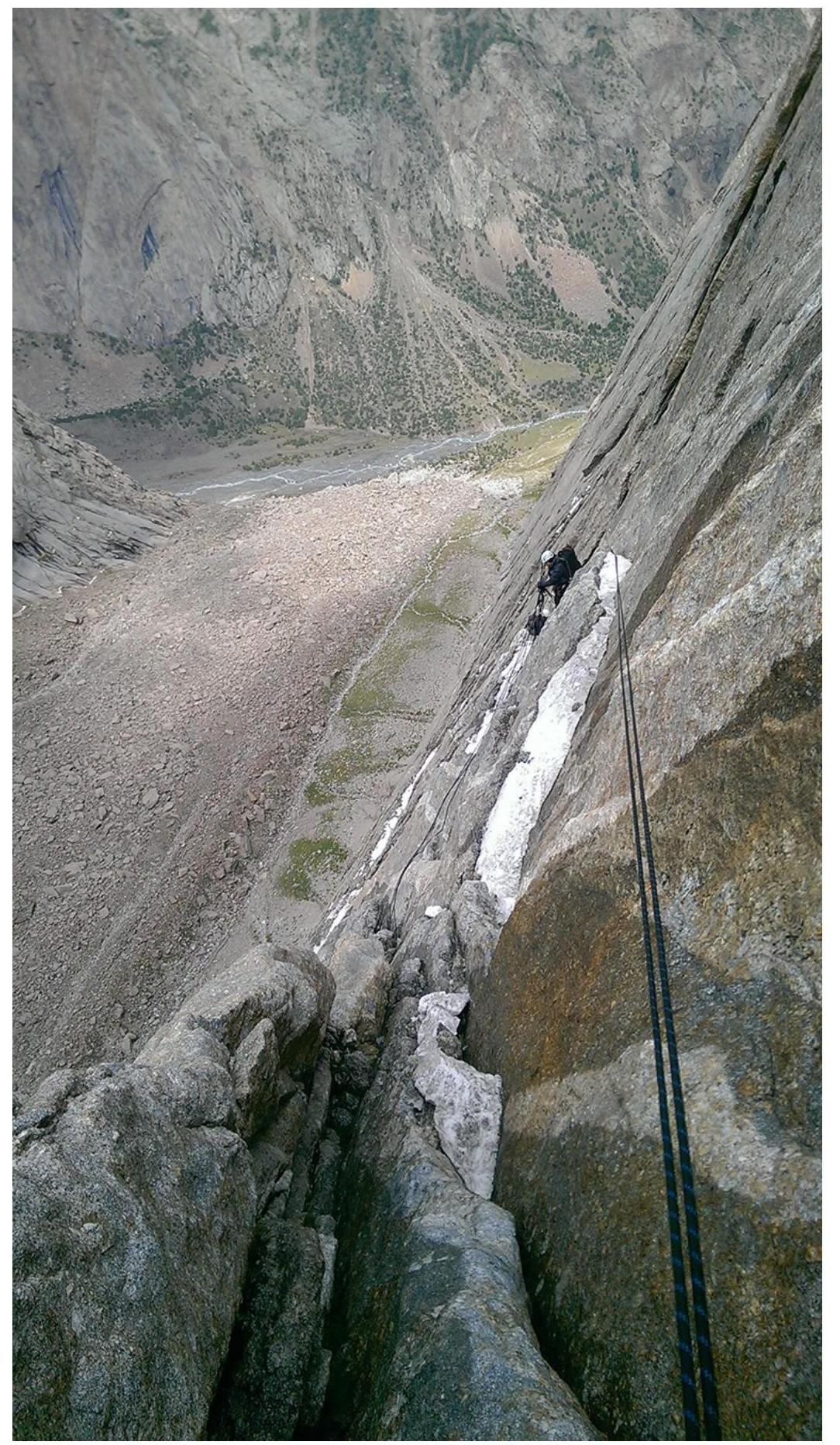
First
rappel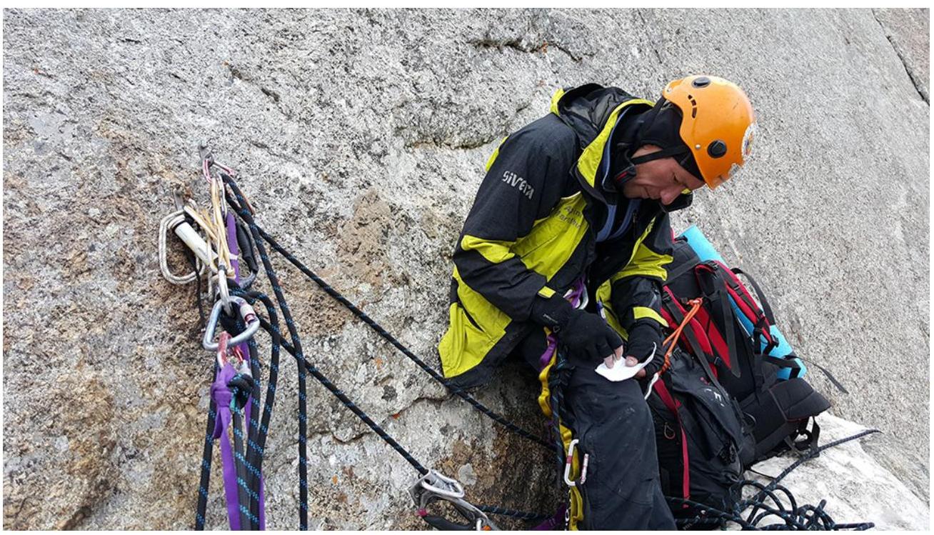
Control
point.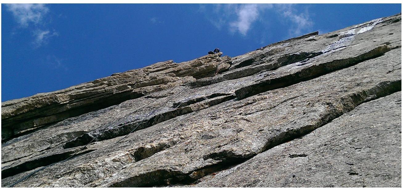
Vorobyov working on R12–R13 after the second
rappel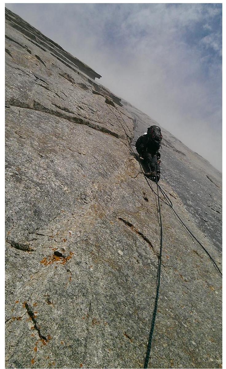
Petrov on
R12–R13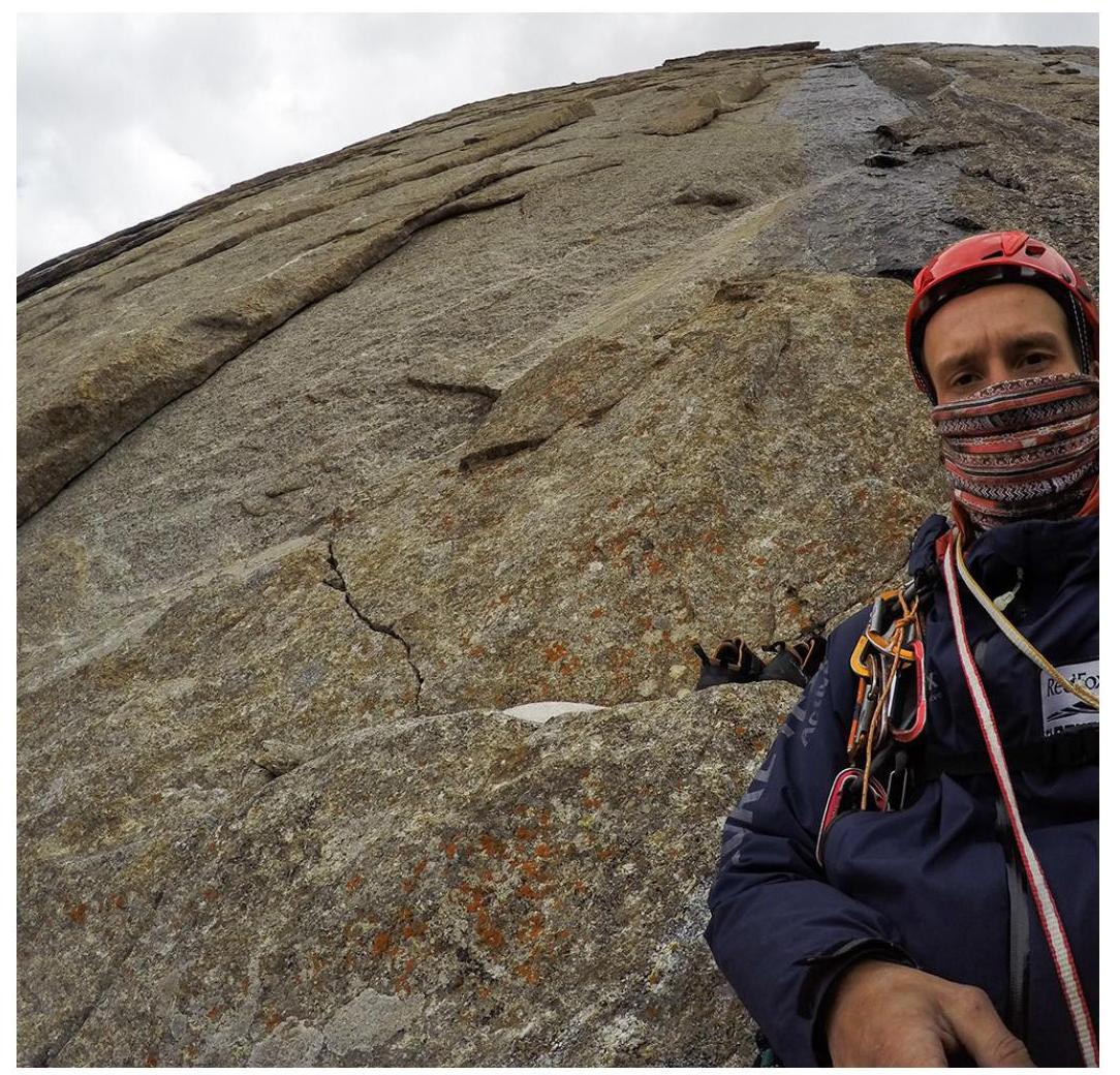
Vorobyov at the end of
R14.
Hail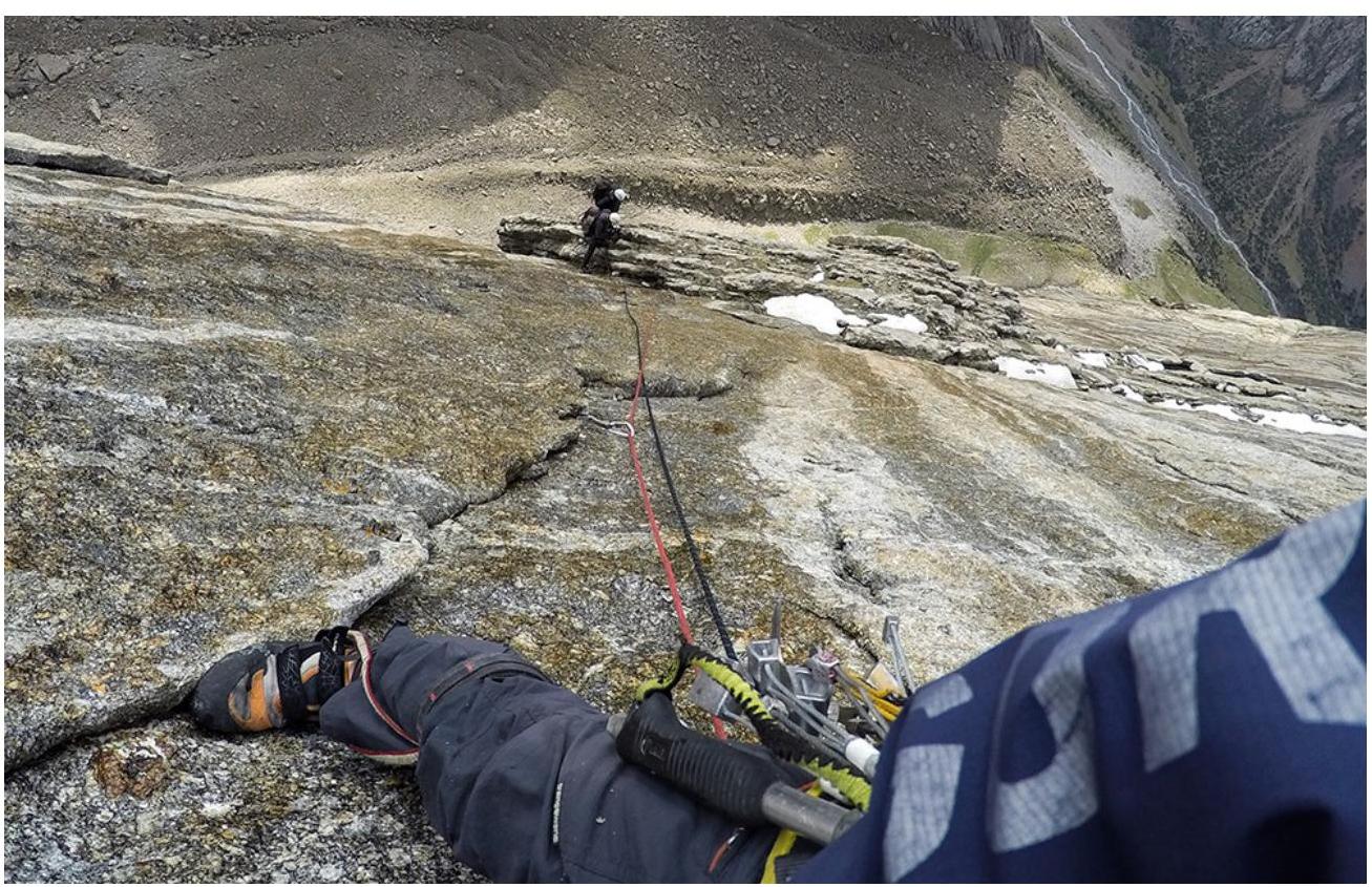
R14–R16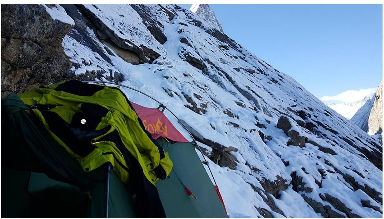
Overnight on the second
terrace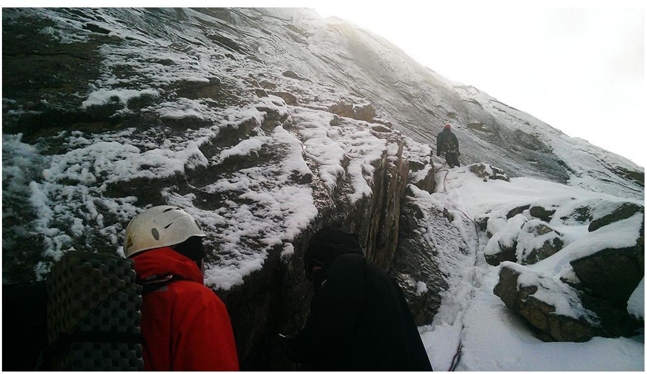
Before R20 after simple rock on the second
terrace.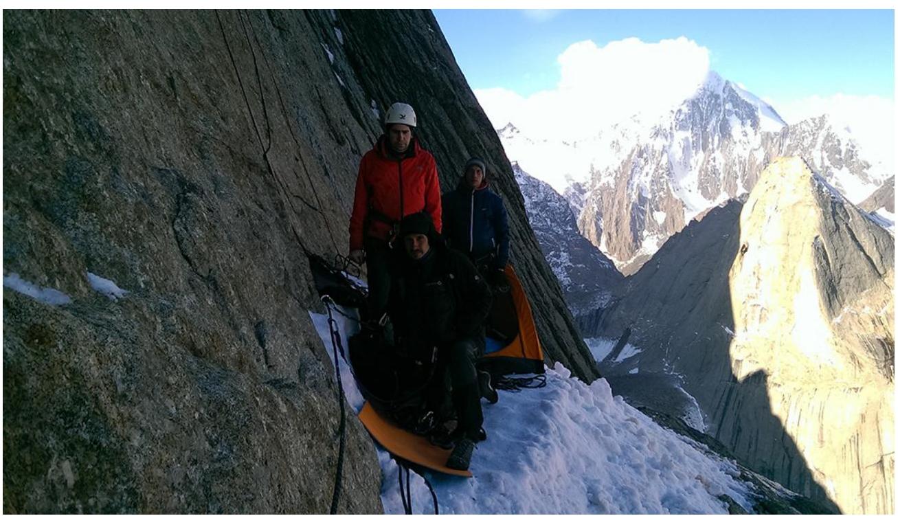
Overnight on
R26.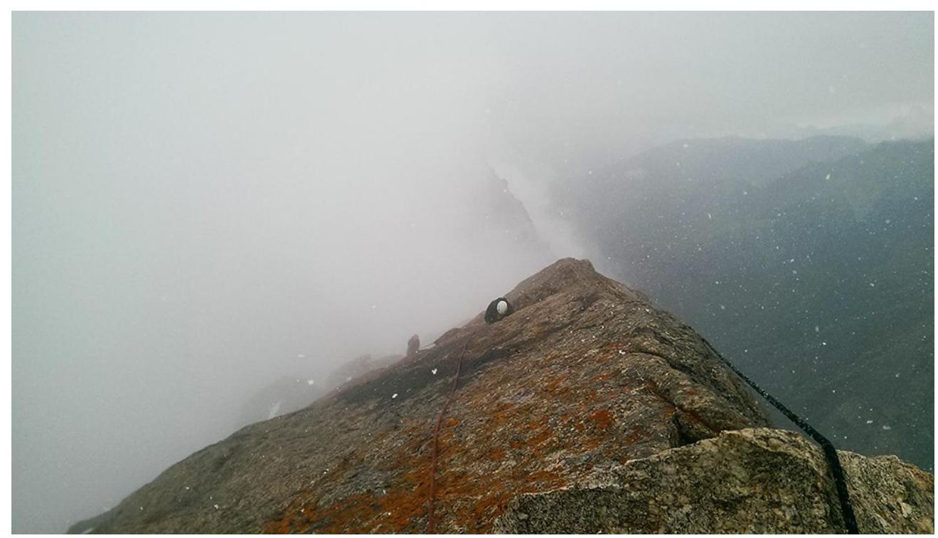
Summit
ridge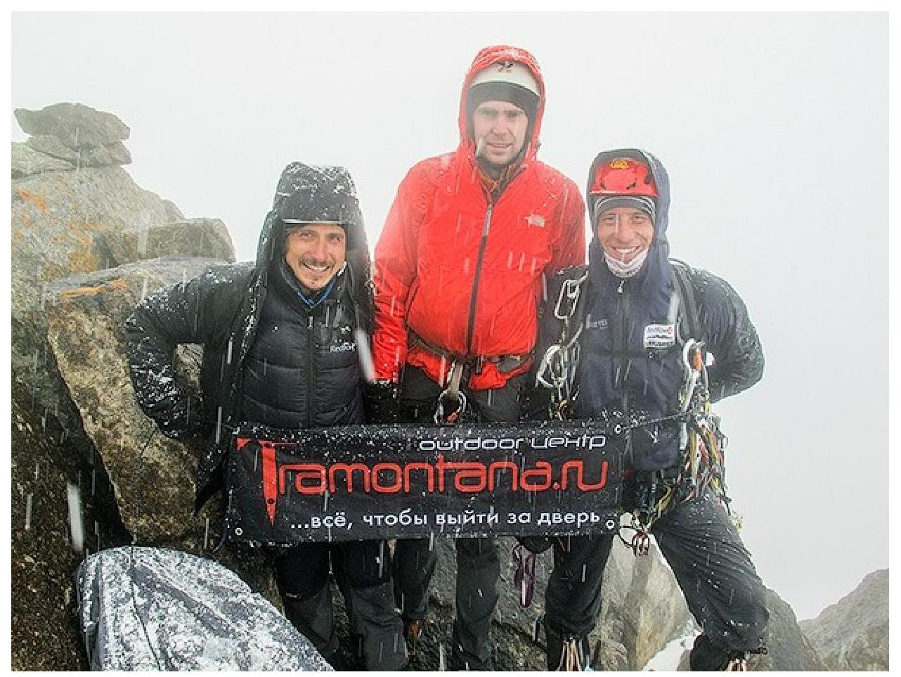
At the summit (Petrov, Barabashov, Vorobyov. Viskov took the
photo)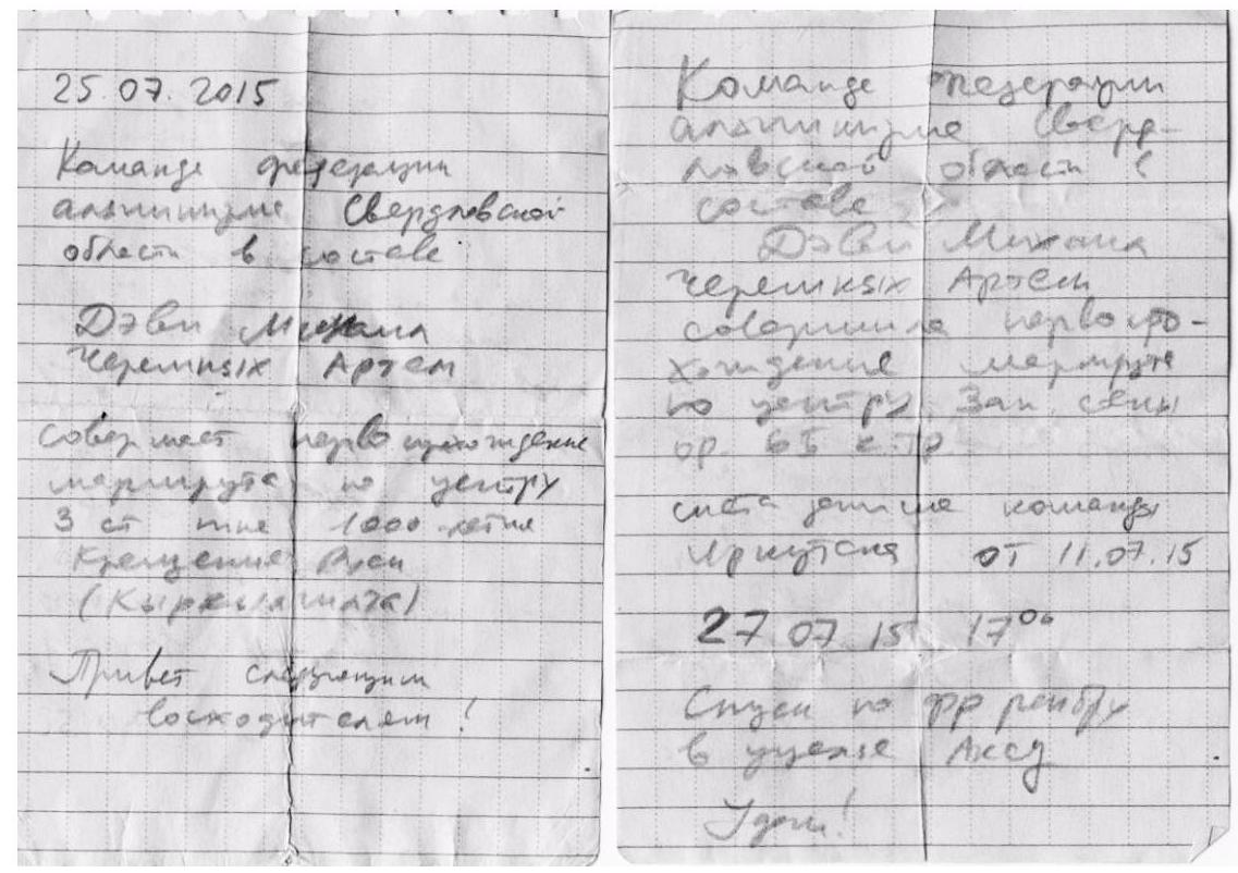
Notes from the 1st control point and the
summit
Overnight under the
summit
Petrov preparing for the first
rappel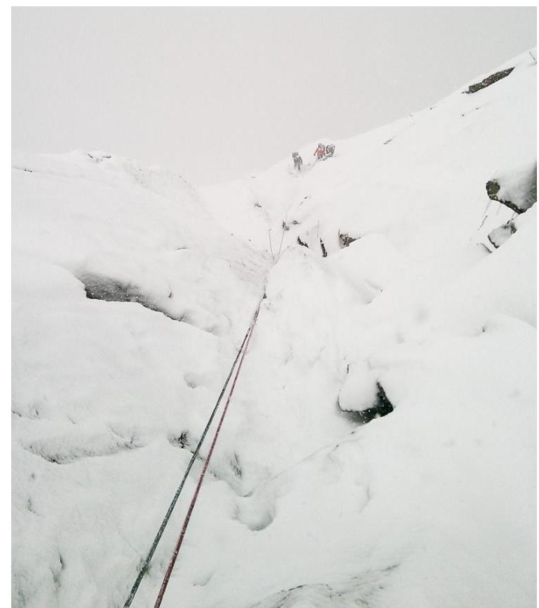
First rappel in knee-deep snow.