ALPINISM SPORT CLUB named after A.S. DEMCHENKO
MOSCOW CHAMPIONSHIP
CSKA Team named after Demchenko
Report on the ascent of Pik Tyсяchelеtia kreshcheniya Rusi (Kyrkchilta), 6A cat. difficulty, 4520 m via the left buttress of the eastern wall
2013
Ascent Passport
- Pamir-Alay, Turkestan Range, Karavshin gorge, 5.4.3
- Pik 1000-letiya kreshcheniya Rusi (Kyrkchilta peak), 4520 m, via the left buttress of the eastern wall (Potankin's route 1991)
- 6A cat. difficulty
- Route type: rock
- Route height difference: 1700 m
Route length: 2000 m
Section lengths:
- IV cat. difficulty: 650 m
- V cat. difficulty: 800 m
- VI cat. difficulty: 550 m
Average slope of the entire route: 66°. Average slope of the second bastion: 79°
- Pitons left on the route: total 0, incl. AIDs 0
Pitons used on the route:
- Bolted stationary: total 3, incl. AIDs 0
- Bolted removable: total 0, incl. AIDs 0
- Anchor pitons: total 20, incl. AIDs 7
- Chocks and friends: total 300, incl. AIDs 11
- Team's climbing hours: 31 h, 2.5 days
- Team leader: Roman Bryk, 1st sports category
Team members: Rinat Aliev, Candidate for Master of Sports, Alexander Tyurin, Candidate for Master of Sports
- Coach: Elena Kuznetsova, Candidate for Master of Sports
- Start of the route: 6:00, July 25, 2013
Reached the summit: 14:00, July 27, 2013 Returned to Base Camp: 8:00, July 29, 2013 Descent via the right buttress of the eastern wall (“French Edge”)
- Organization: CSKA named after A.S. Demchenko
- Report responsible: Roman Bryk, romabryk@mail.ru +7 962 994-19-40
Route Thread
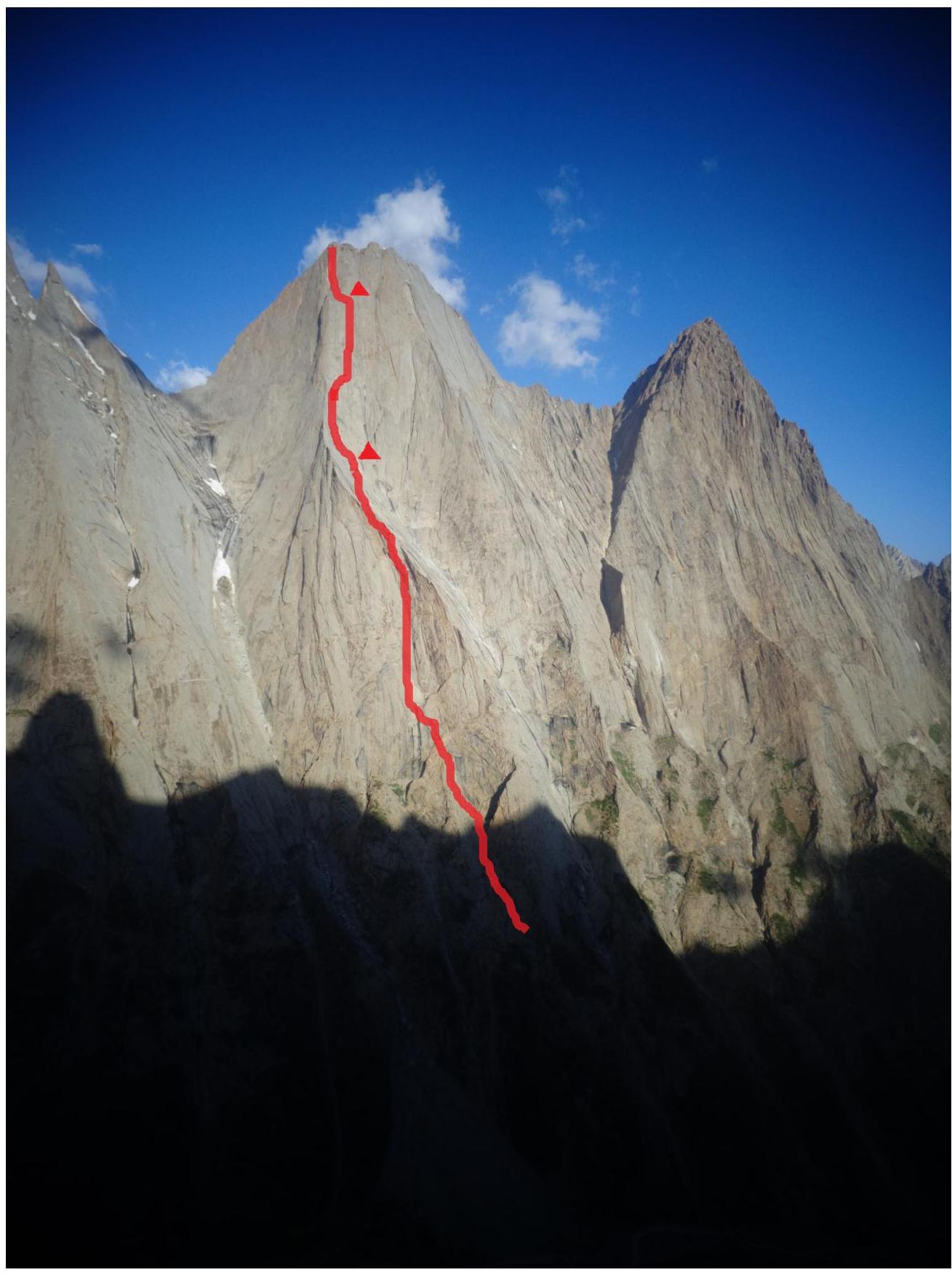
Pik 1000-letiya kreshcheniya Rusi (Kyrkchilta peak), 4520 m, via the left buttress of the eastern wall (Potankin's route 1991) 6A cat. difficulty.
Area Map

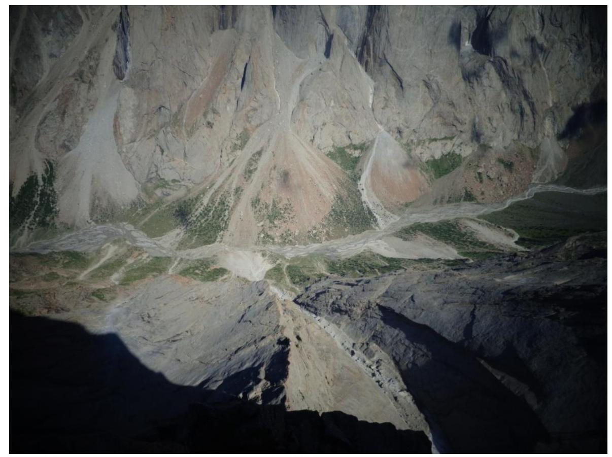
The base camp was located in the AkSu glacier gorge, between peaks 4810 and Slesova.
Team's Tactical Actions
Before starting the route, the team attempted to ascend Slesova Peak. However, due to bad weather, they had to descend. They spent several days on the wall waiting for the weather to improve and climbed 10 ropes in total.
Due to the route's length of about 2000 m, they climbed in the lightest and fastest style possible, without prior preparation. Thanks to the team's coordinated and swift work, they managed to reach the summit in 2.5 days.
- Almost all sections were climbed with free climbing up to 6C
- About 20 m of the route on AIDs A1–A2
First day: to the ridge in the middle of the wall + three ropes to the bivouac (20 ropes), max. 6B, 1200 m
Second day: the key part of the route, 14 ropes to a large shelf with a snowpatch, max. 6C, A1–A2, 500 m
Third day: final climb to the summit, 7 ropes + 2 ropes along the summit ridge, max. 6B, A1–A2, 300 m
Descent, as planned, via the “French Edge”, 1.5 days, as they got lost at night and went into the wrong couloir. About 40–45 rappels.
Approach
The approach to the route starts from the base camp in the AkSu gorge (BC is located between Slesova Peak and peak 4810). Cross the river by a bridge, go down the gorge to the beginning of the slopes of Pik 1000-letiya kreshcheniya Rusi (on the left). Then, climb up the steep slope to the stream flowing between peaks 4810 and 1000-letiya kreshcheniya Rusi. We fetched water at this spot. The first simple rock section of the route begins there. The approach from BC takes 1–1.5 hours.
Bivouacs on the Route
There are shelves for organizing overnight stays on the route, but there are not many options for comfortably accommodating tents for 2–3 people.
We bivouacked:
- 1st bivouac immediately after the ridge (in the middle of the route): first, 1–2 ropes along the ridge, then 1–2 ropes along the shelves to the right, then 0.5 ropes along a simple internal corner to a convenient small platform for three people. This shelf is not visible from the ridge, but it's there.
- 2nd bivouac: immediately after the key main bastion. On a large shelf-terrace, there's a snowpatch; we melted water. However, by the end of summer, the snowpatch may melt.
There are also several decent spots higher up. You can comfortably stay on the summit as well.
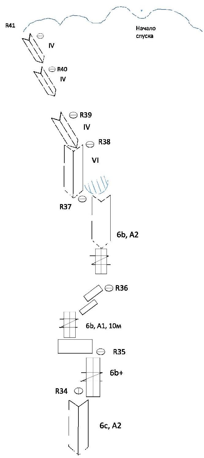
Route Description by Sections
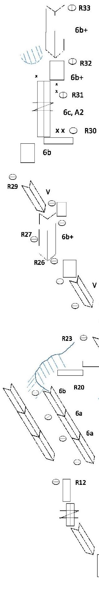
R0–R5 — 250 m of simple rocks, 3rd cat. difficulty. R5–R12 — 350 m of easy climbing, then a transition to the right huge internal corner with further movement along its left side. 4th climbing grade.
R12–R20 — 500 m of climbing on slabs with cracks and internal corners. The upper part before reaching the ridge becomes more difficult. About the last 5 ropes are up to 6A–6B.
R20–R23 — movement along an unpleasant ridge, then a traverse along shelves to the right. Then 0.5 ropes along an internal corner to a shelf. Bivouac.
R23–R26 — return to the ridge to the left, then along a system of slabs and internal corners to a slab with a chip. 5th climbing grade.
R26–R27 — difficult rope along a chip. 6B+, 40 m.
R27–R30 — climbing on slabs and internal corners to the beginning of the key bastion. Up to 6B.
R30–R31 — key rope of the route, along the right side of the central bastion of the route's "nose" via a wide crack 6C, AIDs A1–A2. 45 m.
R31–R32 — difficult climbing, bypassing a cornice to the right. There are two bolts, as well as anchors left by someone aside from the climbing relief. 6B+, 45 m.
R32–R34 — difficult climbing along an internal corner. 60 m. 6B+.
R34–R35 — difficult climbing along a system of internal corners and walls to a convenient shelf. 6C, AIDs A1–A2, 50 m.
R35–R36 — difficult climbing on a slab with narrow cracks, 10 m, 6B, A1. Then 30 m of 4th grade climbing.
R36–R37 — difficult climbing under a cornice. First, along a short crack into an internal corner. Then along the corner to the cornice. The cornice was bypassed on the left. 6B, AIDs A1. 45 m.
R37–R38 — climbing along an internal corner to the beginning of simple terrain. 6th climbing grade, 40 m.
R38–R43 — climbing on destroyed terrain to the summit. Then a traverse along a difficult ridge to the saddle between the 2nd and 3rd gendarmes. 300 m. 4th climbing grade.
Note from the Summit
On the leftmost gendarme, there was no note in the cairn. We didn't have time to write and search for a note. Cirrus clouds were hanging over the summits, and a thunderstorm was starting. We hurried to find the beginning of the descent and reach a convenient shelf.
Descent
To find the descent, you need to traverse the summit towers from left to right. First, along the ridge, and then — identify the highest gendarme (3rd in count) from the side of the opposite Kara-Su gorge.
By going around the gendarme, you'll see a saddle with two large boulders. Between the boulders — the first rappel loop towards the AkSu gorge via the so-called “French Edge”.
If you look from the AkSu gorge at the summit of Pik 1000-letiya kreshcheniya Rusi, the beginning of the descent is between the 3rd and 4th gendarmes (counting gendarmes from left to right).
There are also bivouac spots on the descent. The first bivouac from the top is on the 6th rappel (not very convenient), the next good spot is on the 10th rappel. The lower you go, the more convenient spots there are.
Attention! Loops for rappel are left for 60-meter ropes.
Descent Path

Route Profile

Route Diagram
Recommended Technical Gear List
- 2 sets of “camalots”. The largest size is 4.
- A set of chocks.
- Anchor pitons — 5 pcs. All were left on the descent.
- Consumable cord for descent.
- 3 ropes, 60 m each.
No ice gear was taken.
General Impressions
The route is logical and safe. Initially, before climbing, the route seemed relatively not difficult to us. However, comparing it now with other “sixes” in Central Asia, such as:
- Pogorelov's route on Asan (6A),
- Arkhipov's route on Parandas (6A),
our team believes that Potankin's route is an order of magnitude more difficult. The extended descent also adds complexity. Overall, it's an excellent route for strong, well-climbing teams.
Photo Report

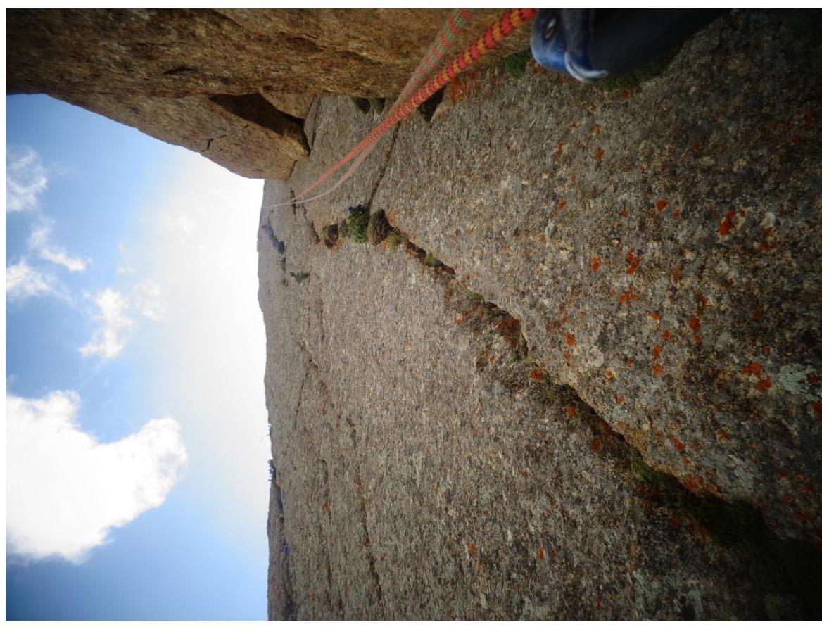
Lower part of the route R7–R15
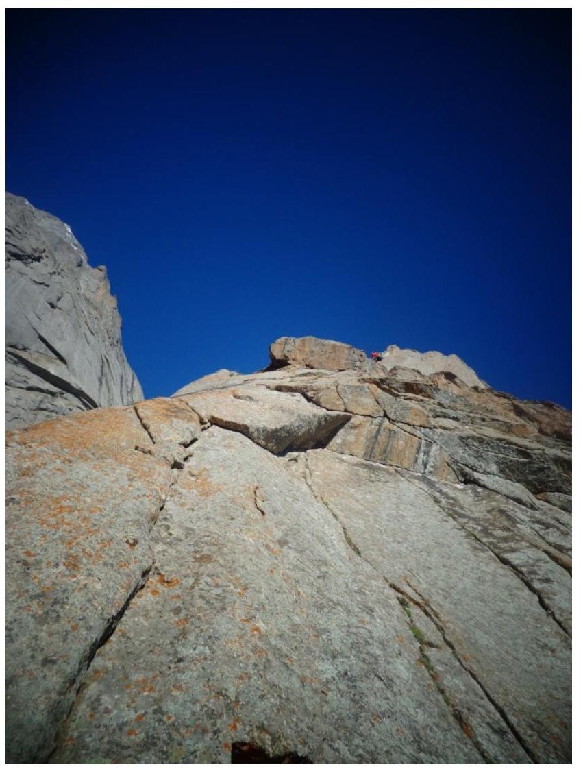
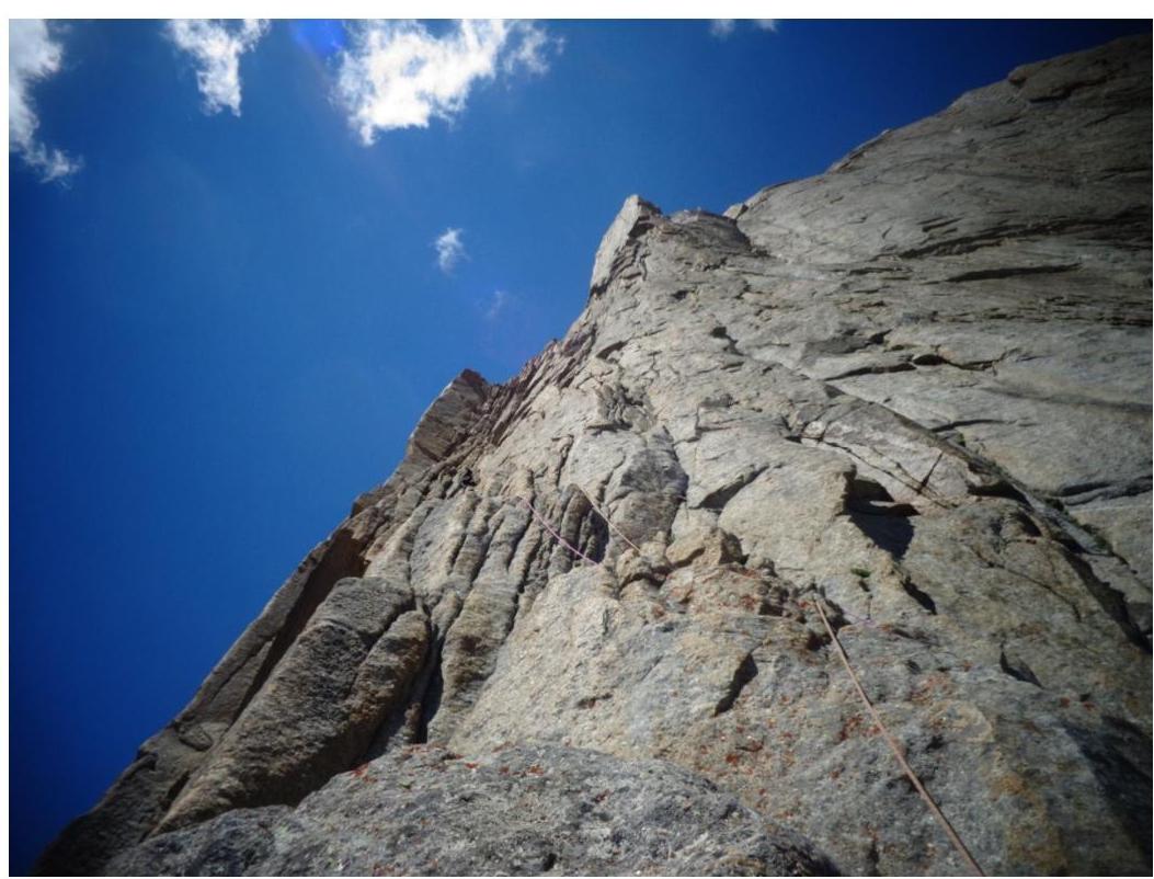
Before reaching the ridge in the middle of the route, R20, 6 cat. difficulty
Second day, sections R27–R30
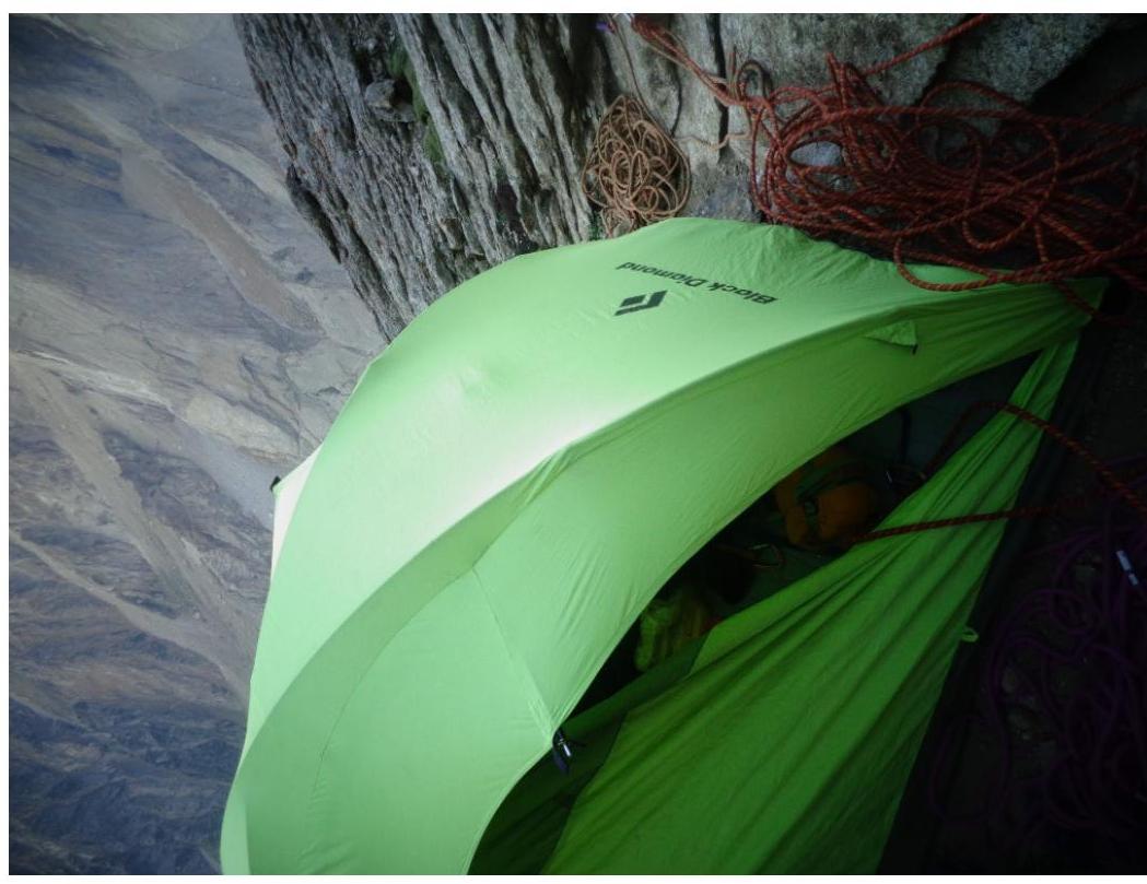
Bivouac on the route
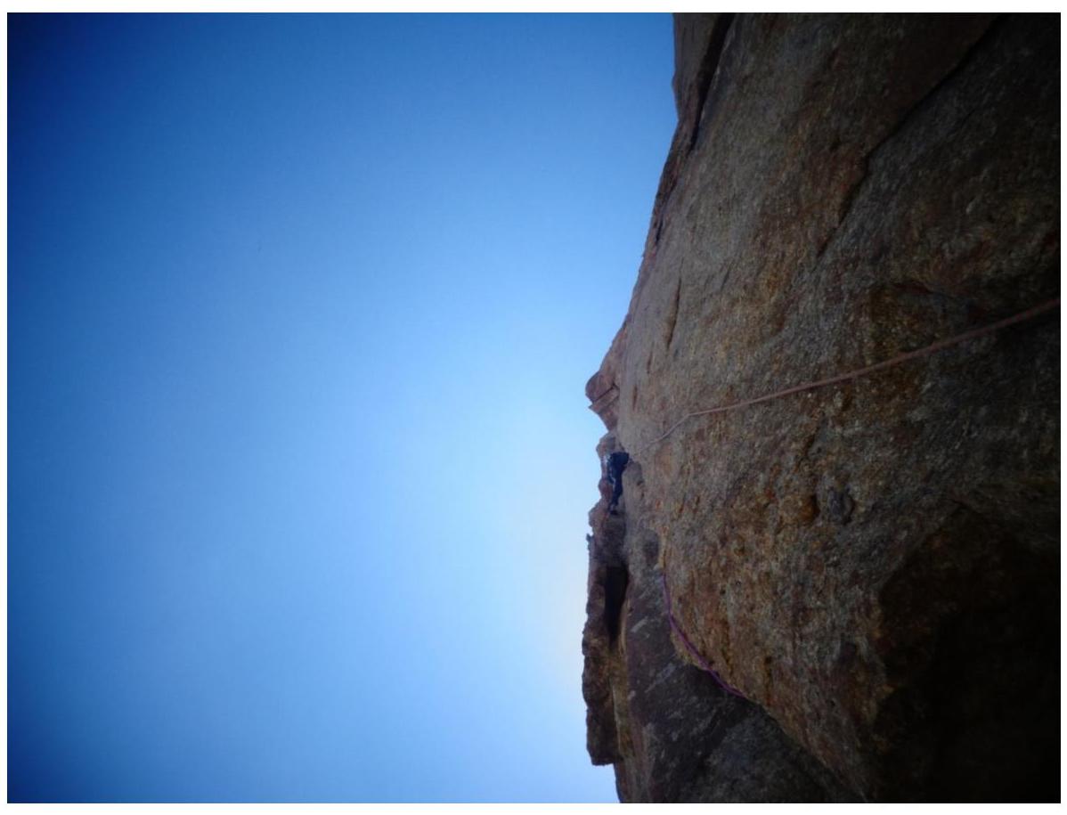
R30–R31 — key rope of the route, along the right side of the central bastion of the route's "nose". Wide crack. 6C, AIDs A1–A2. 45 m. Above, a cornice is visible, which needs to be bypassed to the right along a system of heavy vertical internal corners.
View of the ridge in the middle of the route from the key bastion
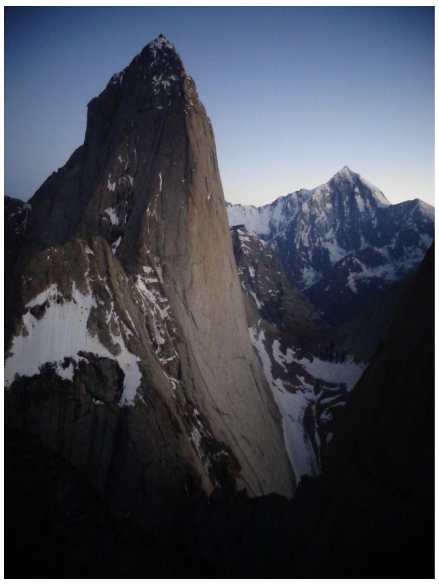
View of peak 4810 from the second bivouac on the route
Additional Information
We used the description from the first ascenders' team on the FAR website: http://www.alpfederation.ru/route/view/3962↗
Upon returning, we found an excellent description by the MSU team (led by I. Saveliev) on the FAR website as well, as part of the 2012 Russian Championship (4th place): http://www.alpfederation.ru/journal/champreports/2012/11/20/4048↗