Passport
- Technical class.
- Turkestan Range, Kara-Su gorge, Karavshin river valley.
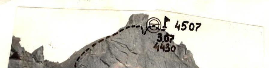
- Peak 4507 m. First ascent via the left part of the northwest wall.
- 6B cat. diff. (approximate).
- Height difference 1300 m, length 2010 m.
Length of sections with 5–6 cat. diff. is 1115 m, including 535 m of 6 cat. diff. Average steepness of the main part of the route: I wall — 75° II wall — 80° Steepness of the entire route — 60°
- Hammers driven:
| rock pins | bolted pins | chocks |
|---|---|---|
| 55 | 4 | 413 |
| 12 | 1 | 84 |
- Travel hours 39, days 4.
- Overnight stays on rock ledges in a tent, comfortable.
- Leader: S. V. Scripko CMS Participants: I. B. Bugachevsky CMS N. M. Golovkin CMS A. N. Lushnikov MS V. L. Pivnyak CMS
- Coach: S. V. Scripko.
- Start of the route: July 1, 1988, 9:00 AM Reach the summit July 4, 1988, 12:00 PM Return to base camp July 5, 1988, 12:00 PM
- Organization: Zelenograd Alpine Club.
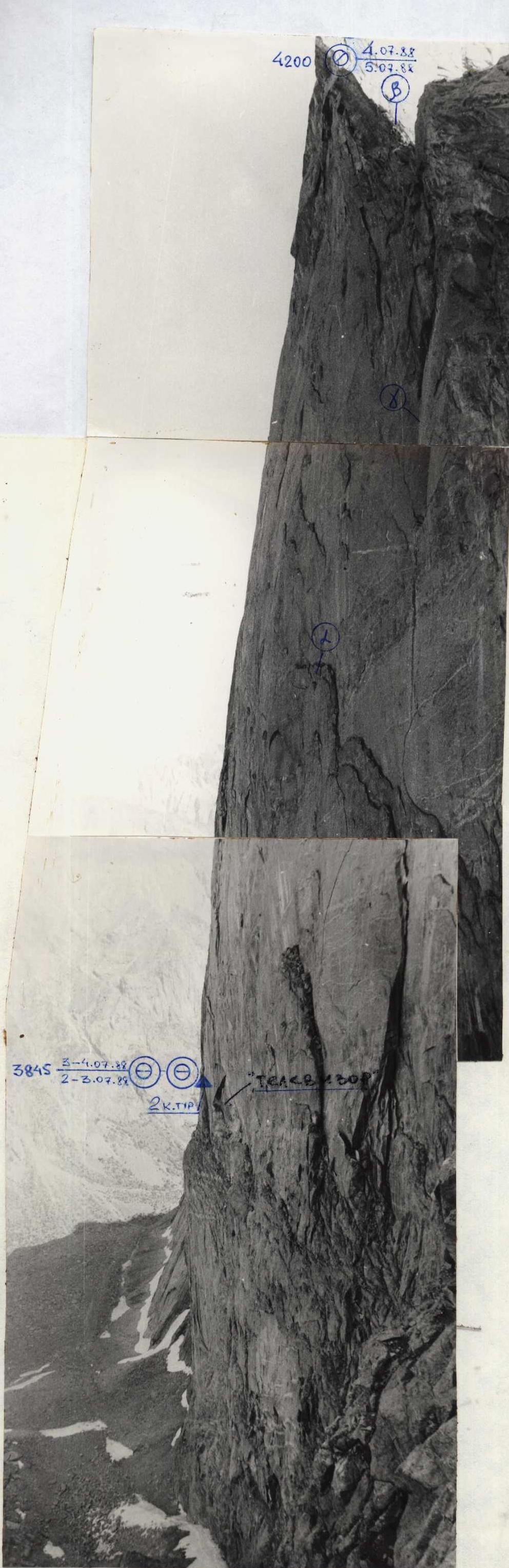
Photo 15. The profile of the wall on the right is taken from the descent couloir (F15). The route goes 40–50 m to the left of the wall contour.
Route taken by the team
Photo-1 Point-1 Object Jupiter-37A Date-15.07 Distance-3 km Altitude
 3.07 ÷


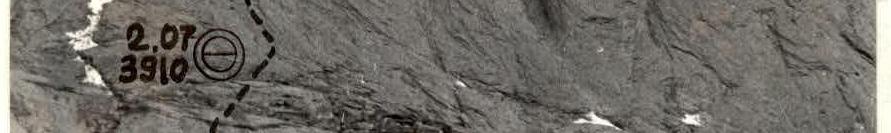


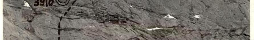


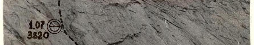


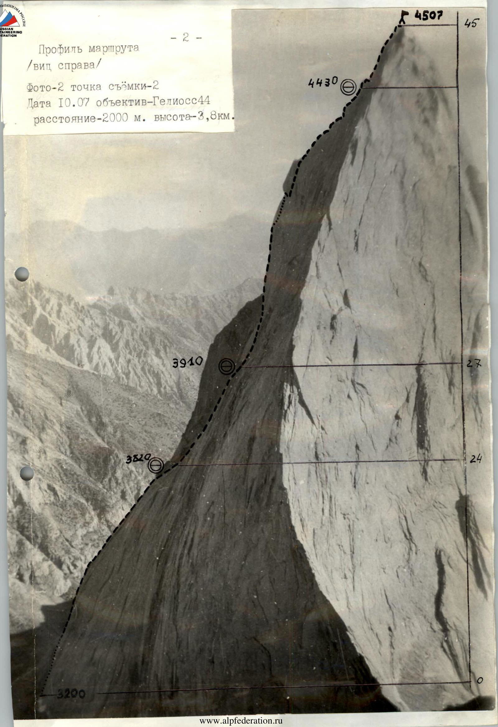
Photo 16. The route profile (right view)
Photo-2 Shot point-2 Date July 10, Lens — Helios-44, distance — 2000 m, altitude — 3.8 km.
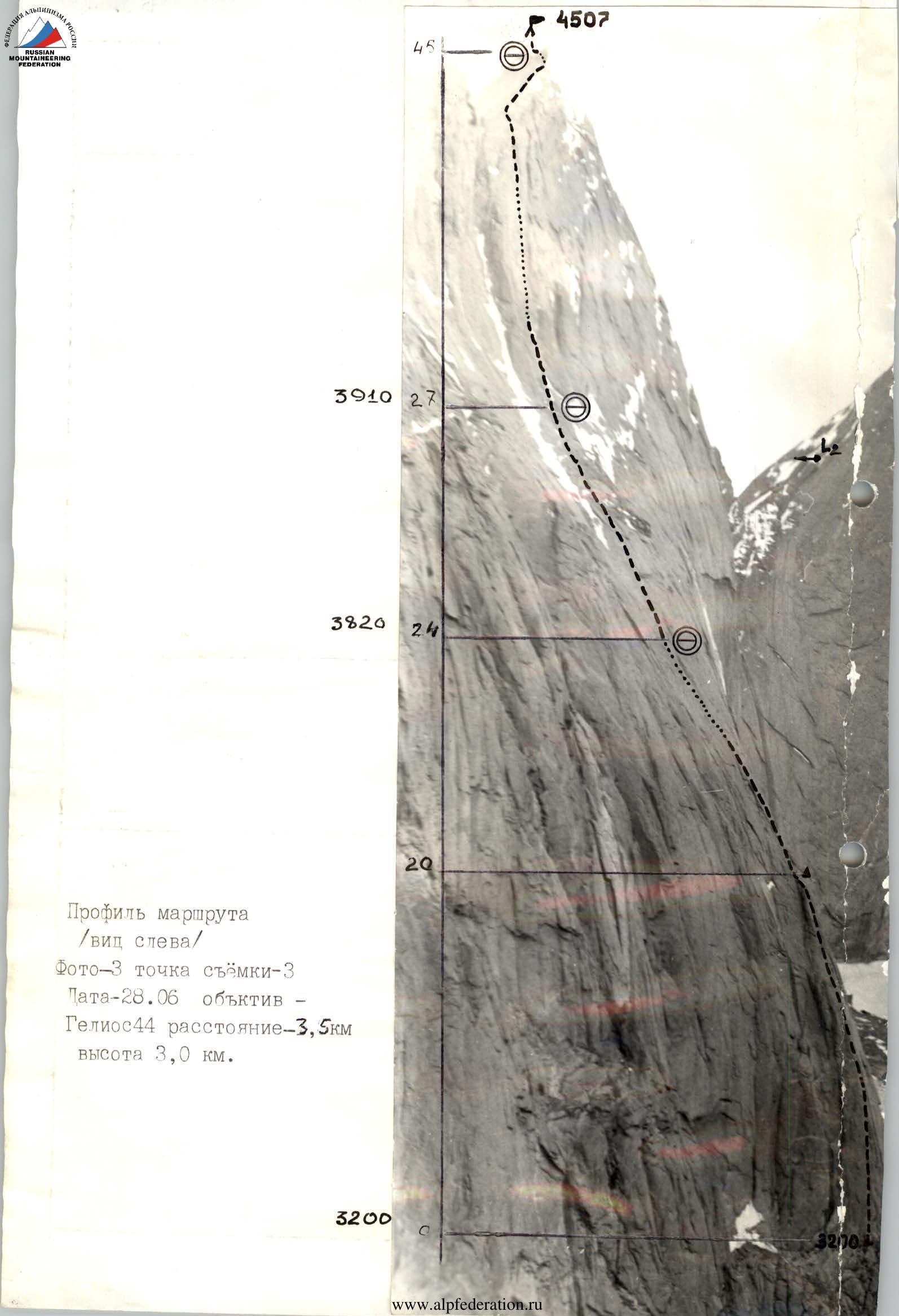
Route profile (left view) Photo-3 Shot point-3 Date June 26, Lens — Helios-44, distance — 3.5 km, altitude — 3.0 km.
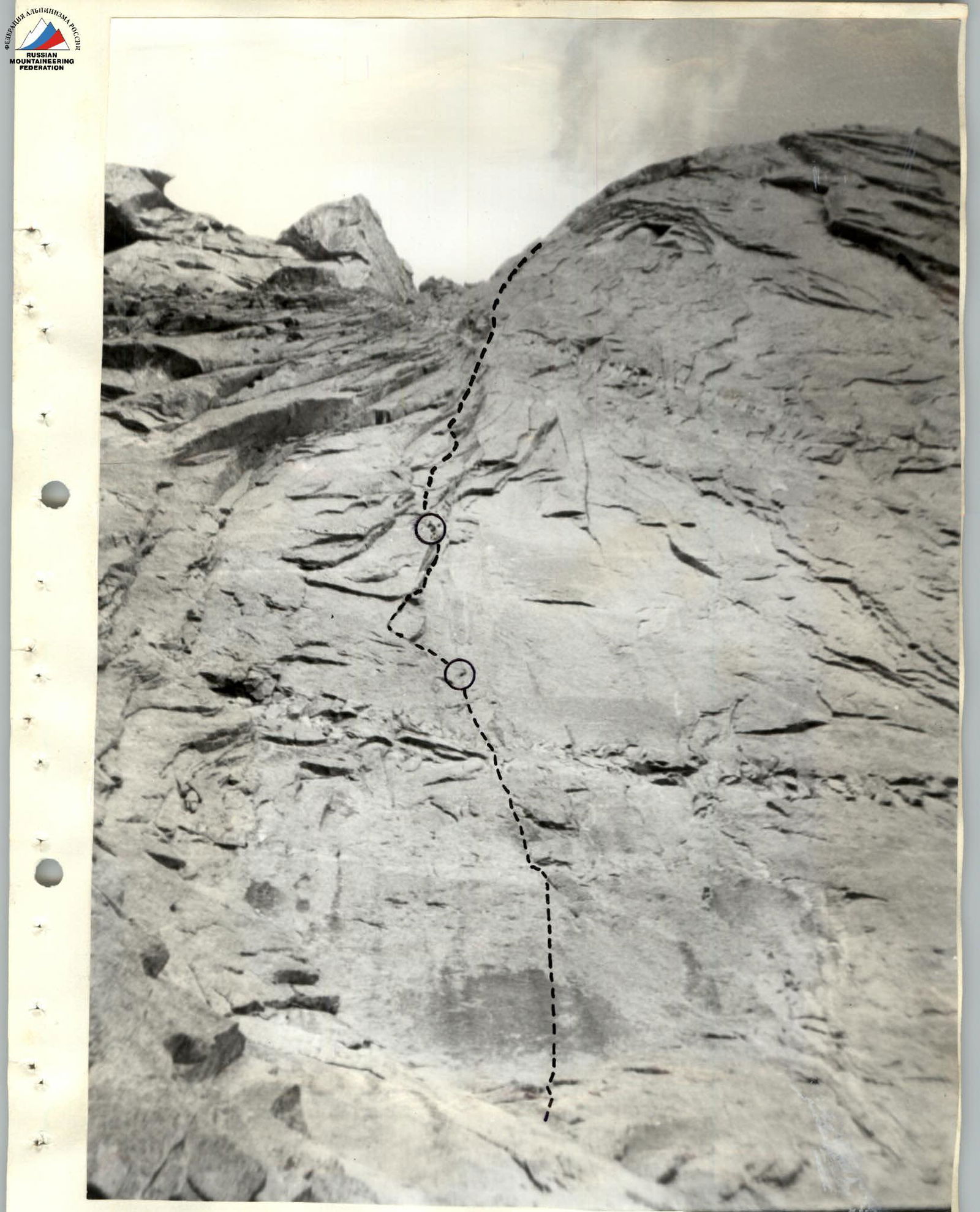
Photo 8. Second bastion Tactical actions of the team. The tactical plan was to ascend the route with 3 overnight stays and possible processing of the lower "pillar" and summit tower; an additional overnight stay was planned in case of bad weather. The route was completed from July 1 to July 5 in full accordance with the tactical plan. The ascent time was 39 hours. Given the possible weather change and long daylight hours, the team planned for long loads — up to 15 hours per day. With a strong and even team composition, the leading pairs were assigned to work on sections R0–R20 (Lushnikov–Golovkin) and R27–R44 (Bugachevsky–Scripko–Pivnyak). Leaders in the pairs typically switch once a day, work in crampons, and without backpacks. All participants are also provided with double protection.
Tasks for the pairs:
- 1st pair: passage and hanging of the rope;
- 2nd pair: supplying the 1st pair with equipment and rope retrieval.
The style of ascent was determined by the route's features and safety requirements. Independent movement of the pairs was planned for sections R20–R27, R39–R40, and R43–R45. Movement along the ropes was carried out on sections R0–R20, R27–R39, and R43–R45. The main principle in choosing the route and bivouac locations was safety.
Day 1. July 1. Main task — passing the lower "pillar". Problem: possibility of free climbing without using bolted pins. It turned out to be possible, and the team decided to move without pre-processing the lower "pillar". The "pillar" is passed using friends and skyhooks. Overnight stay on a comfortable ledge.
Day 2. July 2. Main task — processing the lower part of the summit bastion. From the first overnight stay, we approach the bastion and start processing. The ascent initially goes along smooth slabs between the cornices, the steepness gradually increases, then through the cornices of the lower part of the summit bastion. By evening, we processed 4 ropes. We finished at 20:30 as it started raining from 18:10.
Day 3. July 3. Main task — reaching the ridge. We ascend along the processed sections and continue working on the summit tower. In the middle part, the path goes through a series of cornices, then leads to a gap with smooth edges, almost reaching the ridge. There is practically no relief outside the gap. Then there are smooth slabs and another gap leading under the "Square" gendarme. The "Square" gendarme is bypassed on the right using skyhooks and a pendulum. Overnight stay on the ridge — on an inclined ledge.
Day 4. July 4. We ascend to the summit along the ridge at 12:00 PM. After 30 minutes, we start descending towards Peak 4810. After 7 rappels, we meet the AUSB "Varzob" team ascending along our descent route. On the descent, we hang 19 rappels and 5 others in the couloir descending from 4810. Descent completed at 22:30.
July 5. Early in the morning, we returned to base camp.
Safety measures for the route included:
- High physical, technical, and psychological preparation of the team.
- Excellent knowledge of the region's mountain-climatic conditions, informativeness, and, as a result, a tactical plan.
- Excellent material support, including the use of modern equipment.
- Presence of a qualified observation group below the route with a specific plan for emergency situations. Observation of the team was carried out using a 12x binocular. Communication with observers was stable. On the route, 2 hot meals and a pocket snack were planned. Nutrition was calculated at 350 g per person per day.
| rock pins | bolted pins | chocks |
|---|---|---|
| 55 | 4 | 413 |
| 12 | 1 | 84 |


 ![img-461.jpeg]({"width":219,"height":210,"format":"Jpeg","uri":"