Siberian Federal District Alpine Championship
High-altitude technical class 2018
Report
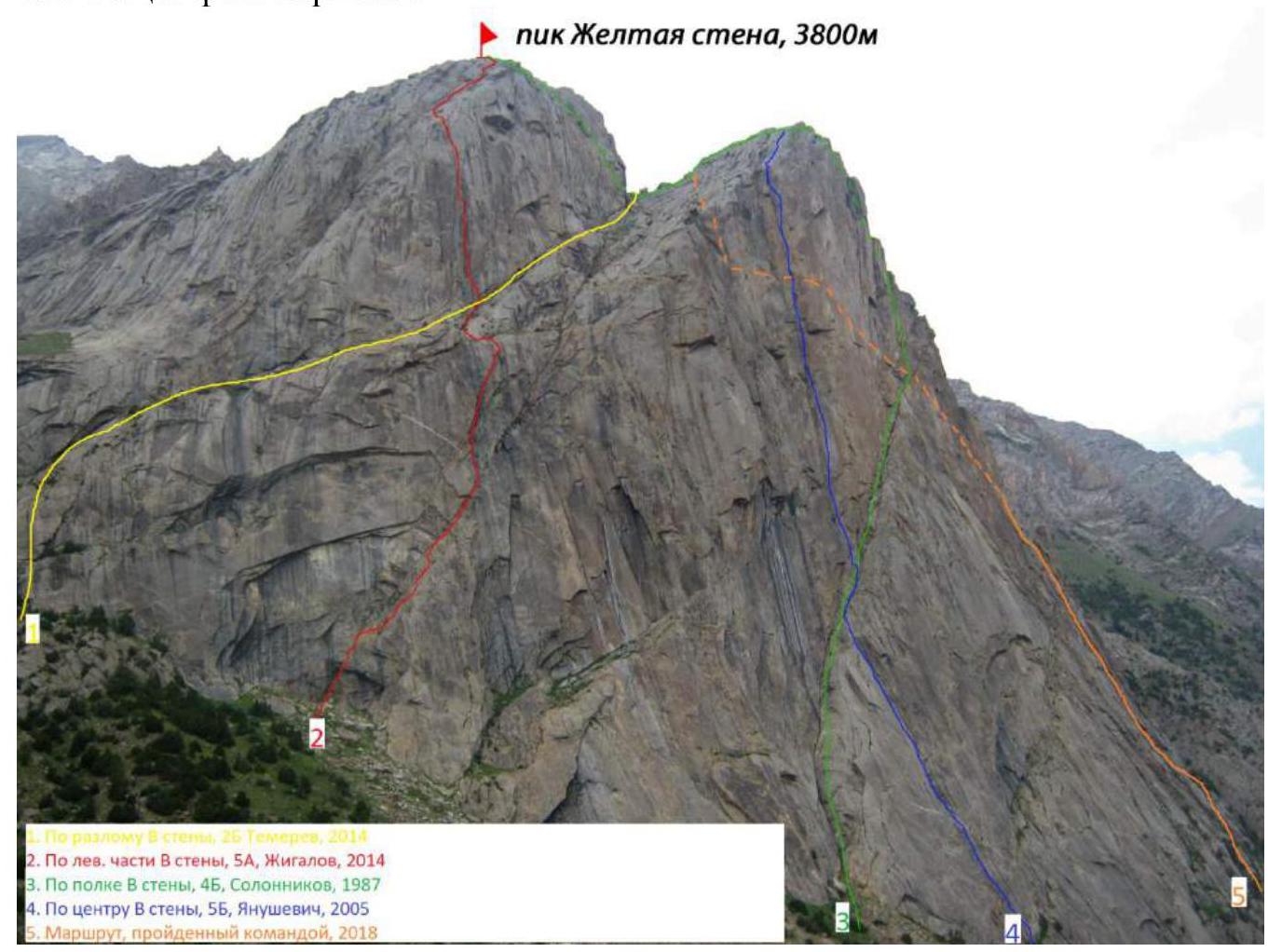
on the ascent of Peak Zheltaya Stena, 3800 m via the route (along the right part of the wall and the eastern edge) presumably category 5B complexity by the team from Krasnoyarsk, for the period July 31, 2018.
I. Ascent Passport
| ### 1. General Information | ||
|---|---|---|
| 1.1 | Full name, sports rank of the leader | Prokofiev D.E. (MS) |
| 1.2 | Full name, sports rank of participants | Polunin V.L. (MS) |
| 1.3 | Full name of coach | Prokofiev D.E. (MS), Zakharov N.N. (MSMK), Balezin V.V. (MSMK) |
| 1.4 | Organization | Krasnoyarsk Regional Alpine Federation |
| ### 2. Characteristics of the Ascent Object | ||
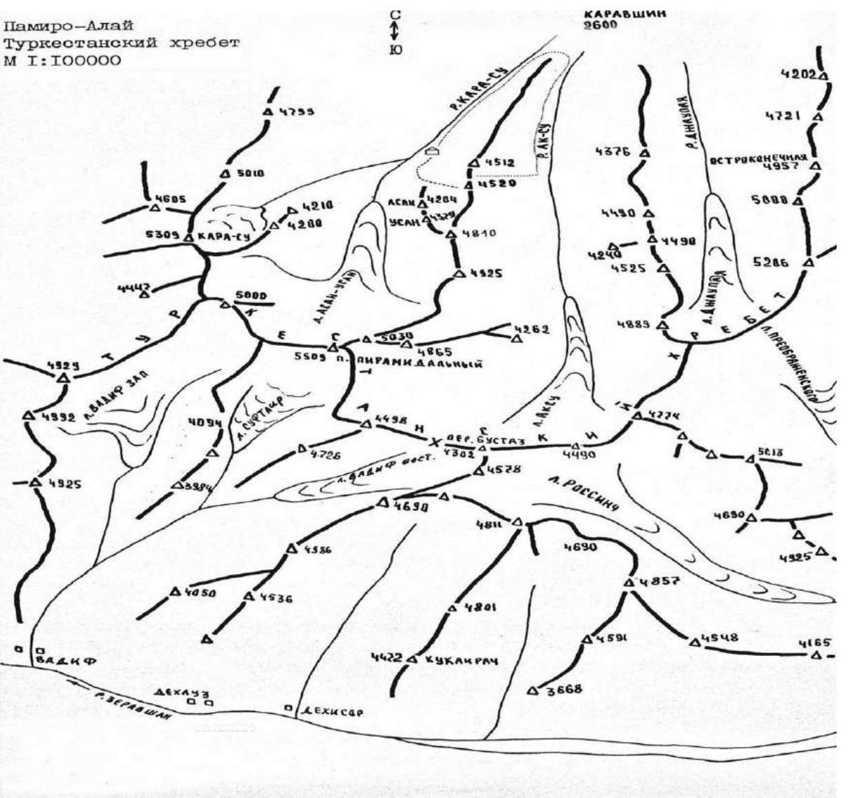
| 2.1 | Region | Pamir-Alay, Turkestan Ridge, |
| 2.2 | Valley | Karavshin valley |
| 2.3 | Section number according to the 2013 classification table | 5.4.3.23a |
| 2.4 | Name and height of the summit | Peak Zheltaya Stena, 3800 m |
| 2.5 | Geographic coordinates of the summit (latitude/longitude), GPS coordinates | |
| ### 3. Characteristics of the Route | ||
| 3.1 | Route name | along the right part of the wall and the eastern edge |
| 3.2 | Proposed category of complexity | 5B |
| 3.3 | Degree of route exploration | first ascent |
| 3.4 | Relief characteristics of the route | Rocky |
| 3.5 | Height difference of the route (altimeter or GPS data) | 650 m |
| 3.6 | Route length (in meters) | 800 m |
| 3.7 | Technical elements of the route (total length of sections of varying complexity with relief characteristics (ice-snow, rocky)) | Category I ice/rock/combination — m. Category II ice/rock/combination — m. Category III ice/rock/combination — m. Category IV rock — 745 m. Category V rock — 260 m. Category VI rock — 120 m. Rock VI, A3 — 50 m. Rock VI, A4 — m |
| 3.8 | Average steepness of the route, (°) | 58° |
| 3.9 | Average steepness of the main part of the route, (°) | 62° |
| 3.10 | Descent from the summit | Via category 1B to the Karasu valley |
| 3.11 | Additional route characteristics | Can be climbed with free climbing 6C+ |
| ### 4. Characteristics of Team Actions | ||
| 4.1 | Time of movement (team's working hours, in hours) | 12 hours, 1 day |
| 4.2 | Overnight | bivouac |
| 4.3 | Route processing time | 0 hours, 0 days |
| 4.4 | Departure on the route | 7:00 July 31, 2018 |
| 4.5 | Arrival at the summit | 19:00 July 31, 2018 |
| 4.6 | Return to base camp | 21:00 July 31, 2018 |
| ### 5. Meteorological Conditions | ||
| 5.1 | Temperature, °C | 10 °C |
| 5.2 | Wind speed, m/s | 5 m/s |
| 5.3 | Precipitation | Rain in the second half of the day |
| 5.4 | Visibility, m | clear |
| ### 6. Person Responsible for the Report | ||
| 6.1 | Full name, e-mail | Prokofiev D.E. desprok@gmail.com |
II. Description of the Ascent
1. Characteristics of the Ascent Object
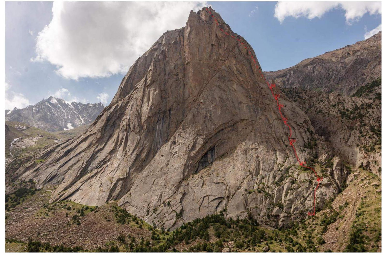
1.1. General photo of the summit
Peak Zheltaya Stena, 3800 m
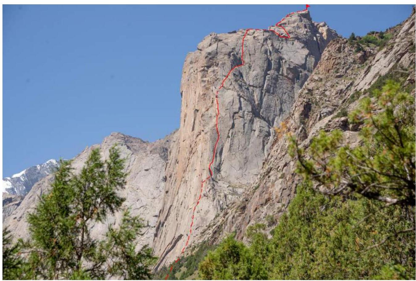
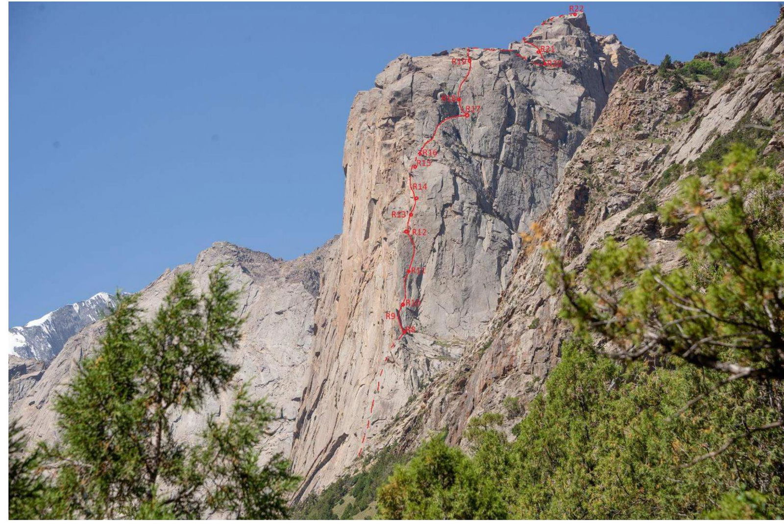
1.2. Photo of the route profile
1.3. Drawn profile of the route

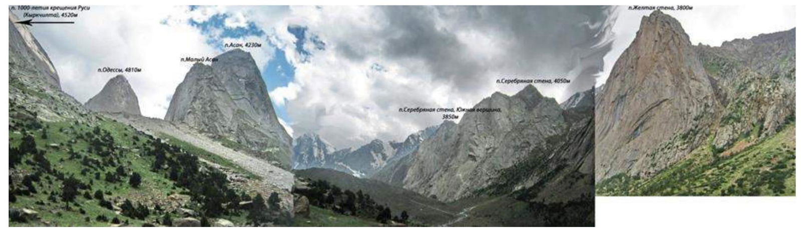
1.4. Photopanorama of the area
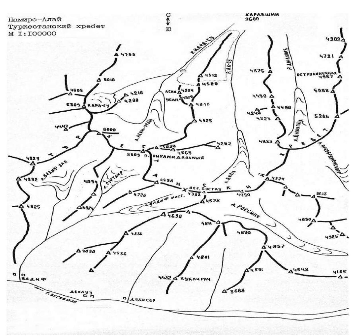
1.5. Map of the area
 |
|---|
2. Characteristics of the Route
2.1. Technical photo of the route
2.3. Route diagram in UIAA symbols
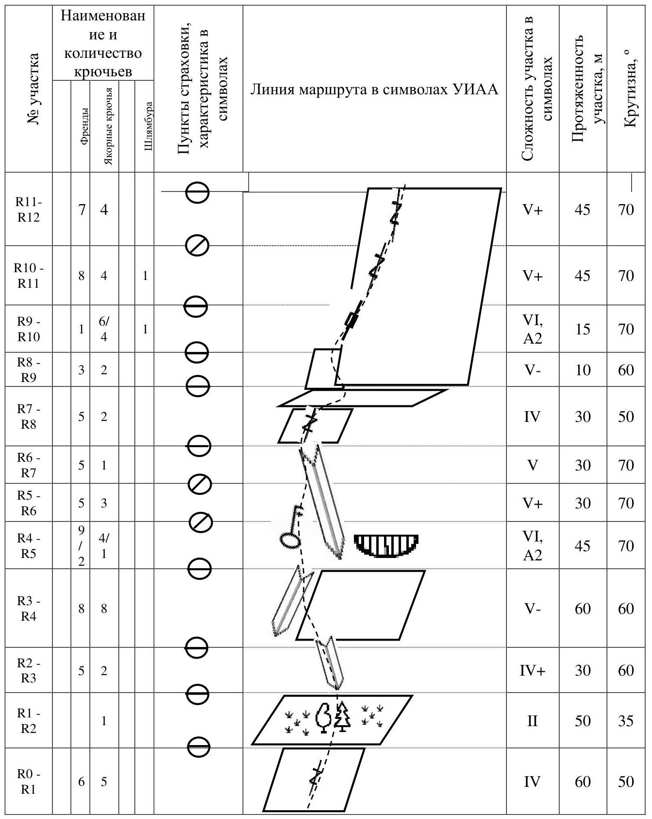
| Section | Total pitons | Friends | Anchor pitons | Bolts | Section complexity in symbols | Section length, m | Steepness, ° |
|---|---|---|---|---|---|---|---|
| R0–R1 | 6 | 5 | IV | 60 m | 50 | ||
| R1–R2 | 1 | II | 50 m | 35 | |||
| R2–R3 | 5 | 2 | IV+ | 30 m | 60 | ||
| R3–R4 | 8 | 8 | V- | 60 m | 60 | ||
| R4–R5 | 9 | 4/2 | 1 | VI, A2 | 45 m | 70 | |
| R5–R6 | 5 | 3 | V+ | 30 m | 70 | ||
| R6–R7 | 5 | 1 | V | 30 m | 70 | ||
| R7–R8 | 5 | 2 | IV | 30 m | 50 | ||
| R8–R9 | 3 | 2 | V- | 10 m | 60 | ||
| R9–R10 | 1 | 6/4 | 1 | VI, A2 | 15 m | 70 | |
| R10–R11 | 8 | 4 | 1 | V+ | 45 m | 70 | |
| R11–R12 | 7 | 4 | V+ | 45 m | 70 | ||
| R12–R13 | 2 | 1 | IV | 20 m | 50 | ||
| R13–R14 | 2 | 1 | VI | 20 m | 70 | ||
| R14–R15 | 8 | 1/1 | VI+, A2 | 40 m | 80 | ||
| R15–R16 | 3 | 1 | V | 15 m | 70 | ||
| R16–R17 | 7 | 6 | III | 60 m | 40 | ||
| R17–R18 | 2 | 2 | V | 15 m | 60 | ||
| R18–R19 | 6 | 2 | IV+ | 30 m | 50 | ||
| R19–R20 | II–III | 80 m | 10 | ||||
| R21–R22 | 3 | 2 | III | 60 m | 30 |
3. Characteristics of Team Actions
3.1. Brief description of the route passage
The route was scouted and planned in 2014. The team's exit from the bivouac in the Karasu valley was at 5:20.
The day before the ascent, a rope bridge was set up across the Karasu river on the nearest rocks to the camp. At 5:20, the team crossed the river and by 6:20 was at the base of the route. They reviewed the line of movement again. Polunin V.L. led. Movement and belaying were done according to the "Climbing with simultaneous belaying" scheme. The team tried to climb as much of the route as possible with free climbing.
The general direction of movement was towards a pronounced internal corner. The initial climbing was easy, leading to a large inclined ledge with trees 100 m. Then, climbing from a small internal corner along walls and outcrops became challenging.

Photo 1 R0–R1
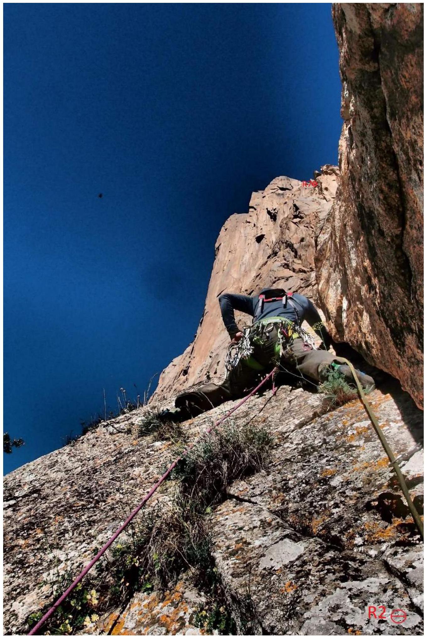
Photo 2 R2–R3

Photo 3 R3–R4
After 100 m of climbing, they reached the base of the internal corner. The corner was 120 m long, with climbing ranging from moderately difficult to extreme. It's possible to climb either through the corner or along the left wall. After passing the corner, the route slightly turns right and upwards towards a large boulder — the "Finger".
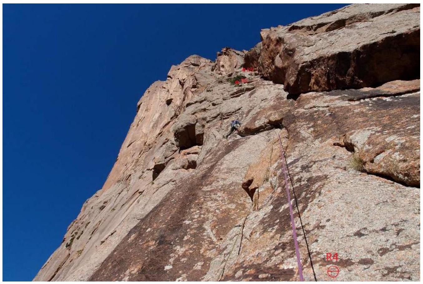
Photo 4 R4–R5
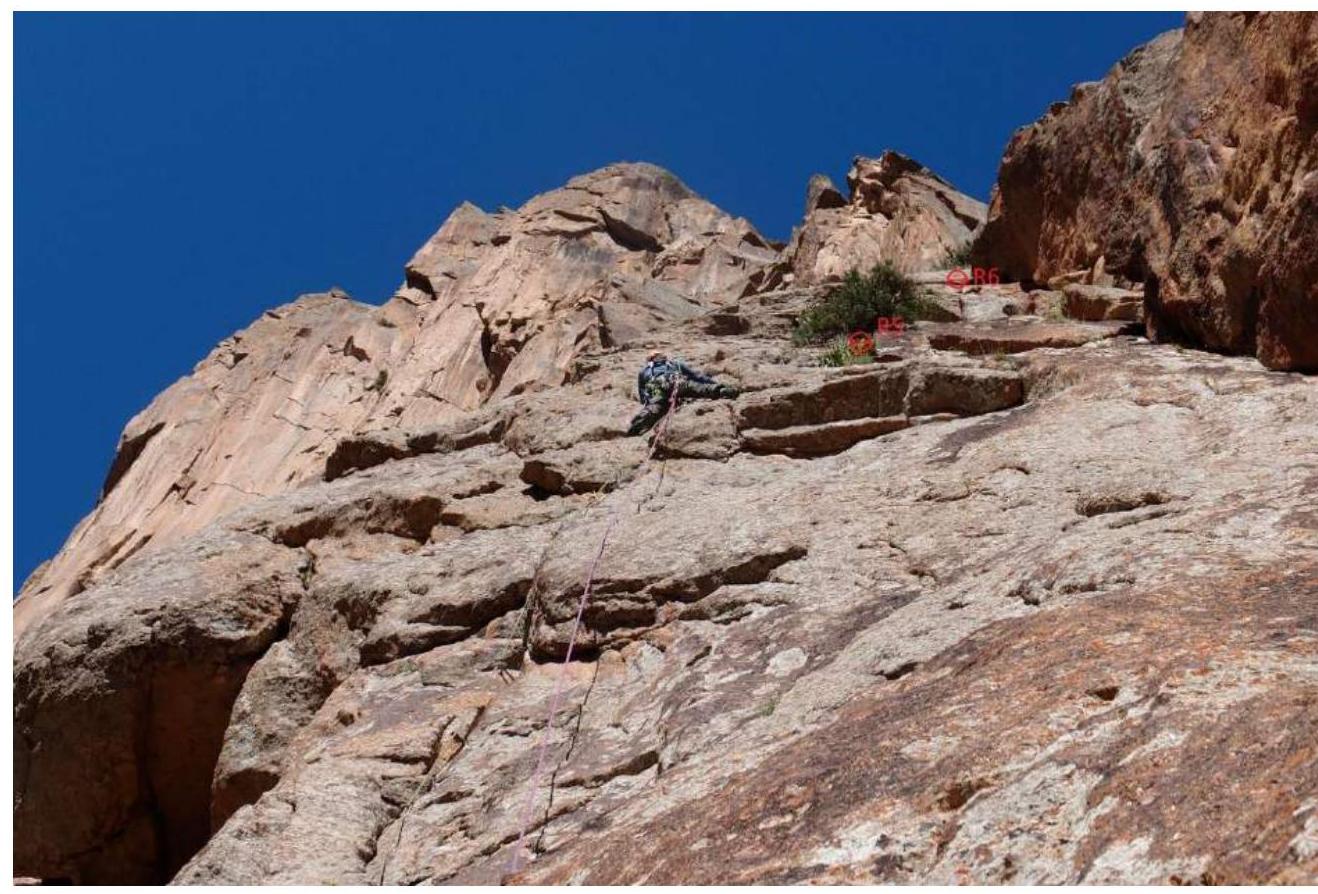
Photo 5 R5–R6
Then, they turned left onto the counterfort — the right edge of the wall — and climbed it with difficult climbing and AIT (Artificial Insulation Techniques) for 200 m, reaching a small ledge. Then, they climbed to the right through a wide crack "Offwidth" for 80 m.
Here, the climbing was extremely challenging, with belaying possible only deep within the crack (it's advisable to bring #5 and #6 cams to facilitate belaying). The offwidth crack led to pre-summit terraces. From here, the pre-summit crack on the Salonnikov route was visible.
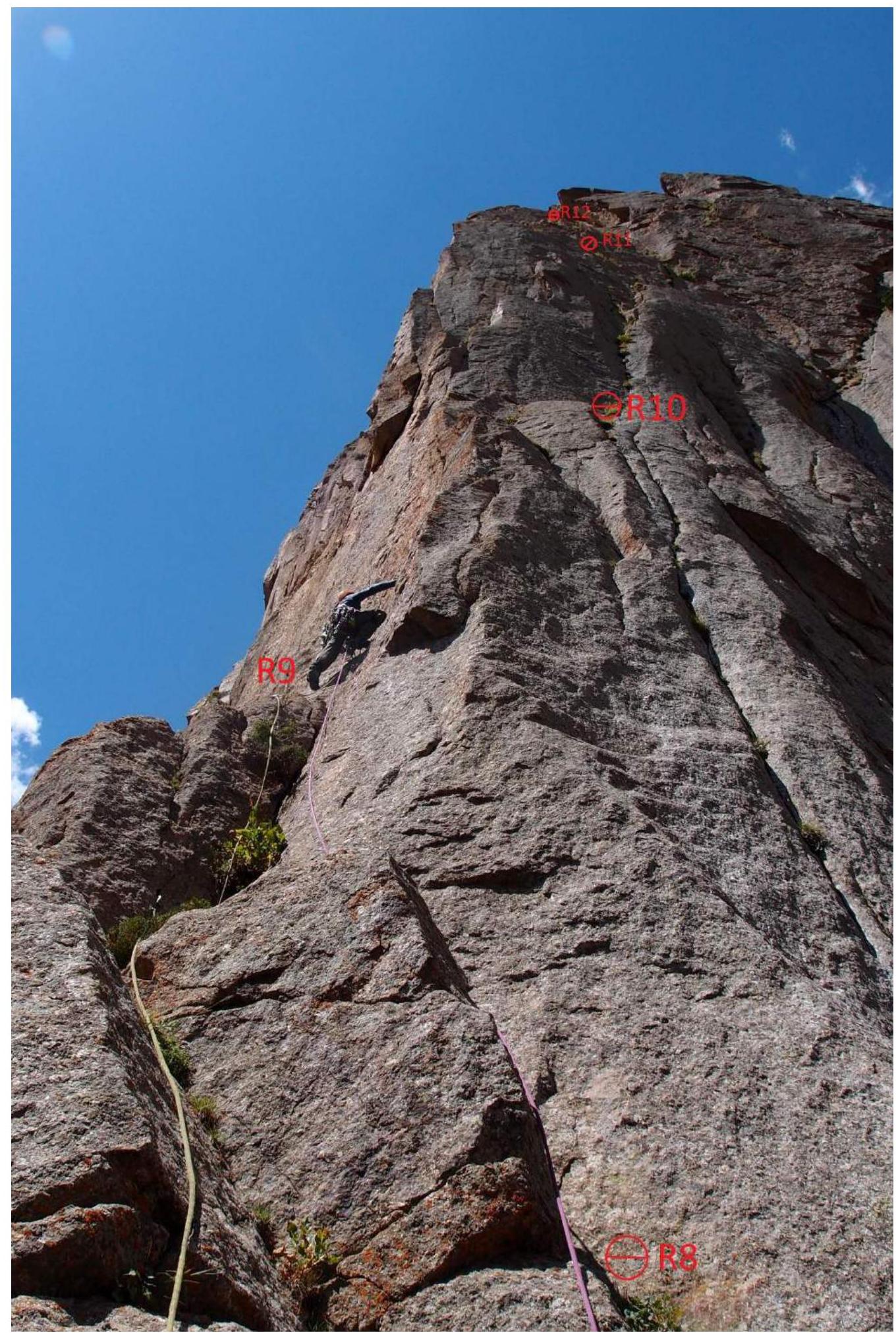
Photo 6 R8–R12
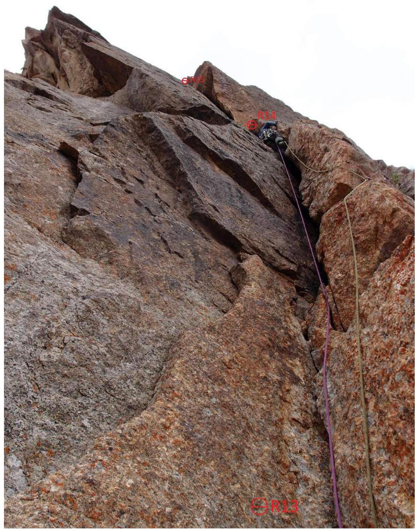
Photo 7 R13–R15
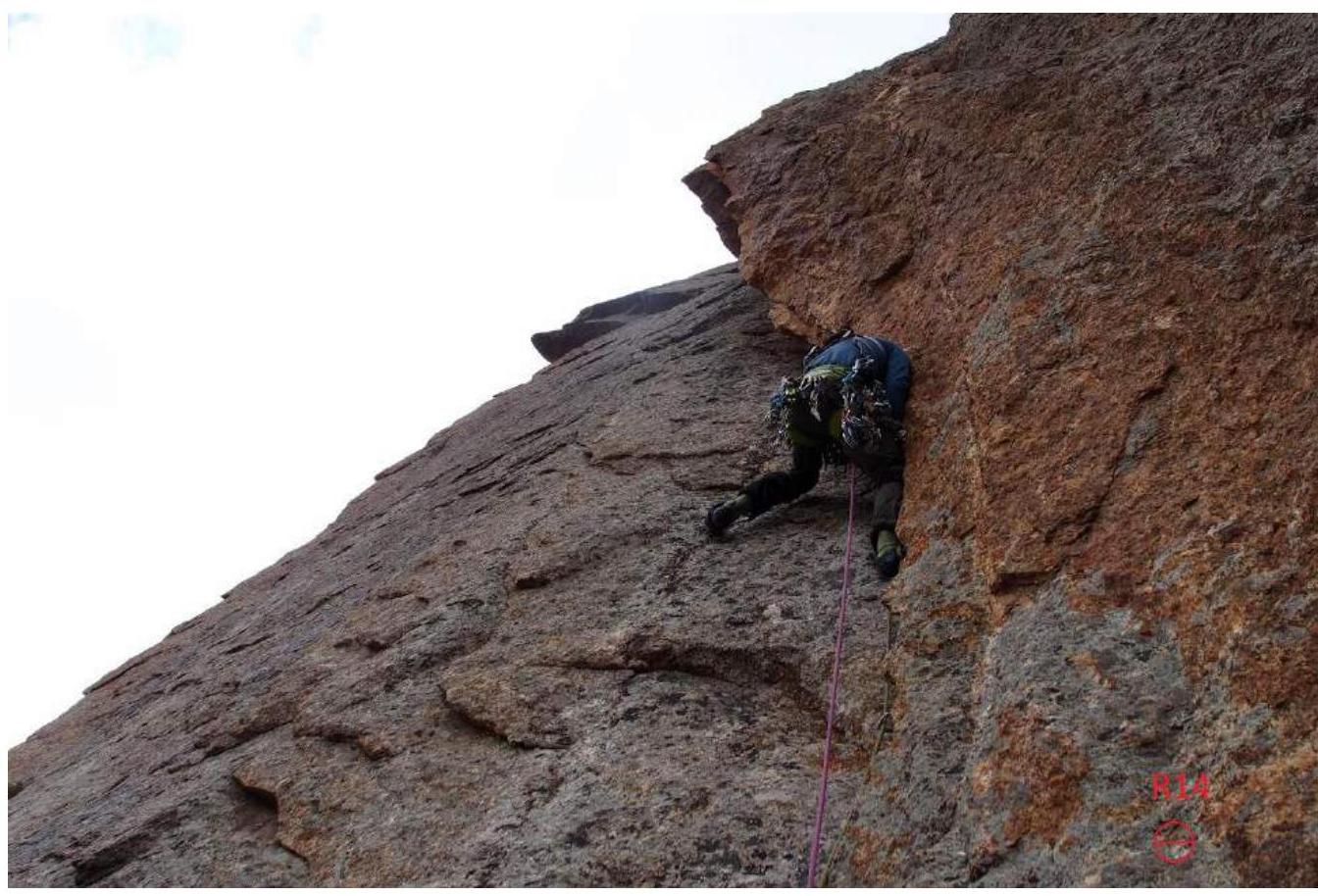
Photo 8 R14
Then, the general direction was to the right and upwards along the wall for 20 m, leading to terraces that connected to the pre-summit ridge. Climbing here was complicated by the onset of rain, making friction climbing on smooth surfaces and walls more difficult. They reached the ridge and proceeded to the summit with relatively easy climbing. Before the summit, they encountered a 8 m wall that could be climbed either with free climbing or AIT, depending on the weather.
The team reached the summit at 19:00 and retrieved the MGU note.
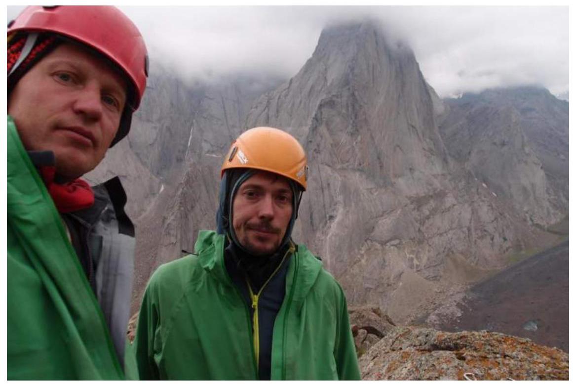
Photo 9 Summit
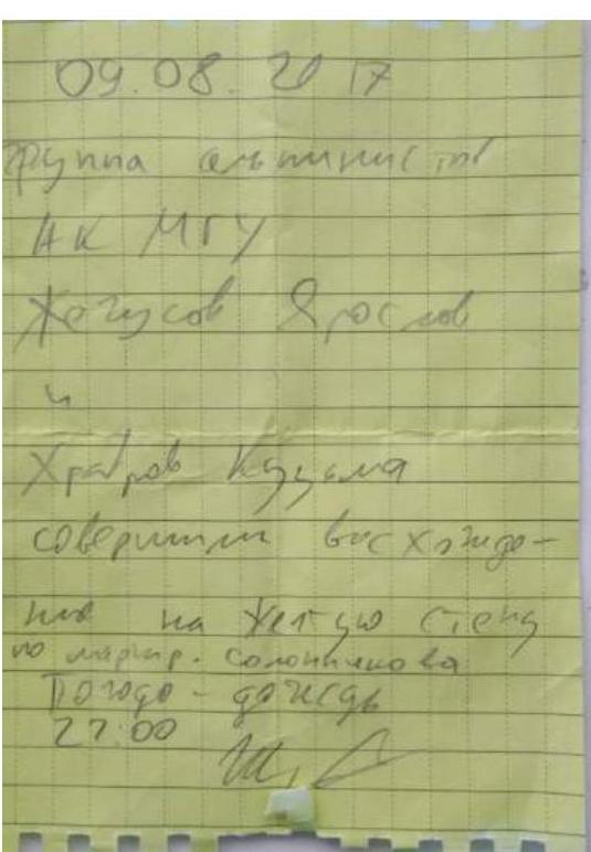
Photo 10 Note
Description of the route by sections
| Section | Description | Photo number |
|---|---|---|
| R0–R1 | Along a series of simple wall sections and internal corners with bushes towards a large grassy ledge 60 m, IV, 50° | 1 |
| R1–R2 | Along the grassy ledge with trees, moving towards the main wall in the direction of the internal corner 50 m, II, 35° | |
| R2–R3 | Upwards through the internal corner with a wide crack at the base 30 m, IV, 60° | 2 |
| R3–R4 | Along the simplest path through walls and internal corners along ledges, climbing in the direction of the base of the large internal corner, with rappel rings left on small trees 60 m, V, 60° | 3 |
| R4–R5 | Upwards with difficult climbing along the wall to the right of the large internal corner, 45 m, VI, 70° | 4,5 |
| R5–R6 | Continuation of the internal corner, 30 m, V+, 70° | 4,5 |
| R6–R7 | Upper part of the internal corner, exit onto ledges with live rocks 30 m, V, 70° | 4,5 |
| R7–R8 | Along the simple terrain with live rocks, exit under the wall with a crack. Upwards through the crack, exit onto a large ledge behind a large boulder 30 m, IV, 50° | |
| R8–R9 | From the left part of the ledge upwards towards a subtle crack on the edge, 10 m, IV, 60° | 6 |
| R9–R10 | To the right and upwards, exit onto the edge through a thin, shallow crack on AIT A2 10 m, then to the right and upwards and traverse along the crack 5 m, station with a bolt, 15 m, VI A2, 70° | 6 |
| R10–R12 | Upwards through a wide crack overgrown with grass, the crack is sometimes heavily clogged with dirt, near the crack along the climbing path there are slabs leaning against the wall 90 m, V+, 70° | 6 |
| R12–R13 | Exit onto small ledges, to the right and upwards, underclimb to the base of the "offwidth" 20 m, IV, 50° | |
| R13–R14 | The first part of the "offwidth" with an exit onto a ledge with a stationary bolt, tense climbing, using #4 cams for belaying, 20 m, VI, 80° | 7 |
| R14–R15 | Vertical "offwidth", over 20 m very tense climbing, requiring a #5 cam for belaying, key section of the route, an old piton is found in a small crack on the "offwidth" outcrop, which can be used to "step up", at the top, the crack widens into a wider chimney and then becomes more gentle, 40 m, VI+, A2, 70° | 7,8 |
| R15–R16 | To the left and upwards along the wall with cracks — exit onto large terraces before the ridge, 15 m, V, 70° | |
| R16–R17 | Movement along simple wall sections and internal corners upwards to the right towards black large streaks 60 m, III, 40° | |
| R17–R18 | Practically from the edge of the ledge, climbing along the wall with a crack to the left and upwards towards the ridge 15 m, V, 60° | |
| R18–R19 | Along wall sections and smooth surfaces, exit onto the ridge, at this point the route connects with the Solonnikov route, 30 m, IV, 50° | |
| R19–R20 | Along the ridge, moving on foot towards the summit 80 m, II–III, 10° | |
| R20–R21 | Wall with a diagonal crack — exit onto pre-summit terraces 10 m, V, 75° | |
| R21–R22 | Movement along terraces, turning left towards the summit, exit onto the summit, 60 m, III | 9 |
| Descent via the descent couloir towards the summit of Serebryanaya Stena |
3.3. Descent path
Descent via the descent couloir towards the summit of Serebryanaya Stena. At 21:30, the team reached the base camp in the Karasu valley.
Overall, the route is a modern category 5B with an abundance of complex technical work and many challenging sections that can be climbed with free climbing and AIT.
We believe that a 5B category route on Zheltaya Stena is necessary for warming up and acclimatization before major ascents. The route is located close to the traditional base camp site and is therefore convenient for warming up.
We also believe that the route is approximately twice as difficult as the Salnikov route, which goes through the center of the wall — this is evident from the time taken by teams of similar strength on both routes.
The route is considered safe.
Communication with the camp in the Karasu valley was maintained throughout.