PASSPORT
- Rock climbing
- Pamir-Alay, Turkestan Range, Karavshin valley
- Peak Asan, 4204 m
- Second ascent, 6B category difficulty
- Elevation gain — 865 m, length — 1075 m
Length of sections with 5–6 category difficulty — 975 m, including 6B category difficulty — 830 m. Average slope of the route (3340–4204) — 77°. Average slope of the wall section of the route (3340–4120) — 80°.
- Pitons hammered in
| Rock | Chocks | Bolt | Ice |
|---|---|---|---|
| 88/37 | -84/20 | 57/36 | 0/0 |
- Team's climbing hours — 36 hours and days — 3
- Overnight stays: 1st — lying on a ledge for 5 people
2nd — lying on a narrow ledge one by one
- Team leader: Igor Victorovich Igolkin MS
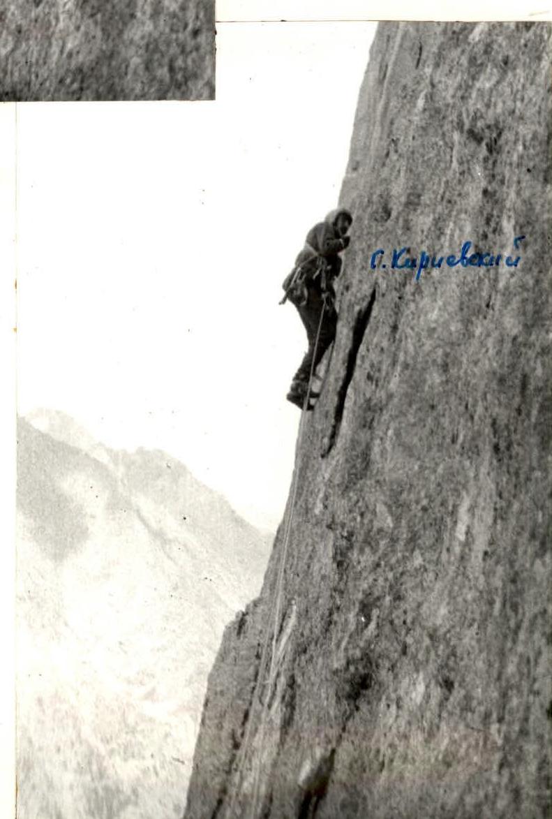
Members: Gennadiy Pavlovich Kirievskiy CMS, Vladimir Viktorovich Bochkov CMS, Alexander Vladimirovich Lapko CMS, Viktor Alekseyevich Rogozin CMS
- Coach: Viktor Ivanovich Igolkin MS USSR
- Approach to the route: July 8, 1988 Summit: July 10, 1988 Return: July 10, 1988
- Organization: AUSB "Varzob"
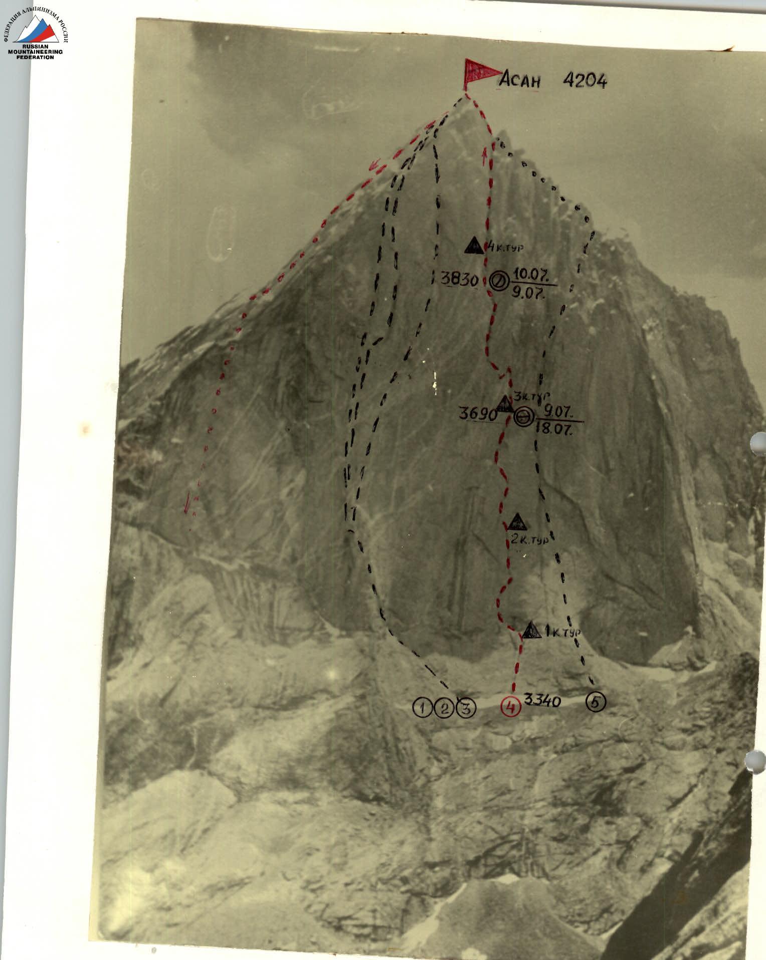
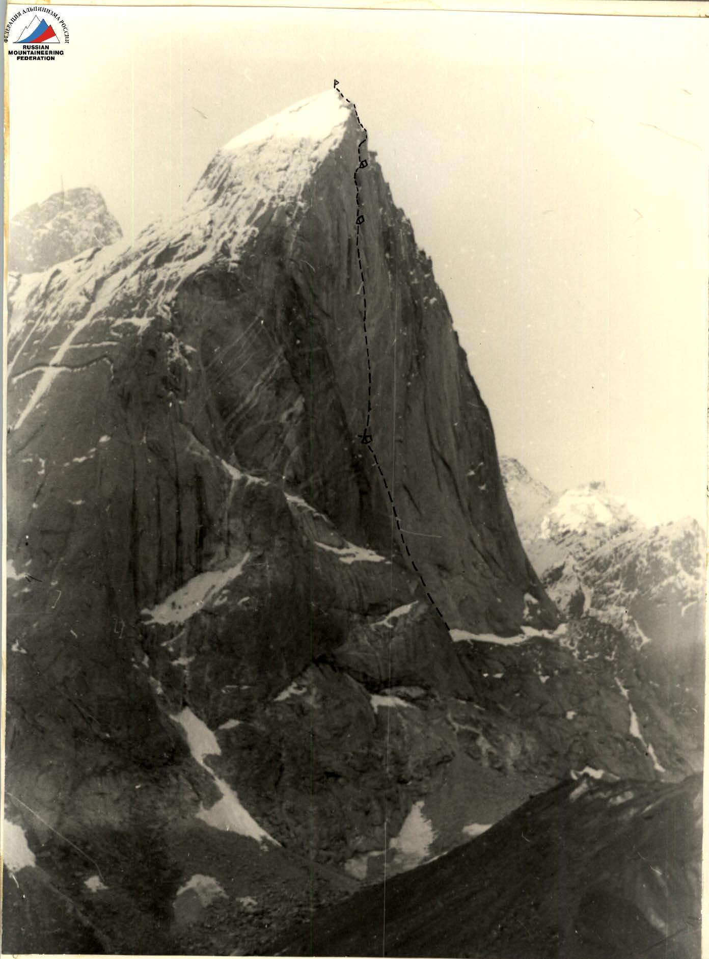
Photo 1. General photo of the summit. Taken on June 18, 1988. (The photo was provided to the team by the first ascenders). Approximate distance to the subject is 3 km. Shooting point F1, height of the shooting point ≈ 3600 m.
Routes:
- 1, 2, 3 — routes of Dnipropetrovsk, Rostov, and Odessa teams, 6B category difficulty, USSR Championship 1986.
- 4 — route of the team (route of the alpine club "Nevsky" via the "mirror" of the S-3 wall, USSR Championship 1988).
- 5 — route of the RSFSR team, RSFSR Championship 1988. The team made the 2nd ascent of the route of the USSR Championship 1988.
The team's tactical plan was to ascend the route to Peak Asan via the "mirror" of the S-3 wall in three climbing days without prior processing. As a result of visual observation of the route and thorough consultations with the first ascenders (alpine club "Nevsky" from Leningrad), it was determined that the team, using the full daylight, could immediately reach the 3rd overnight stay of the Leningraders, and use a narrow ledge in the upper part of the wall as the 2nd overnight stay, where the Leningraders had processed the route on the 4th day of their ascent. This created a very intense climbing regime but allowed for a reserve of daylight for descending from the summit on the 3rd day. At the time of the ascent, snow and ice in the internal corners of the wall had melted, so it was necessary to carry 12 liters of water.
The movement was organized taking into account the work of each rope team and participant as first and last, which created a uniform load for the participants. The first to work were:
- on the section R0–R4 — Igolkin,
- then to the 1st overnight stay — Rogozin,
- between the 1st and 2nd overnight stays — Kirievskiy,
- above the 2nd overnight stay and 60 m before the ridge — Lapko,
- and then to the summit — Bochkov.
The team used the entire arsenal of modern technical means tested at the USSR Championships. Safety was ensured by choosing the direction of movement, gathering participants in places closed to accidental rockfall, working on a double rope using "Edelrid" rope as a safety rope in all rope teams, and a new rope from Kaliningrad. The 1st overnight stay was a common lying position, the 2nd was a lying position separated.
The nutrition was two times a day (morning and evening) using a high-calorie individual ration and a drink in flasks during the day. An autoclave was used for cooking. There were no falls or injuries to the participants. Problematic sections were overcome with the help of high individual technique, partial use of the "pendulum" technique combined with "skyhooks," and a wide range of technical techniques and means.
Due to the practical absence of ledges, intermediate belays were organized on pitons and chocks, and on the "mirror" using bolt pitons. "Stations" for belaying and securing ropes were organized on 3–4 elements with mandatory inclusion of pitons (including bolt pitons).
New elements were:
-
- Using ring ladders sewn into skyhooks for "khookonogi" without intermediate extenders and carabiners, which made it possible to organize a belay point or ITO 10–15 cm higher than usual;
-
- Using, in addition to skyhooks, small bolts with a cable, allowing for a more reliable organization of ITO in a hole made with a punch, 5–7 mm deep.
Communication with the base camp, where the rescue team was located (1.5 hours walk under the wall), was carried out through two observers with CMS qualification, constantly located under the route (via "Lastochka" radio station). Observation was carried out through a 12x binocular, and voice communication was maintained in the lower half of the wall.
The team's reserves were:
-
- Good reconnaissance and consultation, thorough study of the route;
-
- Excellent technical and physical preparation (1st Western peak, Zamin Karor, via the S-3 wall, 6B category difficulty, processed 8 ropes in one overnight stay; on July 4, 1988, a first ascent was made to Peak 4520 in this area, approximately 6B category difficulty);
-
- Combination of experience and youth in the team (average age — 29 years, 3 participants in USSR Championships);
-
- Good material base (nutrition, equipment, medicine, rescue team);
-
- One and a half times reserve of food, gasoline (sealed in cans), and special equipment on the route;
-
- Planning of main work by all participants;
-
- Regular radio communication with the Tajik CSP and AUSB "Varzob".
| Section | Cat. diff. | Length (m) | Steepness (°) | Rock pitons (total/com.) | Chocks (total/com.) | Bolt pitons (total/com.) | Notes |
|---|---|---|---|---|---|---|---|
| R0–R1 | 6 | 100 | 75 | 5/1 | 2 | 2+3/1 | |
| R1–R2 | 6 | 40 | 80 | 4/2 | – | 2+2/1 | |
| R2–R3 | 6 | 15 | 80 | 1/1 | – | 2+2/2 | |
| R3–R4 | 6 | 30 | 80 | 4/4 | – | 7/5 | |
| R4–R5 | 6 | 55 | 80 | 5/3 | – | 1+10/9 | |
| R5–R6 | 6 | 45 | 80 | 3/3 | – | 1+9/8 | Dibrova cornice |
| R6–R7 | 6 | 40 | 80 | 4/2 | – | 2/2 | Burpetrov cornice |
| R7–R8 | 6 | 40 | 75 | 5/2 | 4/1 | – | "Mirror" |
| R8–R9 | 5 | 30 | 75 | 4/1 | 3/1 | – | |
| R9–R10 | 6 | 55 | 90 | 43/19 | 9/2 | 8+35/29 | 3 CT, 14.5 climbing hours, July 9, 8:00, July 8, 22:30 |
| R10–R11 | 4 | 20 | 80 | 18/6 | 10/6 | 8/7 | |
| R11–R12 | 6 | 35 | 75 | 3/1 | 5/2 | 1 | |
| R12–R13 | 5 | 50 | 75 | 4/3 | 3 | – | |
| R13–R14 | 6 | 25 | 75 | 3 | 2 | – | |
| R14–R15 | 5 | 20 | 75 | 2 | 6/4 | 1 | July 10 / July 9, 18:00 (processing 21:30) |
| R15–R16 | 6 | 40 | 90 | 6/4 | 4/2 | – | |
| R16–R17 | 6 | 40 | 85 | 4/3 | 6/2 | – | |
| R17–R18 | 6 | 40 | 90 | 2/2 | 6/3 | 2 | |
| R18–R19 | 6 | 40 | 85 | 1 | 8 | – | |
| R19–R20 | 6 | 45 | 80 | 1 | 8 | – | |
| R20–R21 | 6 | 45 | 80 | 2 | 7/1 | – | |
| R21–R22 | 6 | 45 | 75 | 2 | 6/1 | – | |
| R22–R23 | 6 | 40 | 75 | 2 | 4 | – | "Inclined rock" |
| R23–R24 | 1 | 100 | 45 | 88/37 | 84/20 | 8+49/36 | Peak Asan 4204 |
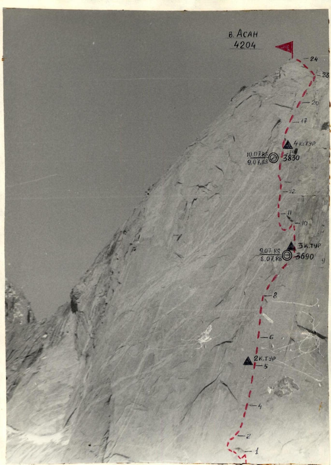
Photo 2. Semi-profile of the wall on the right, taken on June 30, 1988, at 15:00 with a "Zenit-E" camera, "Helios 44-2" lens with a focal length of 40 mm. Distance to the object ≈ 1 km, shooting point F2, height of the shooting point ≈ 3200 m.
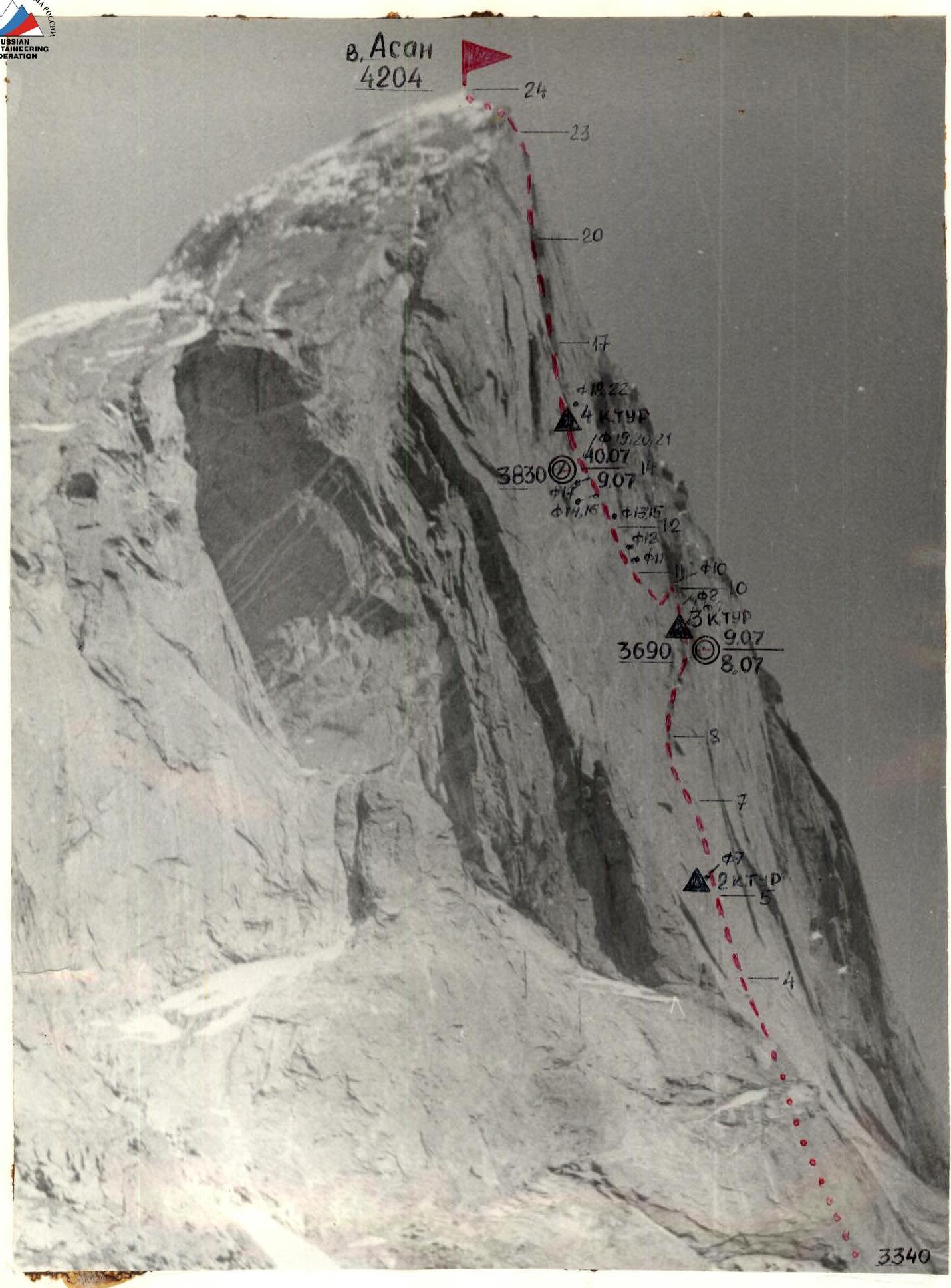
Photo 3. Profile of the wall on the left. Taken on June 30, 1988, at 17:00 with a "Zenit-E" camera, "Helios 44-5" lens with a focal length of 58 mm.
- Distance to the object — 1.5 km
- Shooting point — F3
- Height of the shooting point — 3000 m
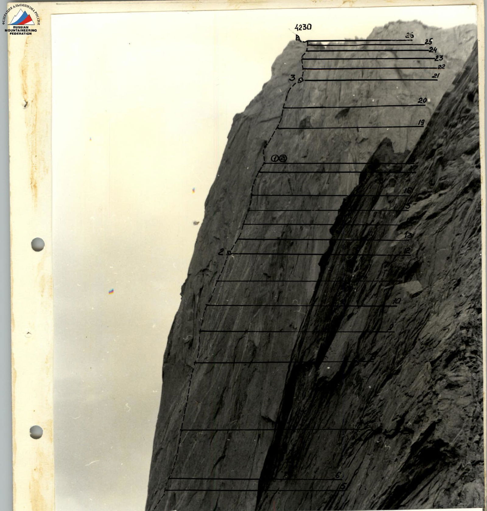
PROFILE OF THE WALL ON THE LEFT
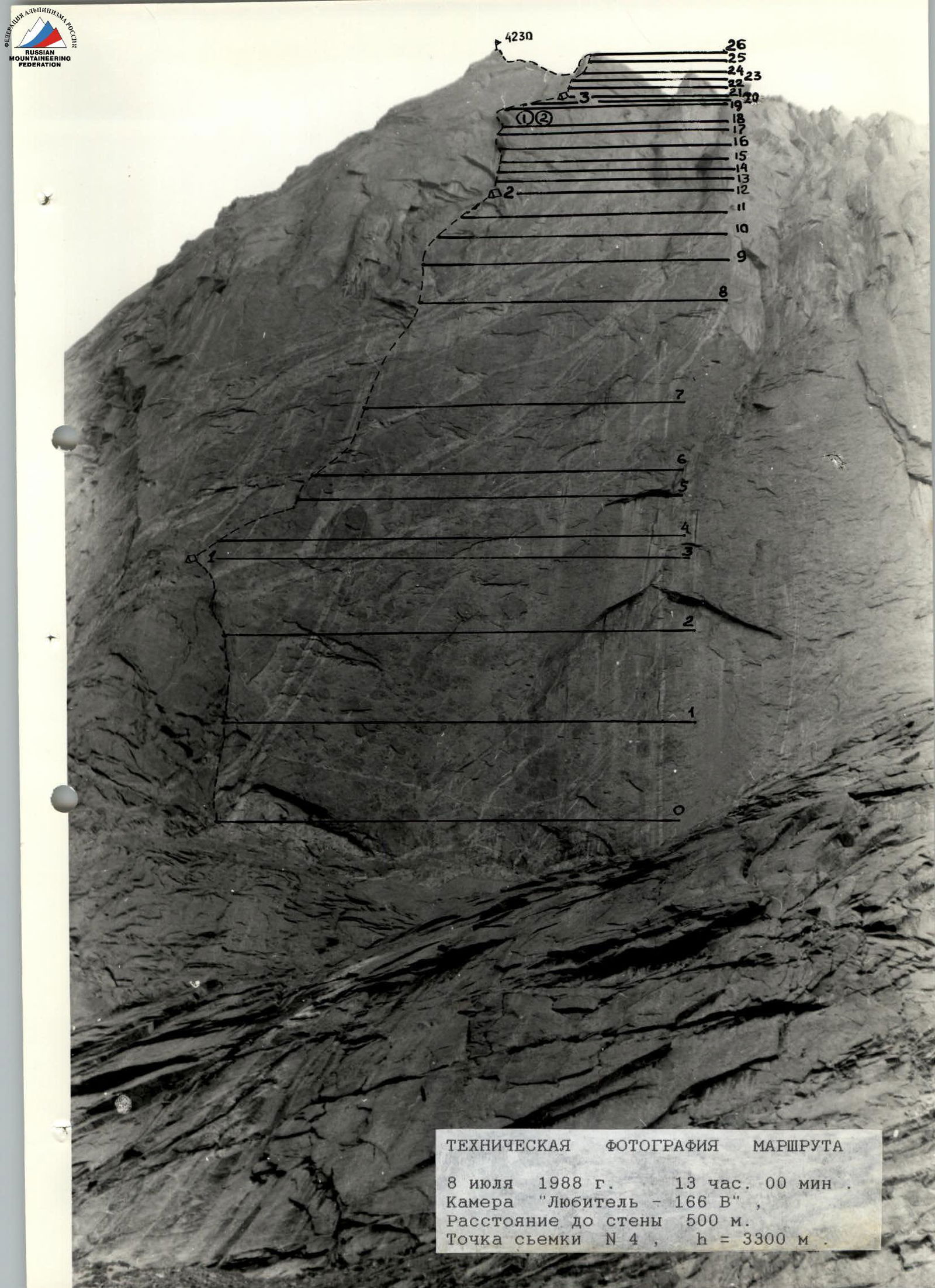
TECHNICAL PHOTOGRAPHY OF THE ROUTE July 8, 1988, 13:00 Camera "Lyubitel-166 V" Distance to the wall 500 m. Shooting point #4, h = 3300 m.
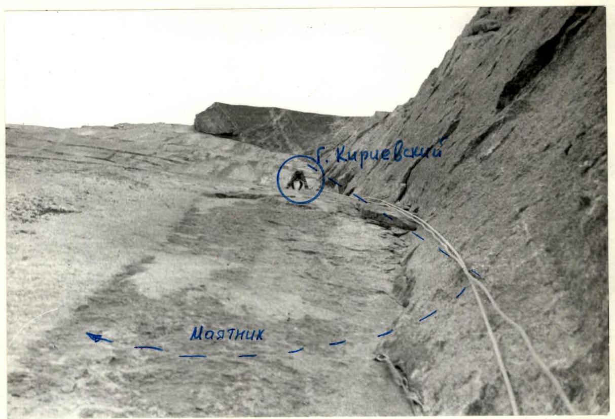
Photo 9. Section R9–R10. Shooting point from section R9–R10 (F9). Date of shooting July 9, 1988, at 11:00
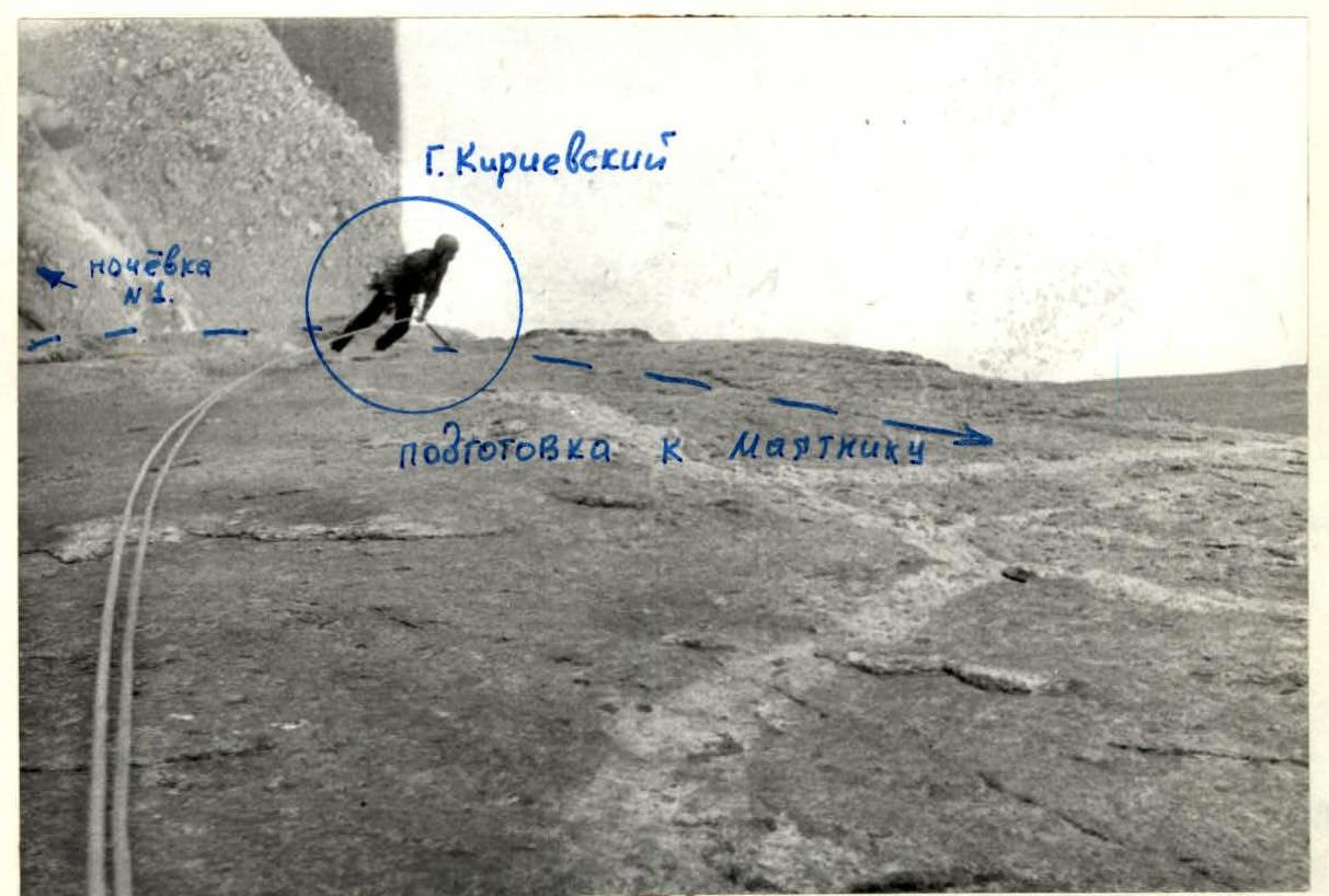
Photo 10. Section of the "pendulum". Shooting point from section R10 (F10). Date of shooting July 9, 1988, at 11:20

Photo 11. Section R11–R12. Shooting point from section R11 (F11). Date of shooting July 9, 1988, at 13:19
Photo 12. Section R11–R12. Shooting point from section R11 (F11). Date of shooting July 9, 1988, at 13:00