Report
On the ascent to the summit of Pik Asan via the Timofeev route, 6A category of difficulty, by the MSU alpine club team from August 14 to 19, 2019.
I. Climbing Report
| 1. General information | ||
|---|---|---|
| 1.1 | Full name, sports rank of the leader | Saveliev Igor Borisovich, Master of Sports |
| 1.2 | Full name, sports rank of participants | Khrabrov Kuzma Andreevich, 1st sports rank, Afanasiev Georgiy Sergeevich, 1st sports rank, Burov Pavel Aleksandrovich, 1st sports rank |
| 1.3 | Full name of coach | Saveliev Igor Borisovich |
| 1.4 | Organization | MSU Alpine Club |
| 2. Characteristics of the climb | ||
| 2.1 | Region | Pamir-Alay, Turkestan Range |
| 2.2 | Valley | Karavshin |
| 2.3 | Section number according to the 2013 classification table | 5.4.3 |
| 2.4 | Name and height of the summit | Pik Asan, 4230 m |
| 2.5 | Geographical coordinates of the summit (latitude/longitude), GPS coordinates *(1) | |
| 3. Characteristics of the route | ||
| 3.1 | Name of the route | via the center of the NW wall (Timofeev route, 1988) |
| 3.2 | Proposed category of difficulty | 6A |
| 3.3 | Degree of route exploration | - |
| 3.4 | Nature of the route terrain | Rocky |
| 3.5 | Height difference of the route (altimeter or GPS data) | 930 m |
| 3.6 | Length of the route (in meters) | 1160 m |
| 3.7 | Technical elements of the route (total length of sections with varying categories of difficulty, indicating terrain type (ice-snow, rocky)) | II category rocky — 200 m. IV category rocky — 135 m. V category rocky — 215 m. VI category rocky — 635 m. Rocky VI, A2 — 365 m. Rocky VI, A3 — 15 m |
| 3.8 | Average steepness of the route, *(2) | 70° |
| 3.9 | Average steepness of the main part of the route, *(2) | 80° |
| 3.10 | Descent from the summit | Via the ascent route |
| 3.11 | Additional characteristics of the route | Lack of water |
| 4. Characteristics of the team's actions | ||
| :--: | :--: | :--: |
| 4.1 | Time of movement (team's working hours, in hours and days) | 44.5 days |
| 4.2 | Overnight stays | platform |
| 4.3 | Time spent on route processing *(3) | - |
| 4.4 | Start of the route | August 14, 2019 |
| 4.5 | Summit day | August 18, 2019 |
| 4.6 | Return to base camp | August 19, 2019 |
| 5. Characteristics of weather conditions *(4) | ||
| 5.1 | Temperature, °C | |
| 5.2 | Wind speed, m/s | |
| 5.3 | Precipitation | |
| 5.4 | Visibility, m | |
| 6. Responsible for the report | ||
| 6.1 | Full name, e-mail | Khrabrov Kuzma Andreevich, kuzma.h@gmail.com |
II. Climbing Description
Tactical Actions of the Team
We planned to complete the route without prior processing, using convenient shelves for hanging platforms as overnight stays. The leader moved on a double rope, the second climber moved on jumar and straightened static ropes for the third and fourth participants.
For protection, we used:
- Three sets of cams — classic Black Diamond C4 (2 third and fourth sizes), Totemcam, and offset cams Metolius;
- A set of standard and a set of offset DMM nuts;
- A set of various anchor hooks, including anchor hooks with a bent beak.
For artificial climbing, we used:
- A set of BD Talon skyhooks;
- Camp Captain Hook;
- A set of Moser Camhook.
Leaders — Igor Saveliev and Khrabrov Kuzma, have previously completed routes of 8th category difficulty according to the French system, have experience in various competitions in the rock climbing class, and have extensive experience in climbing with natural protection both on single-pitch routes and in big mountains. There are no water sources along the entire route; the team took 30 liters of water with them. Due to weather conditions, on the first day, the group worked for only 4 hours and stopped for the night on the R3 ledge. The next two days, the group worked for 10 hours and stopped for the night on the R8 and R13 ledges. On the following day, leaving the R13 bivouac, the group ascended to the summit in 14 hours and descended to the overnight stay location. The descent from R13 was organized via the ascent route and took 6 hours.
Nature of the Route
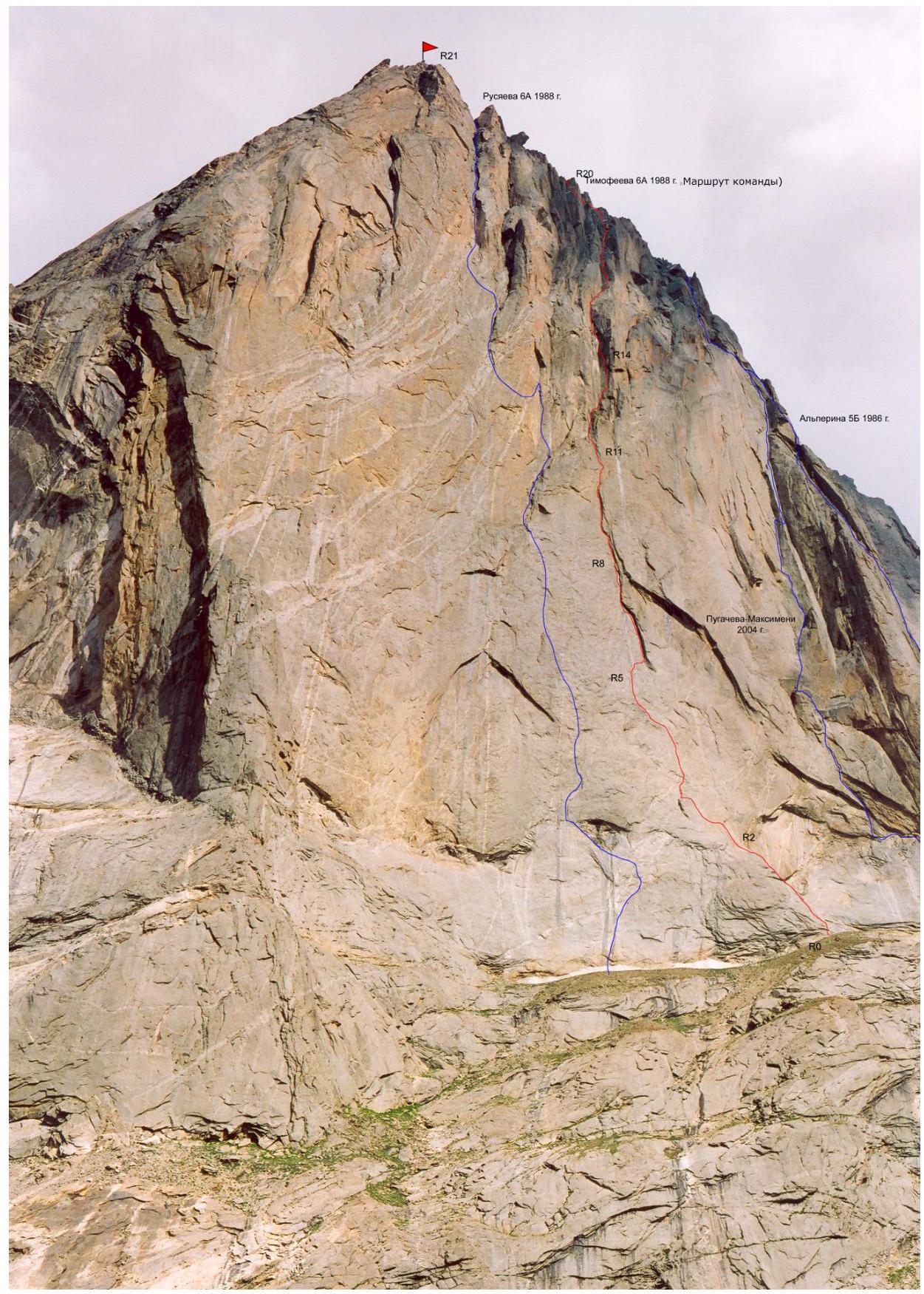
The route consists of four parts:
- a gentle, not very difficult but unpleasant for load carrying pedestal,
- a wall with rare features (mostly climbed on skyhooks),
- a sheer wall with eaves and large internal corners,
- a roof transitioning into a simple ridge.
Climbing was complicated by wet and icy cracks.
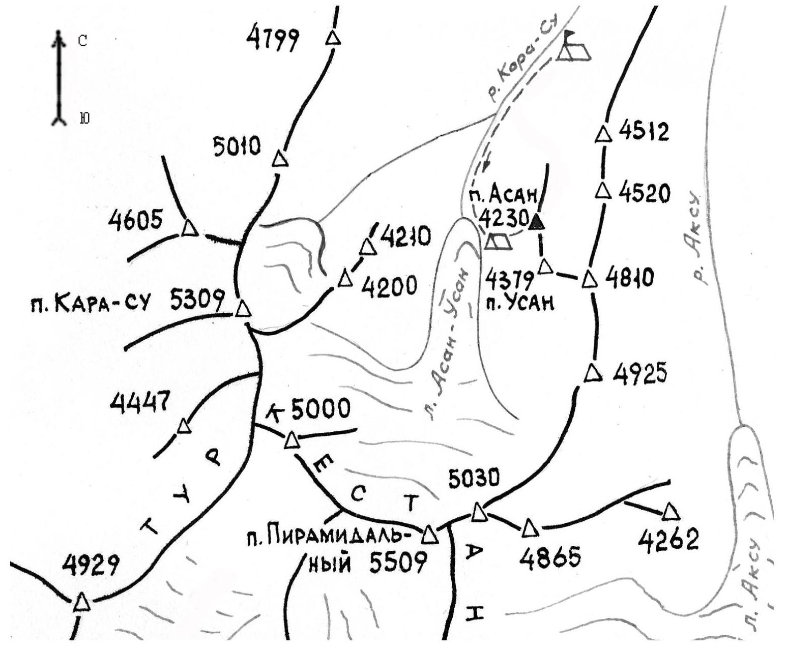
Approach to the Route
From the base camp located in the Kara-Suu valley, follow the cattle trail up the valley without crossing the river. Ascend the scree to the start of the Pogorelova route, then traverse the wall to the start of our route; there's a convenient spot for 2 tents.
Description by Sections
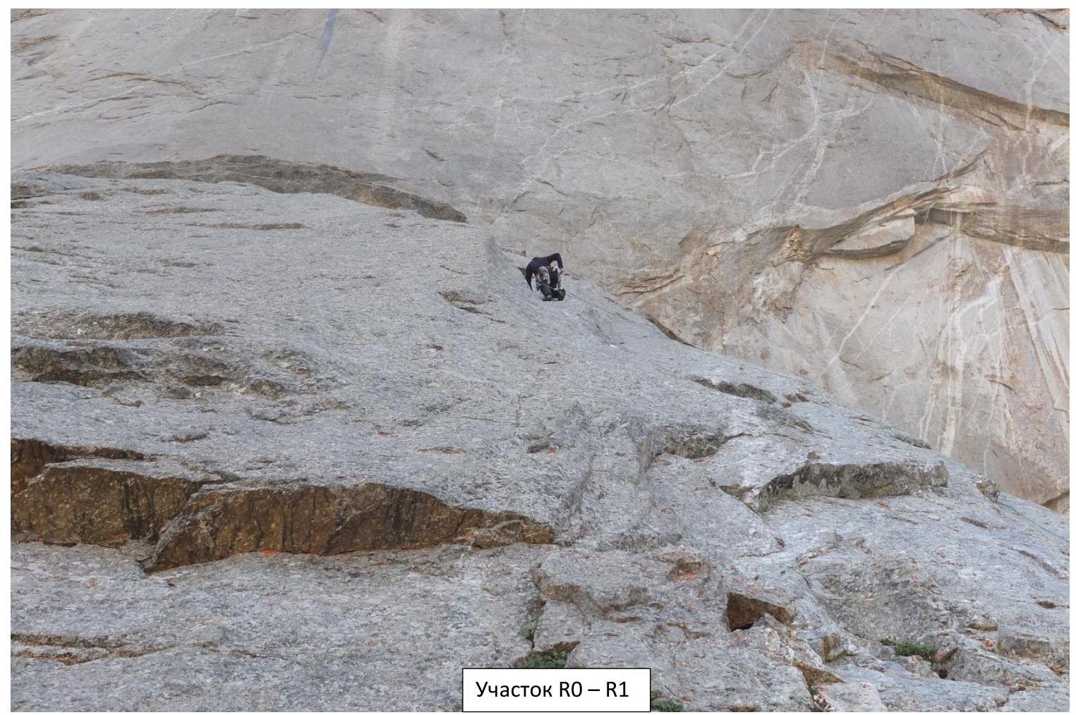
R0–R2 IV–V, move along the central part of the pedestal, bypassing eaves to the right. On R1 station, there's 1 piton; on R2 station, there are 2 pitons.
R2–R3 VI, A2+, 50 m:
- Move up the sloping wall to the left on skyhooks, protection via pitons.
- Transition into an internal corner leading to a convenient ledge for a platform.
Due to suddenly worsening weather, the team stopped here for the night.
R3–R4 VI, A2+, 40 m:
- Up through a sequence of cracks (10 m), artificial climbing on anchors and skyhooks, 2 pitons.
- Then 30 m left and up the sloping wall on featured and pocket skyhooks, protection via pitons, station to the right of the base of the internal corner.
R4–R5 VI, A2+, 30 m:
- Up the internal corner.
- Artificial climbing on cams and anchors.
- Station on pitons.
R5–R6 6A+ Fr, 20 m:
- Easy but careful climbing to the right to the base of a large overhanging internal corner.
- Protection with anchor hooks and small cams.
- The terrain allows for running belays for the 3rd and 4th participants directly from R5 to R7.
R6–R7 6Б+ Fr, A2, 40 m:
- Up the internal corner, then left along the eave.
- Climbing and artificial climbing using large cams (3–4 sizes).
- 2 pitons.
- Station to the left of the eave.
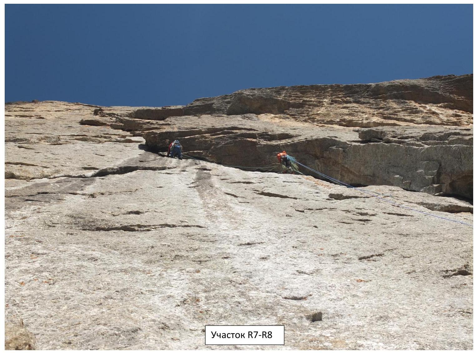
R7–R8 A2+, 20 m:
- Up the internal corner.
- Artificial climbing using medium cams and skyhooks.
- Station on a convenient ledge for a platform.
Here the team stopped for the second night.
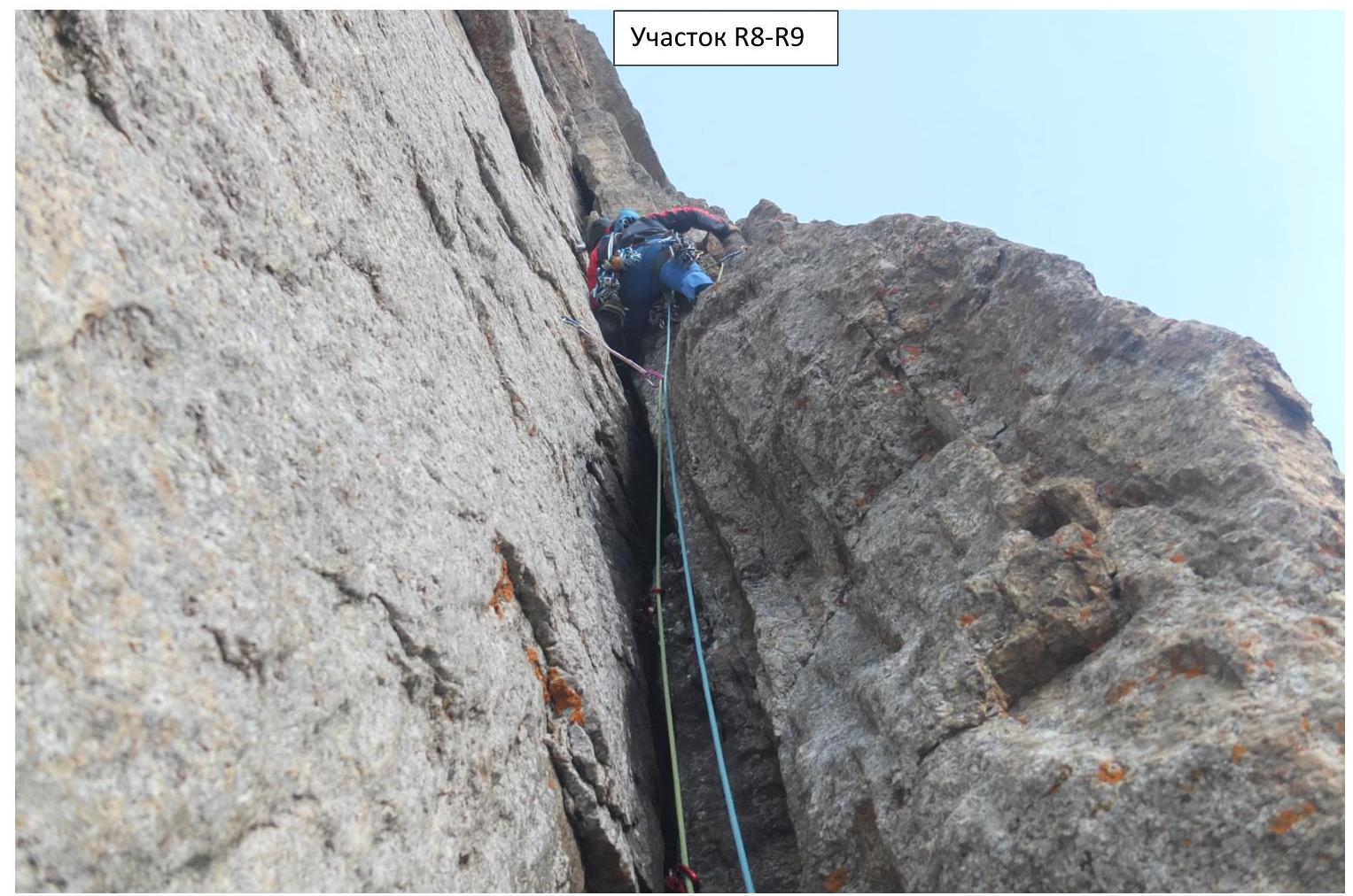
R8–R9 A2+, 25 m:
- Up the internal corner.
- Artificial climbing using medium cams and skyhooks.
- Station under an eave.
R9–R10 6C Fr, 30 m:
- Left along the eave, then up a chimney transitioning into an internal corner.
R10–R11 6Б Fr, 50 m:
- Up the internal corner, then to the right.
- Protection using cams and anchor hooks.
R11–R13 V, 80 m:
- Easy climbing through a series of ledges and walls.
- General direction — towards a huge internal corner (R14–R17).
- Last 20 m — many loose rocks.
- On R13 — a control point, a ledge protected by an eave, suitable for a platform, and several ledges suitable for tent camping.
Here the group stopped for the 3rd night.
R13–R14 6A+ Fr, 20 m:
- Up the wall to the left of the left part of the internal corner.
- Station on a convenient ledge, 2 pitons.
R14–R15 A2+, 6Б+ Fr, 45 m:
- Right into the internal corner and up a narrow crack, then a pendulum to the right wall with a system of cracks.
- Through the system of cracks — complex climbing up and left to an indistinct ledge with a station on our own points.
- Protection with nuts, cams of various sizes, and anchor hooks.
- Climbing becomes more complicated in the upper part.
- An additional obstacle was the abundance of ice and water in the cracks.
R15–R16 A2+, 30 m:
- Up and left through a system of thin cracks.
- Station to the left under an eave.
- Caution: ice periodically falls from the eave.
- Artificial climbing using small cams and anchor hooks.
R16–R17 A3, 30 m:
- Along a resonant crack to the left of the station (10 m) on nuts and cams, then up into an internal corner.
R17–R18 A2+, 40 m:
- First, free climbing (6A Fr) up the internal corner, then artificial climbing using small cams, nuts, and anchor hooks through a system of narrow cracks (anchor hooks with a bent beak work well).
- Station on a ledge on a flattening.
R18–R19 A2+, 55 m:
- Artificial climbing through a system of narrow cracks using small cams, nuts, and anchor hooks, to the right and up under a slight overhang, then along the overhang to the left.
- Station to the right of the base of the internal corner.
R19–R20 A2+, 6Б Fr, 40 m:
- Left into a narrow crack at the base of the internal corner.
- Artificial climbing up: first using large cams (2–3 sizes), then the crack narrows to the width of a palm.
- Not reaching the eave — free climbing traverse to the right.
- Relatively difficult exit via free climbing (~6Б Fr) onto a ledge through a small overhang.
R20–R22 V–IV, 95 m:
- Up through a sequence of walls and ledges.
- Exit onto the pre-summit ridge.
- Many loose rocks at the end of section R21–R22.
R22–R23 II, 200 m:
- Easy ridge leading to the portal.
4925
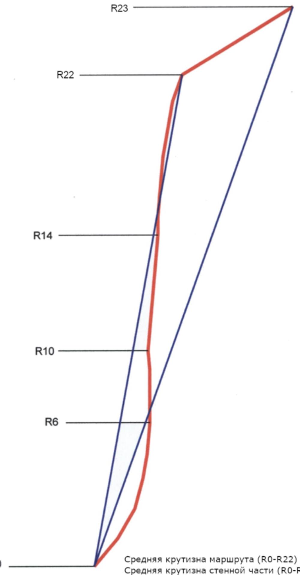
The average steepness of the route (R0–R22) is 70°. The average steepness of the wall part (R0–R23) is 80°.
UIAA Scheme sheet 1
| Section | Length, m | Difficulty | Steepness, ° | Skyhooks | Pitons | Anchor hooks | Nuts | Cams | Note |
|---|---|---|---|---|---|---|---|---|---|
| R0 | 50 | ABC | |||||||
| R1 | 58 | IV | 50 | 1 | 2 | 4 | 4 | ||
| R2 | 55 | V | 60 | 2 | 6 | 3 | |||
| R3 | 50 | VI A2+ | 75 | 2 | 7 | 4 | |||
| R4 | 40 | VI A2+ | 80 | 3 | 8 | 4 | |||
| R5 | 30 | VI A2+ | 85 | 13 | 13 | ||||
| R6 | 20 | 6A Fr | 85 | 5 | 1 | 2 | 4 | 4 | |
| R7 | 40 | 6Б+ Fr A2 | 90 | 20 | 4 | 6 | |||
| R8 | 20 | A2+ | 90 | 15 | 2 | Camp 2 | |||
| R9 | 25 | A2+ | 90 | 15 | 2 | ||||
| R10 | 30 | 6C Fr | 95 | 12 | 3 |
UIAA Scheme sheet 2
| Section | Length, m | Difficulty | Steepness, ° | Skyhooks | Pitons | Anchor hooks | Nuts | Cams | Note |
|---|---|---|---|---|---|---|---|---|---|
| R10 | 50 | 6Б Fr | 85 | 15 | 2 | 2 | |||
| R11 | 60 | V | 85 | 10 | 2 | 2 | |||
| R12 | 30 | IV | 70 | 3 | 2 | Camp 3 | |||
| R13 | 20 | 6A+ Fr | 85 | 2 | 2 | 2 | |||
| R14 | 45 | 6Б+ Fr A2 | 85 | 20 | 8 | ||||
| R15 | 30 | A2+ | 90 | 10 | 2 | 1 | 6 | 2 | |
| R16 | 15 | A3 | 90 | 12 | 10 | 6 | 2 | 1 | |
| R17 | 40 | A2+ | 85 | 5 | 2 | 10 | 5 | ||
| R18 | 55 | A2+ | 85 | 20 | 5 | ||||
| R19 | 40 | A2+ 6Б | 80 | 6 | 1 | ||||
| R20 | 50 | V | 80 | ||||||
| R21 | 45 | IV | 70 | ||||||
| R22 | 6 | ||||||||
| R23 | 200 | II | 45 |
Section R0–R1
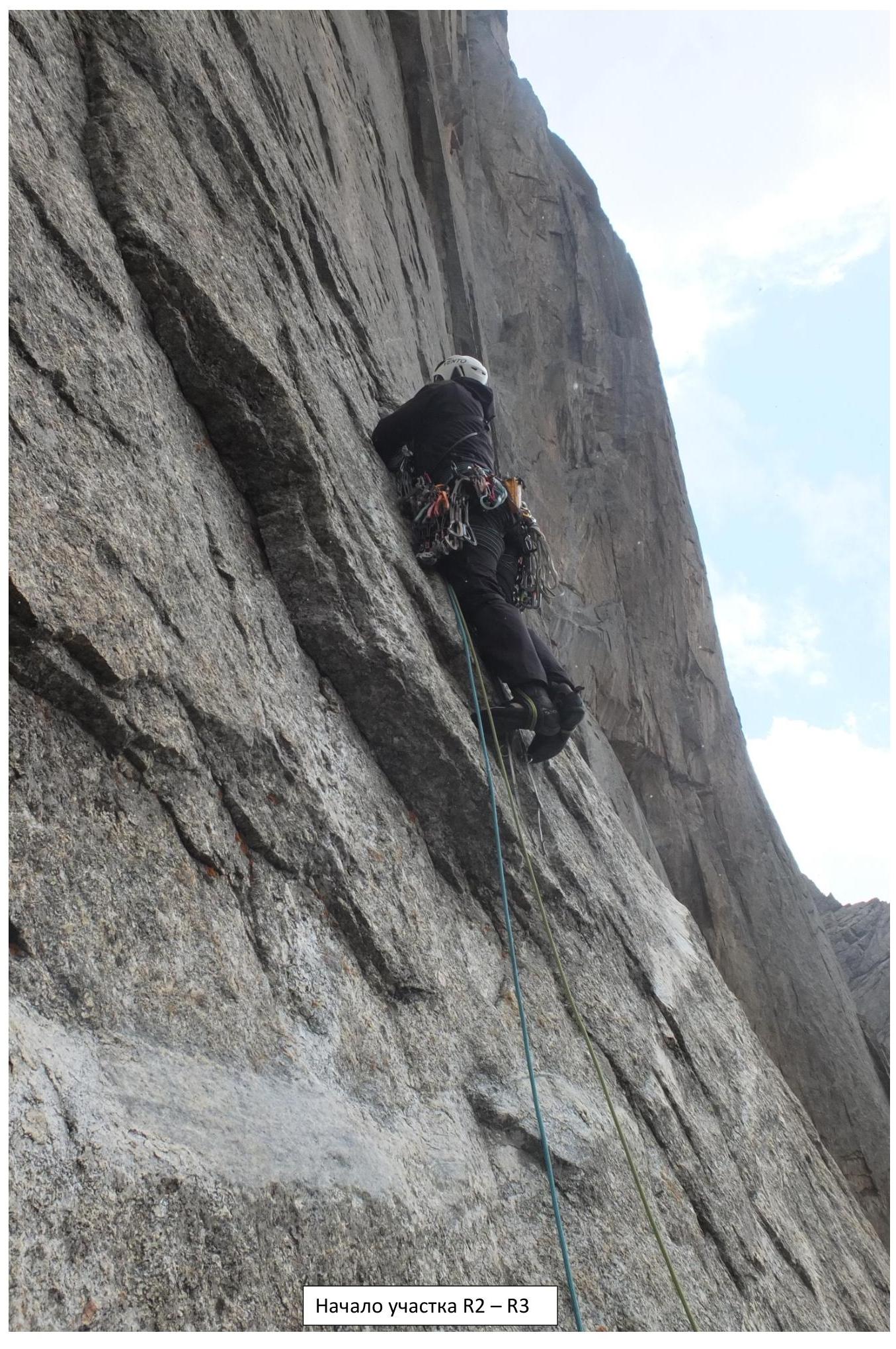
Start of section R2–R3
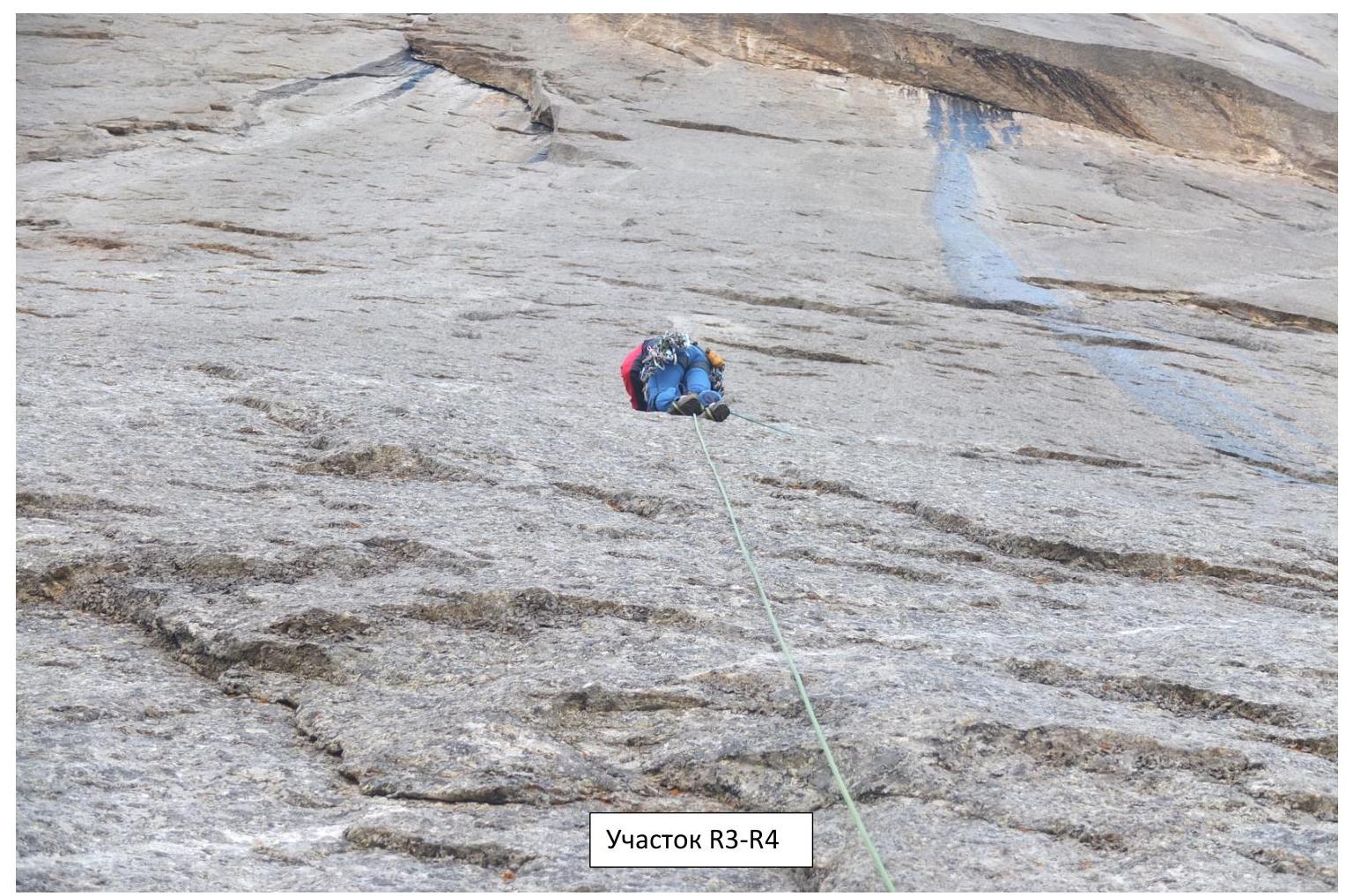 Section R3–R4
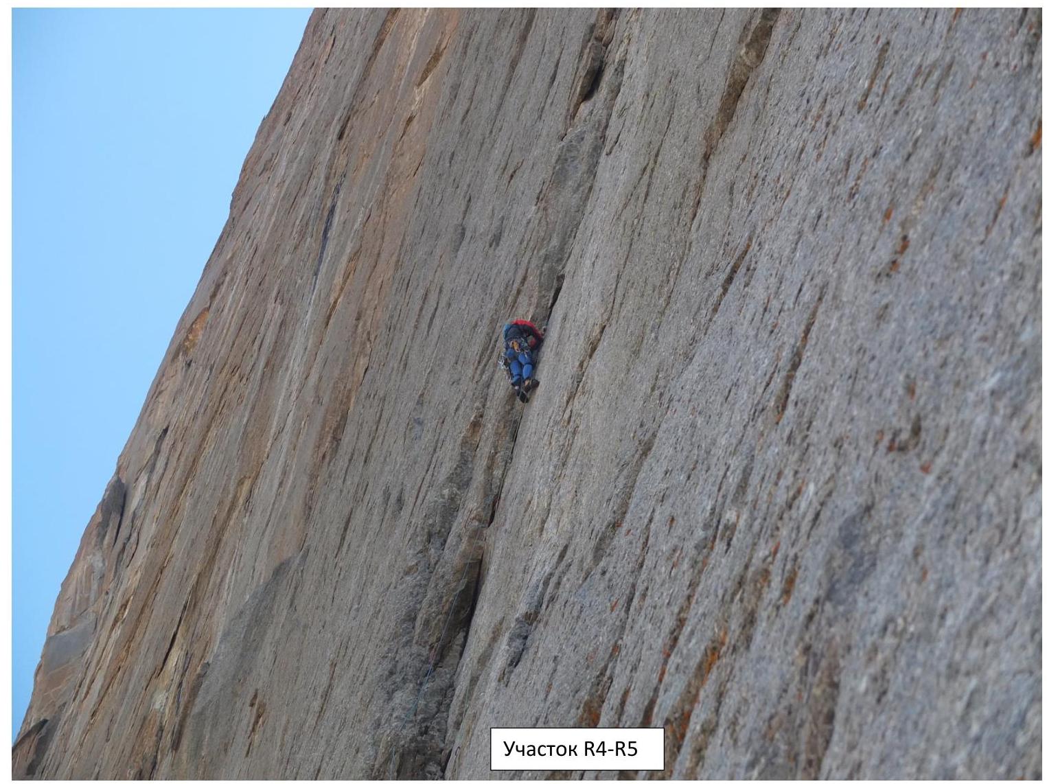 Section R4–R5
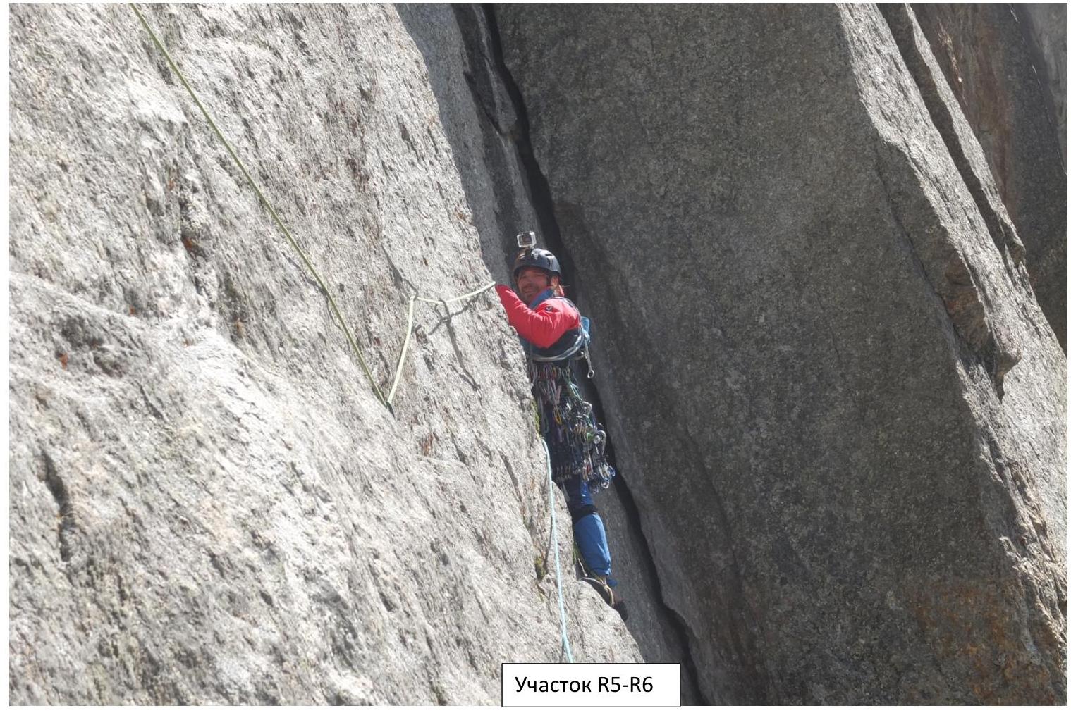 Section R5–R6

Section R6–R7
 Section R7–R8
 Section R8–R9
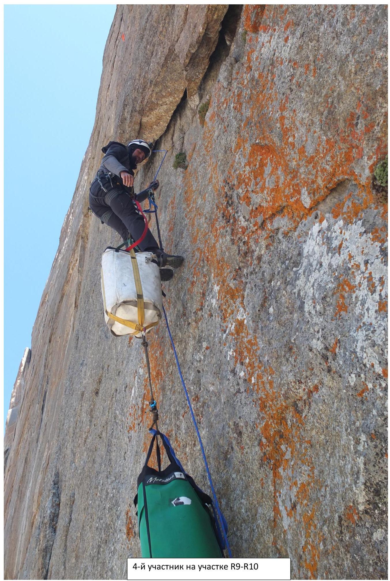 4th participant on section R9–R10
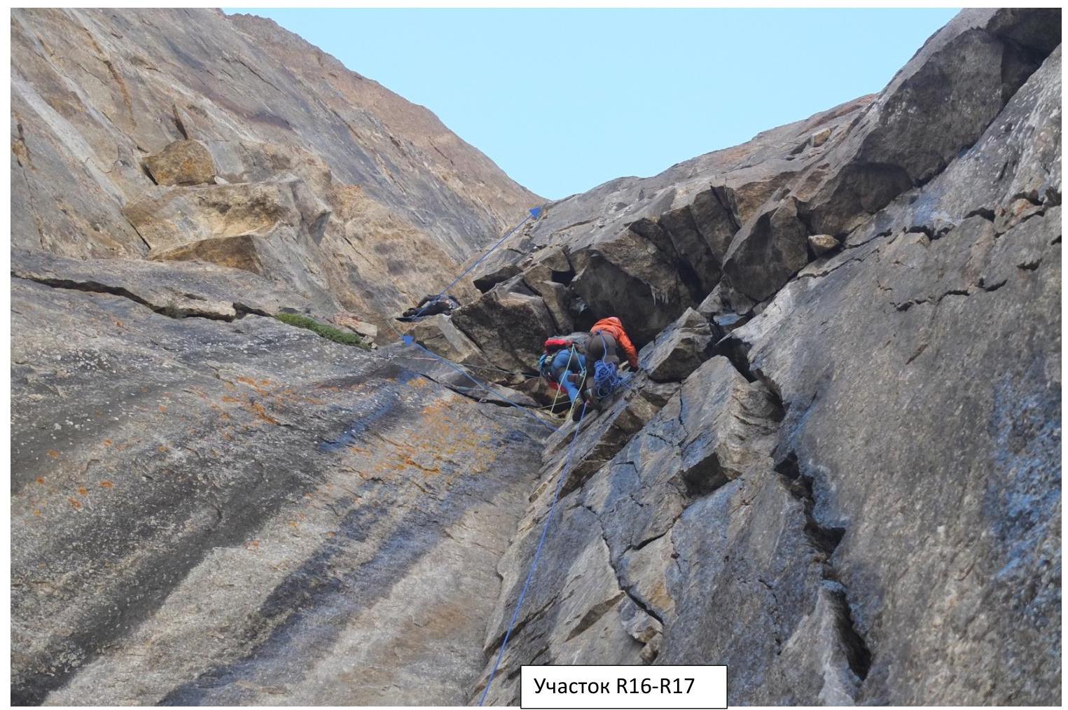
Section R16–R17
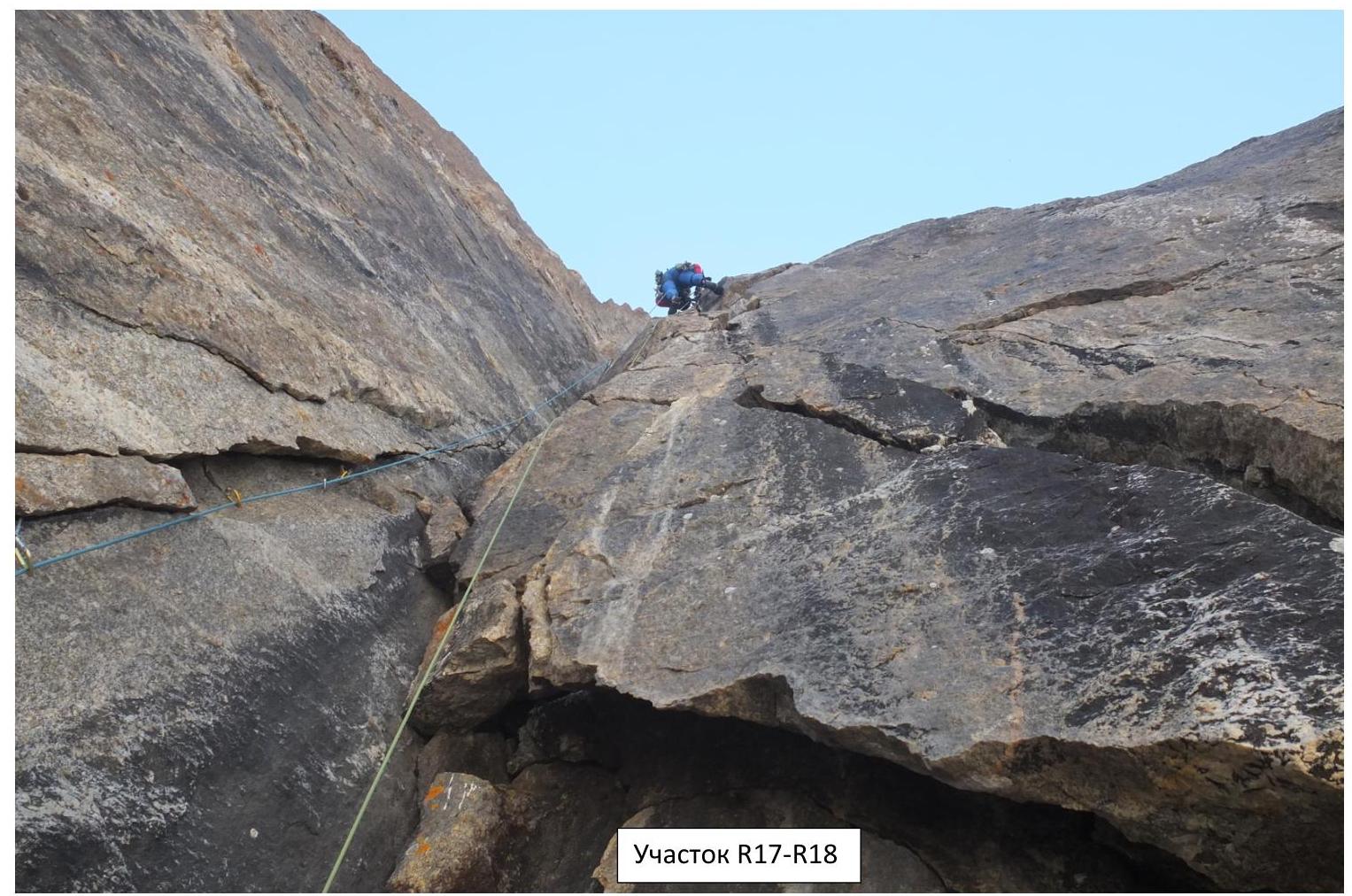 Section R17–R18
 Section R19–R20
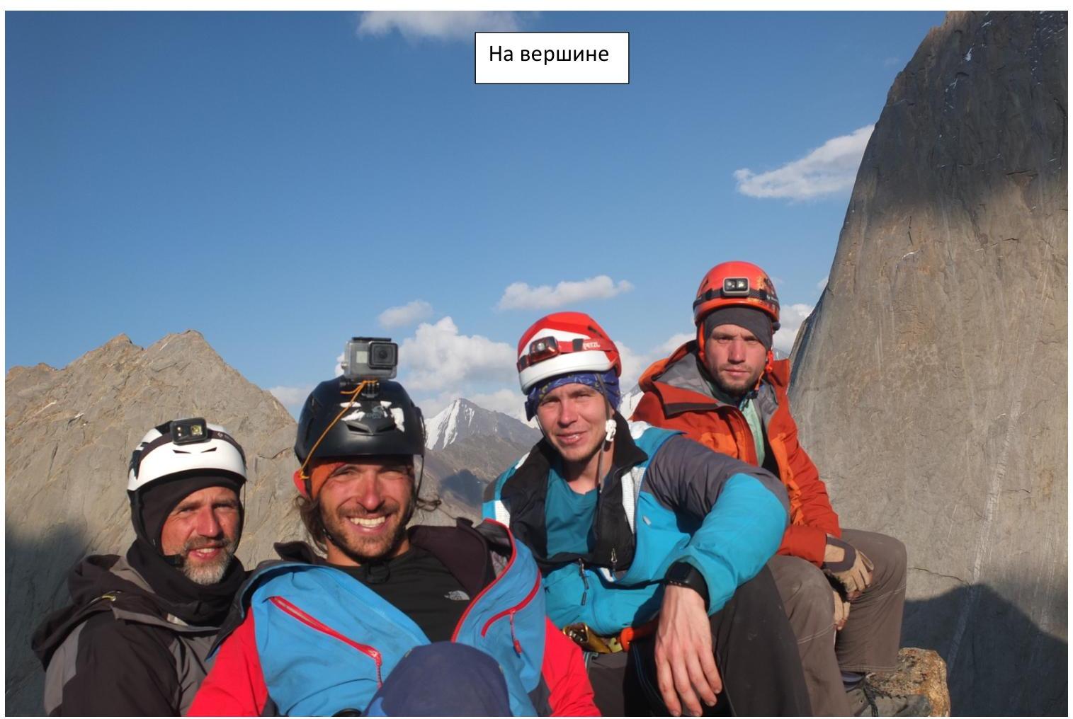
At the summit