Ascent Report
of the team of the Odessa Alpine Club to the peak Asan (4230 m) via the right part of the Northwest wall (first ascent). CIS Championship (EASC) in Alpinism. High-altitude and technical ascents class. Pamir-Alai, Karavshin, August 2007. Odessa – 2007.
Ascent Passport
- Pamir-Alai, Karavshin valley, 5.4.3
- peak Asan, 4230 m, via the right part of the NW wall.
- Claimed – 6A category of difficulty, first ascent.
- Route type: rock.
- Height difference of the route: 930 m (3300–4230).
Route length: 1040 m.
Length of sections: V category of difficulty – 90 m, VI category of difficulty – 610 m.
Average steepness:
- main part of the route – 80°
- entire route – 73°
- "Hooks" left on the route:
total – 35; including bolted – 35.
Hooks used on the route:
- stationary bolted – 35, including ITO – 32
- removable bolted – 0, including ITO – 0. Total artificial points of support (ITO) used – 232.
- Team's working hours: 94.5 hours, 9 days.
- Team leader: Mогила Vladimir Fedorovich – Master of Sports of International Class.
Team members:
- Клебанский Vladimir Mikhailovich – Candidate Master of Sports
- Лавриненко Alexander Vadimovich – Master of Sports
- Цушко Taras Viktorovich – Candidate Master of Sports
- Coach: Горбенко Mstislav Mstislavovich – Honored Master of Sports, Honored Coach.
- Departure to the route: 7:00, August 9, 2007. Reaching the summit: 12:00, August 17, 2007. Return to Base Camp: 17:00, August 17, 2007.
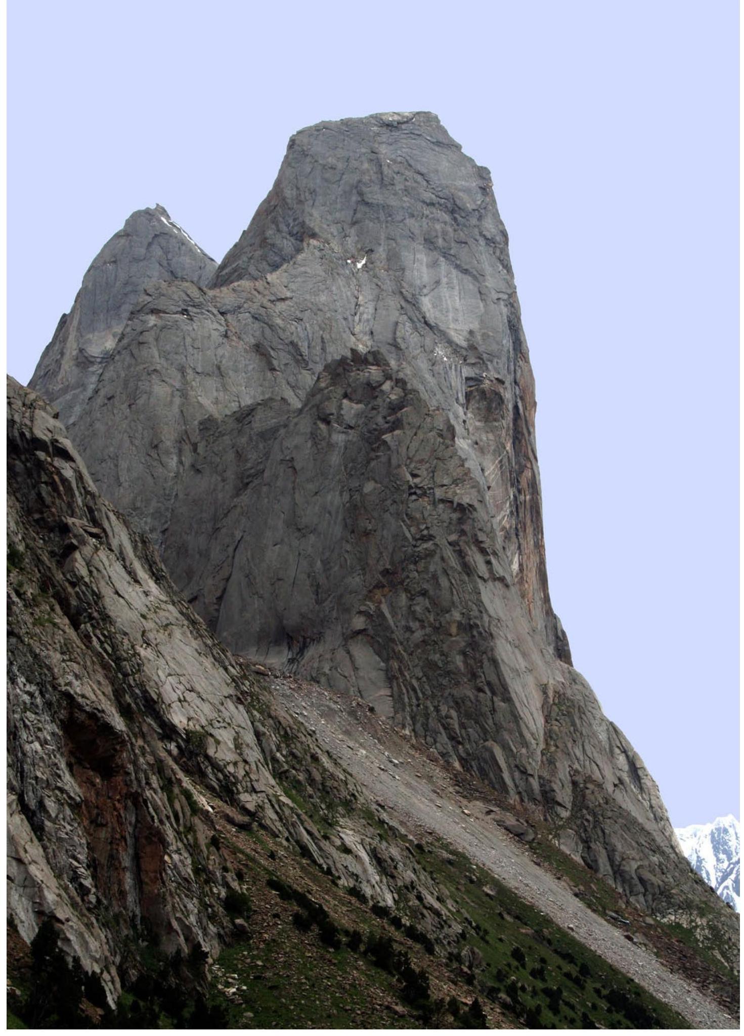
General photo of the summit. Taken on August 6, 2007, 17:37.
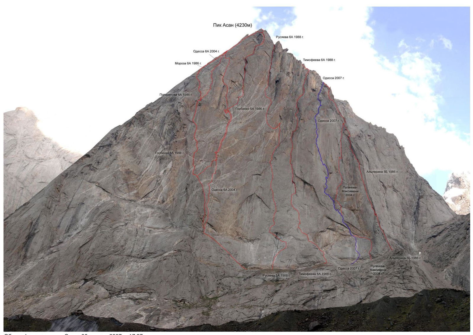
Profile of the NW wall of peak Asan. View from the left (real profile cannot be taken as the wall is obscured by lateral counterforts).
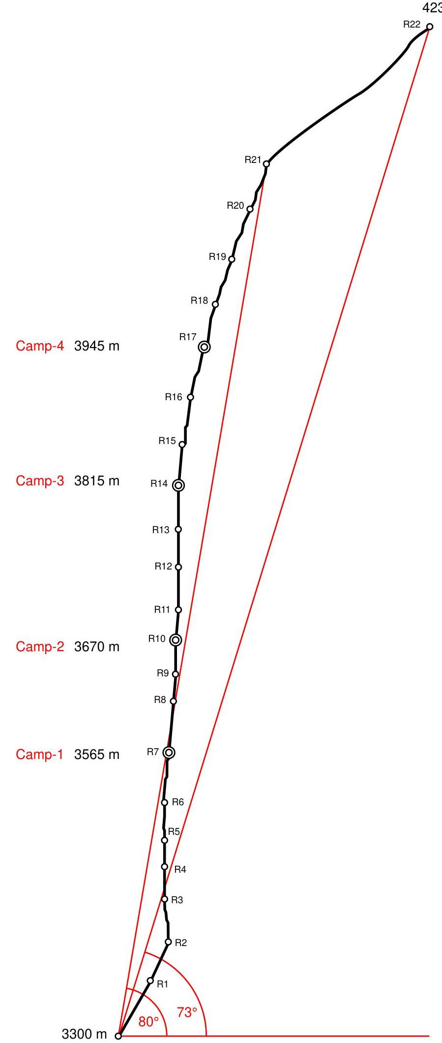
Route profile.
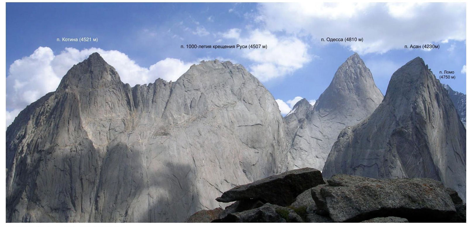
Photopanorama of the ascent area.
Ascent graph.
Team's Movement Schedule by Sections
August 9, 2007, from 7:00 to 18:30 – initial route processing (sections R0–R2). August 10, 2007, from 7:30 to 19:00 – processing (sections R2–R5). August 11, 2007, from 7:00 to 9:00 – lifting cargo via fixed ropes; from 9:00 to 18:30 – completed section R5–R7, overnight stay at Camp 1. August 12, 2007, from 7:30 to 18:30 – completed section R7–R9, overnight stay at Camp 1. August 13, 2007, from 7:30 to 19:00 – completed sections R9–R11, overnight stay at Camp 2. August 14, 2007, from 7:30 to 18:30 – completed sections R11–R13, overnight stay at Camp 2. August 15, 2007, from 7:30 to 18:30 – completed sections R13–R14, overnight stay at Camp 3. August 16, 2007, from 7:30 to 19:00 – completed sections R14–R18, overnight stay at Camp 4. August 17, 2007, from 8:00 to 12:00 – completed sections R18–R22; at 12:00 – reached the summit. August 17, 2007, at 17:00 – returned to Base Camp.
Route Diagram in UIAA Symbols. Sheet 1
| rock | cams | bolt | Route Diagram in UIAA Symbols. Sheet 1 | № | length | cat. diff. | steepness |
|---|---|---|---|---|---|---|---|
| 6/4 | 12 / 7 | 1 / 1 | 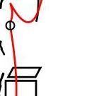 | R9 | 25 m | VI, A2 | 85° |
| 8/4 | 10 / 3 | 3 / 3 | R8 | 50 m | VI, A1 | 85° | |
| 4/2 | 12 / 10 | R7 | 45 m | VI, A2 | 85° | ||
| 7/5 | 12 / 11 | - | R6 | 35 m | VI+, A3 | 90° | |
| 5/4 | 11 / 8 | - | R5 | 25 m | VI, A2 | 90° | |
| 8/8 | 11 / 10 | - | R4 | 30 m | VI, A2 | 90° | |
| 14/13 | 11 / 10 | 1 / 1 | R3 | 40 m | VI, A3 | 95° | |
| 5/5 | 3 / 3 | 5 / 4 | R2 | 40 m | VI, A3 | 75° | |
| 8/8 | 3 / 3 | 6 / 4 | R1 | 60 m | VI+, A3 | 70° | |
| R0 |
Route Diagram in UIAA Symbols. Sheet 2
peak Asan (4230 m)
| rock | cams | bolt | № | length | cat. diff. | steepness |
|---|---|---|---|---|---|---|
| R22 | 20 | I | 40° | |||
| 0 / 0 | 2 / 0 | - | R21 | 45 m | III+ | 70° |
| 1 / 0 | 4 / 0 | - | R20 | 50 m | IV | 70° |
| 2 / 0 | 6 / 0 | - | R19 | 45 m | IV+ | 70° |
| 3 / 0 | 6 / 0 | - | R18 | 40 m | V+ | 75° |
| 2 / 0 | 8 / 0 | - | R17 | 50 m | V | 75° |
| 6 / 4 | 12 / 8 | - | R16 | 45 m | VI, A1 | 80° |
| 6 / 5 | 9 / 7 | 2 / 2 | R15 | 40 m | VI, A2 | 85° |
| 9 / 8 | 10 / 8 | 3 / 3 | R14 | 40 m | VI, A3 | 90° |
| 7 / 7 | 11 / 11 | 3 / 3 | R13 | 35 m | A3 | 90° |
| 8 / 8 | 12 / 12 | 3 / 3 | R12 | 40 m | A3 | 90° |
| 2 / 2 | 3 / 3 | 6 / 6 | R11 | 30 m | A2 | 85° |
| 2 / 2 | 10 / 8 | 2 / 2 | R10 | 30 m | VI, A2 | 90° |
| R9 |
No note was found in the summit tour, but the team left their note in the summit tour.

First climber working on section R1–R2.
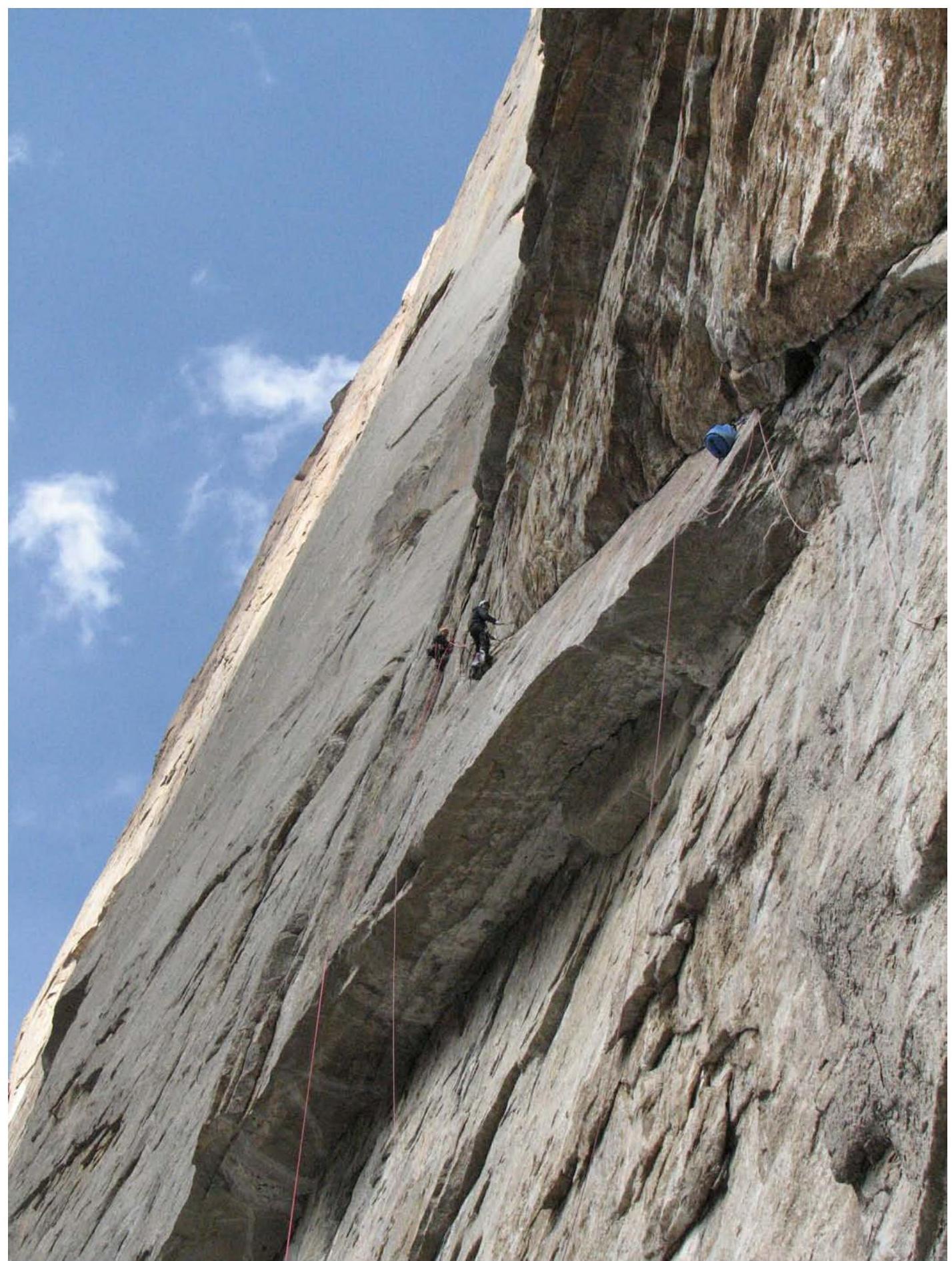
Work on section R3–R4.
Work on section R7–R8.
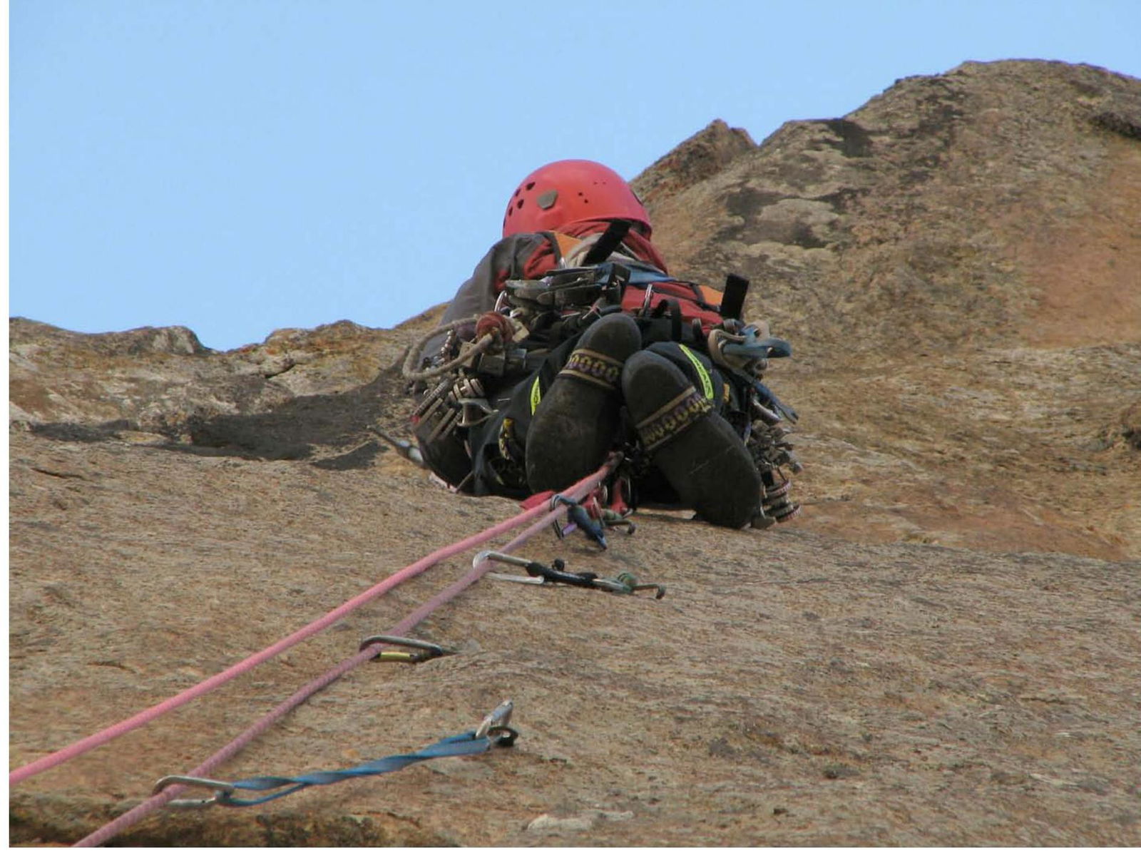
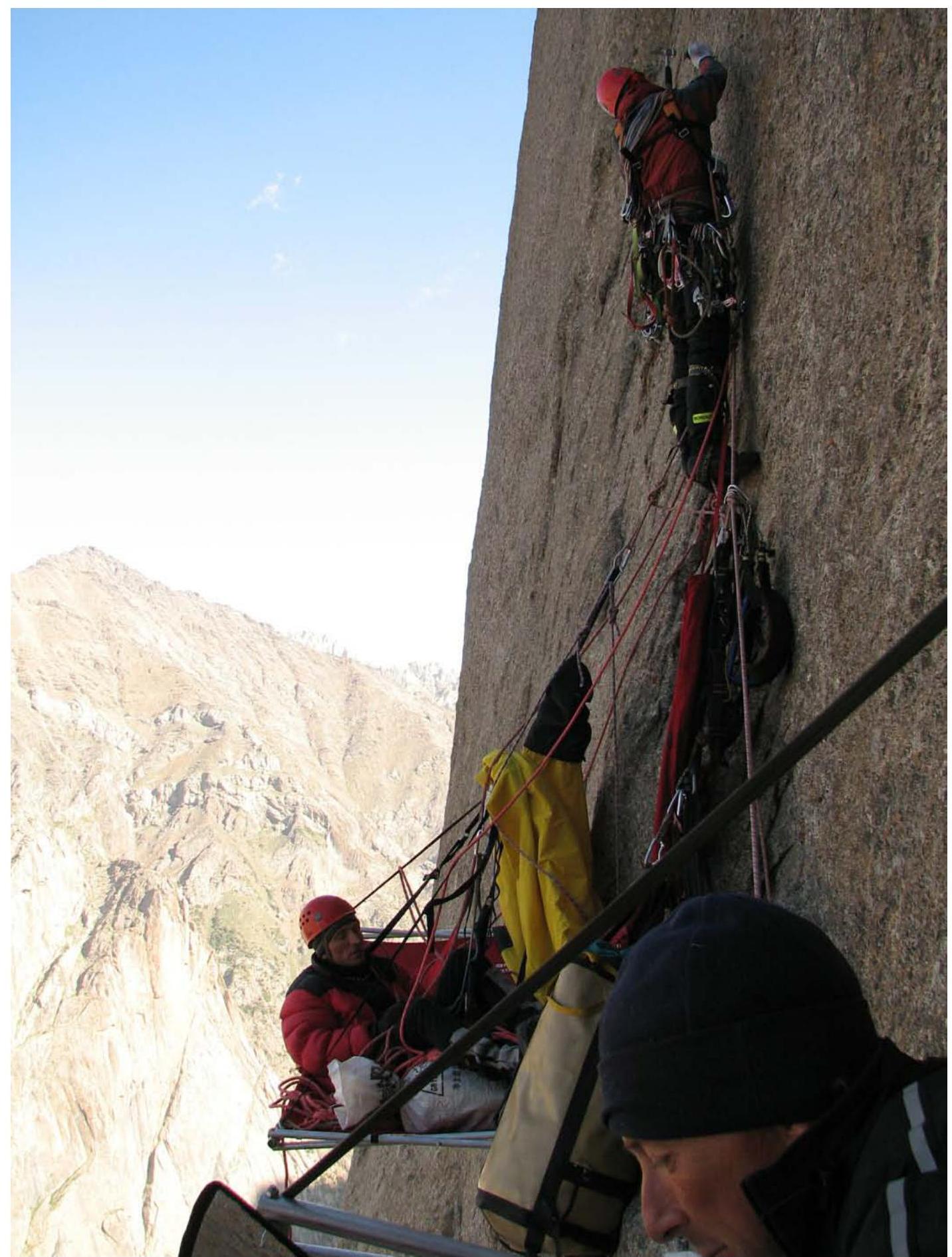
First climber working on section R14–R15.
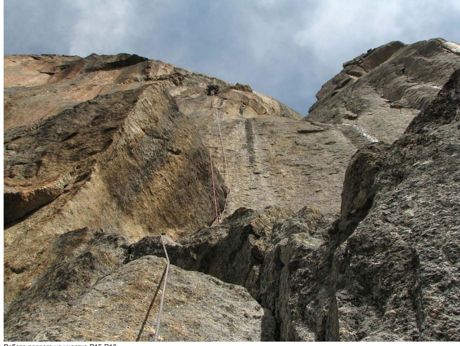
First climber working on section R15–R16.
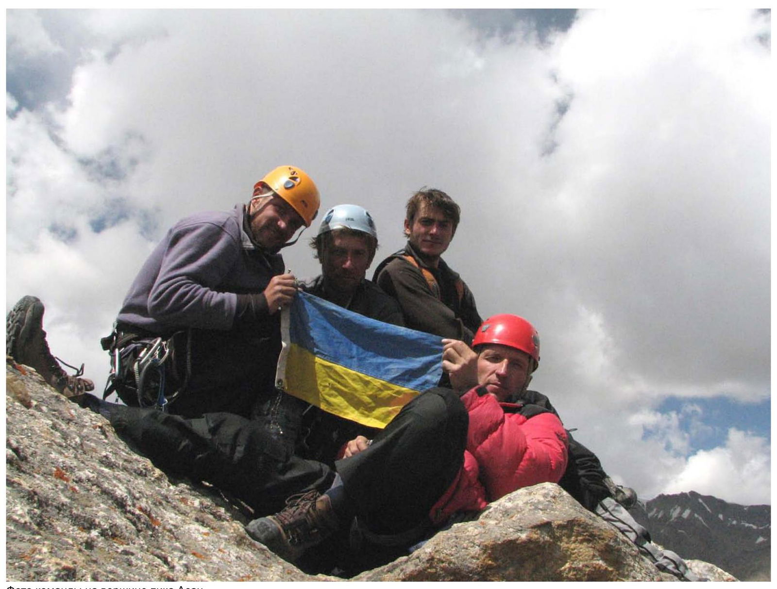
Team photo at the summit of peak Asan.