PASSPORT
- Rock climbing category.
- Pamir-Alay, Turkestan Ridge.
- Peak 4230 m (Asan), center of NW wall.
- Proposed 6B category of difficulty for the first ascent.
- Height difference 830 m, length 1015 m, length of sections with 5–6 category of difficulty — 865 m, of which 6B category — 415 m. Average slope of the route 78° (3400–4230). Of these, 6B category 85° (3540–3800, 3890–4000).
- Driven pitons.
| Rock | Bolt | Nuts |
|---|---|---|
| 145 | 24 | 119 |
| 23 | 24 | 50 |
- Team's total travel time 66 hours and 6 days.
- Overnights: 1st-2nd comfortable on ledges; 3rd: two in hammocks, for four at the previous location; 4th: sitting — four on a ledge, two in hammocks; 5th: uncomfortable sitting, one in a hammock.
- Team leader: Gorbenco Mstislav Mstislavovich MS
Participants:
- Alperin Vladimir Maevich MS
- Serenkov Pavel Sergeevich MS
- Sitnik Mikhail Alexandrovich CMS
- Todorov Viktor Stepanovich CMS
- Bazilevsky Nikolai Mikhailovich CMS
- Coach: Sviridenko Vadim Sergeevich ZTR Ukrainian SSR
- Departure to the route: 15.07.1986. Summit: 20.07.1986. Return: 21.07.1986.
- Odessa Regional Council "AvanGuard" VSS "Trud"
Alpine Club "Odessa"
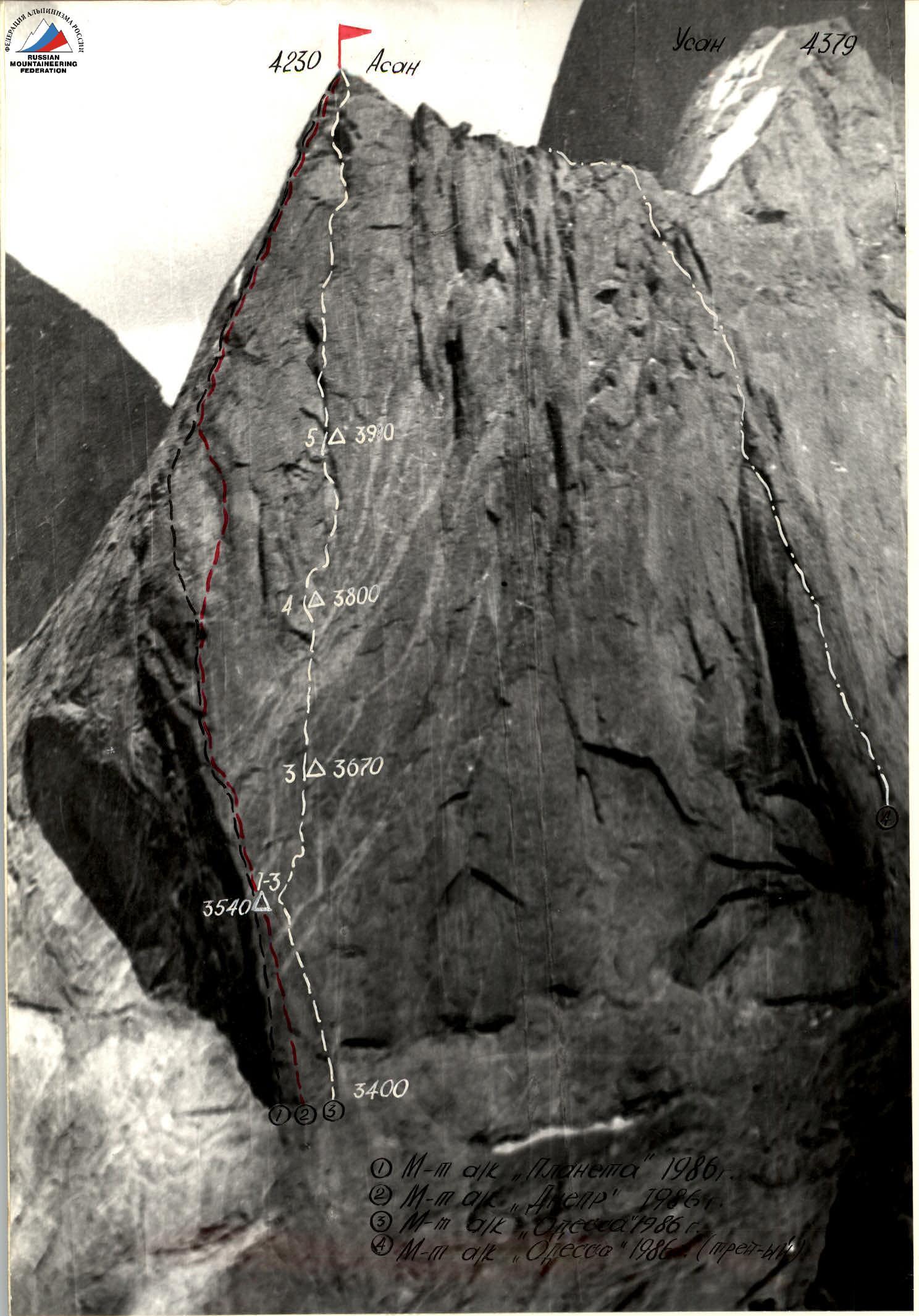 Route of a/c "Planeta" 1986.
Route of a/c "Dnepr" 1986.
Route of a/c "Odessa" 1986.
Route of a/c "Odessa" 1986 (traverse).
Route of a/c "Planeta" 1986.
Route of a/c "Dnepr" 1986.
Route of a/c "Odessa" 1986.
Route of a/c "Odessa" 1986 (traverse).
Photo 1. The picture was taken from the opposite slope (3800 m) on July 12, 1986 at 8:00. Distance 2000 m. Lens "Gelius-44".
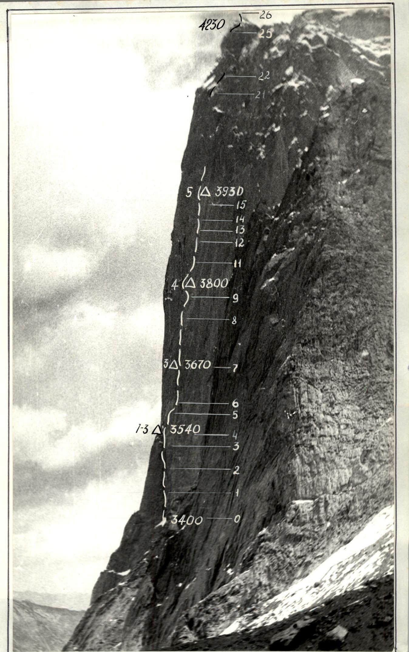
Photo 2. Wall profile on the right. The picture was taken from the right moraine of the glacier. May 28, 1986 16:00. Lens "Gelius-44", distance 1000 m.
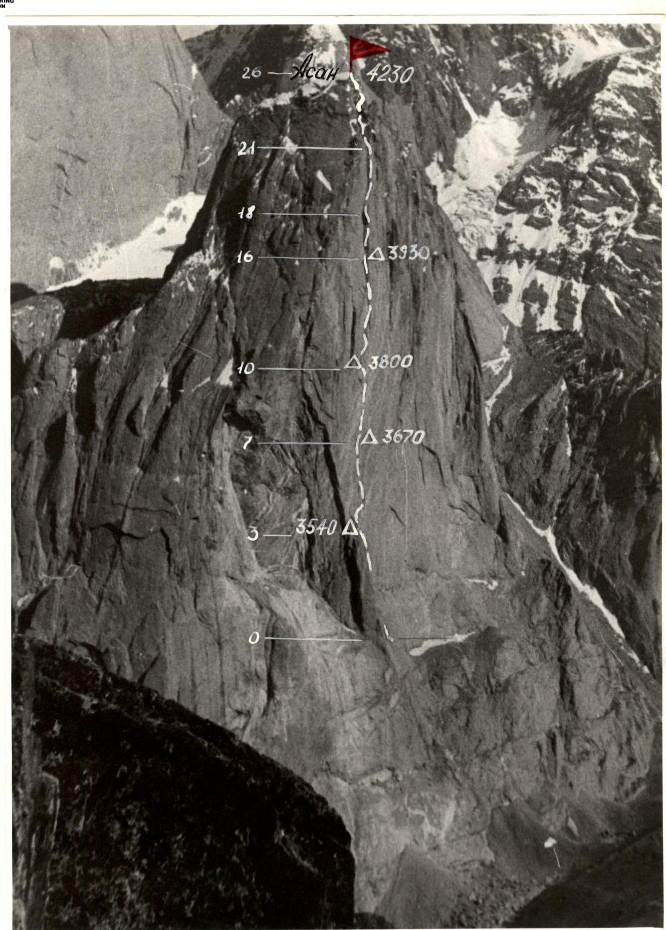
Photo 3. Wall profile on the left. The picture was taken from the opposite slope, distance 3600 m, height 4200 m July 12 17:00. Lens "Gelius-44", H 3600 m.
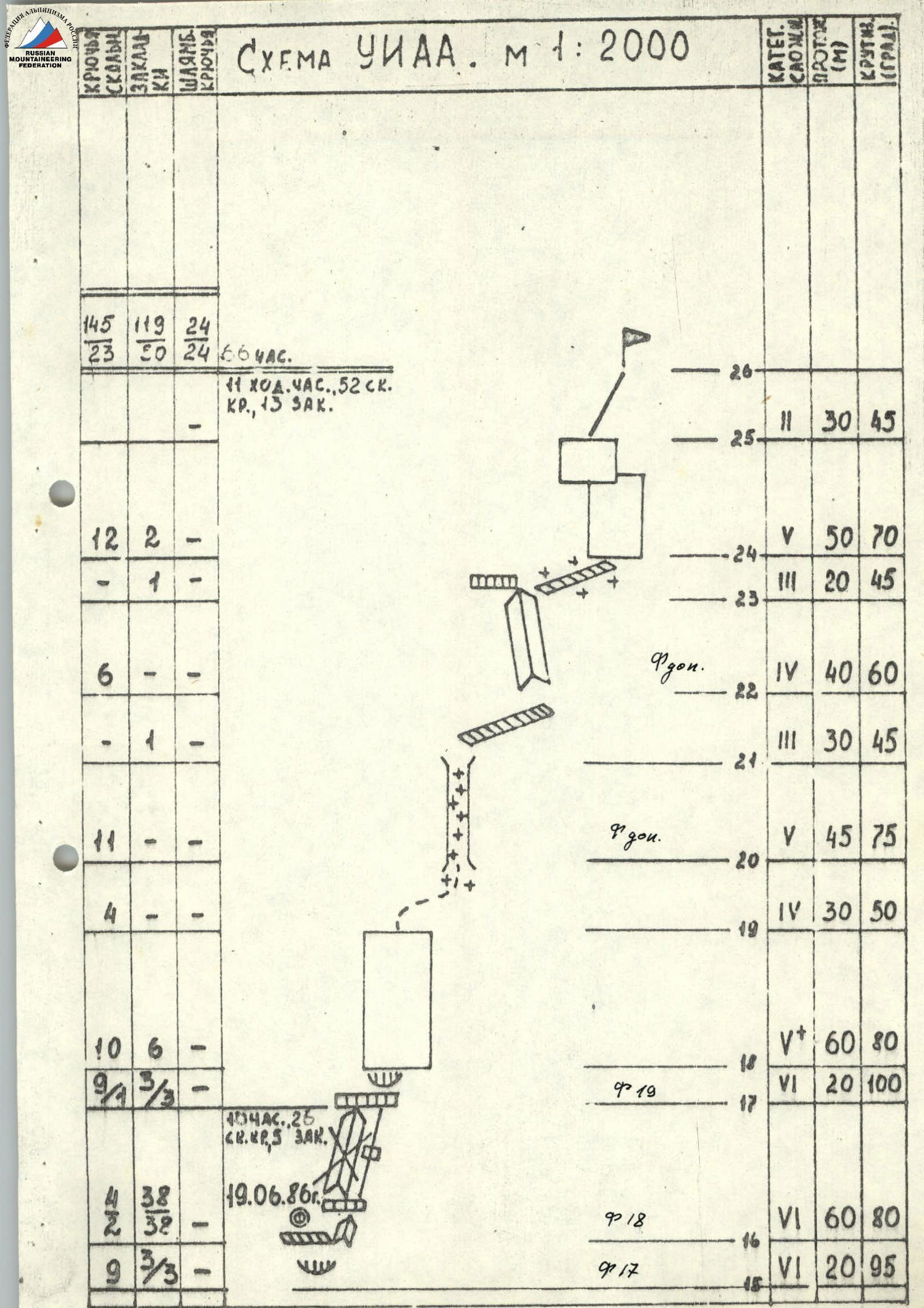
UIAA Scheme. Scale 1:2000
July 18, 1986 12 travel hours, 7 bolt pitons, 10 rock pitons, 24 nuts. R26: category of difficulty 6, 30 m, 80° R25: category of difficulty 5, 20 m, 75° R17: category of difficulty 5, 25 m, 80° R16: category of difficulty 5, 50 m, 70° R15: category of difficulty 6, 40 m, 75° R13: category of difficulty 6, 45 m, 85° R10–R12: category of difficulty 6, A2B, 40 m, 90°
July 17, 1986 12 travel hours, 3 bolt pitons, 7 rock pitons, 2 nuts. R7–R9, R12: category of difficulty 6, A2B, 80 m, 85° 4 travel hours, 4 bolt pitons, 15 rock pitons, 11 nuts. R6: category of difficulty 6, 60 m, 80° R5: category of difficulty 6, 20 m, 85°
July 15, 16, 17, 1986
10 travel hours, 4 bolt pitons, 35 rock pitons, 19 nuts.
R4: category of difficulty 6, A2B, 60 m, 90°
R3: category of difficulty 5, 20 m, 85°
R2 (run-out): category of difficulty 5, 40 m, 70°
R1 (run-out): category of difficulty 5, 40 m, 90°
R0 (run-out): category of difficulty 5, 40 m, 85°
UIAA Scheme. Scale 1:2000
| Rock | Nuts | Bolt |
|---|---|---|
| 145 | 119 | 24 |
| 23 | 30 | 24 |
Total: 66 hours. 11 travel hours, 52 rock pitons, 13 nuts.
R26: category of difficulty 2, 30 m, 45° R24–R25: category of difficulty 5, 50 m, 70° R23: category of difficulty 3, 20 m, 45° R22 (run-out): category of difficulty 4, 40 m, 60° R21: category of difficulty 3, 30 m, 45° R20 (run-out): category of difficulty 5, 45 m, 75° R19: category of difficulty 4, 30 m, 50° R18: category of difficulty 6, 60 m, 80° R17: category of difficulty 6, 20 m, 100°
June 19, 1986
40 hours, 26 rock pitons, 5 nuts.
R16: category of difficulty 6, 60 m, 80°
R15: category of difficulty 6, 20 m, 95°
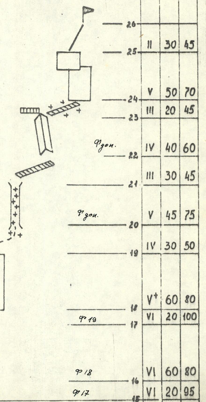
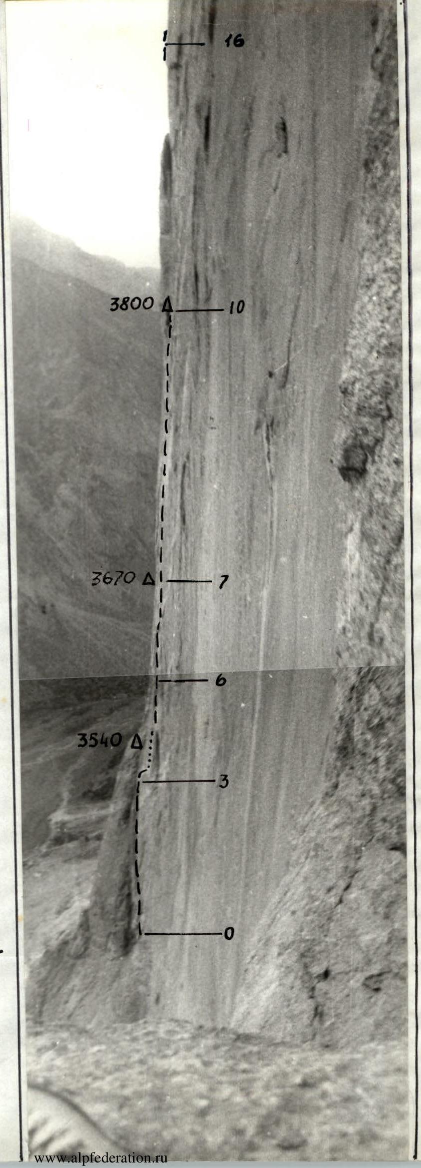 Photo 12. Profile of the main part of the wall. Sections R0–R16. July 9 18:00.
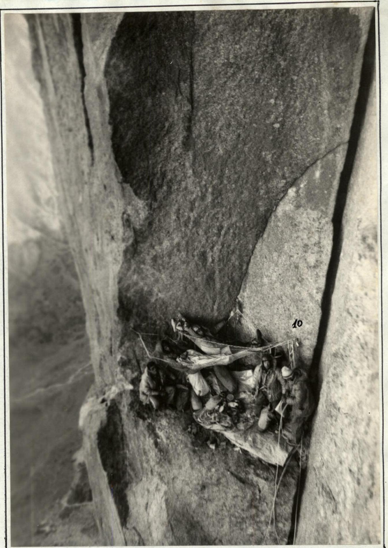
Photo 14. 4th bivouac in a niche. July 19 8:00.
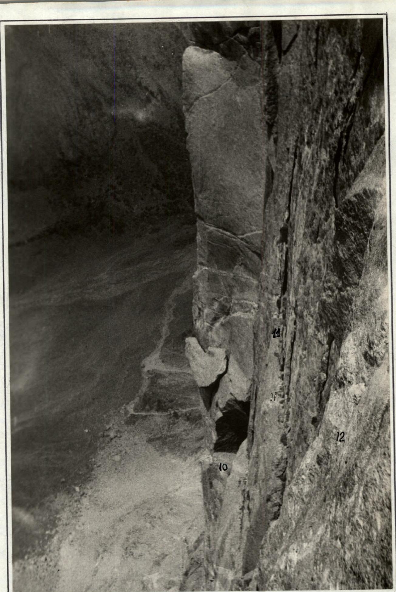
Photo 16. Section R11–R12. Traverse along a ledge with exit via an inner corner. View of the 4th bivouac. July 19 12:00.