Ascent Passport
-
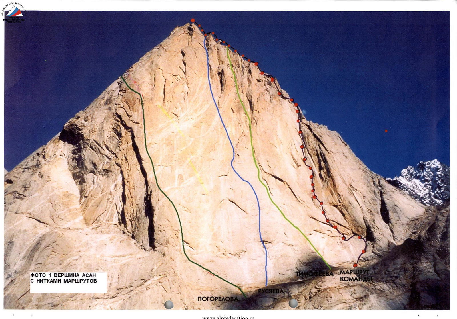
Kyrgyzstan, Pamir-Alay
-
Technical category
-
Turkestan Range, Karavshin Valley, section 5.4.3.
-
Peak Asan 4230 m, via the right part of the western wall
-
Proposed - 6A category, first ascent
-
Route characteristics:
height difference: 930 m, length - 1050 m; length of 6A-6B category sections - 361 m; length of 5 category sections - 261 m; average steepness of the main part of the route (start - exit to the ridge of the south and west wall) 77°
-
Pitons hammered (including in the denominator for IT)
rock 76/4, ice 0/0, bolt 25/25, chock 274/1
-
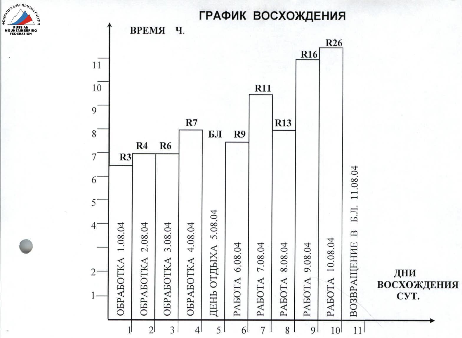
Team's climbing hours: 75 hours and days - 9
including processing climbing hours: 28.5 hours and days - 4
-
Number of bivouacs and their characteristics:
1-2-3-4th - in hammocks; 5th - on the Asan-USen col - lying down
-
Team leader: Pugachev Sergey Alexandrovich - Master of Sports;
participant: Maksimenya Alexander Grigorievich - Candidate for Master of Sports;
-
Team coach: Zagirnyak Mikhail Vasilievich - Master of Sports.
-
Approach to the route: August 6, 2004.
summit - August 10, 2004, return - August 11, 2004.
-
Organization - Poltava Federation of Alpine Sport
 www.alpfederation.ru↗
August 10, 2004
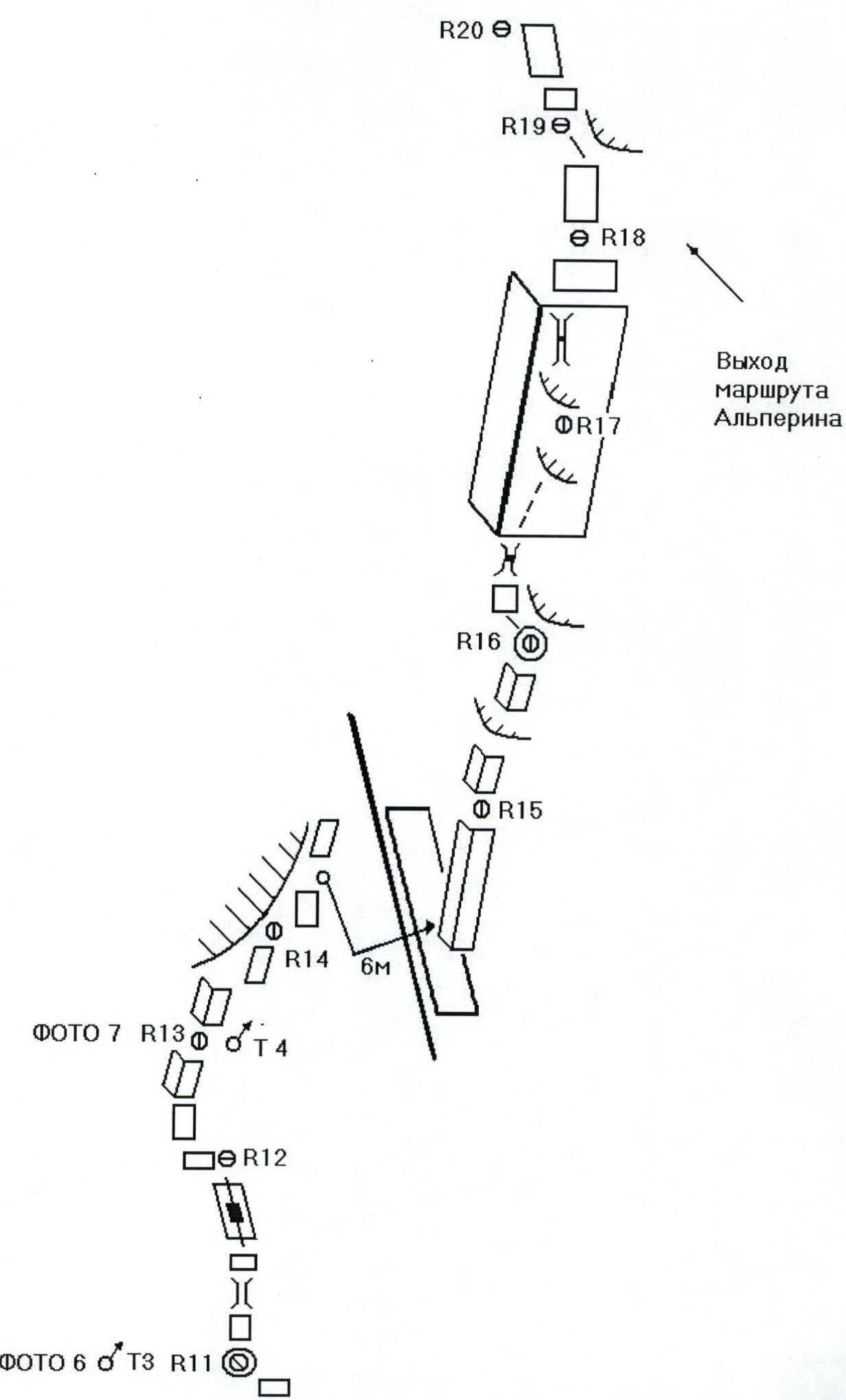
R19 R18 R17 August 9, 2004 R16 R15 R14 R13 August 8, 2004 R12 August 7, 2004 R11 R10 August 6, 2004 R9
Route
TIMOFEEVA R8 R7 R6 R5 R4 R3 R2
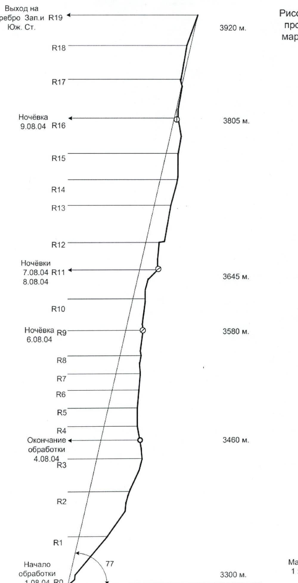
Hand-drawn route profile
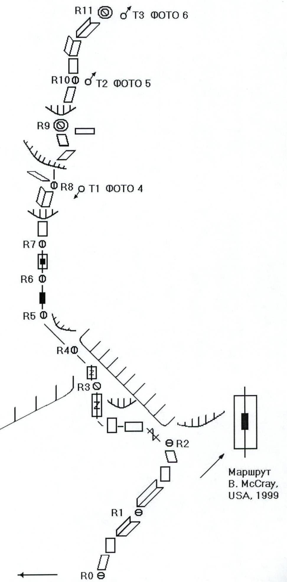
Route diagram in UIAA symbols. Part 1
Route diagram in UIAA symbols. Part 2
Route diagram in UIAA symbols. Part 3
ROUTE DESCRIPTION BY SECTIONS
| Section | Comments on passage |
|---|---|
| R0–R1 | August 1, 2004. Route processing. First A. Maksimenya. Route start reference point - an inward angle leaning to the right, about 100 m long. Located 120 m to the right of Timofeev's route. |
| R1–R2 | Station using a bolt left by the team of Brian McCray and Roxana Brock (USA, 1999). After the end of the inward angle - upward movement on the slab by free climbing. |
| R2–R3 | Long traverse to the left on a full rope length. Free climbing. Station - 12 m under the cornice. |
| R3–R4 | August 2, 2004. Route processing. First S. Pugachev. Movement upwards under the cornice. Broken rocks. Then - movement under the cornice to the left. Upper layer of rocks constantly affected by water, no footholds. |
| R4–R5 | Light rain throughout the day of processing. |
| R5–R6 | August 3, 2004. Processing. First A. Maksimenya. Continuation of the traverse, work on IT. After bypassing the cornice - upward movement on the broken slab along the flake looking left. |
| R5–R6 | Continuation of movement along the flakes. Use of skyhooks for IT. |
| R6–R7 | August 4, 2004. Processing. First S. Pugachev. Movement on the slab with little relief for protection. Use of bolts, skyhooks. Direction of movement - left under a small cornice. PHOTO 4. |
| R7–R8 | Movement on the slab with "booming" flakes under the cornice-skyhooks, IT, bolts. Overcoming the cornice "head-on" on IT and exit to the inward angle leaning to the right, then up the angle under the slab-like overhanging cornice. End of processing. |
| R8–R9 | August 6, 2004. Passage of processed sections. Overcoming the cornice "head-on" on skyhooks and bolts, along a system of inclined ledges - exit to a narrow horizontal ledge under the overhanging slab. Setting up a camp for the night. Processing R9–R10. |
| R9–R10 | August 7, 2004. First Pugachev. Passage of the slab on IT, skyhooks. Direction - to the right on the slabs and system of cracks mainly on IT. Station under a smooth vertical slab. PHOTO 5. |
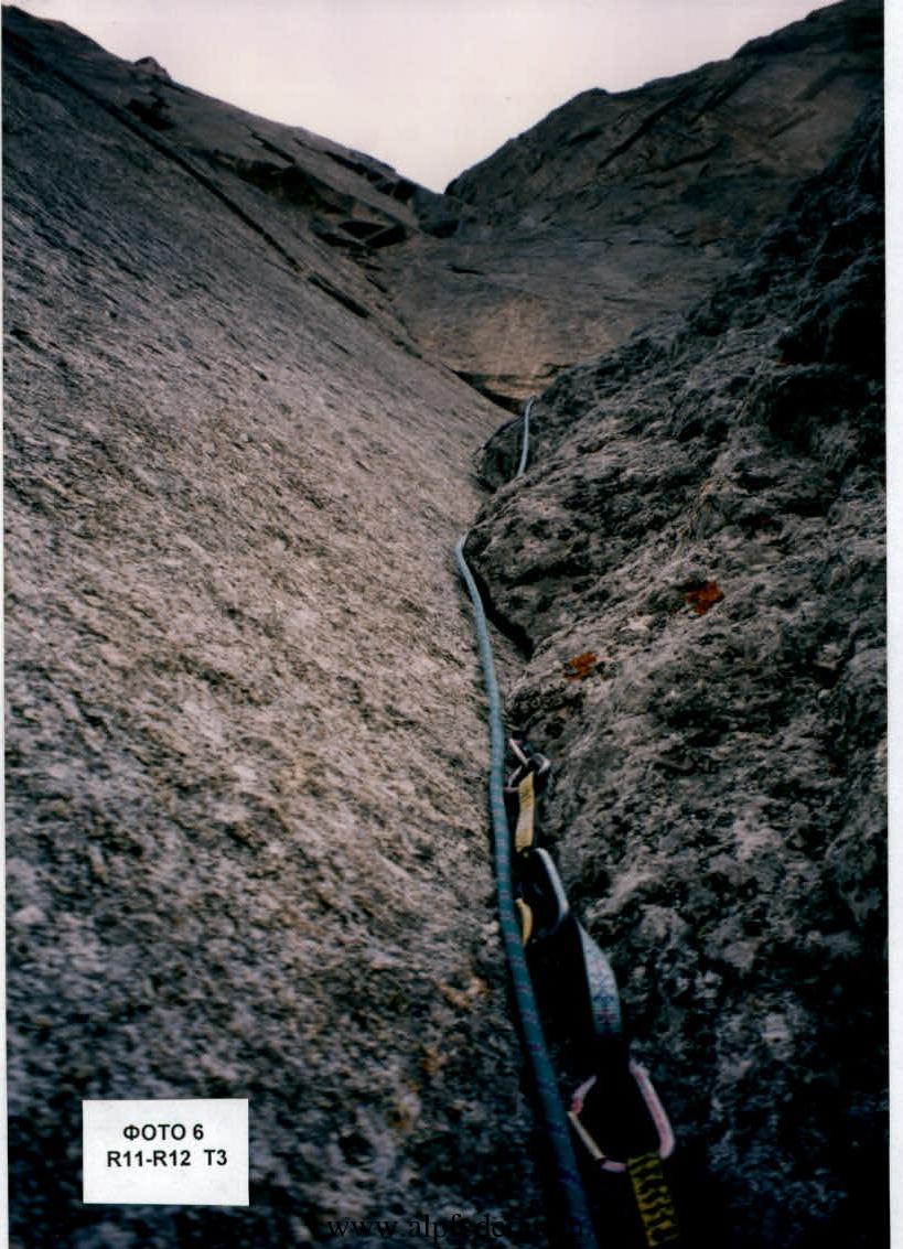
| R10–R11 | Passage of the slab using bolts and skyhooks - IT. Movement along the inclined inward angle and exit to a simple talus ledge and inclined slab leading under a flake with a vertical chimney. Bivouac at the base of the chimney on small horizontal ledges. Processing of the subsequent section. PHOTO 6. |
| R11–R12 | From the bivouac, bypass the chimney to the right and exit to the top of the flake, then - along the vertical slab leading to the left, to a horizontal ledge. Start of the slab - complex IT on "hatchet" pitons. Rain from 17:00. |
| R12–R13 | August 8, 2004. First Maksimenya. Along the horizontal ledge to the right, then complex climbing on the slab with small holds under the base of the inward angle closed by cornices. Cracks of the angle are filled with moss, making protection very difficult. Rain after 14:00. |
| R13–R14 | August 9, 2004. First Pugachev. Continuation of movement along the angle under the slab-like cornice. PHOTO 7. |
| R14–R15 | Bypass of the cornice to the right on the slab towards the edge separating the long inward angle crossing the entire lower part of the wall. Movement on IT-skyhooks, bolts, pendulum piton at the top of the slab. Pendulum to the right for 6 m. Into a parallel inward angle, with an intermediate piton on the slab separating the angles. Protection in the angle is very difficult due to large Friends which need to be removed as you move. |
| R15–R16 | Continuation of movement along the angle with many overhanging cracks. Use of large Friends and chocks. Exit under a slab-like cornice. Setting up a hanging bivouac. After 16:00 rain with wet snow. |
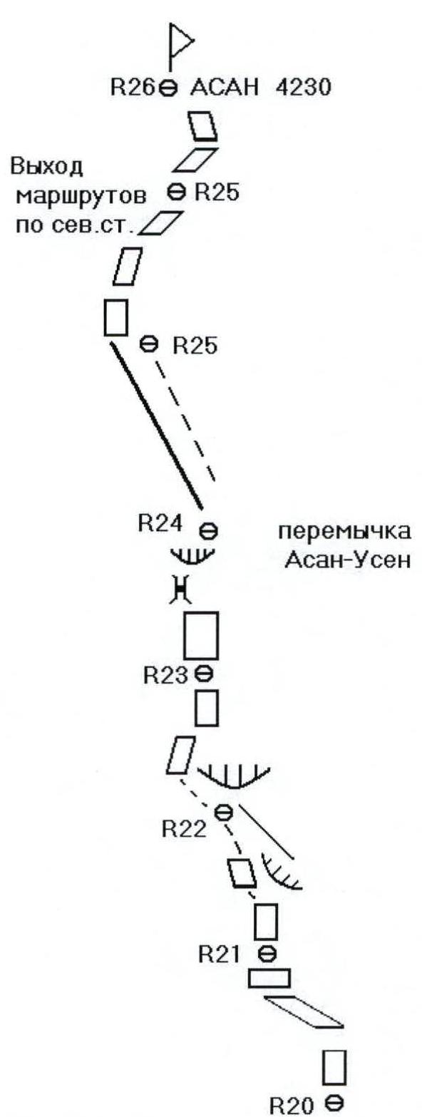
| R16–R17 | August 10, 2004. First Maksimenya. Bypass of the cornice to the left, exit to the chimney, movement along the right wall of the chimney mainly by free climbing. Passage of the cornice to the left on IT. Station on the right side of the angle. |
| R17–R18 | Movement along the right wall of the chimney mainly by free climbing. Exit under the overhanging chimney "head-on" and station on top of the flake under the vertical slab. Here, junction with Alperin's route category 5B. |
| R18–R19 | Passage of the vertical slab upwards-to the right and along the couloir bounded on the right by cornices. Exit to the ridge connecting the West and South walls. From here on, there are no problems with organizing protection. |
| R19–R20 | Movement along the slabs of the South wall upwards. |
| R20–R21 | Along the inclined slab upwards and to the left with exit along a horizontal ledge to the West wall. |
| R21–R22 | Movement along the vertical slab of the West wall and exit to the ridge separating the West and South walls. |
| R22–R23 | Continuation of movement along the ridge bypassing the cornice to the left and along a system of inclined slabs upwards. |
| R23–R24 | Movement along the right part of the ridge - along an inclined slab upwards and through the cornice exit to the Asan-USen col. Here, setting up a bivouac. Presence of a snowpatch. |
| R24–R25 | Simultaneous movement along the col in the direction of the summit. Here, junction with routes from the North wall. |
| R25–R26 | Along an inclined slab upwards and to the right, with exit to the summit of Asan 4230 m. |
| R26 | August 11, 2004. Descent from the summit along the East ridge, North wall and then along the East wall in the direction of peak "4810". |
TABLE OF PROTECTION ELEMENTS USED
| SECTION NUMBER | ROCK PITO | BOLT PITO | CHOCKS | SKY-HOOKS | COMMENTS ON PASSAGE | SECTION LENGTH, m | STEEPNESS, DEG. | CATEGORY OF DIFFICULTY |
|---|---|---|---|---|---|---|---|---|
| R0–R1 | 1/1 | Processing August 1, 2004 | 10 | 40 | II | |||
| 2/0 | 3270 m | 5 | 85 | V | ||||
| 1/1 | 5/3 | 55 | 50 | IV | ||||
| R1–R2 | 1/1 | 2/0 | From R2 to the right - start of American route | 35 | 50 | IV | ||
| 2/0 | Processing August 1, 2004 | 10 | 85 | V | ||||
| 5/3 | 10 | 75 | V | |||||
| R2–R3 | 2/0 | 1/0 | Processing August 1, 2004 | 8 | 70 | V | ||
| 2/0 | 3/0 | 170 m, 6.5 hours | 25 | 65 | V | |||
| 4/3 | 4 rock pitons, 1 bolt, 25 chocks | 12 | 75 | V | ||||
| R3–R4 | 2/1 | 1/1 | 6/4 | Processing August 2, 2004 | 12 | 95 | VI+, A1,e | |
| 7/7 | 2/2 | 18/18 | 36 m, 7 hours, 9 rock pitons, 3 bolts, 24 chocks | 24 | 100 | VI+, A3,e | ||
| R4–R5 | 6/6 | 1/1 | 11/11 | Processing August 3, 2004 | 20 | 90 | VI+, A2,e | |
| R5–R6 | 5/5 | 2/2 | 13/13 | 2 | 40 m, 7 hours, 11 rock pitons, 3 bolts, 24 chocks | 20 | 85 | VI+, A2,e |
| R6–R7 | 3/3 | 2/2 | 12/12 | 2 | Processing August 4, 2004 | 18 | 85 | VI+, A2,e |
| R7–R8 | 5/5 | 2/2 | 5/5 | 2 | 12 | 95 | VI+, A3,e | |
| 3/3 | 1/1 | 6/6 | 2 | 40 m, 8 hours, 11 rock pitons, 5 bolts, 23 chocks | 10 | 80 | VI, A1,e | |
| R8–R9 | 4/3 | 2/2 | 4/4 | 1 | Bivouac August 6, 2004, Processing R9–R10 | 9 | 100 | VI+, A2,e |
| 3/3 | 1/1 | 4/3 | 31 m, 7.5 hours, 7 rock pitons, 5 bolts, 18 chocks | 22 | 85 | VI+, A2 | ||
| R9–R10 | 1/1 | 2 | 4 | 100 | VI, A1,e | |||
| 2 | 4 | 15 | 85 | VI, A2,e | ||||
| 1/1 | 6/3 | 10 | 80 | VI | ||||
| R10–R11 | 3/3 | 2/2 | 2/2 | 4 | Bivouac August 7, 2004, Processing R11–R12 | 12 | 90 | VI, A2,e |
| 96 m, 9.5 hours, 23 rock pitons, 2 bolts, 15 chocks | ||||||||
| 3/3 | 5/5 | Bivouac August 8, 2004, Processing R12–R13 | 10 | 75 | V+ | |||
| 1/0 | 5/0 | 45 m, 8 hours, 7 rock pitons, 1 bolt, 15 chocks | 15 | 45 | III | |||
| control tour | ||||||||
| R11–R12 | 2/0 | 3/3 | 12 | 90 | V | |||
| 12/12 | 4 | 18 | 85 | VI, A1 | ||||
| R12–R13 | 1/1 | 6 | 10 | II | ||||
| 2/0 | 2/0 | 15 | 80 | VI | ||||
| 6/5 | 1/1 | 12/12 | 24 | 80 | VI, A1 | |||
| R13–R14 | 7/7 | 1/1 | 15/15 | 25 | 75 | VI, A1 | ||
| R14–R15 | 1/1 | 2/2 | 4 | Pendulum to the right 6 m | 8 | 80 | VI+, A1,e | |
| 3/3 | 1/1 | 18/18 | 25 | 90 | VI+, A2 | |||
| R15–R16 | 2/2 | 12/12 | Bivouac August 9, 2004 | 20 | 80 | VI+, A2 | ||
| 1/1 | 13/13 | 98 m, 11 hours, 13 rock pitons, 5 bolts, 58 chocks | 20 | 105 | VI+, A2 | |||
| R16–R17 | 1/1 | 1/1 | 6 | 100 | V | |||
| 2/2 | 5 | 100 | VI | |||||
| 6/6 | 25 | 80 | V | |||||
| 2/2 | 5/5 | 8 | 105 | VI, A1 | ||||
| R17–R18 | 13/13 | 84 m, 6 rock pitons, 30 chocks | 40 | 80 | V+ | |||
| 3/1 | 5 | 100 | VI | |||||
| R18–R19 | 3/0 | 2/0 | R18 - junction with Alperin's route | 35 | 75 | V+ | ||
| R19–R20 | 6/3 | 35 | 70 | IV | ||||
| R20–R21 | 3/0 | 15 | 75 | V | ||||
| 4/3 | 25 | 45 | IV | |||||
| R21–R22 | 9/5 | 40 | 95 | IV | ||||
| R22–R23 | 3/0 | 8 | 85 | V+ | ||||
| 7/3 | 25 | 65 | IV | |||||
| R23–R24 | 1/1 | 6/3 | Exit to Asan-USen col | 40 | 85 | V+ | ||
| 10.5 hours, 4 rock pitons, 40 chocks | ||||||||
| R25–R26 | Bivouac August 10, 2004 | 150 | 30 | II | ||||
| R26 | 2/0 | Summit ASAN 4230 m | 60 | 55 | III | |||
| Length 1078 m. Climbing hours 75 | ||||||||
| rock pitons 76 | ||||||||
| bolt pitons 25 | ||||||||
| chocks 274 |
Preparation for Ascent
The route was chosen as the most "attached" to the relief of the right part of the West wall. The safety of its passage was ensured by the selection of equipment: Friends, skyhooks, hammocks, presence of various bolt pitons. The good physical and technical shape of the participants was due to a large number of ascents in Crimea, and a preliminary ascent on POGORELOV's route category 6A on peak Asan.
Tactical Actions of the Team
The team's tactics included preliminary processing of the route, as well as further processing after setting up a bivouac. The first climber moved on a double rope without a backpack. The presence of a large amount of equipment led to the need to pull the load, as the most expedient way to move it. Bivouac sites were chosen based on safety considerations and the presence of relief features - under cornices and vertical walls. The absence of large ledges on the route made it impossible to use a tent, but hammocks with tents were used instead, as the weather conditions that season were unusual for this area (frequent rains, often with wet snow).
Communication with the Base Camp was carried out using Motorola radios, and visual and radio contact was regularly made with the teams "Dnepr" and "Odessa". Due to the lack of water on the route, 18 liters were taken. For passages of sections with category VI difficulty, the following were used:
- bolt pitons
- IT-skyhooks
On overhanging stations of complex sections, bolts were also used.
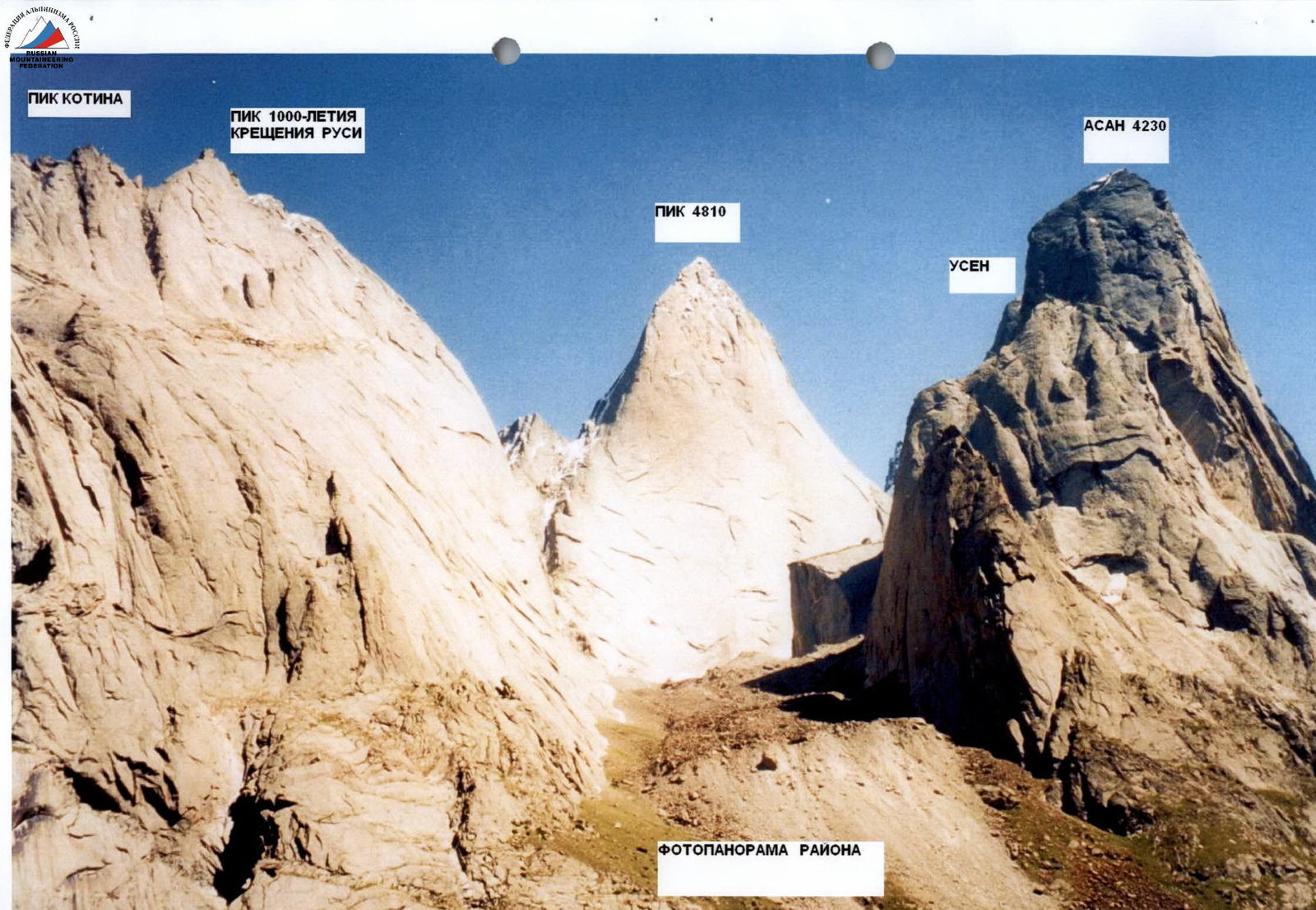
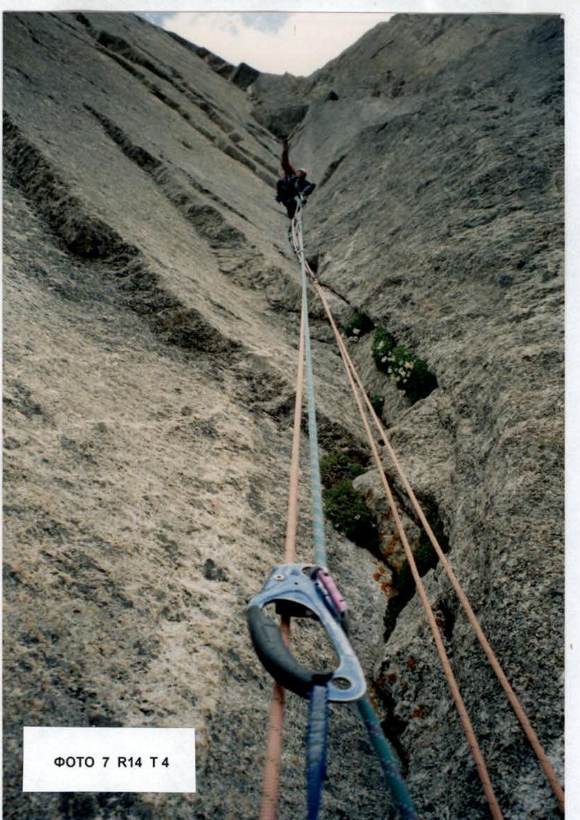
PHOTO 7 R14 T4