43
I Championship of the All-Union Council of the All-Union Voluntary Sports Society (VDSSO) of Trade Unions on Alpinism 1989
Technical Class
REPORT
on the ascent (first ascent) to Peak 4800 m (Parus Eastern) via the bastion of the North-East wall, approximately 6A category of difficulty, by the team of the "Olimp" Alpine Club of the Sumy Regional Council of VDSSO Trade Unions from August 9 to 17, 1989.
Team Leader: Mityukhin F.P.
Team Coach: Mityukhin F.P.
- Addresses:
- "Olimp" Alpine Club of the Sumy Regional Council of VDSSO Trade Unions 244011, Sumy, Novomestenskaya St., 26
Leader: Mityukhin Fedor Petrovich, 244031, Sumy, 40 let Oktyabrya St., 59, apt. 67, work phone 29-94-86
Coach: Mityukhin Fedor Petrovich
Height measurements were made using calculations. Steepness was determined visually and with a protractor.
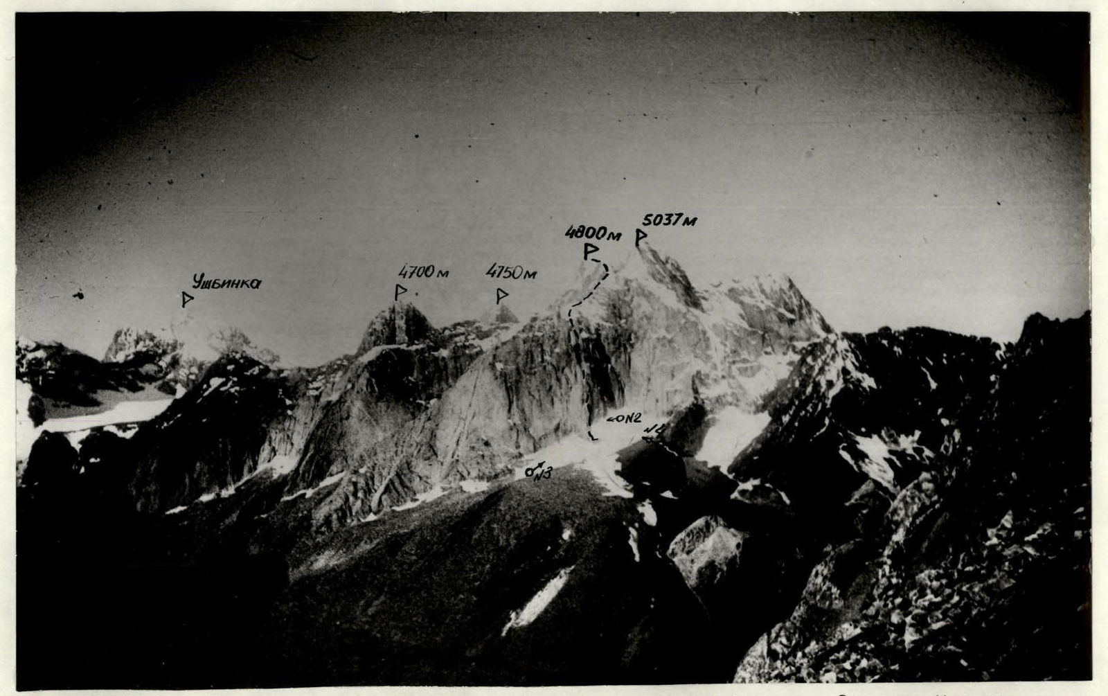
№1. PHOTOPANORAMA OF THE REGION. Taken on 23.07.1989, 9:00, "Helios 44–2", F=58 mm, S=2.5 km, H=3962 m. Point on the diagram — №1 — TEAM ROUTE
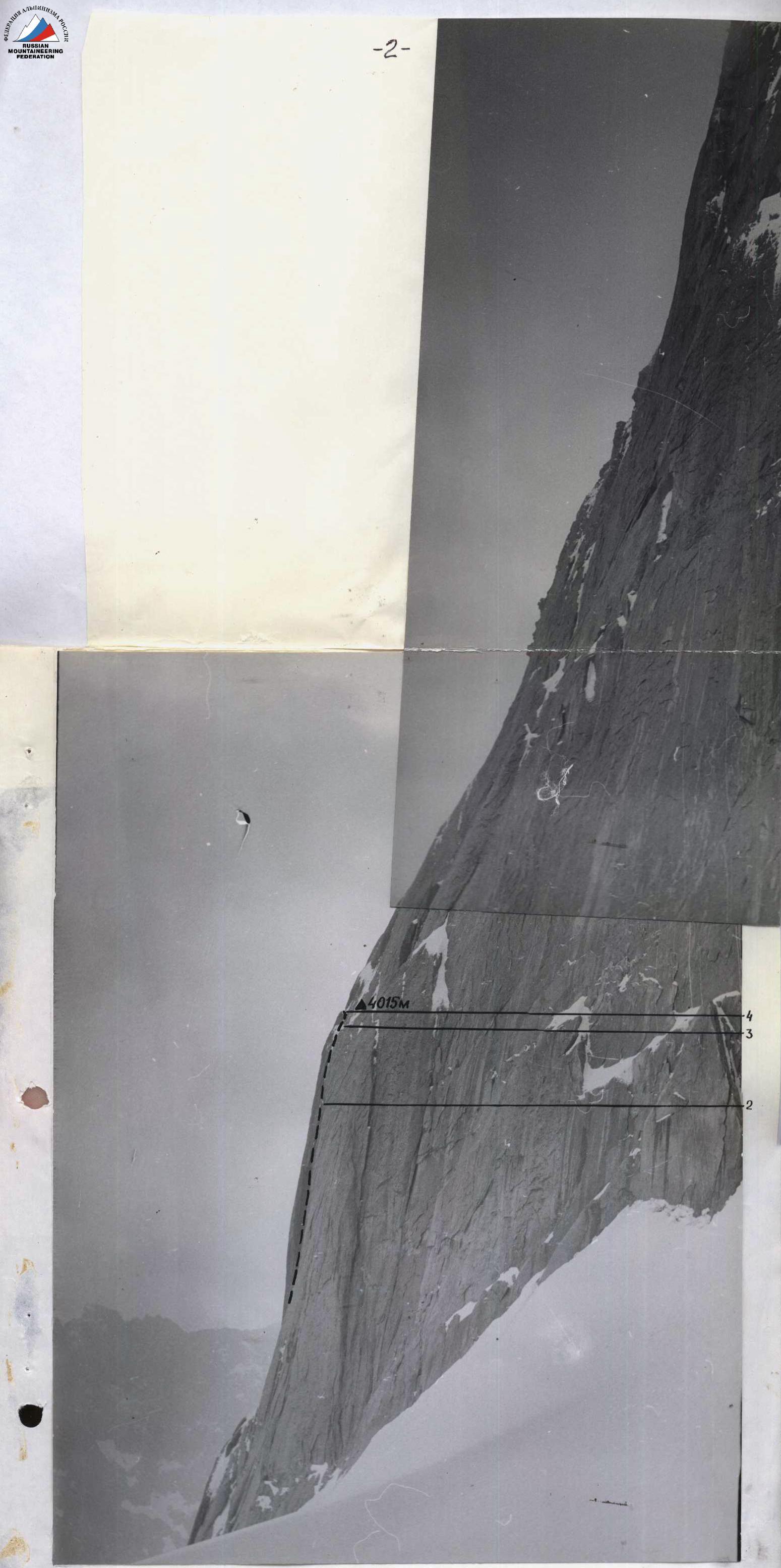
№2. PROFILE OF THE WALL ON THE RIGHT. Taken on 23.05.1989, "ZENIT-E", "YUPITER-37A" lens, F=135 mm, S=250 m, H=3900 m. TEAM ROUTE. Point on the area diagram — №2
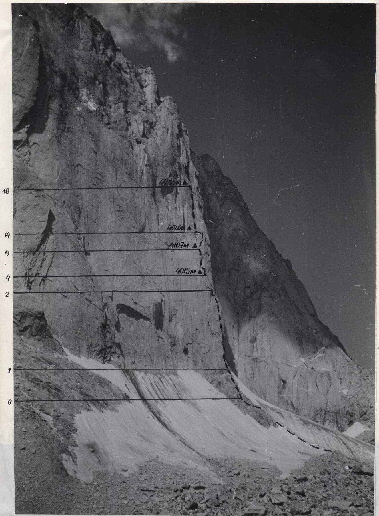
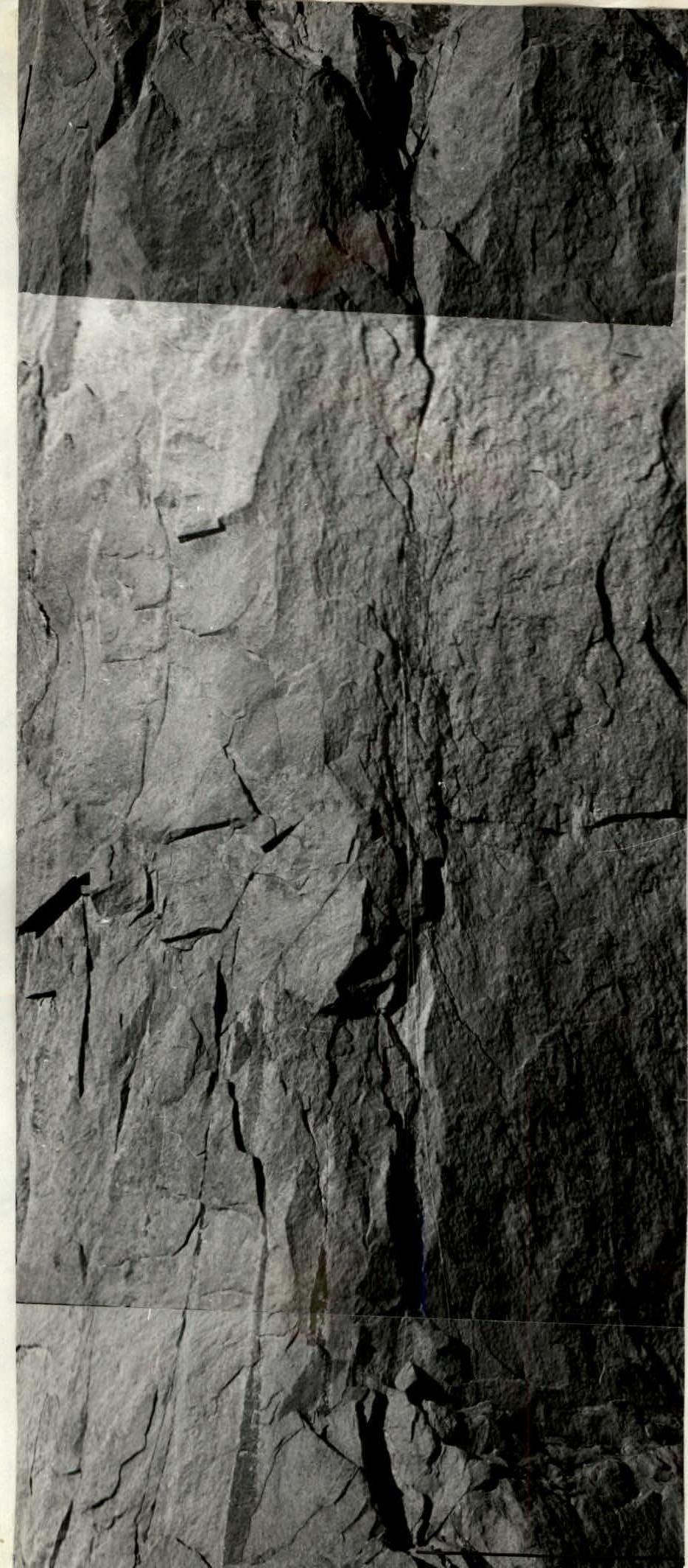
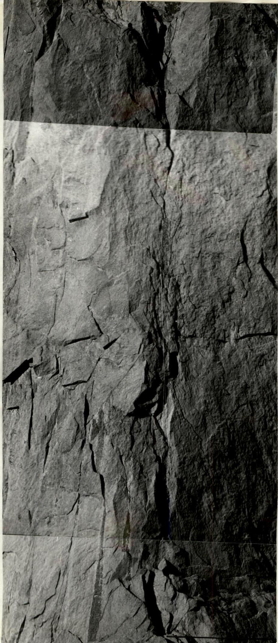
№3. PROFILE OF THE WALL ON THE LEFT. Taken on 08.08.1989, "ZENIT-E", "Helios 44–2" lens, F=58 mm, 11:00. TEAM ROUTE. S=300 m, H=3800 m. Point on the diagram — №3

№4. TECHNICAL PHOTOGRAPH OF THE ROUTE. Taken on 08.08.1989, 11:00, "ZENIT-E", "Helios-44–2", F=58 mm, S=300 m, H=3900 m. Point number on the diagram — №4
BRIEF REVIEW OF THE ASCENT REGION
Peak 4800 m (Parus Eastern) is located in the Pamir-Alay range, in the spurs of the Turkestan ridge, south of the Fergana Valley. The highest points in the region are peaks 5300 m (Sabakh) and 5355 m (Ak-Su Main).
The massif of "Parus" peaks stretches from east to west and includes three peaks: "Parus Main" 5037 m, "Parus Western" 4850 m, and "Parus Eastern" 4800 m. To the west, the "Parus" massif borders the Sabakh gorge, and to the east, the Uryam gorge. The region began to be explored in the early 1980s by groups of Leningrad and Moscow climbers. The Ak-Su gorge, located east of the Uryam gorge, turned out to be the most visited due to its relatively easy access. Since 1982, the выездная AUSB "Alay" has been operating there. Routes to the peaks of Ak-Su, Blok, Admiralteets, and Iskander repeatedly won prizes in the USSR championships, republics, Moscow, and Leningrad. By 1986, the Ak-Su gorge area had become quite well-developed, and the attention of climbers turned to the peaks in the neighboring Uryam and Sabakh gorges.
Some of the first peaks to be conquered were peak 5300 (Sabakh), peak 4810 m, and peak 5037 m (Parus Main). Until the 1989 season, peak 4800 m (Parus Eastern) remained unconquered.
The simplest path to the foot of peak 4800 m (Parus Eastern) goes from the settlement of Katran up the Ak-Su gorge (18 km) along a dirt road to the site of the AUSB "Alay" base camp, then westward through a pass to 10–3 from peak 4437 m (Atabekova), from the pass down through the Uryam River, and up to the foot of the mountain. The walking approach from the AUSB "Alay" base camp to the foot of the mountain takes 7–8 hours.
There is another option for approaching peak 4800 m (Parus Eastern) through the Uryam gorge, which can be accessed from the village of Katran via a geologists' base, opposite which the gorge begins. The approach along the trail takes 14–16 hours. The first ascent to peak 4800 m (Parus Eastern) was made in July 1989 by a group of climbers from the Moscow Sports Club of the VDSSO Trade Unions from the northwest, out of the Sabakh gorge, with an approximate route difficulty of 3B category. The complex northern and northeastern walls of peak 4800 m remained unpassed, which influenced the choice of the object of ascent by the team of the Sumy Alpine Club "Olimp" in the I Championship of the All-Union Council of the VDSSO Trade Unions in 1989.
ROUTE DIAGRAM IN UIAA SYMBOLS
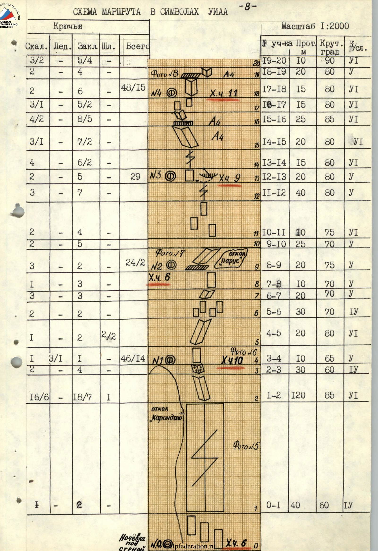
Pitons
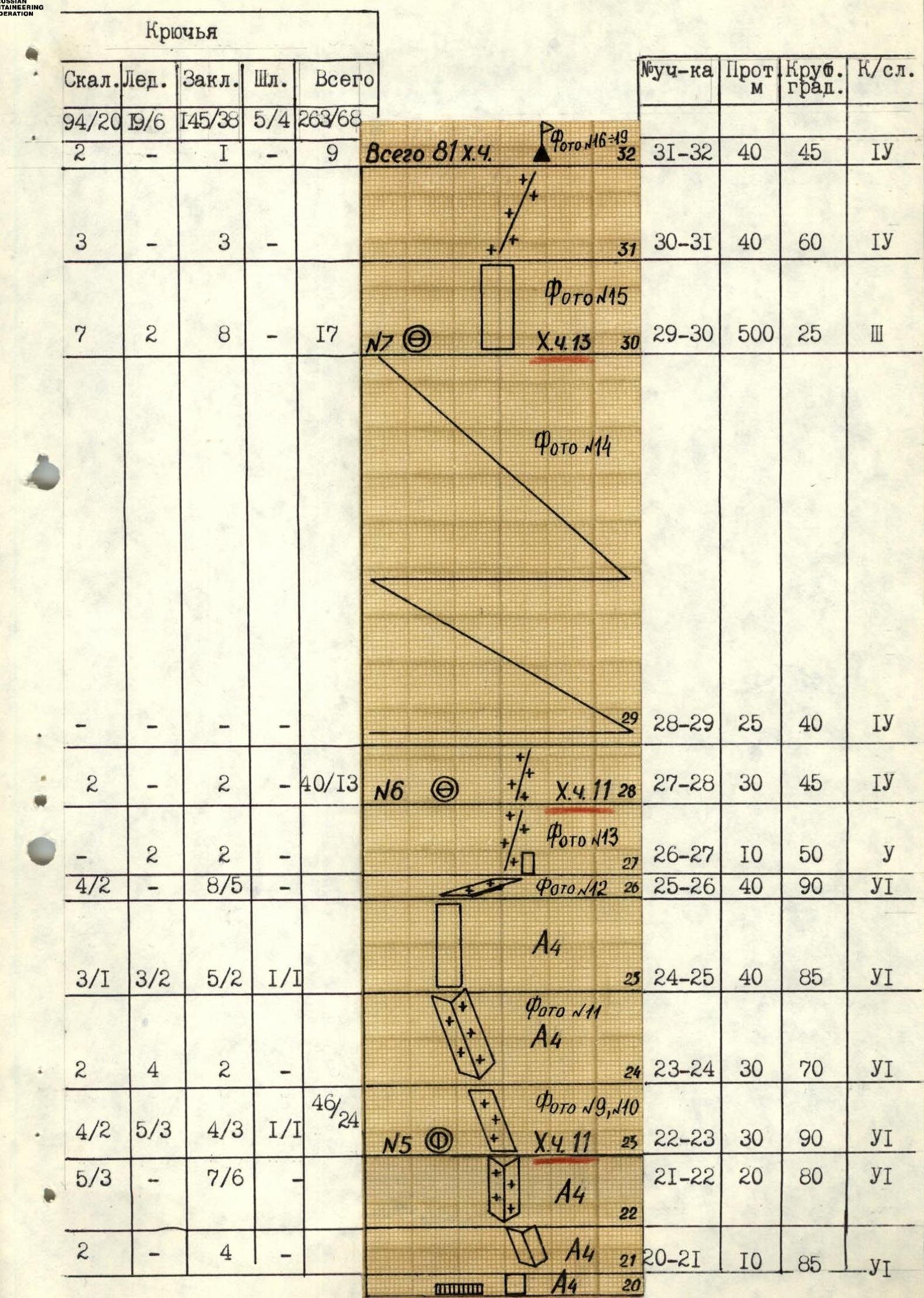
DESCRIPTION OF THE ROUTE BY SECTIONS
- R0–R1. Start of the route: characteristic two ledges at the base of the "Karandash" outcrop. From them, upwards along a system of monolithic slabs-outcrops leading under the wall with a 40 m cleft.
- R1–R2. Up the cleft, very difficult climbing. The rocks are monolithic; medium and large placements and "friends" go well. The cleft leads to the base of an internal corner 120 m.
- R2–R3. Then leftwards along the internal corner, filled with ice 30 m.
- R3–R4. A ten-meter steep internal corner filled with ice. Passed using ice screws. Exit to the top of the "Karandash" outcrop. Be cautious at the top: loose rocks!
- R4–R5. Upwards along a monolithic 20 m wall with micro-cracks, using pitons and skyhooks for passage and belay to the base of an internal corner.
- R5–R6. Along the corner, rightwards upwards 30 m to a system of slabs-outcrops.
- R6–R7. A system of slabs 20 m is passed by free climbing. Large hexes and medium placements go well.
- R7–R8. Rightwards upwards along an internal corner 10 m to the base of a wall.
- R8–R9. Up the wall 20 m to a ledge under the base of the "Parus" outcrop.
- R9–R10. From the ledge, rightwards upwards along an internal corner under a wall 25 m.
- R10–R11. The wall 10 m is passed directly. Difficult climbing. Climbing wedges are used for belay.
- R11–R12. A system of slabs is passed upwards to the right 40 m. Medium placements and "friends" go well.
- R12–R13. Then upwards along a cleft 20 m is passed by free climbing under an overhang.
- R13–R14. From under the overhang, a traverse 20 m pendulum leftwards and then along the wall 15 m upwards under a cleft. Difficult climbing.
- R14–R15. Up the cleft 20 m (difficult climbing) to an internal corner.
- R15–R16. Leftwards upwards along an internal corner 25 m (very difficult climbing), ending in a cornice.
- R16–R17. The cornice is overcome directly. Then leftwards upwards along an internal corner 15 m (difficult climbing) to a system of slabs-blocks.
- R17–R18. A system of slabs (dangerous — loose rocks!) is passed upwards — rightwards. Difficult climbing.
- R18–R19. A large internal corner. Smooth monolithic rocks are passed on friction.
- R19–R20. From the bivouac, first a smooth inclined ledge, then along an internal corner 10 m (very difficult climbing) to a cornice.
- R20–R21. The cornice is passed directly. Then a 10-meter sheer wall (difficult climbing) leads to the base of an internal corner.
- R21–R22. A sheer internal corner. (Very difficult climbing). Exit to the base of the "comma".
- R22–R23. The start of the "comma" is a vertical internal corner filled with ice 30 m. (Very difficult climbing). Passed using crampons, ice screws, and ice axes.
- R23–R24. From the bivouac, leftwards upwards 30 m along a steep inclined snow-ice ledge (difficult climbing) to the base of an internal corner.
- R24–R25. Along an internal corner filled with ice (difficult climbing) 40 m under a wall.
- R25–R26. A sheer wall is passed first leftwards upwards, then in the upper part rightwards, and exit to a snow ledge (difficult climbing) 40 m.
- R26–R27. Then along an inclined snow-covered ledge rightwards upwards 10 m — exit to the "roof". A convenient place for belay.
- R27–R28. Along a snowy slope, exit to a hollow on the ridge 30 m. A convenient place for a bivouac.
- R28–R29. From the bivouac, movement along a snowy ridge 40 m.
- R29–R30. Movement along the ridge towards the eastern peak. 500 m. A convenient place for a bivouac under the pre-summit tower.
- R30–R31. From the bivouac, upwards along a fragmented slab — exit to the pre-summit ridge 40 m.
- R31–R32. Along a snowy ridge, exit to the summit 40 m. Descent by "dülfer" to the bivouac site, then along the ridge 240 m to the eastern tower, and from it, descent by "dülfers" northwards along a couloir.
- Belay spot is inconvenient (belays in stirrups)

№2. SECTION R2–R10. 09.08.1989, 11:00, "YUPITER-37A + K2", F=270 mm (shooting point on the diagram №4)
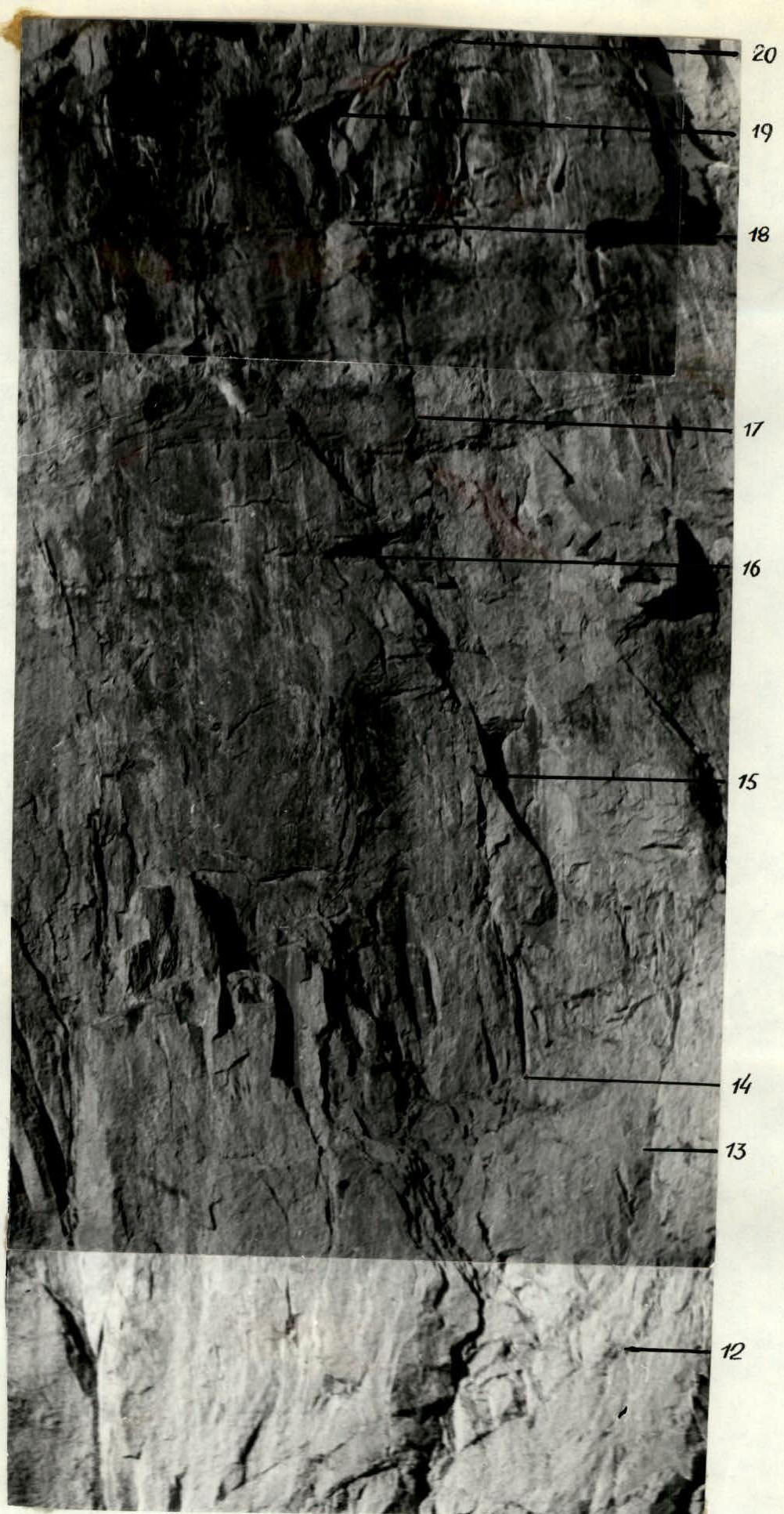
№3. SECTION R12–R20. 09.08.1989, 11:00, "YUPITER-37A +K2", F=270 mm (shooting point on the diagram №4)
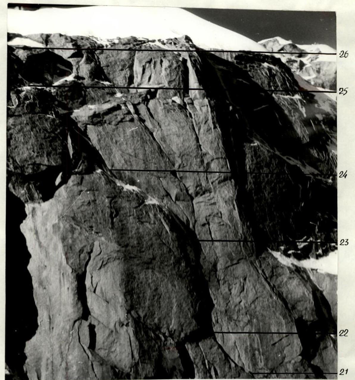
№4. SECTION R21–R26. 09.08.1989, 11:00, "YUPITER-37A+K-2", F=270 mm (shooting point on the diagram №4)
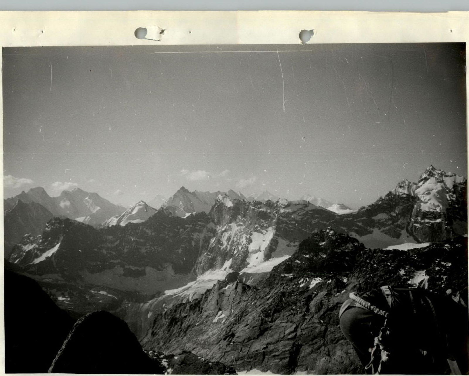
№18. View from the summit to the south-southwest. Lomo "T-43", F=40 mm
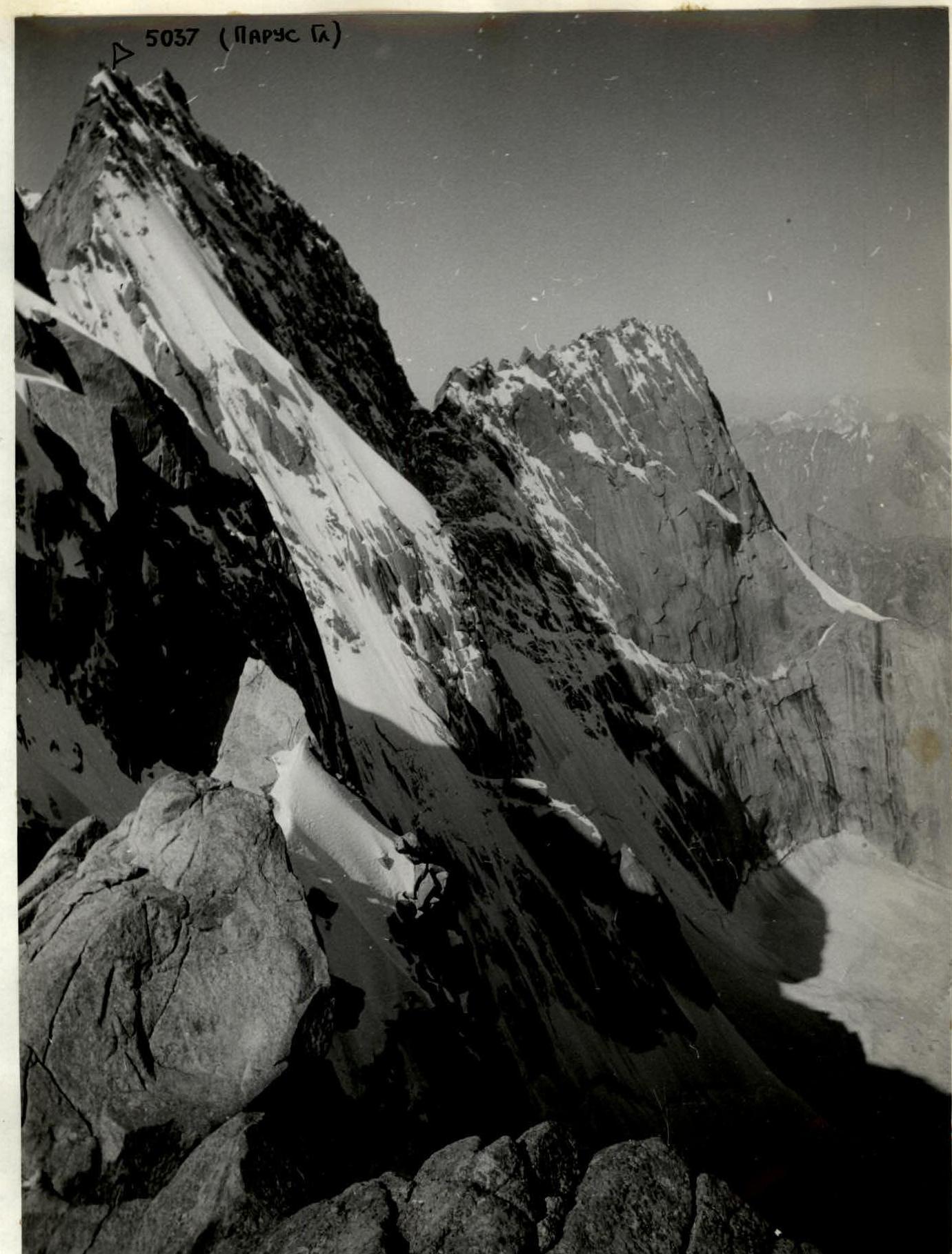
№20. VIEW TO THE NORTH-WEST from the ridge on the descent. Lomo "T-43", F=40 mm
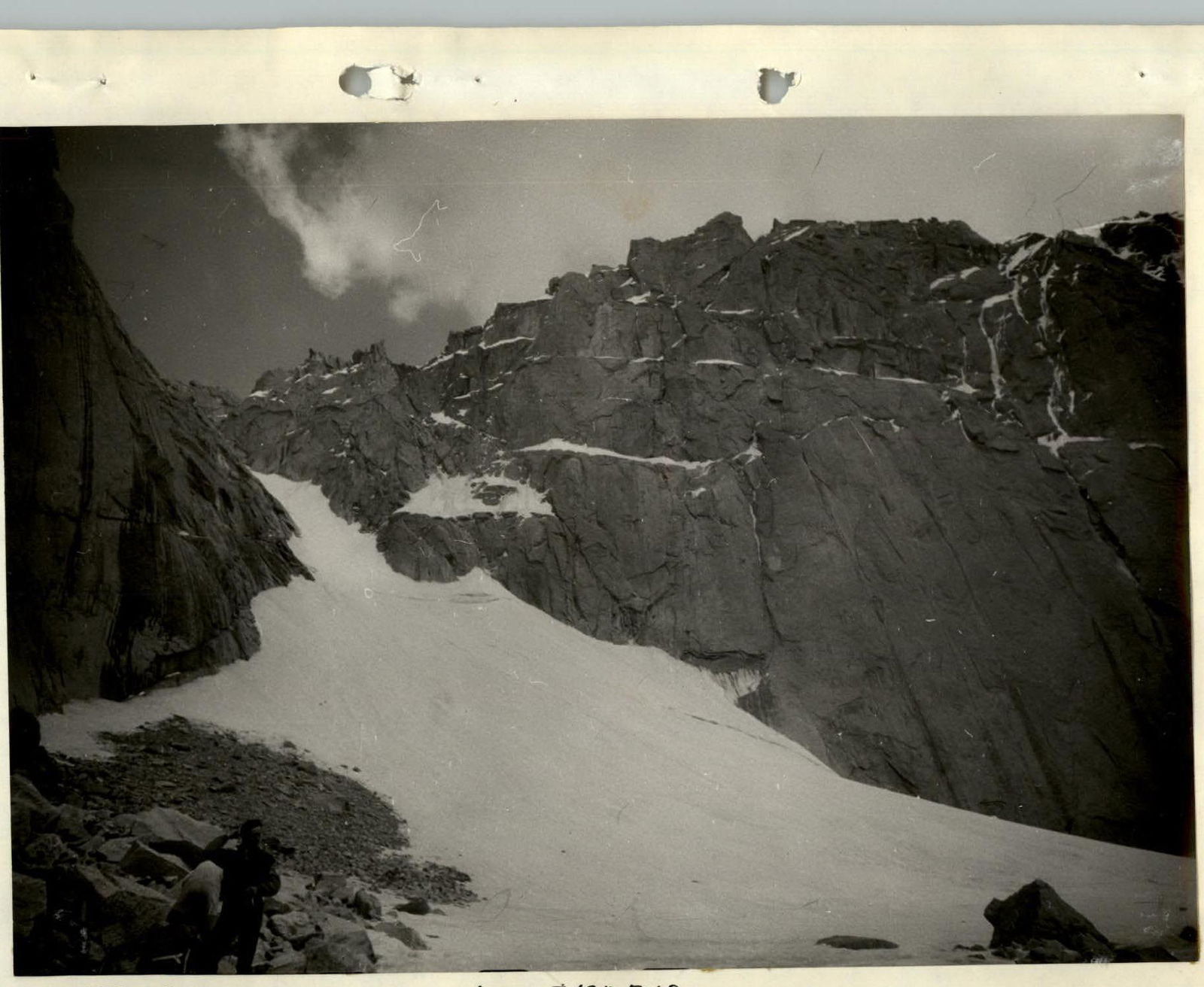
№22. Descent couloir. Lomo "T-43", F=40 mm