Ascent Report
Teams of the Irkutsk Region Federation of Alpinism and Climbing to the peak Iskander (5120 m), first ascent via the right part of the South face, approximately 6B category of difficulty.
Russian Alpinism Championship, high-altitude technical class. Kyrgyzstan, Pamir-Alay, Lailak valley region, August 2015.
| Team: | Bashkirtsev E. P. |
|---|---|
| Veretennin D. A. | |
| Coach: | Kosoturov S. V. |
Ascent Passport
- Pamir-Alay, Lailak valley region. According to KMGV 2013 – 5.4.2
- Iskander. Height 5120 m. Right part of the South face. Route name "Water Truce".
- Proposed category – 6B category of difficulty, first ascent.
- Route type: rock.
- Height difference of the route 1050 m.
Route length 1250 m, wall part 920 m. Length of sections:
- V category of difficulty – 225 m.
- VI category of difficulty – 470 m. Average steepness of the main part of the route – 59°. Wall part of the route – 69°.
-
Pitons left on the route: bolted – 2 pcs., anchor – 1 pc., camalots – 0 pcs., ice screws – 0 pcs. Used: pitons – 14 pcs., camalots – 176 pcs., bolted pitons – 2 pcs.
-
Team's climbing hours: ascent – 26 h, descent – 6 h. 4 days (including 1 day for descent).
-
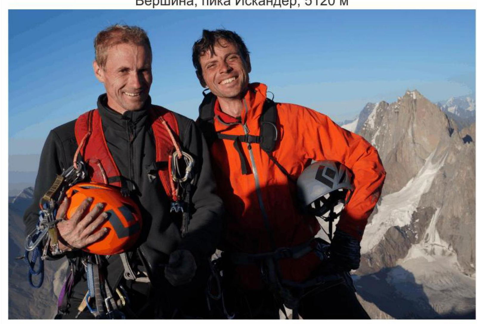
Team: Veretennin Denis Anatolyevich – MS, Bashkirtsev Evgeny Petrovich – CMS.
-
Coach: Kosoturov Sergey Vladimirovich – MS.
-
Departure from the assault camp to the route: hour, date, month, year.
Route started: 8:00, August 10, 2015. Reached the summit: 18:00, August 12, 2015. Returned to the assault camp: 14:00, August 13, 2015. Returned to the Base Camp – 19:00, August 13, 2015. Descent from the summit via Zhiltsov's route 6A.
-
Organization: Irkutsk Region Federation of Alpinism and Climbing.
-
Person responsible for the report: Veretennin D. A., email veret-den@mail.ru, phone +7 902 519 7672.
Photo of the area, peak Iskander 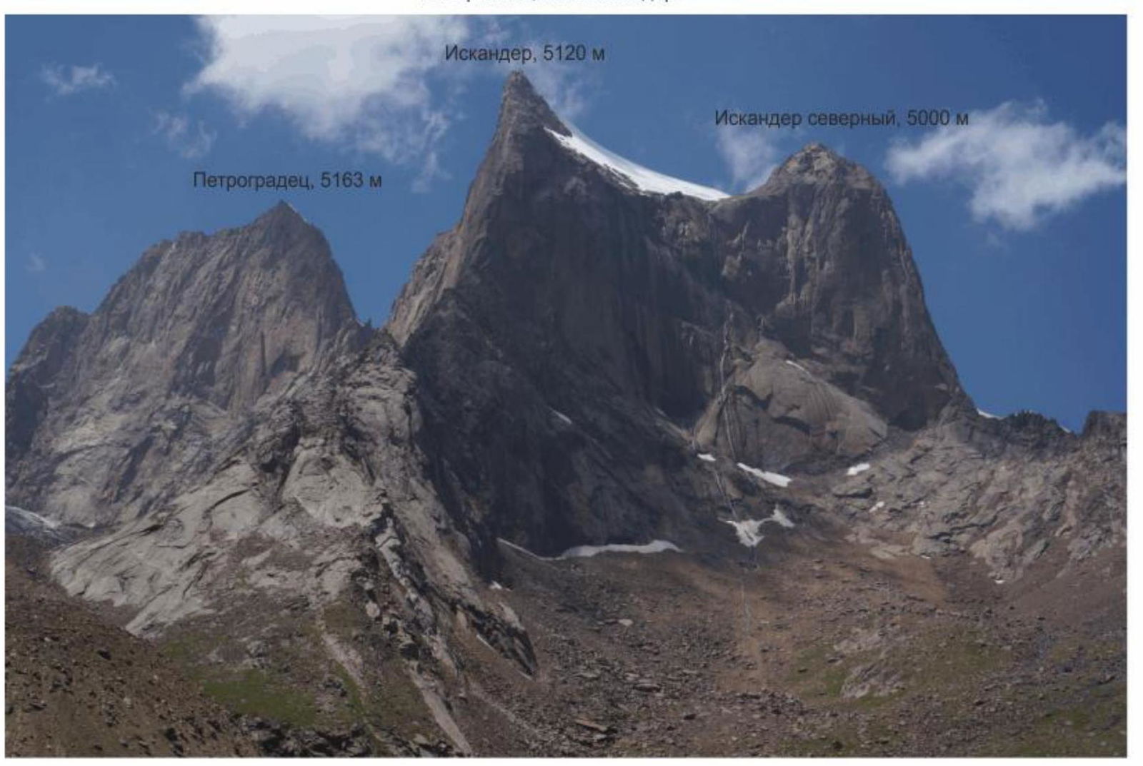
Route diagrams of peak Iskander 5120 m, Zhiltsov's route, 6A 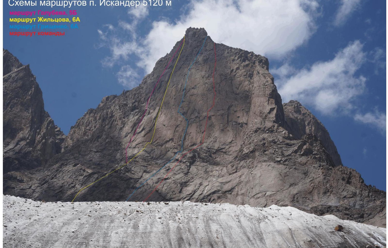
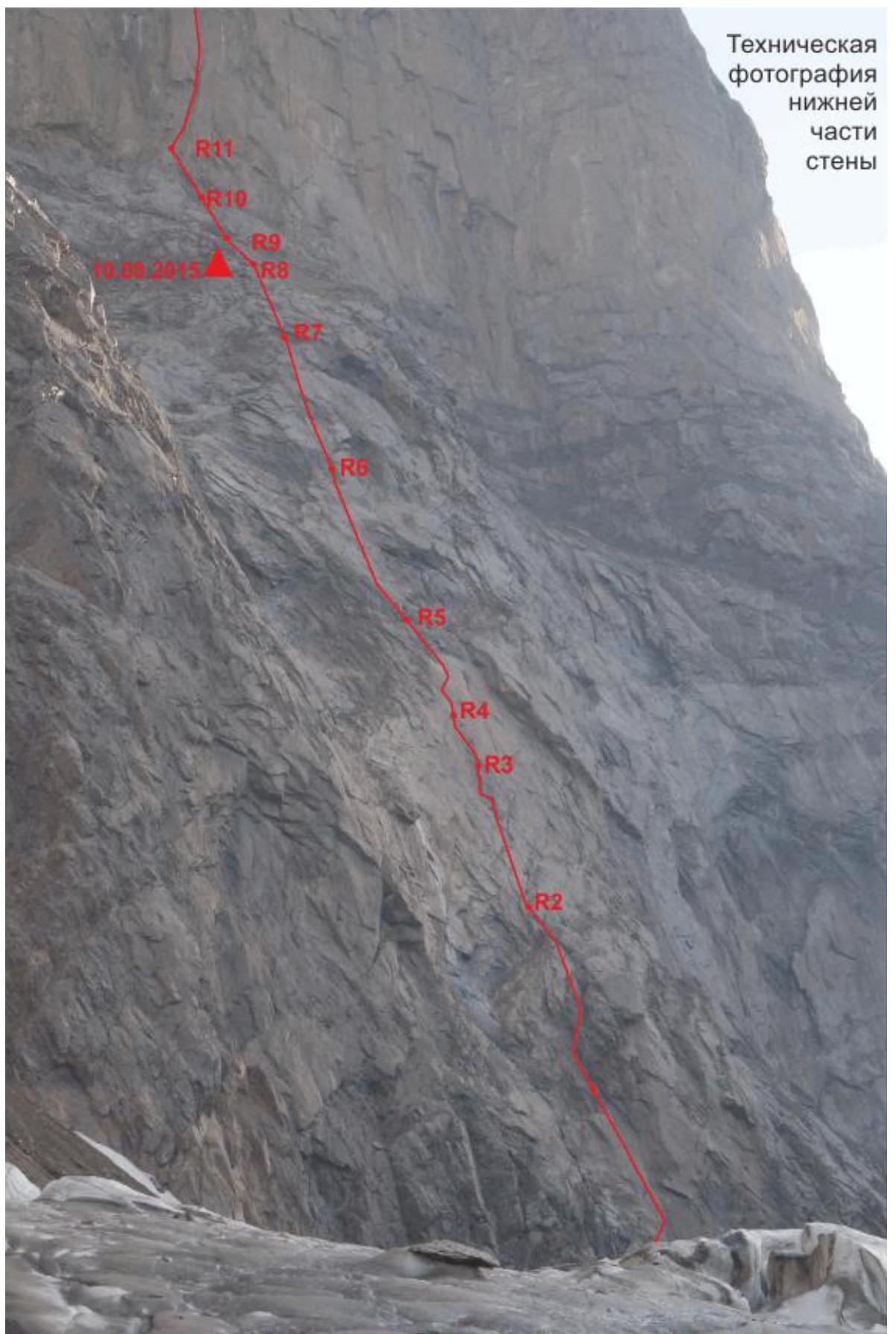
Technical photo of the lower part of the wall 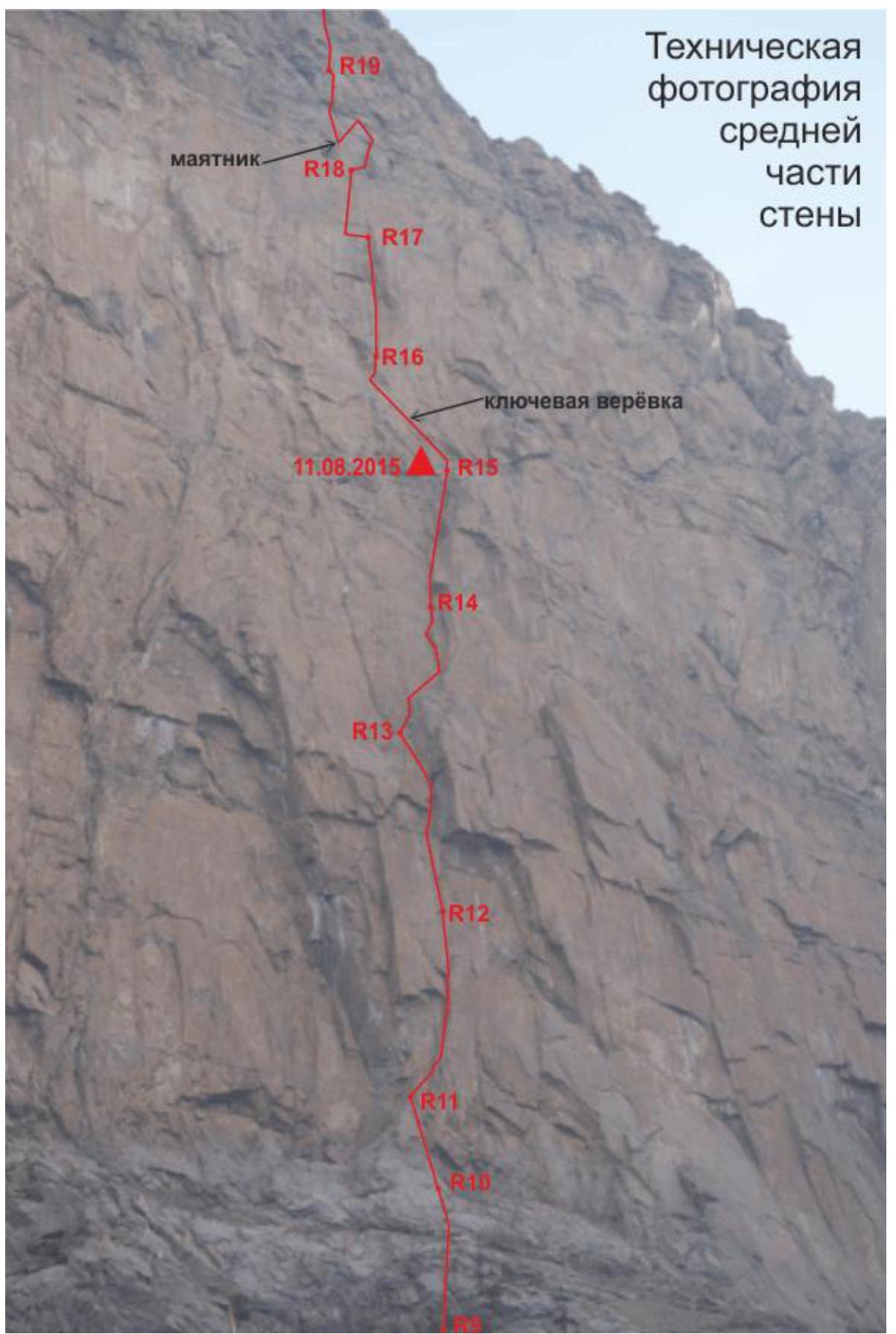
Drawn profile of the route 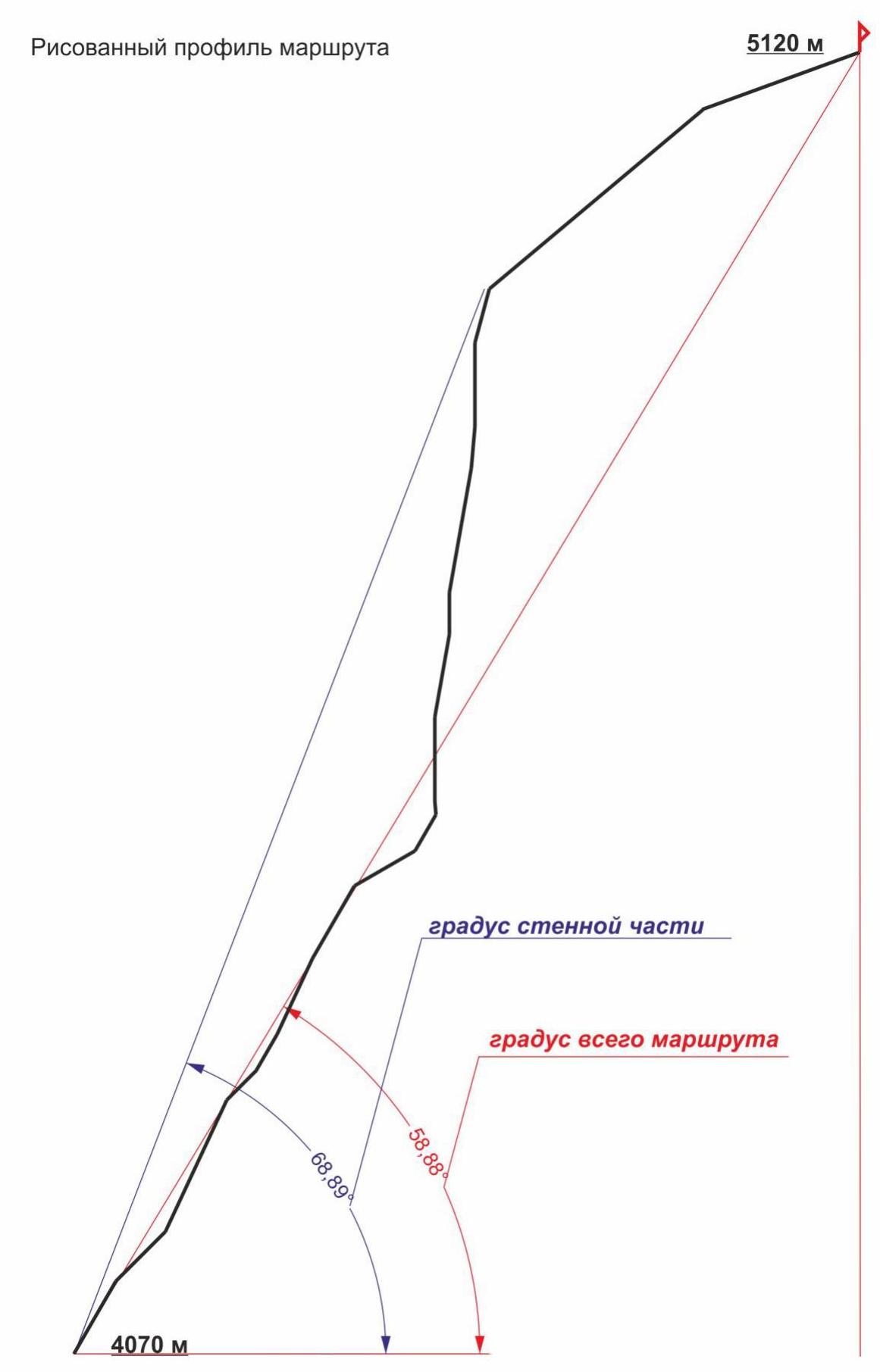 Diagram of the main part of the route in UIAA symbols, scale 1:2000. Sheet 1
| Pitons | Nuts | Bolts | Sect. | Length (m) Angle (deg) | |
|---|---|---|---|---|---|
| - | 4 | - | 10 | 10 m, 95°, VI | |
| - | 3 | - | 9 | 30 m, 60°, III–IV | |
| - | - | - | 10.08.2015 | 8 | 50 m, 30°, I |
| - | 5 | - | 7 | 60 m, 60°, V | |
| 1 | 10 | - | 6 | 60 m, 65°, V–VI | |
| 1 | 4 | - | 5 | 30 m, 60°, IV–V | |
| - | 4 | - | 4 | 30 m, 45°, III | |
| - | 8 | - | 3 | 60 m, 65°, IV–V | |
| - | 8 | - | 2 | 45 m, 65°, V | |
| - | 6 | - | 1 | 50 m, 45°, IV | |
| 2 | 10 | - | 4070 m | 0 | 65 m, 60°, IV–VI |
Diagram of the main part of the route in UIAA symbols, scale 1:2000. Sheet 2
| Pitons | Nuts | Bolts | Sect. | Length (m) Angle (deg) | |
|---|---|---|---|---|---|
| exit to the ridge | |||||
| - | 8 | - | 19 | 40 m, 75°, VI | |
| 1 | 12 | 1 | 18 | 60 m, 90°, VI+ | |
| - | 7 | - | 17 | 35 m, 85°, VI | |
| - | 9 | - | 16 | 40 m, 80°, VI | |
| 2 | 6/2 | skyhook – 2 | AIT 7 m | 15 | 50 m, 80°, VI+ |
| - | 6 | - | 14 | 30 m, 90°, VI | |
| - | 11 | - | 13 | 60 m, 80°, VI | |
| 5/4 | 23/16 | - | AIT 30 m | 12 | 60 m, 90°, VI+, A2 |
| 2 | 12 | - | 11 | 55 m, 85°, VI+ |
Diagram of the main part of the route in UIAA symbols, scale 1:2000. Sheet 3
| Pitons | Nuts | Bolts | Sect. | Length (m) Angle (deg) | |
|---|---|---|---|---|---|
| - | - | - | start of descent via Zchiltsov's route 6A | 22 | 120 m, 20°, II |
| - | 5 | - | 21 | 50 m, 40°, III | |
| - | 15 | - | 20 | 160 m, 20–60°, II–V |
Team Movement Schedule by Sections:
Ascent Schedule
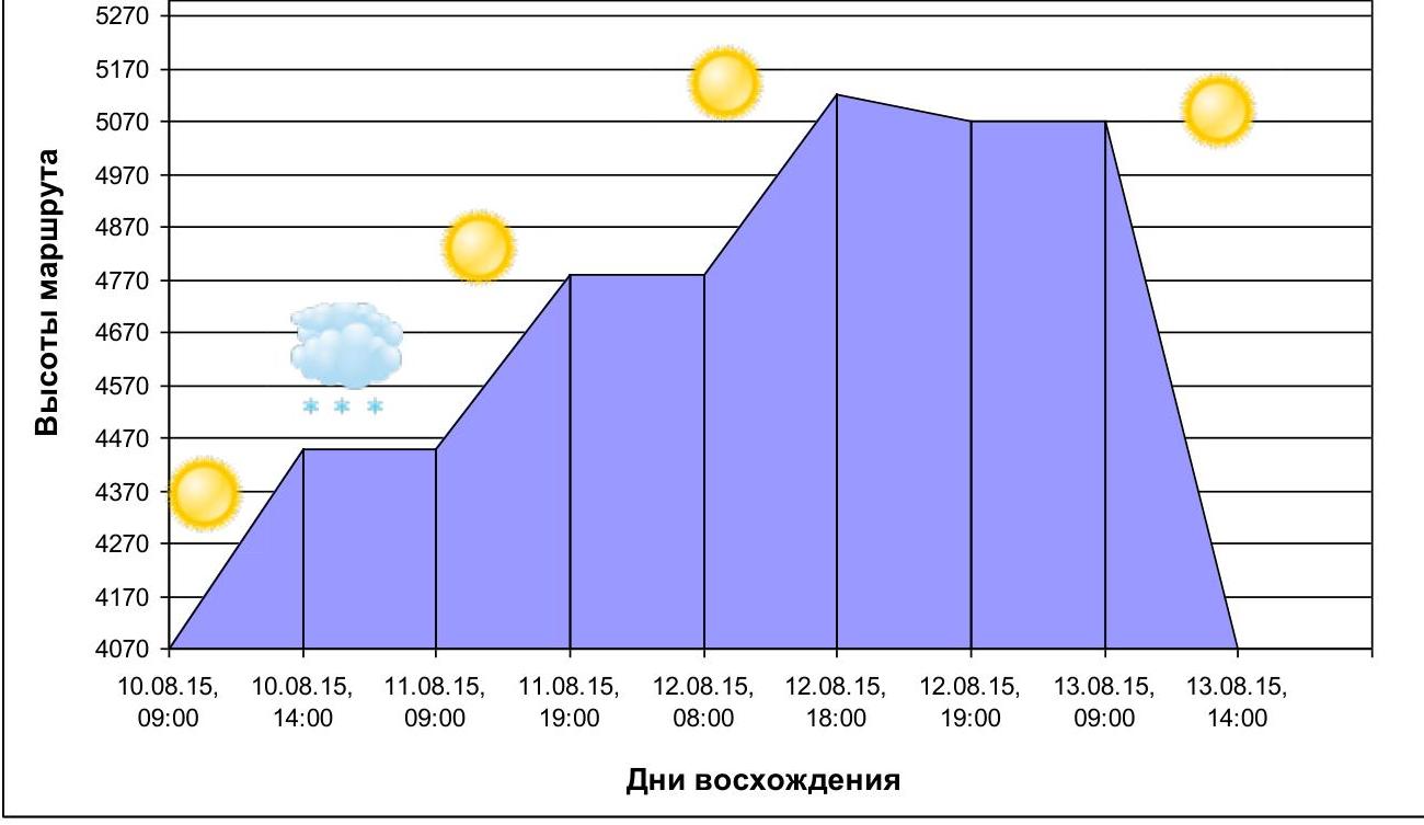 August 10, 2015 – from 8:00 to 14:00, section R0–R10 was completed (lower bastion to the large shelf, 60 m of the second bastion); overnight stay on the large shelf. Heavy snowfall, wind, and blizzard did not allow continuing work that day.
August 11, 2015 – from 9:00 to 19:00, section R11–R16 was completed; overnight stay at Camp-2 on R15 (late start due to severe ice on the rocks).
August 12, 2015 – from 8:00 to 18:00, reached the summit. From 18:00 to 19:00, descended from the summit to R21. August 13, 2015:
- from 9:00 to 14:00, descended via Zchiltsov's route 6A.
- from 14:00 to 19:00, returned to the Base Camp.
Tactical Actions of the Team:
The team arrived in the Lailak valley on July 26, 2015. Before starting the ascent, they managed to climb a warm-up route, Shibanov's route, to the peak Iskander Maly, category 5A. Within 12 hours from overnight stay to overnight stay under the wall, they acclimatized well. The route was carefully chosen during a reconnaissance sortie using a 60x spotting scope.
The route can be conditionally divided into three parts:
- 1st part – to the exit to the large shelf crossing the entire wall;
- 2nd part – from the large shelf to the exit to the ridge;
- 3rd part – the ridge itself to the summit.
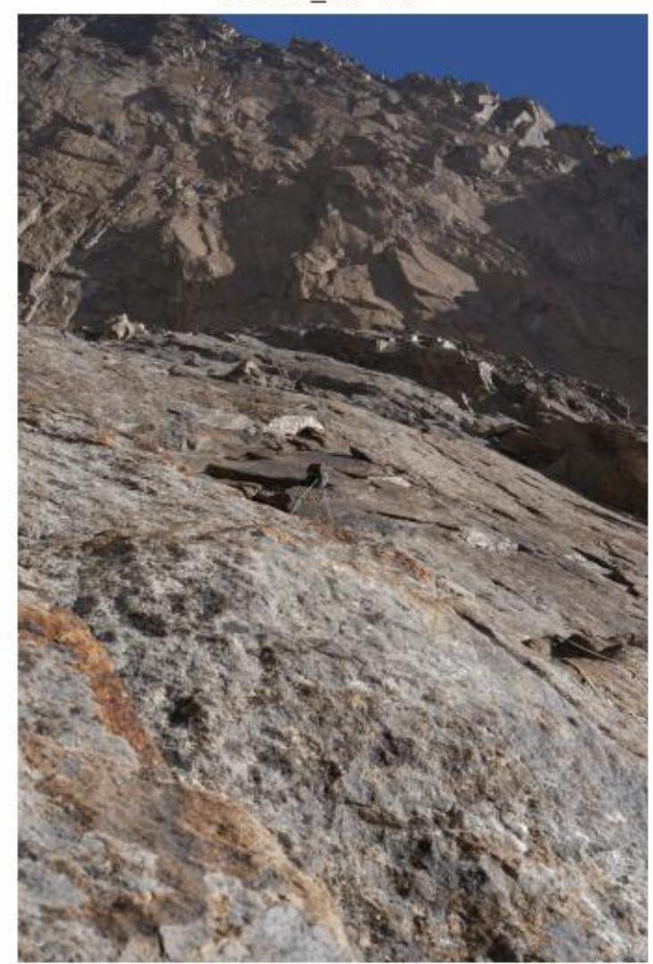
1st part: pleasant, not very difficult climbing on monolithic slabs, however, in bad weather, the passage will take significantly more time.
2nd part: extremely difficult climbing, high wall angle, "crust" in the cracks, making camalot protection less reliable, some areas with very poor relief, key ropes R11–R13, R15–R17, R18–R19.
Ridge: not difficult, with some vertical, heavily damaged small walls, climbing up to category V.
The team planned to complete the route with two overnight stays – one on the wall, one on the ridge, but a sudden change in weather and a thunderstorm with snow and strong wind forced them to stop working on the route at 14:00 on the first day of ascent, which disrupted the entire ascent schedule. Almost the entire route was completed with free climbing, except for:
- 30 m AIT on section R12–R13.
- 7 m (one bolt, 2 skyhook holes) on section R15–R16.
The descent from the summit was initially planned via Zchiltsov's route 6A, as this route is currently equipped with rappel stations, and a team from Moscow descended via this route before us. The descent was logical and took us about 5 hours to reach the assault camp under the wall.
There are problems with water on the route; water is available in large quantities on the ridge and on R15, there is a reserve of ice in a small chimney on the right.
The team enjoyed climbing this route and standing on the summit of such a wonderful peak as Iskander.
Section R3–R4
Section R9–R10
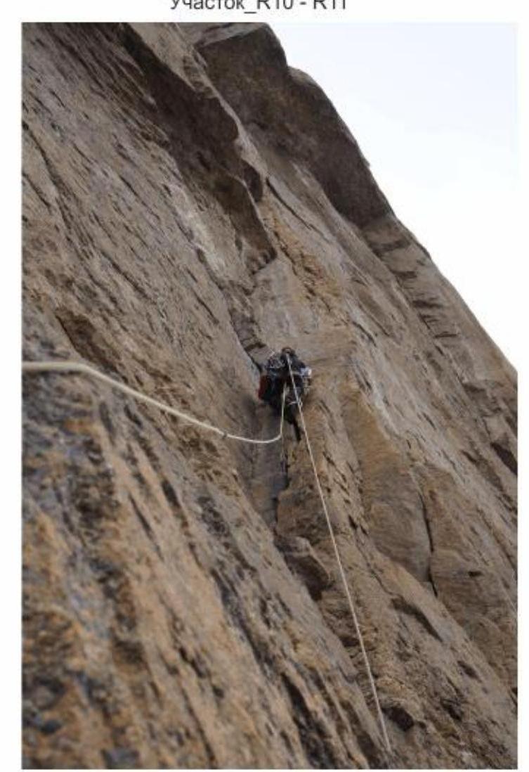
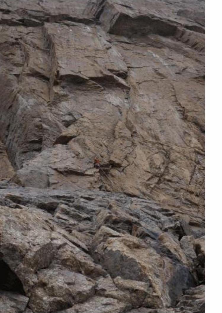
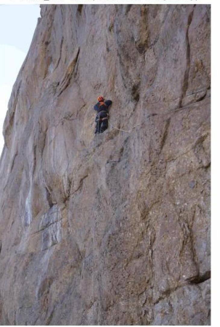
Section R10–R11
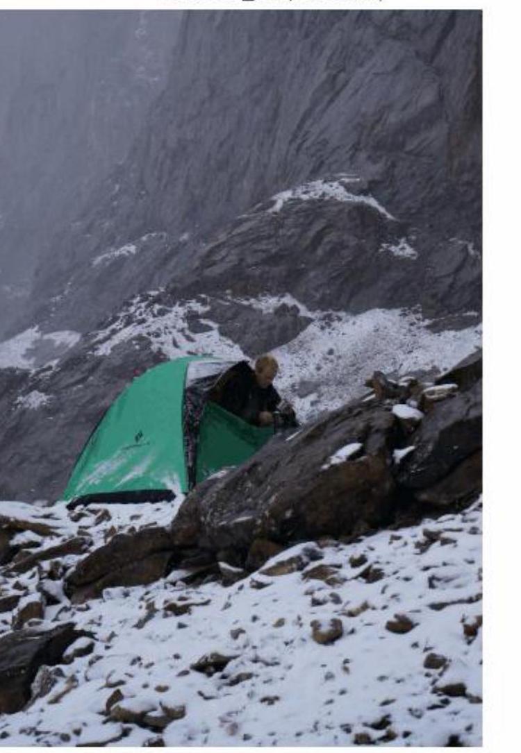
Overnight stay at R8 (bad weather)
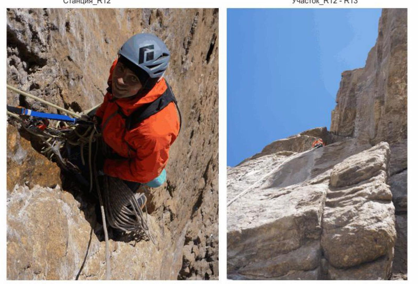
Station R12
Section R12–R13
Section R14–R15 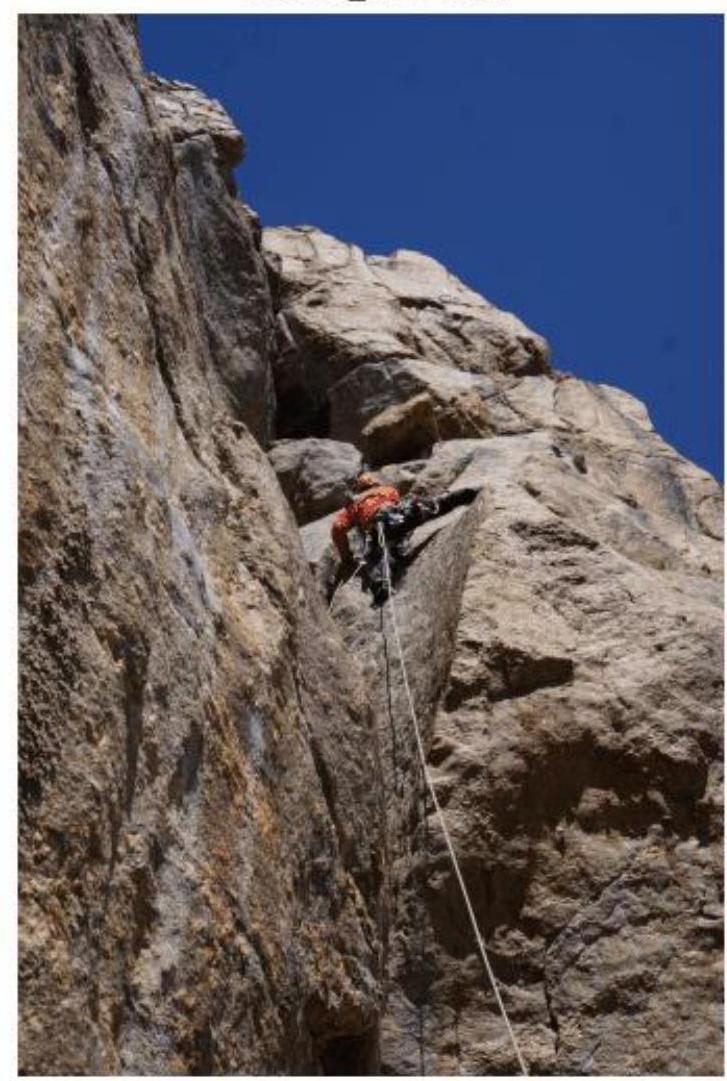
Section R15–R16 (very "poor" relief)

Section R16–R17
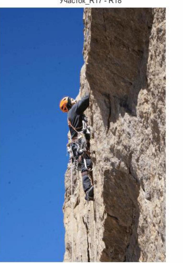
Section R17–R18
Summit of peak Iskander, 5120 m