MINISTRY OF SPORT, TOURISM AND YOUTH POLICY OF KRASNOYARSK KRAI
KRASNOYARSK REGIONAL ALPINISM FEDERATION
RUSSIAN ALPINISM CHAMPIONSHIP 2019. High-Altitude Technical Class
REPORT
Combined team of Krasnoyarsk Krai and Novosibirsk Oblast
On the first ascent of the route "Re-reading the Classics" via the "pillar" on the Northern wall, presumed 6A category.
Krasnoyarsk, Novosibirsk 2019
ASCENT PASSPORT
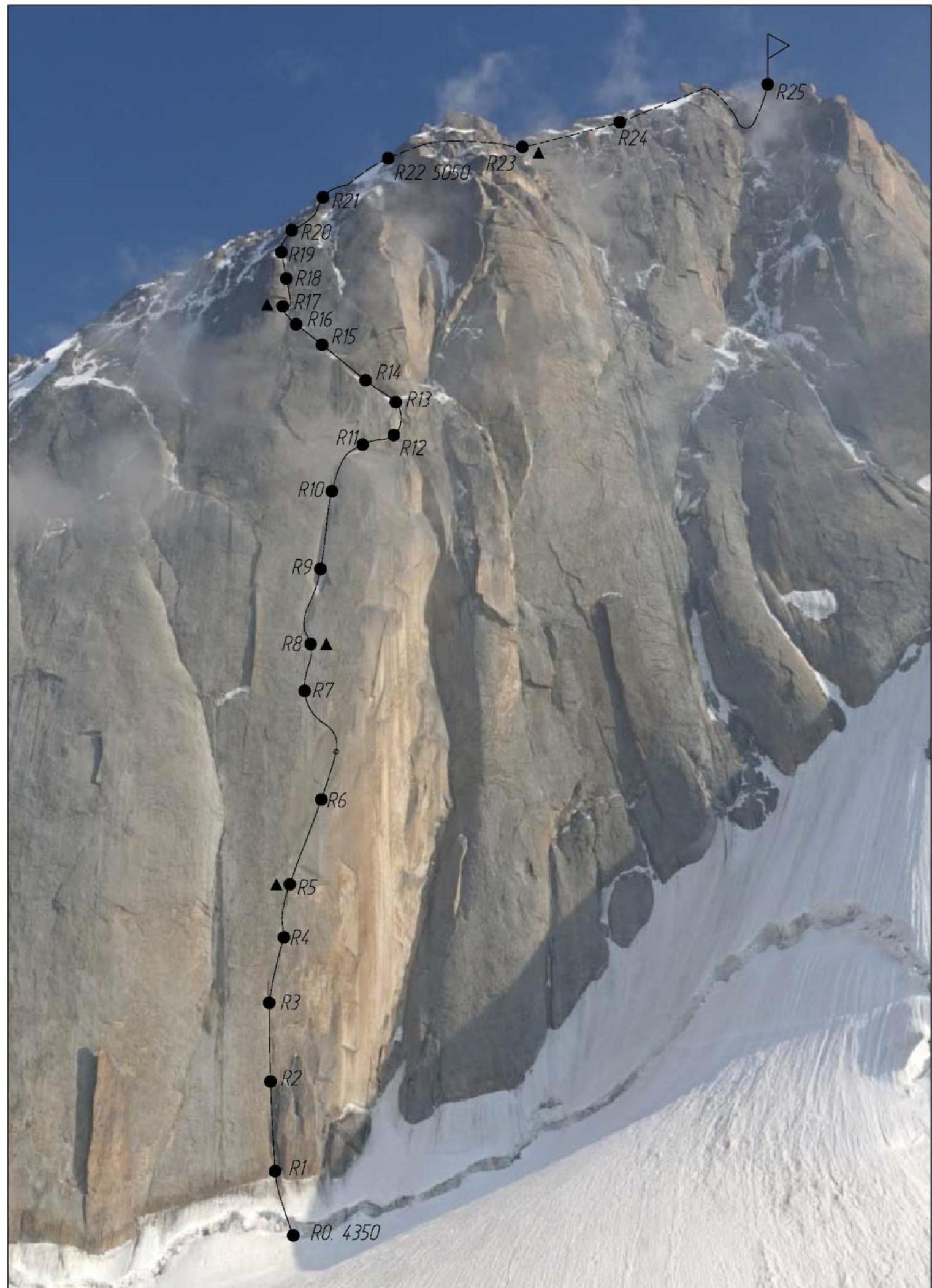
Region — Pamir-Alay. Turkestan Range, Laylyak valley Peak — Peak Bлока 5239 m via the "pillar" on the Northern wall Route character — combined.
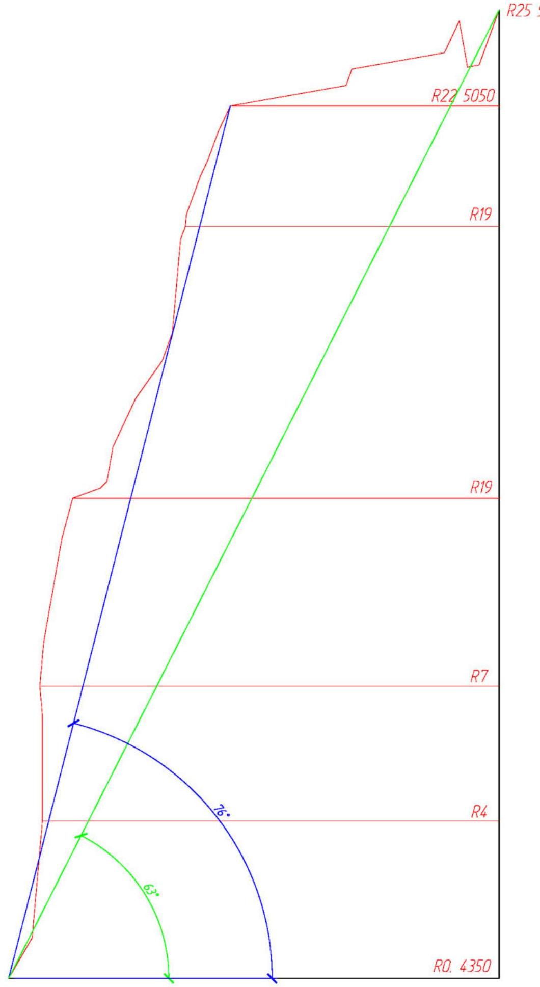
Route characteristics
Elevation gain — 890 m, main part of the route elevation gain — 700 m length — 1164 m. Length of sections with 5–6 category difficulty — 721 m, average steepness of the route — 56°, main part of the wall (3350–5050) — 74°. Left on the route: pitons — 18, including drilled pitons — 18; " закладок" — 0. Pitons used on the route: stationary drilled pitons — 18, of which on belays and bivouacs — 11 Total ITC used about — 420. Climbing time — 57 hours, days — 5. Team leader — Parfyonov Aleksandr Aleksandrovich, Master of Sports Team members: Timofeev Vyacheslav Mikhailovich, Candidate Master of Sports Sukharev Aleksey Yuryevich, Candidate Master of Sports Team coaches: Zakharov Nikolai Nikolaevich, International Master of Sports, Honored Coach Balezin Valery Viktorovich, International Master of Sports
Departure date
On the route — August 6, 2019 at 6:00, on the summit — August 10, 2019 at 11:00, return to base camp — August 10, 2019 at 23:20
Organized by: Ministry of Sport, Tourism and Youth Policy of Krasnoyarsk Krai; Youth Regional Public Organization "Federation of Alpinism and Rock Climbing of Novosibirsk Oblast" (MRPO "FAIS NSO")
Team's tactical actions
The route choice was related to the fact that the center of the Northern wall of Peak Bлока has not been explored, — between Efimov's and Lavrenenko's routes there is visible terrain consisting of three large macro-cracks, approximately 50, 70, and 100 meters in size, as well as an internal corner leading to the Northern ridge at an elevation of 5050 m. Unfortunately, home photos did not allow to determine the nature of the cracks and the suitability of the terrain for ITC or free climbing. The second crack maintained an element of intrigue until the moment of ascent: it was found to overhang at the start and have smooth ice-covered walls. It had to be traversed almost entirely on skyhooks.
The lower part of the wall — up to the start of the ice gully, — is a steep rock bastion, almost entirely between R1 and R8 — close to 90°, or overhanging. We spent two days out of 4.5 days required for the route ascent here.
The remaining sections, starting from R8 and up to the exit onto the Northern ridge at the end of section R19, as well as the traverse along the Northern ridge and transition to the Eastern ridge, proceed logically along the terrain and do not require the use of skyhooks.
After sunrise on the Northern wall, on days 3-4, it becomes unsafe on gentle sections: ice on the "roof" starts to melt, and rocks fall. Therefore, for the overnight stay at the end of the 2nd and 3rd days, we had to stop by 16:00, under the protection of the terrain: – The second bivouac was organized under the protection of a nearly vertical rock slab forming the 3rd, 100-meter crack. – The third bivouac was set up under a cornice, at the end of section R16–R17.
It is worth noting that the route is safe if the described movement schedule is followed. The team ascended the route in capsule style, without prior processing, and each day the platform was carried in assembled state to be set up at a new location. Belay stations were organized on drilled pitons only where safety required it; most stations were set up on natural features. Bivouac sites were equipped with 8×60 mm pitons.
The successful resolution of tactical and technical tasks, as well as safety during the route ascent, were facilitated by the following factors: – Leader rotation on the route; all 3 team members could lead; – Each participant was belayed with two ropes; – Use of lightweight and modern mountaineering gear, including a latest-design Krasnoyarsk platform; – Extensive training during the preparation period and the team's cohesion in previous seasons allowed for high speed on technically complex sections of 5th and 6th category difficulty. – The team received detailed consultations on the wall's behavior from the leader of the ascent via Korobkov's route in 2015, Prokofiev D.E.
Route description by sections
R0–R1. Snow-ice slope, with a bergschrund in the middle, traversed directly, via the most intact part, 40 m, 60°, IV–V category difficulty.
R1–R2. Internal corner with jammed blocks at the start, with a slit for small and medium cams inside the corner, 30 m, 85°, 6th category difficulty, A2–A3.
R2–R3. Continuation of the internal corner, gradually turning into a wall, with a slit for fiffs and anchors, 35 m, 85°, 6th category difficulty, A2.
R3–R4. Traverse right-up under an overhanging crack, several steps on skyhooks, 35 m, 85°, 6th category difficulty, A3+.
R4–R5. Monolithic slab, moving on skyhooks right-up towards the start of a huge expanding crack, belay station on drilled pitons. For belay, removable drilled pitons and 8×45 mm pitons (2 pcs) were used, 25 m, 90°, 6th category difficulty, A3.
R5–R6. Along the huge crack right-up. The gap between the crack and the wall initially forms an overhanging off-width, then transitions into a gradually expanding chimney, with ice-covered walls. Unsuitable for camming. Movement on hole skyhooks, belay on removable drilled pitons and 8×45 mm pitons, 45 m, 90°, 6th category difficulty, A3.
R6–R7. 20 meters up the chimney, then a transition on skyhooks and fiffs to the outer wall of the crack to the left, and further movement up on ringing flakes on fiffs and camming devices, 25 m, 95°, 6th category difficulty, A3.
R7–R8. Up a slab via a crack, partially blind, on fiffs and small cams, to a small ledge at the start of the ice rivulet, 30 m, 85°, 6th category difficulty, A2.
R8–R9. From the ledge up 8 m via a crack on fiffs to the start of the 0.6–1 m wide ice rivulet. Further on ice with tools. The ice rivulet flows in a chimney formed by a huge 100-meter crack. Initially 8 m, 85°, 6th category difficulty, A2, then 40 m, 75–85°, 5–6 category difficulty.
R9–R10. Up the ice rivulet with tools, 50 m, 75–90°, 5–6 category difficulty.
R10–R11. The ice rivulet transitions into a small stream, with ice thickness 5–7 cm and width 20–30 cm in places. Ice is sometimes detached from the rock. Belay on anchors and camming devices in cracks to the right of the stream. At the end of the section — exit onto a ledge. 35 m, 75–90°, 6th category difficulty (Wi 6).
R11–R12. Rightward along an icy inclined ledge, 25 m, 20°, II–III category difficulty.
R12–R13. Up a sloping internal corner with a slit for medium and large camming devices right-up, 8 m, 45°, 5th category difficulty, to the base of a slightly overhanging wall. Up the wall on small camming devices and fiffs with an off-width, then via a crack on thin petal hooks left-up to the start of a snow-ice bowl. Belay station on ice. 30 m, 80°, 6th category difficulty, A2. The section from the start of the overhanging wall to the belay station on ice is shared with Efimov's route.
R13–R14. Series of icy internal corners leading onto ice, moving left-up, 40 m, 6th category difficulty, A0–A2, Wi5.
R14–R15. Icy internal corner, moving left-up, 55 m, 65°, 5th category difficulty, A2.
R15–R16. Series of internal corners and chimneys formed by cracks, moving left-up, 40 m, 55°, IV category difficulty.
R16–R17. Via cracks in an inclined slab left-up, to the base of an icy internal corner. To the left, under the protection of a cornice, is the 3rd bivouac. 25 m, 70°, 6th category difficulty, A2.
R17–R18. From under the cornice rightward to the base of a large internal corner, up icy cracks in the internal corner. Belay station on an ice flake. 45 m, 85°, 6th category difficulty, A2.
R18–R19. Up the left wall of the internal corner, which is covered in ice, 35 m, 85°, 6th category difficulty, A2. Then 12 meters up the right wall of the internal corner on accretion ice, 6th category difficulty (Wi 5) to the start of a firn bowl. 8 m up the firn to the exit onto the ridge. On the ridge is a large inclined ledge.
R19–R20. From the ledge up an internal corner, 10 m, 85°, 6th category difficulty, A2. Then from the corner rightward onto a snowy slab with ringing flakes and free-standing slabs, up the slab. For belay, there is a hole for a removable drilled piton; other points are on flakes, 35 m, 70°, 5th category difficulty, with sections A2.
R20–R21. Up an inclined slab and large blocks via climbing, 15 m, 65°, 5th category difficulty, then 25 m, 70°, 5th category difficulty, up-left via cracks in an internal corner and a crack with medium and large cams. Belay station on a ledge with a large rock.
R21–R22. Snow-ice wall to the exit onto the Eastern ridge, 25 m, 60°, III–IV category difficulty.
R22–R23. Movement along the ridge to the left, 100 m, 10°, II category difficulty. Bivouac in a platform at the base of a rock wall. There are two 8×45 mm pitons 2 m apart.
R23–R24. Up a crack in the rock wall, to a ledge 15 m, 70°, 5th category difficulty, then along the ridge 80 m, I category difficulty.
R24–R25. Up a snow-ice wall, on the right slope of a gendarme, 30, m, 65°, IV category difficulty. Further 10 m along the ridge and a 40 m rappel with a descent leftward into a couloir onto a rock ledge, then 50 m up a ruined internal corner, 65–70°, IV category difficulty, to a pedestrian ledge leading to the summit. Did not find a cairn, built our own.
| Section # | Length, m | Steepness, ° | Difficulty |
|---|---|---|---|
| R24–R25 | 130 | 65–70 | 4 |
| R23–R24 | 95 | 70, 10 | 6 |
| R22–R23 | 100 | 10 | 2 |
| R21–R22 | 25 | 60 | 3–4 |
| R20–R21 | 40 | 65–70 | 5 |
| R19–R20 | 45 | 85, 70 | 6, A2 |
| R18–R19 | 55 | 85 | 6, A3, Wi5 |
| R17–R18 | 45 | 85 | 6, A2 |
| R16–R17 | 25 | 70 | 6, A2 |
| R15–R16 | 40 | 55 | 4 |
| R14–R15 | 55 | 65 | 5, A2 |
| R13–R14 | 40 | 70 | 6, A0–A2, Wi5 |
| R12–R13 | 38 | 45, 80 | 6, A2 |
| R11–R12 | 25 | 20 | 2–3 |
| R10–R11 | 35 | 75–90 | 6, Wi6 |
| R9–R10 | 50 | 75–90 | 5–6 |
| R8–R9 | 48 | 85 | 6, A2 |
| R7–R8 | 30 | 85 | 6, A2 |
| R6–R7 | 45 | 95 | 6, A3 |
| R5–R6 | 45 | 90 | 6, A3 |
| R4–R5 | 25 | 90 | 6, A3 |
| R3–R4 | 35 | 85 | 6, A3+ |
| R2–R3 | 35 | 85 | 6, A2 |
| R1–R2 | 30 | 85 | 6, A2–A3 |
| R0–R1 | 40 | 60 | 4–5 |
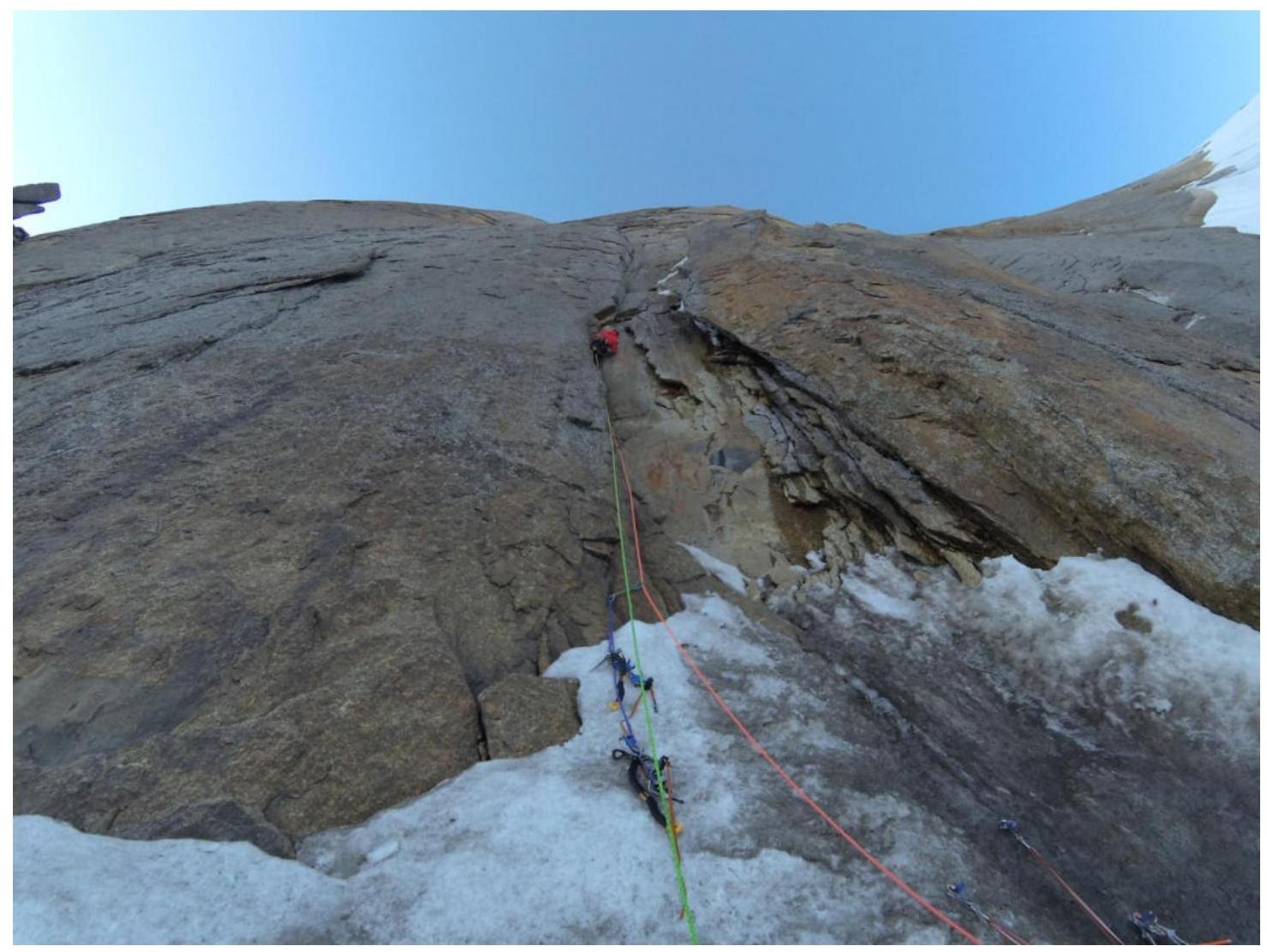
Fig. 1. Leader at the start of section R1–R2.
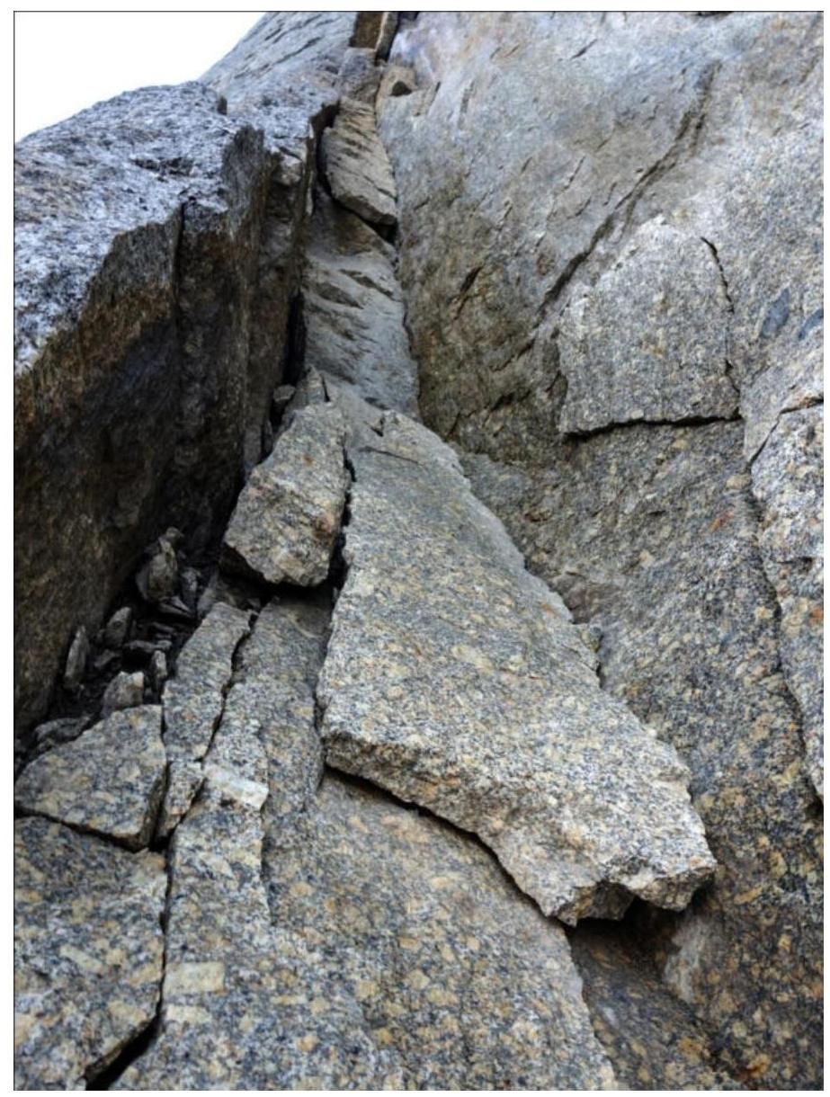
Fig. 2. At the start of section R1–R2.
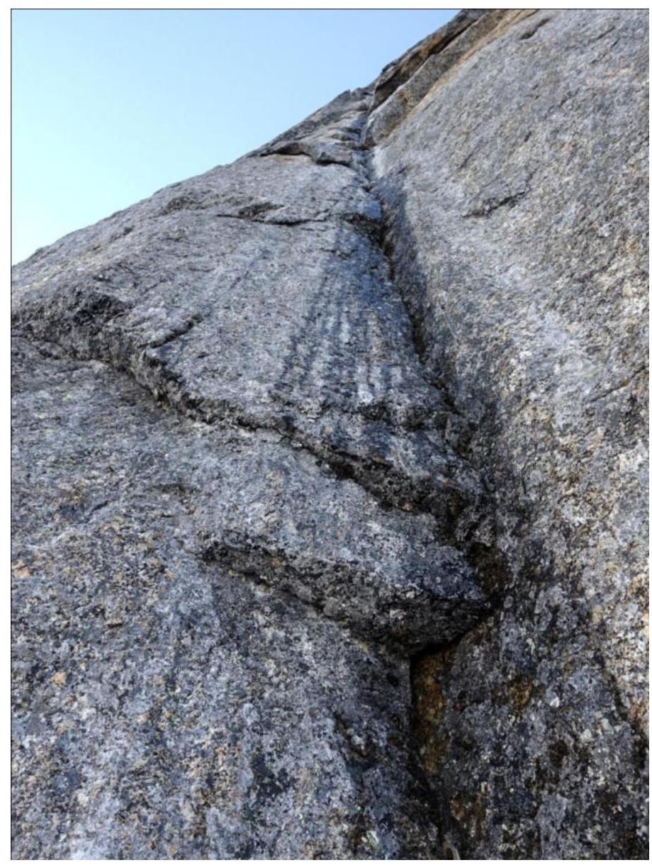
Fig. 3. At the start of section R2–R3.

Fig. 4. Section R4–R5.
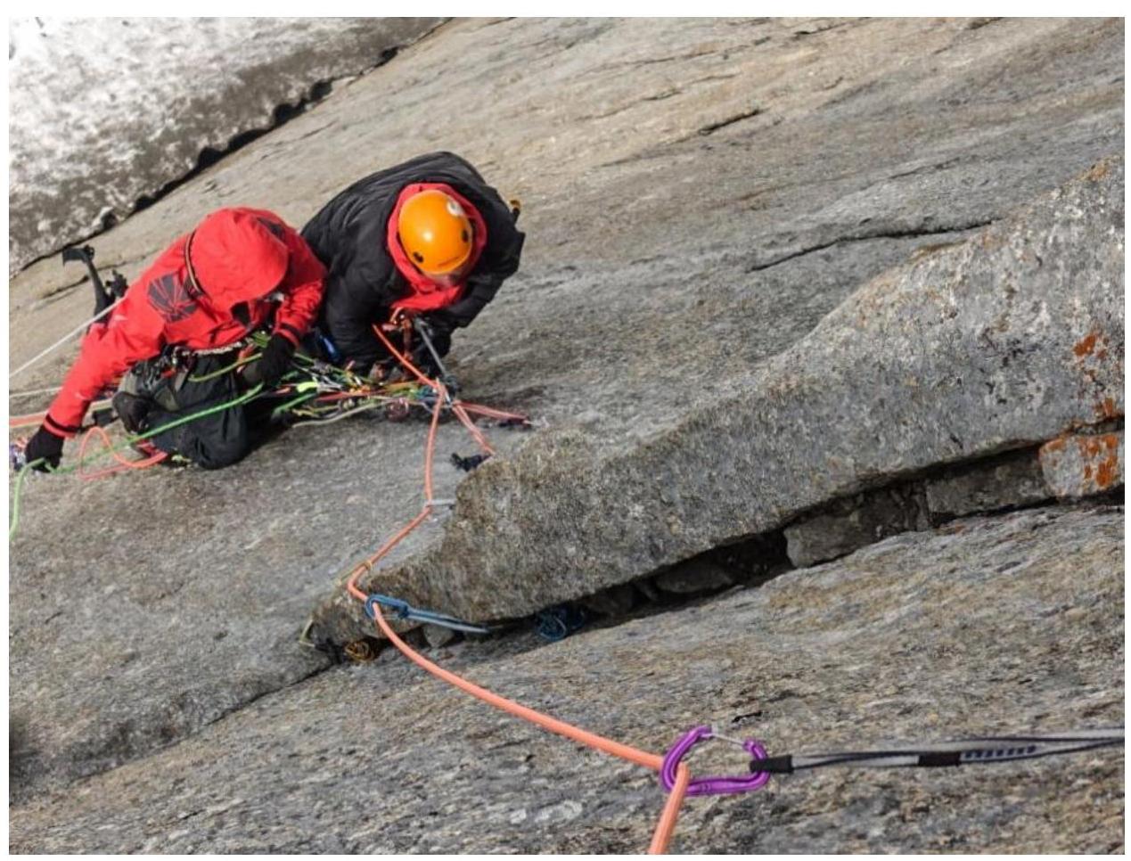
Fig. 5. At the start of section R5–R6.
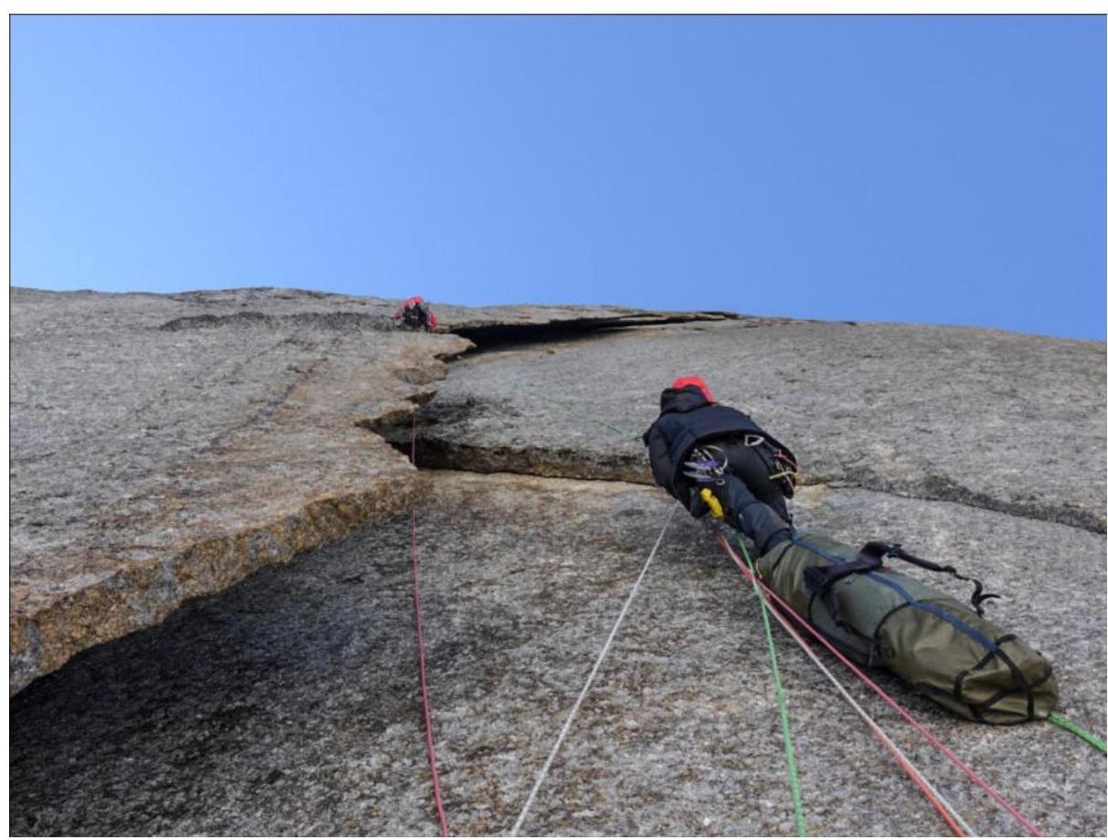
Fig. 6. Section R6–R7, leader has just completed the transition to the outer wall of the crack.

Fig. 7. Section R6–R7 after the transition to the crack, leader is climbing the next section.
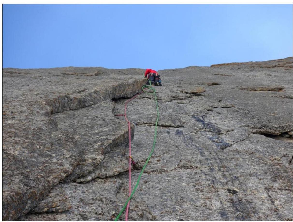
Fig. 8. Section R7–R8.
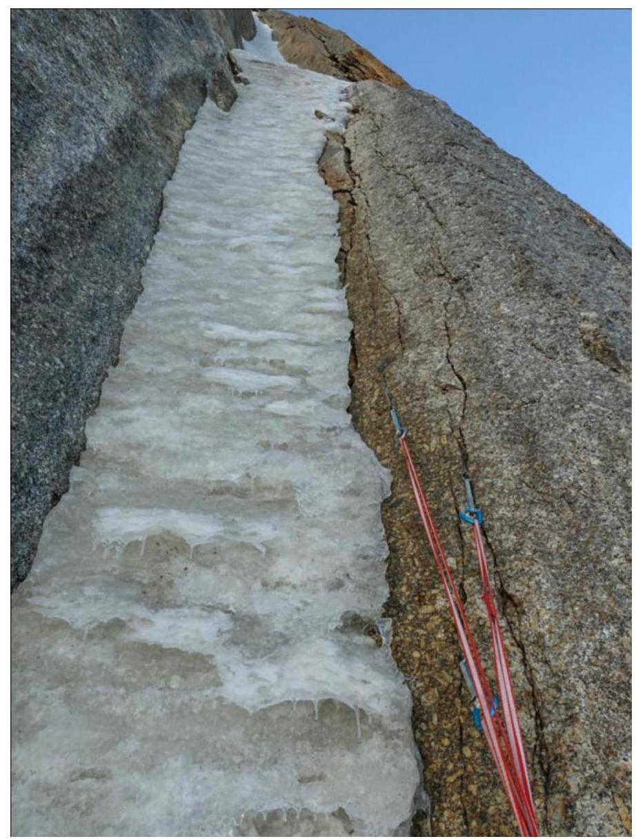
Fig. 9. Belay station at the end of section R8–R9.
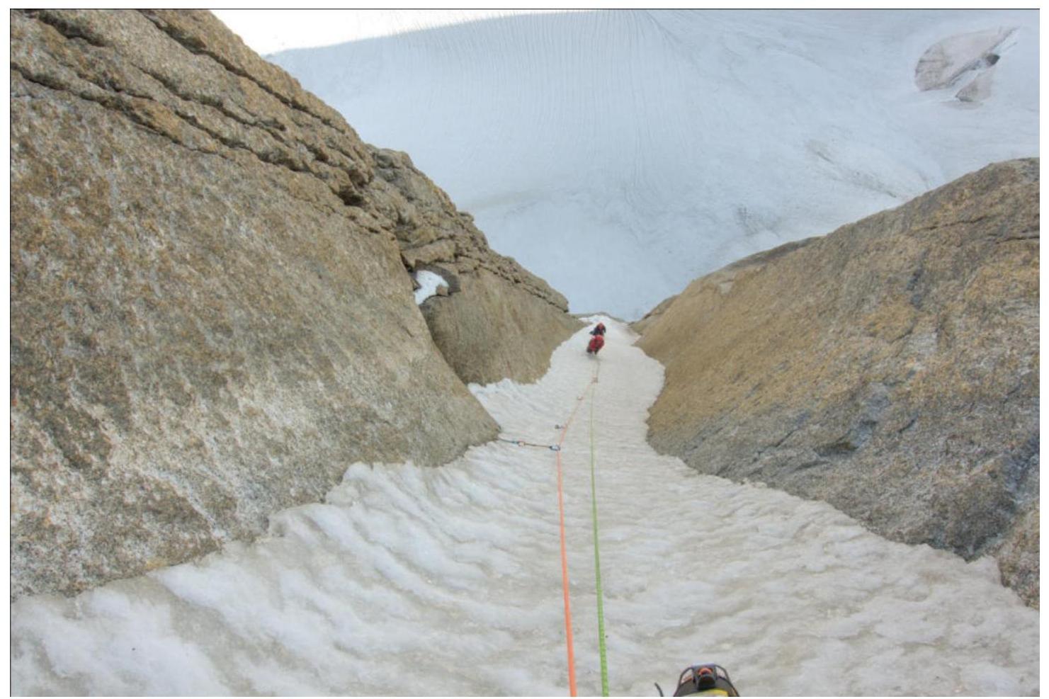
Fig. 10. On section R9–R10.
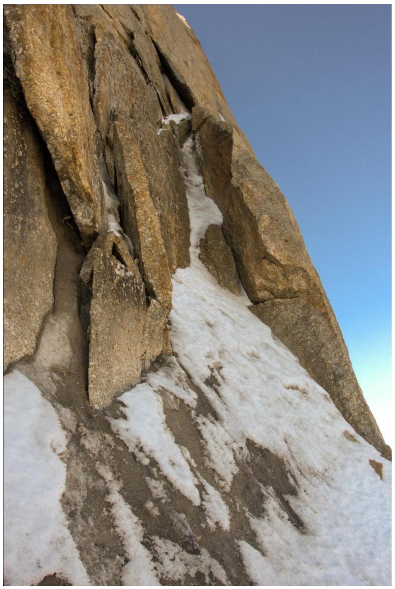
Fig. 11. Start of section R11–R12.
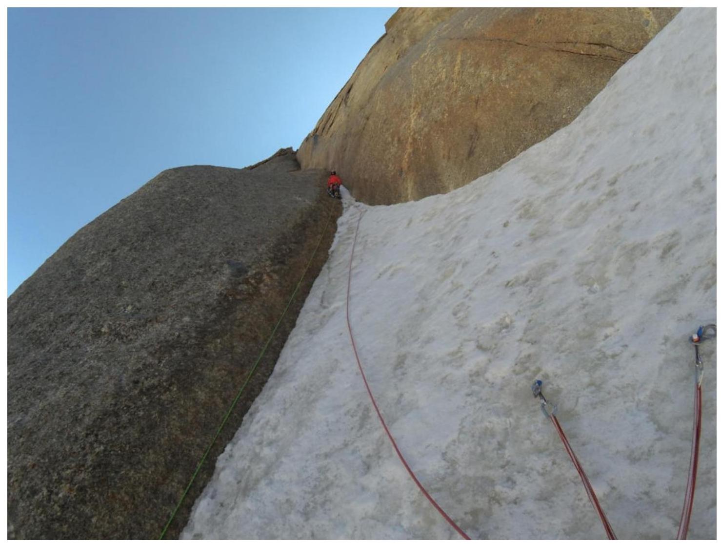
Fig. 12. Start of section R13–R14.
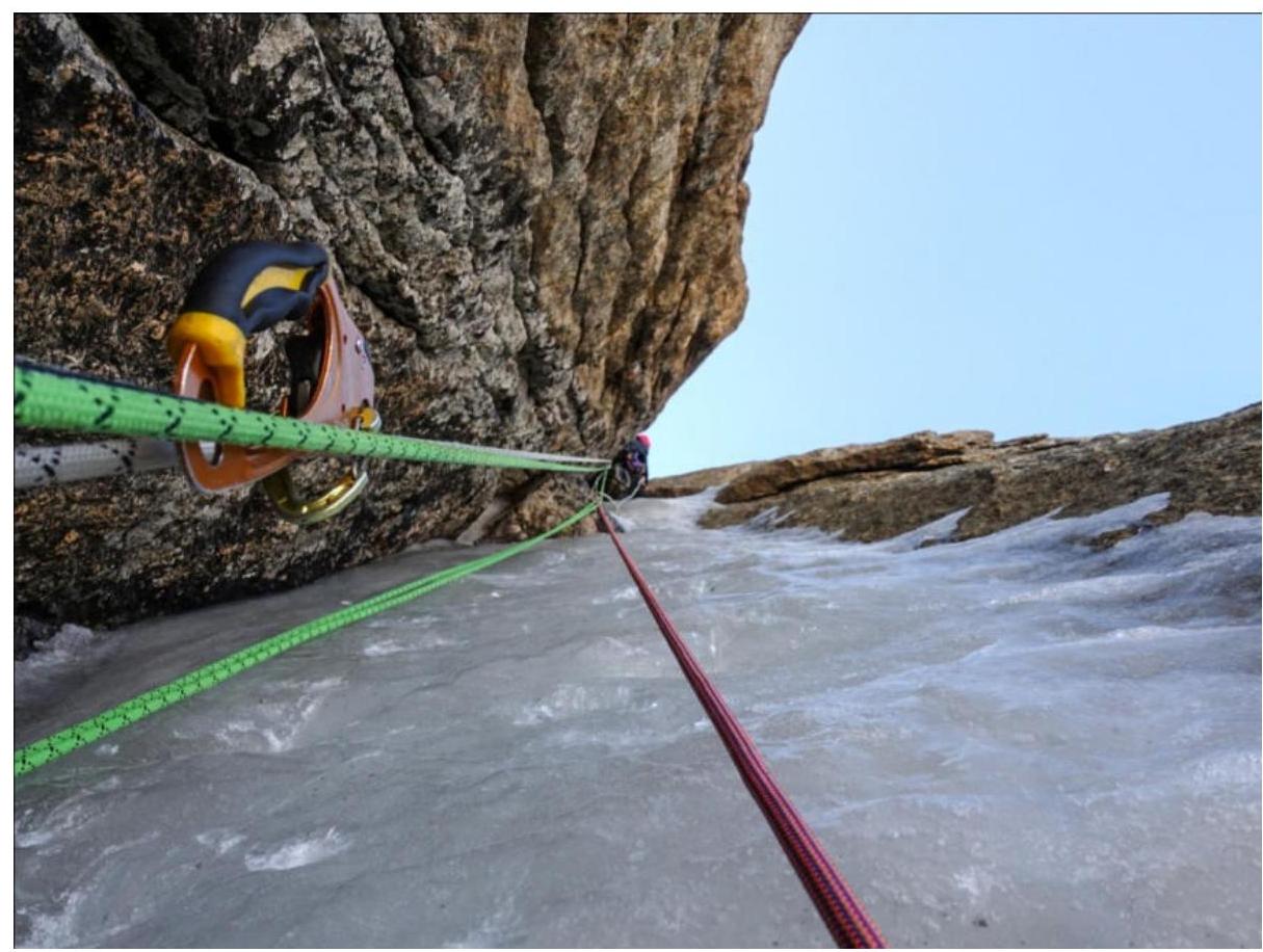
Fig. 13. Middle of section R18–R19.
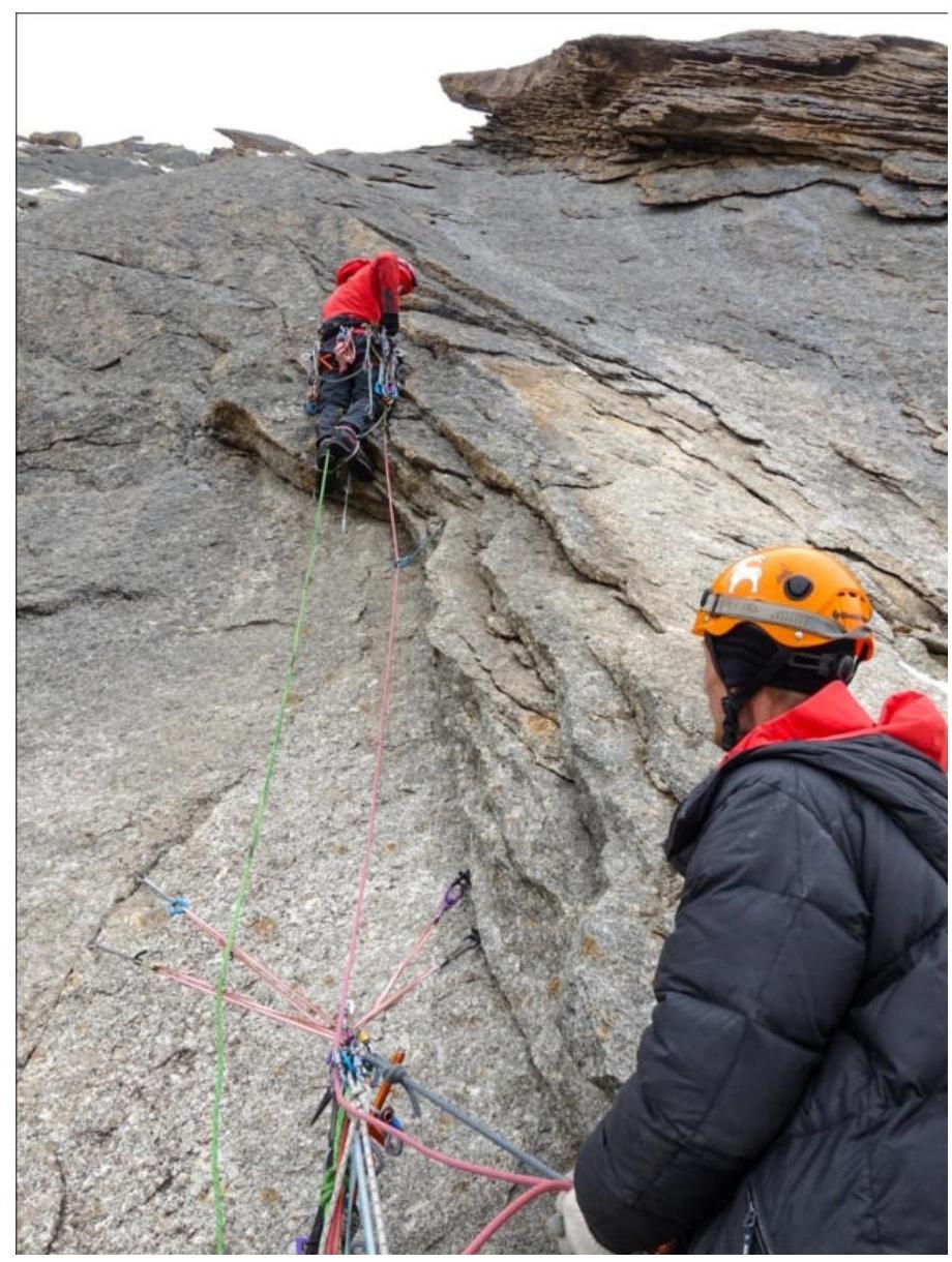
Fig. 14. At the start of section R19–R20.

Fig. 15. Exit onto the Eastern ridge, section R21–R22.
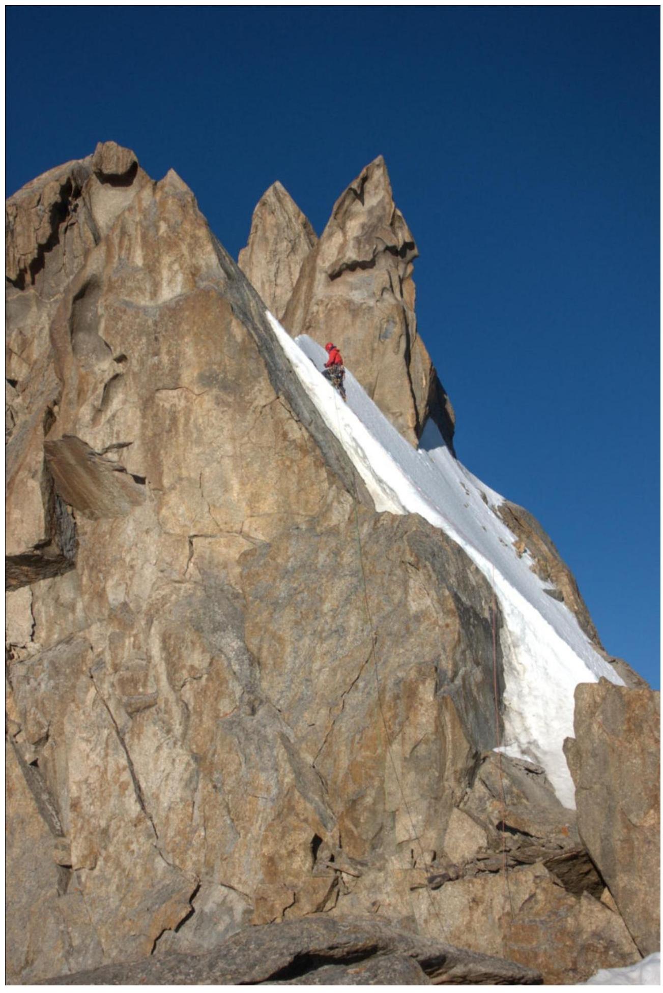
Fig. 16. Start of section R24–R25.
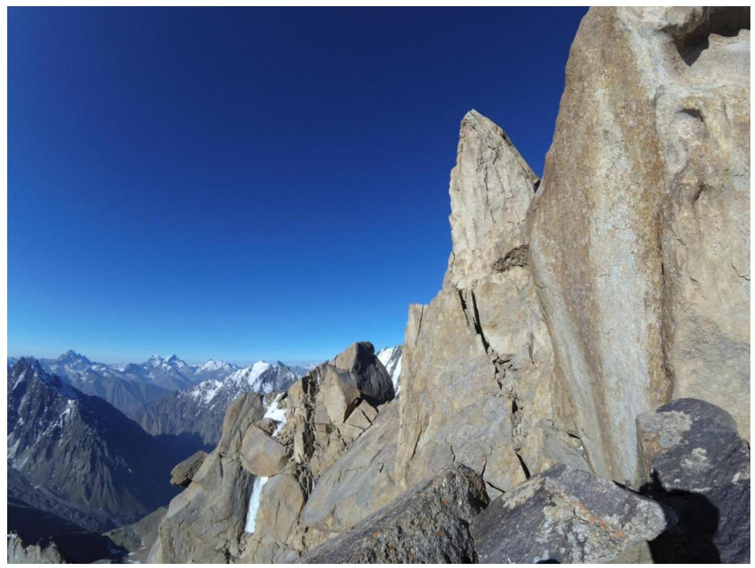
Fig. 17. On section R24–R25, before descending into the couloir. The exit from the couloir and the final pedestrian meters to the summit are visible. The summit is visible.