Ascent Record
- Pamir-Alay, Turkestan Range, Laylyak valley, 5.4.2.
- Peak Bloka, 5239 m, via West and Northwest wall (Maximenya route, 2008)
- Proposed — 6A category (2nd ascent)
- Route type: rock
- Route height difference: 875 m, wall 790 m (by altimeter)
Route length: 1035 m.
Length of sections:
- 5th category — 125 m.
- 6th category — 615 m. Average steepness:
- main part of the route — 78°
- entire route — 68°
- Equipment left on the route:
Total bolts: 24 (including 12 on stations). All bolts from the first ascent.
Hooks used on the route:
- stationary bolts — 24 (including 10 for artificial aids)
- removable bolts — 0 (including 0 for artificial aids) Total artificial aids used:
- chocks and friends — 140 (including 112 for artificial aids)
- hooks — 85 (including 62 for artificial aids)
- Team's climbing hours: 66 h, 7 days including 13 h, 1 day for preparation
- Team leader: Ivanov Alexander Sergeevich, Master of Sports Participants: Shulgin Maxim Alexandrovich, 1st sports category
- Coach: Ivanov Alexander Sergeevich, Master of Sports
- Departure to the route: 11:00, July 26, 2011 Summit: 17:45, August 1, 2011 Return to Base Camp: 12:00, August 3, 2011 Descent via NW and W wall.
- Organization: Moscow City Federation of Alpinism and Sports Climbing team
- Report responsible: Ivanov Alexander, ivanov@vdnk.ru, 8 (963) 992-11-35
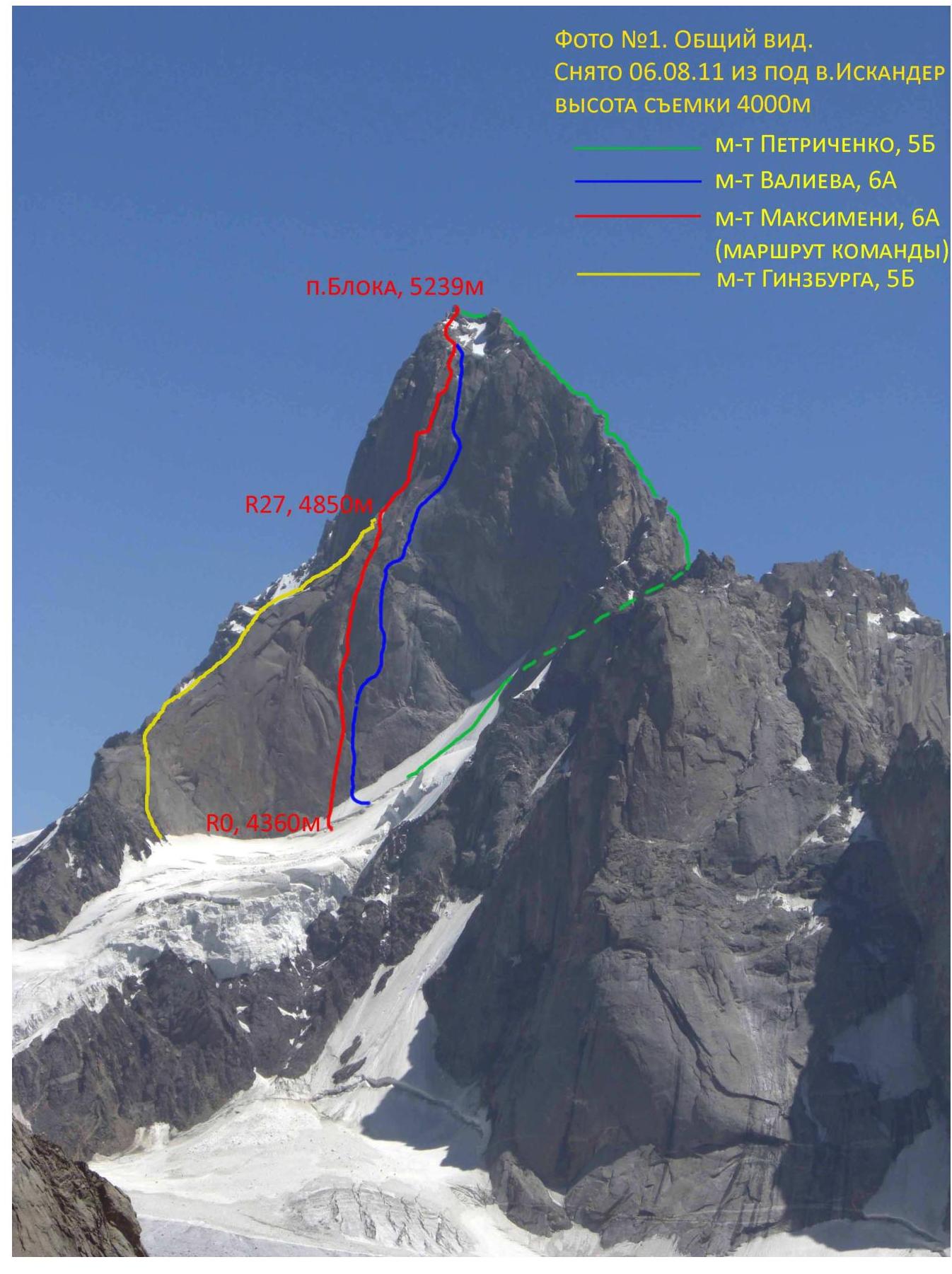
Peak Bloka, 5239 m
R27, 485 m
R0, 4360 m
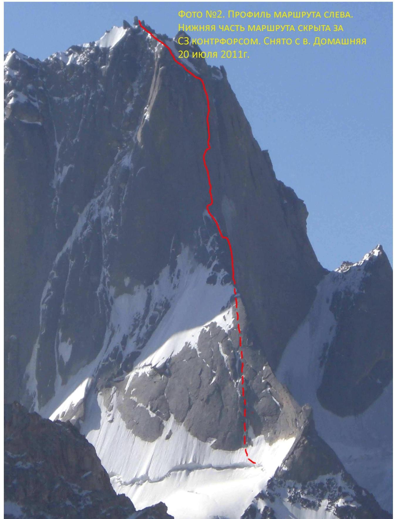
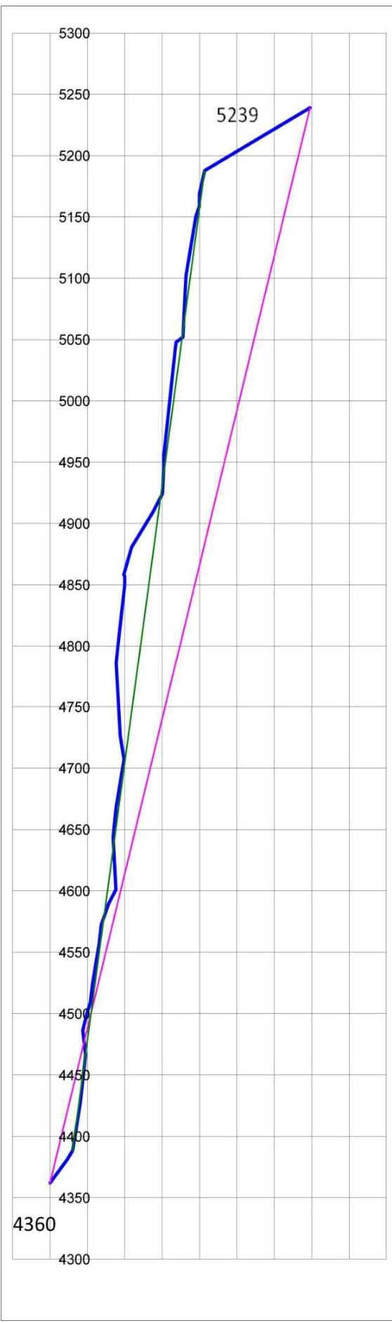
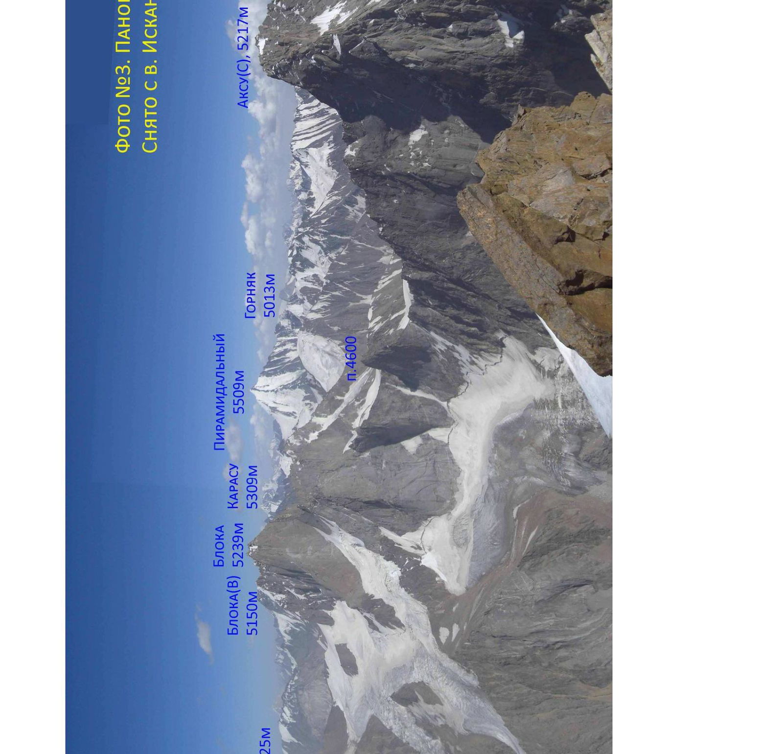
Photo #3. Panorama of the area. Taken from Iskander peak
| Hooks | Chocks | Bolts | Aids | R | Description |
|---|---|---|---|---|---|
| 0 | 10 m, 25°, I | ||||
| 1 | 25 m, 40°, IV | ||||
| 1 | 2 | 10 m, 45°, I | |||
| 5 / 2 | 7 / 3 | 9 | 3 | 40 m, 75°, VI, A1 | |
| 12 / 10 | 2 / 2 | 18 | 4 | 35 m, 80°, VI, A1 | |
| 9 / 9 | 1 / 1 | 1 / 1 | 17 | 5 | 20 m, 100°, VI+, A3 |
| 5 | 1 | 6 | 15 m, 70°, V+ | ||
| 1 | 7 | 10 m, 60°, IV, traverse | |||
| 1 | 8 | 15 m, 80°, V– | |||
| 3 ice + 2 | 2 | 9 | 35 m, 60–90°, V | ||
| 3 / 1 | 2 / 1 | 5 | 10 | 15 m, 80°, VI, A2 | |
| 1 | 11 | 20 m, 60°, V | |||
| 1 | 12 | 15 m, 50°, IV | |||
| 1 / 1 | 5 / 5 | 6 | 13 | 8 m, 95°, VI, A1 | |
| 2 / 2 | 2 / 2 | 1 / 5 | 18 | 14 | 5 m, 95°, VI, A2 / 5 m traverse, V / 8 m pendulum |
| 15 | 25 m, 80°, VI, A3 | ||||
| 16 | |||||
| 1 / 1 | 4 / 3 | 10 | 17 | 15 m, 75°, VI, A2 | |
| 1 / 1 | 2 / 9 | 17 | 18 | 15 m, 75°, VI, A2 | |
| 2 / 1 | 9 | 19 | 25 m, 75°, VI, A1–A2 | ||
| 2 / 2 | 15 / 13 | 20 | 20 | 20 m, 105°, VI+, A3+/A4 | |
| 3 / 3 | 15 / 13 | 30 | 21 | 60 m, 95°, VI, A2/A2+ | |
| 8 / 5 | 1 | 11 | 23 | Pendulum 12 m, 20 m, 80°, V+, A1 | |
| 1 / 1 | 6 / 6 | 10 | 24 | 15 m, 80°, V+, A1 | |
| 25 | 25 m, 80°, VI, A1+ | ||||
| 26 | 25 m, 65°, VI, A2 | ||||
| 27 | 40 m, 45°, IV | ||||
| 1+ | 2л6 | 28 | 20 m, 50°, IV+ | ||
| 4 / 4 | 2 / 2 | 6 | 29 | 20 m, 85°, VI+, A3 | |
| 30 | |||||
| 3 / 2 | 15 / 14 | 40 | 31 | 90 m, 80°, VI, A2 | |
| 1 | 1 | 32 | 5 m, 20°, I | ||
| 33 | 10 m, 25° II | ||||
| Traverse 5 m, 1; 8 m, 80°, VI, A1 | |||||
| 5 / 5 | 5 / 5 | 20 | 34 | 40 m, 85°, VI, A2 | |
| 3 / 3 | 3 | 35 | 10 m, 90°, VI+, A2 | ||
| 4 / 4 | 6 / 5 | 21 | 36 | 50 m, 75°, VI+, A3 | |
| 4 / 4 | 1 | 37 | 10 m, 90°, VI+, A3 | ||
| 4 / 4 | 38 | 20 m, 70°, V+, A1 | |||
| 39 | 150 m, 10–60°, I–V | ||||
| 40 |
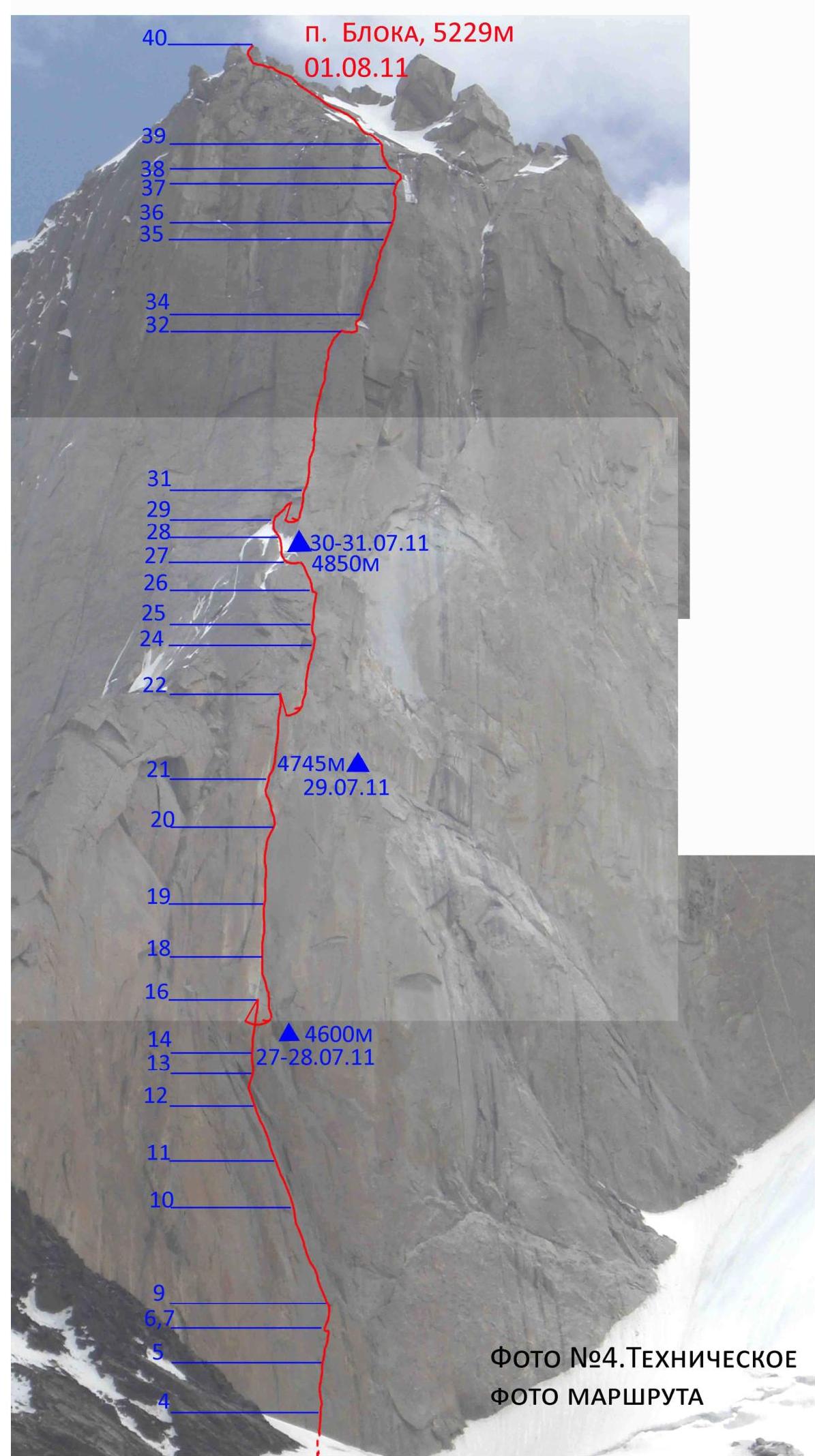
Photo #4. Technical photo of the route
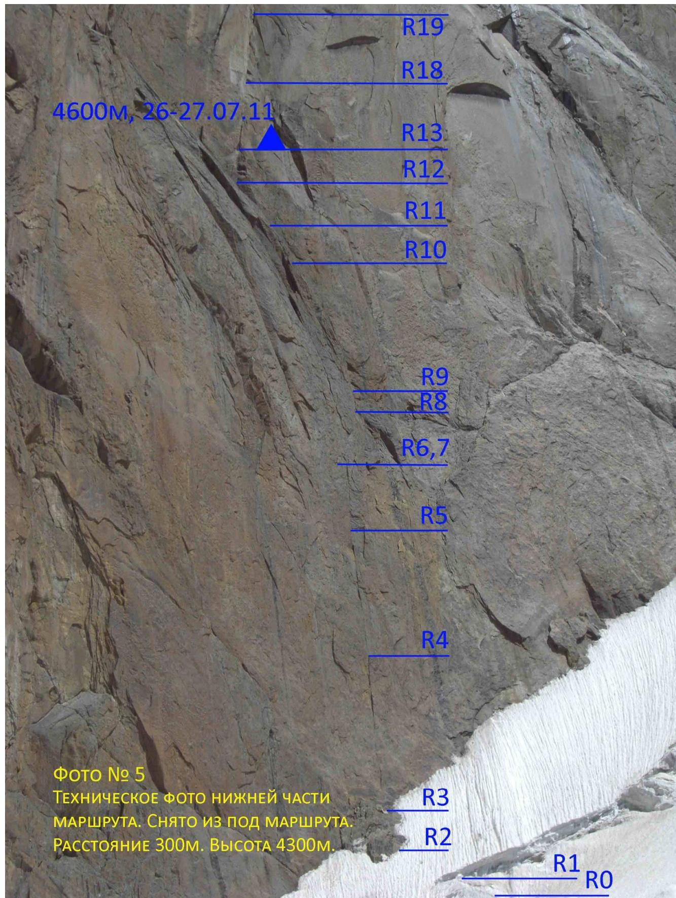
Photo #5. Technical photo of the lower part of the route. Taken from under the route. Distance 300 m. Height 4300 m.
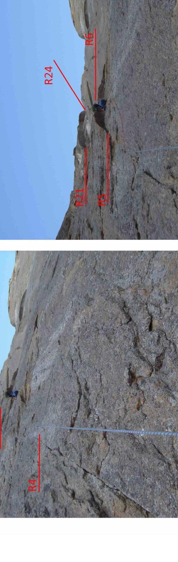
Photo #6. R3–R5. Working on the rope. The cornice closing the West wall is visible. Taken from the middle of R3–R4.
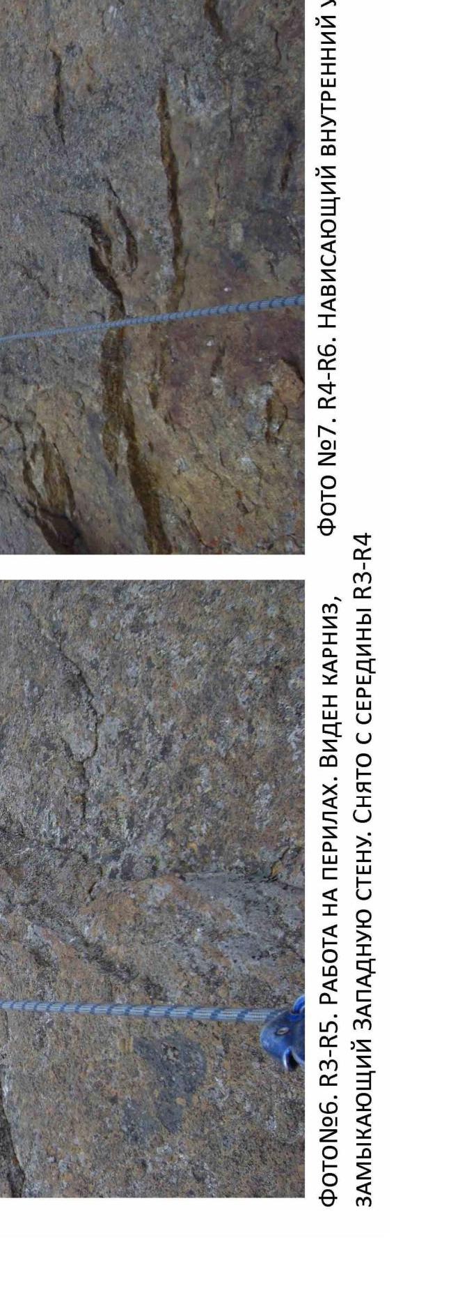
Photo #7. R4–R6. Overhanging inner corner.
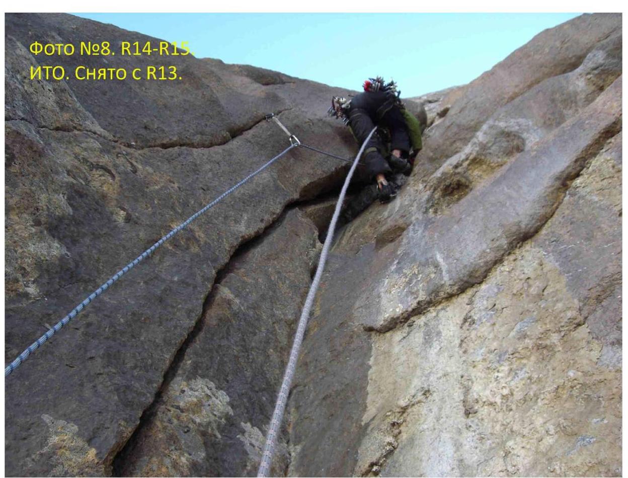
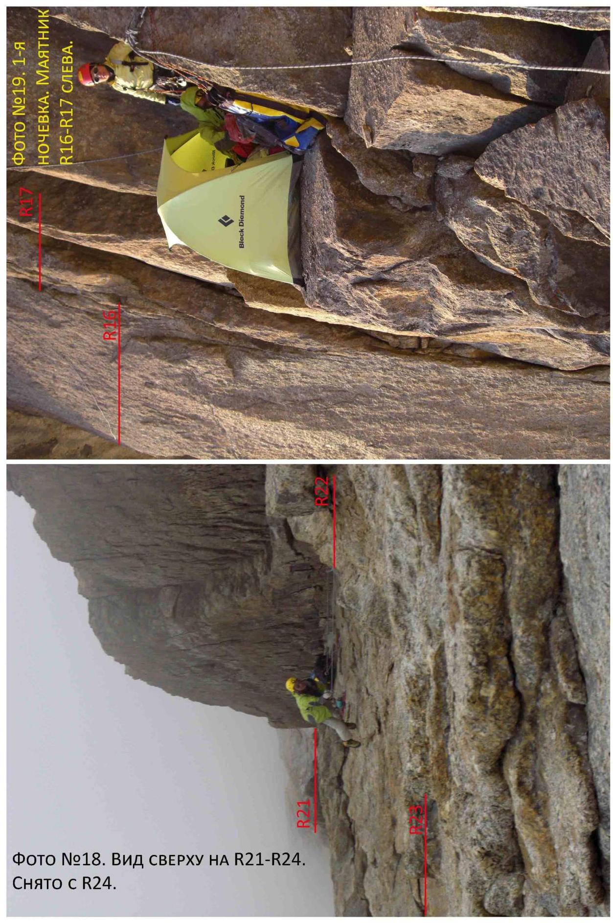
Photo #9. R21–R24. Large inner corner. Pendulum to bypass the huge cornice R22. Taken from the middle of R21–R22.
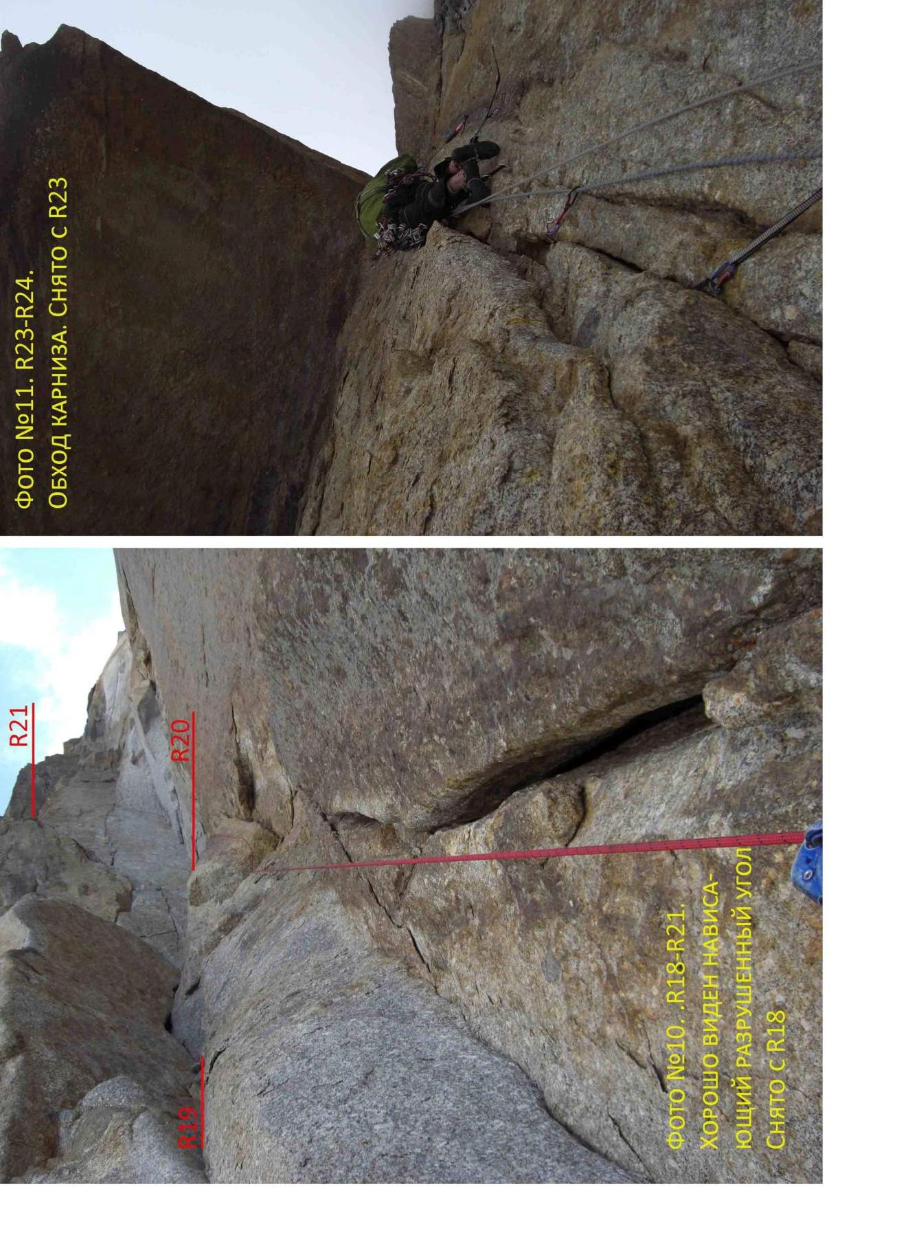
Photo #11. R23–R24. Bypassing the cornice. Taken from R23.

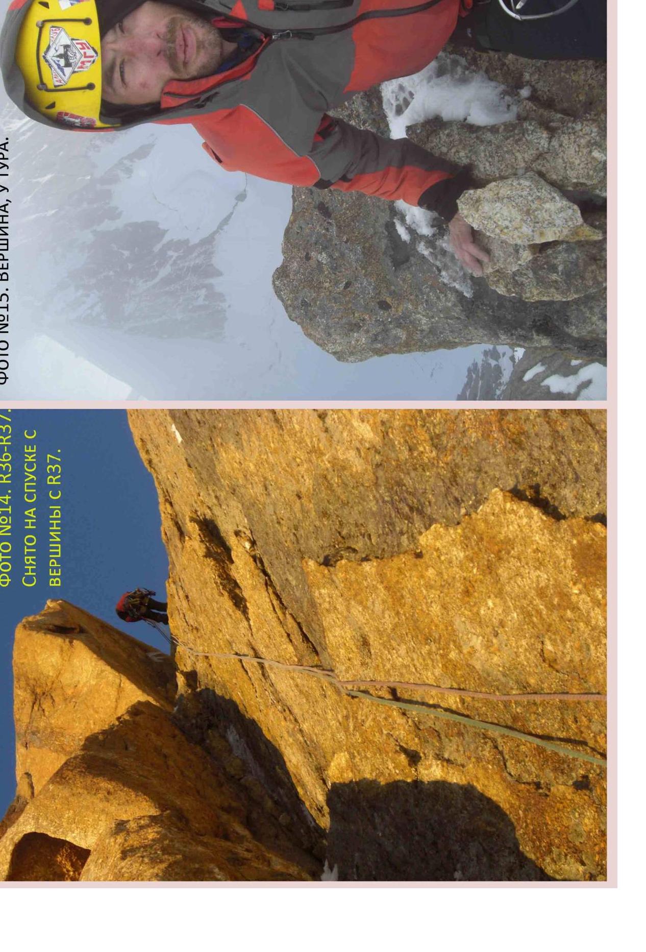
Photo #14. R36–R37. Taken on descent from the summit from R37.
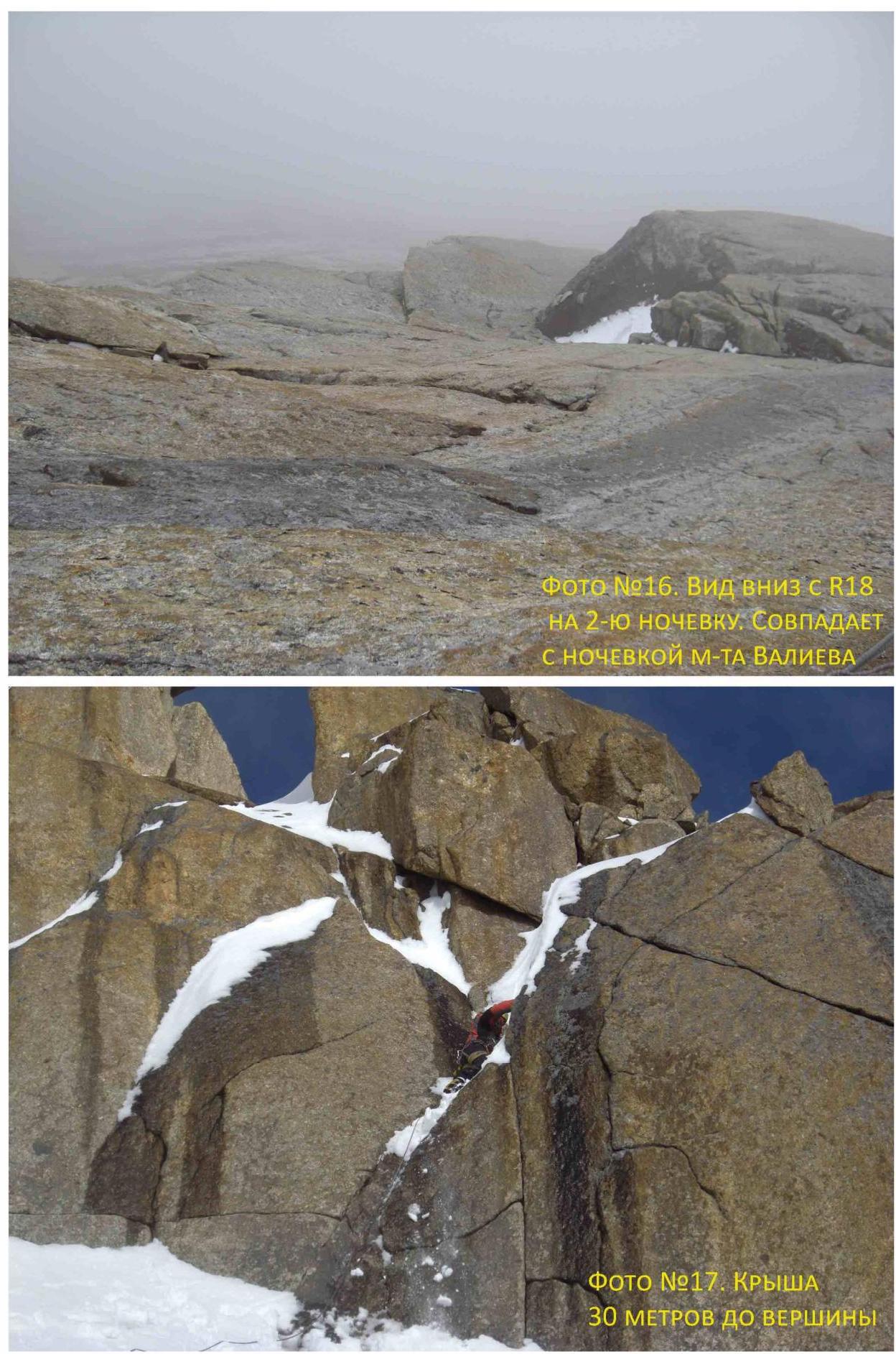
Photo #17. Roof 30 meters to the summit.
Approach
Peak Bloka is located in the Turkestan Range in the upper Laylyak valley, in its left tributary — Aksu valley. Approach:
- From Ozgurush village up the Laylyak valley.
- Further up the Aksu valley to the base camp at the site of the former Alay camp (5–6 hours).
From the base camp:
- Up the left bank of the Aksu river.
- Climb the moraine to the Aksu glacier cirque.
- Turn left and ascend along the stream flowing from the slopes of Peak Bloka.
- On the moraine to the right of the glacier tongue — camp (3 hours from BC).
Up the glacier to the West wall of Peak Bloka. Movement in the upper part of the glacier in rope teams 2–3 hours from the moraine camp.
General characteristics of the route
The route was first climbed by Alexander Maximenya in 2008 in good weather conditions in 10 days. The route starts 50 m to the left and below the West wall than the Valiev route — 6A (formerly 6B). The route runs parallel to the Valiev route at a distance of 30–100 m.
The route can be divided into 3 unequal parts:
- very complex West wall up to R27, where the route turns onto the key ropes of the Ginzburg route on the Northwest wall;
- complex Northwest wall R27–R39;
- simple short roof.
c by complexity, the route can be compared with the Valiev route, except that when turning from the West wall to the Northwest wall there are 60 m of average complexity climbing.
In comparison with other 6th category routes, I believe that this route is more complex than the Voronin and Dorro routes on Erydag, Zhiltsov on Iskander, Timofeev on Asan, much more complex than the Forostyan route on Chegem, Khokhlov on Sugan, Pogorelov on Asan. However, it is less complex than the Voronov route on Peak Odessa (4810). In general, we can say that the Maximenya route on Peak Bloka is a very complex 6A, almost 6B. For Shulgin M. it was the first 6th category route.
Several years ago, part of the wall collapsed on the Valiev route. Currently, the Valiev route is subject to constant rockfall and is objectively dangerous. Under these conditions, the Maximenya route is a good alternative.
Description by sections
R0–R3. From the bivouac in the depression under the wall, approach by a simple snow slope to the bergschrund. Cross the bergschrund (difficult). By a snow slope of medium complexity to a rock island adjacent to the wall, from the top of which the wall part of the route begins.
R3–R4. Crack for climbing and artificial aids. Large chocks and small friends go well. Water in the crack.
R4–R5. The crack becomes narrower. Mainly artificial aids on anchors and fifi hooks.
R5–R6. Overhanging inner corner. Throws. Anchors, fifi hooks. Some points are unreliable. Station to the left of the cornice.
R6–R9. Climbing the slab, move right around the corner by a traverse to the base of the chimney, further to a convenient ledge to the right of the chimney.
R9–R10. Descend to the start of the chimney. Along a vertical icicle about 20 m. Further, the chimney becomes easier, the ice ends. You can climb to the left, but it is much more difficult.
R10–R13. First, artificial aids in a narrow chimney filled with ice, then climbing an inner corner, further along a simple slab to the right to a large crack. Station at the base of the crack.
R13–R15. Wide overhanging crack, large friends. Further, the crack narrows, turns into an inner corner. Flaking scales in the crack, need to clean. 5 bolts, ears removed. Artificial aids.
R15–R18. Continuation of the inner corner. Not reaching the big cornice about 15 m, traverse climbing the slab along small ledges. Bolt in the middle of the slab. From the bolt, a pendulum to the start of the crack. Artificial aids along the crack to bypass the cornice. The crack is heavily littered, rough. At the level of the cornice, the relief is heavily destroyed. To the right and down from R17 — a ledge, convenient for a bivouac, which is easier to descend by rappelling from the R18 station.
R18–R19. Wide crack for large camalots (#3–5). Rough.
R19–R20. Traverse 2 m to the inner corner. Bolt. Artificial aids along the corner. Bolt. Further climbing into a niche under an overhang.
R20–R21. From the station left and up: first climbing, then artificial aids. Very difficult strongly overhanging crack. Very heavily destroyed, much had to be cleaned. There is a risk of dislodging stones on R17–R20. For me — the psychological key to the route.
R38–R39. Artificial aids along the wall with expanding cracks. Waterfall, ice in the cracks. Through the rib to the left, an inclined wall leads to the roof.
R39–R40. Along the simple roof (short walls are encountered) to the summit. Rocks in wet snow, under it ice. Avalanche danger. Crampons advisable.
Descent along the Northwest wall, then along the West wall between the Maximenya and Valiev routes. The start of the descent coincides with the Maximenya route (R40–R33).
The route was largely climbed using artificial aids. The team did not consider it possible to climb the route free climbing mainly because a significant part of the cracks for protection had to be thoroughly cleaned. The upper 2/3 of the route was climbed in strong bad weather, which also did not allow free climbing in rock shoes.
All key ropes on the route were climbed using artificial aids. The most difficult sections of the route: R5–R6 — overhanging inner corner, artificial aids on fifi hooks, anchors. R17–R19 — at first, the crack is heavily littered, many points are unreliable, artificial aids on large chocks. Then the crack becomes wide, and you need to either have several large friends or constantly remove camalot #4 from under yourself, moving it up. R20–R21 — the key to the route. Artificial aids on stoppers and small friends. Strongly overhangs, heavily destroyed, there is a risk of dislodging stones on other participants. R29–R31 and R36–R37 — very poor relief for artificial aids, as everything is in ice, but in good weather conditions and in the absence of rime ice, these sections should be climbed free climbing.
The first climber ascended on two ropes — main and 1/2, both used for protection of the first. The main rope was left for the belay, and 1/2 was used only for protection of the first. Shulgin M. led on R9–R15 and R22–R26. On all other sections, Ivanov A. was the first.
- 4 main ropes (2 dynamic, 2 static) 60 m
- 1/2 dynamic rope — 8 mm
Initially, the route was not equipped with skyhooks and a drill. Only bolts left by the author of the route were used.