35 pr. 537 i. 1.
27.0384
PASSPORT
-
CATEGORY — snow and ice.
-
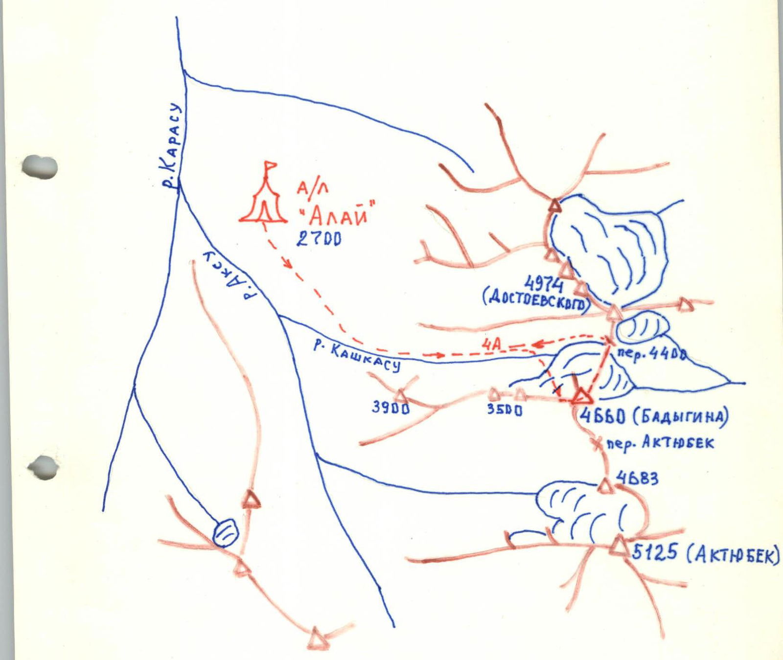
Pamir-Alay, Turkestan Range, Ak-Suu valley.
-
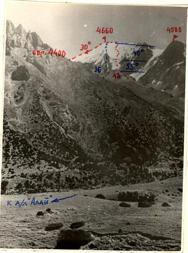
Peak 4660 m (Badygin) via the North face.
-
Presumed 4A category of difficulty, first ascent.
-
Height difference 760 m; total length 1100 m; length of 4th category of difficulty sections 310 m.
-
Average steepness of the route — 45°.
-
Average steepness of the key section 75–80° with a length of 30 m.
-
Pitons driven: a) For belays: Rock — 0 Ice screws — 15 b) For AID — 0 The route is snow and ice.
-
Travel hours — 6 hours to the summit; descent via 2A category of difficulty route (approximately) — 2 hours.
-
Overnight stays on the route were not done; places for overnight stays are available.
-
Group composition — a team of two:
KULIKOV Igor Vladimirovich, 1st sports category — leader KARIMOVA Olga Alexandrovna, 1st sports category — participant
Coach — KENSITSKY Leopold Vsevolodovich, Master of Sports of the USSR.
-
Departure to the route — August 13, 1983. Peak 4660 m — August 14, 1983. Return to "Alay" tourist center — August 14, 1983.
August 14, 1983.
| Section | Average steepness | Length | Nature of terrain | Cat. diff. | State of the route | Weather conditions | Pitons (rock / ice screws / chocks) | Movement type | Departure time |
|---|---|---|---|---|---|---|---|---|---|
| R0–R1 | 45° | 200 m | Firn gully | 3 | Dense firn, with frozen water flows | Frosty | 0 / 0 / 0 | Simultaneously | 8:00 |
| R1–R2 | 75–80° | 30 m | Ice slope | 1 | Exposed ice | Frosty | 0 / 4 / 0 | Alternately | |
| R2–R3 | 45° | 120 m | Glacier tongue | 3 | Ice, exposed or with white crust | Frosty | 0 / 4 / 0 | Alternately | |
| R3–R4 | 50–55° | 200 m | Glacier tongue | 4 | 0 / 5 / 0 | Alternately | |||
| R4–R5 | 40–45° | 430 m | Firn and ice | 3 | Firn. Ice in places, crevasses | Sunny | 0 / 0 / 0 | Simultaneously | 11:00 |
| R5–R6 | 50° | 60 m | Ice slope | 4 | Exposed ice | Sunny | 0 / 2 / 0 | Alternately | |
| R6–R7 | 25° | 200 m | Scree ridge | 2 | Slate ridge, firn in places | Sunny, windy | 0 / 0 / 0 | Simultaneously | 13:00 |
MAP-DIAGRAM OF THE "ALAY" TOURIST CENTER AREA