Ak-Su North
5217 m
Report
of the Tomsk Region team (TFA) on the ascent to Ak-Su Peak (N) via the N bastion of the wall, "6B", (c) third ascent
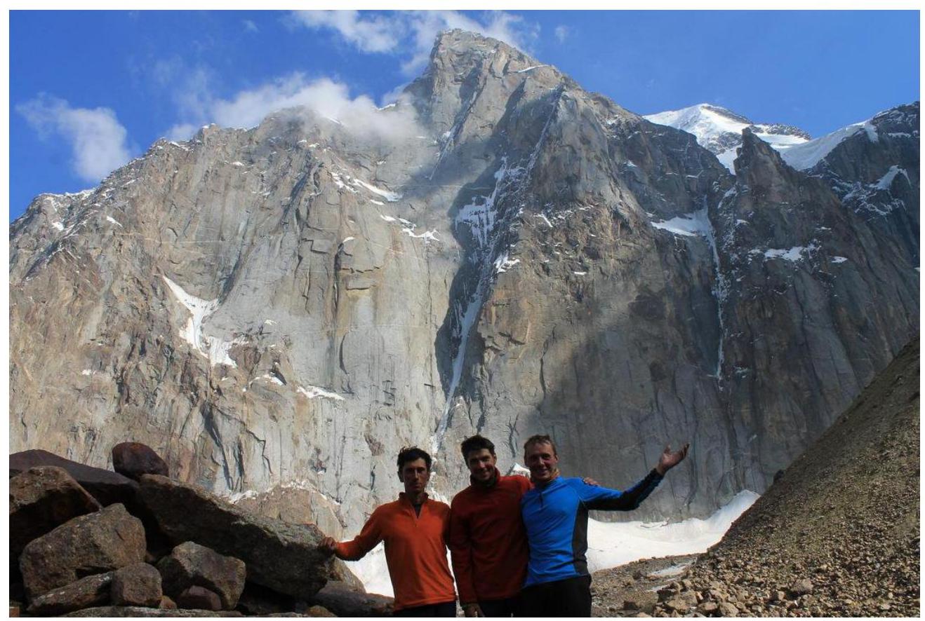
Participants: Temerev I.M., Kopytov F.A., Terekhin V.A.
Ascent Passport
-
Pamir-Alay, Ak-Su valley, 5.4.2.5e
-
Ak-Su Peak (N) 5217 via the bastion of the northern wall.
-
Third ascent, proposed 6B category of difficulty.
-
Route type: combined.
-
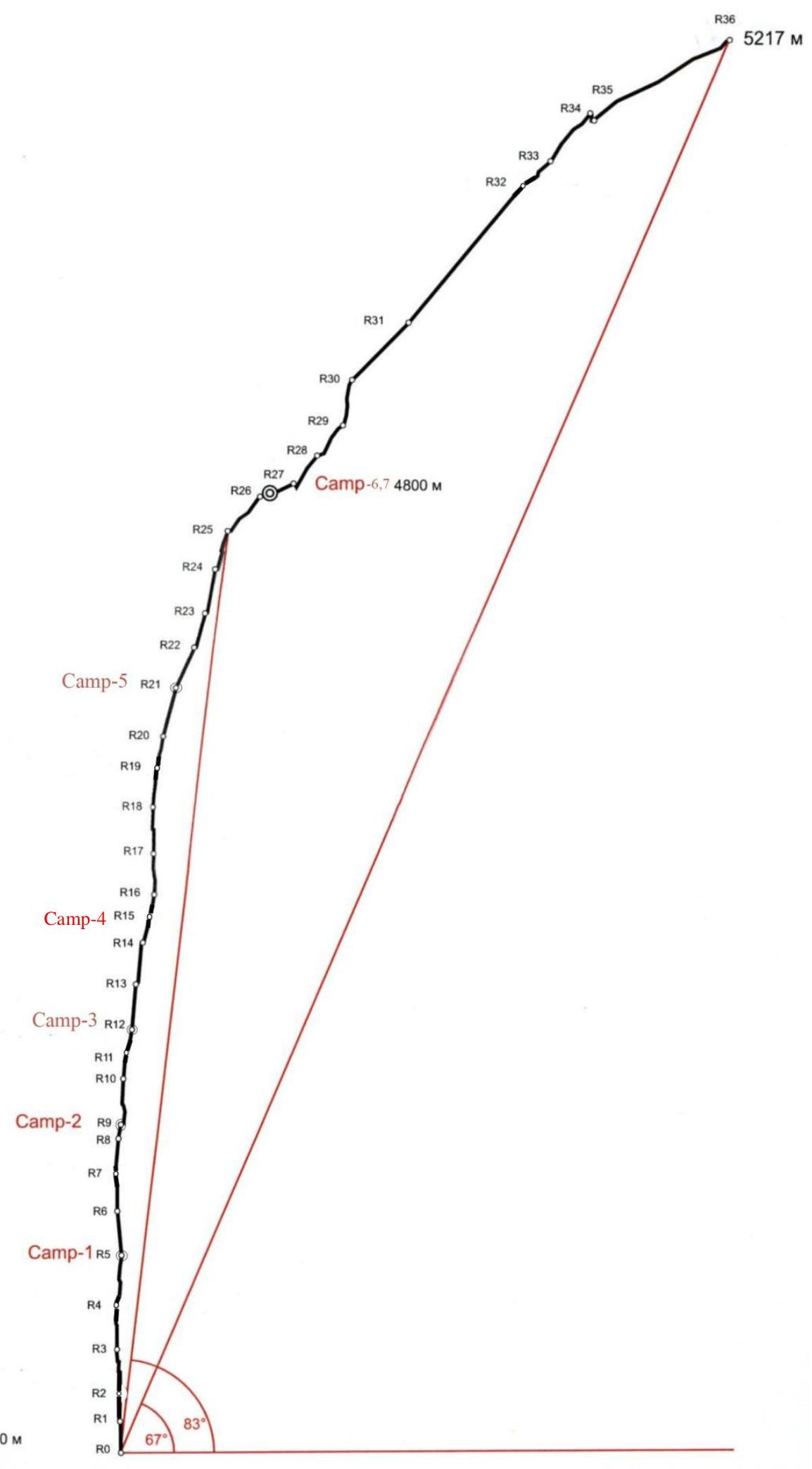
Route height difference — 1437 m (3780–5217)
Route length — 1848 m. Section lengths:
- V category of difficulty — 365 m
- VI category of difficulty — 855 m
Average steepness of the main route section (from R1–R3780 m to R30–R4920 m) — 83° Average steepness of the entire route — 67°
-
Hooks left on the route:
- Bolted hooks at overnight stays — 4 pcs., at the beginning of the descent via the bastion (Souz ledge bend) — 1 pc. Used hooks on the route:
- bolted station hooks — 52, including ITO — 42;
- bolts left on descent 2 pcs., pitons at overnight stays 5 pcs.;
- removable bolts — 6, including ITO — 6 pcs.;
- rock anchors, fifi hooks — 600 pcs., including ITO — 550 pcs.;
- total artificial support points (ITO) used — 920 pcs.
- on the wall section, only about 100 m were climbed free.
-
Team's total climbing hours: 101 hours, 9 days.
First two days were spent processing the lower 4 sections and overnight stay was on the moraine. 5 overnight stays on the wall platform. 23rd and 24th nights were spent on the Souz ledge (R26).
-
Team leader:
- Temerev Ivan Mikhailovich — MS
Participants:
- Kopytov F.A. — MS
- Terekhin V.A. — MS
-
Coach: Temerev I.M.
-
Departure to the route: 8:00, July 16, 2013 (16th and 17th August — days for processing the first 5 sections, departure on July 18, 2013)
Summit reached: 13:00, July 24, 2013 Return to the base camp under the wall at 18:00 on July 25, 2013
-
Organization: MROO "Tomsk Alpine Federation".
-
Report responsible: Temerev I.M.
E-mail: ivantem@ngs.ru, ICQ: 204984743, Skype: ivantem1979, phone: 9528823151.
Description of the Climbing Area
The Karavshin valley is geographically located in the Turkestan Range, west of the Matcha mountain node. Politically and administratively, it is in the Batken district, Osh region of Kyrgyzstan.
The Turkestan Range area (Pamir-Alay system) is an excellent place for fans of technically challenging ascents. There are many interesting routes here:
- From relatively simple
- To extreme
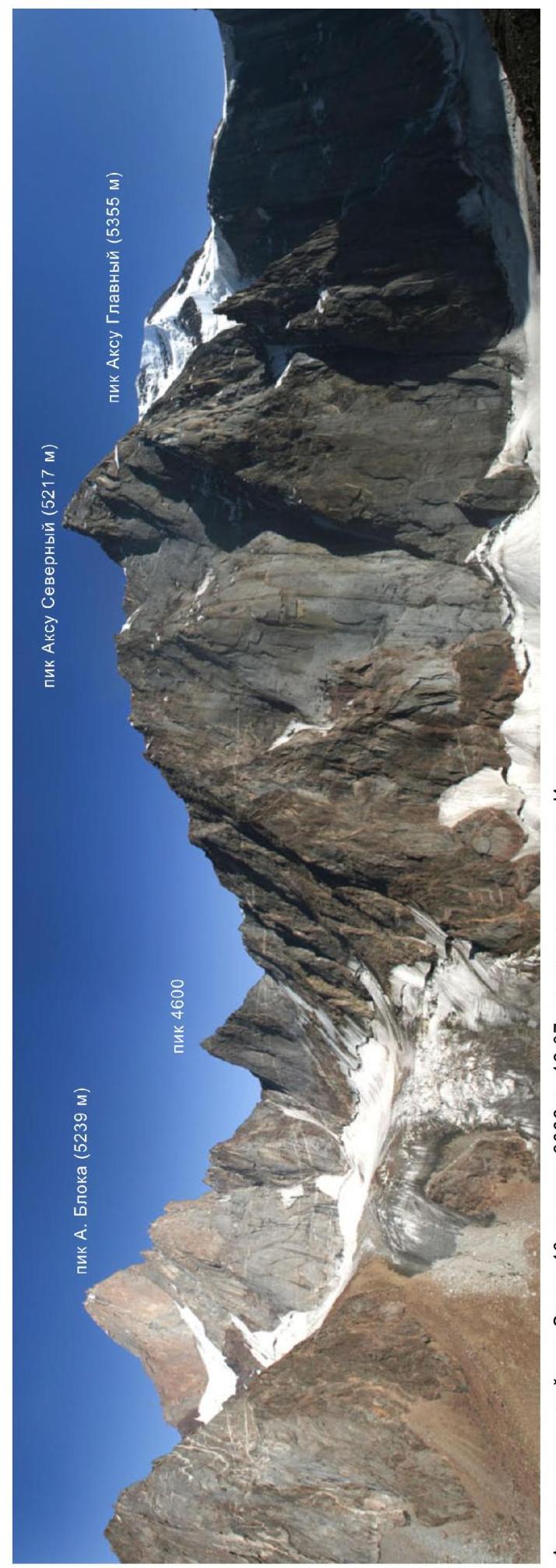
The peaks of the Lyaylyak valley mountain group form a rocky barrier, embracing the glacier like a horseshoe: from west to east — these are the peaks Iskander (5120 m), Petrogradets (5165 m), Admiralteyets (5090 m), Ak-Su (5355 m), A. Blok (5229 m), Atyubek (5125 m), Dostoevsky (4974 m). From the base camp at an altitude of 3000 m, it takes 2–3 hours to reach the upper reaches of the Ak-Su glacier. In the neighboring (to the west) Karasu valley, at the headwaters, there are peaks 5011 m, named after the 50th anniversary of the Moscow Spartak (4690 m), the northern spur from Vizbor peak (4655 m) to Dalniy peak (4457 m). Further west in the Uryam valley is the peak Sobaka (5300 m).
You can get to the area:
- By helicopter
- By car to the Uzguysh village, and then on foot, using horses for cargo transportation (18 km, 5–7 hours walk).

Explanations on the Category of Difficulty
The route was first ascended by a Ukrainian team in 2006 in 13 days and proposed as a 6B category route. The second ascent was made by a strong Irkutsk duo in 2008 in 11 days. Both teams have a wealth of experience in climbing big walls, and yet, "all participants of the ascent were impressed by the North wall of Ak-Su and noted not only its extent and grandeur but also the extraordinary technical difficulty of the route".
Despite the claims of the first ascenders that they were "helped by a good set of modern 'big wall' equipment, a diverse set of relief skyhooks and anchor hooks, which made it possible, albeit very slowly, to move along the system of small ledges, 'nailheads', and 'deaf' microscopic cracks without total use of bolt-hole technique", we claim that this is somewhat misleading. Undoubtedly, there are no bolt-ladder sections on the route if understood as total use of bolt-hole technique, but without relief and skyhooks, as well as removable bolts, there is absolutely nothing to do there. You can climb at 9b, but on smooth vertical slabs without relief under protection, moreover, covered with water, nothing new has been invented. The route is technically extremely challenging.
Our team managed to improve the time of the second ascent by 2 days, but it still took 9 working days! Comparative completion times for other routes:
- In 2011, we completed (the now classic) 6B via the Kritsuk route on peak 4810 in 4.5 days.
- In 2014, the same team completed the Kritsuk route on peak 4810 in Karavshin in 3.5 days.
- Here, on 6A, it took 9 days!
We insist that the complexity category of the V. Mогилы route via the center of the bastion on the North wall of Ak-Su (N) is 6B.
For example, here are comparative characteristics of some 6A and 6B routes in the Karavshin and Lyaylyak valleys:
- Karavshin, 6A route
- Karavshin, 6B route
- Lyaylyak, 6A route
- Lyaylyak, 6B route
| Peak, route | V category of difficulty | VI category of difficulty | category of difficulty | Route length | Height difference | Steepness° |
|---|---|---|---|---|---|---|
| 5.4.3. 23Z 6B Odessa center bastion of the left part of NW wall K. Sakharov, 94 | 290 | 1020 | 1640 | 1260 | 78 | |
| 5.4.3. 23G 6B Odessa center NW wall A. Kritsuk, 88 | 521 | 884 | 1546 | 1140 | 78 | |
| 5.4.3. 23A 6B Odessa (4810) center NW wall A. Voronov, 88 | 230 | 955 | 1450 | 1120 | 79 | |
| 5.4.3. 23V 6B Odessa center NW wall G. Kopeyka, 88 | 220 | 725 | 1425 | 1200 | 75 | |
| 5.4.3. 24V 6B Odessa center E wall and S edge A. Pogorelov, 99 | 375 | 708 | 1443 | 1050 | 78 | |
| 5.4.3. 24A 6B Odessa center E wall A. Klenov, 93 | data | |||||
| 5.4.3. 24B 6B Odessa center E wall A. Odintsov, 95 | 360 | 603 | n/a | 1050 | 78 | |
| 5.4.2. 7 6B Ak-Su (N) couloir N wall A. Moshnikov, 84 | 1115 | 273 | 2053 | 1407 | 70 | |
| 5.4.2. 7A 6B Ak-Su (N) center N wall V. Popov, 86 | 715 | 618 | 1718 | 1467 | 73 | |
| 5.4.2. 7B 6B Ak-Su (N) center N wall I. Chaplinskiy, 88 | 895 | 455 | 1930 | 1500 | 74 | |
| 5.4.2. 7V 6B Ak-Su (N) center N wall via "nose" P. Shabalin, 94 | 255 | 1350 | 1940 | 1467 | 75.5 | |
| 5.4.2. 7G 6B Ak-Su (N) center N wall A. Odintsov–A. Ruchkin, 96 | 400 | 900 | 1910 | 1517 | 76 | |
| 5.4.2. 7E 6B Ak-Su (N) "mirrors" center N wall A. Pugovkin, 2004 | 295 | 1215 | 1600 | 1420 | 72 | |
| 5.4.2. 5E Ak-Su (N), via bastion N wall V. Mогилы, 2006 | 365 | 855 | 1848 | 1437 | 83 |
Photo of the peak's general view
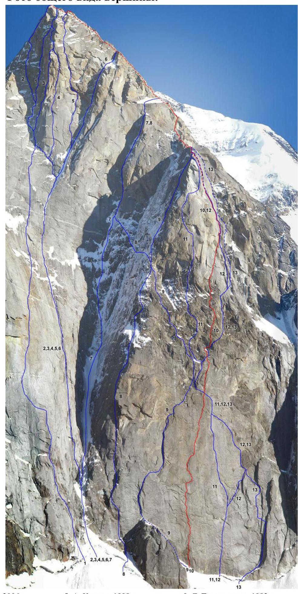
- A. Pugovkin, 2006
- V. Popov, 1986
- P. Shabalin, 1994
- I. Tukhvatullin, 2002
- A. Klenov, 1998
- I. Chaplinskiy, 1988
- A. Moshnikov, 1984
- Yu. Kostenko, 1988
- L. Troshchinenko, 1982
- V. Mогилы, 2006 (TFA team's route 2013)
- A. Klenov, 1996
- V. Pershin, 1988
- V. Vedernikov, 1986
Photo of the route profile
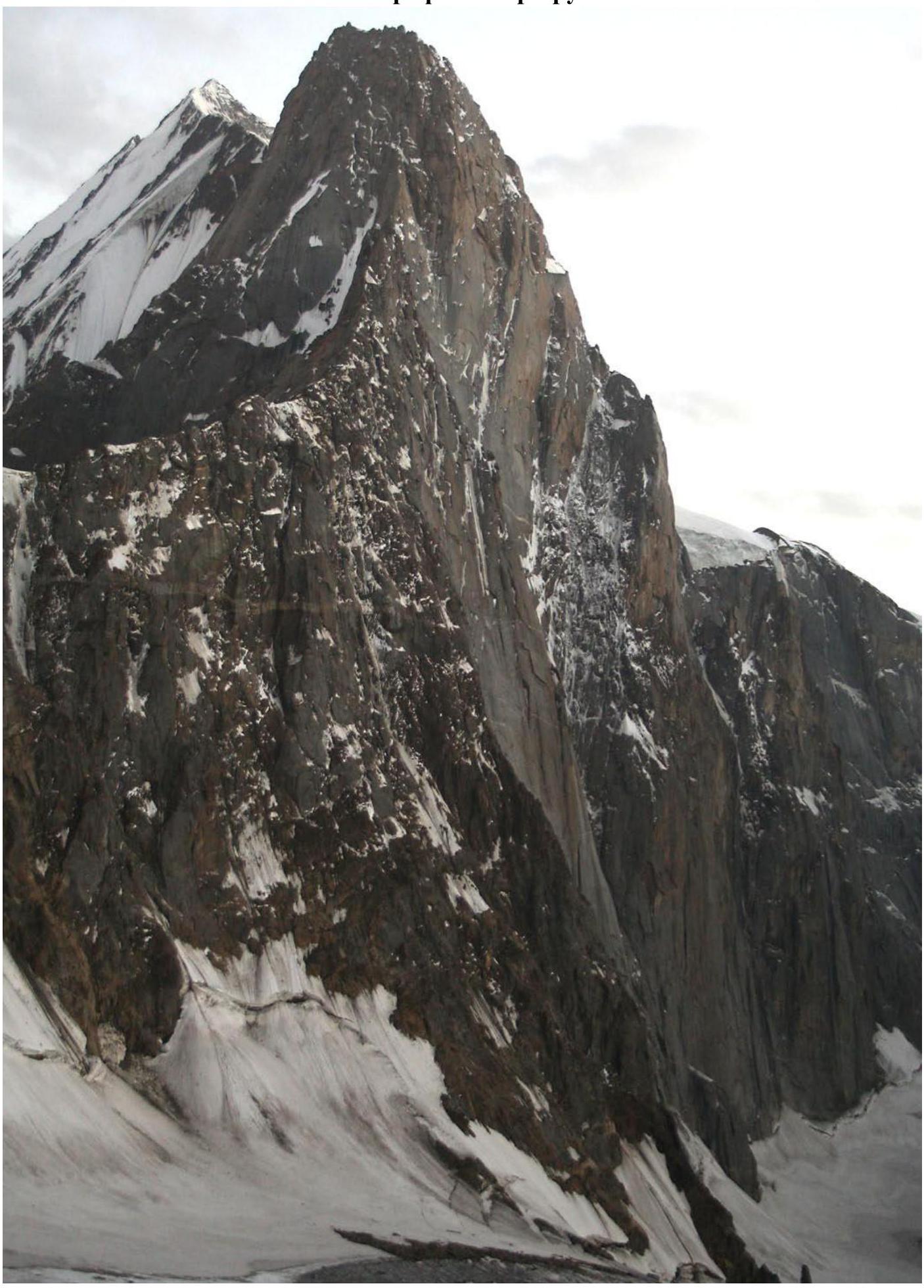
Photo of the wall profile on the left. Taken on July 25, 2006, 19:47, under Pik A. Blok.
Route profile (graph-scheme)
Photopanorama of the area
Photopanorama of the area. Taken on August 13, 2006, 16:37, from the slopes of Iskander peak.
Team's movement schedule by sections and weather conditions
- July 16, 2013 from 8:00 to 17:00 — processing sections R0–R3. Alternating lead between Kopytov and Temerev. Sunny. After 16:00, ice and rocks started falling down the wall.
- July 17, 2013 from 8:00 to 16:00 — processing sections R3–R4. Alternating lead between Kopytov and Temerev. Sunny. After 16:00, ice and rocks started falling down the wall.
- July 18, 2013 from 7:00 to 20:00 — climbing with a load through sections R0–R5, processing R6. Terekhin leads. Overnight stay at the beginning of R6 (pitons for platform). At the start of R5 on a sloping ledge, something falling from above crushed the Petzl ear. We thought it was a bad omen for the overnight stay (previous teams had stayed there). Sunny.
- July 19, 2013 from 7:00 to 20:00 — climbing with a load through sections R6–R9, overnight stay (pitons for platform). Temerev leads. Processing R10 (Kopytov). Sunny.
- July 20, 2013 from 7:00 to 20:00 — climbing with a load through sections R10–R12, overnight stay (pitons for platform). Kopytov leads. Processing R13 (Temerev). From R12 (important!), do not climb up to the ledge with a bolt and carabiner, but go right and up diagonally. R13 is heavily destroyed. On descent, a piton was hammered for descent, and an ear was left. Sunny. At the overnight stay, water was dripping from the ledge all night, and the tent was hit by a falling stone.
- July 21, 2013 from 7:00 to 20:30 — climbing with a load through sections R13–R15, overnight stay (pitons for platform). Terekhin leads. Processing R16, R17 (Terekhin). Variable cloudiness, occasional hail.
- July 22, 2013 from 6:30 to 22:00 — climbing with a load through sections R16–R21, overnight stay (pitons for platform). Temerev leads. Processing R22 (Temerev). Sunny. Thunderstorm and hail in the evening.
- July 23, 2013 from 7:00 to 20:00 — climbing with a load through sections R22–R26, overnight stay. Pitons hammered for descent, ear left. Kopytov leads. Processing R27–R30 (Kopytov). Sunny.
- July 24, 2013 from 5:00 to 13:00 — unloaded assault on the summit. At the assault camp on the "Souz" ledge around 18:00. Very cold until 10:00. Sunny and incredibly hot during the day.
- July 25, 2013 from 4:00 to 18:00 — descent via the ascent route. Very difficult diagonal rappels. Cut some rope for abseiling and left about 50 m of rope. Sunny, no precipitation.
| rock | stopper | bolt | Route scheme in UIAA symbols. Sheet-1 | № | length | category of difficulty | steepness° |
|---|---|---|---|---|---|---|---|
| 3 / 1 | 15 / 10 | 1 | R11 | 30 m | VI, A2 | 85 | |
| 8 / 7 | 18 / 12 | 2 / 1 | R10 | 50 m | VI+, A3 | 90 | |
| 2 / 1 | 6 / 2 | 2 | R9 | 15 m | V+, A1 | 80 | |
| 12 / 11 | 12 / 10 | 1 | R8 | 40 m | VI, A2 | 85 | |
| 8 / 8 | 12 / 8 | 2 / 1 | R7 | 40 m | VI, A3 | 90 | |
| 9 / 9 | 8 / 8 | 6 / 5 | R6 | 50 m | VI, A3 | 95 | |
| 7 / 4 | 19 / 10 | 3 / 1 | R5 | 55 m | VI, A2 | 85 | |
| 9 / 9 | 11 / 9 | 8 / 7 | R4 | 50 m | VI, A2 | 90 | |
| 10 / 10 | 16 / 14 | 4 / 3 | R3 | 50 m | VI+, A4 | 95 | |
| 8 / 8 | 8 / 8 | 4 / 2 | R2 | 30 m | VI, A3 | 90 | |
| 9 / 7 | 11 / 9 | 3 / 2 | R1 | 35 m | VI, A3 | 90 | |
| R0 |
| rock | stopper | bolt | Route scheme in UIAA symbols. Sheet-2 | № | length | category of difficulty | steepness° |
|---|---|---|---|---|---|---|---|
| - | - | - | R27 | 40 m | - | 20 | |
| 4 / 3 | 5 / 3 | - | R26 | 50 m | V, A2 | 50 | |
| 1 | 8 | - | R25 | 45 m | V+ | 75 | |
| 2 | 6 | - | R24 | 50 m | V+ | 80 | |
| 3 / 1 | 6 / 1 | - | R23 | 40 m | V, A1 | 75 | |
| 14 / 12 | 10 / 8 | - | R22 | 50 m | VI, A2 | 65 | |
| 8 / 8 | 14 / 12 | 1 | R21 | 55 m | VI, A2 | 75 | |
| 4 / 4 | 9 / 4 | 1 | R20 | 35 m | VI, A2 | 80 | |
| 6 / 2 | 11 / 10 | 1 | R19 | 45 m | VI-, A2 | 85 | |
| 8 / 7 | 12 / 11 | 1 / 1 | R18 | 50 m | VI, A2 | 90 | |
| 5 / 5 | 14 / 9 | 2 / 1 | R17 | 45 m | VI, A2 | 90 | |
| 3 | 6 | - | R16 | 25 m | V | 80 | |
| 1 | 7 | 1 | R15 | 30 m | V- | 75 | |
| 6 / 5 | 12 / 10 | 1 | R14 | 45 m | VI, A2 | 85 | |
| 9 / 5 | 12 / 10 | 1 | R13 | 50 m | VI-, A2 | 85 | |
| 3 / 2 | 9 / 4 | 1 | R12 | 25 m | V, A1 | 80 | |
| R11 |
| rock | stopper | bolt | Route scheme in UIAA symbols. Sheet-3 | № | length | category of difficulty | steepness° |
|---|---|---|---|---|---|---|---|
| - | - | - | N Ak-Su (5217 m) | R36 | 180 m | III | 30 |
| - | - | - | R35 | 8 m | descent | ||
| - | - | - | R34 | 70 m | IV | 50 | |
| - | - | - | R33 | 40 m | V+ | 45 | |
| - | - | - | R32 | 200 m | III–IV | 50 | |
| - | - | - | R31 | 90 m | III | 45 | |
| 6 / 4 | 10 / 5 | - | R30 | 50 m | VI/A2 | 80 | |
| 2 / 4 | - | - | R29 | 45 m | V | 50 | |
| - | - | - | R28 | 40 m | V | 50 | |
| - | - | - | R27 |
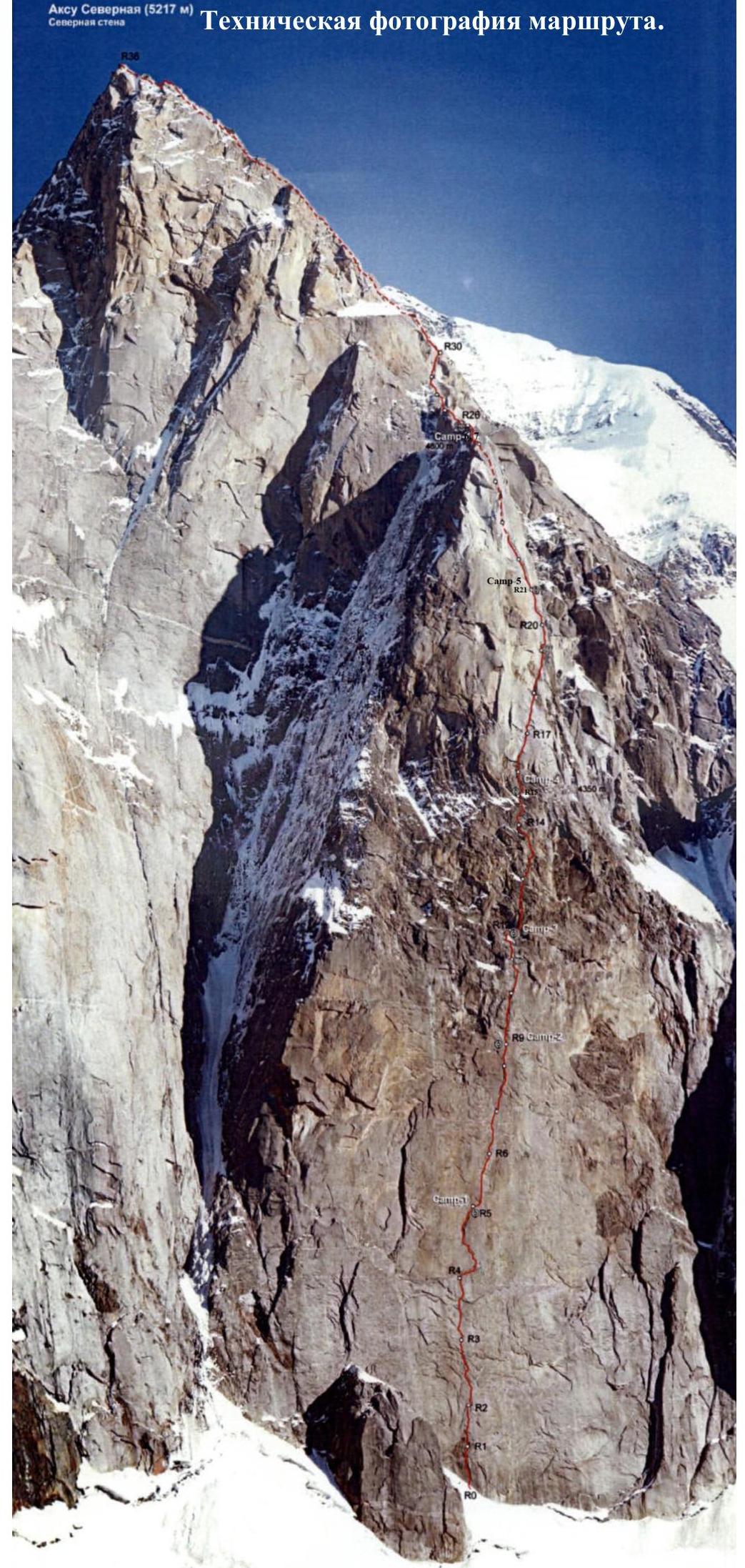
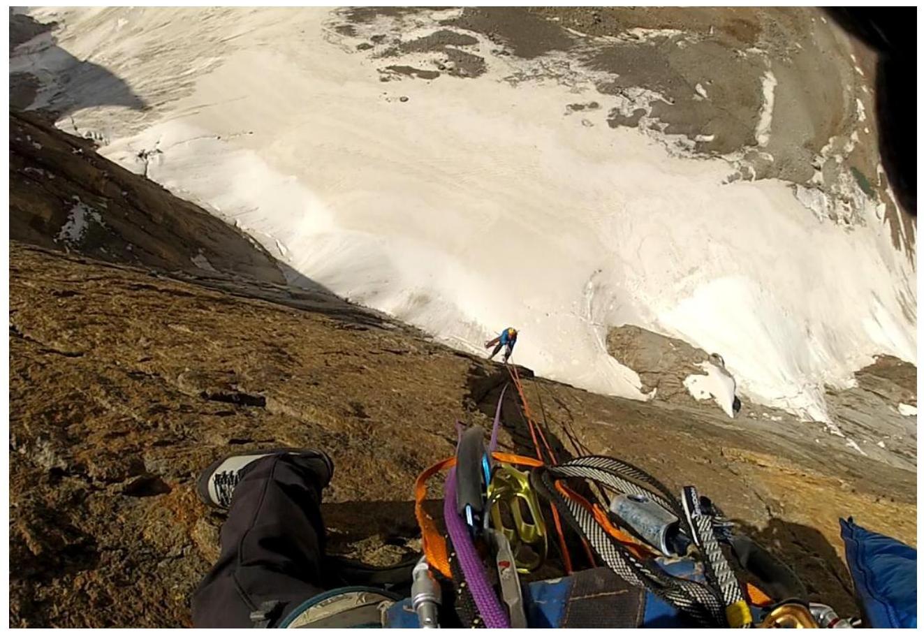
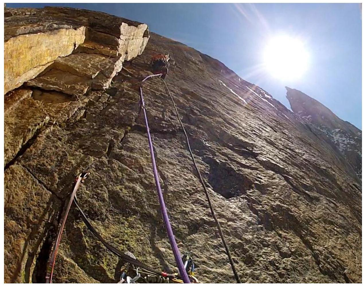
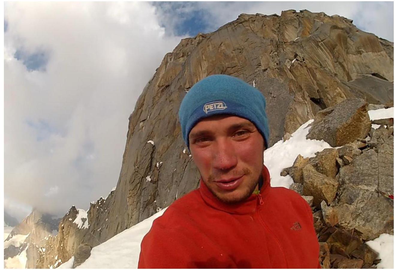
Photo illustrations
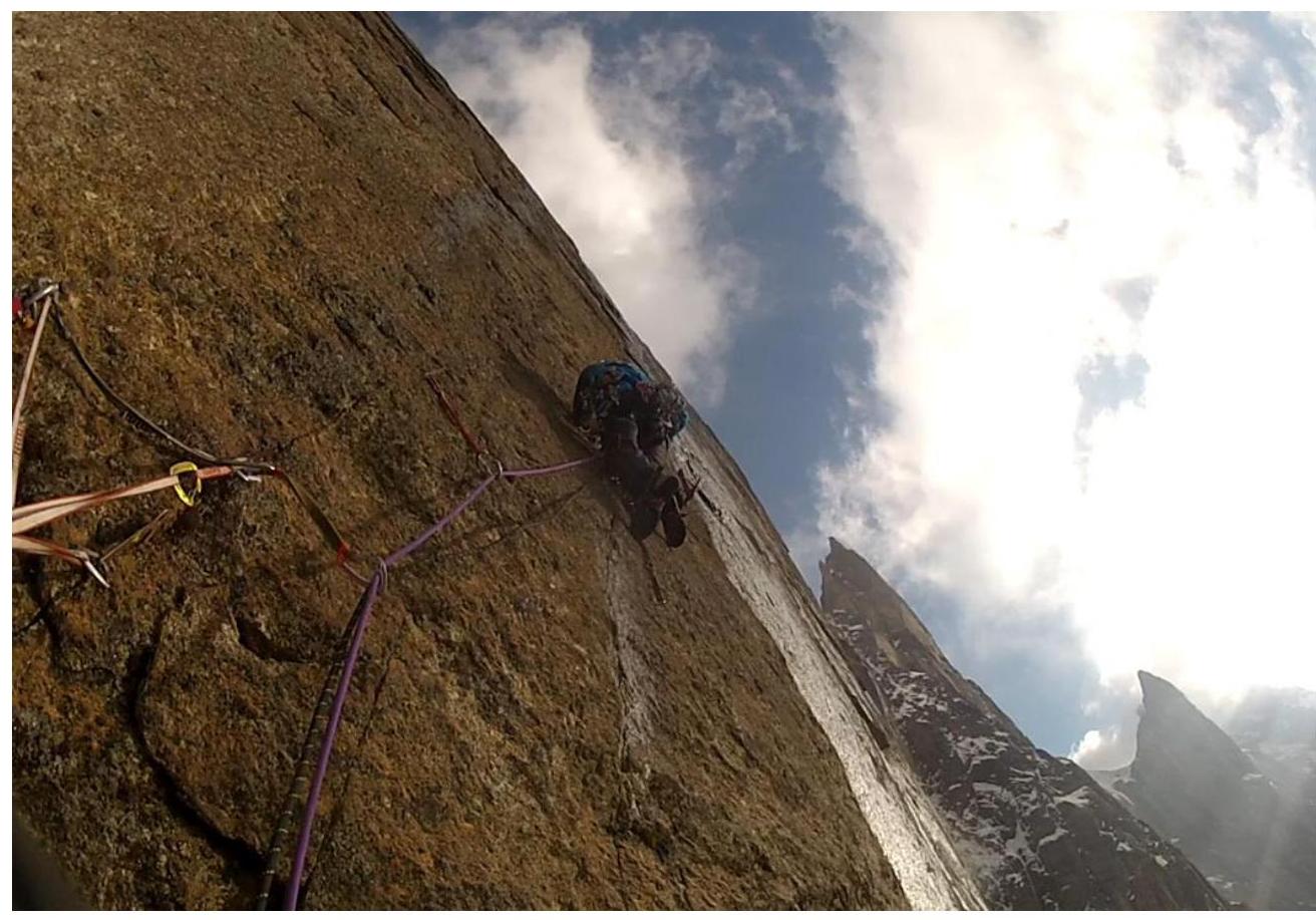
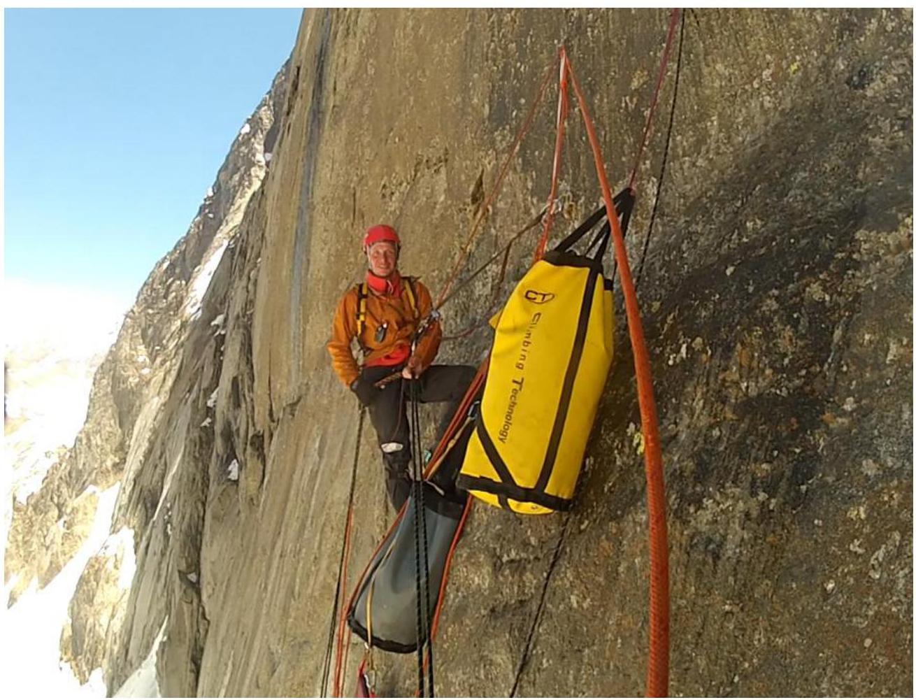
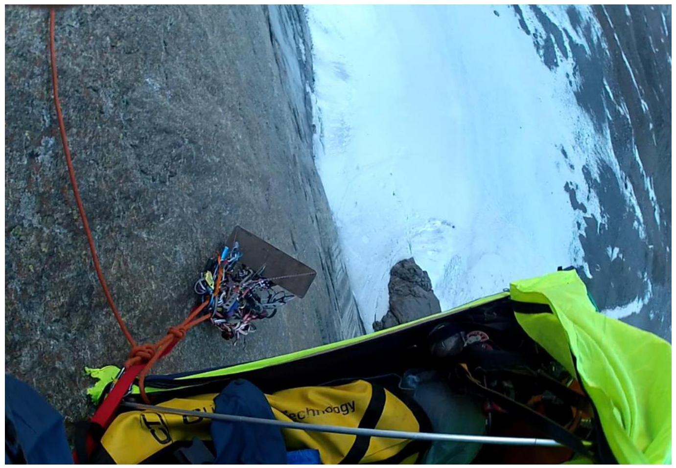
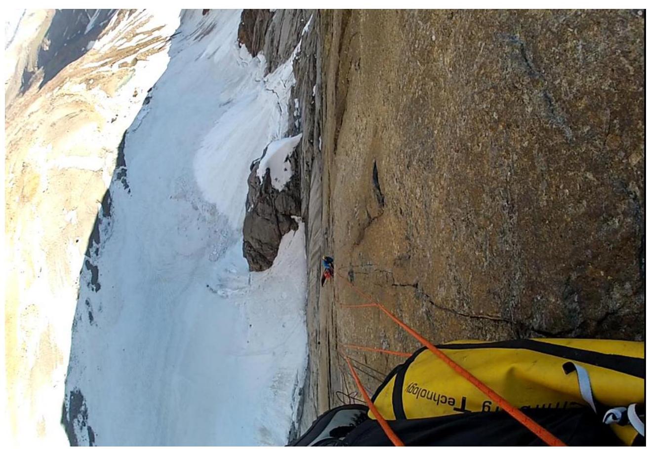
N Ak-Su (5217 m). Technical photograph of the route.
When climbing section R27, we irretrievably dropped the camera with all the route photos. The presented wall photographs are taken from GoPro video recordings. After R26, the camera battery finally died, and we dropped the spare one on the third overnight stay at section R12. Therefore, we have no illustrations after R26.
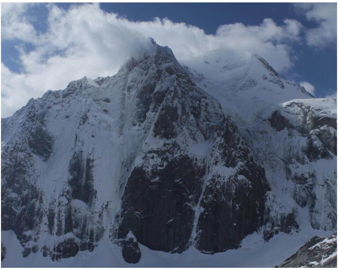
State of the Ak-Su wall before the start.
R3
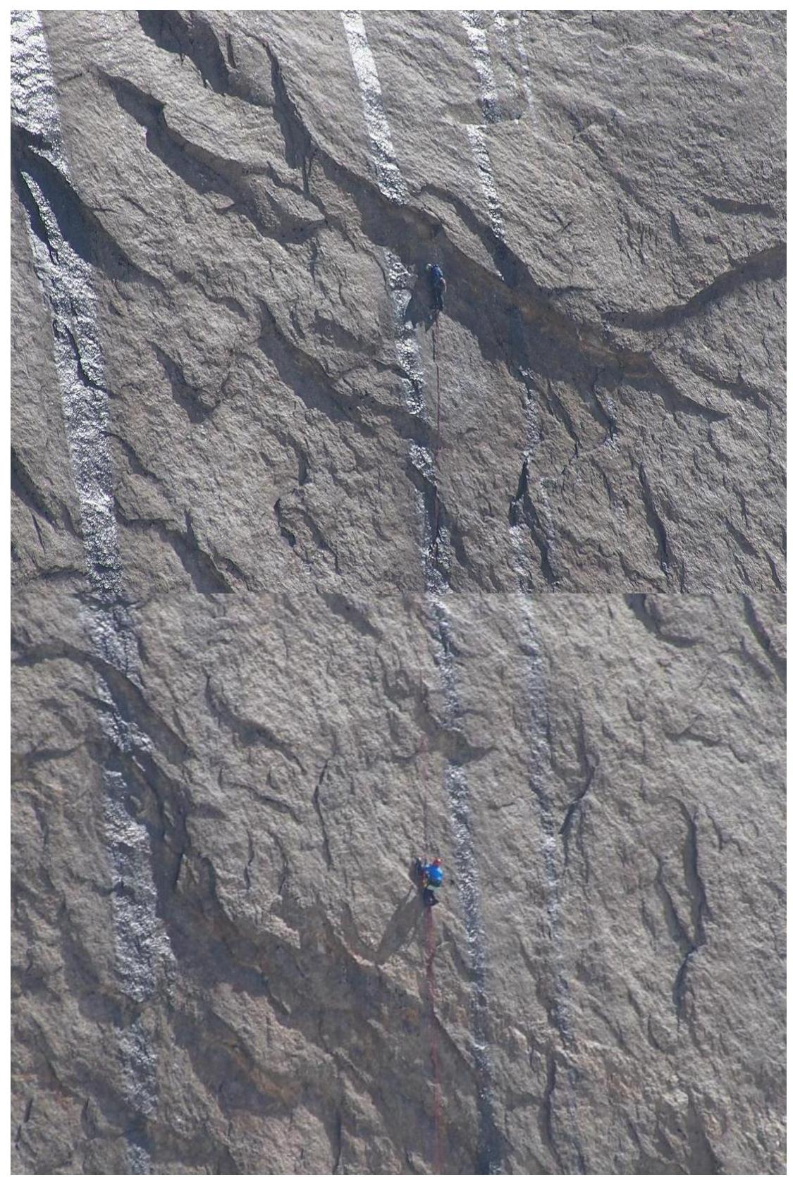
R6
Leaving the first overnight stay on R6
View of R5 from the first overnight stay.
View of R6
View of R8
R9
View from the "Souz" ledge to section R27.
Overnight stay on the "Souz" ledge (R26).

After descending from the route.