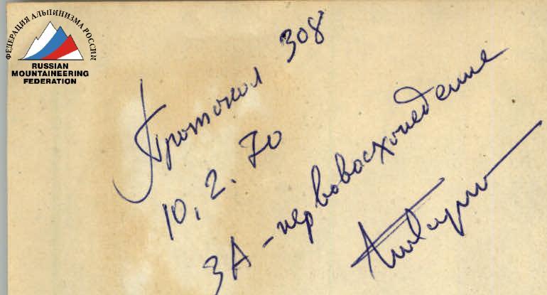
Protocol 308 10.02.1970 3A – first ascent
Description of the ascent route to the peak Belaya via the northwestern edge (first ascent)
Group composition:
- ZHGILEV A.V. (leader)
- ABLESIMOV V.E.
- GITERMAN B.P.
- GLADILIN A.S.
- MELNIKOVA R.N.
- PINAEV V.S.
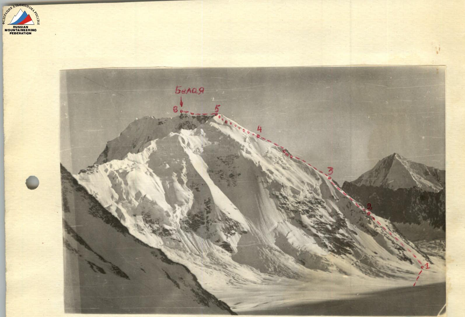
Photo 1. View of the peak from Matcha Pass
 The peak "Belaya" is located in the eastern part of the Zeravshan Ridge (Pamiro-Alai). To the east of it (see diagram 3) is the peak "Malaya Igla", to the west - an unnamed peak 5223 m. The height of the peak is 4700 m (by altimeter). It is clearly visible from Matcha Pass (see photo 1).
The group gathered in Arzamas-16, consisting of: ZHGILEV A.V. (leader), PINAEV V.S., MELNIKOVA R.N., ABLESIMOV V.E., GLADILIN A.S., GITERMAN B.P., having preliminarily assessed the ascent route to peak "Belaya" via the northwestern edge of 3A category of difficulty, completed the first ascent to the peak on August 6, 1969.
The route is mainly snow-ice. Small sections of heavily destroyed rocks are found in the middle part of the edge. The path from peak "Lozhnaya Belaya" (point 5 in photo 1,2) passes along a sharp, heavily destroyed rocky summit ridge. The condition of the route depends on weather conditions.
The group left the base camp on Matcha Pass on August 6 at 3:30, reached the summit at 11:00, and returned to the camp on the same day at 18:30.
The approach from the base camp to the start of the route (height 3600 m) takes 1 hour. The initial part of the route passes through two wide snow couloirs, separated by a snow-ice inflection (sections R1–R2, R2–R3).
Section R1–R2, with a steepness of 30°, is traversed in simultaneous motion in 1 hour. At the same time, ~400 m of height is gained. Further ascent is steeper (steepness 35°–40°), with a thinner upper layer of snow, requiring, along with simultaneous movement, alternating movement with belay through an ice axe. Section R2–R3 ends with an exit to open ice (about 40 m, steepness 40°–45°). This is one of the technically difficult sections of the route. Belay using ice screws is used. The ascent through sections R1–R2, R2–R3 takes a total of 2 hours 30 minutes and leads to the edge, leading to the summit ridge. The edge is mainly snowy, sharp, and rests against a gendarme consisting of loose, heavily destroyed rocks. The gendarme is bypassed on the right with an ascent along a steep, rockfall-prone couloir (1.5 ropes, difficult section). Movement is alternating. This takes 0.5 hours.
Further ascent is along the edge to point 4 (height 4430 m). Here, the 1st control cairn is laid. From the cairn, movement is to the right of the edge on snow with an exit to the summit ridge. Movement is simultaneous (section R4–R5). At the beginning of the summit ridge (height 4680 m, point 5) there is a fairly flat area.
From the east, a snowy edge approaches it (see photo 1,2). The group was here 5 hours after the start of the ascent and laid the 2nd control cairn.
The further path (section R5–R6) is along a sharp rocky, heavily destroyed ridge. This is a section of climbing using belay, through inflections. On the way, there are:
- 2 gendarmes, which are bypassed on the right.
The peak "Belaya" is located 40 minutes' walk from the beginning of the summit ridge ("Lozhnaya Belaya"). Its height is 4700 m. This is a pointed rocky peak with a gendarme in the form of a needle (see photo 1,3). From the east, an edge approaches it.
The descent is along the ascent path to point 4 (photo 1,2). Further descent is along a snowy couloir to the AHUN glacier (see photo 2). This path was chosen for reasons of a safer descent (thicker snow, less steep). The average steepness of the snow is 30°–35°. Movement is alternating with the installation of handrails. The descent takes 3 hours 30 minutes.
Classifying the route as a 3A category of difficulty, the group proceeded from the experience of ascents:
- traverse of Tyutyu-Bashi, 3B category of difficulty (Adyr-Su, Caucasus);
- peak Yuzhnaya Matcha (Pamiro-Alai, approximately 3B category of difficulty);
- peak "Malaya Igla" via the western edge (Pamiro-Alai, approximately 3A category of difficulty). In its nature, this route is closer to the traverse of Tyutyu-Bashi, longer, with a greater height difference, and more complex snow-ice work.
Recommended equipment for a group of 4 people
- Ropes 40 m — 2 pcs.
- Ice screws — 5–6 pcs.
- Rock pitons — 3 pcs.
- Pamir tent — 1 pc.
- Hammers — 2
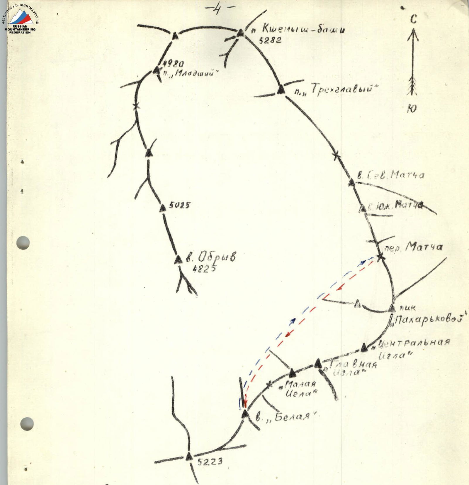
Fig. 3. Diagram of the ridges of the upper Zeravshan glacier

Photo 1. View from Malaya Igla Pass.
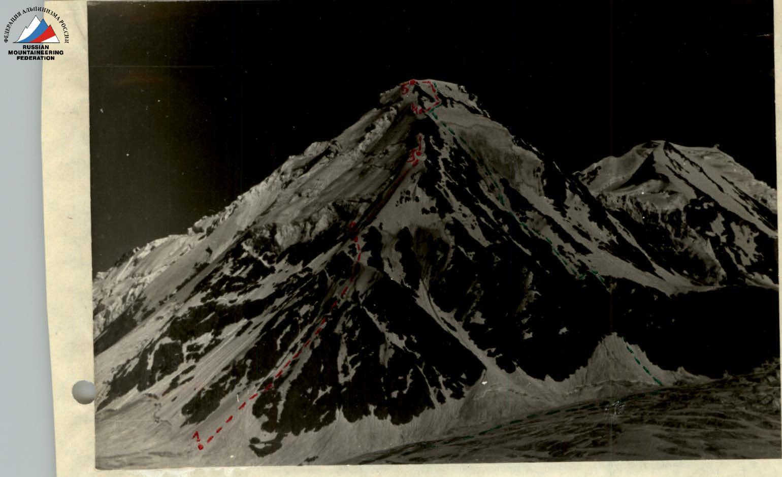
Photo 2. The route from the side of the Zeravshan glacier (Condition as of 1968).
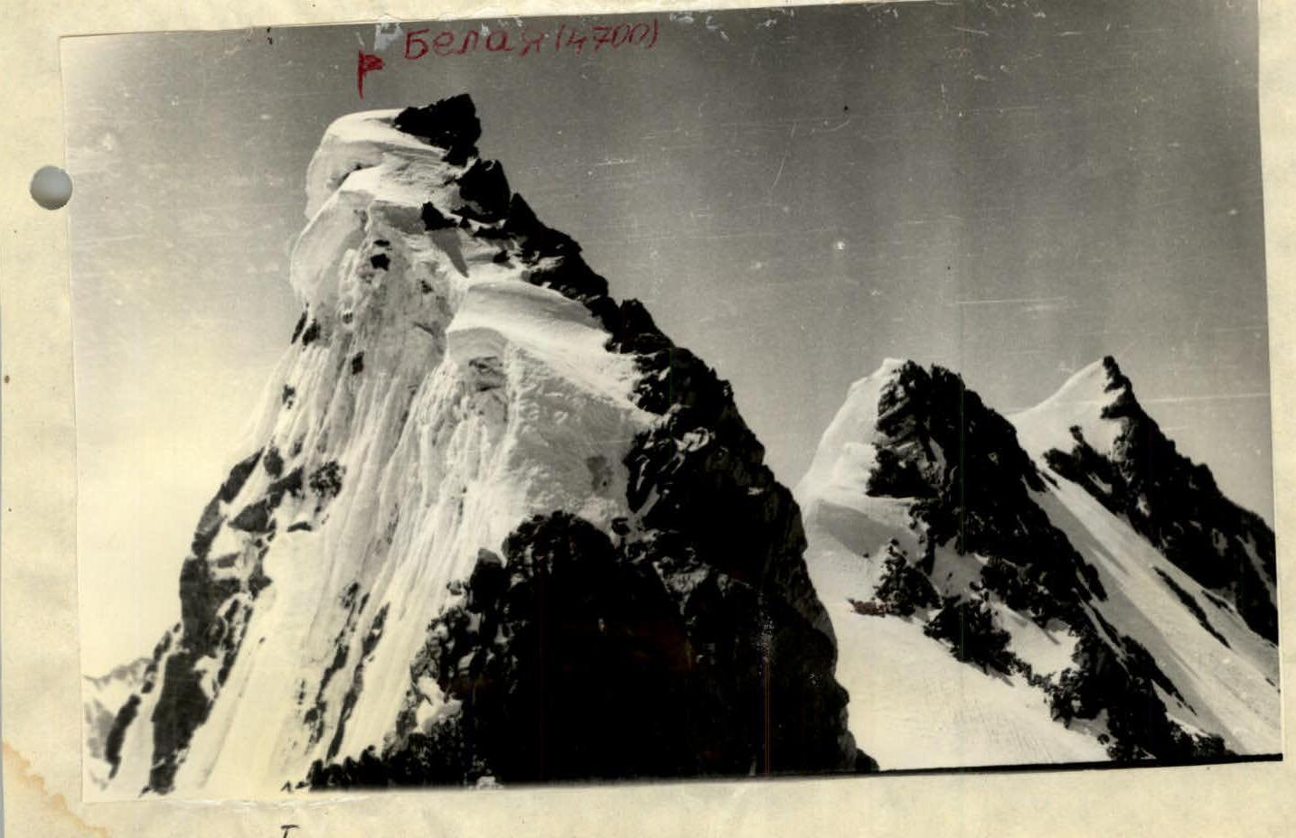
Photo 3. Peak Belaya