
Report
on the first ascent of the group from the Magnitogorsk Alpine Club to the summit 4292 m (“Peak of the Magnitogorsk Alpine Club”) via the southwest slope and west ridge
Leader of the first ascent in 2015: Sergey Soldyatov, e-mail: sswmgn@ya.ru, phone: 8-912-806-00-54
Coach: Sergey Soldyatov, e-mail: sswmgn@ya.ru, phone: 8-912-806-00-54
Ascent Passport
- Region: Pamir-Alai, Zeravshan Range.
- Summit: 4292 m (Proposed name “Peak of the Magnitogorsk Alpine Club”). Location: (39°13′30.3″ N 68°45′54.6″ E).
- Route: via the southwest slope and west ridge.
- Category: 3A, first ascent.
- Route type: rock.
- Elevation gain: 590 m
Route length: 1090 m, including:
- sections of category I: 640 m
- sections of category II: 350 m
- sections of category III: 100 m
Average slope of the main part: 54°, overall route: 23°
- Pitons left on the route: total 3
including bolted pitons: 0
- Team's total climbing time: 16.5 hours
Leader: Sergey Soldyatov — Master of Sports, acting 2nd category. Participants:
- Alexander Burzhinsky — 3rd sports rank
Roman Eliseev — 3rd sports rank
Anastasia Tonkareva — 3rd sports rank
Olga Filipova — 2nd sports rank
- Coach: Sergey Soldyatov — Master of Sports, acting 2nd category.
- Departure from Base Camp (“Archovoe Plateau”): 4:30 AM, August 25, 2015.
Route started: 7:30 AM, August 25, 2015.
Reached the summit: 12:55 PM, August 25, 2015.
Returned to Base Camp “Archovoe Plateau”: 9:00 PM, August 25, 2015. Descent via the ascent route.
- Organization: Magnitogorsk Alpine Club
- Responsible for the report: Anastasia Tonkareva, e-mail: as.tonkareva@mail.ru, phone: 8-982-334-38-96
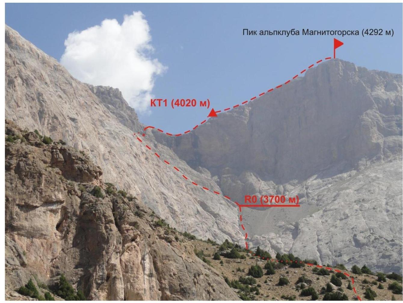
Photo 1. Overall photo of the route. July 24, 2015, 9:36 AM. Taken from Base Camp “Archovoe Plateau”. Approximate distance to the shooting point is 4 km.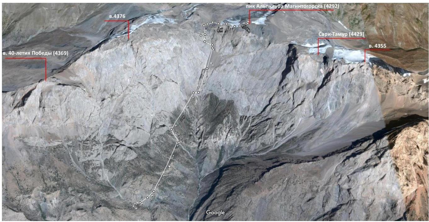
Photo 2. Panorama of the area. Created using Google Maps on September 19, 2015.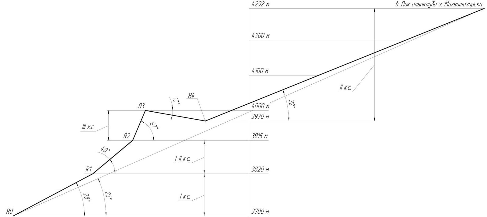
Route profile. Peak of the Magnitogorsk Alpine Club (4292 m)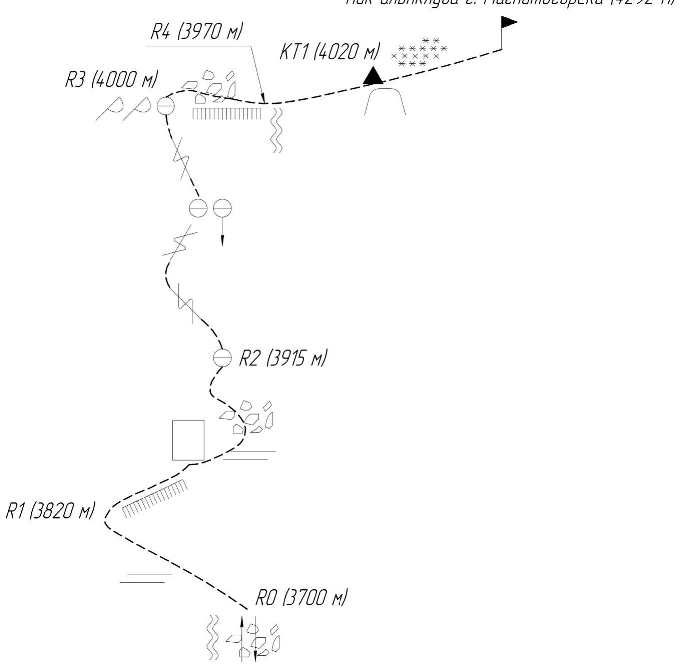
Route scheme in UIAA symbols
Brief Overview of the Ascent Area
The area where the first ascent to the unnamed peak 4292 m was made is located in the spurs of the Zeravshan Range, on the right side of the Yaghnob river valley, when moving downstream. The ascent area is called the Archovoe Plateau. It got its name due to the abundance of the arch tree (juniper) growing here in large quantities, forming impassable thickets in some places.
In summer, dry weather prevails in the area, as evidenced by the dry soil and, as a result, the absence of grass cover.
To get to the Archovoe Plateau, one needs to drive along the old M-34 highway towards the settlement of Zeravshan, passing through the Anzob Pass (3373 m). About eight kilometers from the village of Anzob (about two to two and a half kilometers before the turn to the village of Marzich), a trail begins on the right side. Initially, it goes up and to the right along a scree slope.
Overall, the trail does not have steep ascents or difficult sections, as it is used by locals to approach the upper summer pastures. In some places, the trail disappears on eroded scree slopes, but currently, signal cairns and terrain features formed as a result of long-term use by locals remain.
After a two to three-hour ascent, the trail reaches the Archovoe Plateau, offering a view of the peaks of 40th Anniversary of Victory and Sari Tamur. On the slopes of the plateau, there are small areas suitable for camping.
Despite the abundance of juniper in the area, firewood needs to be collected by venturing tens to hundreds of meters from the campsite. A stream serves as a water source and is located downhill. In summer, it becomes shallow, so one needs to find a suitable spot to collect water. It is recommended to boil water before consumption, as livestock grazing on nearby slopes come to the stream.
At the foot of the peak 40th Anniversary of Victory lies the Psoras nomadic camp, where women and children reside. The locals are friendly and hospitable. When visiting this area, bring gifts for the locals, as well as essential items such as:
- water containers
- rope
- flashlights
- batteries
- etc.
During the first ascent, the unnamed peak 4292 m was named “Peak of the Magnitogorsk Alpine Club”.
Route Description
From the Base Camp (B.C.), head north along the upper trail towards the upper waterfall, through the juniper forest.
Attention! After 30–40 minutes of walking, the path intersects a huge canyon with vertical rock walls. There are only two passages:
- One is on the left at the beginning of the canyon, along the base of the wall. The passage is possible but not recommended.
- The second passage is where the canyon abruptly turns into an 80-meter waterfall. A trail leads to this spot. Moving to the right along a scree shelf, enter the canyon, carefully navigating through scree and rocks, using a rope for insurance if necessary.
Continue up the canyon for about 30–40 minutes until reaching a large white rock. Here, the first logical exit is to the right, up a couloir, onto a grassy slope.
About two hours after leaving the B.C., approach the rocks. Leaving the couloir on the left, move along the rocks, using simultaneous insurance if necessary, to reach a large scree slope (Photo 3). Moving along the scree slope, following a stream, reach the start of the route (point R0, see Photo 3, 3700 m).
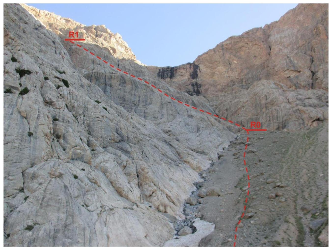
Photo 3. Route line from the start to the first control point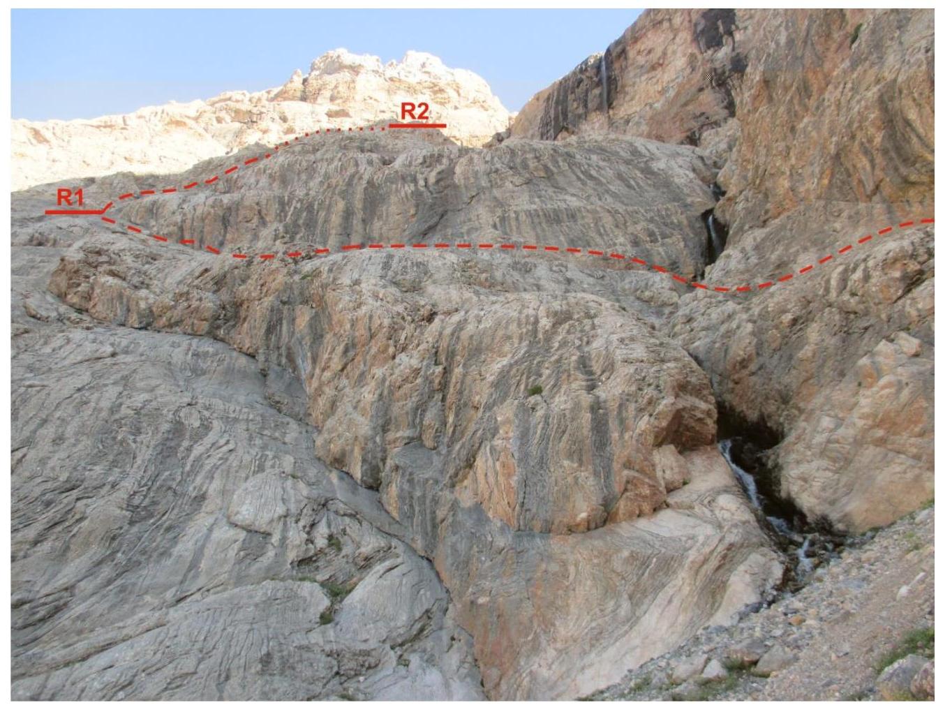
Photo 4. View from the start of the route
From the start of the route, move left, ascending rocks to a waterfall, cross it at a convenient spot, and continue up the rocks with simultaneous insurance to the first control point (Photo 4).
After the control point, continue moving:
- right along the rocks;
- then along the scree slope, turn right;
- moving along a loose shelf, find a logical exit upwards to the left, from where the waterfall will be visible.
Here begins the key section of the route (R2–R3, Photos 5, 6). Ascend via the second crack from the left of the waterfall to the ridge, using alternate insurance with two ropes. From control point R3, carefully move along the scree slope to the waterfall (R4, Photo 5).
From the waterfall, along the scree slope and snow, reach control point КТ1 and continue to the summit (Photos 7, 8).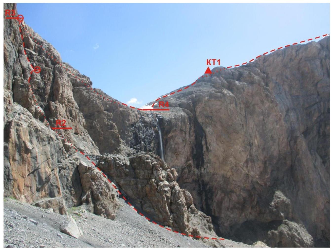
Photo 5. View of the key section (R2–R3) of the route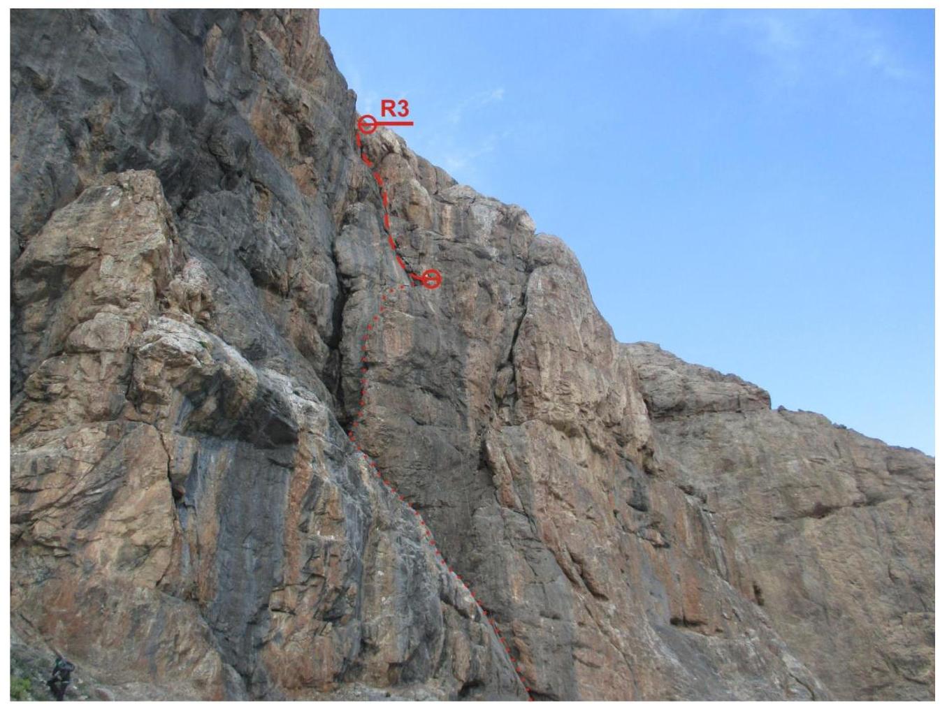
Photo 6. View of section R2–R3 from control point R2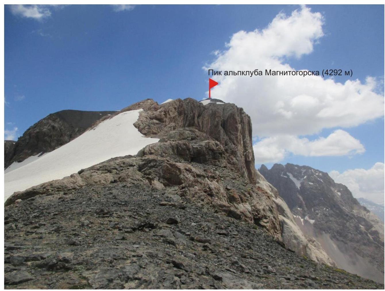
Photo 7. View of the summit from control point КТ1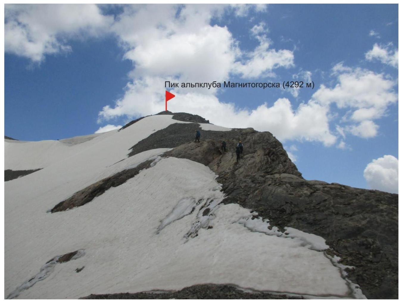
Photo 8. On the way to the summit
Descent is via the ascent route. From the summit, carefully descend to the station to begin rappelling (Photo 9), with simultaneous insurance possible. The overall view of the descent section is shown in Photo 10:
- the first part is 30 m;
- the second is 50 m to the scree slope.
Two pitons and a cordelette are left at the first station, and a cordelette is left at the second. When choosing a spot for rappelling, carefully examine the terrain, which is well visible from control point КТ1.
Attention! The return route is strictly along the ascent path through the meadows and juniper forest. Do not take the false path downhill along the stream — it's a trap. You will have to return. The bitter experience of the first ascenders.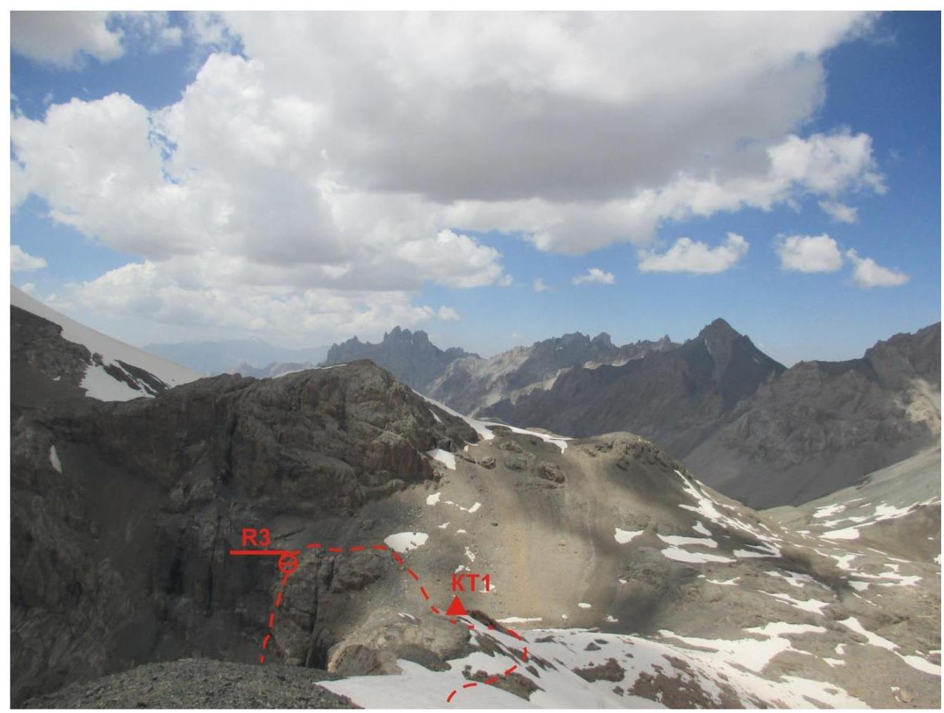
Photo 9. Descent to the rappelling spot. View from the summit.
Photo 10. Overall view of the descent — rappelling
Comments
Sign in to leave a comment