Ascent Passport
-
Rock climbing category
-
Fann Mountains, Zeravshan Range, Alauddin valley
-
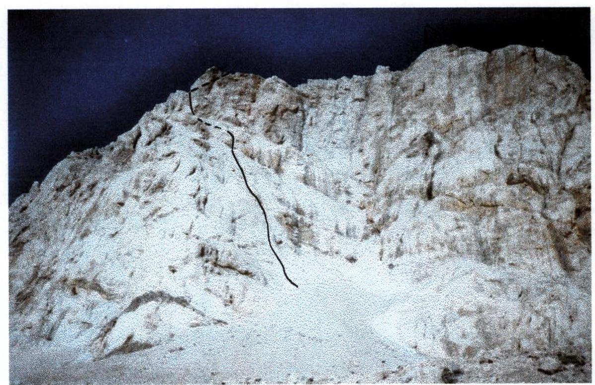
p. Zamok, 5070 m, via West wall, Ilyin V. route
-
Difficulty category: 5A
-
Elevation gain: 650 m.
Distance: 1330 m. Average slope of the main part of the route 52° Length of sections with 5–6 difficulty category: 300–350 m.
-
Pitons driven: rock: 0 nuts: 40 friends: 32
-
Team's climbing hours: 29 h 30 min
-
One overnight stay.
-
Team leader: Shyrina Elena Nikolaevna, 1st sports category Team member: Logvinenko Vitaly Mikhailovich, 2nd sports category
-
Coach: Plotnikov Valery Grigorievich, Master of Sports
-
Approach: August 22, 2002
Departure for the route: August 23, 2002 at 6:30 AM Summit: August 24, 2002 at 10:00 AM Return: August 24, 2002 at 6:00 PM
p. Zamok (5070 m)
General photo of the summit
Release for the ascent
The team's release for the ascent was carried out in accordance with the "Mountain Climbing Rules".
Releasing officer: Arefieva Rufina Grigorievna, Master of Sports, 1st category instructor.
The control deadline was set at the rescue team of MATC "Alauddin-Vertical".
Team's tactical actions
Familiarized ourselves with the route description and received consultation at MATC "Alauddin-Vertical".
On August 22, we approached the route and spent the night on the "pedestal" below the route. On August 23, at 6:30 AM, we left the campsite. The weather was good. Despite our intentions to complete the route in one day, we took all necessary gear for a possible overnight stay.
The first climber went with a lightened backpack. Both wore rock climbing shoes. The entire route was climbed using free climbing without the use of artificial climbing aids.
At 5:00 PM, we were forced to stop for the night due to deteriorating weather conditions (rain). On the morning of August 24, we resumed climbing at 7:00 AM. At 10:00 AM, the team reached the summit. We began our descent at 10:10 AM. By 12:00 PM, we had descended to the overnight stay location.
Route scheme in UIAA symbols
| Sections in UIAA symbols | Distance (m) | Difficulty category | Slope (in degrees) | Section | Notes |
|---|---|---|---|---|---|
| 5070 m | |||||
| 250 | 1 | 5 | R19 | ||
| 100 | 2 | 30 | R18 | ||
| 4^+4^+ | 50 | 3 | 20 | R17 | |
| 40 | 3 | 45 | R16 | ||
| 20 | 5 | 75 | R15 | ||
| 30 | 3 | 20 | R14 | ||
| 80 | 2 | 20 | R13 | Overnight stay | |
| 80 | 3 | 40 | R12 | ||
| 40 | 3 | 35 | R11 | ||
| 35 | 5 | 55 | R10 | Control point # 3 | |
| 100 | 4 | 35 | R9 | ||
| 60 | 5 | 35 | R8 | ||
| 40 | 3 | 35 | R7 | ||
| 60 | 4 | 60 | R6 | Control point # 2 | |
| 10 | 5–6 | 80 | R5 | ||
| 40 | 4–5 | 65 | R4 | ||
| 80 | 5 | 65 | R3 | ||
| 30 | 3 | 60 | R2 | ||
| 90 | 3–4 | 35 | R1 | Control point # 1 | |
| 80 | 3 | 30 | R0 |
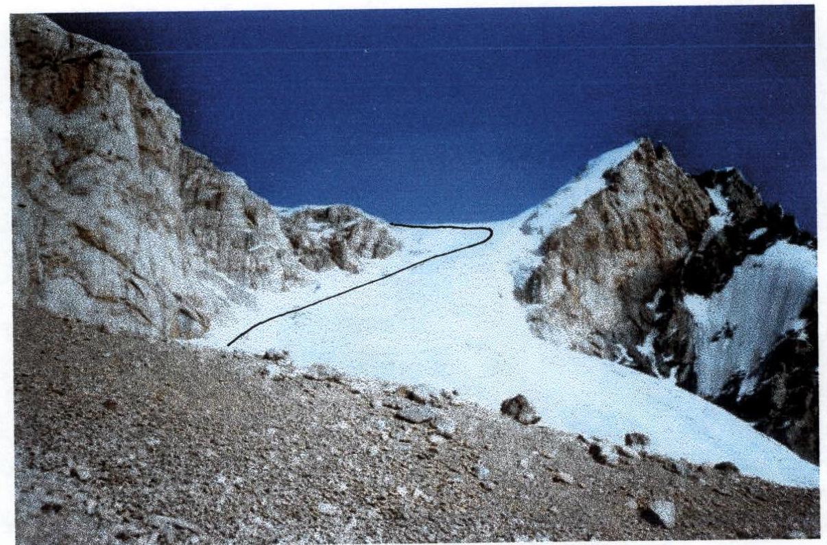
Descent
Descent towards p. Paykhamber via black slab scree for about 500 m. Bypass the rocky gendarme on the right, descend lower, then ascend back to the ridge. Reach the saddle between p. Zamok and p. Paykhamber. From the saddle, descend down the ice (do not turn into the scree couloir earlier). Cross the glacier from left to right downwards. Be cautious, there are crevasses. From the glacier, descend to the right via scree to the overnight stay location.