Ascent Log
-
Technical category.
-
Pamir-Alay, Zeravshan Range, Fann Mountains, northern part.
-
Peak "Bodkhona", 5138 m, 5B category of difficulty via the North-Western Counterfort, G. Gulnev 1967.
-
Route type: rock.
-
Route elevation gain: 1440 m (by altimeter); route length — 2940 m; length of sections with V category of difficulty — 250 m; VI category of difficulty — 130 m; average steepness of the main part of the route — 55–60°, (up to Gulnev's shoulder); entire route — 45°.
-
Hooks left on the route: 0.
Hooks hammered on the route:
- Bolted: 2* / 1*
- Rock: 8* + 10 / 2
- Chocks: 2* + 84 / 5
- Ice: 12
* — previously hammered hooks used. (Used for belay point) – (Used for artificial climbing aids)
-
Team's climbing hours: 44 hours, 4 days.
-
Overnights:
- 1st ( bivouac) — platform on the counterfort's spur.
- 2nd (bivouac) — comfortable platform on a shelf.
- 3rd (bivouac) — comfortable platform on Gulnev's shoulder.
-
Leader: Lebasov Evgeny Mikhailovich, 1st sports category.
Team members:
- Shiriaeva Elena Nikolaevna, Candidate Master of Sports.
- Tulaev Denis Nikolaevich, 1st sports category.
- Drakin Andrey Valentinovich, Candidate Master of Sports.
-
Coach: Novoselova Galina Vladimirovna, 1st sports category.
-
Departure to the route: 6:00, August 15, 2005. Summit ascent: 10:30, August 18, 2005. Return to Base Camp: 17:00, August 19, 2005.
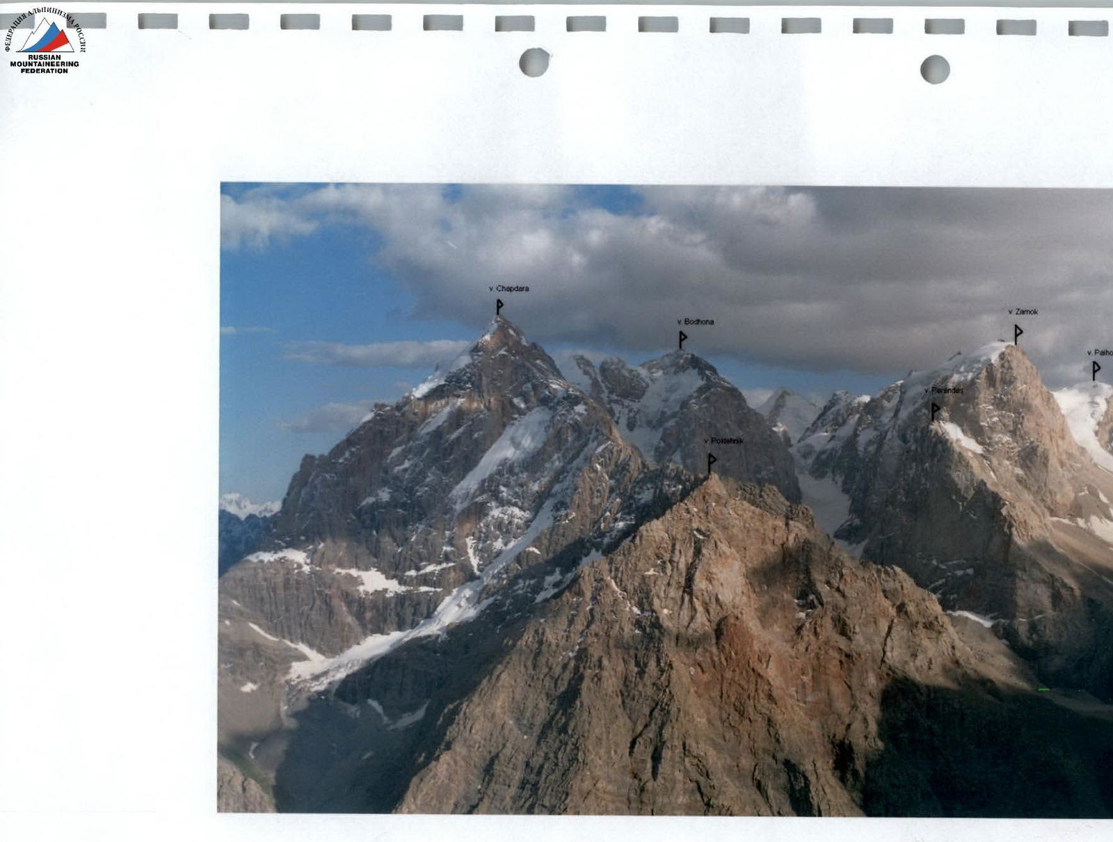
Photo #1 (panorama of the area).
Photo #2 (peak Bodkhona, 5138 m)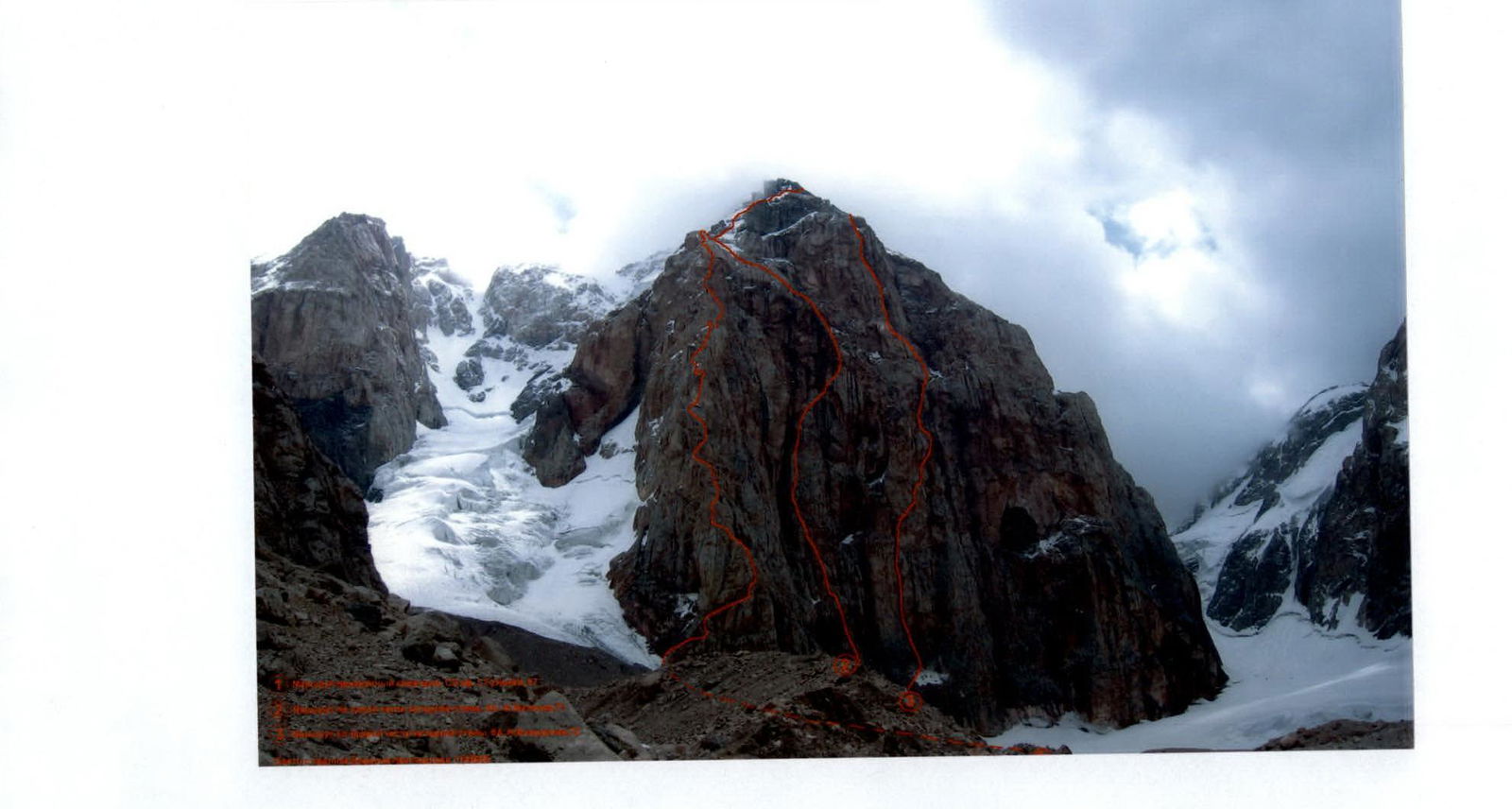 Photo #3 (route climbed by the team, Gulnev G., 1967)
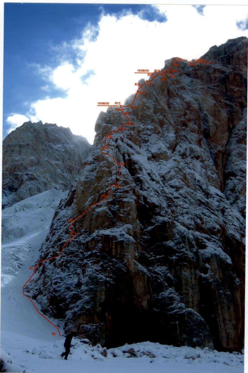
Ascent Graph
to peak Bodkhona via NW counterfort 5B, Gulnev's route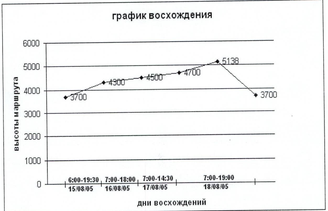
Route Description by Sections
The route is classified as rock according to the classifier. However, it's no secret that in the Fann Mountains, there have been frequent summer precipitations in recent years. The team ascended after 4 days of bad weather and heavy snowfall. Therefore, the route had a lot of snow and ice — this concerns the main part of the route (up to Gulnev's shoulder). The upper part of the route is completely covered in snow.
When moving from Gulnev's shoulder to the summit and back:
- All participants wore crampons and carried ice axes.
- Ice was often encountered.
The route can be considered combined.
We recommend taking:
- 5–6 ice screws for organizing belays and stations.
- Crampons — mandatory for all participants.
| R0 | -- | The route starts from the left part of the NW counterfort. Approach to the start along the glacier 15°–20° along the rocks. |
|---|---|---|
| R1 | 49 m, 40°–70°, IV | Movement along scree shelves, small chimneys, and walls. Exit to a small wet grotto. |
| R2 | 20 m, 60°, IV | 10 meters up to the left along the wall, 10 meters up to the right — exit to a large oblique shelf, visible from below. |
| R3 | 40 m, II | Along the large scree shelf to its right edge (to the end). |
| R4 | 25 m, 90°–70°, A1–V+ | Upwards is a crack with two standing pitons 7 m V+ 90° A1. Further exit to an oblique (20°), small (2×2), very slippery shelf. From it 10 m up along the slabs. Traverse right 1 m. Small descent to a small shelf under the wall. From R15, the route goes along the right part of the counterfort. |
| R5 | 25 m, 60° III–IV | Up the wall to a scree shelf. |
| R6 | 45 m, 60° III–IV | Movement along broken rocks upwards to the left. |
| R7 | 35 m, 45° III–IV | Wall, then ridge. There's a place for an overnight stay. From here on, every 2–3 ropes, there are cleared areas for 3–4 people to overnight. Not everywhere is water (snow). |
| R8 | 55 m, 20°–60° II–IV | Along the wall to the right — bypassing an overhang through an internal corner. Further to the right along a 30 m 20° shelf. |
| R9 | 15 m, 50°–90° III–V | Exit to a large 70×20 m shelf, along it to the right. |
| R10 | 50 m, 50° III | Around the corner to the right. Along scree corners 50 m. At the end — a shelf, possible overnight stay. No water. |
| R11 | 30 m, 40°–60° III–V | It's not recommended to go left along the shelf. 10 m up the wall, then to the right past a chimney along a narrow shelf behind the wall's bend. 2 meters above, there's a standing piton, we make a station on it, as the ropes often don't reach. |
| R12 | 20 m, 25° I–III | On the slab along a narrow shelf upwards to the left with an exit to a large oblique shelf. To the right is a wall of a gendarme, to the left is a place for a tent and a control cairn. We stop for the night at 19:30. A note from July 28, 2005, from a group of climbers from FALS St. Petersburg under the leadership of Rubtsov E.R. was found. |
| R13 | 25 m, I | Along the shelf to the right under the gendarme's wall. |
| R14 | 25 m, 80° VI | Along the gendarme's wall through a system of parallel cracks, exit to the right onto the gendarme's shoulder. Climbing is difficult. Complicated by the fact that the cracks are filled with snow and ice. Used an ice hammer during the ascent. Crampons are recommended. There's a loop on the shoulder for a belay. |
| R15 | 8 m, 80° IV; 20 m, 80°–90°–20° V; 40 m, 60°–70° IV–V | From the shoulder upwards 8 m, there are standing pitons. Further left traverse to a shelf. The route transitions to the northern part of the counterfort. Along the shelf, traverse left along the gendarme's wall to an internal corner filled with ice. Movement only in crampons and with an ice tool (mixed M6). 2–3 ice screws are necessary for belay. To the left, there's a path of broken bolted pitons. Belay on a bolt. |
| R16 | 40 m, 50°–80° IV | Left upwards through an ice couloir with deep snow along the rocks to the next ice couloir. Then upwards under a small wall, which is bypassed to the right. After it, a belay under a red wall. |
| R17 | 40 m, 60°–70° III–V | Along the shelves first to the right, then to the left. |
| R18 | 45 m, 40°–60° I–IV | Along the shelf, then through the ridge to the right, then another 15 m. Good platform, behind which is a 5 m descent to a narrow ridge with a rappel loop to the right. On the narrow ridge, there's ice. We stop for the night at 16:00. Part of the group goes to hang ropes. |
| R19 | 25 m, 70°–90° | Rappel to the right from the narrow ridge. There's a platform for 2–3 people. |
| R20 | 45 m, 70°–30° V–II | Straight from the platform upwards, a 15 m chimney. Then to the right 35 m between the wall and the slab. And 7 m rappel to the right. |
| R21 | 50 m, 70° IV | First, obliquely upwards to the right, then upwards to the left. |
| R22 | 25 m, 60° III | To the left onto a narrow ridge, crossing an ice slope. On the narrow ridge, there's a platform for 2–3 people. |
| R23 | 50 m, 40°–100° II–VI | Along the narrow ridge along the rocks to the ice. Along the ice, we approach under the bastion's wall. Upwards through an internal corner with small cracks. Cracks are completely filled with snow. Everywhere is ice. Movement exclusively in crampons and with an ice tool. There's a bolt along the way to the right. Exit to a narrow shelf under an overhanging wall. Standing piton. 2 m to the left under a broken internal corner. Artificial climbing aids on "carrots" 5 m. Exit to oblique slabs. To the left is a chimney with a plug. Climbing is difficult. Through the chimney with the help of artificial climbing aids, exit to ice 5 m. Shelf. Possible overnight stay for 1–2 people. |
| R24 | 40 m, 40°–100° IV–VI | Upwards along the corner filled with ice. To the left is a standing piton. Under the overhang, there's a bolt filled with ice. To the right is a shelf with snow. |
| R25 | 40 m, 70° IV–V; 70 m, 50°–60° III | Upwards along the chimney with an exit to a shelf. From it to the right along the wall, then easy climbing, shelves, walls. Along the internal corner, exit to Gulnev's shoulder. Good place for an overnight stay. We stay. Snow. Control cairn. In it, two notes. One is a memorial to G. Gulnev. The second: from August 5, 2005, 21:00 FASIL St. Petersburg under the leadership of Nagaev R.R. Moshnikov 6B. |
| From the platform straight upwards along the wall. Along the snow, approach to rocks with ice and snow. Along the rocks with ice and snow, movement to the right upwards and to the left onto a narrow ridge (to the rappel loop). From the loop, exit to ice 35°–45°. Simultaneous movement upwards to the right, as there's a lot of snow. We move left upwards to a narrow ridge in the right part of a huge bastion. The bastion is bypassed on foot along the right side along snow and ice, turning into a narrow shelf with elements of climbing. Further left upwards to the top of the bastion. Traverse along the rocks to a narrow ridge. Along a narrow shelf down, then up to the summit rise along a wall with cracks. Along a scree couloir, approach under the summit wall. Wall 10 m. Climbing is difficult. The leader changes the note. A note from a group of climbers from FALS St. Petersburg under the leadership of Rubtsov E.R. was found. Date not specified. Descent to Gulnev's shoulder along the ascent route. | ||
| R26 | 1000 m, 70°–20° III–I | Descent from Gulnev's shoulder starts immediately after arriving from the summit. Along the rocks along rappel loops 7 ropes. There are many loops and they are frequent. The last rappel leads through a bergschrund to snow 10°. We cross the glacier to the right downwards 100–150 m and through crevasses exit to the rocks of the right bank. We descend along the rocks 40 m to a piton on a rock. Two rappels along loops under overhanging ice, and we're on snow. Along the lateral moraine and ice, we exit to wooden overnight stays (start point). |
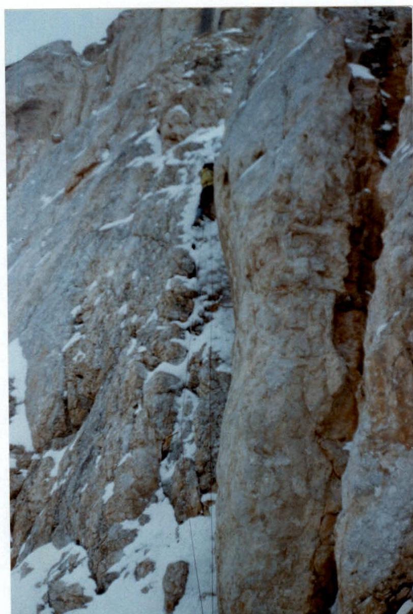
Photo #5 (passage of section R14)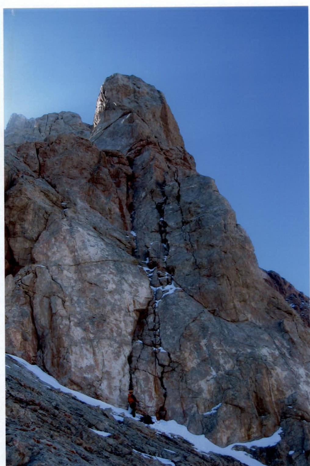 Photo #6 (passage of section R23)
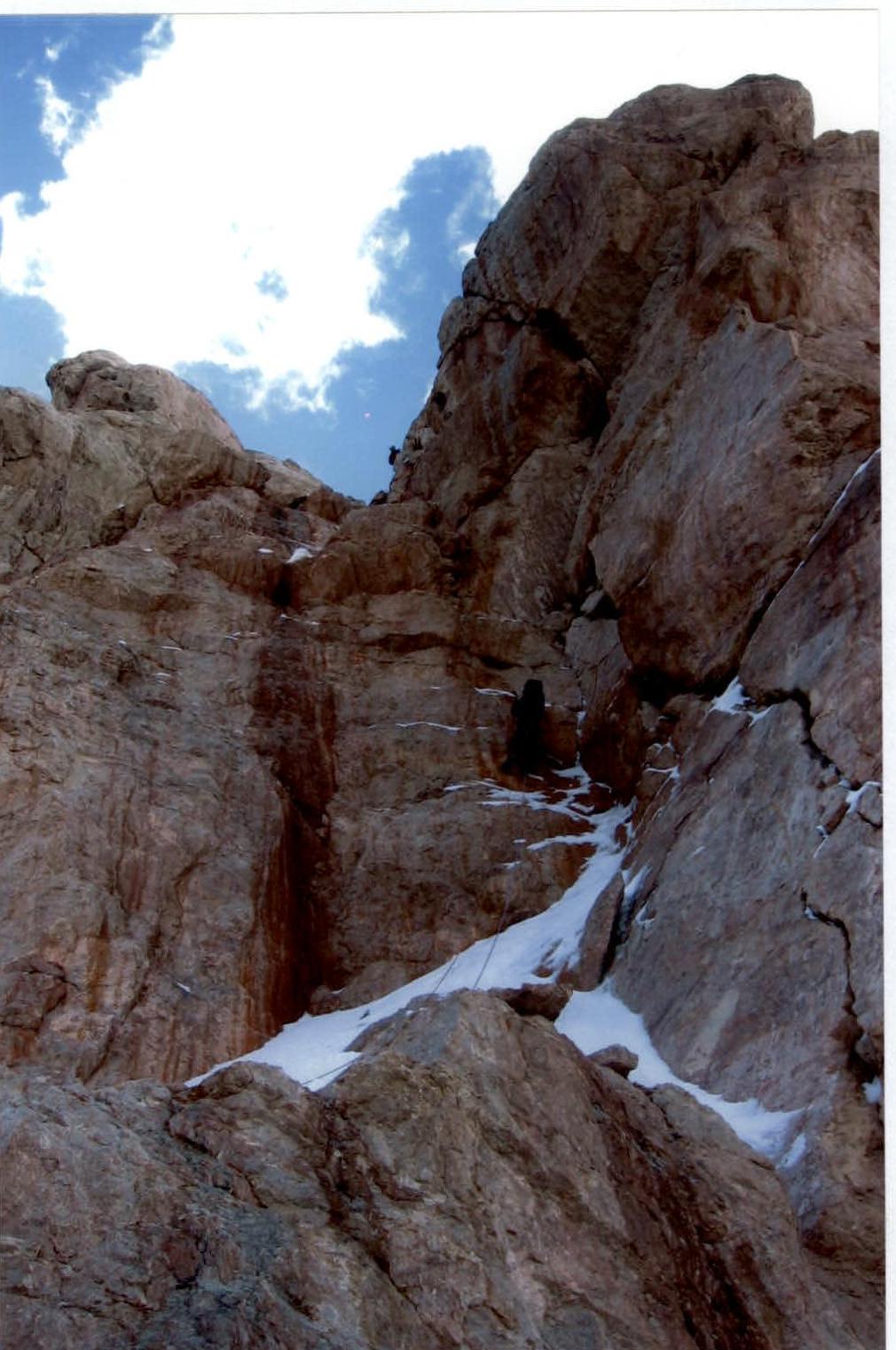 Photo #7 (passage of section R4)
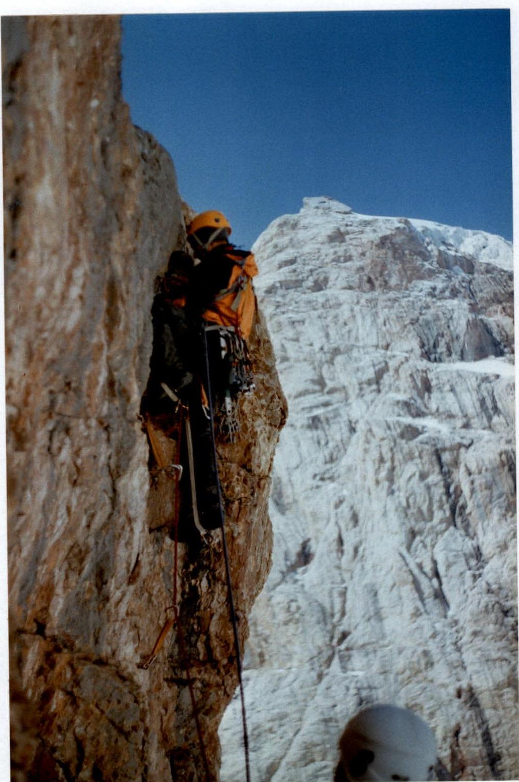 Photo #8 (passage of section R15)
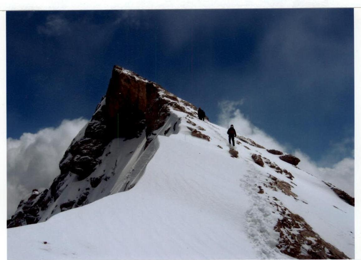
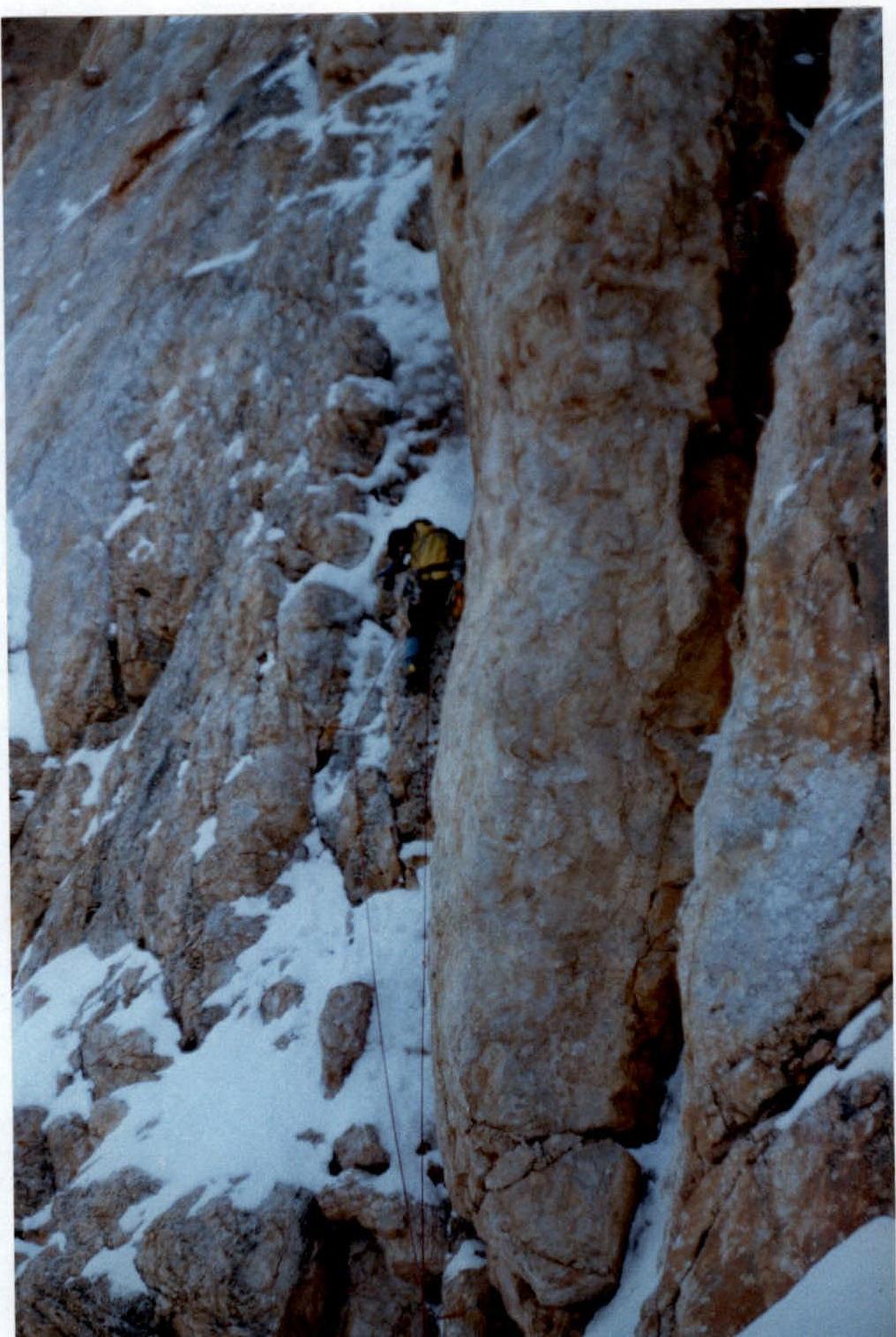 Photo #9 (path to the summit from Gulnev's shoulder)
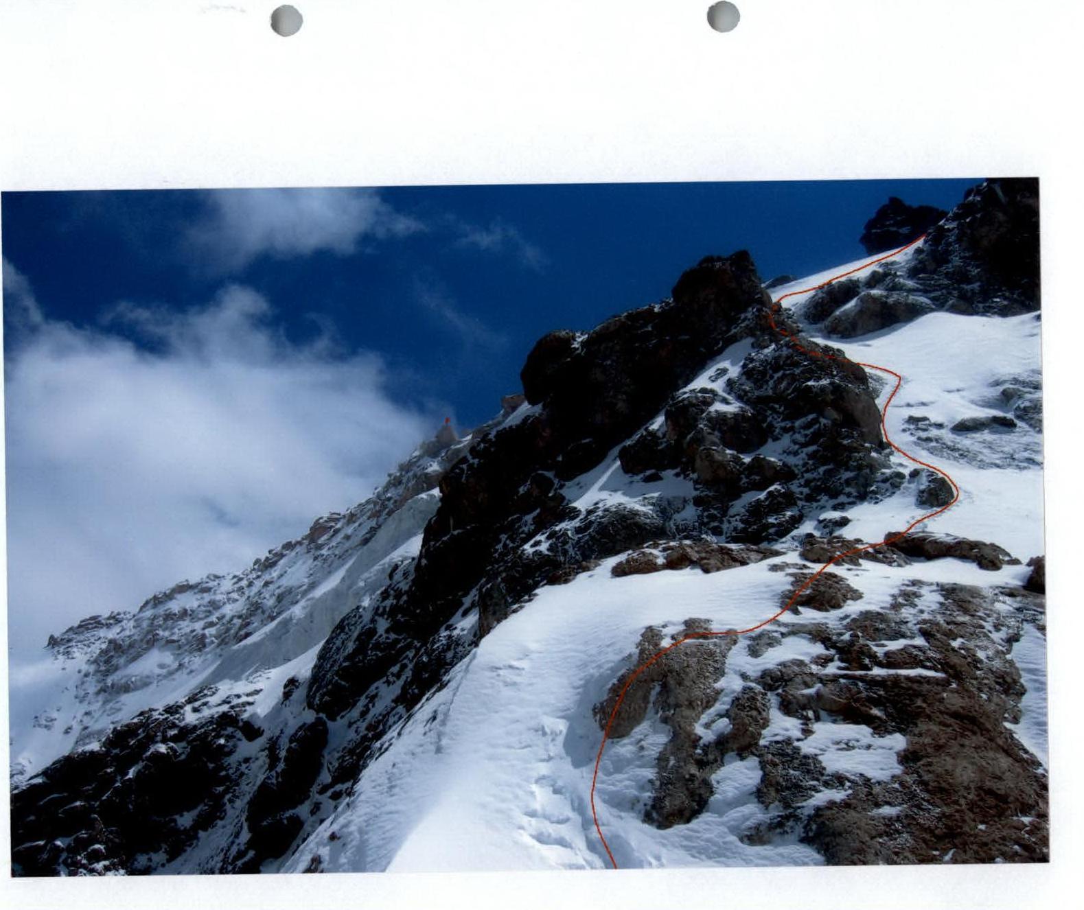 Photo #10 (last technically difficult section before the summit)
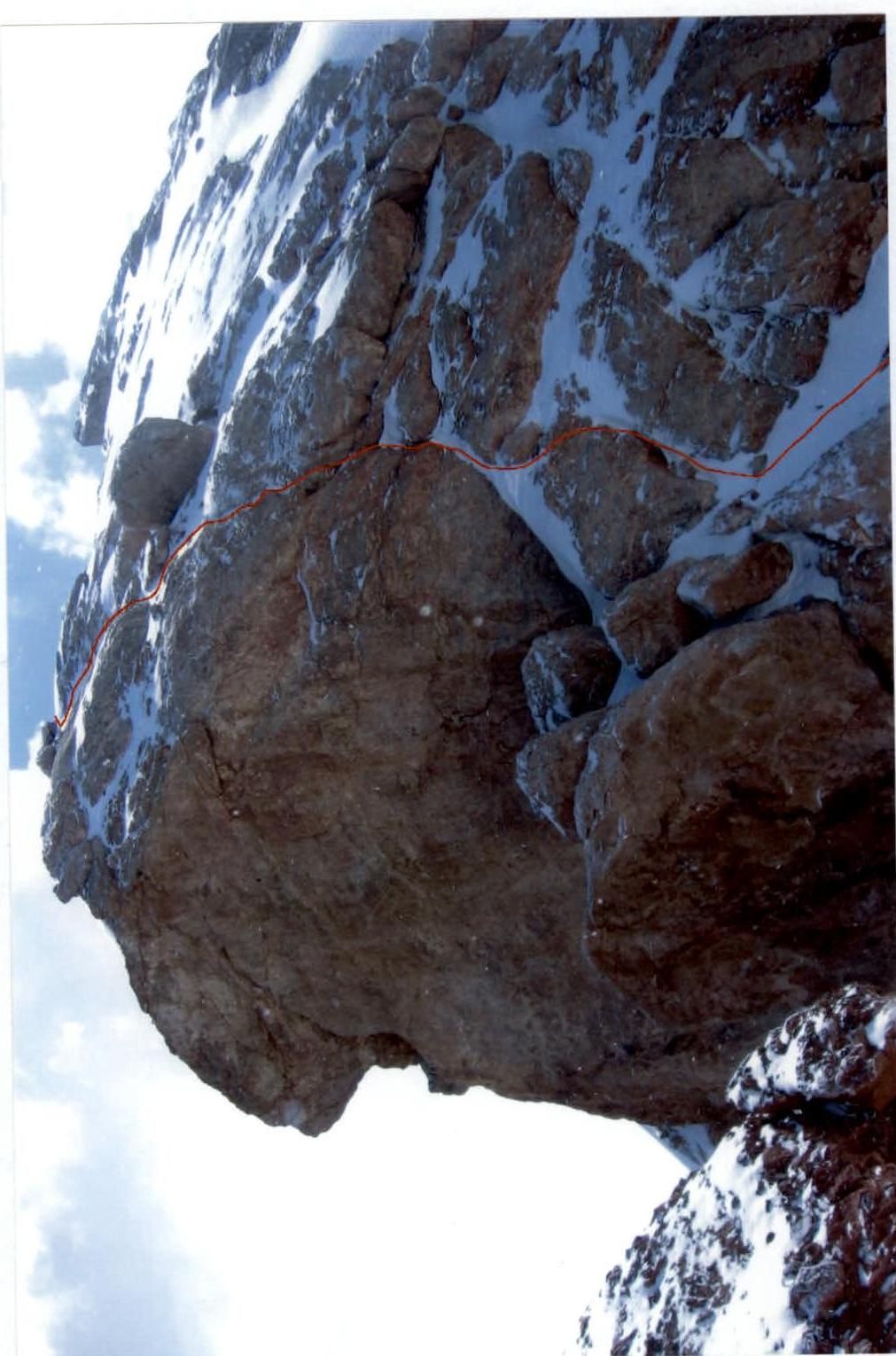 Photo #11 (state of the route before the ascent)
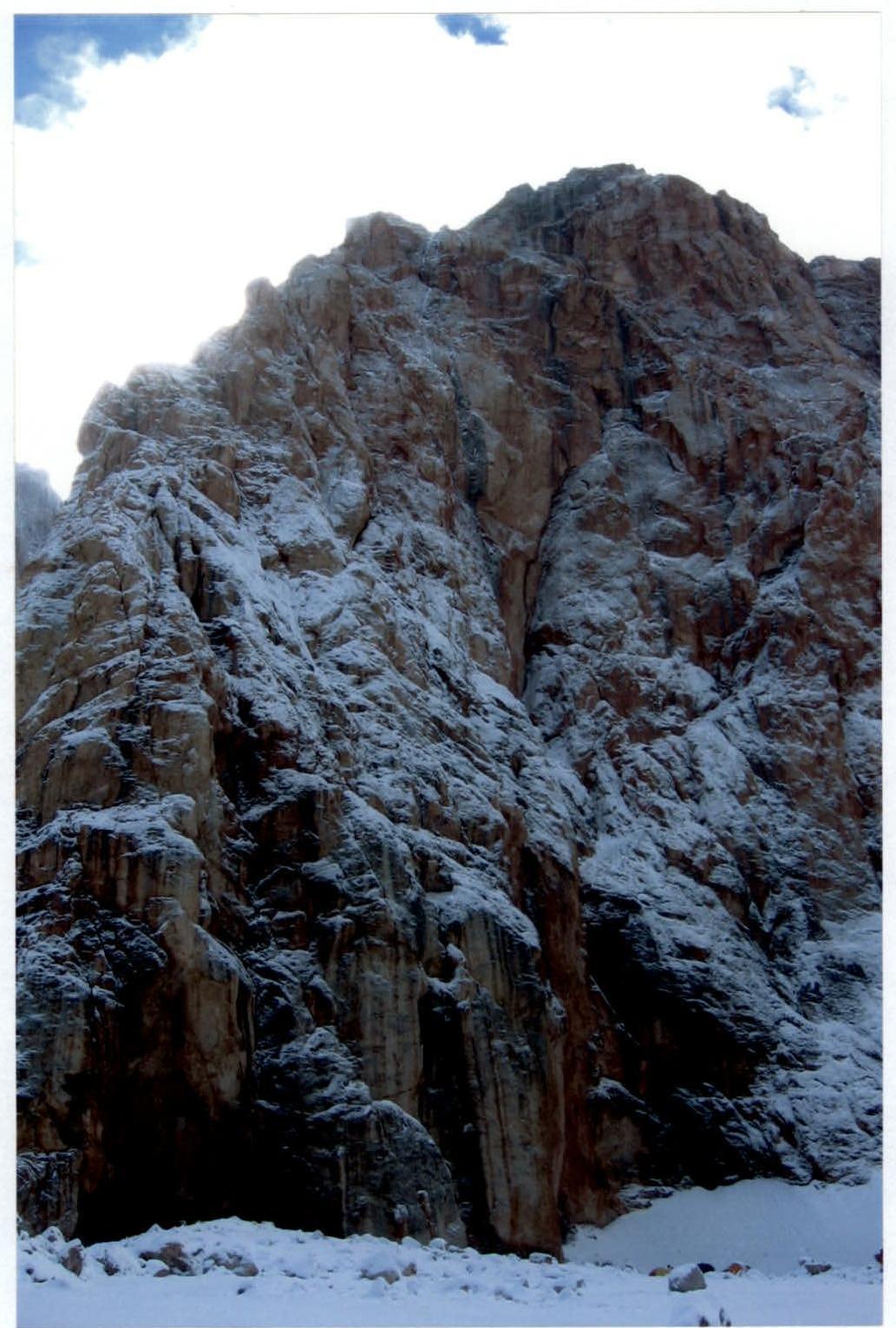
Supplement to the Report
on the ascent to peak Bodkhona via the 5B category of difficulty route, completed in the period from August 15, 2005, to August 19, 2005.
In 2005, the weather in the Fann Mountains was very unstable. A large amount of precipitation, the end of the season, and several other factors strongly affected the state of the routes in the area. A group of climbers as part of the Tomsk Federation of Alpinism's training camps ascended peak Bodkhona via the 5B category of difficulty route, G. Gulnev 1967. There was a lot of snow and ice on the route. Most of the time, they moved in crampons. The leader worked with an ice tool. The route took more time than in good weather conditions.
We request that for all groups that were in this area and climbed this route, it be classified not as a rock route, as indicated in the classifier, but as a combined route, which most accurately reflects the actual state of the route.
Photographs are attached.