
Report
on the ascent of the group
from the alpcity of Magnitogorsk
to the summit 4150 m
via the Western ridge
Magnitogorsk
2012
Leader: Makarova Ekaterina Gennadyevna, 455023, Magnitogorsk, Lenina ave., 55, apt. 57, e-mail: katyushka90@rambler.ru, tel. (3519) 23-94-08, 89090923981
Coach: Igolkin Viktor Ivanovich, 455000, Magnitogorsk, Lenina ave., 37, apt. 23, e-mail: iavare.ivi@gmail.com, tel. (3519) 20-82-17, 89090936521
Ascent passport.
- Region: Pamir-Alay, Gissarsky ridge, Siama river gorge
- Summit: 4150 m, via the Western ridge
- Category: first ascent, proposed 1B
- Route characteristics:
Height difference: 1050 m
Route length:
- sections of 1st category: 150 m
- sections of 2nd category: 1050 m
Average steepness:
- main part of the route: 45°
- entire route: 25°
- Time spent on the route — 4 h 15 min, total — 7:25 h
Climbing days — 1 day
- Exit to the route: July 20, 7:30. Exit from b/l: July 20, 06:30, from R0 — 7:30. Summit ascent: July 20, 11:45. Return to the assault camp: July 20, 13:55. Descent from the summit via the rightmost counterfort of the Western ridge to the Siama gorge to the "Green Hotel" b/l.
- Group: Group of the alpcity of Magnitogorsk
Leader: Makarova Ekaterina Gennadyevna, 1st sports category, Magnitogorsk.
Participants:
- Makarova Natalia Gennadyevna, Zn., Magnitogorsk.
Group coach: Igolkin Viktor Ivanovich, MS, Magnitogorsk.
- Organization: alpcity of Magnitogorsk
Ascent leader E.G. Makarova
Senior coach of UTS V.I. Igolkin
- With the help of an altimeter, a height of 4150 m was recorded.
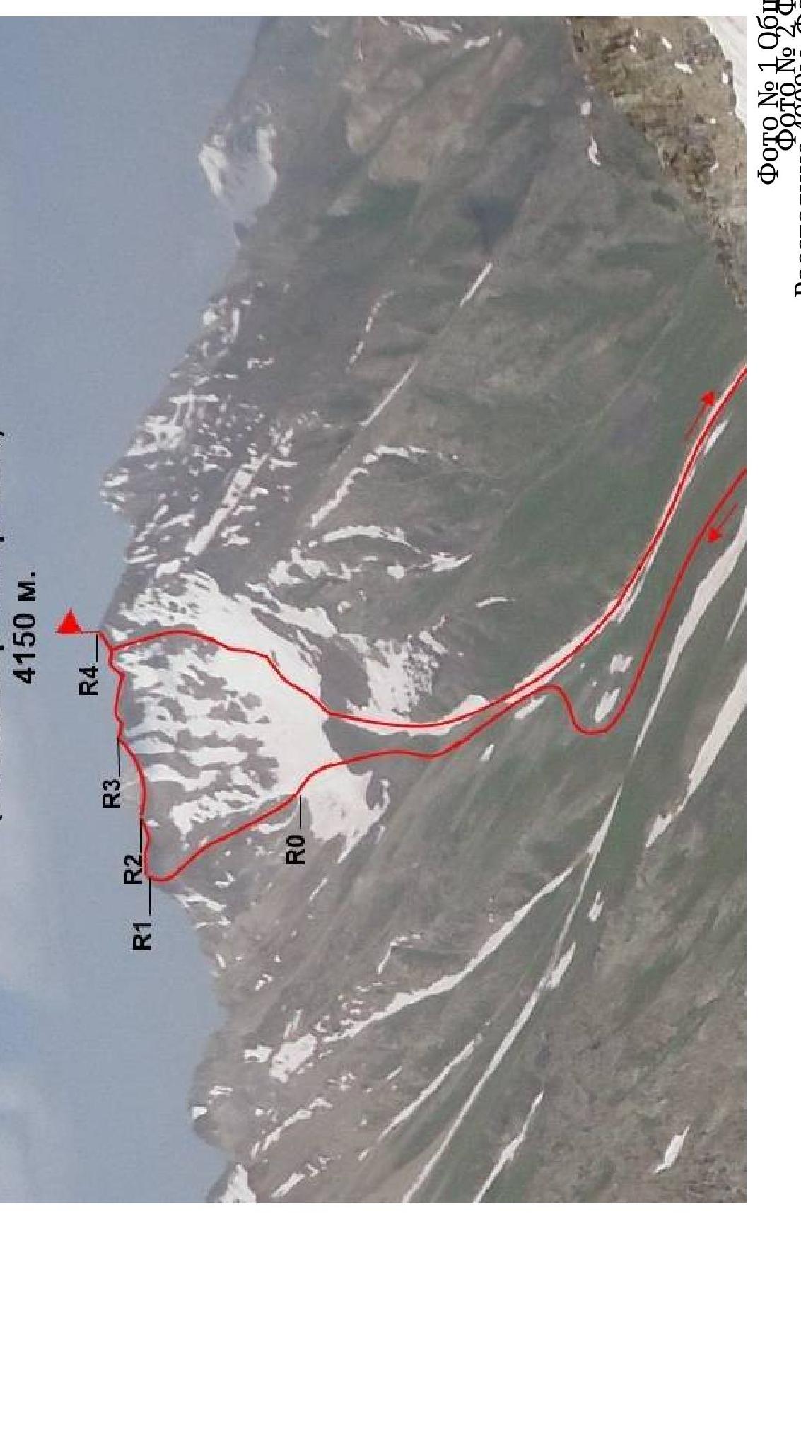
Photo #1 — group photo. Photo #2 — photopanorama of the area. Distance 4000 m, camera — Samsung L700. Taken on July 15, 2012. Shooting point F2. With the approach to the Cheryrekh pass.
Brief overview of the ascent area.
This area is located in the upper reaches of the Siama and Kadam-Tash rivers. They are separated by a low spur branching off to the south from the Gissarsky ridge, where the four towers of the Siama Crown peaks are located.
From the Festivalnaya peak, the ridge splits:
- its eastern branch borders the Siama valley to the south,
- the western one — the Kadam-Tash valley.
To the north, the Siama gorge is bounded by a spur of the Gissarsky ridge, which is a watershed between the Siama and Maykhura river basins. Here lies the beautiful peak Medvezhiy Zamok (Bear Castle).
Above the Bolshoy Siama glacier rises, having regular outlines, the peak Shlem (Helmet).
The highest point of the area is Belaya Piramida (White Pyramid) — 4855 m, located on the main watershed of the Gissarsky ridge in the Kadam-Tash cirque. From Belaya Piramida to the south, a short but high spur branches off, which steeply drops into the Kadam-Tash valley with the southern slopes of the peak Khodzha-Lokan.
The peak 4150 m (Makarov Sisters Peak) is located in the same spur of the Gissarsky ridge, where peaks like:
- Medvezhiy Zamok
- Shlem
are situated, between the Zamok and Pastushiy passes. When observed from the "Zelyonaya Gostinitsa" b/l (3300 m), against the sky, a ridge oriented to the West is clearly visible. The ridge oriented to the South is less noticeable due to the overlapping relief. From the Southern side, the slopes of the Western ridge are more gentle, talus with many counterforts. From the north, the slopes of the Western ridge are steep and drop down to the Yak-Archa glacier. Area map
Siama.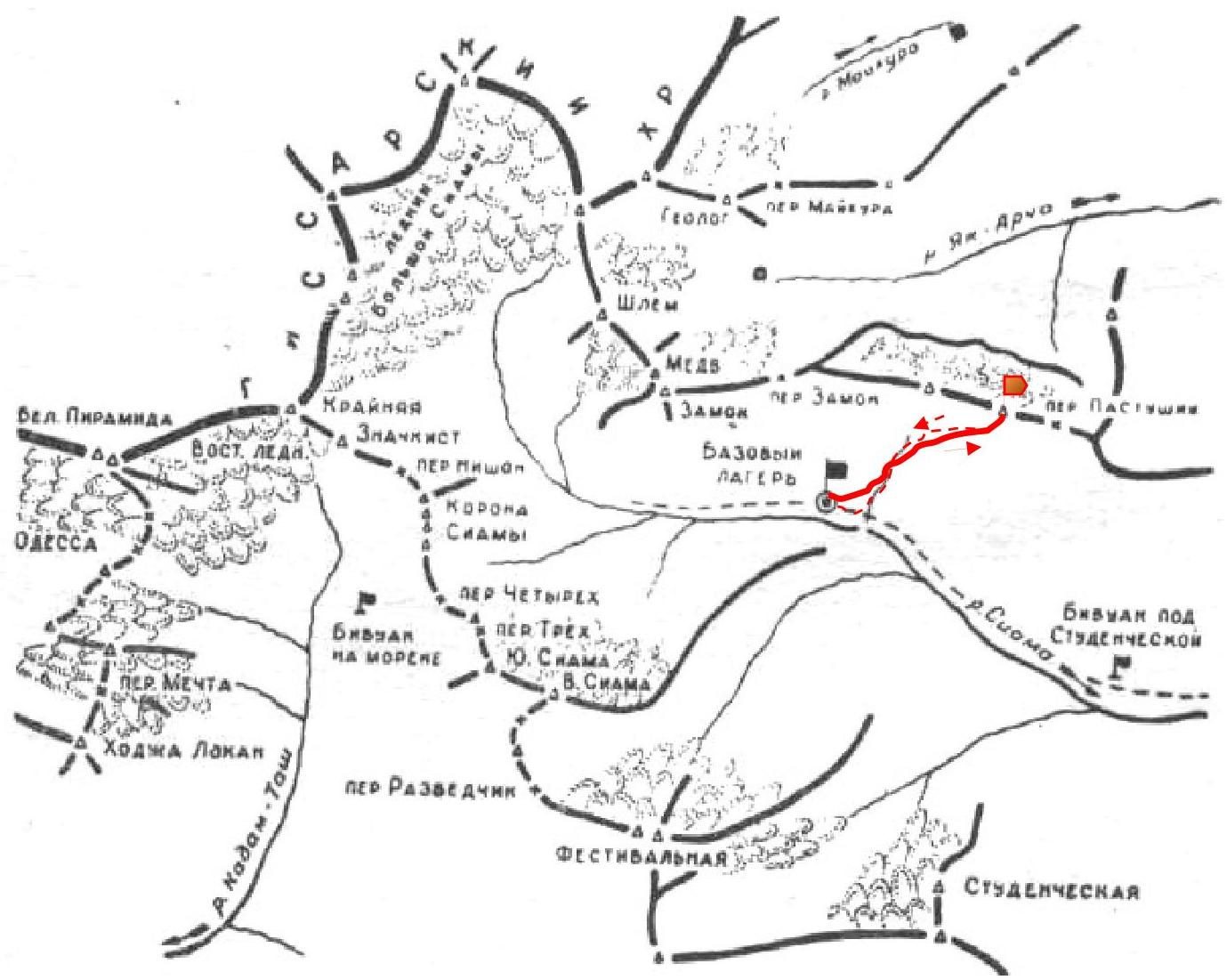
Preparation for the ascent.
The group was formed from alpinists of the alpcity of Magnitogorsk, who underwent the proposed training according to the annual program of events. All participants had experience in climbing peaks of the Southern Urals, passed the test on OFP, participated in:
- ski marathons,
- mountain cross-country,
- rock climbing competitions,
- alpine technique competitions.
In the mountains, they underwent a cycle of training sessions on rock and snow preparation, made training ascents in the areas of the "Varzob" base, Igizak, and V. Siama:
- Makarova Natalia made an ascent to the peak Ular via a route of 2A category.
- Makarova Ekaterina made 3 ascents of 3B, 4B, and 5B categories.
On a training exit to the Siama river gorge, after returning from the route of 5B category (peak Khodzha-Lokan), it was decided to make a first ascent on the nearest peak from the "Zelyonaya Gostinitsa" base camp. A visual analysis of possible route options to this peak was conducted, photos were taken from different points of the mountain relief, and the approach path to the peak was optimized. The peak was named in honor of the climbers.
Tactical actions of the group.
After returning from the ascent to Mechta (Khodzha-Lokan) via a route of 5B category, Makarova Ekaterina, feeling strong, decided to make a first ascent with the participants of the gathering. The main tasks when choosing a mountain and a route were:
- The possibility for beginners to complete the full program to close the first stage of training;
- Better gradual acclimatization for both beginners and experienced climbers;
- Making the route logical and beautiful;
- Safety;
- Making the route of the first category as close as possible to the base camp.
The route was divided into 2 main sections:
- The first section — ascent via a counterfort with an exit to the ridge
- The second section — traversing the ridge with an exit to the summit
The rope team worked simultaneously with the use of a safety rope to train working with a rope. When organizing safety on narrow parts of the ridge and when passing rocky sections, for safety, the rope team switched to alternate movement.
Description of the route by sections.
R0–R1 — The route starts slightly to the right of the lower point of the transition from firn to talus on the leftmost counterfort. Destroyed relief. Talus alternates with "ram's foreheads". Bypass all large "gendarmes" on the right, aiming for the uppermost row of "gendarmes" through which you need to exit to the ridge. Approximate steepness 45°
R1–R2 — Movement along the ridge. Further movement is desirable with the use of a safety rope, due to:
- destroyed relief;
- a steep, cliff-like wall along the entire ridge on the side of the Yak-Archa glacier;
- approximate steepness — 15°
R2–R4 — a small descent and ascent to the upper part of the ridge, bypassing firn (if present); steepness increases to 45°. Through small rocky sections on the elevations — a convenient transition to the next section. Relief is destroyed, on the ascent it is a slab covered with small talus stones. It is desirable to use a safety rope.
R3–R4 — traversing along the ridge to the pre-summit "gendarmes". It is recommended:
- to bypass the first one on the left,
- to bypass the second one on the right. It is desirable to use a safety rope. Exit to the summit via a slab with an approximate steepness of 50°
Descent via the 4th counterfort (descend from the summit in the direction of the ascent):
- along the moraine with transitions to несложные скалки and "ram's foreheads" to the glacier;
- along a long snow tongue to the main path going through the gorge along the Siama river;
- via a path return to the "Zelyonaya Gostinitsa" base camp.
| Section № | Length | Steepness | Relief characteristics | Category of difficulty | Number of pitons |
|---|---|---|---|---|---|
| R0–R1 | 300 м | 45° | Destroyed counterfort | 15-25 | - |
| R1–R2 | 200 м | 15° | Rocky ridge | 15–2А | - |
| R2–R3 | 300 м | 15°–45° | Rocky ridge | 15-25 | - |
| R3–R4 | 400 м | 15°–50° | Rocky ridge | 15-25 | - |
A note left on the summit 4150 m by the group of alpinists from the alpcity of Magnitogorsk on July 20, 2012
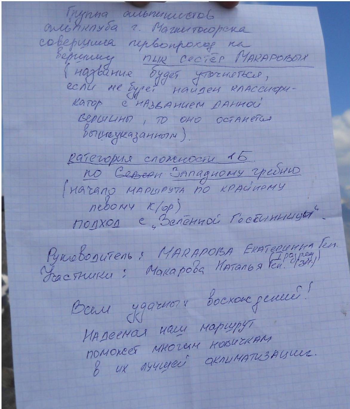
Pryme ygoutos bocxone perusi! Mageemar wali mapuppy nomonest Mhocum Hocurxam b ux ayuyeci ckauMATLSAunur.
- Group equipment: a) tabular, additional, special equipment:
ropes main carabiners belay devices hammers:
- ice pitons
- crampons
- rappel rings
- sling-extenders
b) bivouac equipment, clothing:
personal equipment
- sleeping bag
- crampons
- down jacket
- protective matches
- lighter
- fundak c)
convenience over 100
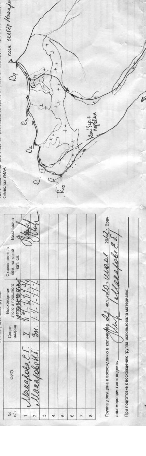
Photo illustrations for the report.
All photos taken with a Samsung L700 camera.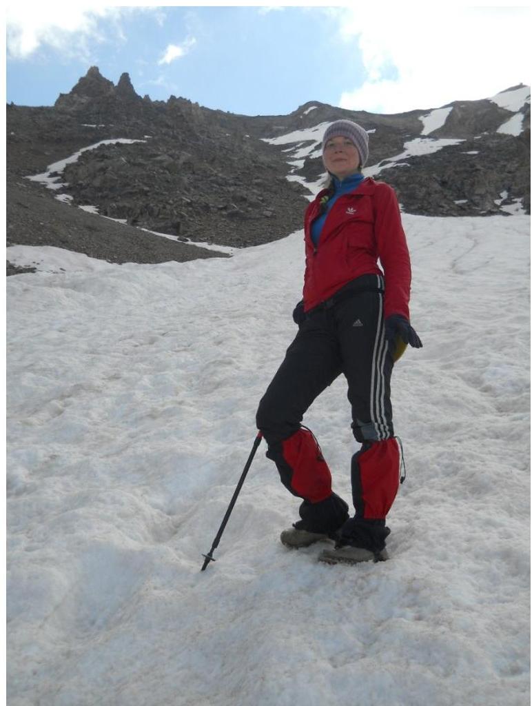
Photo 3. On the approach to section
R0–R1.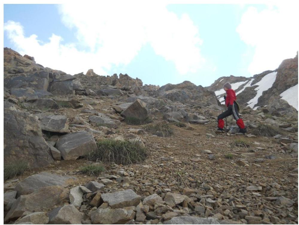
Photo 4. On section R0–R1.1. Start of
the route.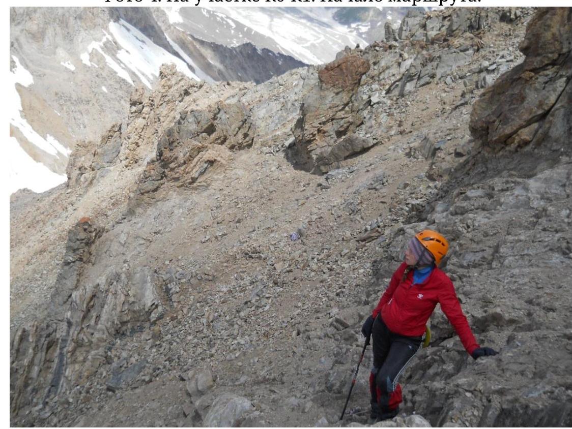
Photo 5. On section R0–R1. Upper part of
the section.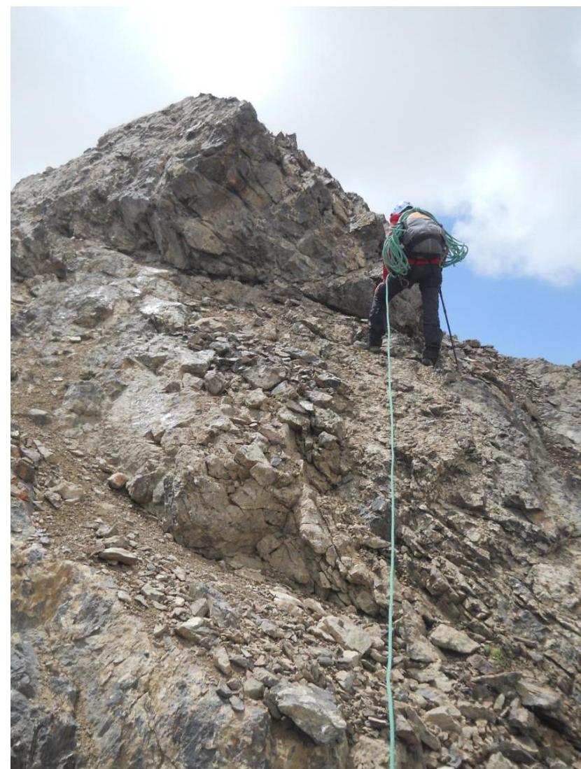
Photo 6. On section
R1–R2.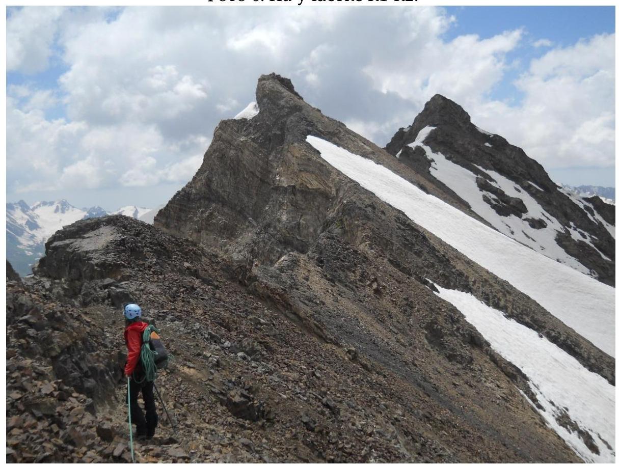
Photo 7. On section
R2–R3.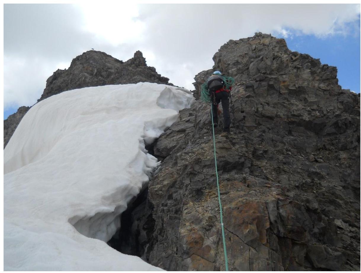
Photo 8. On section
R3–R4.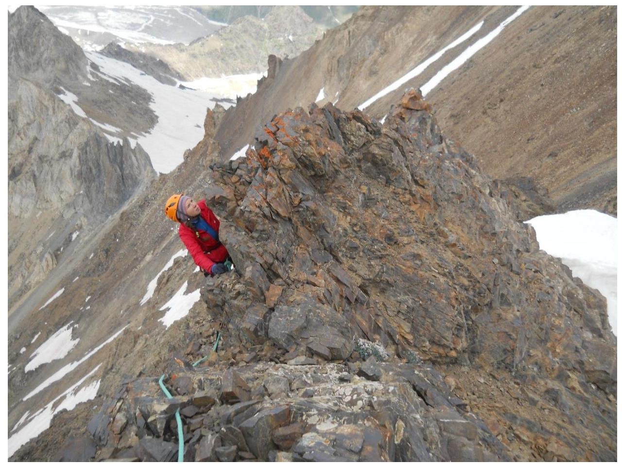
Photo 9. Pre-summit
"gendarmes"
Photo 10. On the summit Makarova
Ekaterina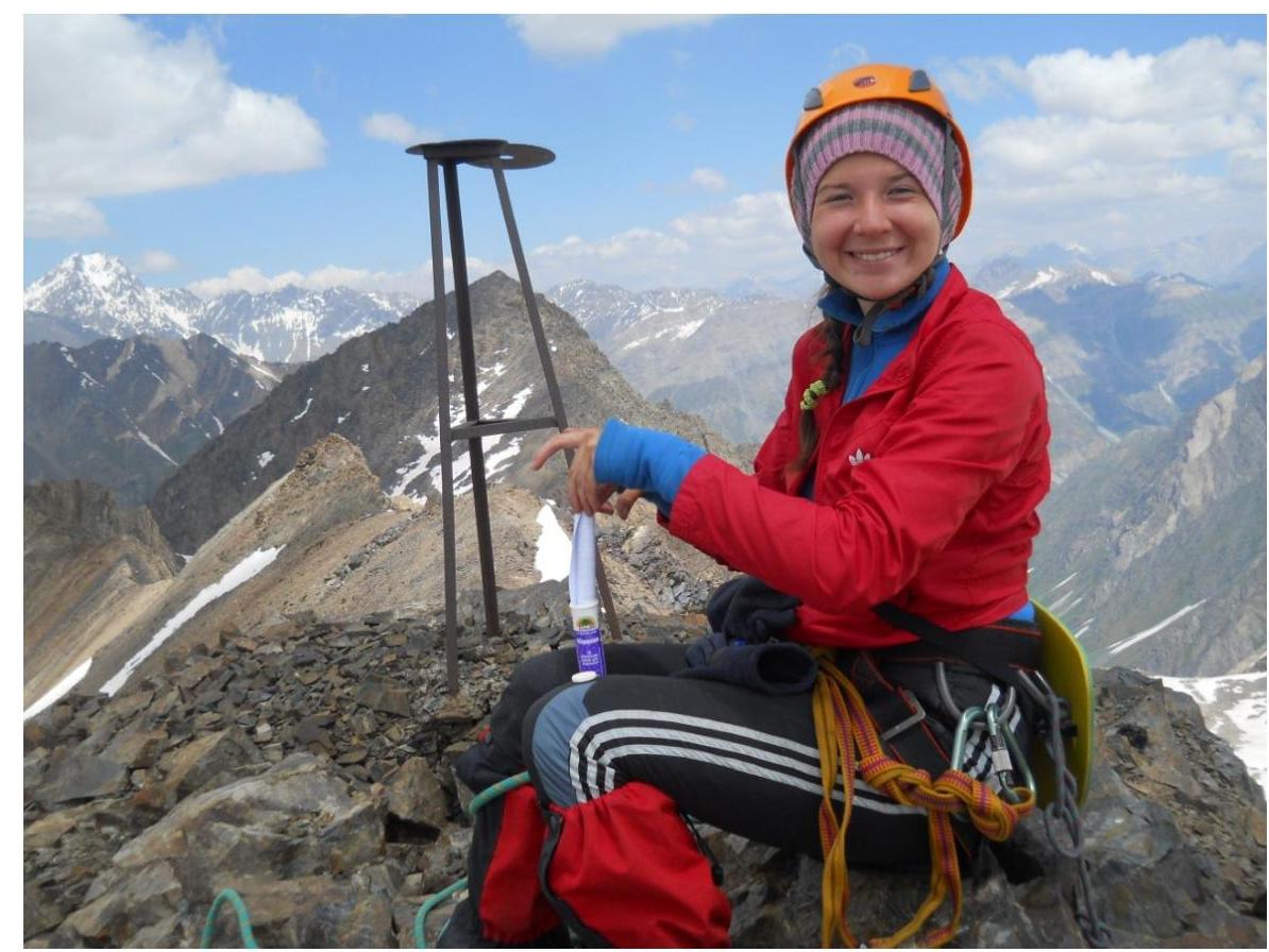
Photo 11. On the summit Makarova
Natalia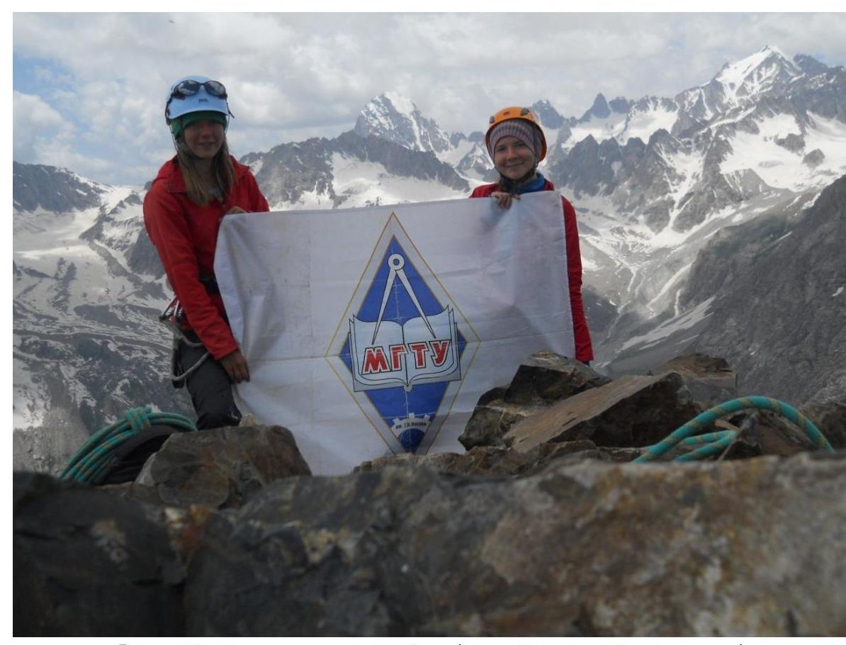
Photo 12. On the summit 4150 m (Makkarov Sisters Peak) 23