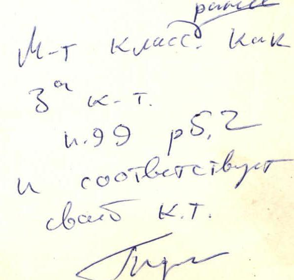
Climbing Passport
Climb category: Rock (combined) Climbing area: Iguizaki area (5.2) Peak, its height, and ascent route: Khamsöya traverse of 3 peaks (C–S) Proposed difficulty category: 4A (3A) Route characteristics:
- Elevation gain: 300 m
- Average slope: 30°
- Section lengths: R1–300; R2–500; R3–200; R4–200;
- Pitons driven:
- For belay:
- Rock: 28
- Ice:
- Bolts:
- For creating ITO: 2
- For belay:
- Number of climbing hours: 14 hours
- Number of nights and their characteristics: none
Surname, first name, patronymic of the leader and participants, their sports qualification:
- Skrigitel E. 2nd sports category
- Skrigitel A. 1st sports category
- Prisyazhnoy V. CMS
- Aganesyan E. 2nd sports category Team coach: Tkachev V. Date of departure and return: May 9, 1974
Dushanbe 1981
Khamsöya 4A
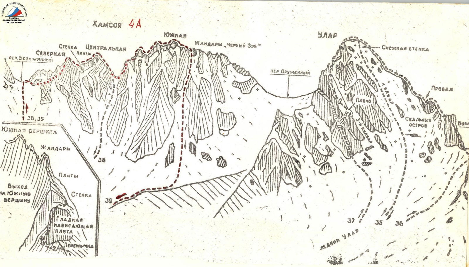
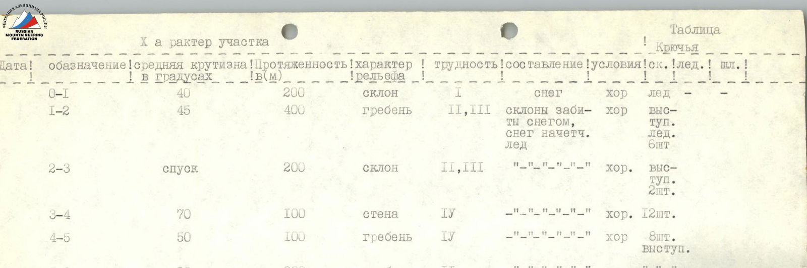
Table 1. Section characteristics (version 1)
| Designation | Average slope in degrees | Length (m) | Relief character | Difficulty | Condition | Conditions | Rock pitons | Ice pitons | Bolt pitons |
|---|---|---|---|---|---|---|---|---|---|
| R0–R1 | 40 | 200 | slope | 1 | snow | good | ice | ||
| R1–R2 | 45 | 400 | ridge | 2, 3 | slopes covered with snow, snow is wet, ice | good | outcrops | 6 pcs. | |
| R2–R3 | descent | 200 | slope | 2, 3 | — | good | outcrops | 2 pcs. | |
| R3–R4 | 70 | 100 | wall | 4 | — | good | 12 pcs. | ||
| R4–R5 | 50 | 100 | ridge | 4 | — | good | 8 pcs. outcrops | ||
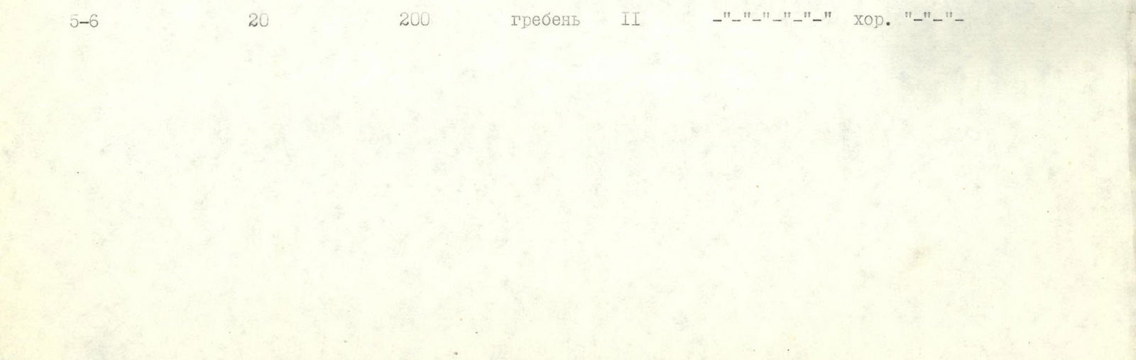
| R5–R6 | 20 | 200 | ridge | 2 | — | good | — |
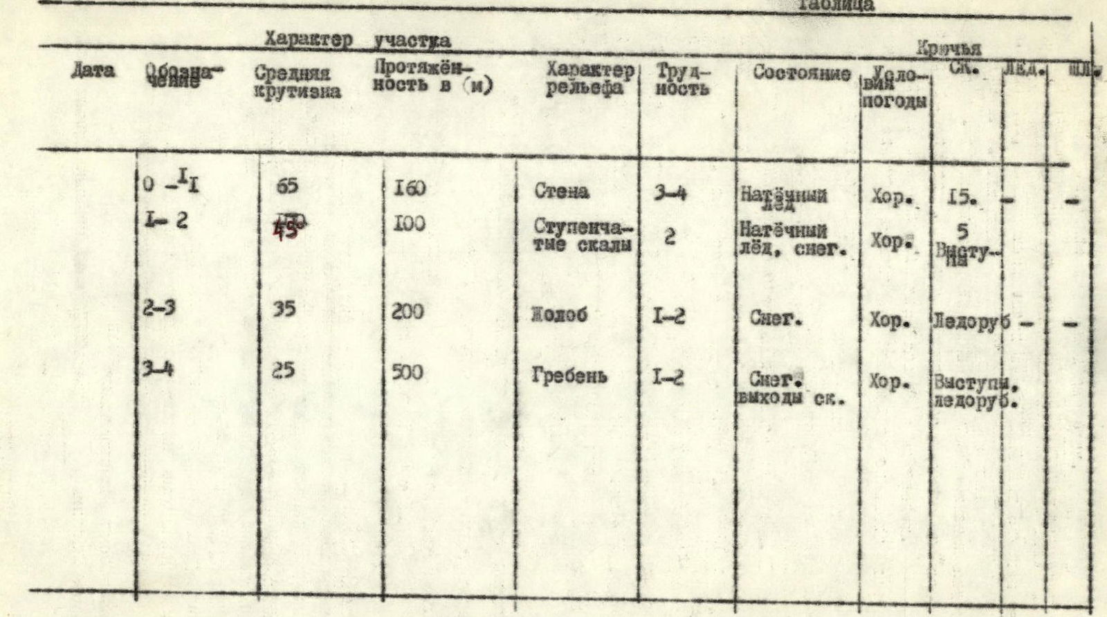
Table 2. Section characteristics (version 2)
| Designation | Average slope | Length (m) | Relief character | Difficulty | Condition | Weather conditions | Rock pitons | Ice pitons | Bolt pitons |
|---|---|---|---|---|---|---|---|---|---|
| R0–R1 | 65 | 160 | Wall | 3–4 | Wet snow | Good | 15 | – | – |
| R1–R2 | 45 | 100 | Stepped rocks | 2 | Wet ice, snow | Good | 5 outcrops | – | – |
| R2–R3 | 35 | 200 | Gutter | 1–2 | Snow | Good | Ice axe | – | – |
| R3–R4 | 25 | 500 | Ridge | 1–2 | Snow, rock outcrops | Good | Outcrops, ice axe | – | – |
Table
Description of the approach to the route
From the base camp on the "Green Glade" located under the NW slopes of Bivachnaya peak, ascend along the western slopes of the peak, through the gorge of B. Igizaka peak.
- After 30–40 minutes of walking, the western walls of Bivachnaya peak come into view on the left. In the left part, the wall is broken by a couloir that ends with a wall and a waterfall in its lower third. Ascend the snowy slope to the base of the couloir. The approach takes 1 hour.
Explanation for the table
The route begins on the wall 50 m to the right of the waterfall. 160 m of icy, snow-covered rocks lead to the base of the couloir. 20 m along the gutter and then 80 m up and to the left through it to the top of a rocky pyramid (control tower). The ledges are filled with snow.
From the control tower:
- Traverse 50 m under the right (in the direction of travel) walls of the couloir;
- then, staying close to the walls, exit onto the N ridge of the peak;
- along the ridge (continuation of route 2A cat. diff.) 500 m — exit to the summit.
Descent is via route 1B cat. diff.
NOTE: It is not recommended to move along the couloir from the control tower along the left (in the direction of travel) walls, as there is a risk of cornices collapsing due to warming by the sun during the day.
The route description is compiled for climbing in the winter period from November 1 to May 10. The condition of the route should be considered as combined.