24. South peak of Naysagby from the east, category III, route 16, fig. 11 (Frusin K., Galatenko V., Popereka M. — 1954)
The ascent to the summit is made from a bivouac located in the upper reaches of the Pugus River, where there are good glades. It is better to approach the bivouac from the Khodzha-Obi-Garm resort via the road through the Ruidasht plateau and the Takhob pass. You can stop at the bivouac right after the pass or move further up the trail along the stream towards the South Naysagba peak. The approach takes 2–3 hours.
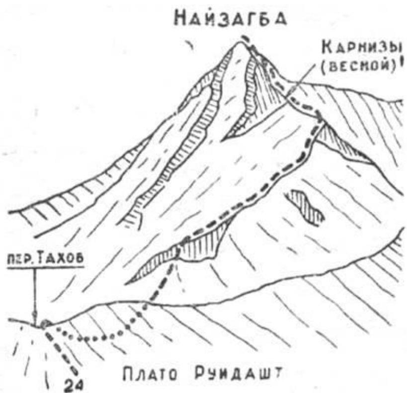
Fig. 11. The ascent route goes along the eastern ridge, which in its lower part turns to the southeast, thus closing the cirque of the peak from the east, formed by the southern ridge and the said ascent route along the ridge to the summit from the east.
From the bivouac, move towards the summit along the stream via grassy slopes or the stream bed (snow in spring). In the lower part of the ridge, there is a rocky belt. The exit to the ridge is on the right side via ledges and gutters of the rocky belt. Then follow simple rocks along the ridge. Move further along the ridge to the summit (snow at the beginning of summer, cornices to the north!).
Individual rock outcrops are bypassed or overcome with belay. Descent from the summit is made via the ascent route. The ascent takes 8–9 hours.