Ascent Passport
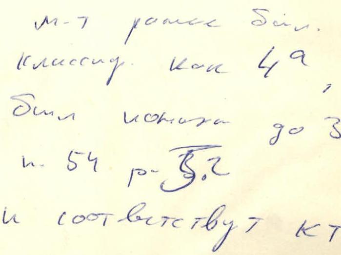
Climb Category: Rock (Combined) Peak, its height, and ascent route: Bolshoy Igizak via N wall 4100 m (via cleft) Estimated Difficulty Category: 4A (35) Route Characteristics:
- Height difference: 350 m
- Average steepness: 50°
- Length of sections:
- I: 200 m
- II: none
- III: 40 m
- IV: 160 m
- Pitons driven:
- For belay: 0
- Rock: 34 + 8
- Including ice: 10 (into rocks)
- Bolted: –
- Number of travel hours: 10 h
- Number of nights and their characteristics on the route: none
Surname, initials of leader and participants, their sports qualification:
- I. Baykovskiy D. — II category
- II. Ipmukhametov A. — II category
Team coach: Lavrukhin V. I. Date of departure and return: May 2, 1982 Dushanbe 1981 =?
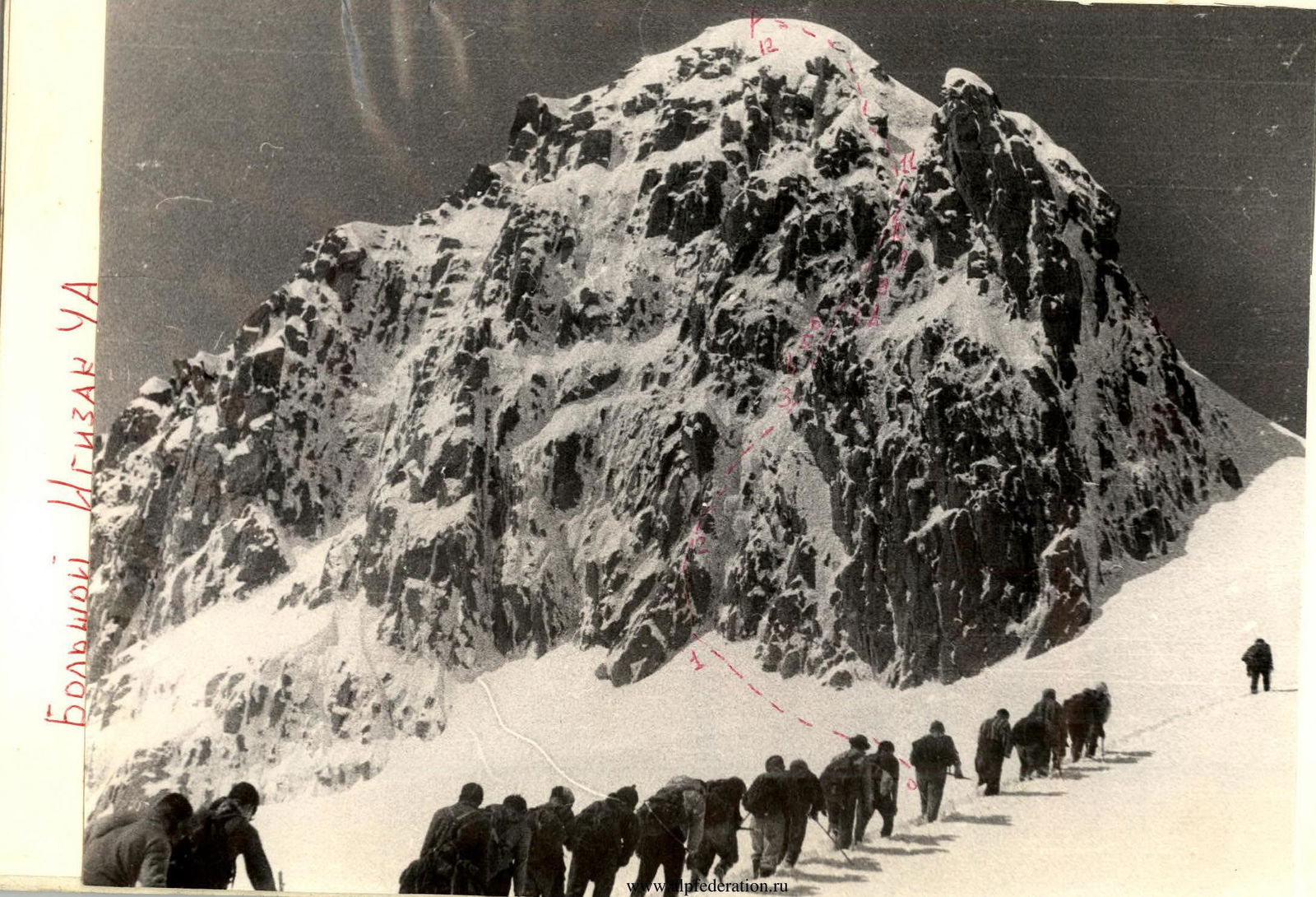

Igizak area diagram: V. Bolshoy Igizak from "Zelyonaya polyana" bivouac
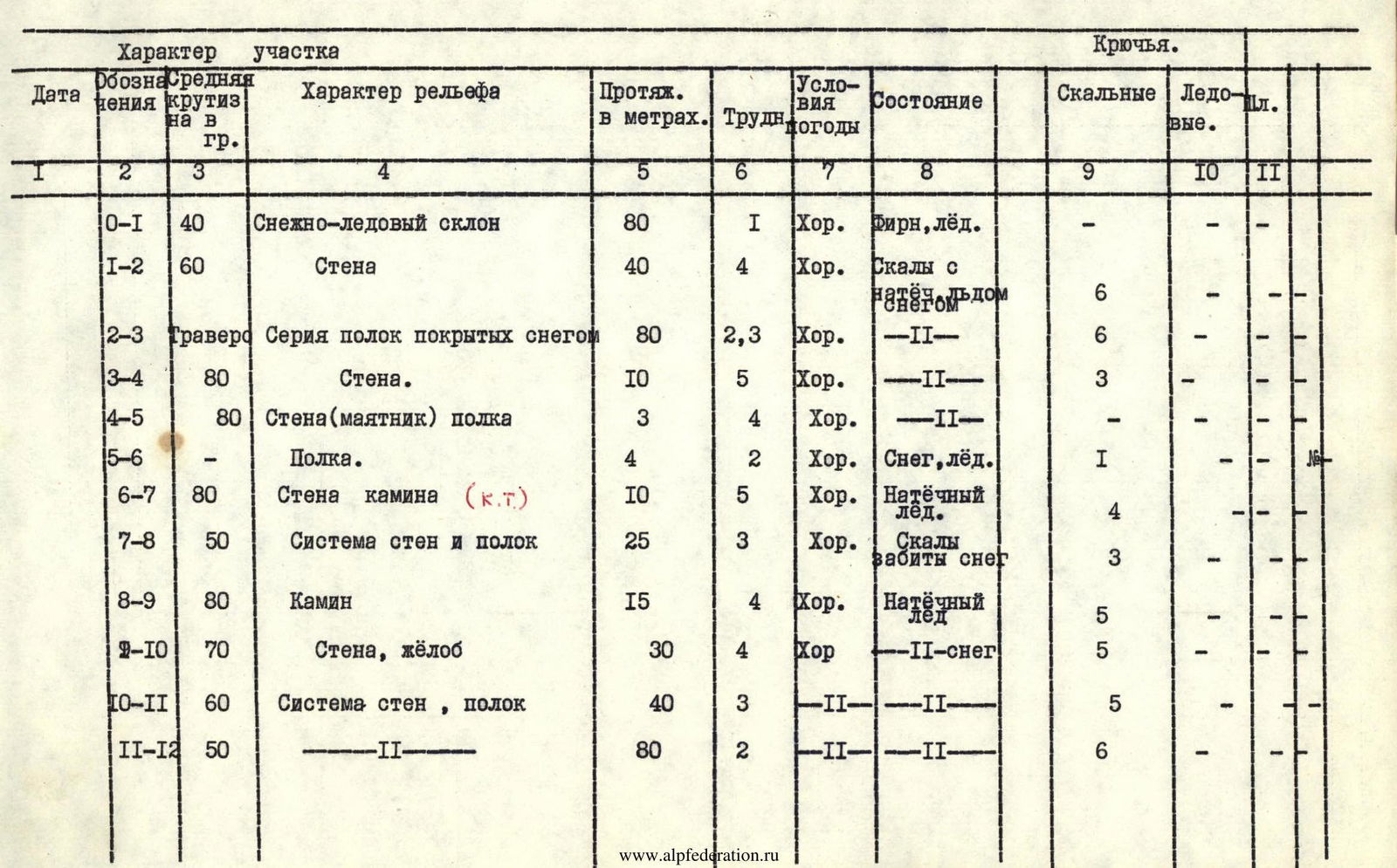
Table of key indicators
Bolshoy Igizak via North wall. Via cleft.
Brief explanation of the table.
Approach: from "Zelyonaya polyana" bivouac, go up along the Igizak river through snowy slopes to a snow corrie, then right along the route to the northern slopes of Bolshoy Igizak. The approach takes 2.5–3 h.
Route
The route up the wall goes through its left part, via a couloir. Climb on the right side of the snowy-icy couloir until the start of the peak's sheer walls. In the absence of snow, move to the rocks and climb them to the right along the route up to a ledge at the foot of the sheer walls. Along the snow, on the ledge to the right, reach a series of simple ledges, and further along them traverse right (80 m). Approach the base of an internal corner filled with snow and built-up ice. On the right side of the internal corner, there are two chimneys. Move up the right sheer chimney to its right side to a small ledge, clearing rocks from ice to drive in pitons; climbing is difficult, with a lot of water and ice. From the ledge, pendulum left to a 3 m narrow ledge, traverse it for 4 m, then climb right up a steep wall for 10 m. At the top — a platform, a control cairn. Along a wide ledge (25 m) climb to a chimney with a large plug. The 15 m chimney is filled with snow and ice and is overcome by exiting onto the plug to the right. Further up for 30 m along icy rocks and a groove to a platform. Along simple rocks (40 m) left up to a ridge and 80 m along a snowy ridge to the summit. Descent from the summit via the Western leading ridge — route 1B difficulty category.
Route features:
- Climbing the route in winter is significantly complicated by the presence of snow and ice on the route, which sharply reduces the pace of movement.
- Places for belay and passage need to be cleared.
- Belay can be organized using ice pitons ("morcovki") driven into wide crevices filled with ice.
This description does not limit other options for passing the route, depending on its condition at the time of departure.
Ascent is recommended in good weather when the built-up ice is somewhat crumbly and ice is easily broken off the rocks.
In bad weather, several groups have unsuccessfully attempted to ascend.