I. Climbing type — technical 2. Climbing area — Pamir-Alay, Gissar Ridge 3. Summit — Zamin-Karor I-Western via NW wall. KTMGV 5.2. 4. Difficulty category — 6B 5. Height difference — 1283 m, including: wall — 980 m. Length — 1635 m. Length of sections with 5–6 difficulty category — 1015 m, including: 6th category — 575 m. Average steepness of the wall section — 65° 6. Pitons hammered in:
| Rock | Nuts | Bolts | Skyhooks |
|---|---|---|---|
| 60+7x | 170+9x | 37x | 24 |
| 12 | 7 | 22 |
- Team's climbing hours — 31.5 hours; 3 days
- Overnight stay — I — separate, semi-reclined (1+1+2)
- Team — MP "Alp-Poisk" from St. Petersburg
- Leader — Sidorov Dmitry Valerievich — CMS
Participants:
- Kirgirin Valery Anatolievich — CMS
- Plechkov Andrey Yurievich — CMS
- Fedorkov Yuri Vladimirovich — CMS
II. Coach — Master of Sports of the USSR Glushko Vyacheslav Ivanovich
12. Departure to the route — July 10, 1992
Summit ascent — July 12, 1992
Return — July 13, 1992
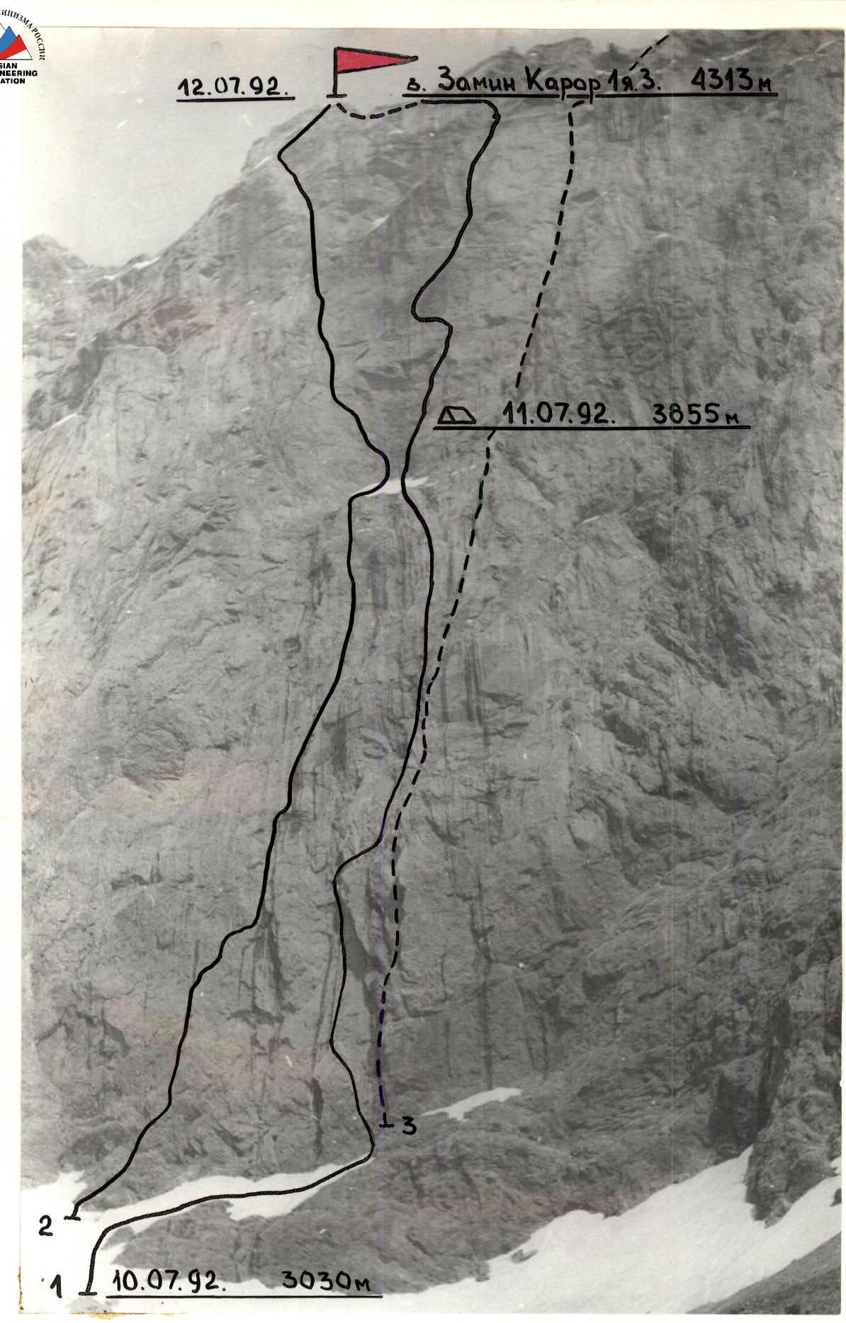
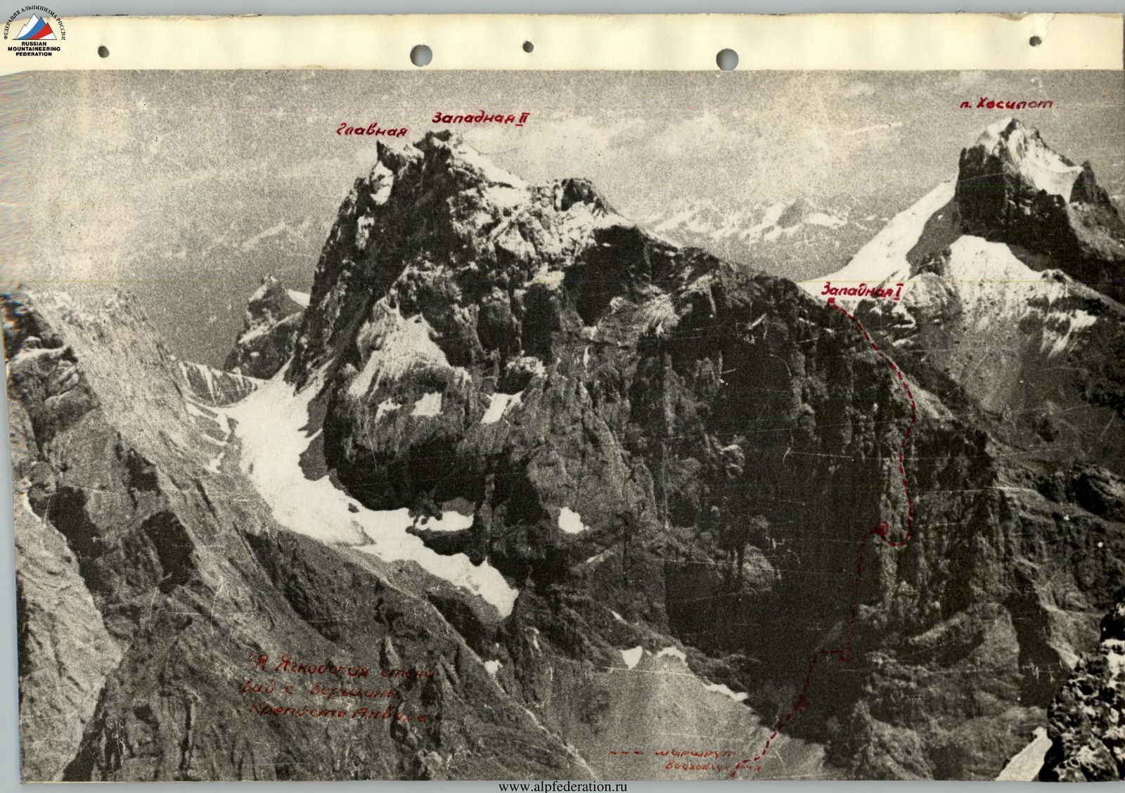
Photo — 1. Date taken — July 7, 1992. Lens — Industar 61L/3. Distance — 1.5 km. Shooting height — 2800 m. Shot number — 1. 1 — route taken by the team via NW wall (Eifmov, 1979). 2 — O. Kapitanov's route via NW wall, 6A category (1974). 3 — route via the central part of NW wall, 5B category (Shramko, 1971).
Profile of the route to Zamin-Karor I-Western via NW wall, 6th category. View from the right

Photo — 2. Date taken — July 7, 1992. Lens — Industar 61L/3. Distance — 1.5 km. Shooting height — 3800 m. Shot number — 2.
Profile of the route to Zamin-Karor I-Western via NW wall, 6A category. View from the left
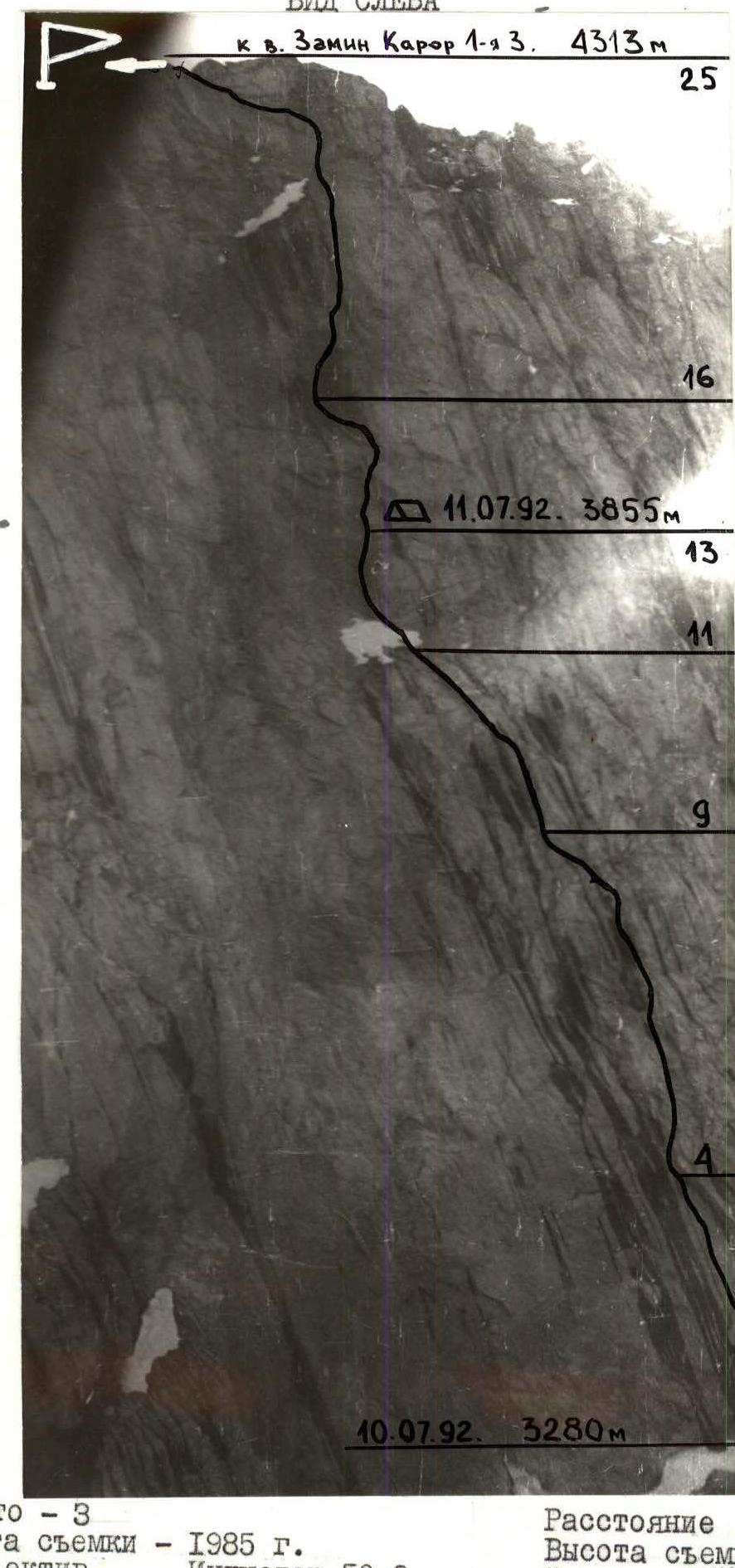
Photo — 3. Date taken — 1985. Lens — Industar 50-2. Distance — 1 km. Shooting height — 3800 m. Shot number — 3.
Photopanorama of the area
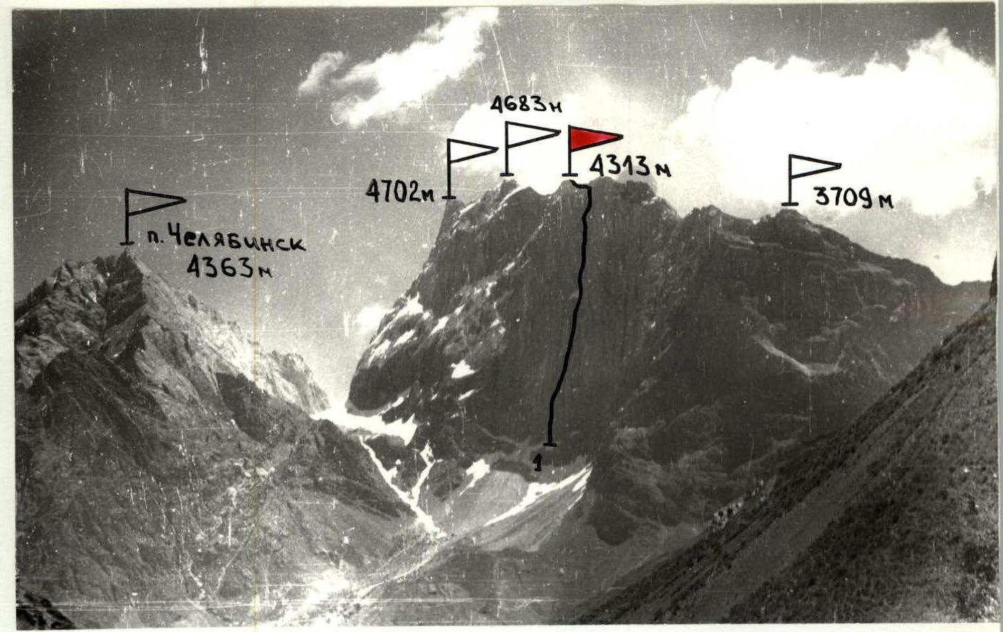
Photo — 4. Date taken — 1985. Lens — Industar 50-2. Distance — 5 km. Shooting height — 2800 m. Shot number — 4. 1 — route via NW wall, 6A category (Eifmov, 1979).
The results of observations, studied materials, and consultations formed the basis of the tactical plan. The team planned to complete the route with one overnight stay on the wall, i.e., with maximum speed. The team fully implemented their plan. The route was completed from July 10 to July 13, 1992, in 31.5 climbing hours with one day of preliminary processing. The descent from the summit took 6 hours. Team composition: Sidorov D.V. — CMS — captain, Kirgirin V.A. — CMS, Plechkov A.Y. — CMS, Fedorkov Y.V. — CMS. To implement the high-speed ascent schedule, the team was determined to be 4 people. The movement was organized as follows: the leader worked without a backpack in rock shoes on a double rope (UIAA+USSR), setting up fixed ropes. Other team members climbed the fixed ropes using jumar and Petzl-type ascenders. The second team member carried a lightened backpack (first aid kit, personal items, and items for the first climber), straightening and dividing the fixed ropes. The third porter carried the main load. The fourth climber with a lightened backpack "cleaned" the route. All participants had double protection. To allow all participants to work as the first climber, the leader changed twice a day after processing.
The route has been visited rarely in recent years: once every two years; it is complex, which is why there are "old" "standard" protection elements (similar to popular routes in Karavshin to the summits of Asan and 4810). The participants tried to minimize the use of artificial aids and go for clean climbing as much as possible. Only the need to overcome the "mirror" (above the "unit") and the eaves was planned using artificial aids. The team used modern, state-of-the-art equipment that had passed strength tests. Belay points were organized mainly on 3 elements, blocked with a sling.
The ascent schedule exactly corresponded to the tactical plan and was as follows:
- July 10. Processing by the duo Sidorov–Fedorkov. Task — reaching the first control cairn. Problem — overcoming the smooth slab — "mirror" (section R3–R4). Solution — extreme climbing, alternating with artificial aids and work on skyhooks. From 10:00 to 18:00, the problem was solved.
- July 11. Start of work at 8:15. Task — reaching a safe overnight stay above the "glass". Problem — a long section of wet, dirty rocks. Solution — extreme caution, high level of rock climbing preparation, and significant mountaineering experience. By 19:45, the duo Kirgirin–Plechkov solved the task and processed the rope above the overnight stay.
- July 12. Start of work at 8:15. Task — reaching the summit. Problem — a belt of eaves leading to the upper bastion against the backdrop of fatigue from the last day of ascent. Solution — extreme attentiveness and skills working on eaves. By 20:15, the team reached the summit. Overnight stay on the descent, 150 m from the summit. The leading duo of the day — Fedorkov–Sidorov.
- July 13. Descent along the summit ridge, including 1 rappel. Then along the slopes of Zamin-Karor and the Pindor River valley. The descent to the base camp took 6 hours.
There were no injuries or falls during the ascent. During the ascent, a qualified rescue team, a doctor, was present in the base camp, ready to act; constant observation was maintained, and regular radio communication was kept.
On the route, there were two hot meals and a daytime snack. Food was taken on the route at a rate of 350 g/person·day. There is water on the route, but at the overnight stay location, there was snow, which had to be melted for cooking.
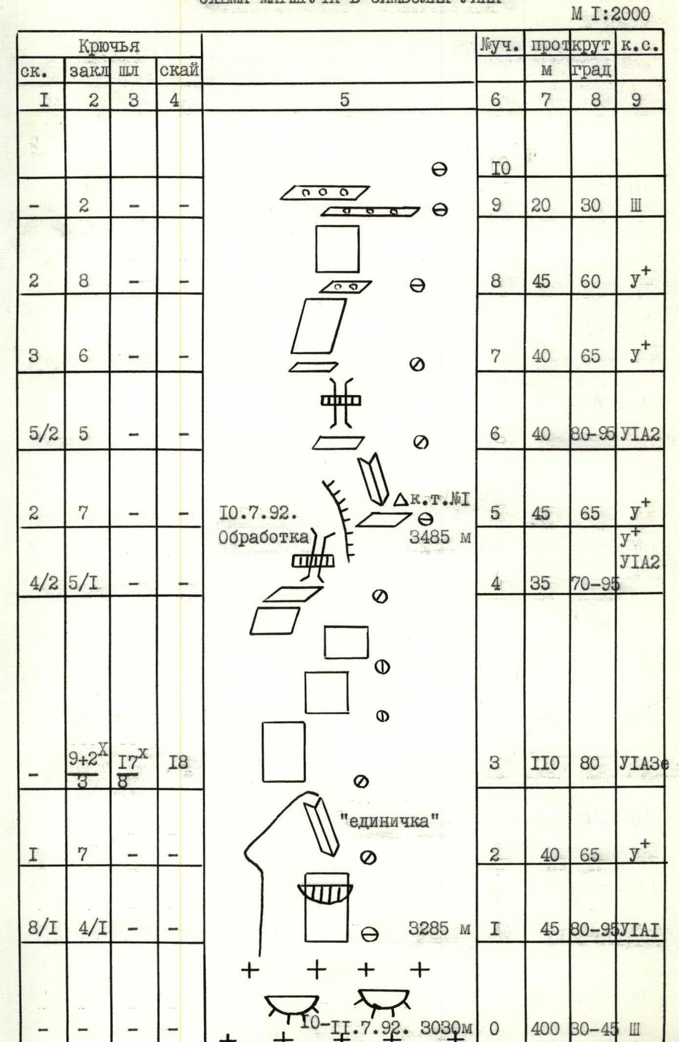
Route diagram in UIAA symbols M 1:2000
8a —
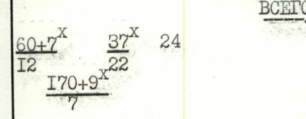
Total: 1635 m
The route was completed in 31.5 climbing hours.
Description of the route by sections
- Section R0–R1. Snow slope leads to the base of the NW wall, then to the right along the snow "tie" and "ram's foreheads" to the approach under the "unit". From here, the wall section of Eifmov's route begins. 400 m, 30–45°, 3.
- Section R1–R2. Wall with an overhang in the middle part. Passed with partial use of artificial aids. 45 m, 80–95°, UIAA1.
- Section R2–R3. Wet inner corner (chimney) leads to the top of the "unit". 40 m, 65°, y+.
- Section R3–R4. Smooth slab — "mirror". Passed using skyhooks and bolts. In the upper part, an extremely difficult traverse 6 m to the left. Belay point in a convenient niche. 110 m, 80°, UIAA3e.
- Section R4–R5. Over the wall and chimney through the overhang to the right over the "flake". Control cairn. 35 m, 70–95°, y+–UIAA2.
- Section R5–R6. Destroyed inner corner. 45 m, 65°, y+.
- Section R6–R7. Inner corner turns into a chimney with an overhang, wet and dirty. Rocks are heavily destroyed. 40 m, 80–95°, UIAA2.
- Section R7–R8. Monolithic slabs separated by ledges. Many loose stones. 40 m, 65°, y+.
- Section R9–R10. Inclined slab with "live" stones leads to the base of the inner corner. 20 m, 30°, 3.
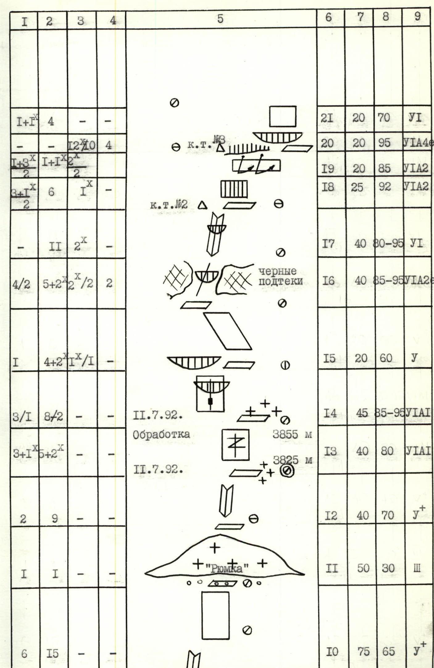
- Section R10–R11. 20 m, 95°, UIAA4e.
- Section R11–R12. Cross the snow shelf at the base of the "glass". 50 m, 30°, 3.
- Section R12–R13. Inner corner leads to a system of snow-covered ledges. Pleasant climbing. 40 m, 70°, y+. Overnight stay location.
- Section R13–R14. Vertical wall with a wide crack. Small stoppers and cams are used. 40 m, 80°, UIAA1.
- Section R14–R15. Passage through an overhang with a slit, then traverse to the right with a height gain, bypassing the overhanging wet slab. 45 m, 85–95°, UIAA1.
- Section R15–R16. Over the wet inclined slab, exit to the left between two black streaks. 20 m, 60°, y.
- Section R16–R17. Wet crack with an overhang. Skyhooks, bolts, and artificial aids are used. 40 m, 85–95°, UIAA2e.
- Section R17–R18. Inner corner with an overhang leads to a narrow ledge with a control cairn. Belay point on bolts. 40 m, 80–95°, U1.
- Section R18–R19. Wall with a small overhang. 25 m, 92°, UIAA2.
- Section R19–R20. Departure with two pendulums to the right under the overhanging "flakes". Water flows from above through the overhang. Control cairn. 20 m, 85°, UIAA2.
- Section R20–R21. Bolt route through the overhang (cornice). Water flows.
- Section R21–R22. Passage along the wet slab to the right edge of the giant inner corner. 20 m, 70°, U1.
- Section R22–R23. Right edge — wall with microrelief. Extremely limited choice of protection elements. Exit to a large snow shelf. 95 m, 60–70°, UIAA1.
- Section R23–R24. Destroyed, partially icy slabs lead under the summit ridge. 105 m, 65°, y+.
- Section R24–R25. Over the "tile" rocks, exit to the shoulder in the ridge. 30 m, 75°, y.
- Section R25–R26. Movement along the ridge to the left-up towards the summit. 150 m, 45°, 3.
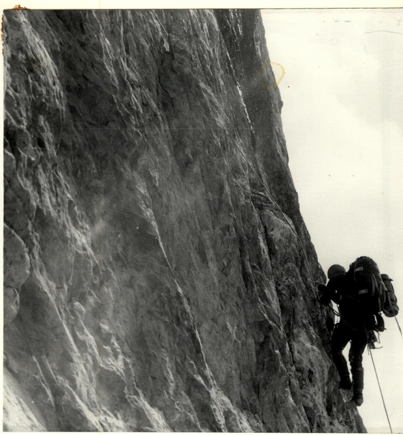
Photo — 8. Section R7–R8.
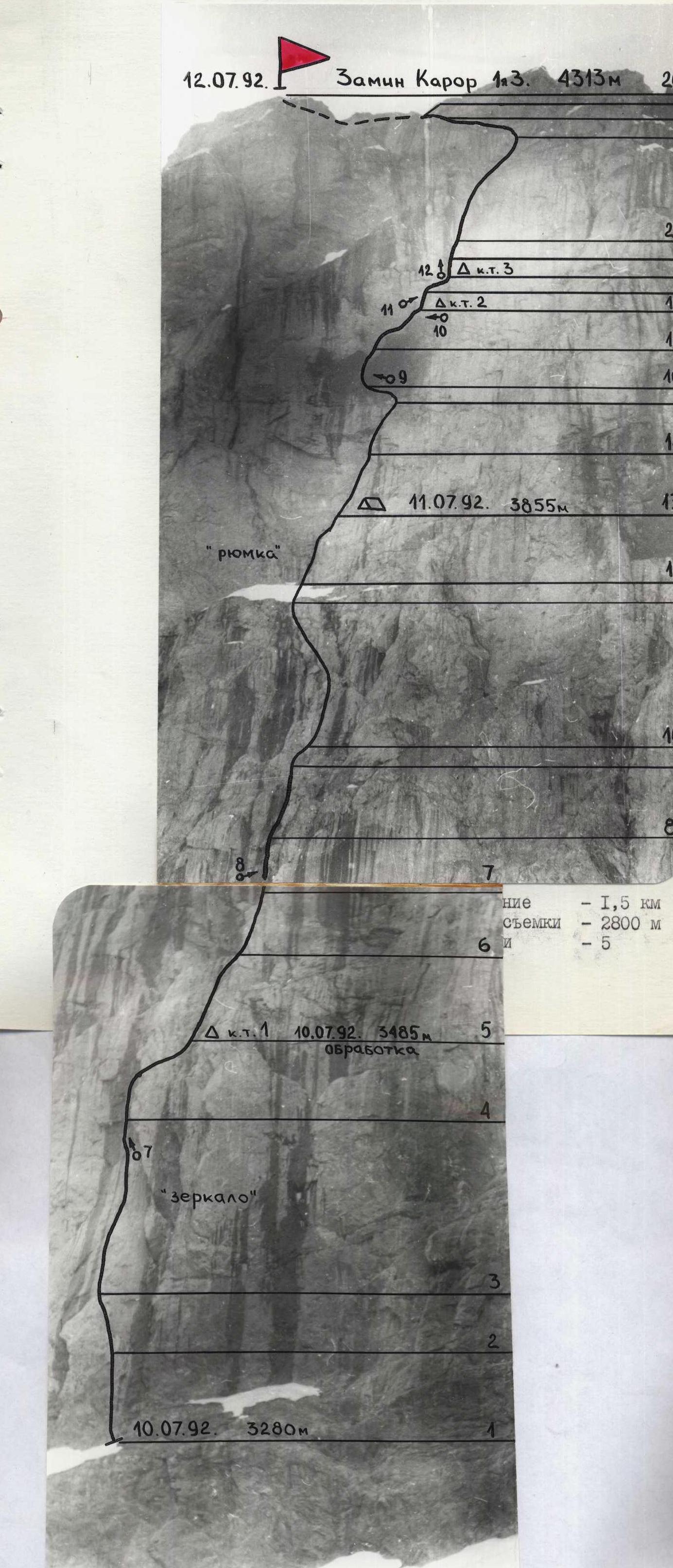
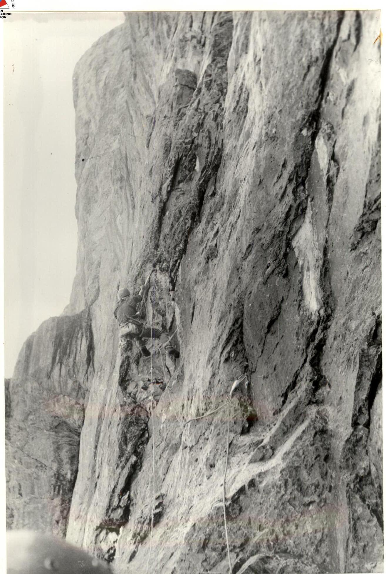
Photo — 9. Section R16–R17.