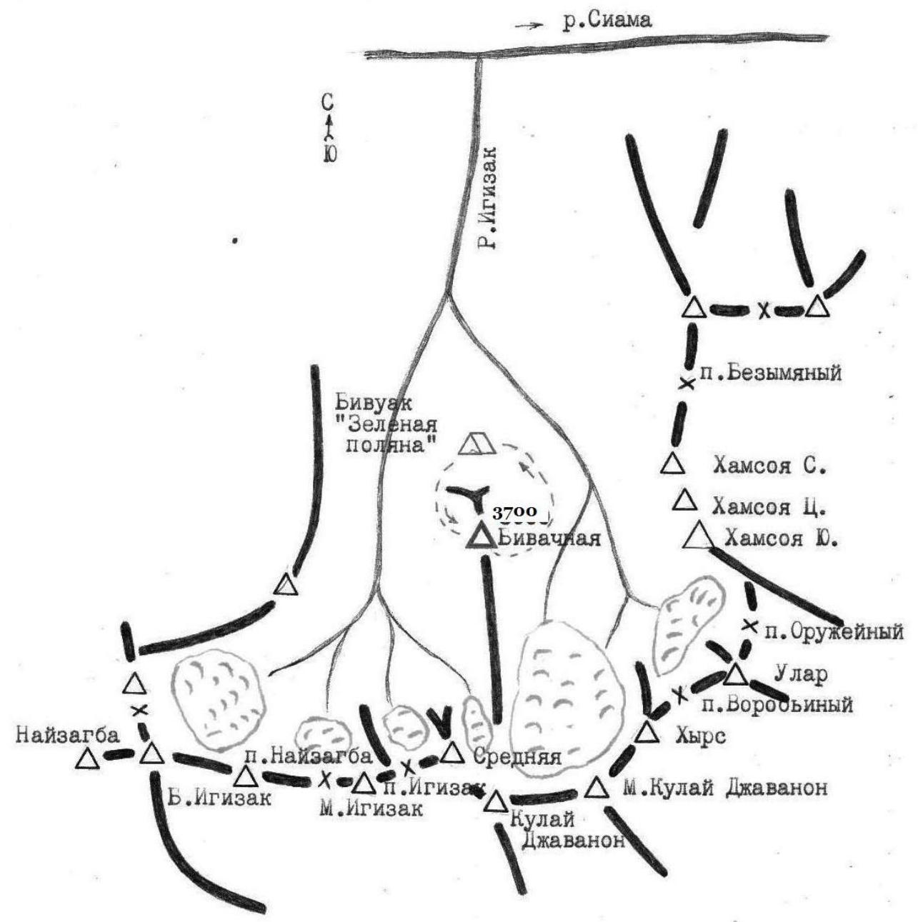
Area map (From the book by S. N. Sogrin. "Routes — Pamir-Alay")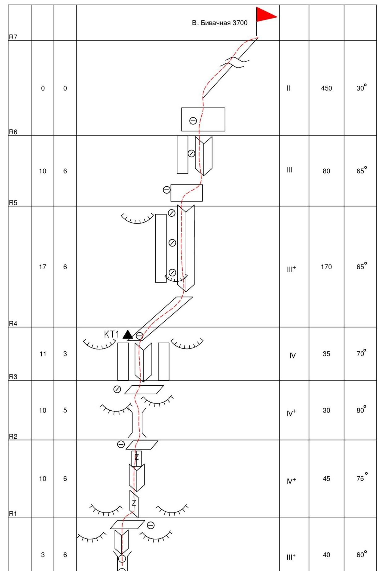
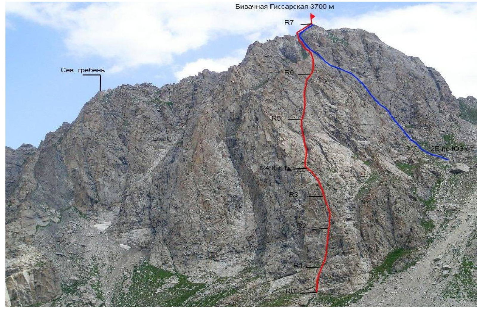
Bivachnaya Gissarskaya 3700 m R7 North ridge F-R8 B 16 1095 B 4 1095 4-A P/P 2013
Photo 4. Technical photography of the route. Taken with FE250/X800 camera on July 24, 2011 at 12:38. Distance to the shooting point is 1 km.
Route Description
From the "green meadow" bivouac, go upstream along the Igizak stream, approach the right western part of the Bivachnaya massif wall. The approach takes 1 hour. The route starts 100 m to the right and below the dark vein ("integral"), which cuts through the wall. A characteristic landmark for the start of the route is the dry stream bed, leading under the wall to a small cairn with a stopper, turning into an internal corner. A pronounced, visible crack runs along the entire route thread.
R0–R1 — through a cairn and an internal corner, rocks of medium complexity, 40 m to a small overgrown ledge. A good place to organize a station. Placement elements go well.
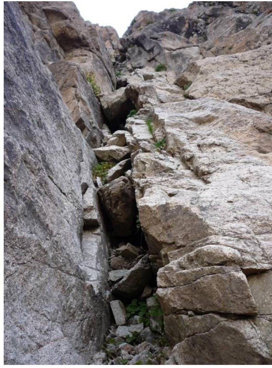
R1–R2 — along a slab with a wide pronounced crack, turning into a small internal corner, up 45 m. The steepness of the slope and the complexity of climbing increase. To the right and left of the crack, the rocks are smoothed out, the cracks are deaf; anchor pitons go well for reliable intermediate protection. The crack itself is clogged with growing grass; be careful. This is the first key section of the route; it is climbed on friction with small but good holds.
R2–R3 — the steepness of the slope increases to 80 degrees. The route continues first through a notvery pronounced cairn, then moves to a slab with a large crack (the main thread of the route); to the right and left are smoothed rocks — "ram's foreheads". Although the length of the section is 30 meters, there are places with small overhanging stones. The second key section. Anchor pitons go into deaf cracks. Station on a small inclined ledge.
R3–R4 — further up the crevice directly upwards, the length is 35 m (IV cat. diff.). The wall is overhanging in places. The route is logical; to the right and left, there are either overhanging slabs or "ram's foreheads"; movement is possible only along the crevice. The third key section. It is climbed on friction; intermediate belay points are anchor pitons (due to deaf cracks). Exit to a large scree ledge, with a control cairn on it.
R4–R5 — a large internal corner; climbing is done along the left edge; the right edge is strongly overhanging. 170 m. Average steepness is 65°. The beginning of the route is slightly complicated by a large overhanging stone. In general, the section is not difficult when the rocks are dry (III+ cat. diff.). Both pitons and placement elements are used for belaying. Move carefully, as the route is peppered with falling stones. Exit to a ledge, convenient for organizing a station and resting.
R5–R6 — movement along the second internal corner, along the left edge. 80 m, not difficult climbing (cat. diff. III). The section is exposed to falling stones; move carefully. Exit to a ledge. End of technical sections.
R6–R7 — along simple stepped rocks, exit to the ridge, then 450 m of exhausting meters to the summit. Descent via 1B into the Kulay-Dzhavon cirque; however, if the path to the right is chosen non-optimally, one may encounter several unpleasant rappels.
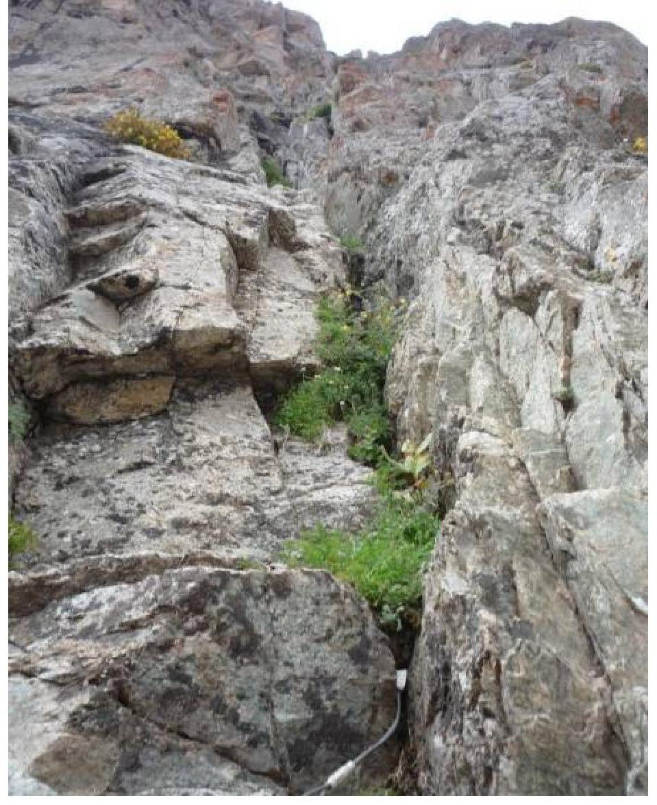
- Photo 5. R0. Start of the route.
Photo 6. Section
R1–R2.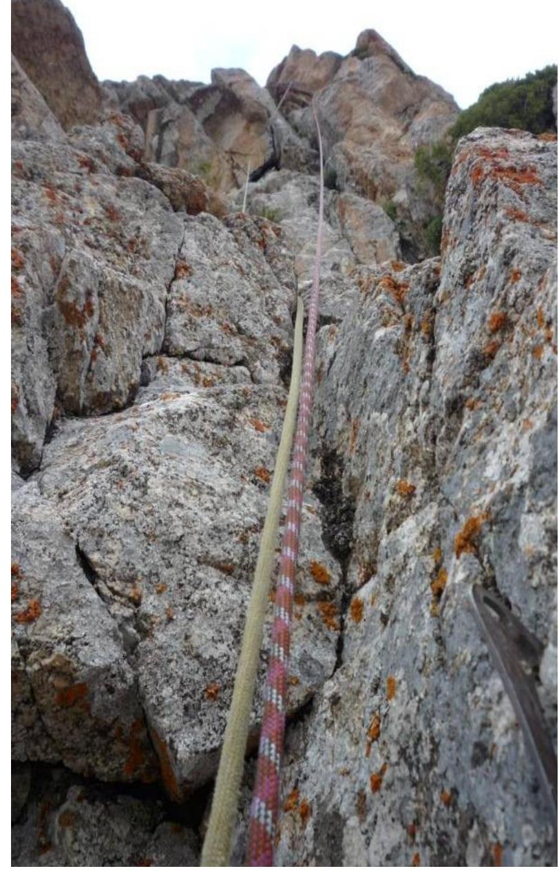

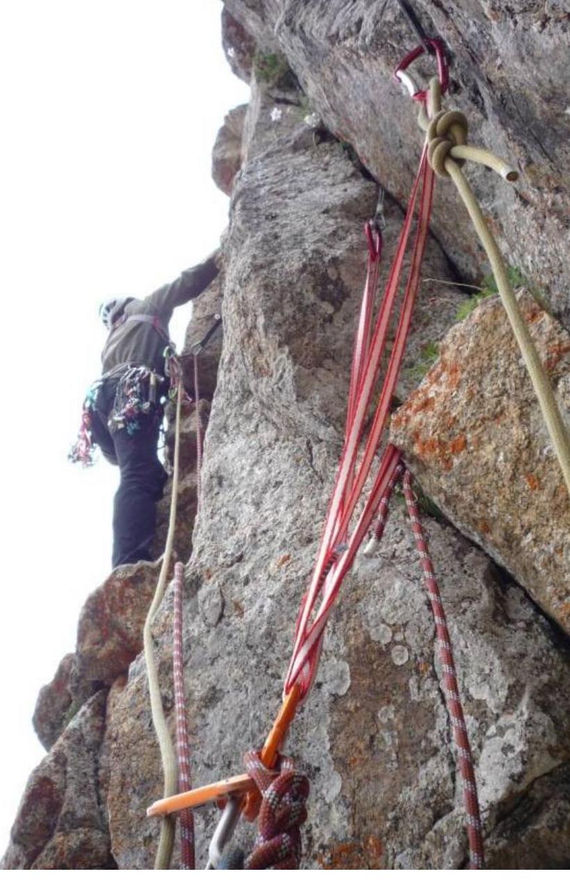 Photo 7.
Section R2–R3.
Photo 7.
Section R2–R3.
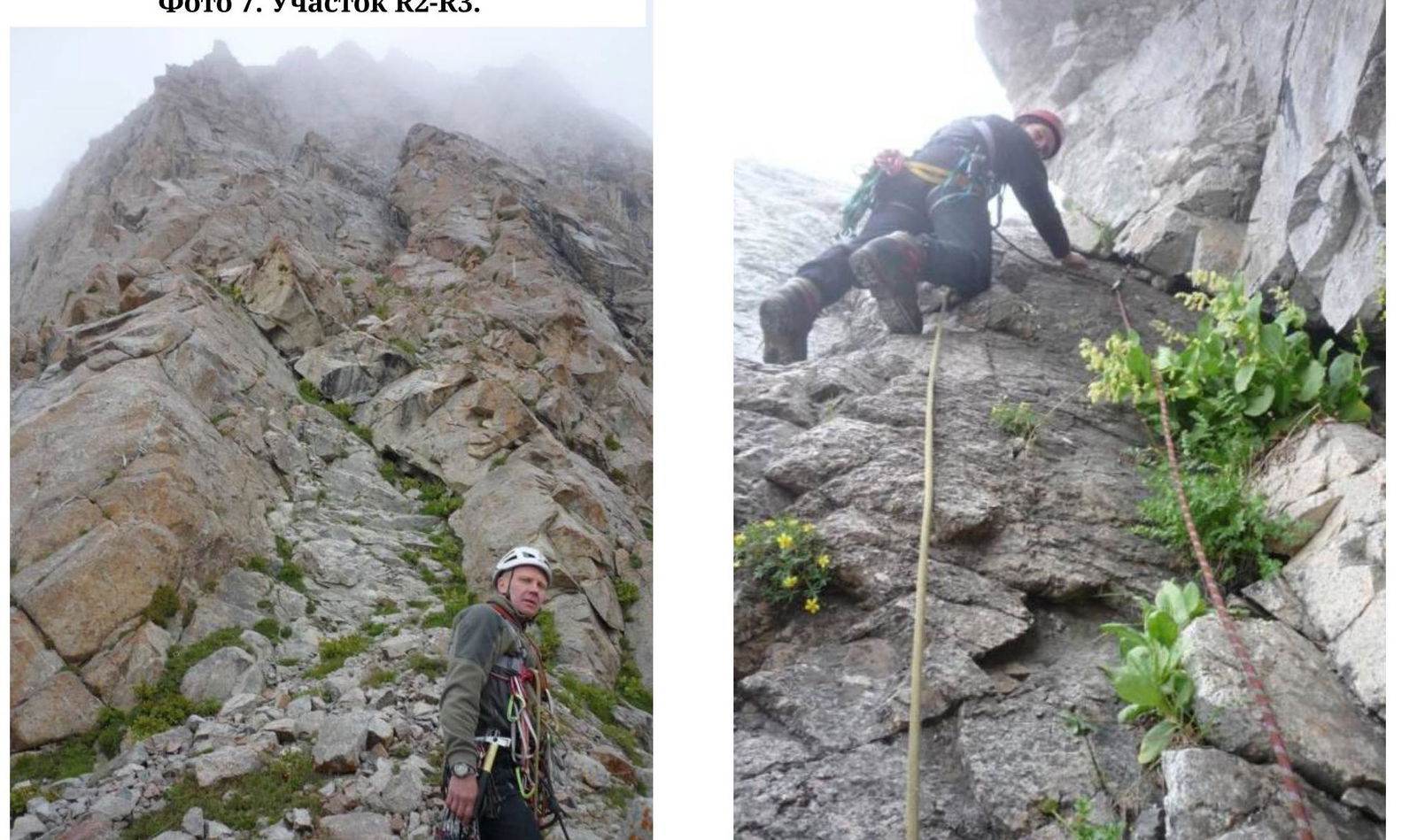 Photo 9.
Section R4. Large ledge K.T. 1.
Photo 9.
Section R4. Large ledge K.T. 1.
Photo 10. Section R4–R5. First internal
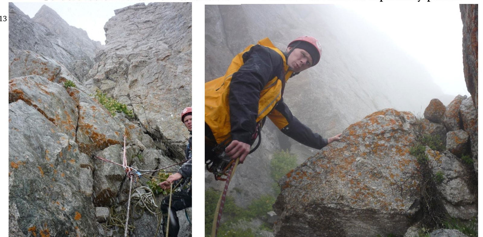
Photo 11. Section R5. Second ledge. Entrance to the second internal corner.
Photo 12. Section R6. Ledge before exiting to
the ridge.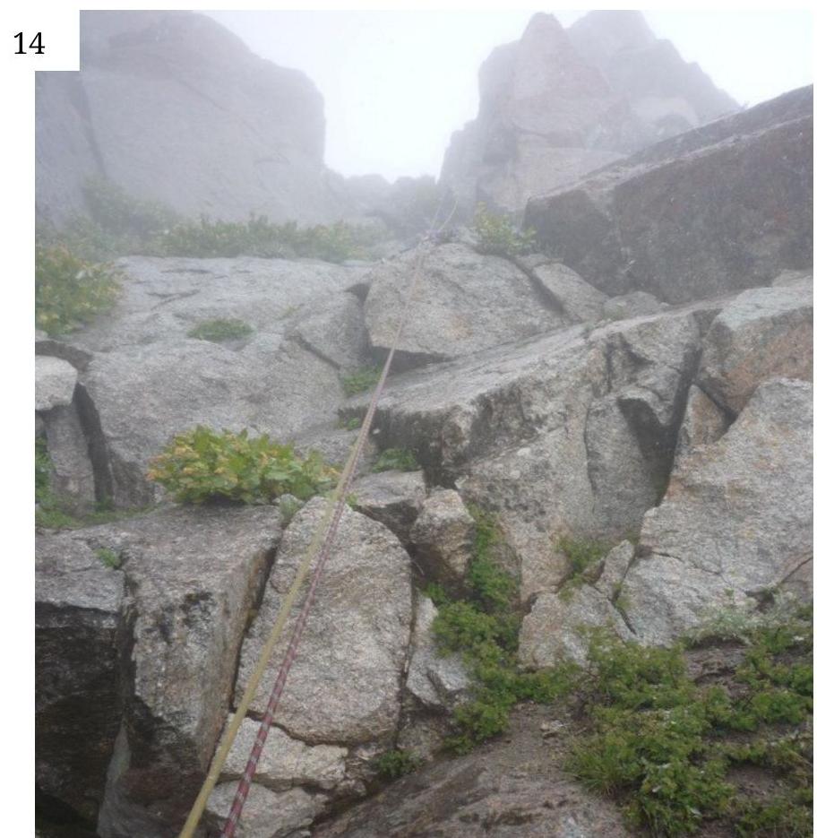
Photo 13. Section R6–R7. Exit to the pre-summit ridge.
Photo 14. Section R7. Summit