Ascent Passport
- Region: Pamir-Alay, Hissar Range (section 5.2)
- Peak: Bivachnaya Gissarskaya, 3700 m via the right part of the West Wall
- Proposed difficulty category: 4A category route
- Route type: Rock
- Elevation gain: 400 m
Route length: 850 m, including 110 m of 4th category difficulty sections. Average steepness of the main part of the route (R0–R8) is 68°. Average steepness of the entire route is 50°
- "Kruch" left on the route: total — —
including piton anchors
- Team's travel time: 9 hours 30 minutes, 1 day*
- Leader: Vorobyev Alexander — 1st sports category. Participants:
Bogolyubsky Konstantin — 1st sports category
-
Coach: Igolkin Victor Ivanovich — Master of Sports
-
Departure to the route from Base Camp ("Zelenaya polyana") — 6:00, July 10, 2013
Route started — 7:00, July 10, 2013. Reached the summit — 16:30, July 10, 2013. Return to Base Camp ("Zelenaya polyana") — 18:00, July 10, 2013. Descent from the summit via the Southwest ridge, 1B category. 11. Organization: Alpkлуб of Magnitogorsk
-
Person responsible for the report: Vorobyev A.V. 456208, Zlatoust, Chelyabinsk region, 50 let Oktyabrya st., 4-43, e-mail: snowmengt@mail.ru, phone (3513) 63-70-84, 89048196281
-
-
- during the ascent, weather conditions deteriorated after section R5 (wet snow), which reduced the speed of the ascent.
-
-
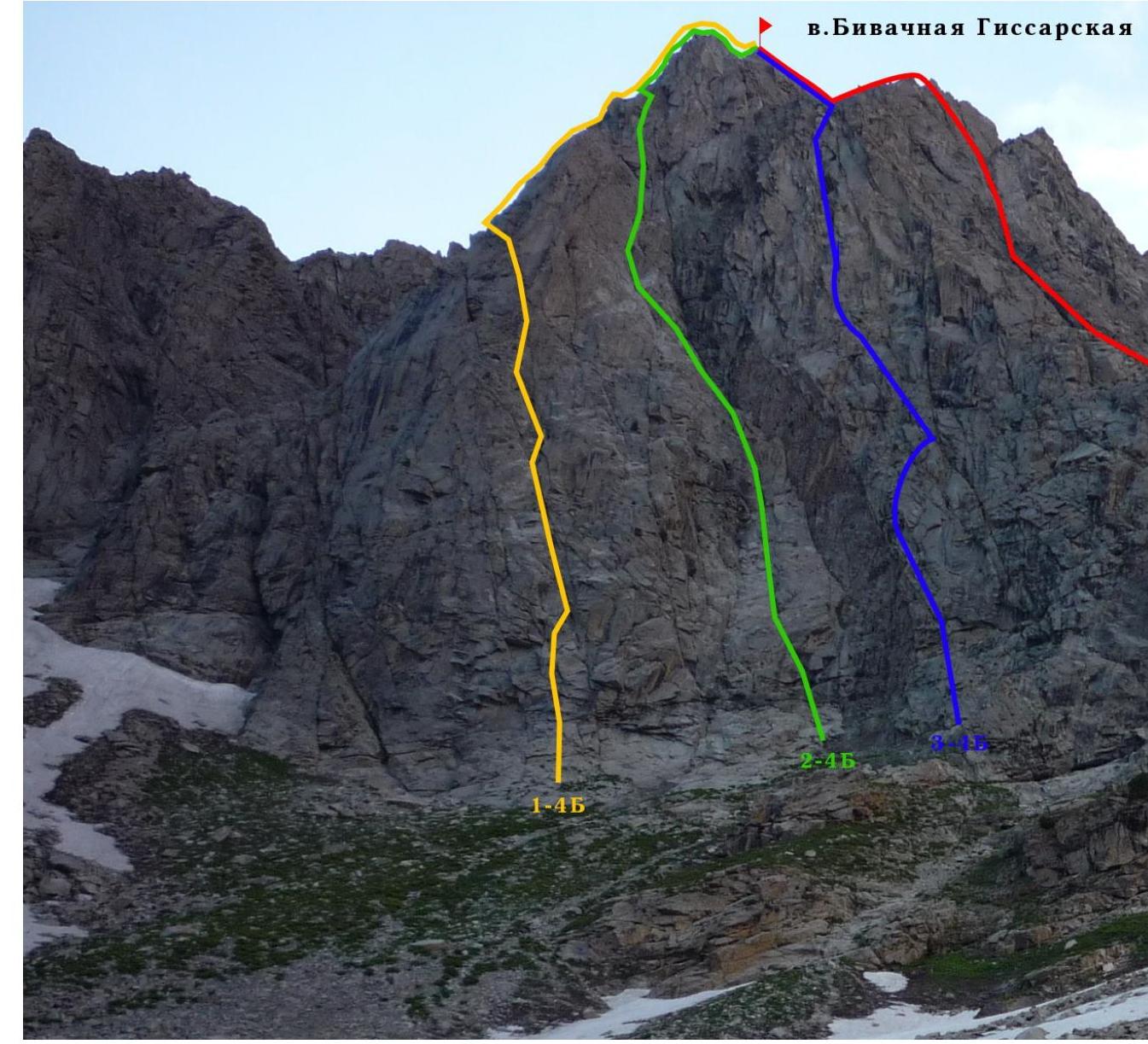
Photo 1. General photo of the peak. Taken with a DMC-LZ8 camera on 07/10/2013 at 05:57. Distance to the shooting point is 0.5 km. Bivachnaya Gissarskaya 3700 m
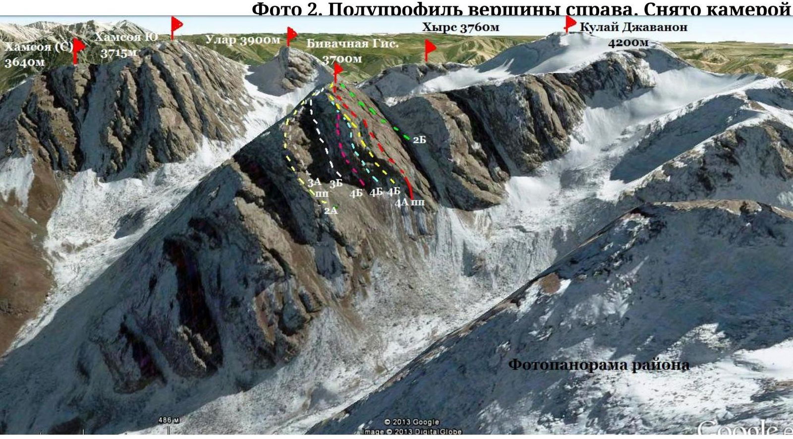
Photo 3. Panorama of the area. The image was taken from a satellite through a prog