The ascent class is technical. The ascent area is the Gissar Ridge, Igizak area.
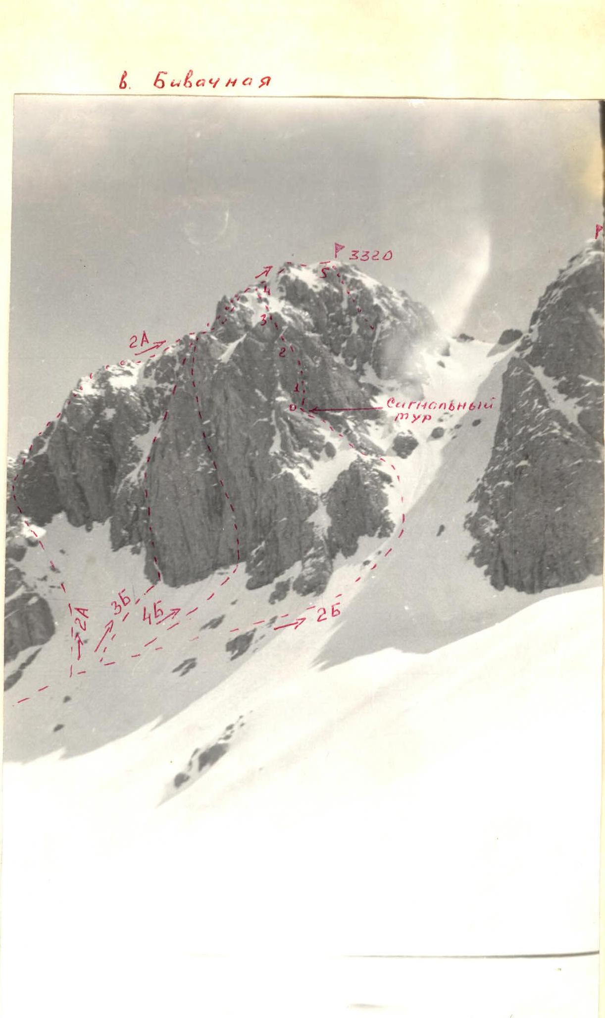
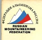
3700 m. No. 10. Peak, its height, route - p. "Bivachnaya" 3320 m via the Southwest wall.
Proposed difficulty category - 2B. Route characteristics:
- height difference - 300 m;
- average steepness - 50°. Driven pitons: rock - 16. Number of walking hours: - 7. Number of overnight stays and their characteristics - none. Surname, name, patronymic of the leader, participants and their qualifications:
- Lavruhin V. - MS.
- Kozlov P. - CMS. Team coach: Sogrin S.N. - MS. Dushanbe - 1978.
–43–
 Approach to the route
From the "Green Glade" bivouac, go upstream along the stream flowing from the cirque of the Bolshoy Igizak peak. At the mouth of the cirque, start traversing left along the snowy, and in summer, talus slope with a simultaneous ascent to the neck of the slope leading to the pass located south of the "Bivachnaya" peak. The ascent to the pass is carried out almost to the middle of its length. In the middle part of the ascent to the pass, a good transition along the talus slope in summer (snow in spring) opens up to the southwest slopes of the peak. Along the rocky slope to the left far corner (in the direction of travel) along the talus slope under the wall. From the transition point from the couloir leading to the pass under the wall, a logical route is visible, such as an internal corner, running from the very left edge of the talus shelf, where we arrived.
The general direction of the route is along the internal corner. Descent from the peak is along the 1B category difficulty route. The ascent takes 6-8 hours from the base camp and back.
Table of main characteristics of the route to the "Bivachnaya" peak via the Southwest wall - 2B category difficulty.
The table was compiled by Lavruhin
| Date | Designation | Average steepness in degrees | Length in m. | Character of relief | Difficulty | State | Weather conditions | Rock. | Ice | Bel |
|---|---|---|---|---|---|---|---|---|---|---|
| I | 2 | 3 | 4 | 5 | 6 | 7 | 8 | 9 | 10 | II |
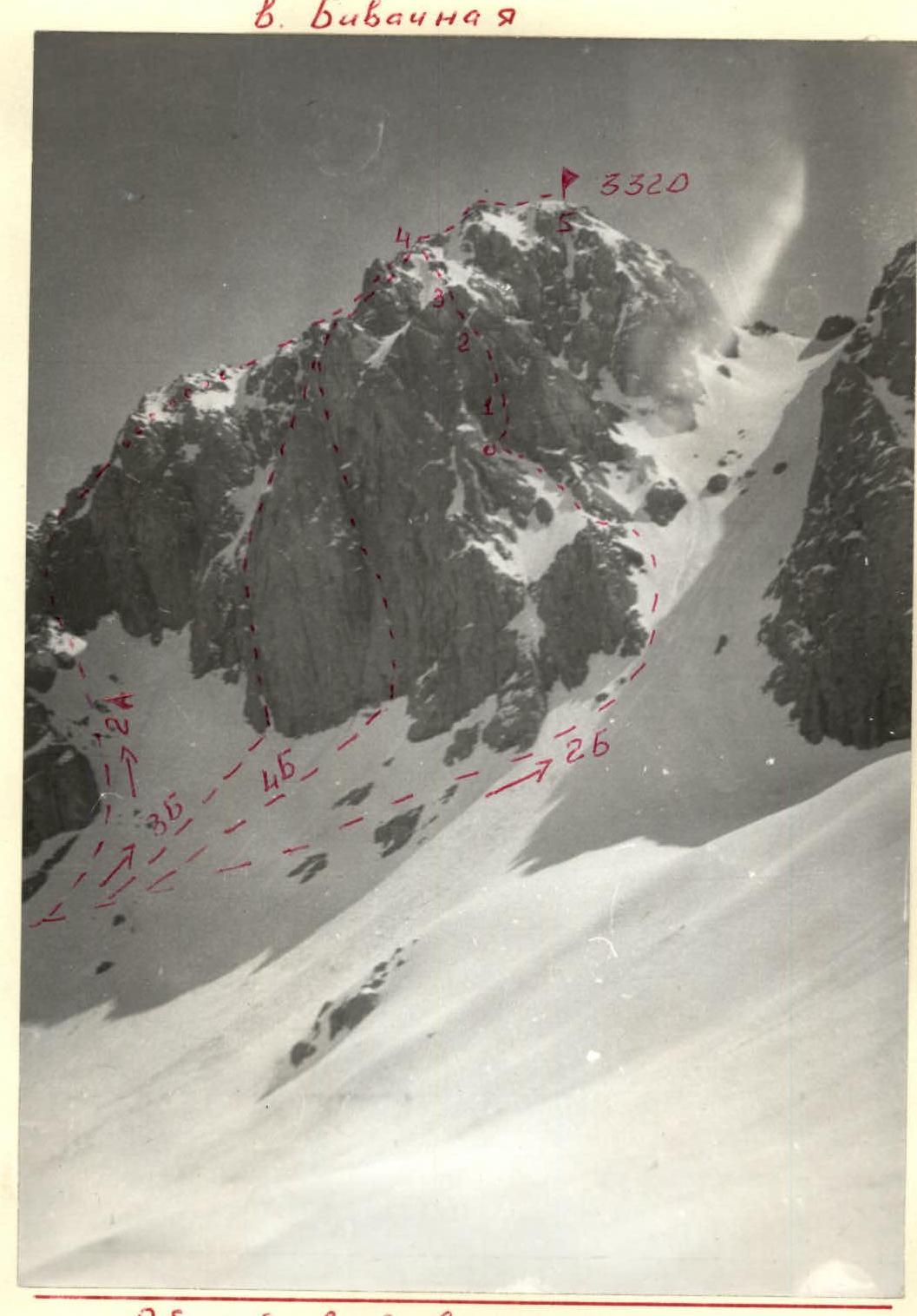
| May 21, 1978 | R0–R1 | 70 | 40 m | internal corner | III, II | Monolith | good | 5 | – | – |
| "–" | R1–R2 | 65 | 80 m | wall | I, III | monolith | good | 7 | – | – |
| "–" | R2–R3 | 65 | 60 m | internal corner | II, III | MONOLITH | "–" | 5 | – | – |
| "–" | R3–R4 | 30 | 120 m | talus slope, rock outcrops | I | loose rocks | "–" | protection for ledges, simultaneously | ||
| "–" | R4–R5 | 30 | 200 m | rocky ridge | I, II | destroyed ridge | "–" |
Section R0–R2
–49–
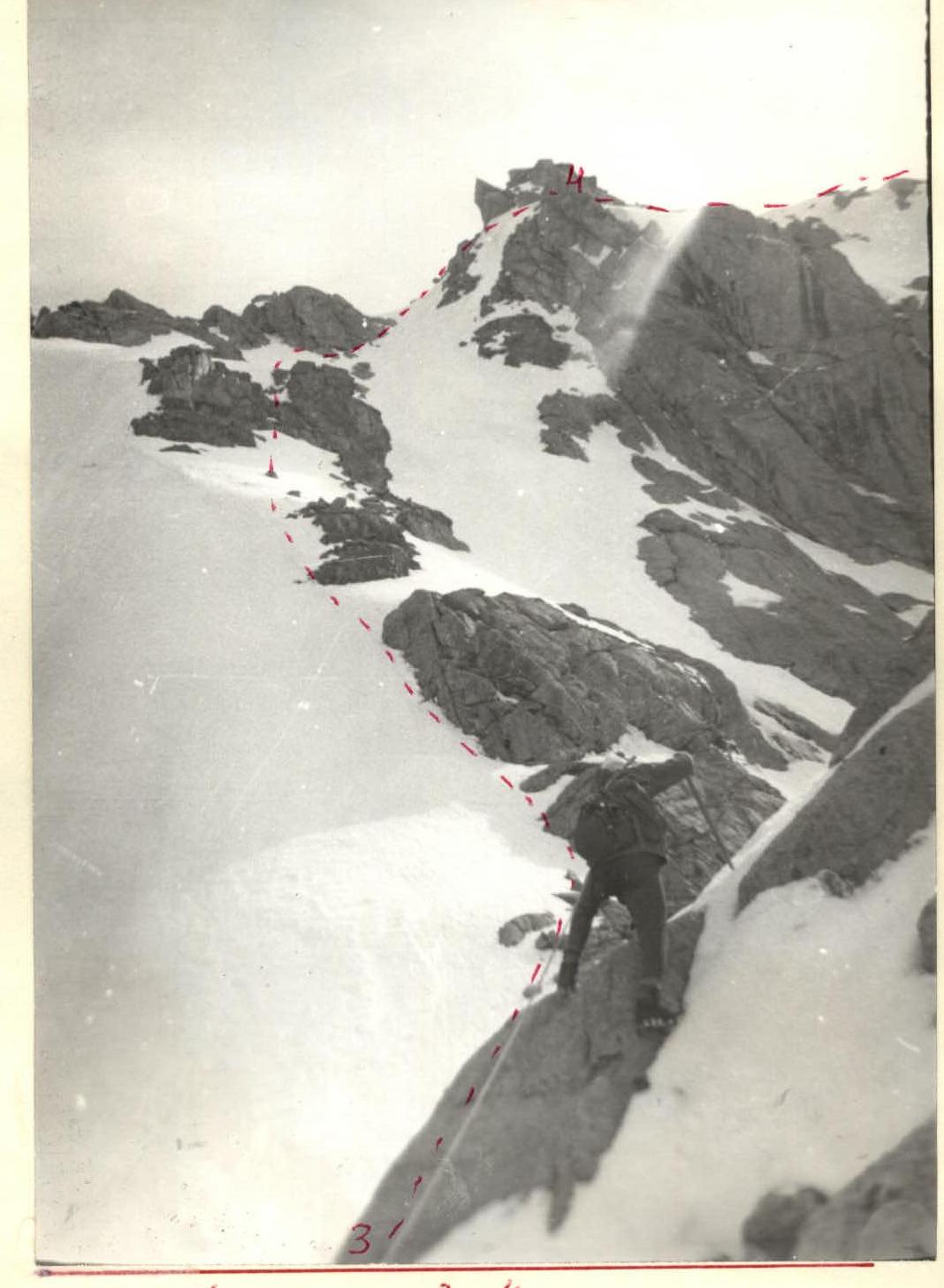
Section R3–R4