Brief Description
Ascent route to p. "Носорог" (Rhinoceros Peak) via the northern ridge, category 2B
From the base camp located in the upper reaches of the Hodja-Sang-Hok valley, on a grassy clearing under the slopes of p. 40 let Komsomola Tadzhikistana (40 Years of Komsomol of Tajikistan Peak) and per. Sang-Hok, first ascend via grassy and then snowy slopes to below per. Sang-Hok. Without reaching the pass, turn right and ascend the snowy slope leading to the ridge, then along the ridge to the right for 40–50 meters on easy rocks — exit onto a snowy plateau. From the plateau, via simple rocks at 35–40°, reach the ridge visible from the base camp as a "fence". Move along the ridge towards the summit. Bypass obstacle rocks and cornices on the left. After descending into a small depression, bypass a rock pinnacle on the right by descending on snow to a snowy shoulder. Having bypassed the pinnacle, ascend to the ridge via an inner corner for 40 meters at 45°. Then, for 60 meters, move along the inner corner of the ridge to the "Rog" pinnacle. From the "Rog" pinnacle, descend into a small depression and ascend to the summit via a snowy slope, bypassing the ridge on the left on snow.
The descent from the summit is to the south along the ridge, then via simple rocks for 40–50 meters into a wide snowy couloir, which leads to a snowy plateau.
An alternative descent is possible via the ascent route. The entire route is visible from the base camp and is logical. Recommended for camping and sports groups. A. Koshkin + 3 people, July 5, 1983, 300 m, 40°, 6 rock rings, 1 artificial aid, 8.5 hours.
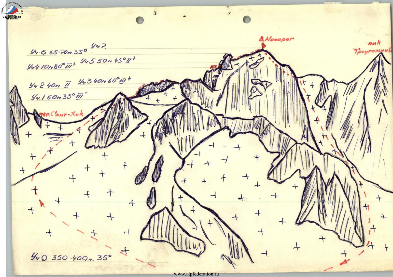
Table of Main Characteristics of the Route
TABLE OF MAIN CHARACTERISTICS OF THE ROUTE to p. "Носорог" (Rhinoceros Peak) via the northern ridge, category 2B
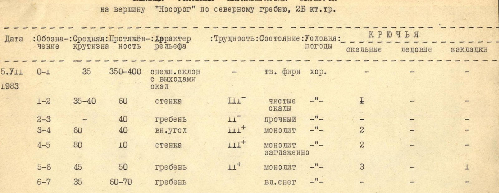
No overnight stays. Travel time from base camp to the summit — 5 hours. Descent from the summit — 3 hours.
| Date | Section | Average steepness | Length | Character of relief | Difficulty | Condition | Weather conditions | Rock pitons | Ice pitons | Chocks |
|---|---|---|---|---|---|---|---|---|---|---|
| 5.VII.1983 | 0–1 | 35 | 350–400 m | snowy slope with rock outcrops | — | hard firn | good | — | — | — |
| 1–2 | 35–40 | 60 m | wall | III | clean rocks | — | 1 | — | — | |
| 2–3 | — | 40 m | ridge | II | solid | — | — | — | — | |
| 3–4 | 60 | 40 m | inner corner | III+ | monolith | — | 2 | — | — | |
| 4–5 | 80 | 10 m | wall | III+ | monolith, smooth | — | 2 | — | — | |
| 5–6 | 45 | 50 m | ridge | II+ | monolith | — | 3 | — | 1 | |
| 6–7 | 35 | 60–70 m | ridge | — | wet snow | — | — | — | — |

