Ascent Passport
- Ascent category: rock climbing.
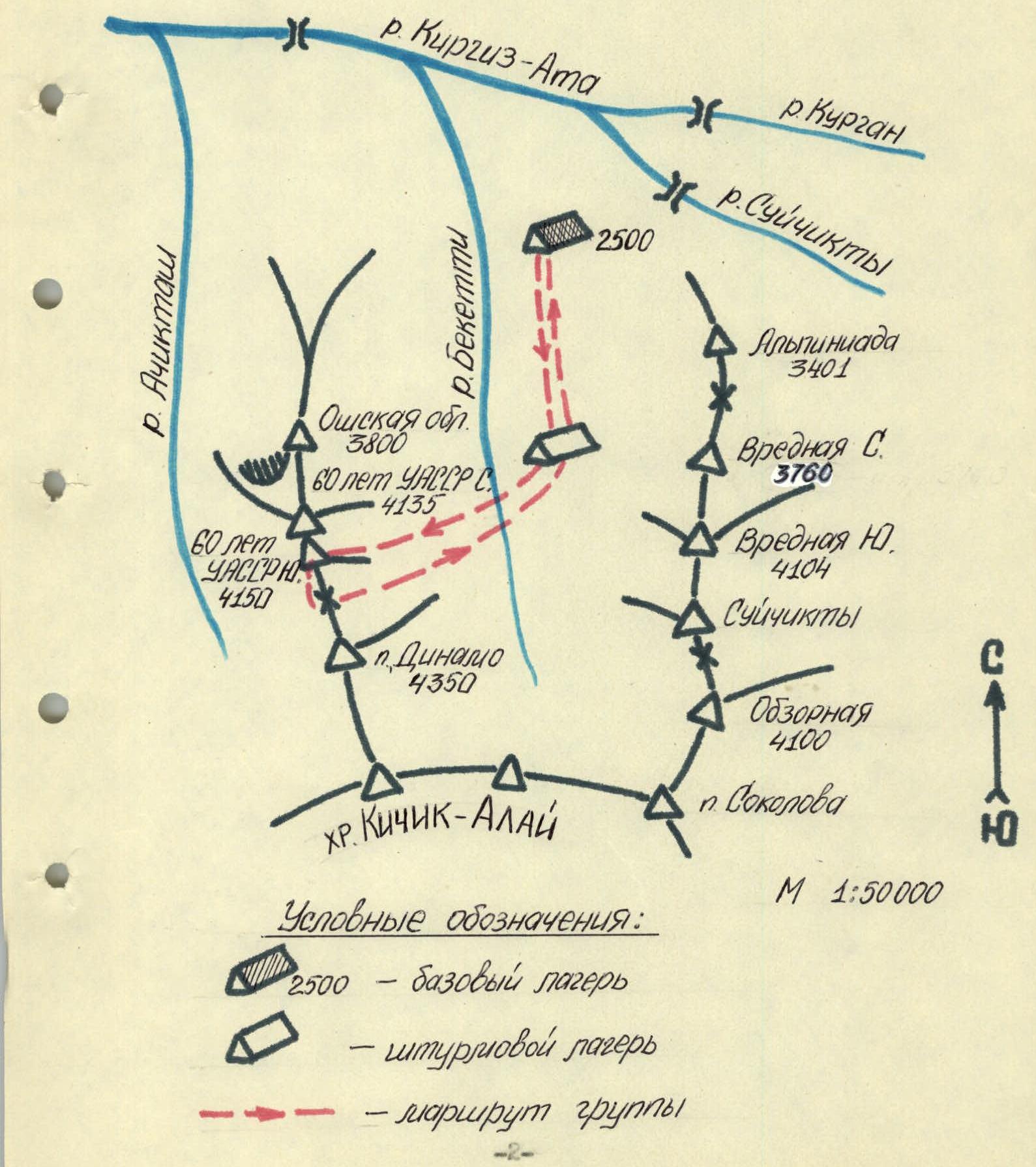
- Ascent area, ridge: Pamir-Alay, Kisik-Alay ridge, northern spur.
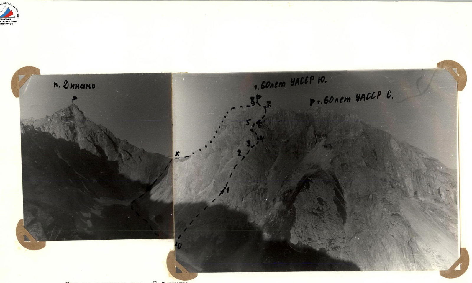
- Peak, its height, ascent route, route characteristics: 60 let UASSR Yuzhnaya, 4150 m, via the eastern ridge, rock climbing.
- Proposed complexity category: 3B.
- Route characteristics: elevation gain — 600 m; length of sections with 3–4 complexity category — 125 m; average steepness — 45–50 °.
- Number of pitons and placements of protection: 22/0.
- Total climbing time: 9 hours.
- Number of nights and their characteristics: —
- Surname, name, patronymic of the leader, participants, their qualification: Anisimov Oleg Viktorovich — II category (leader), Babushkina Svetlana Viktorovna — II category, Tolstobrova Natalia Borisovna — II category, Zabezhinsky Gleb Borisovich — II category.
- Team coach: —
- Date of departure and return: August 3, 1989.
- Organization: first ascent organized by Alay Mountaineering and Sports Club (AUSB "Alay").
The path from the base camp at the confluence of the Beketti and Kirgiz-Aty rivers follows a trail along the right (orographic) bank of the Beketti River to the upper cirque of the Beketti valley. The assault camp is located on grassy slopes in the cirque of the Beketti River valley. The path from the base camp to the assault camp takes 2 hours.
The approach to the route from the assault camp follows a grassy-scree slope — 45 minutes.
View of the peak from g. Suichty.
Ascent Area Map
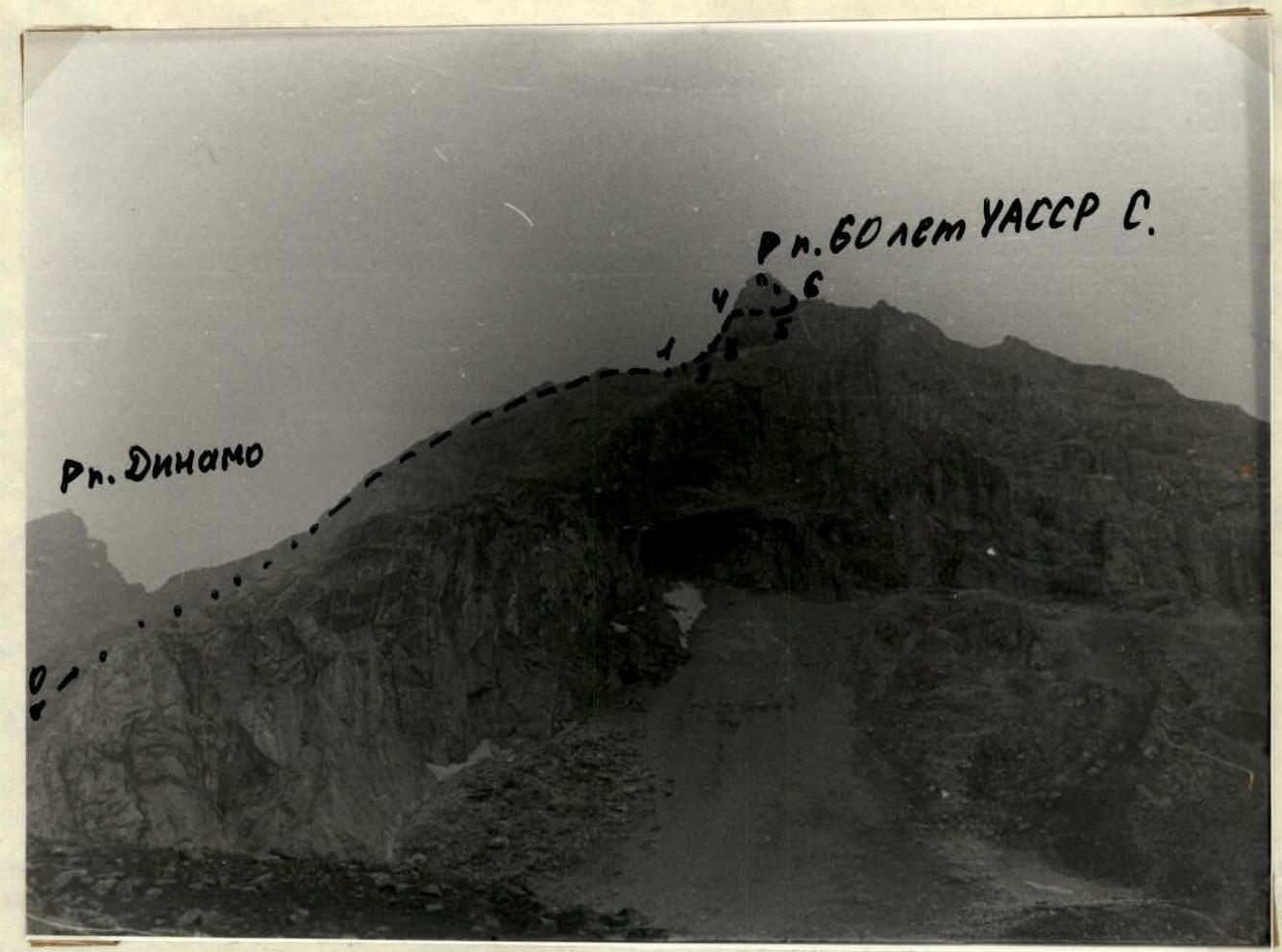
View of the peak and ascent route from the Beketti River valley.
Route Diagram in UIAA Symbols
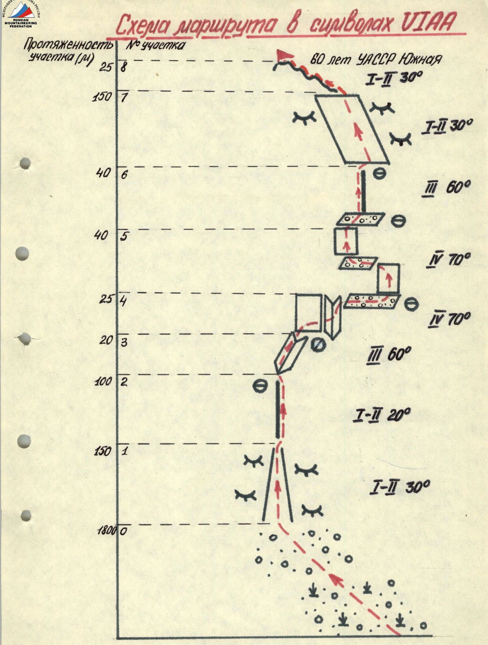 TABLE OF MAIN CHARACTERISTICS OF THE ASCENT ROUTE.

| Designation | Average steepness, degrees | Length, m | Terrain characteristics | Complexity | Weather conditions | Condition | Pitons | Protection placements | Loops | Type of belay | Notes |
|---|---|---|---|---|---|---|---|---|---|---|---|
| R0–R1 | 30 ° | 200 | rocky chute, grassy-scree slope, slabs | I–II | good | good | - | - | - | Simultaneous movement in rope teams | Approach to the start of the route |
| R1–R2 | 20 ° | 150 | ridge | I | good | good | - | - | - | Simultaneous movement in rope teams | |
| R2–R3 | 60 ° | 20 | inner corner | III | good | rockfall | 1 | 3 | 1 | Piton belay | |
| R3–R4 | 70 ° | 25 | wall | IV | good | rockfall | 1 | 2 | 1 | Piton belay | Traverse along the wall to the left to a ledge |
| R4–R5 | 70 ° | 40 | rocky wall  | IV | good | rockfall  | 4 | 2 | 1 | Piton belay | Two rocky-scree ledges on the section |
| R5–R6 | 60 ° | 40 | rocky ridge  | III | good | rockfall | 3 | 5 | 2 | Piton belay | |
| R6–R7 | 30 ° | 150 | smooth slabs  | I–II | good | good | - | - | 1 | Simultaneous and alternate movement in rope teams | |
| R7–R8 | 30 ° | 25 | rocky ridge  | I–II | good | good | - | - | - | Simultaneous movement in rope teams | Reaching the summit |
Note: when counting the number of protection points on each section, the upper station (main belay point) was not counted, except for the section R5–R6.
Descent: from the summit along the ridge to the southern ridge 80 m; then rappel (40 m) to the scree pass between the peaks 60 let UASSR Yuzhnaya and p. Dinamo. From the pass, descend along the fine scree into the Beketti River valley.