Approach. The approach to the slopes of p. Chaka from the overnight stay located near the large lake (the site of the base camp under the peak Bratyev Kolomtsevyh) takes 2 hours. When approaching, it is advisable to stick to the left side of the glacier descending from the peak Kirgiz-Ata. This path has:
- a more even ascent without sharp drops;
- fewer rock boulders along the way.
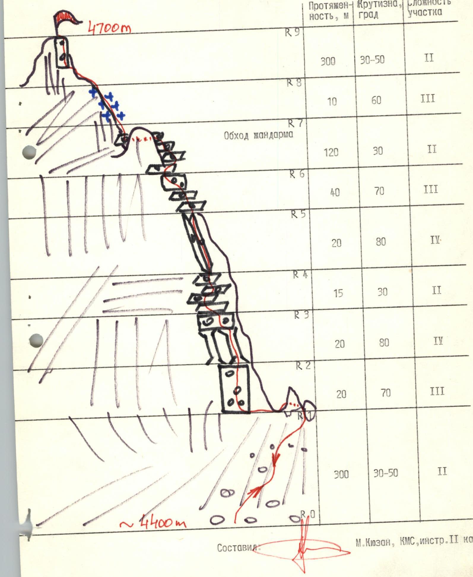
Ascent. From the glacier, the ascent to the saddle between p. Chaka and v. Tsaritsyna occurs along a wide scree couloir, in the lower part of which there is a jumble of huge boulders. The steepness of the couloir increases with altitude gain. The upper part has fine scree, alternating with rocky outcrops. The average steepness is from 30° to 50° (in the upper part). The length of the couloir is about 300 m. At the beginning of summer, ascent on snow is possible.
The ridge of the saddle has 3 gendarmes, which are bypassed on the western side or when ascending directly under the wall with an exit to the saddle (dangerous, rockfall possible). The ascent, depending on the condition of the couloir, takes about 1 hour.
The ascent along the northern ridge occurs mainly along the left part. First, about 20 m along a destroyed wall to the base of two parallel chimneys.
Ascent of 20 m (10 of them along the chimney) up the right chimney, protection only on inserted elements (rocks crumble). Above the chimney, using a system of figure-eight ledges, we approach the only logical ascent point - a steep inner corner (about 20 m).
The ascent is of moderate difficulty, the walls of the corner are unreliable (collapse of slab-like blocks is possible). Passage is very smooth movements and loaded grip. Only inserts are used, which need to be "seated" deeply.
After the inner corner, there is an exit to the ridge. Further:
- along the ledges,
- overcoming a semi-destroyed wall on the ridge (10 m, moderate difficulty),
- bypassing the ridge gendarme on the right,
- we come to a narrowing of the ridge, from which the summit rock block is already visible.
Ascent along a steep snow-ice ridge (10 m), it is possible to bypass on the left, but there is slippery dirt on steep rock slabs.
Further along a simple, wide, destroyed ridge (about 250–300 m) to a semi-destroyed summit rock block, about 5 m high.
The ascent from the saddle to the summit takes about 3–4 hours. Descent from the summit - clearly along the ascent path. Descent to the base camp takes about 3 hours.
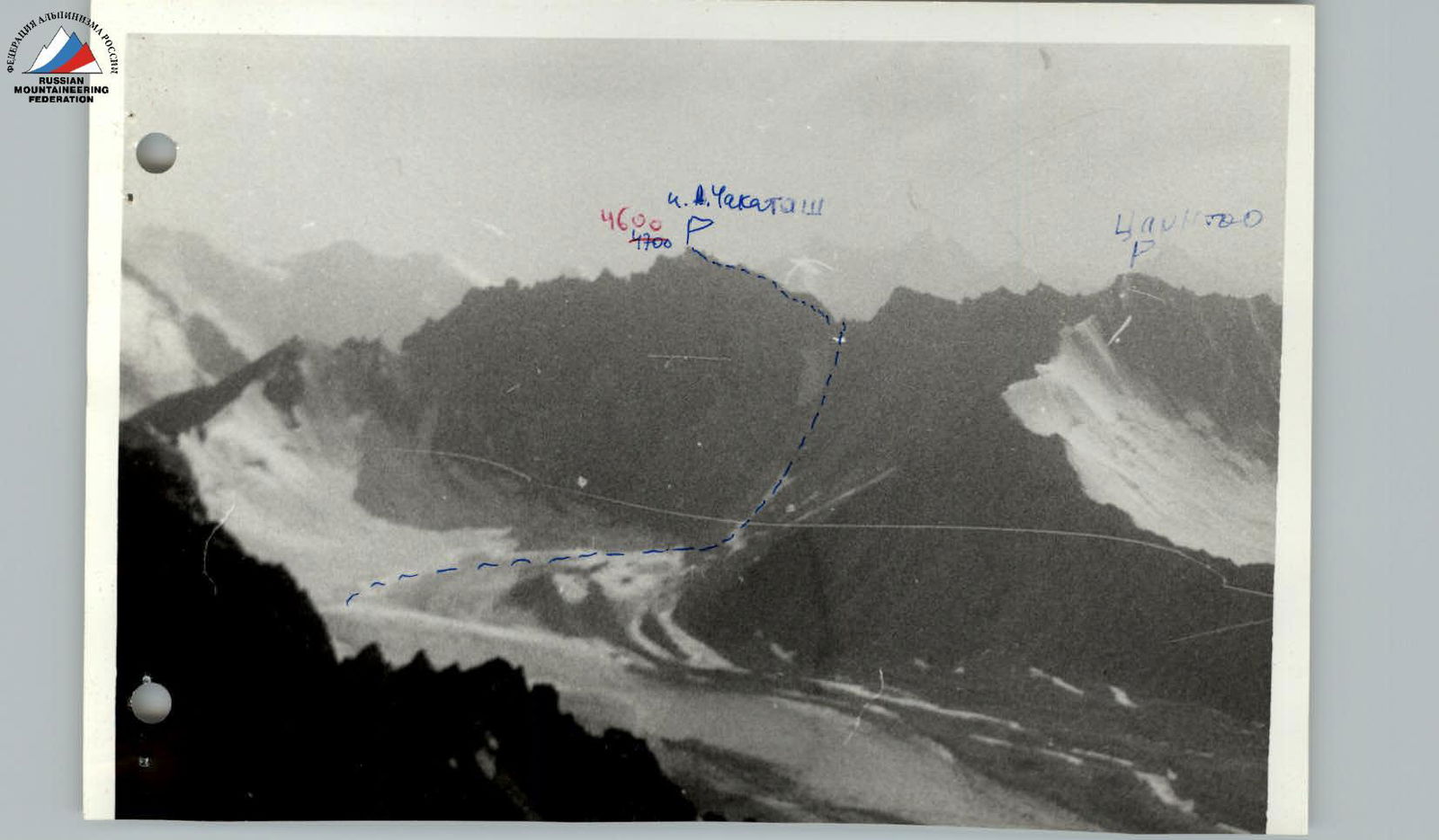 The route of the first ascent to peak Chakata (p. 4700) along the northern ridge 3B cat. sl. (guideline).