PASSPORT
- Rock.
- Pamir-Alay, Kirgiz-Ata gorge, 4180.
- Peak XX Congress of Komsomol via the counterfort of the South slope, 4200.
- Presumed Category 2B difficulty, first ascent.
- Height difference – 150 m, length – 280 m.
- Route steepness – 50°. Pitons driven: Rock: 10 Bolt: 0 закладных: 0 Ice: 0
- Climbing hours – 3.
- No overnight stays.
- Group composition: Suviga V.I. — Master of Sports, Leader. Gorbunov Yu.A. — Candidate for Master of Sports, Participant. Ovcharenko S.V. — Candidate for Master of Sports, Safety Officer. Studenin A.B. — Candidate for Master of Sports, Participant.
- Group coach — Honored Coach of the USSR Ilyinsky E.T.
II. Ascent calendar: February 16, 1987 — departure and return from the ascent.
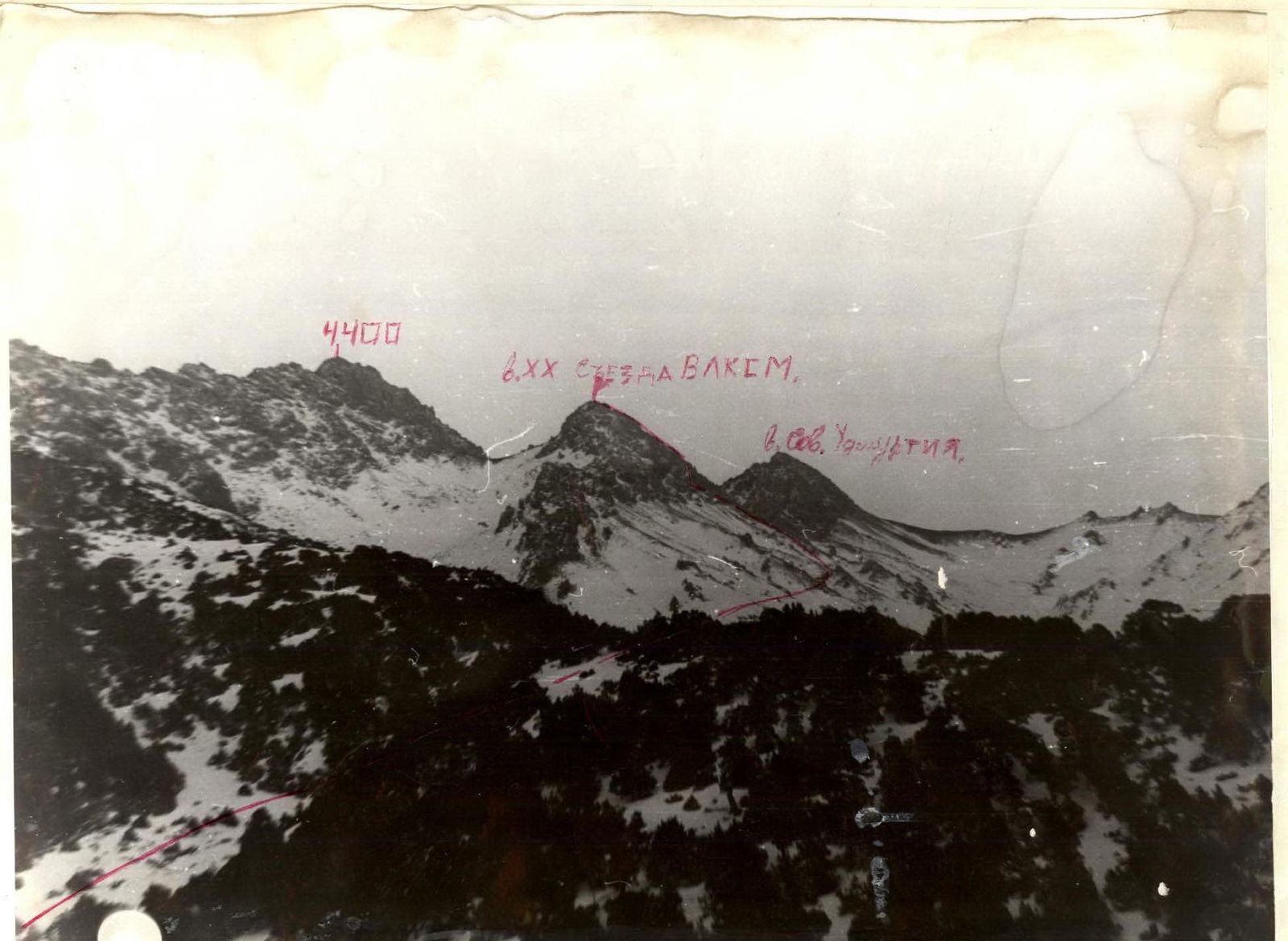 4400, Peak XX Congress of Komsomol, Peak Soviet Udмуртия. Photo #1.
Approach to the route description
From Osh city, take a scheduled bus to Naukhat settlement. Ascend along the road to the upper reaches of the Kirgiz-Ata tract.
From the geologists' house:
- Up along the old road, left/north of the Мазар massif, 1 hour.
From the end of the road:
- Along the trail along the stream past Peak Andizhanets.
- The route profile is clearly visible (general view photo).
- Bypass the massif of Peak XX Congress of Komsomol from the south (2 hours).
- Ascend along the scree slopes to the beginning of the rock ridge of Peak XX Congress of Komsomol. (Photo #2 taken).
- Then, via scree couloirs and small rock walls, approach the start of the route.
The approach from the geologists' houses takes 4–4.5 hours.
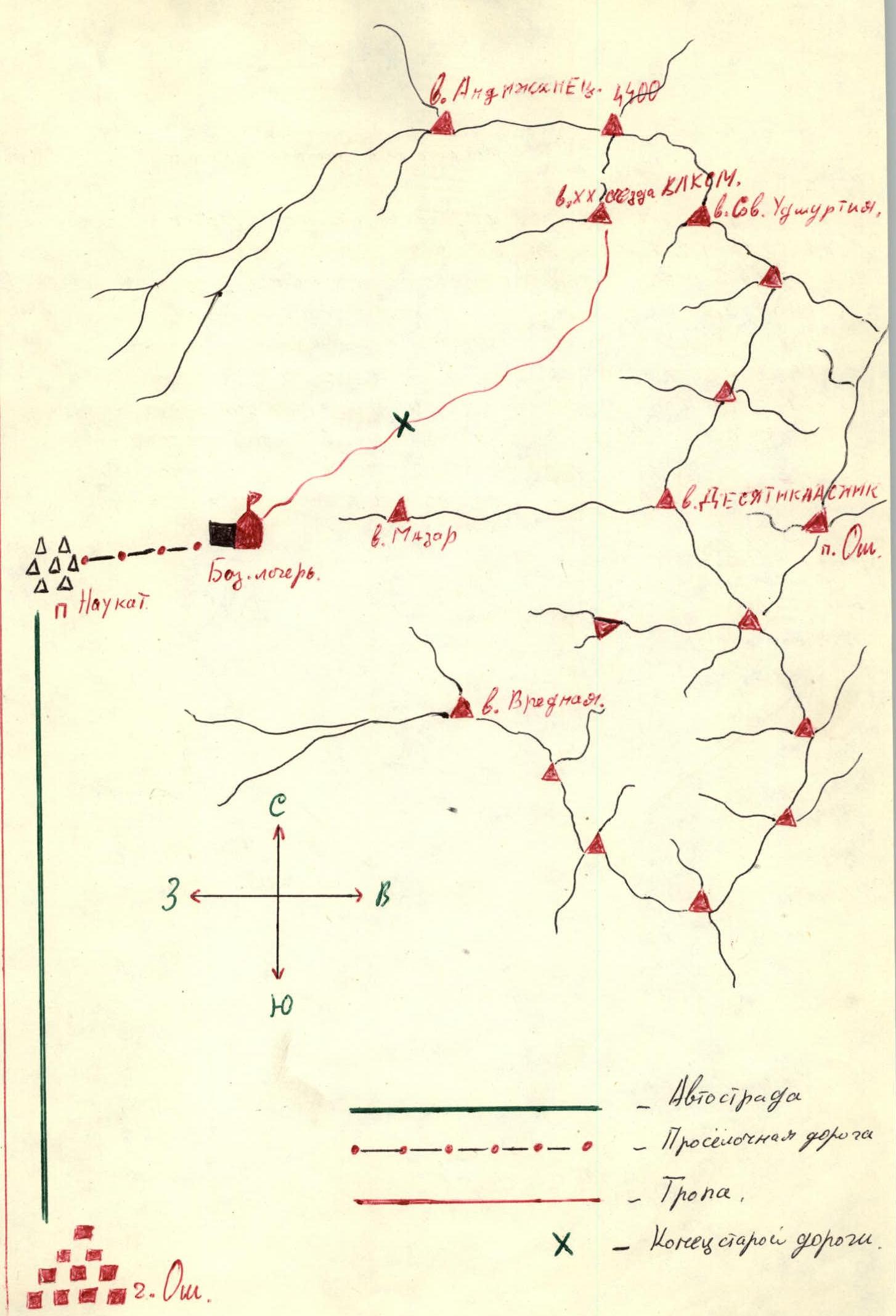
Map elements: Peaks: Peak XX Congress of Komsomol, Peak Soviet Udмуртия, 4400, Peak Мазар, Peak Вредная, Peak Десятикассник. Localities: Naukhat settlement, Osh settlement, Osh city. Base camp.
Legend: Highway. Dirt road. Trail. End of old road.
[www.alpfederation.ru↗]www.alpfederation.ru↗
Route scheme in UIAA symbols
Ascent path. Descent path.
| Section # | Length | Steepness | Difficulty category |
|---|---|---|---|
| R1 | 40 m | 70° | III |
| R2 | 30 m | 60° | II |
| R3 | 10 m | 55° | II |
| R4 | 40 m | 15° | I |
| R5 | 40 m | 10° | I |
| R6 | 20 m | 60° | II |
| R7 | 100 m | 30° | II |


