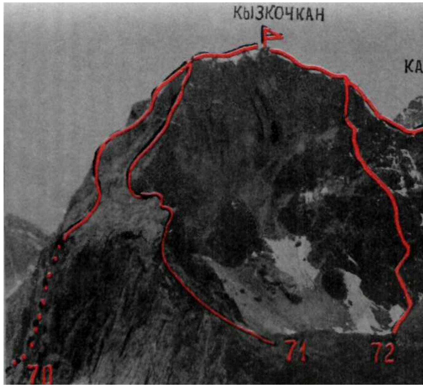
70. Kyzkochkan via the East Face
The route is rocky, category 5A difficulty (fig. 5, 61, 62, 73, 77–79). Length — 1000 m, elevation gain — 750 m, with 70°, VI — 20 m, duration — 14–16 hours. The approach path from the "Kirgizata" alpine camp (group of 2-6 people) to the initial bivouac in the Joldjilga gorge under the East Face of Kyzkochkan peak — see route 14.
- From the initial bivouac, approach the talus cone-outlet of the couloir on the left side of the East Face.
- Ascend 120–150 m up the talus on the right side of the cone-outlet, then possibly up a narrow snowy couloir descending between the southeast slopes of Kyzkochkan peak and the ridge-island, rising along the wall under the South Ridge of the peak, to a small ledge under the chimney on the left side of the huge internal angle formed by the light left edge of the East Face and the Southeast Face.
- From the ledge, ascend 40 m up and to the right via a moderately difficult route.
- Ascend a 55–60 m chimney to a ledge.
- From it, ascend a 25 m moderately difficult 60–70° chimney to reach the talus ledges in the center of the huge internal angle.
- From the angle, ascend traversing up and to the right along the ledges for 20–25 m, then up a 50 m moderately difficult 30 m slab and a difficult wall, left of the overhanging sections, to reach the Lower Shoulder of the Right Rib of the huge internal angle.
- From the shoulder, ascend 30–40 m up a difficult vertical wall, bypassing the overhanging rock "gendarmes" on the left, with an exit onto a short 6–10 m narrow rocky ridge of the Right Rib.
- From the ridge, ascend 70–80 m up, left of the cleft, via a difficult wall with very difficult short sections on the left side of the Right Rib.
- Then, ascend 80–100 m up a difficult wall, exiting to the right onto a talus ledge of the Right Rib with "live" rocks.
Control section. From the initial bivouac — 8–10 hours.
- From the control section, traverse 25–30 m left and up along the ledges with "live" rocks and ascend a 60 m difficult, with very difficult short sections, 80° black monolithic wall (key location of the route) to reach the talus ledges in the middle part of the East Face.
- From here, ascend 180–250 m up and to the right via simple and moderately difficult rocks with talus ledges.
- Then, ascend 15–20 m up a moderately difficult wall to reach a ledge on the Southeast Ridge.
- From the ledge, ascend 20–30 m up and to the right via a destroyed moderately difficult 70° wall on the right side of the Southeast Ridge.
- Then, ascend 60 m via simple rocks on a gentle section of the ridge under the ascent.
- From under the ascent, traverse 25–30 m to the right along a talus ledge into a couloir and ascend 50 m up the destroyed steep 40–60° rocks with short moderately difficult walls to reach the Southeast Ridge.
- Ascend the gentle Southeast Ridge to reach the East Shoulder.
From the East Shoulder, ascend along the gentle, easy 150–200 m East summit ridge composed of large talus to reach the summit of Kyzkochkan. From the initial bivouac — 14–16 hours.