ASCENT DOCUMENTATION
28 30
- CATEGORY — rock climbing
- REGION — KIChIK-ALAI ridge
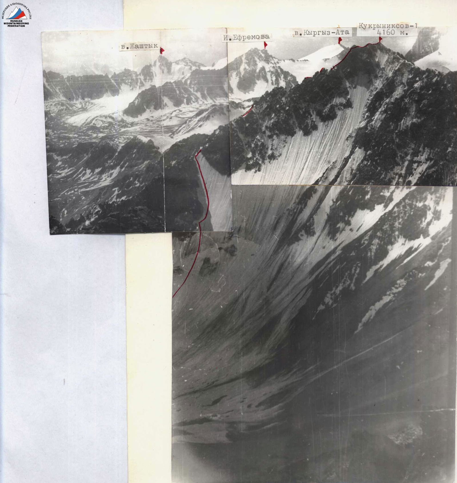
- PEAK — KUKRYNIKOSOV (S) (4160 m) first ascent via the north face of the eastern ridge (combined)
- PROPOSED cat. diff. — 3B
- Elevation gain — 630 m Length of sections with R0–R6 cat. diff. — NONE, average steepness — 43°
- PITOONS DRIVEN: For belaying and creating intermediate belay anchors: rock — 10 ice — 4
- Total climbing time (ascent) — 6.5 hours
- Overnight stops on the route — NONE
- PARTICIPANTS:
- Bochkov Vladimir Viktorovich — II sports category
- Samokotin Yuri Timofeevich — II sports category
- COACH: Master of Sports MS LEVIN
- DATE of departure and return: July 28, 1981
CHELYABINSK REGION ALPINISM FEDERATION
1981
Route diagram in UIAA symbols
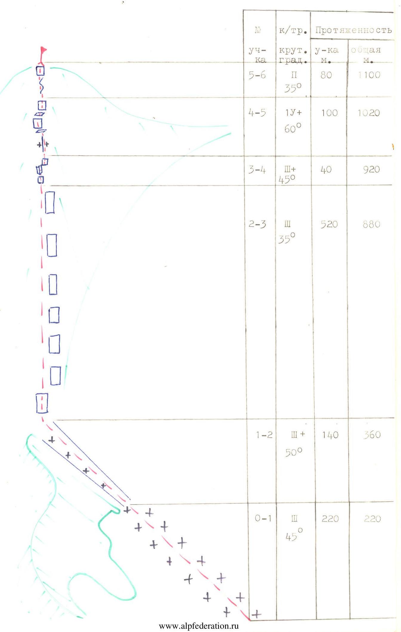
| Date, time | Section, steepness | Length, m | Terrain characteristics | Cat. diff. | Terrain condition | Weather conditions | Rock/ice pitons |
|---|---|---|---|---|---|---|---|
| 28.07. 7:30–14:00 | R0–R1 45° | 220 | Slope with bergschrund | III | Firn, ice; traverse +8° early morning in crampons | – / 1 | |
| R1–R2 50° | 140 | Couloir | III+ | Ice, many embedded live rocks | Calm, clear | – / 3 | |
| R2–R3 35° | 520 | Ridge | III | Destroyed, loose rocks with snow and ice accretion | «—» | – / – | |
| R3–R4 50° | 40 | Wall | III+ | Very destroyed rock | «—» | – / 3 | |
| R4–R5 60° | 100 | Wall | 1У+ | Rocks are fragile. Hard to find a place for belay | +14° | 7 / – | |
| R5–R6 35° | 80 | Summit | II+ | Brittle rocks, covered with ice | «—» | – / – | |
| 10 / 4 |
DESCENT: along the southern ridge, then left-down into the Suychikty gorge and along the moraine and glacier to the left of the Kievyalanka peak.
Classification proposals
The described route is undoubtedly more complex than the first 3B in this region — 3B N. ridge of Kievyalanka. It is also more complex than the first 4A in this region — 4A N. ridge of Peak 40 Years of Soviet Army. The snow-ice slope is comparable to a similar key section on Peak Boris Ruchyev, but the rocky ridge is an order of magnitude more complex. Overall, the route is quite comparable to the 4A cat. diff. route on Peak Kirov via the saddle with Peak Smena (Kyrgyz Ala-Too) — it is also beautiful, logical, and diverse.
We request to include in the KTMGV USSR:
KUKRYNIKOSOV-1 (4160 m) 3B combined via the north face of the eastern ridge, V. Bochkov, 1981.
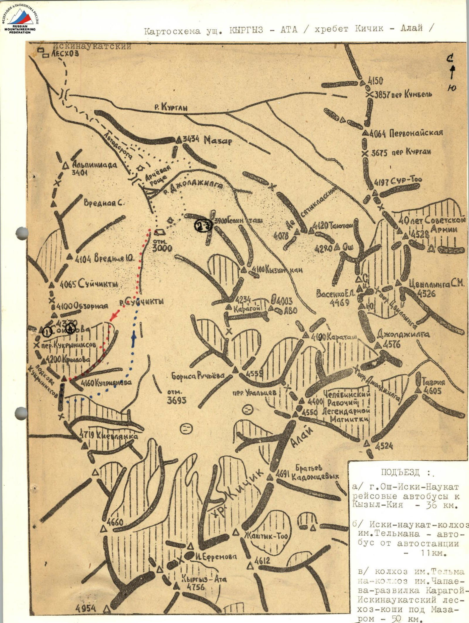
Approach
a) Osh — Iski-Naukat — scheduled buses to Kyzyl-Kiya — 36 km. b) Iski-Naukat — Telman collective farm — bus from the bus station — 11 km. c) Telman collective farm — Chapayev collective farm — Karagoy junction — Iskinaucat Forest Enterprise — camp under Mazara — 50 km.
(1) Photo shooting point 1 and so on.
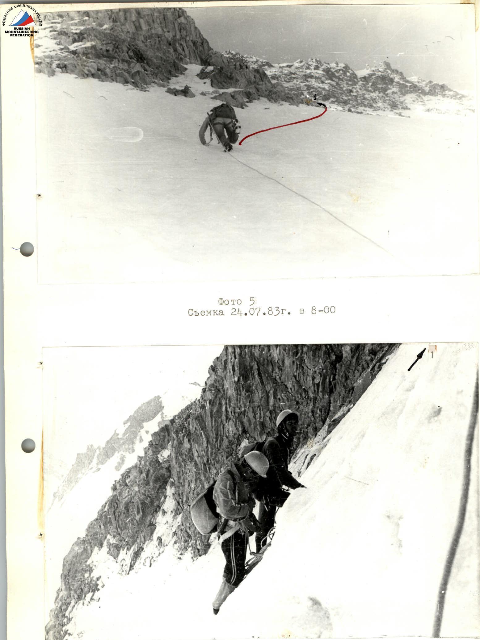
Photo 6 Section «R0–R1» (shot on July 24, 1983 at 8:30)
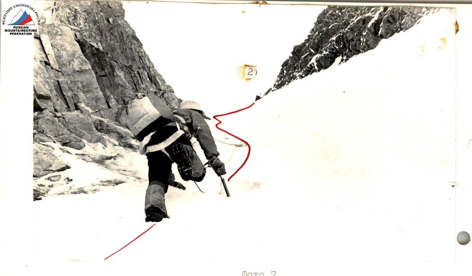
Photo 7 (shot on July 24, 1983 at 9:30)
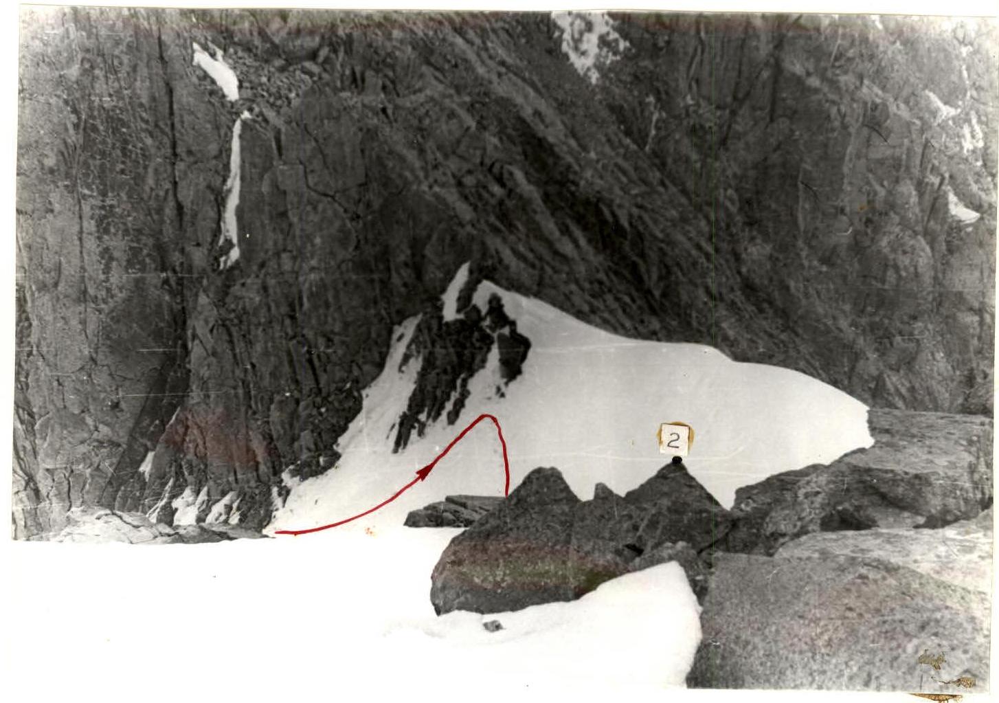
Photo 8 (shot on July 24, 1983 at 10:30)
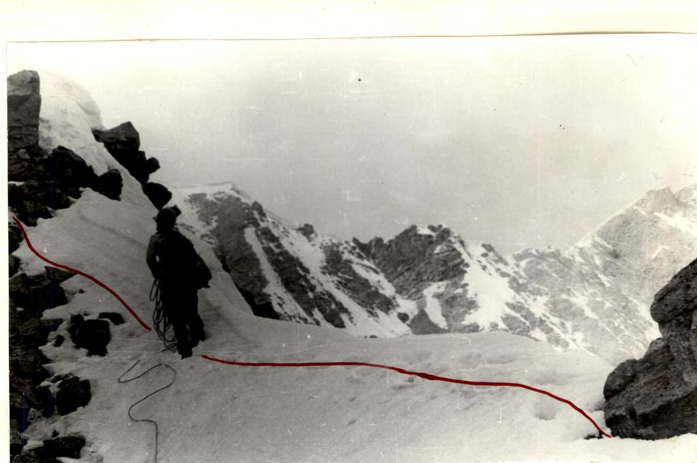
Photo 9 Section «R2–R3» (shot on July 24, 1983 at 11:00)
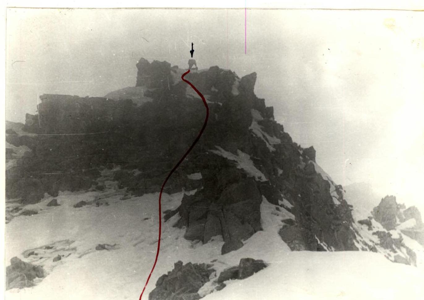
Photo 10 Section «R2–R3» (shot on July 24, 1983 at 11:30)
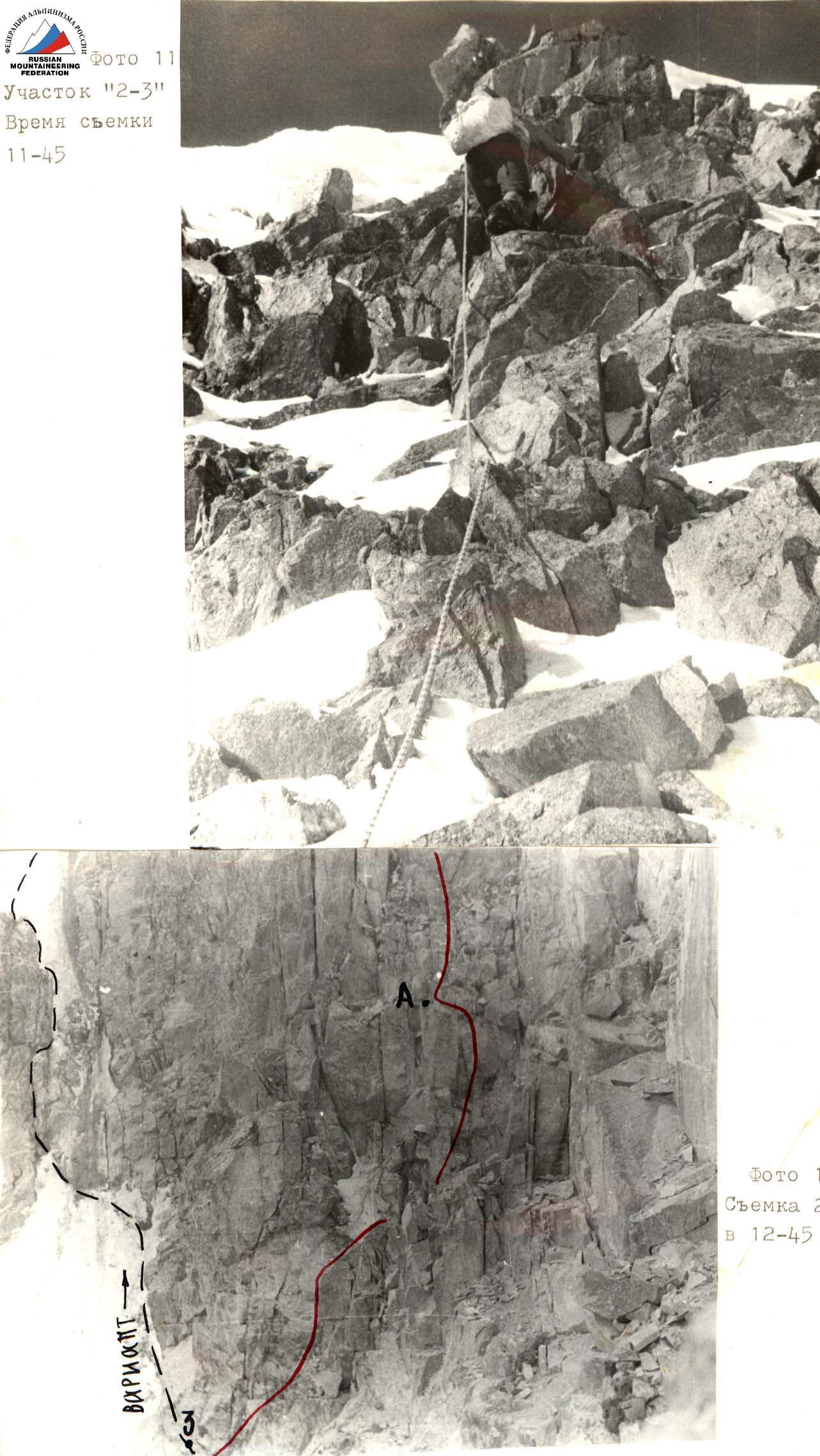
Photo 12 (shot on July 24, 1983 at 12:45)
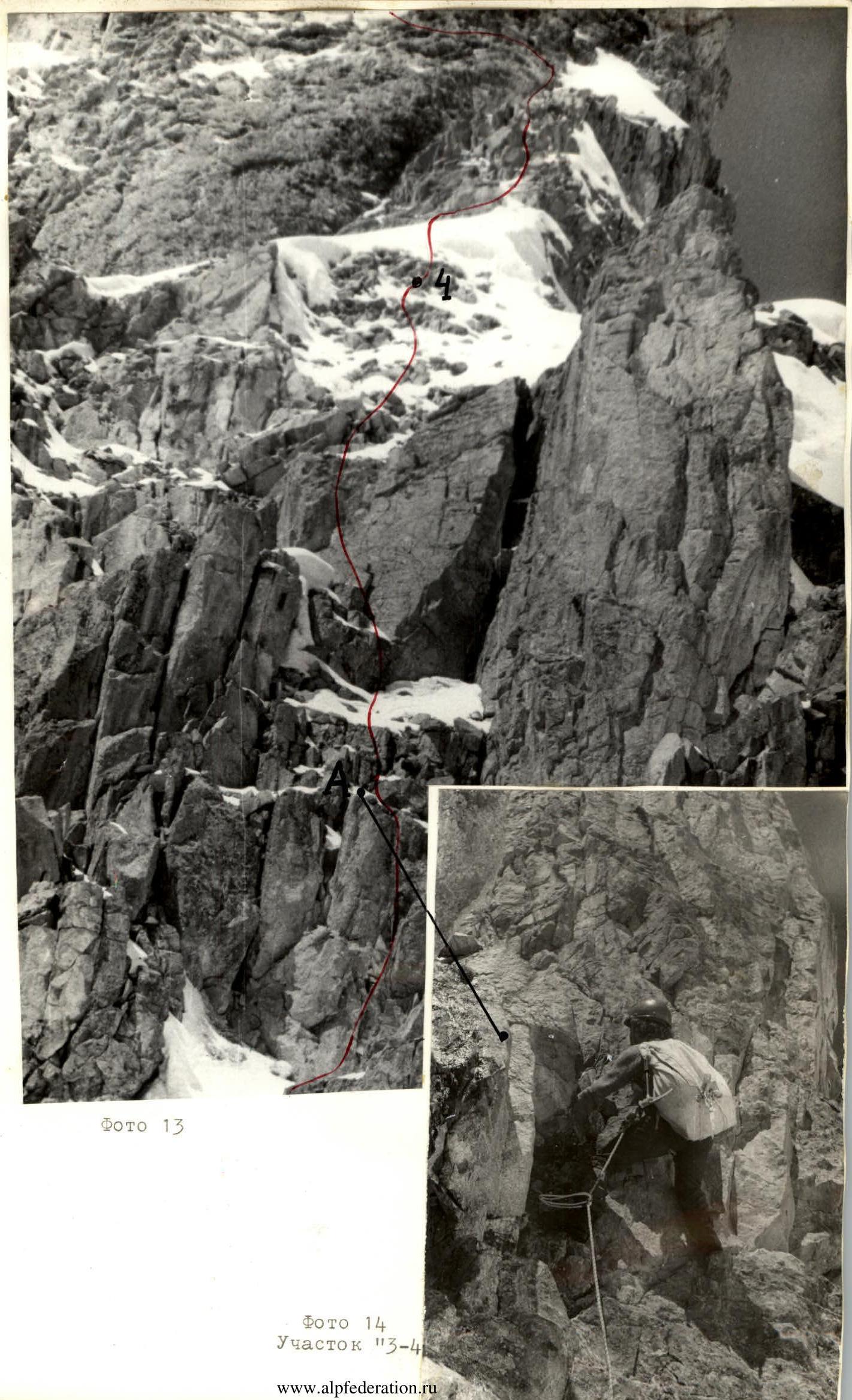
Photo 14 Section «R3–R4»
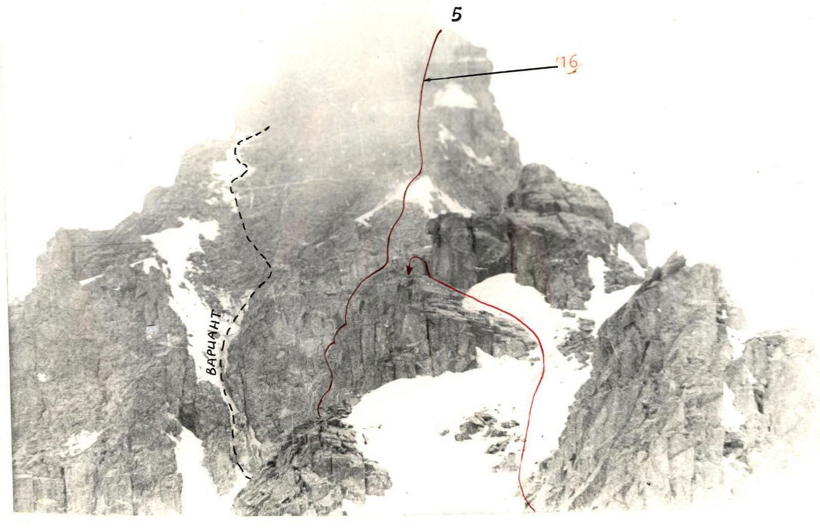
Photo 15 Shot from section «R2–R3»
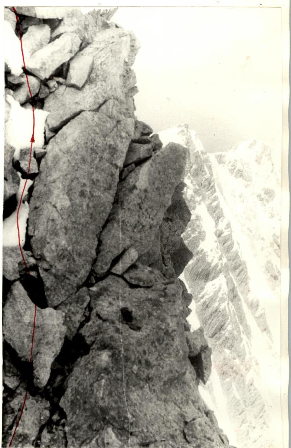
Photo 16 Section «R3–R4» see reference on photo 15
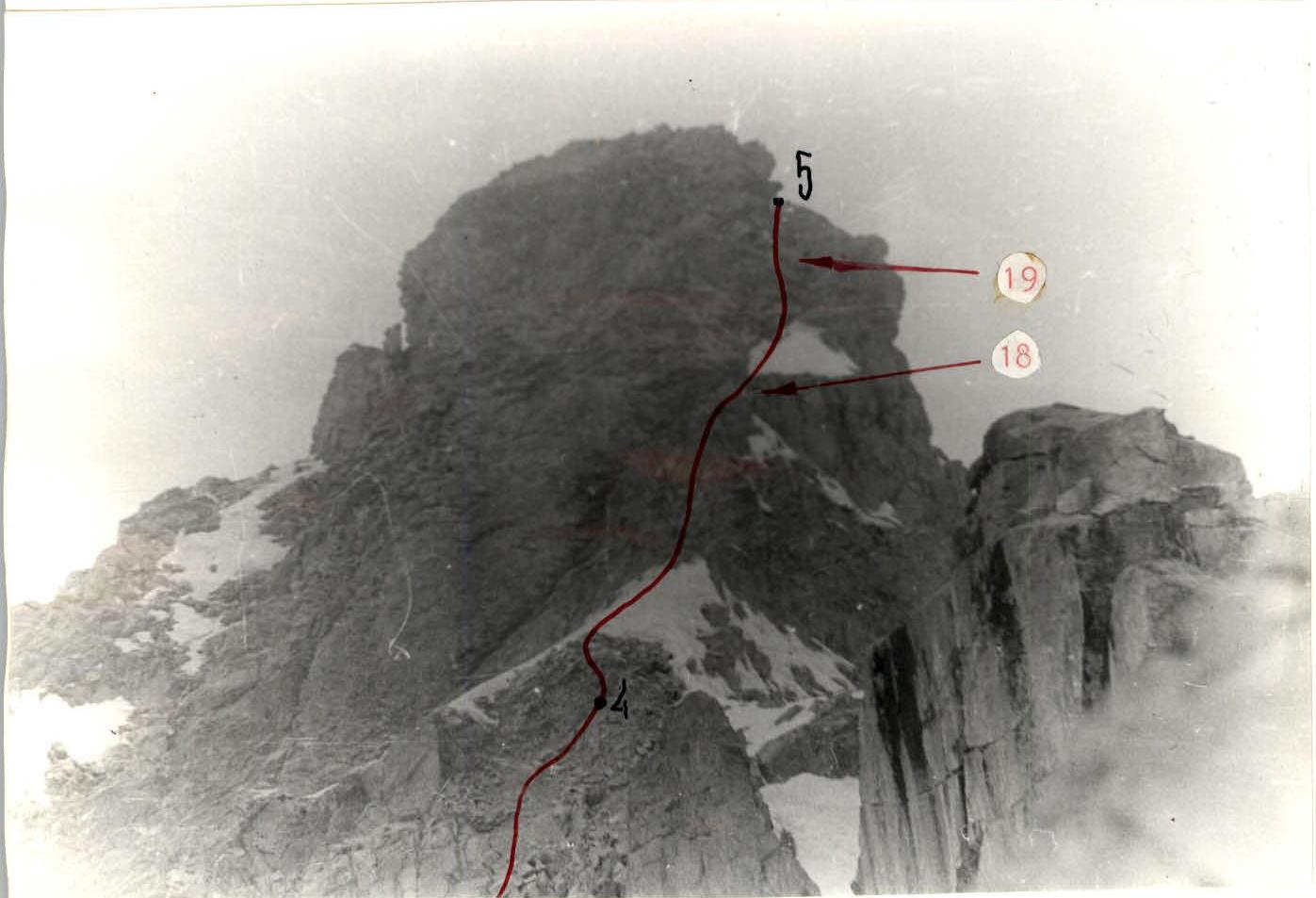
Photo 17 Shot from section «R2–R3»


