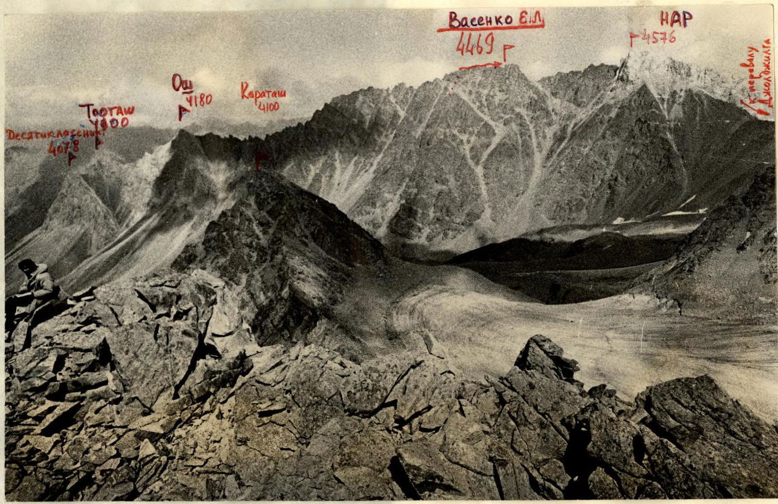
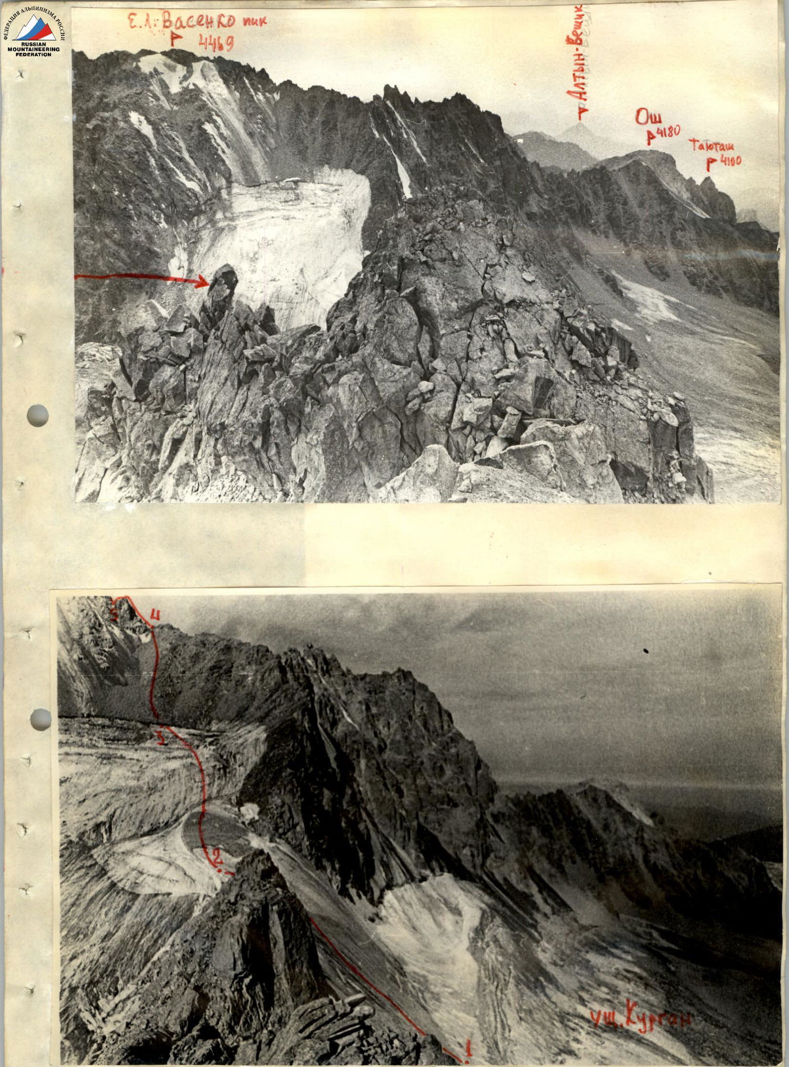
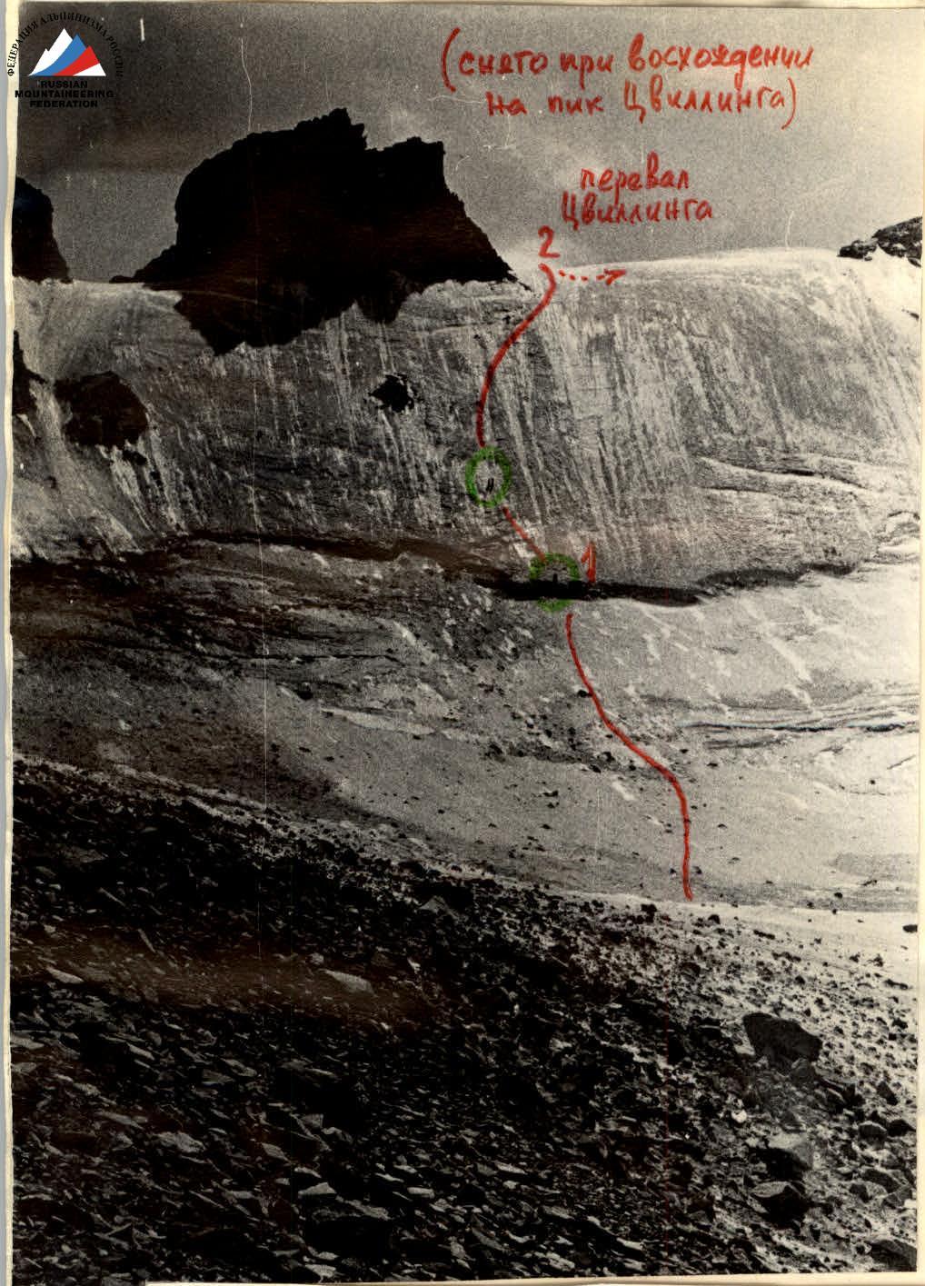
View of the peaks on the eastern side of Joljilga valley
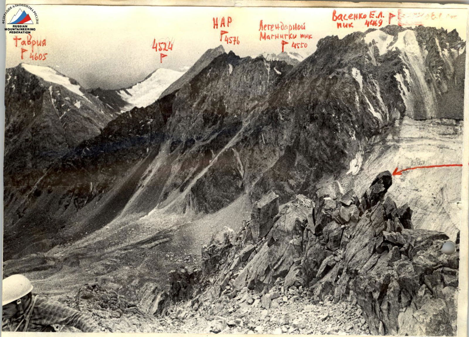
View from the east from the ridge of p. Tsvillinga
 www.alpfederation.ru↗
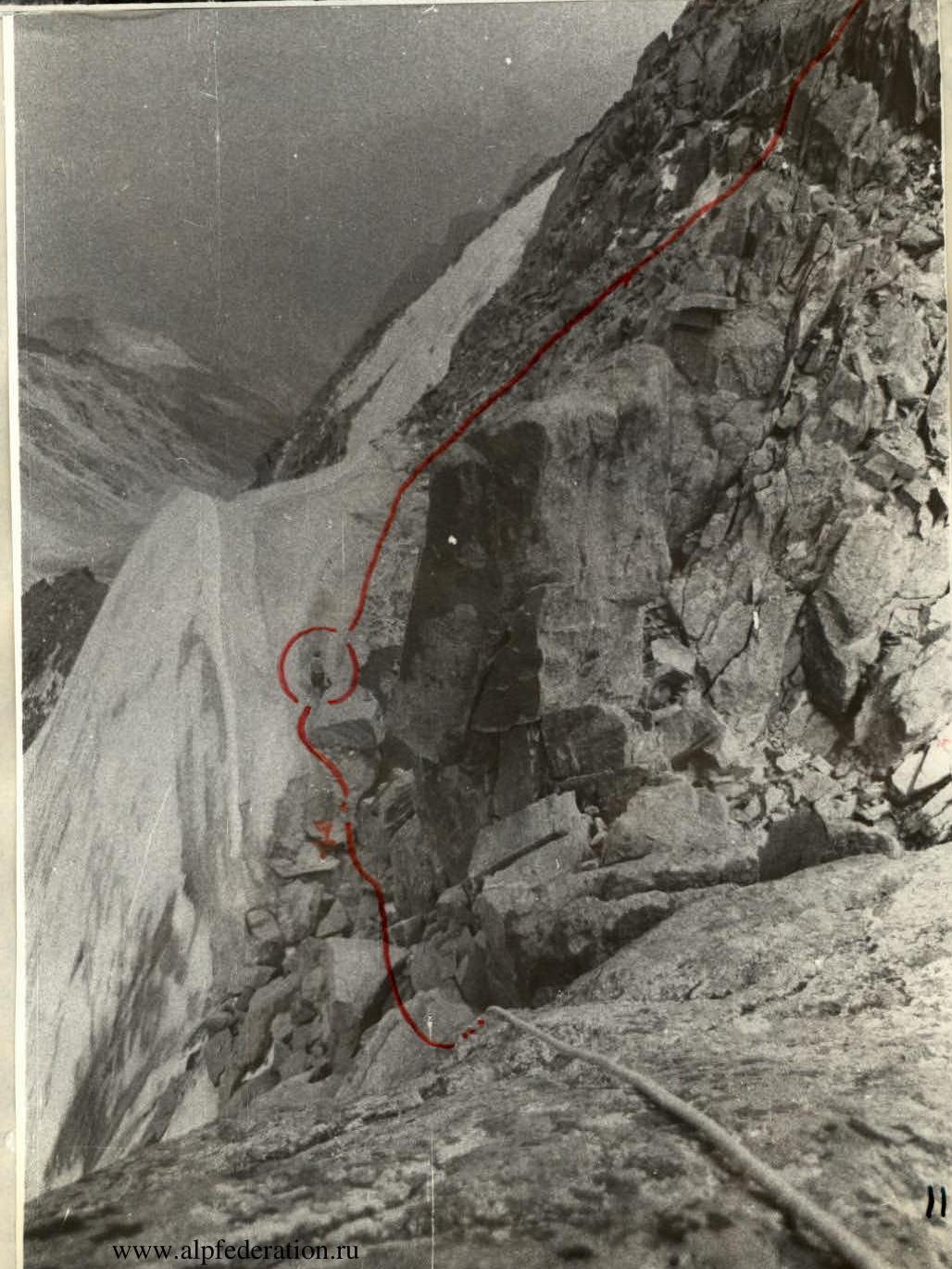
 Climb to sec. R1–R2

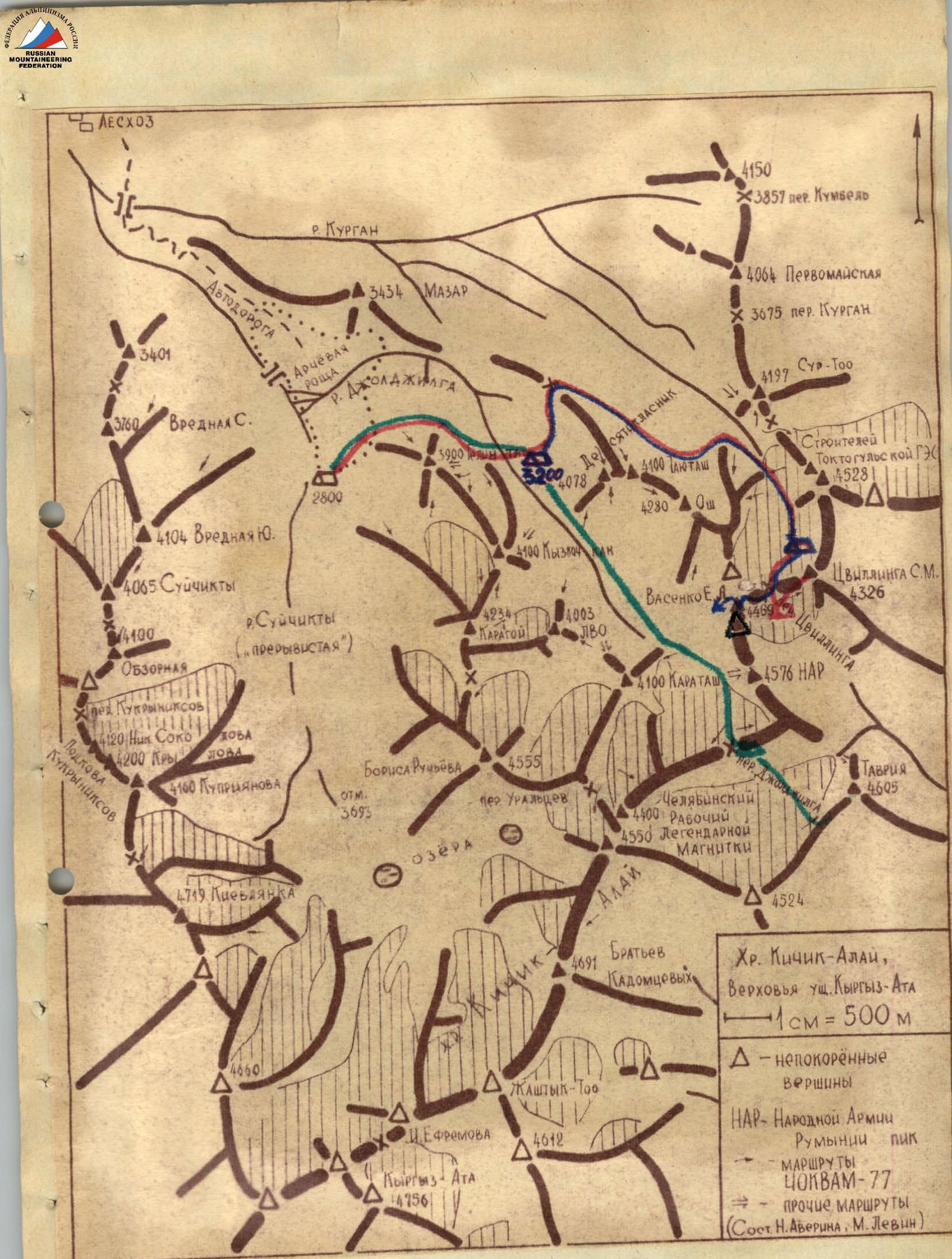
August 23, 1977 from 14:00 to 16:30 - approach from the assault camp "3200" on the green meadows of the Joljliga river to the moraine of the Kurgan glacier at the start of the route.
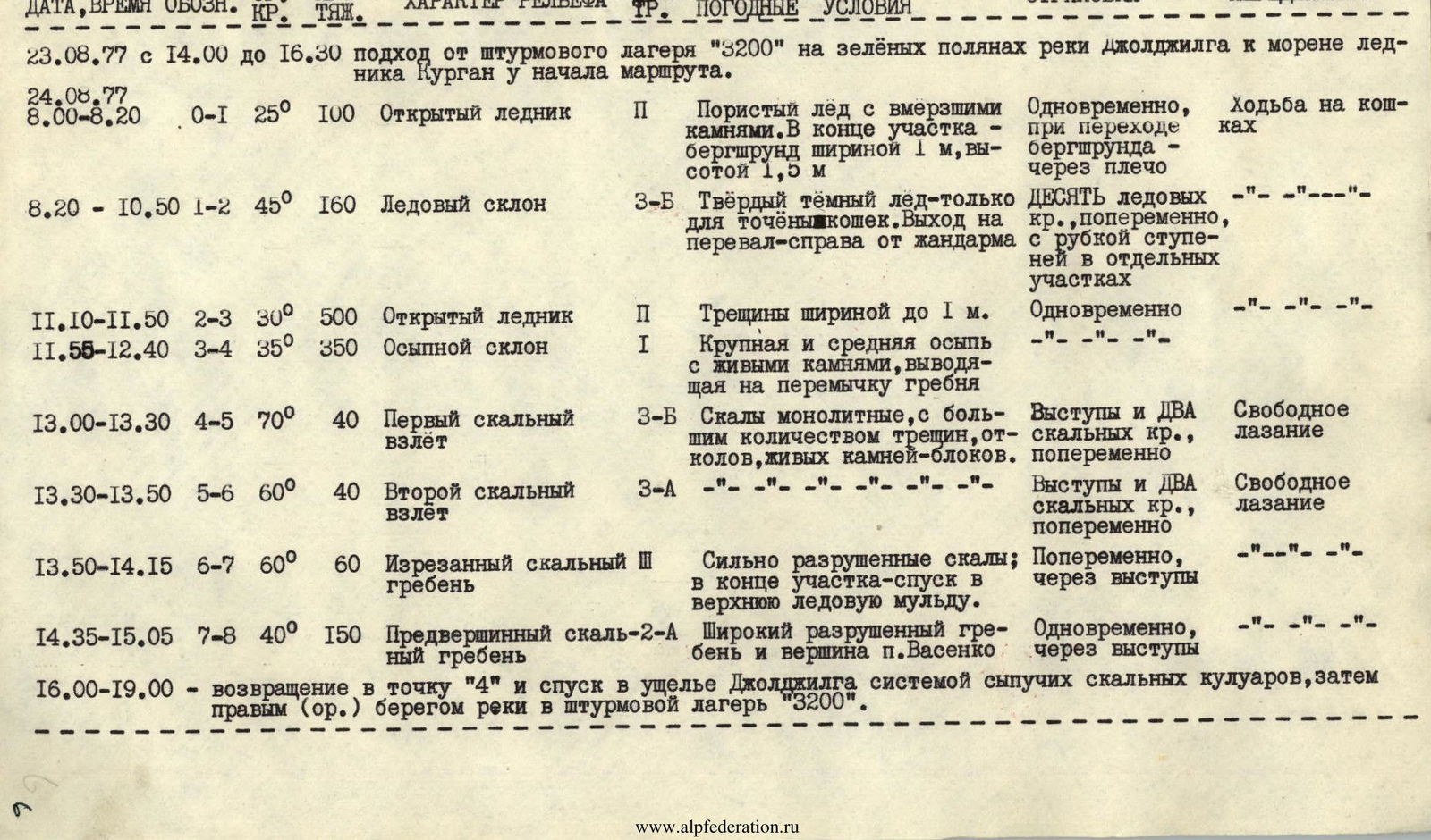
| DATE, TIME | MARK | S/SR | DIST. | TERRAIN CHARACTERISTICS | DIFF. | CONDITIONS, WEATHER | BELAY | MOVEMENT |
|---|---|---|---|---|---|---|---|---|
| 24.08.77 | ||||||||
| 8:00–8:20 | R0–R1 | 25° | 100 | Open glacier | I | Porous ice with frozen stones. At the end of the section - a 1 m wide, 1.5 m high bergschrund | Simultaneously, when crossing the bergschrund - over the shoulder | Crampon walking |
| 8:20–10:50 | R1–R2 | 45° | 160 | Ice slope | 3B | Hard dark ice - only for sharp crampons. Exit to the pass - to the right of the gendarme | TEN ice pitons, alternately, with cutting steps in some areas | -"—"—"—"—"—" |
| 11:10–11:50 | R2–R3 | 30° | 500 | Open glacier | I | Crevasses up to 1 m wide. | Simultaneously | -"—"—"—"—"—" |
| 11:55–12:40 | R3–R4 | 35° | 350 | Scree slope | I | Large and medium scree with loose stones, leading to the ridge saddle | -"—"—"—"—"—" | -"—"—"—"—"—" |
| 13:00–13:30 | R4–R5 | 70° | 40 | First rock ascent | 3B | Monolithic rocks, with many cracks, splits, loose stone blocks. | Outcrops and TWO rock pitons, alternately | Free climbing |
| 13:30–13:50 | R5–R6 | 60° | 40 | Second rock ascent | 3A | -"—"—"—"—"—"—"—" | Outcrops and TWO rock pitons, alternately | Free climbing |
| 13:50–14:15 | R6–R7 | 60° | 60 | Jagged rock ridge | II | Severely destroyed rocks; at the end of the section - descent into the upper ice mulde. | Alternately, via outcrops | -"—"—"—"—"—" |
| 14:35–15:05 | R7–R8 | 40° | 150 | Pre-summit rock ridge | 2A | Wide destroyed ridge and summit of p. Vasenko | Simultaneously, via outcrops | -"—"—"—"—"—" |
16:00–19:00 - return to point "4" and descent into the Joljilga valley through a system of loose rock couloirs, then down the right (or.) bank of the river to the assault camp "3200".
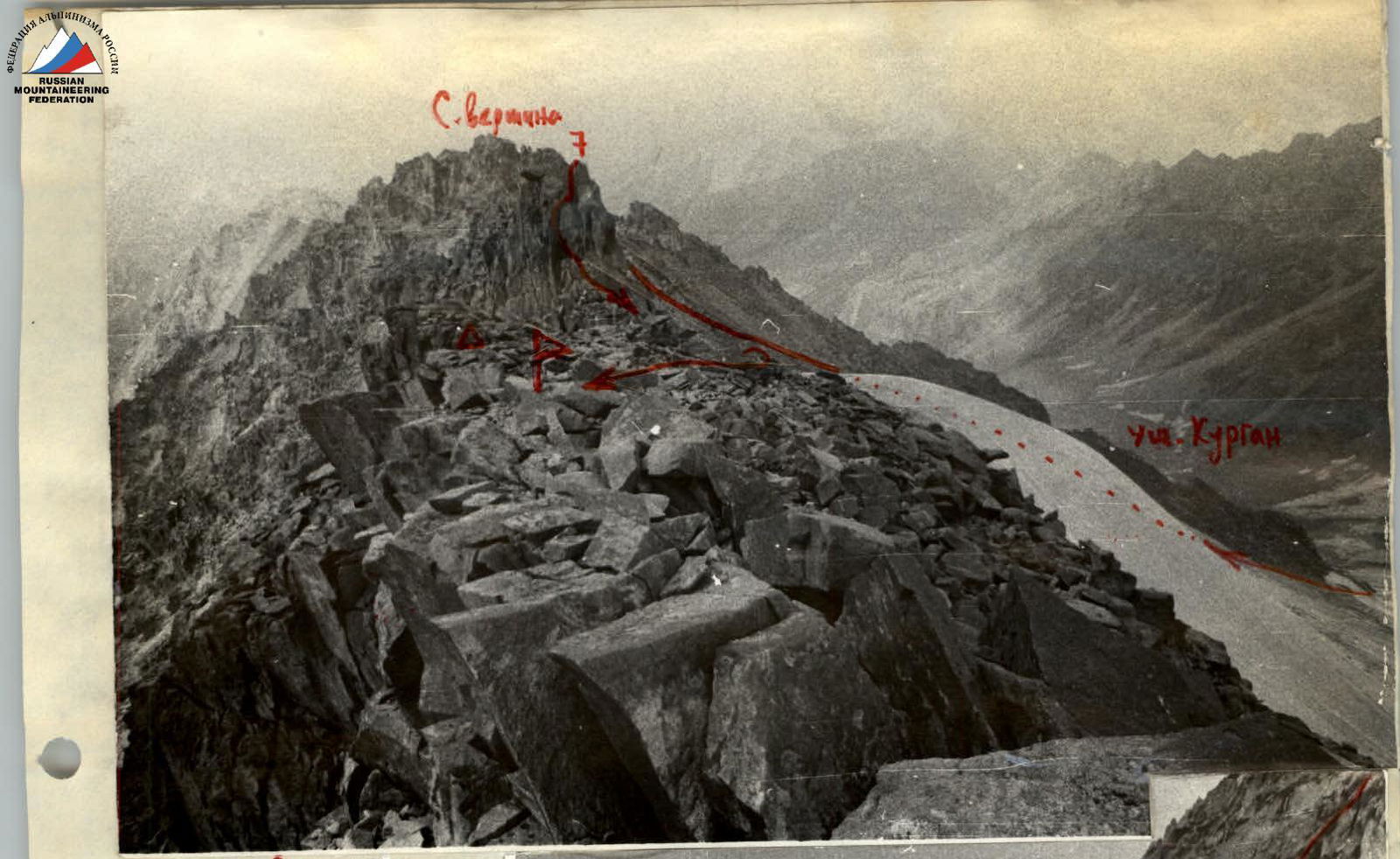
Summit (A-control cairn)