R. G. Veryasov, 62
Location and Approaches (4120)
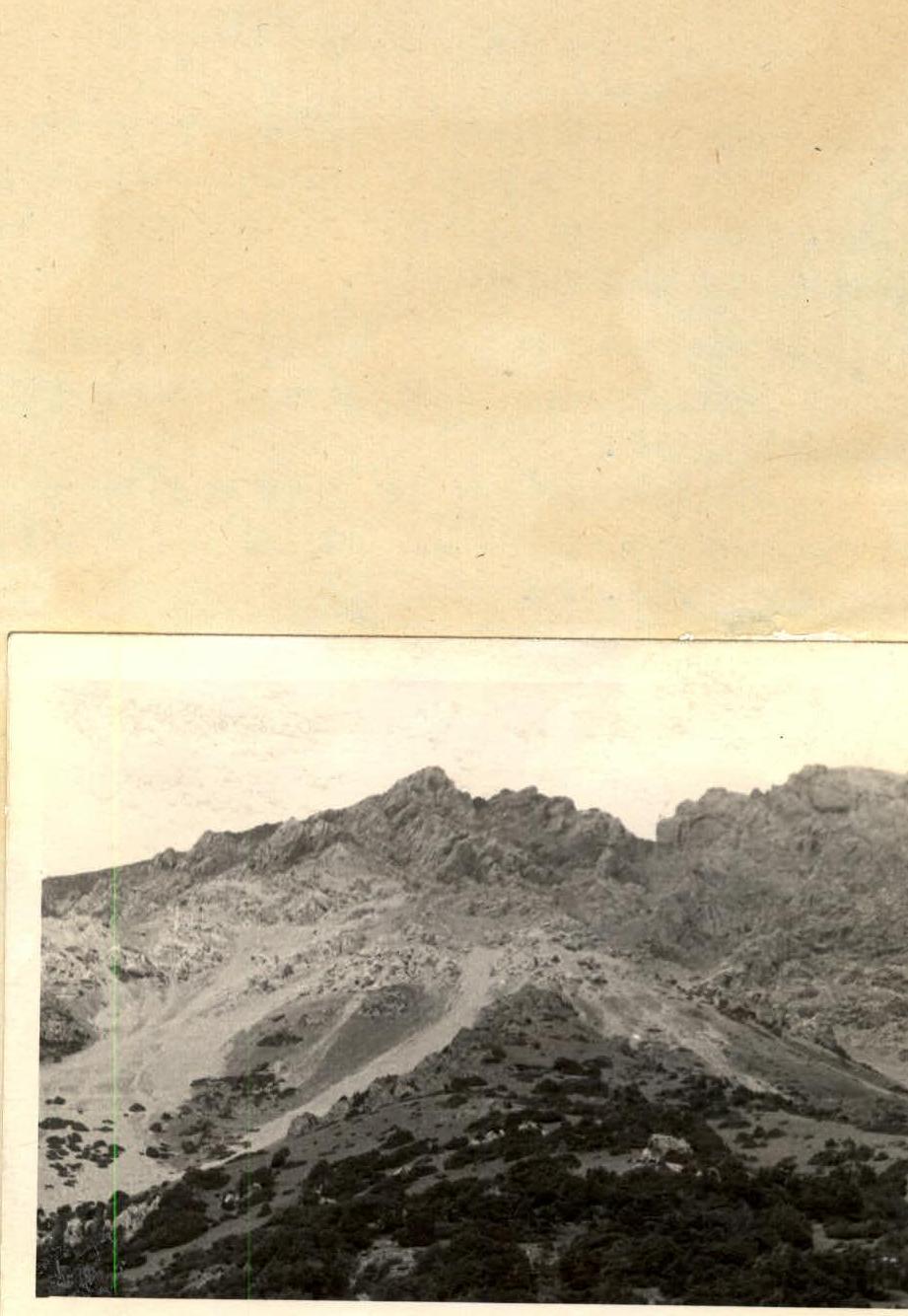
Peak Andizhan is located in the crest of the Peredovoy Ridge between the Ak-Buura and Kyrgyz-Ata rivers on the northern slopes of the Kikik-Alay Ridge. Its southern slopes descend to the Kaldyrama River (the eastern tributary of the Kyrgyz-Ata River).
A vehicle usually drives from Osh through Naukhat and past the forestry department to the foot of Mount Mazar (see description of Peak 40th Anniversary of the Soviet Army).
Mount Mazar and Peak Andizhan stand opposite each other. In other words, the ascent to Peak Andizhan can be made from the vehicle stopping point.
Ascent Route
From the base camp, we start ascending along a grassy slope. The slope is partially covered with juniper forest. We ascend 300-350 m along the grassy slope on the right side of a couloir. This couloir reaches the pre-summit ridge and is visible from the base camp. It is difficult and dangerous to walk along the couloir itself due to the fine scree and potential rockfall. Then, along the ridge, we ascend another 350-400 m on very fragmented rocks and scree to the beginning of the couloir.
We ascend along the couloir on coarse scree to a saddle. The ascent path is 90-100 m, with a steepness of 30-35°.
The summit is visible from the saddle. On the way to the summit, there are some rocky outcrops, but they can be bypassed on the left. We approach the summit. The exit to the summit itself is along a monolithic rock, where belaying is necessary. The ascent to the summit on the rock is 6-7 m. Steepness is 35-40°. The entire path from the camp to the summit takes 4.5-5 hours.
The descent is along the ascent path to the saddle, and then down the couloir on scree.
The entire path can be classified as a Category 2A route.
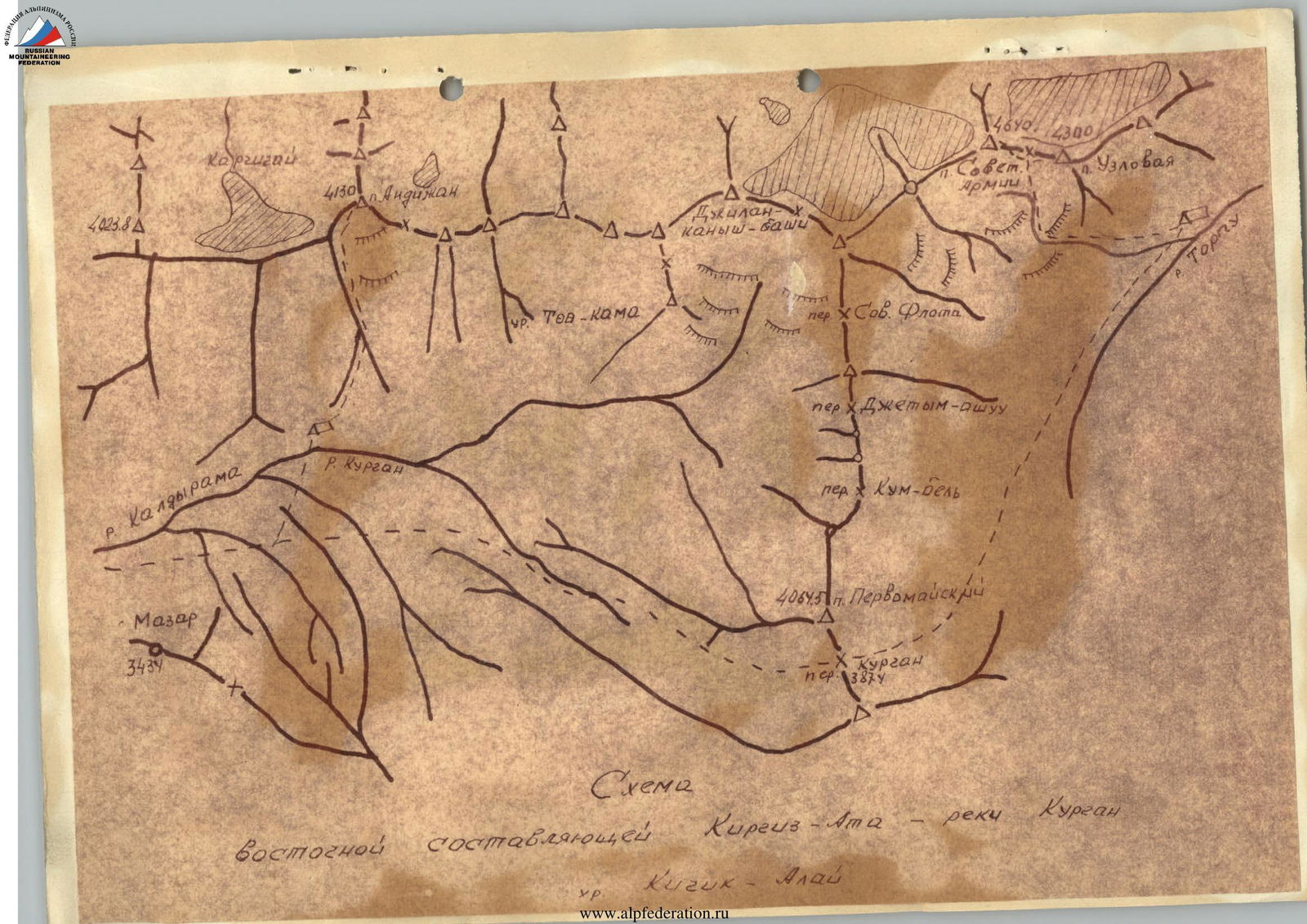
Diagram
eastern tributary of Kyrgyz-Ata – Kuragan River Kichik-Alay valley