Description of the approach to the route
From the base camp located in Guamyщ valley, ascend the grassy slope to the moraine of Glacier №4. Follow the glacier to the glacial lakes, turn left towards the wide couloir narrowing at the top (1 hour).
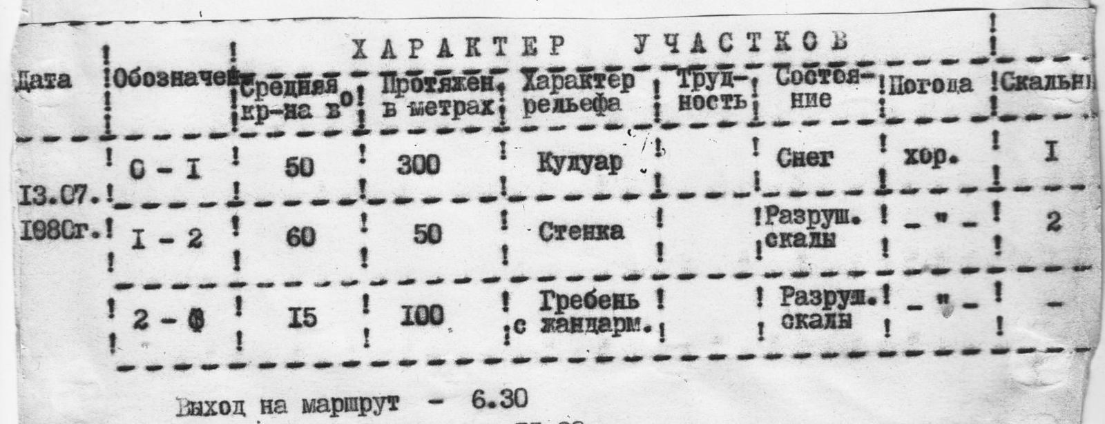
Brief explanation of the table
Section О–I: Ascend the snow-filled couloir to the saddle. The couloir is traversed with alternating belay, belay through an ice axe. There are sections covered with ice, which can be bypassed via несложным (uncomplicated) rocks with a key belay (I piton). The steepness of the section is 50°.
Section I–2: The exit to the saddle is represented by destroyed rocks (40 m) with a five-meter rock wall at the bottom. The belay is piton (2 pitons). Steepness is 60°.
Section 2–3: From the saddle, move left along the ridge through destroyed rocks and talus shelves, bypassing gendarmes on the left. The summit is a destroyed rock of red color. Descent to the north via a couloir.