- Ascent passport. I. Category — technical.
- Pamir-Alay, Gumush gorge.
- Karaganda South (4850) via the North face of the East ridge.
- Category 5B, combined
- Height difference 850 m.
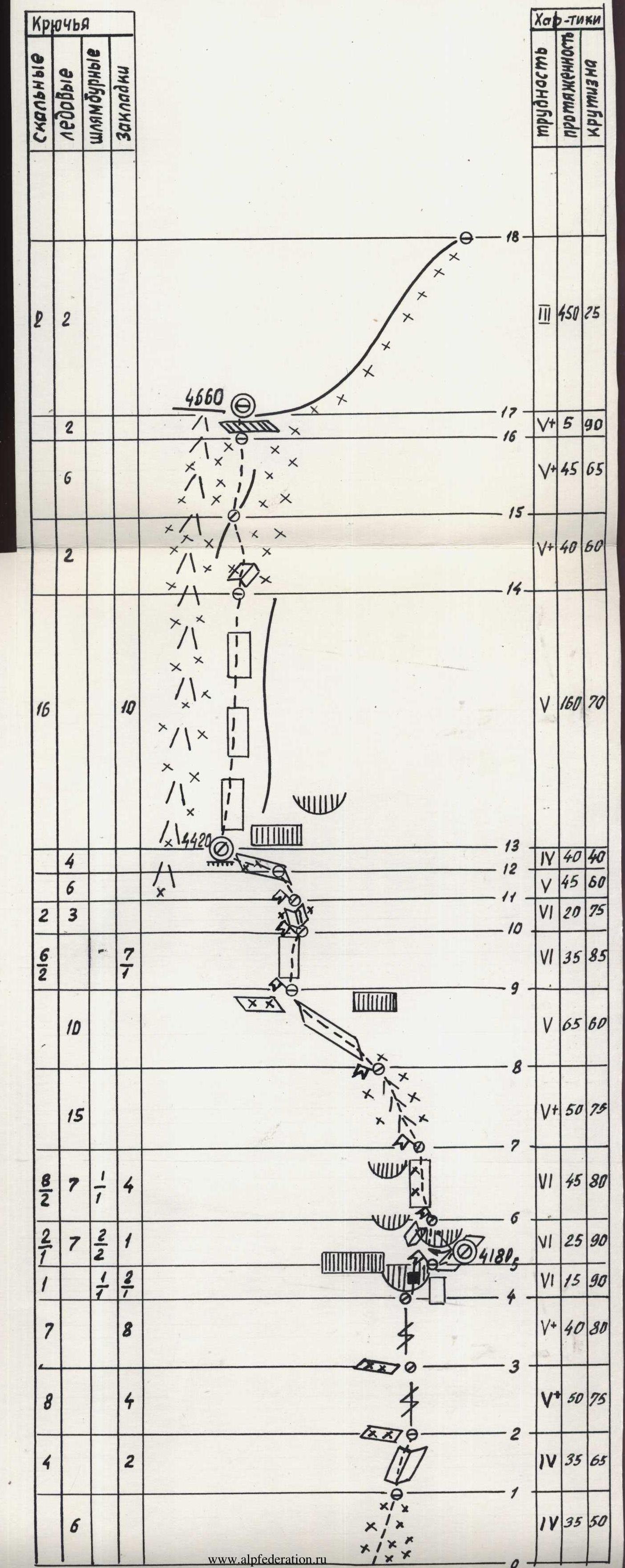
- Length of sections: ice — 300, rock — 390, snow — 450. Category 5–6 sections — 630 m, average steepness — 75°.
- Number of pitons: rock 56/5, ice 68, bolt 4/4, nut 38/2.
- Climbing hours — 43, days — 5 (including one acclimatization day).
- Bivouacs 1st and 2nd — sitting on ledges, 3rd — lying on the ridge.
- Team composition: leader — Monaenkov E.I. — Master of Sports, participants — Levchenko A.N. — Candidate for Master of Sports — Martynov L.B. — Candidate for Master of Sports — Kogan I.M. — Candidate for Master of Sports
- Approach to the route — July 14, 1983, reaching the summit — July 18, return to camp — July 18.
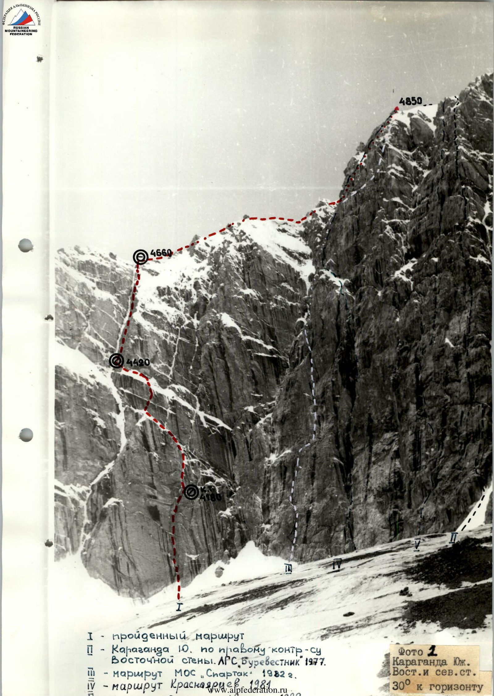
Photo 1. Karaganda South. East and north face. 30° to the horizon.
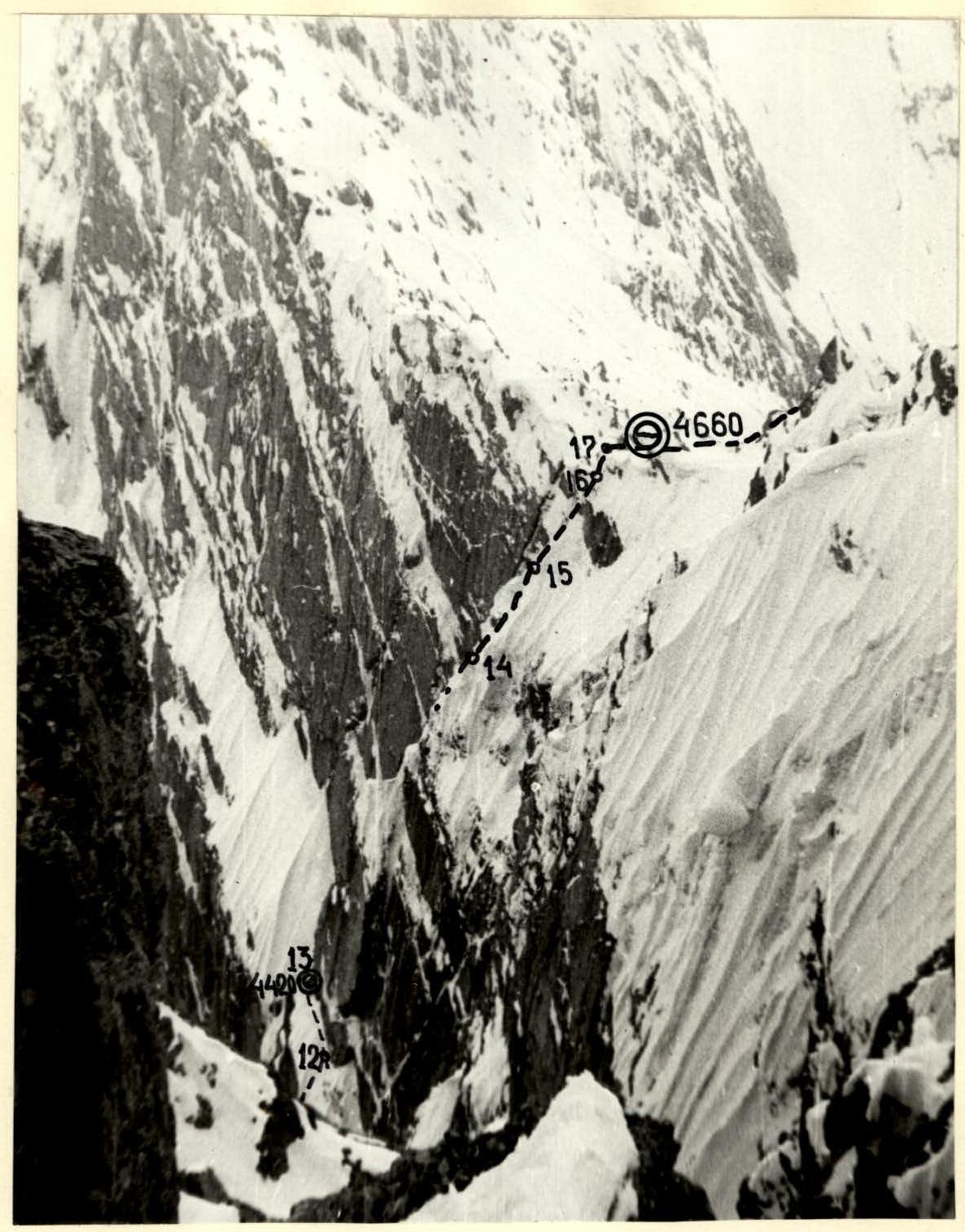
Photo 2. View from the South ridge of Karaganda South peak. July 18, 1983.
Profile. Sections R13–R17
Route description by sections
Section R3 — a fairly wide crevice filled with ice. Few places for belay, rocks are fragile.
Section R5 — overhang is passed through a wide gap, rocks are smooth, few handholds. Very large nuts or sectors are used. A variant to the right along the smooth wall is possible.
Section R7 — from the ledge upwards to the left pendulum towards the ice-filled internal corner and along the rib between the corner and the wall upwards.
Section R8 — steep smooth rocks, covered with ice, are passed on the left part. Few places for pitons.
Section R11 — wall with few handholds, ice, water. In the middle part, it is intersected by a narrow, strongly sloping ledge. Continuing along the ledge left or right does not make sense.
Section R16 — steep snow leads to a small ridge on the left. Going straight is dangerous due to the steepness of the snow and the risk of a cornices collapse. The ridge is the only place to set up a belay.
Section R17 — very steep snow on ice. It is necessary to dig a trench, reach the ice, and screw in ice screws. Otherwise, it is impossible to ensure a belay. The couloir on the left is prone to rockfall. Probably, in warmer weather this section, as well as the previous one, is free of snow and is purely ice. Route representation in UIAA symbols
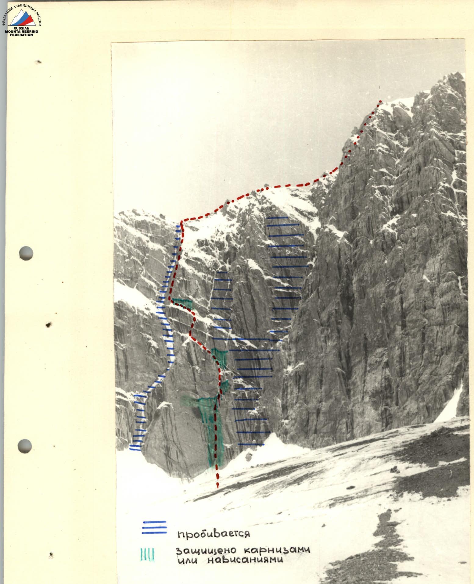
Hazardous sections diagram

Photo 4. View from below, 45° to the horizon. July 20, 1983. Sections R1–R7

Photo 6. View from the slope of p. 5100. August 5, 1983. Sections R1–R17