RUSSIAN MOUNTAINEERING FEDERATION RUSSIAN MOUNTAINEERING FEDERATION
CLIMBING ASCENT DOCUMENT

- Ascent category — technical.
- Ascent area — Alai Ridge.
- Peak "Sыnovey", 5100 m, via the southwest buttress and south ridge.
- Category 5A difficulty.
- Elevation gain of the route 800 m, length of 5th category difficulty sections 120 m, average slope on sections 0–6 60°.
- Pitons used:
- for belays — 36;
- for artificial climbing aids — 0;
- rock pitons — 36;
- ice screws — 0;
- bolt pitons — 0.
- Number of climbing hours from the start of the route to the summit — 14.
- Overnight stay below the route on the moraine of the glacier.
- Leader — Sergey Yurievich Gladkov — 2nd sports category, instructor.
Team members:
- Sergey Illarionovich Stepanov — 2nd sports category, instructor.
- Stanislav Fedorovich Naumov — 2nd sports category, instructor.
- Andrey Nikolaevich Kornienko — 2nd sports category.
- Departure date 12 July 1978, return to the initial bivouac 12 July 1978.
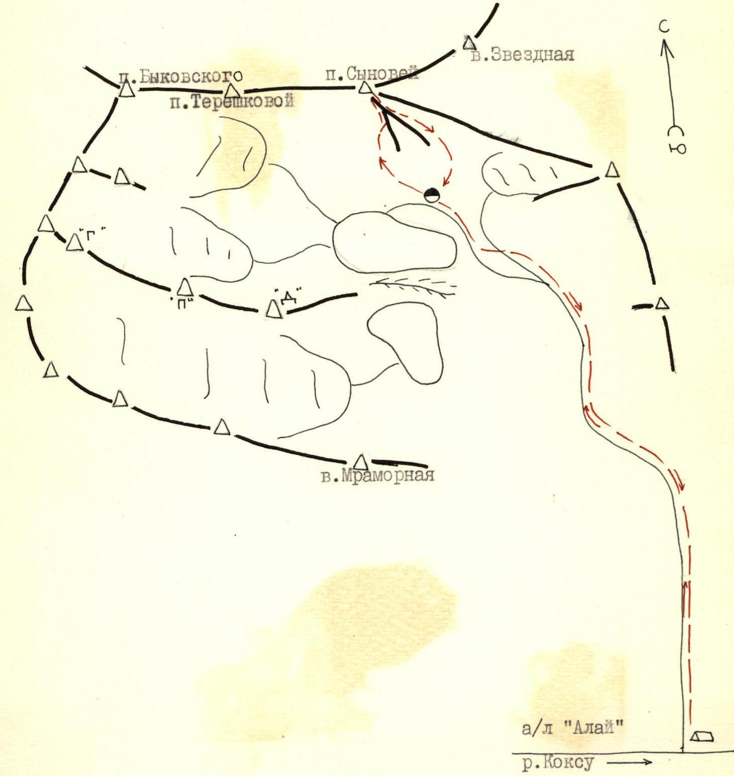
Area map of the ascent.
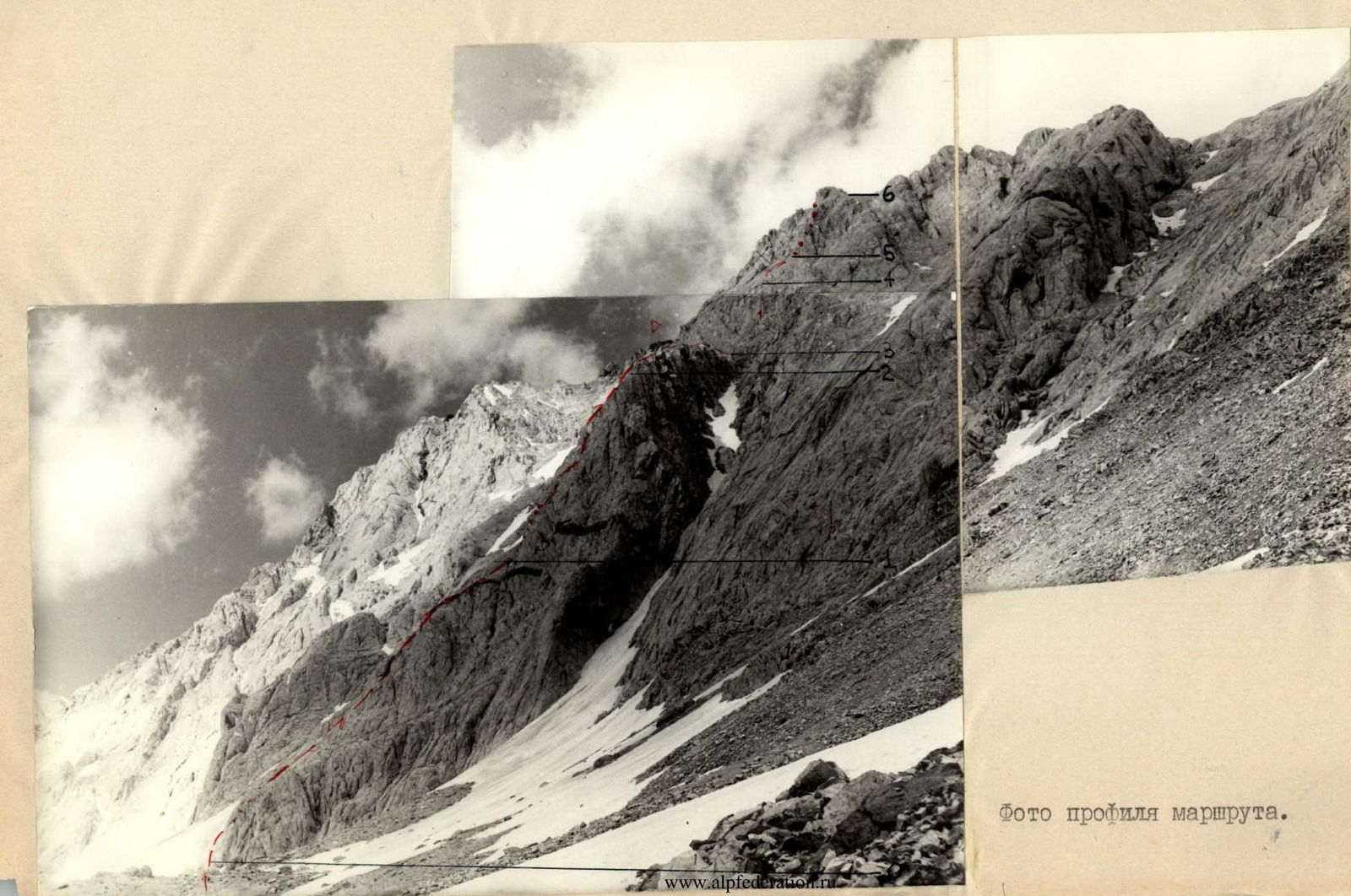
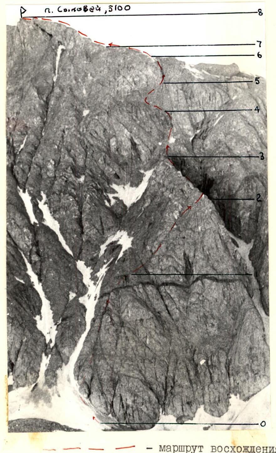
Route profile photograph.
View of the marble block protruding from the wall from a ledge on section 4–5
(shooting location and direction indicated by an arrow on the general view photo).
Table of sections
I. Description of the approach to the route
From the "Kozhdeba" meadow (location of the "Alai" tourist base) along the right bank of the left tributary of the Koksu River upstream. Follow a good trail to where the river turns left. Then head towards the canyon on a trail along the right bank of the valley, overcoming the uplift of the mouth step. Beyond the uplift, the peaks "Tereshkova" and "Sыnovey" come into view.
Through a wide valley with numerous moraine ridges, streams, and lakes — approach the southern slopes of Peak Sыnovey to the initial bivouac.
From Kozhdeba meadow 4–4.5 hours.
II. Explanation for the table of route sections
The southwest slopes of the buttress (sections R0–R1, R1–R2) are composed of soft, loose rocks. The rocks are partially covered with sand and small scree. Movement is carried out along characteristic crevices cutting through the slope vertically. Climbing is mainly done using friction footholds. Handholds are limited. There are few cracks suitable for piton placement. Large-sized pitons are most commonly used. In the morning, these sections are in the shade, and their passage is complicated by low air and rock temperatures.
At the shoulder of the buttress, at the start of section R2–R3, there is a control cairn. Following section R2–R3 is the key section of the route — the wall of the south ridge.
From where the buttress joins the wall, climb straight up a steep (up to 80°) 8–10 m wall to a ledge. Climbing is extremely difficult, using small handholds dynamically. The first climber goes without a backpack and only in rubber boots.
From the ledge, climb up along the corner formed by the wall and a marble block protruding from the wall. Climbing is difficult, with some use of the marble block for stemming. Pitons are also placed in the marble block since the main rock of the wall has virtually no cracks suitable for piton placement.
Section R4–R5 begins with a scree-covered, almost horizontal ledge. Along the ledge, first left for 30 m, then up and right through rocks of medium and above medium difficulty to the base of an internal corner.