ASCENT DOCUMENT
-
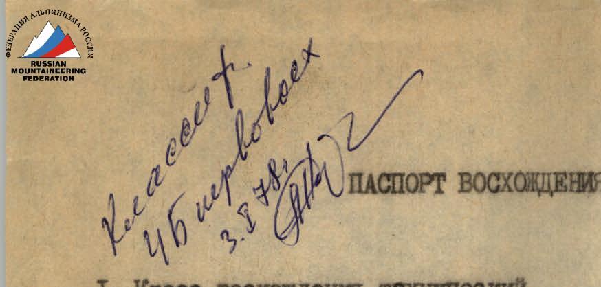
Ascent class: technical.
-
Ascent area: Pamir-Alay ridge, Alay ridge.
-
Peak, its height, ascent route: p. I. S. Nikitin 4820 m via the North ridge.
-
Proposed difficulty category: 5A cat. diff.
-
Route characteristics: height difference from p. Aydarbek to v. 4820 m — 970 m. Length of sections with 5–6 cat. diff. is 360 m, average steepness is 3°–60°.
-
Number of pitons driven: for belaying, for creating artificial anchors
- rock — 20
- ice — 30
- bolt pitons
-
Number of travel hours — 16 hours.
-
Number of nights and their characteristics.
-
Surname, name, patronymic of the leader, participants and their qualifications: Tarasova T. I. — II sports category — leader Korovnikov R. I. — I sports category — participant Perelygin S. I. — I sports category — participant Lyubavin S. S. — II sports category — participant
-
Team coach: Zaev E. F.
-
Date of departure and return: July 28, 1977 – July 29, 1977.
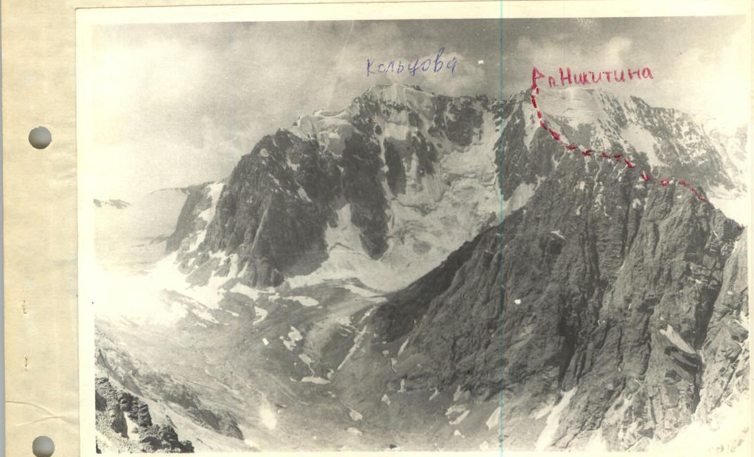
p. Koltsova and p. N. Nikitin. Koltsova (В) and Koltsova (3)?
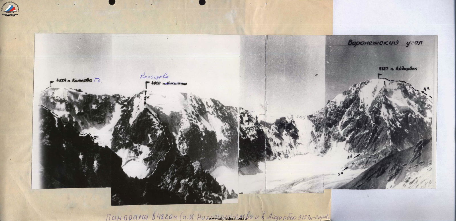
Panorama of v. 4820 m (p. N. Nikitina) and v. Aydarbek 5127 m — on the right.

Appendix 2
Characteristics of the section, belay, passage, and length
| Designation | Average steepness | Length, m | Relief | Difficulty | Condition / Conditions | Belay (rock) | Belay (ice) | Belay (bolt) | Passed (rock) | Passed (ice) | Passed (bolt) | Time (h, min) |
|---|---|---|---|---|---|---|---|---|---|---|---|---|
| R0–R1 | 40°–45° | 500 | slope, ledges | 2 | Fragmented, good rocks | Simultaneous | - | - | - | - | - | 1 h 30 min |
| R1–R2 | 10°–15° | 350 | ridge I | 5 | Fragmented, good | - | 3 | - | - | - | - | 2 h 30 min |
| R2–R3 | 85° | 120 | wall, corner | Unstable rocks, good monolith | 10 rock pitons, 3 outcrops | - | 2 | - | - | - | - | 4 h |
| R3–R4 | 40° | 250 | ridge, ledges | 2 outcrops | Fragmented, good | Simultaneous | - | - | - | - | - | 1 h 30 min |
| R4–R5 | 45°–50° | 160 | rock-ice | Icy, good rocks | 4 outcrops, 5 rock pitons | - | - | - | - | - | - | 1 h 30 min |
| R5–R6 | 50°–55° | 320 | ice ridge, IV–V ice | - | Good | 25 rock pitons | - | - | - | - | - | 5 h |