
ASCENT DOCUMENT
- Ascent class — technical.
- Ascent area, ridge — Koksu tract area, Alai ridge, Kemisdykty glacier cirque.
- Peak, its height, ascent route — p. 4824, via north-eastern ridge.
- Proposed difficulty category — 4A.
- Route characteristics:
- route — combined;
- height difference — 950 m;
- length of sections 5–6;
- average steepness — 35°.
- Number of pitons driven for belaying and artificial support:
- rock — 5;
- ice — 3;
- bolted — none.
- Number of climbing hours — 12 h.
- Number of nights and their characteristics — none.
- Surname, name, patronymic of the leader, participants and their qualification:
- Bubynin L. V. — 1st sports category;
- Korenyugin I. K. — 2nd sports category.
- Team coach — Zaev Eduard Fedorovich.
- Date of departure and return:
- departure July 29, 1977 at 5:30;
- return — July 29, 1977 at 17:30.
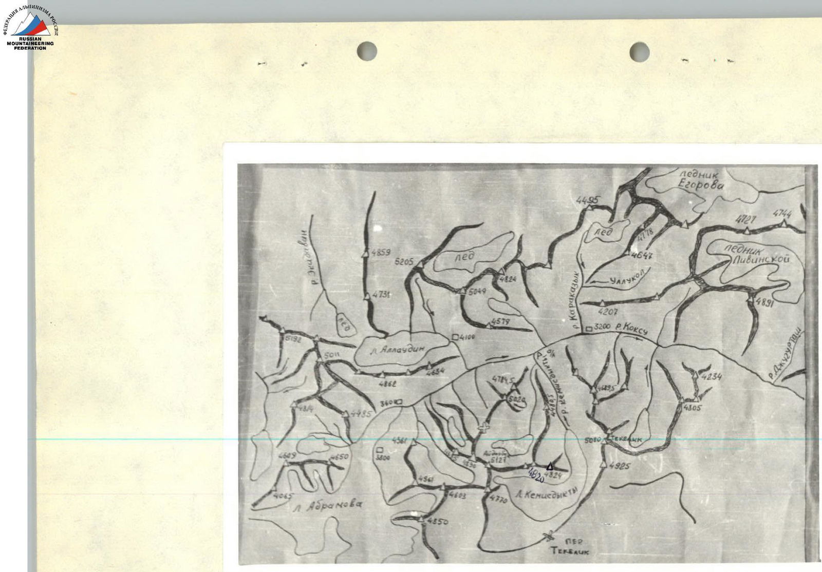 Map of the ascent area.
Appendix 2
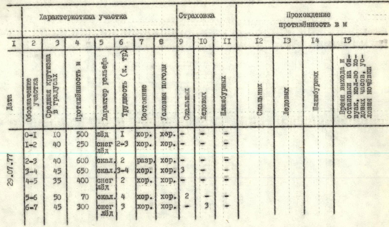
Brief explanation of the table
Section R0–R1. From the overnight stay on the moraine below peak 4824 (Koltsov Peak), approach via Kemisdykty glacier to the start of the route, bypassing the rock tower at the foot of peak 4824 (Koltsov Peak) on the right.
Section R1–R2. Climbing on crampons in teams up a steep snow-ice slope through a bergschrund to the start of a wide rock slope (right slope of the ridge above the base tower).
Section R2–R3. Climbing up simple broken rocks towards a gap in the ridge after the rock tower. Exit onto the ridge. Here is a control cairn.
Section R3–R4. Further along the ridge, on rocks of medium and above medium difficulty — exit onto a flattening part of the ridge.
Section R4–R5. Snow-ice ridge, traversed in crampons, simultaneous movement.
Section R5–R6. Pre-summit rocks of medium difficulty are traversed with simultaneous belaying. Belaying is done by wrapping the rope around rock outcrops.
Section R6–R7. Traversing a steep snow-ice ridge is done on crampons with alternate belaying via ice screws. Exit onto the summit.
Descent is done to the southern side via a snowy, then scree gully. The gully is exposed to rockfall, so precautions are necessary. Descent takes 3–4 h.
The group assesses the complexity of the route as cat. diff. 4A.
The group, as first ascenders, proposes to name the 4824 m peak after Alexei Koltsov, a famous Russian poet.
 Photo of the general view of the route.
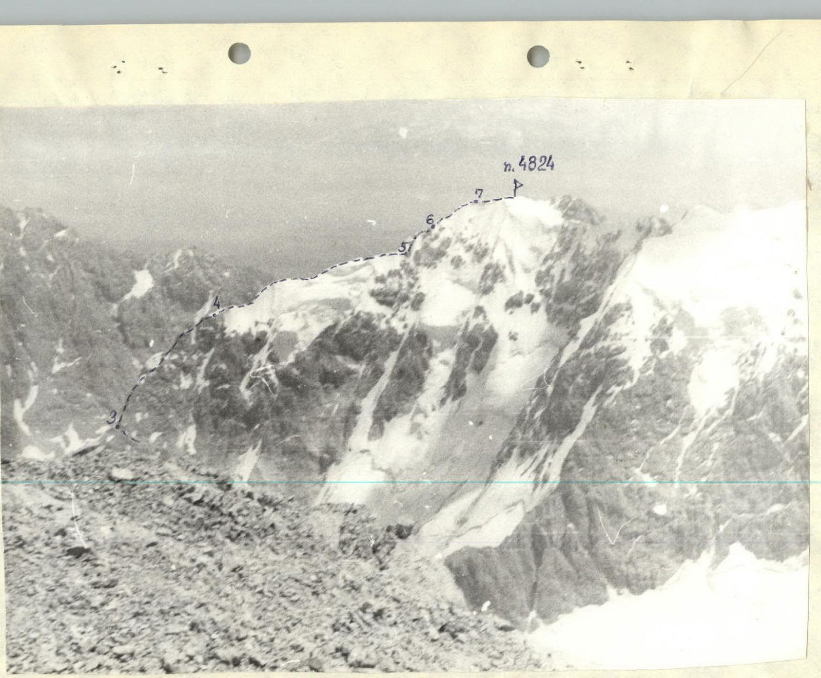 Photo of the route profile.