First ascent via the NE edge, category 4A, to the summit of Zub Begichi (4100 m), Alaysky Khrebet, Kok-Su gorge
Alpinist camp “Alay” (head of the training department — Honored Coach of the RSFSR, Master of Sports of the USSR A.F. Naumov).
Group composition:
- G.G. Andreev — Master of Sports
- V.S. Balyberdin — 1st sports category
Leningrad, 1978
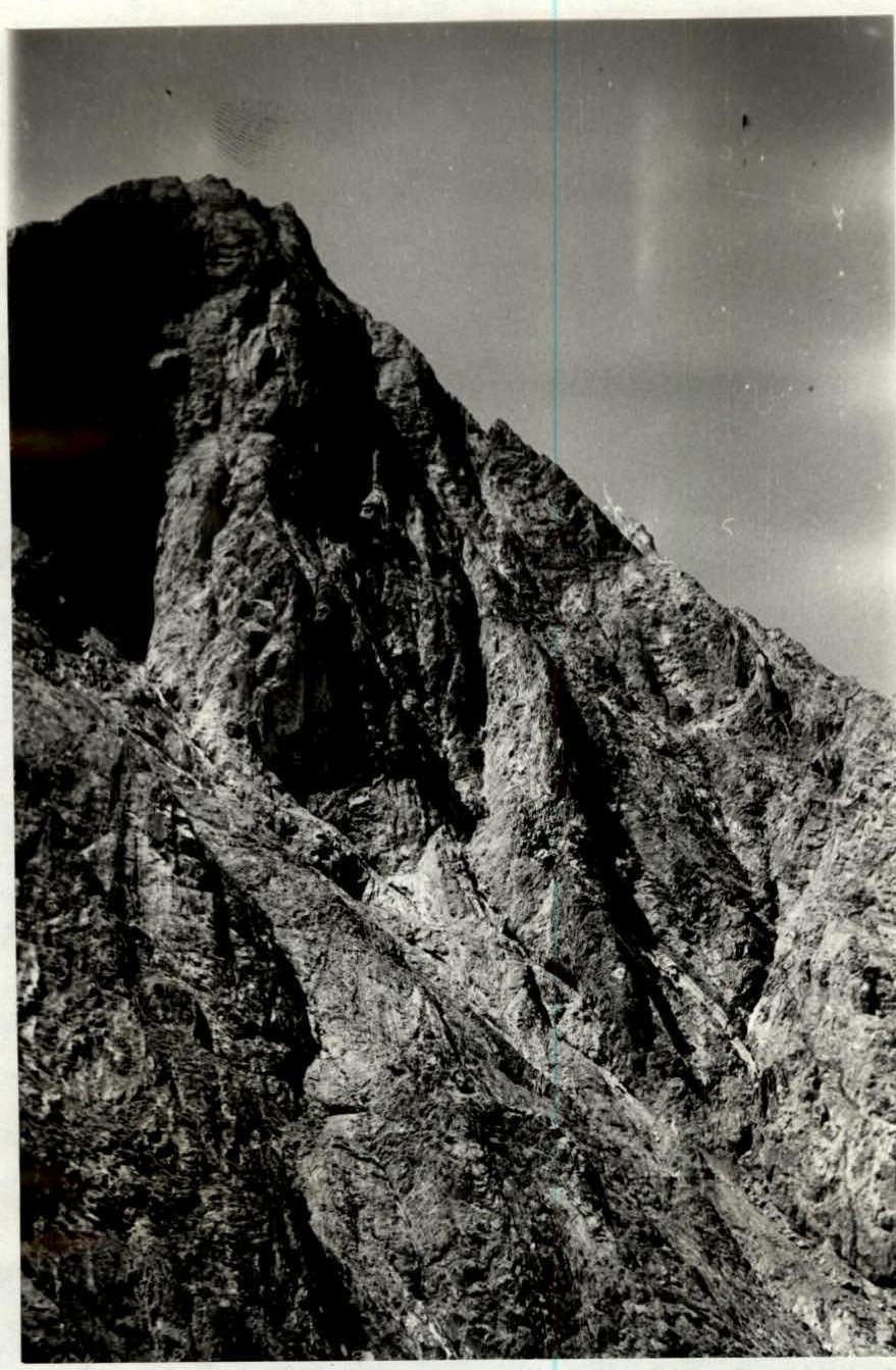
Photo 1. Zub Begichi peak (4100 m). Northeast wall and profile of the northeast buttress (view from the east).
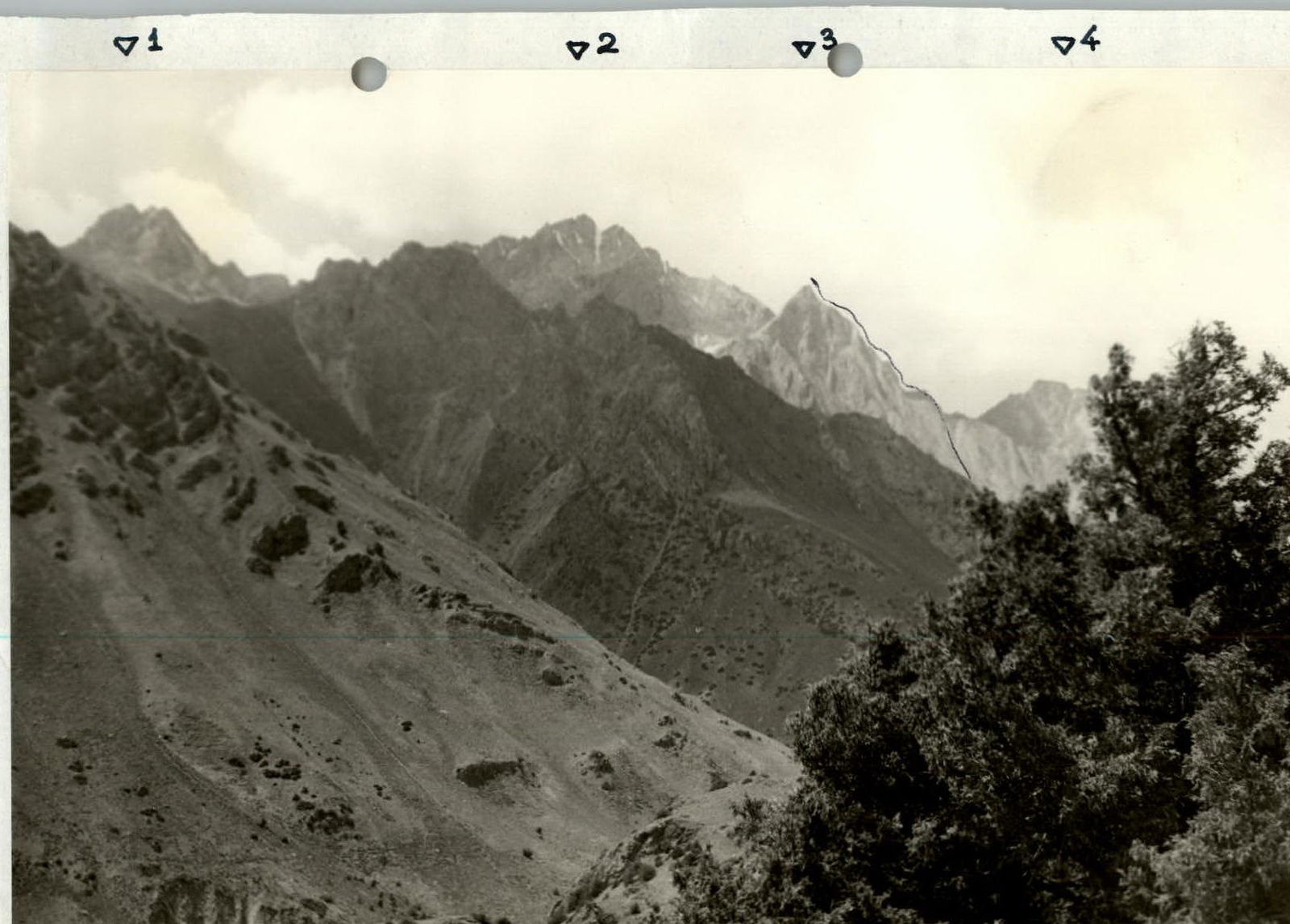
Photo 2. Panorama of the Kok-Su river gorge in the area of the base camp.
- 3 — Zub Begichi peak, 4100 m, northeast wall;
- 2 — Jalgyz Konush peak, 4470 m;
- 1,4 — unnamed peaks.
Description of the ascent route to Zub Begichi peak (4100 m) via the northeast buttress, category 4B (first ascent)
From the camp, located in the Kozhdeba clearing, ascend along the right (orographic) bank of the Kok-Su river, along the trail to the clearing opposite the crashed helicopter (40–45 minutes walking). In the far left corner of the clearing, ascend via scree, leaving the rock wall to the right, to the start of the couloir. Up the couloir, along the eastern walls of the northwest ridge of the peak, ascend to the foot of the northeast wall (1.5–2 hours).
- Ascend left-upwards onto the northeast buttress via moderately difficult rocks and a 20–30 m wall.
- Traverse along the sharp crest of the buttress (some "loose" rocks!) to below the base of the upthrust (60–80 m).
- Ascend the upthrust of the buttress on the right via smooth slabs (piton protection, 160 m).
- Reach the top of the upthrust.
- Further, the buttress becomes more gentle.
- Alternate movement with protection through ledges (80 m).
- The pre-summit upthrust of the buttress (over 210 m long) is an edge weakly protruding from the wall and leading below the summit tower.
- At this point, the buttress joins the northwest ridge.
- Ascend the pre-summit upthrust head-on, partially along ledges on the right (key protection, rockfall hazard).
- Reach the summit via difficult, heavily broken rocks (40 m, piton protection — key section of the route).
Descend from the summit eastwards along the steep, very narrow and broken ridge to the dark brown couloir (about 80–90 m). Descend into the couloir 20 m (rappel). Further down the couloir (80–100 m), exit onto scree and then onto a grassy slope. Crossing the northeast cirque to the east of peak 4470, exit onto grassy
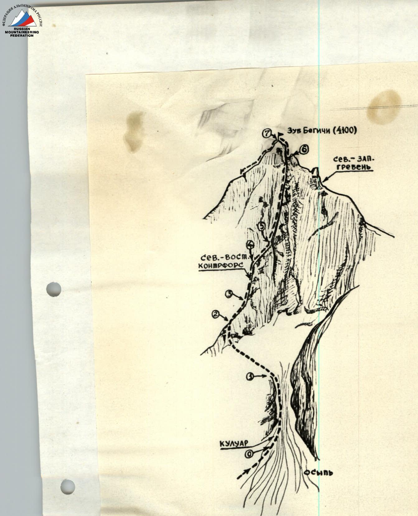
Route diagram for ascending Zub Begichi peak (4100 m) via the northeast buttress.