-
Climbing category: combined
-
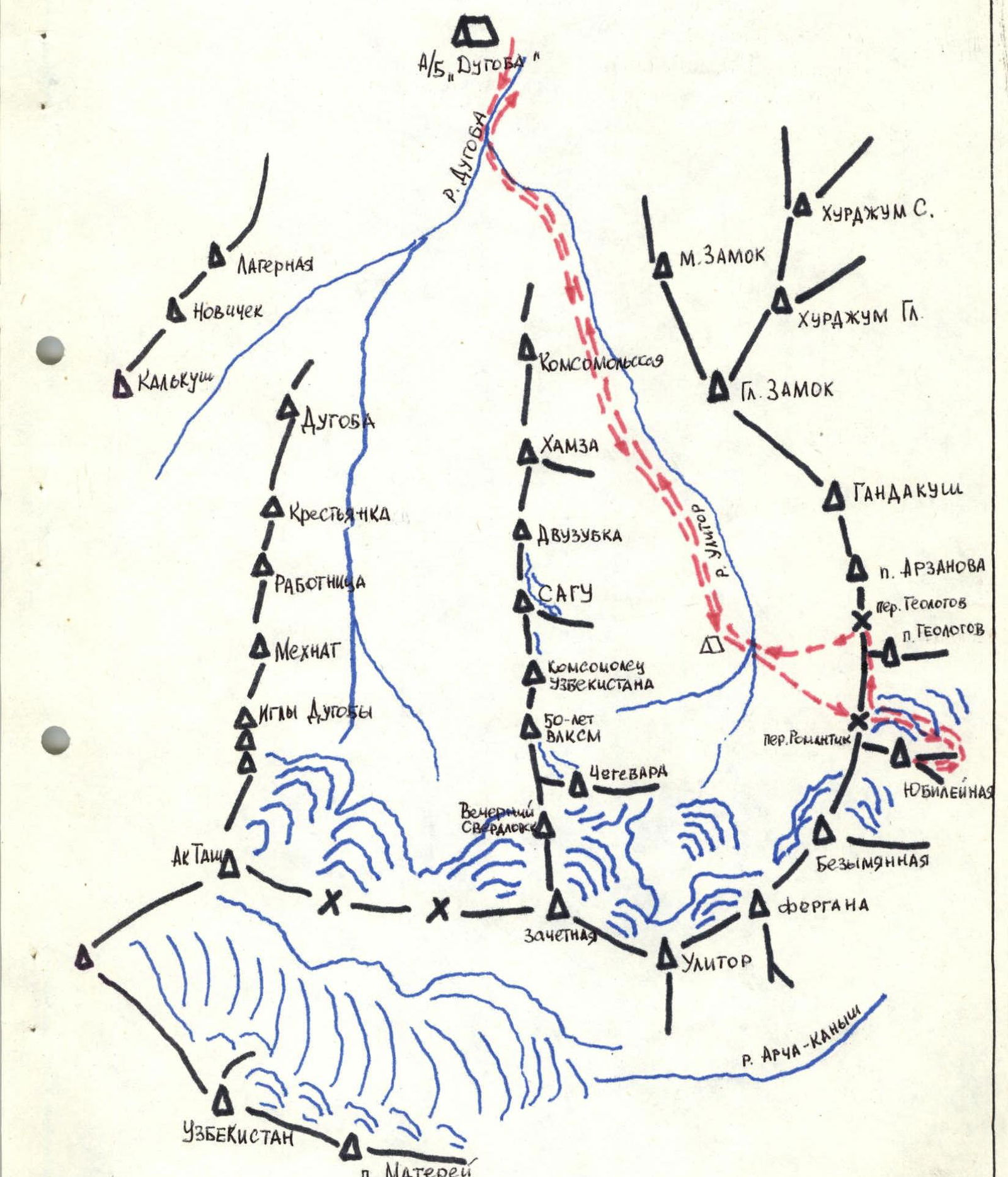
Climbing area: AUSB "Dugoba", Kollektorsky Ridge, spur of the Alay Ridge
-
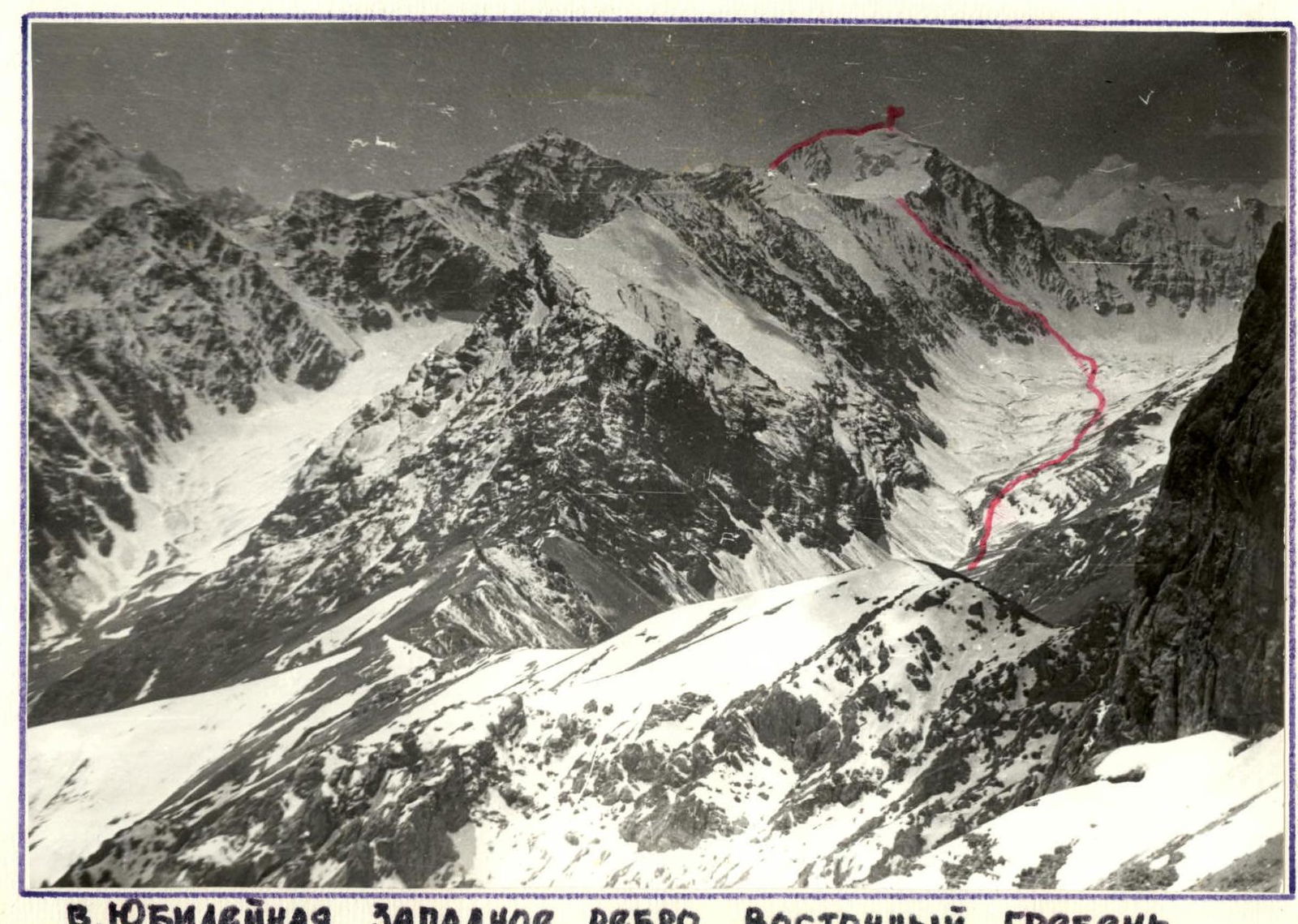
Peak, its height, route taken: p. Yubileynaya 4860 m. Western edge and Eastern ridge.
-
Estimated category of difficulty: 2B
-
Route characteristics: combined
-
Height difference: 1260 m.
-
Length of sections:
- Cat. diff. 5
- Cat. diff. 4
- Cat. diff. 3 — 53 m.
- Cat. diff. 2 — 930 m.
- Cat. diff. 1 — 1270 m.
Total route length: 2250 m.
-
Average steepness:
- Western edge — 40°
- Eastern ridge — 35°
-
Pitons hammered in:
- rock — 15
- ice — 4
- placement elements — 14
-
Number of travel hours: 12
-
Number of overnight stays: none
-
Full name of the leader and participants, qualification:
- Shcherba Anatoly Yakovlevich, CMS — leader
- Gubanov Anatoly Alexandrovich, 2nd sports category
-
Team coach:
- Bocharov Vladimir Nikolayevich, Master of Sports of the USSR
-
Date of departure on the route: September 14, 1988
-
Date of return from the route: September 14, 1988
-
Climbing organized by: AUSB "Dugoba".
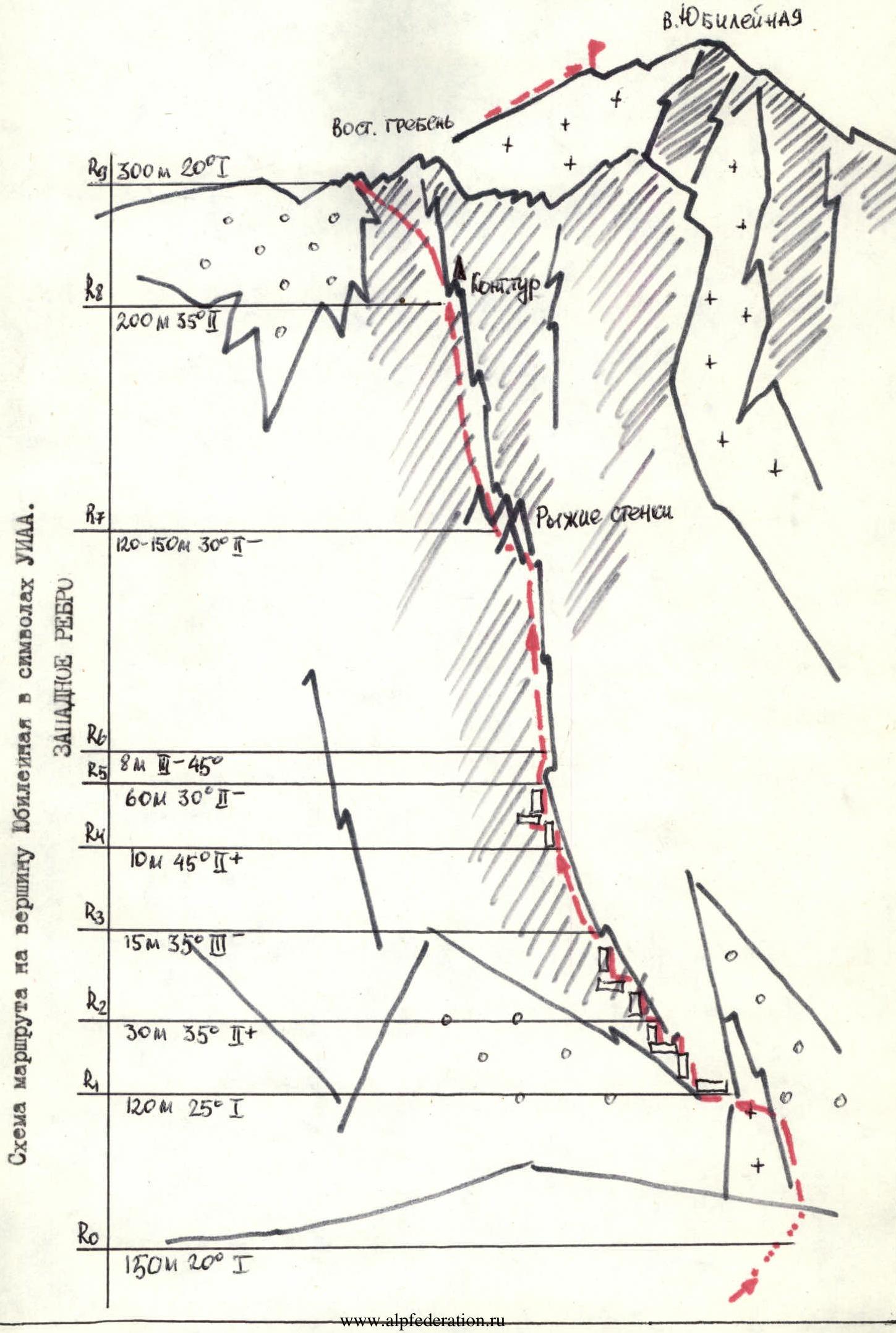
BRIEF DESCRIPTION OF THE ROUTE
From the "Dugoba" base camp, it takes 6 hours to reach the "Arzanovskie nochyovki" in the Ulitor gorge.
From "Arzanovskie nochyovki":
- We ascend for 1 hour under p. Yubileynaya to a large black scree.
- Then up the scree — 150 m, in its left part we approach the destroyed edge and climb straight up.
- Scree, short walls — 120 m, we approach the high part of the edge and then traverse left and up, walls, scree shelves; in the upper part the rocks become more complicated — 45 m.
- Then straight up — 10 m, loose rocks!
- From them left and up 120/120 m, we approach a complex wall — 8 m up.
- Up to the right we reach the base of the edge.
- Then we climb straight up 120–150 m and approach under the rusty walls, between the walls to the left, and then straight up we climb to a large rusty gendarme — 200 m (first control cairn).
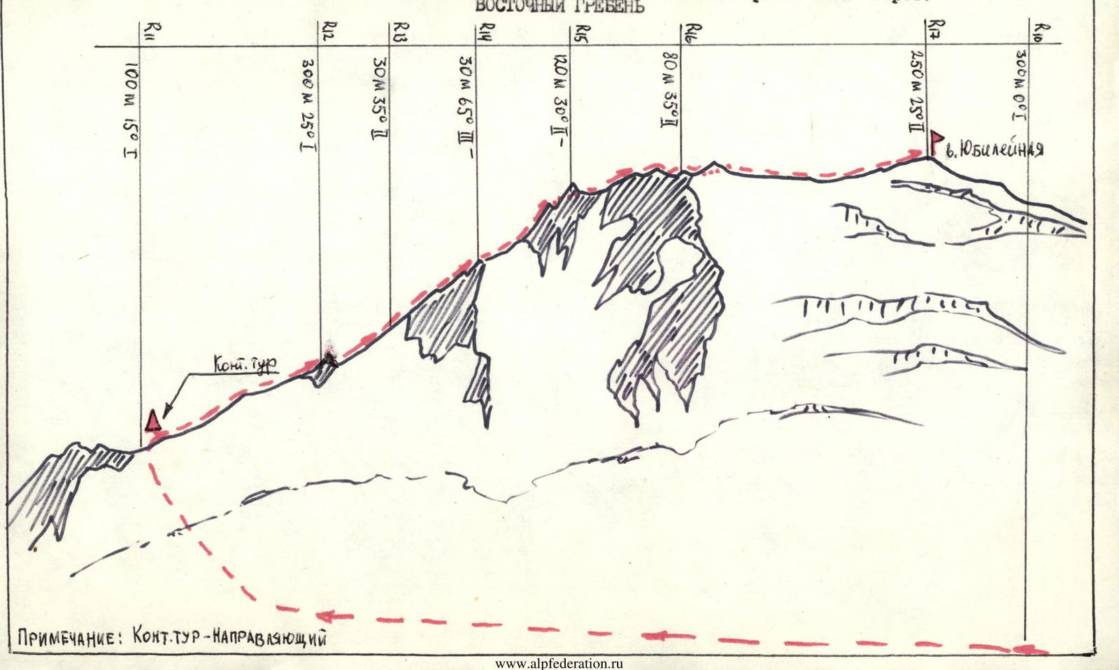
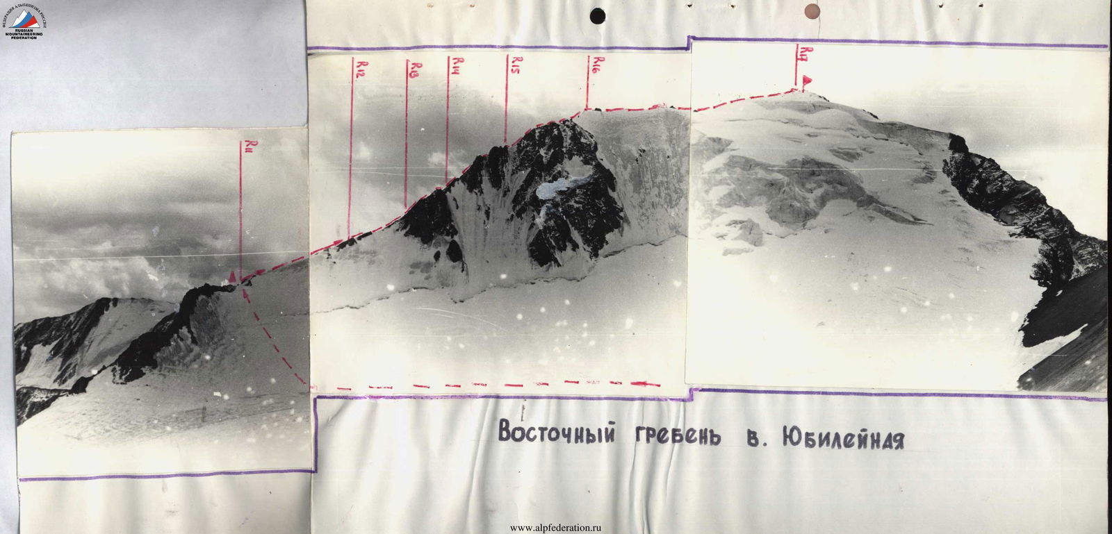
- From the gendarme we climb straight up the scree slope — 300 m and reach the Romanтик pass 2A cat. diff. (height 4400 m) — a convenient place for a bivouac.
From the pass:
- We descend along the scree down under the northern slopes of p. Yubileynaya, cross a gentle snowfield in the direction of the Eastern ridge.
- Ascent to the ridge along gentle snow, ice; at the end of summer an open bergschrund is possible.
- On the ridge — a "guiding" control cairn.
- Further ascent along a gentle snow-ice ridge, alternating with small rocky walls and snow overhangs.
- We approach a gendarme — 300 m.
- Then the ridge narrows and becomes more complicated (30 m), we approach the second gendarme, on its left side — a complex wall — 30 m, rocks are destroyed!
- From it along the snowy ridge — 120 m.
- Then — 80 m along the scree ridge.
- Along a wide ridge with snow cornices and ice sections — 250–300 m we reach the summit.
Descent from the summit along the ascent route. Alternative descent variant from the Geolog pass. Descent takes 1.5–2 hours. The ascent is planned for two days. It is recommended to take bivouac equipment.
Route diagram to p. Yubileynaya in UIAA symbols.
Route diagram to p. Yubileynaya in UIAA symbols: Height of the peak 4800 m. Eastern ridge