Ascent Passport
- Ascent class: technical
- Ascent area: Pamir-Alay, Alay Ridge
- Peak, its height, and ascent route: Pik Shait, 4916 m, via N.N.E wall by Ovcharov's route (recognized route).
- Expected difficulty category: 5B
- Route characteristics: height difference — 900 m, average steepness — 60°, length of sections: 1st difficulty category — 40 m, 3rd-4th difficulty category — 445 m, 5th difficulty category — 585 m, 6th difficulty category — 60 m.
- Number of pitons: for belaying: rock — 19, ice — 6, chocks — 110.
- Number of climbing hours: 15
- Number of bivouacs and their characteristics: no bivouacs.
- Full name of the leader, participants, and their sports qualification:
- Zakharov Nikolai Nikolaevich — Candidate Master of Sports
- Chentsov Sergey Vasilievich — Candidate Master of Sports
- Team coach — Yakovlev Vitaly Dmitrievich.
- Date of departure on the route — July 10, 1980, 2:00 AM. Return — July 10, 1980, 10:00 PM.
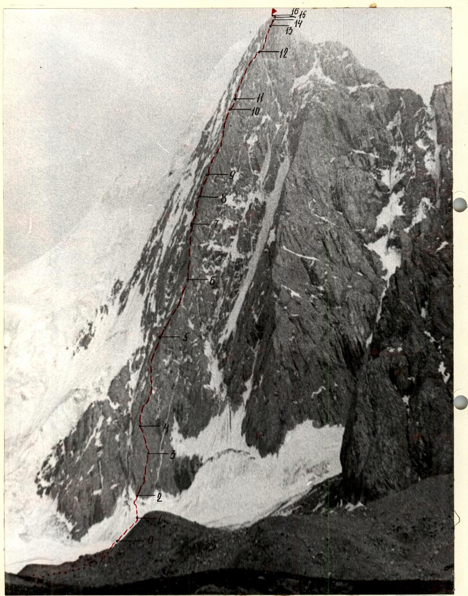
TABLE OF MAIN ROUTE CHARACTERISTICS
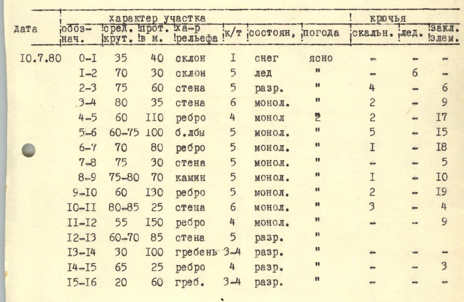
Brief explanation of the table
Section
R0–R1: Firm firn, steps are easily kicked. R1–R2: Approach to the bergschrund on ice with a good bridge, then exit via the left wall to the rock. R2–R3: Wall. Destroyed rocks with frozen stones. R3–R4: Wall to the left leads to an edge. Difficult. R4–R5: Edge with shelves, many cracks for chocks. R5–R6: Edge widens. Rocks are like "ram's foreheads", mostly on friction. R6–R7: Clear edge like a bastion. Passed through the center. R7–R8: Edge flattens, leading to a wall. On friction, no cracks for pitons. R8–R9: Chimney with a plug at the bottom, passed in a wedged position. R9–R10: Exit to an edge via a smoothed slab and wall. There are ledges and shelves. R10–R11: Wall. Few cracks, small holds. R11–R12: Approach to a small depression via an edge. R12–R13: Through the depression, then along the wall. Unstable rock, blocks on shelves in some places. R13–R14: Ridge, destroyed rocks. R14–R15: Sentinel, passed head-on, rocks destroyed. R15–R16: Along the destroyed ridge to the summit.
Descent from the summit ridge to the left onto the ridge leading to Pik Bursun, then along the ridge to a large sentinel and then left onto the glacier 7 sportsmen. Descent takes 1.5–2.5 hours.