2
Teams
SACS “BAKA–Dugoba 2012” on the ascent route to Mt. SAGU via the icy slope of the northern wall of the northwestern ridge "3B", (K)
Leader
Temerev I.M.
Participants
Timofeev D.I., Matveev S.V., Voronezhceva O.A., Alabugin I.V., Tyshkylova N.P., Selezneva S.V., Mukhametzhanov B.M.
Ascent Passport
- Pamir-Alay, region 5.1.1. Gadjir, Mashalyan, Dugoba, Koyсу, Archakanysh rivers basin (north of the Alay range).
- Mt. SAGU, icy slope of the Northern wall of the northwestern ridge.
- First ascent, proposed category 3B.
- Route type: combined.
- Route elevation gain — 1050 m.
Route length — 2470 m. Section lengths:
- II category — 850 m.
- III category — 930 m.
- IV category — 140 m.
- V category — 250 m.
Average steepness:
- icy slope — 45°
- Pitons used on the route:
- ice screws — 20 pcs.
- Team's total climbing time: 7 h 30 min, 1 day.
- Leader:
- Temerev Ivan Mikhaylovich — CMS
Participants:
- Timofeev D.I. — 3rd sports category
- Matveev S.V. — 3rd sports category
- Voronezhceva O.A. — 3rd sports category
- Alabugin I.V. — 3rd sports category
- Tyshkylova N.P. — 3rd sports category
- Selezneva S.V. — 1st sports category
- Mukhametzhanov B.M. — 3rd sports category
-
Coach: Endelin O.V.
-
Departure from “Pup Sel'skogo” base camp: August 10, 2012, 5:00.
Start of work on the route: August 10, 2012, 8:40. Reaching the ridge: August 10, 2012, 13:15. Reaching the summit: August 10, 2012, 16:15. Descent to Aktash overnight stay: August 10, 2012, 19:00.
- Organization: SACS “BaKA–Dugoba 2012”. Photo of the general view of the summit.
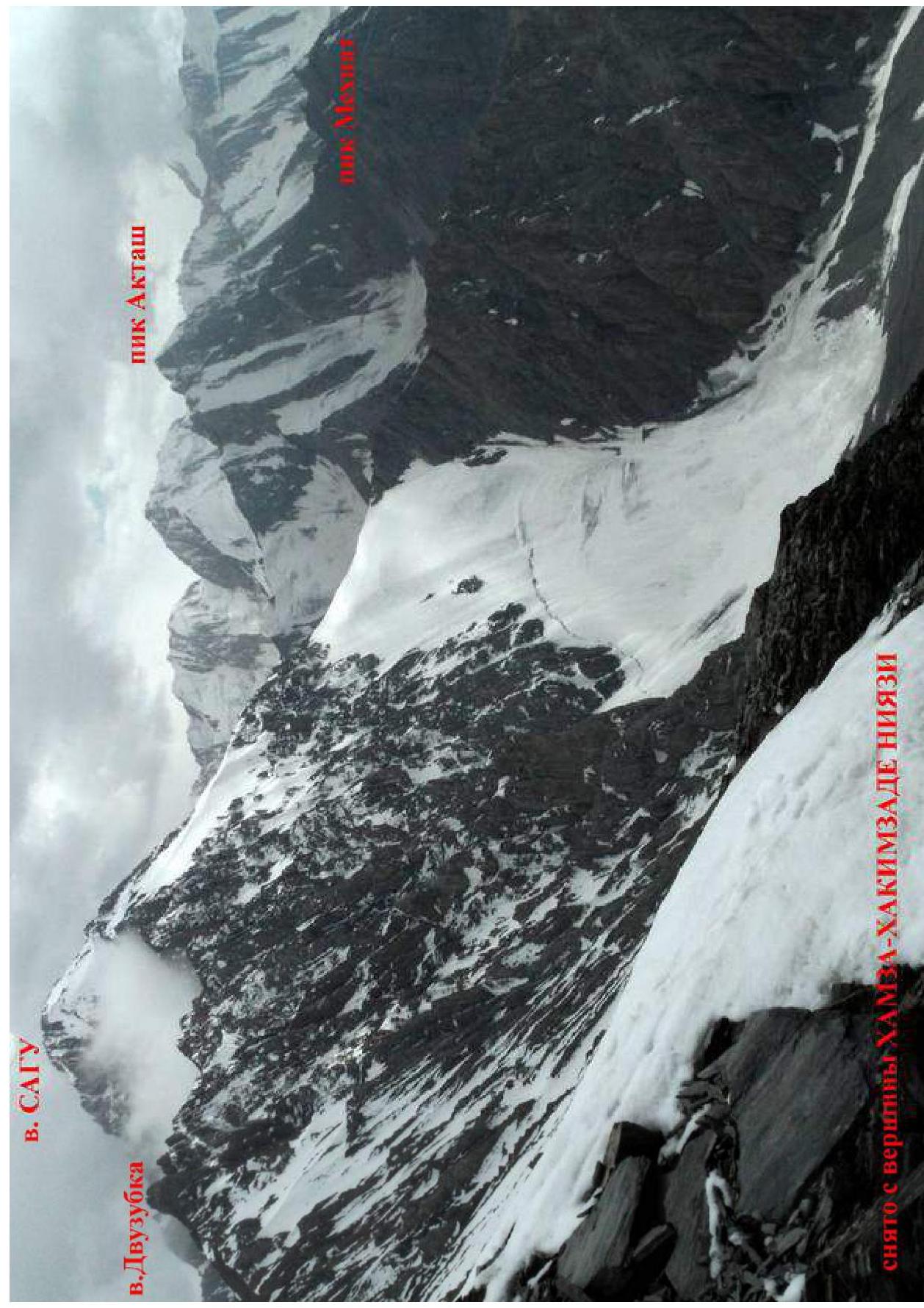 Photo of the route profile.
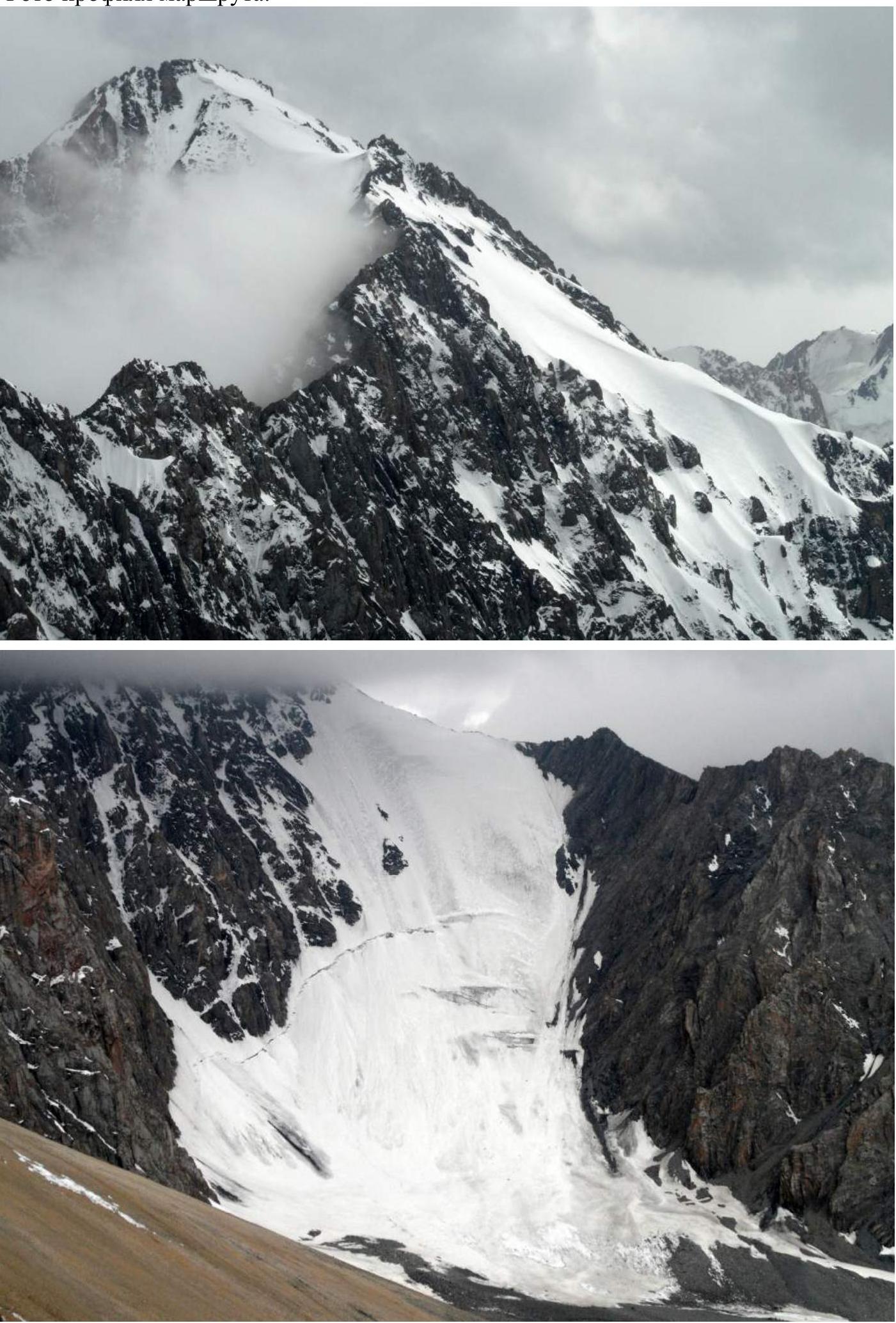 Photopanorama of the area.
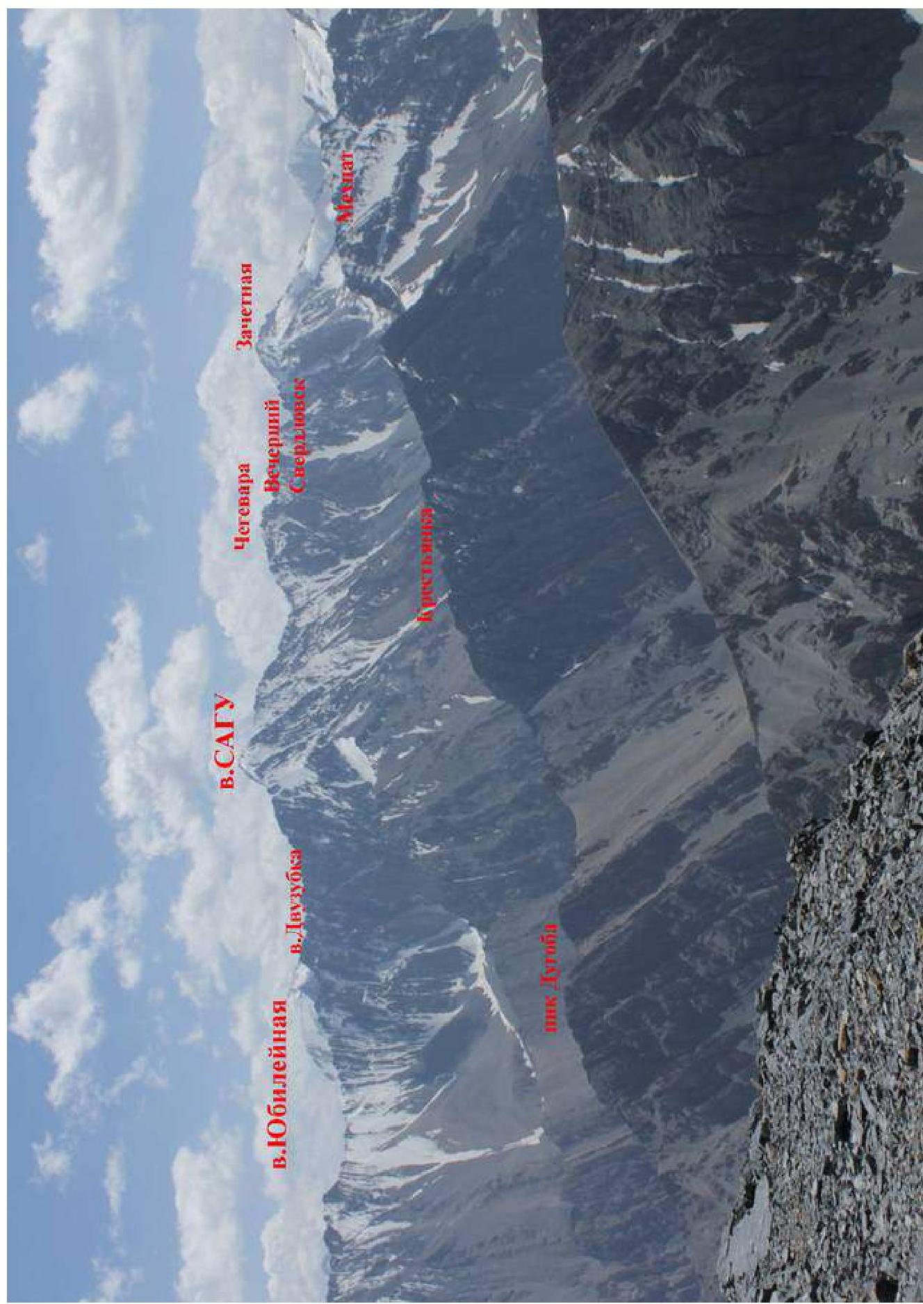 Diagram of the ascent route in UIAA symbols.
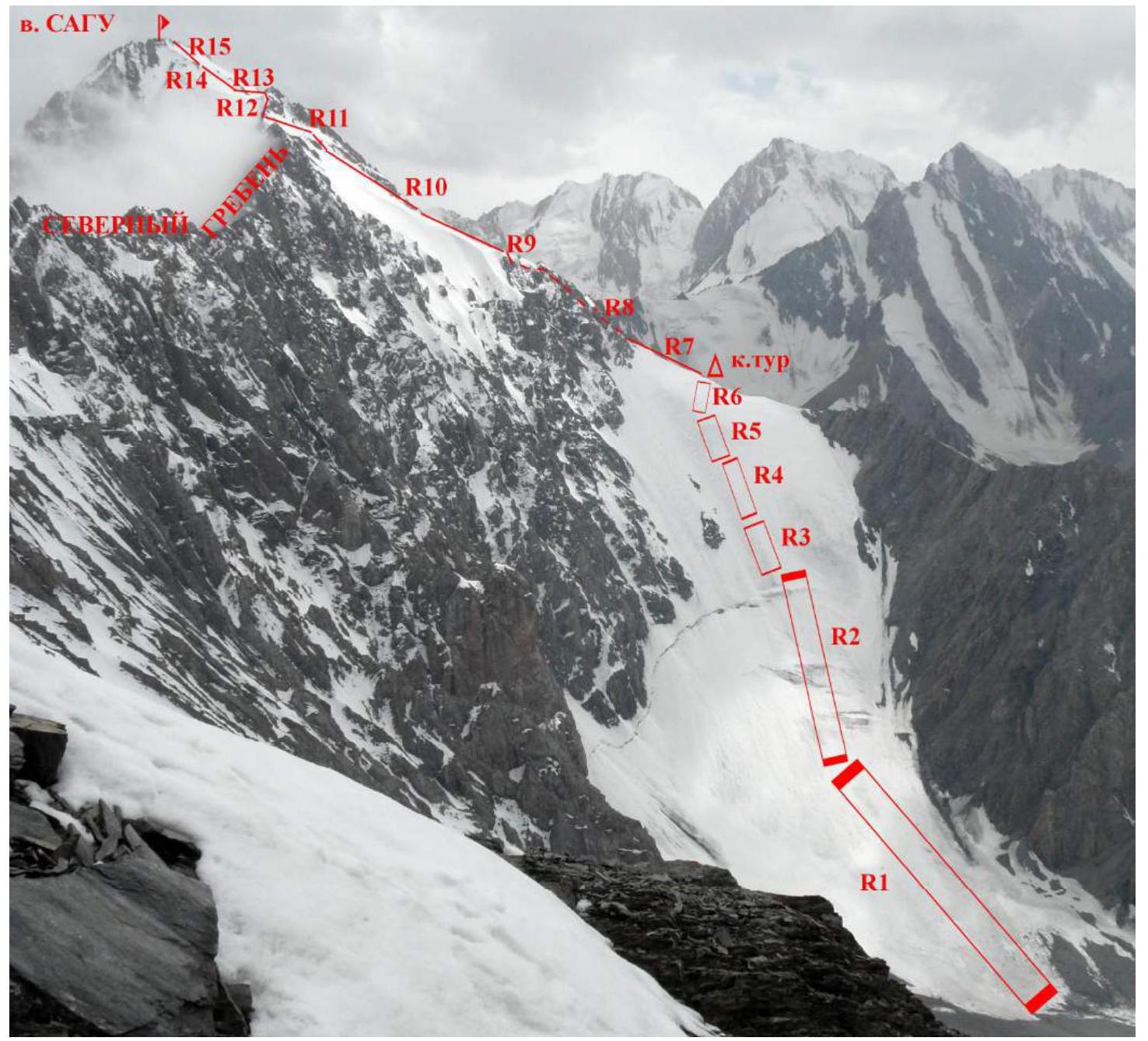 Description of the route by sections and time breakdown.
5:00 — departure from the camp at “Pup Sel'skogo” overnight stay.
7:50 — approach to the glacier under the start of the route.
8:40 — start of simultaneous movement in rope teams.
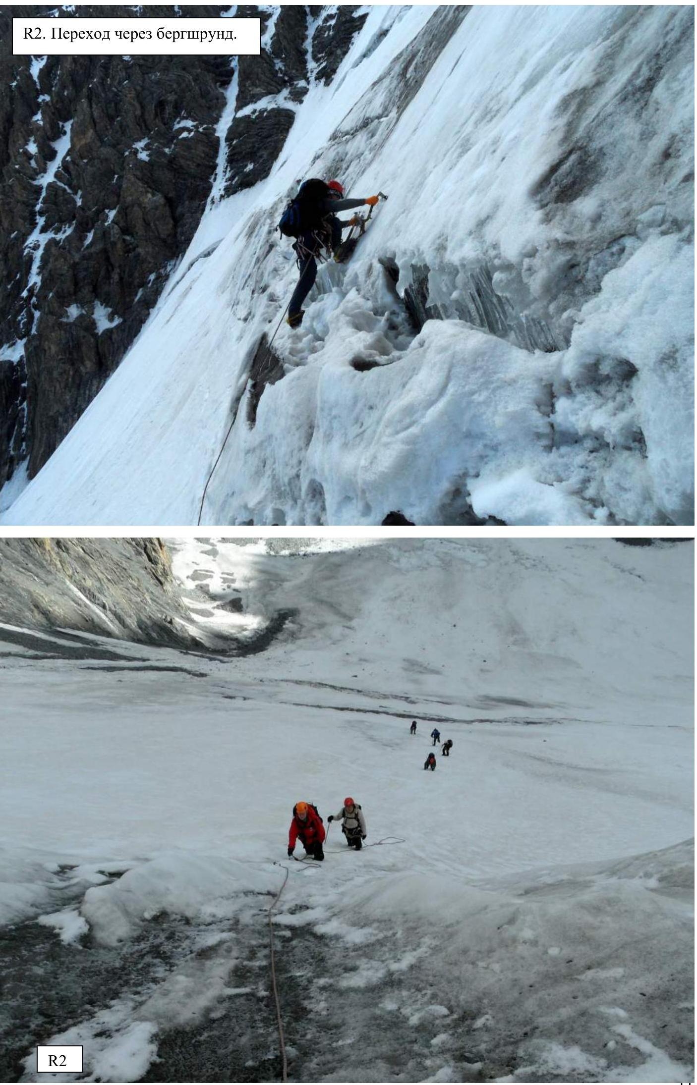
9:40 — crossed the bergschrund alternately. Started hanging fixed ropes.
13:15 — reached the ridge.
13:40 — further movement along the ridge was simultaneous-alternating.
16:15 — reached the summit.
19:00 — descended along the 3B route to Aktash overnight stay.
Description of the route by sections and time breakdown.
5:00 — departure from the camp at “Pup Sel'skogo” overnight stay.
7:50 — approach to the glacier under the start of the route.
8:40 — start of simultaneous movement in rope teams.
9:40 — crossed the bergschrund alternately. Started hanging fixed ropes.
13:15 — reached the ridge.
13:40 — further movement along the ridge was simultaneous-alternating.
16:15 — reached the summit.
19:00 — descended along the 3B route to Aktash overnight stay.
The line of movement for ascent was chosen trying to stick to a not very pronounced ice rib, running approximately in the middle of the slope. This was done due to the high risk of rockfall along the sides of the icy slope. As soon as the sun lit up the rocks, stones began to melt and fall immediately. Both single stones and in whole series. It is also recommended to pass the lower gentle part of the glacier as early as possible and as quickly as possible.
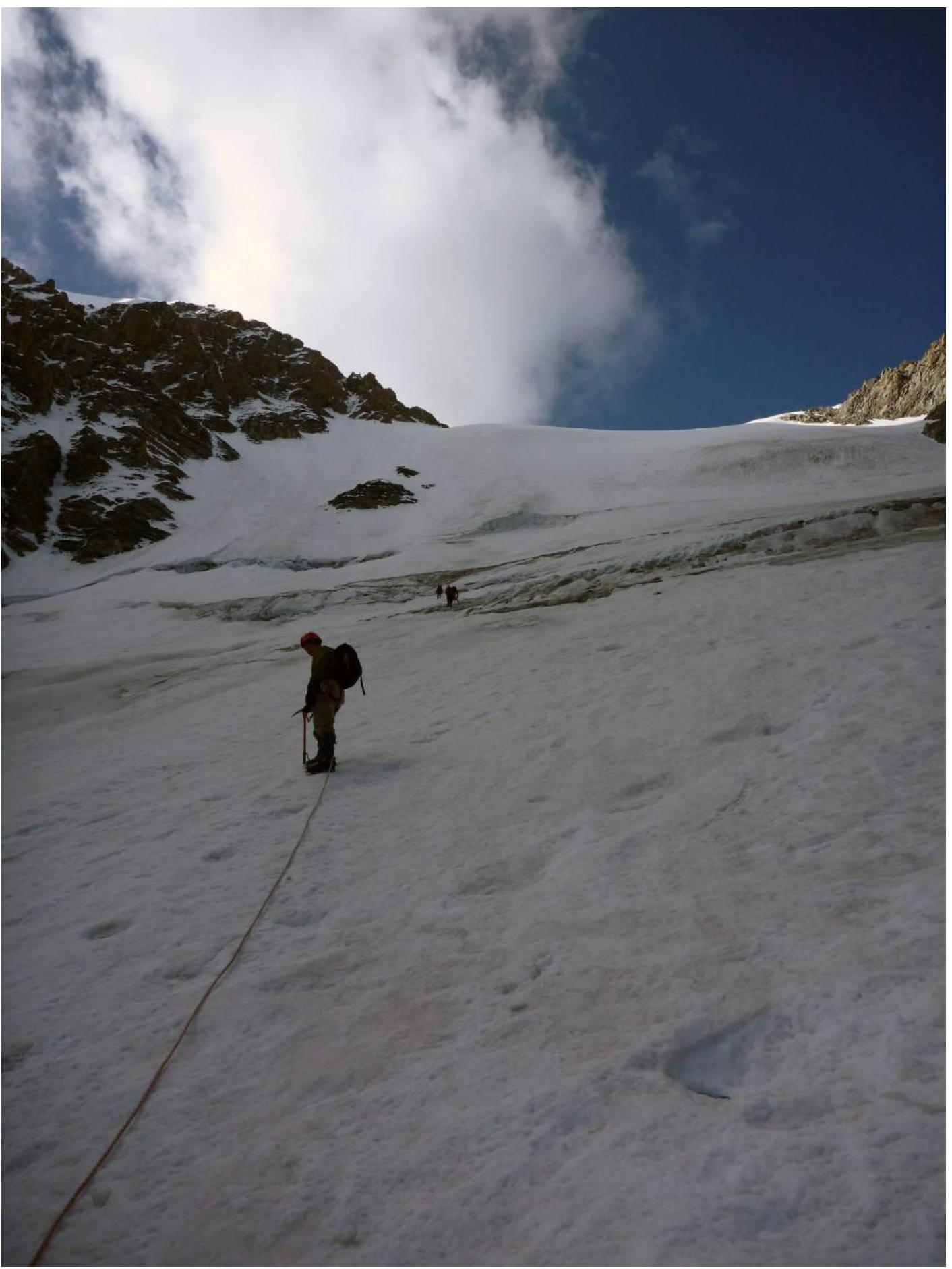
- R1: 10–30°, 300 m, II, snow-ice slope, simultaneously.
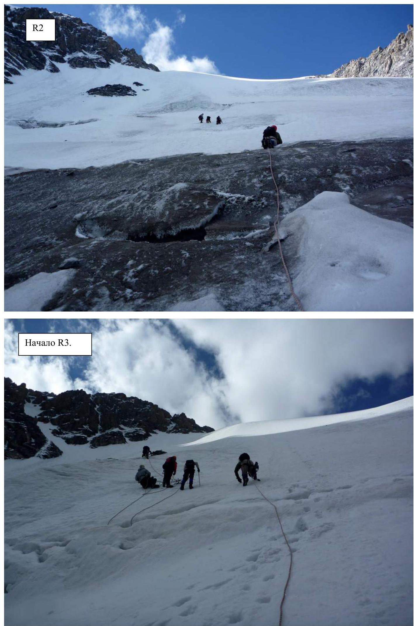
- R2: 40°, 300 m, III, snow-ice slope, simultaneous-alternating. Crossing the bergschrund.
- R3: 45–55°, 100 m, IV, icy slope, fixed ropes.
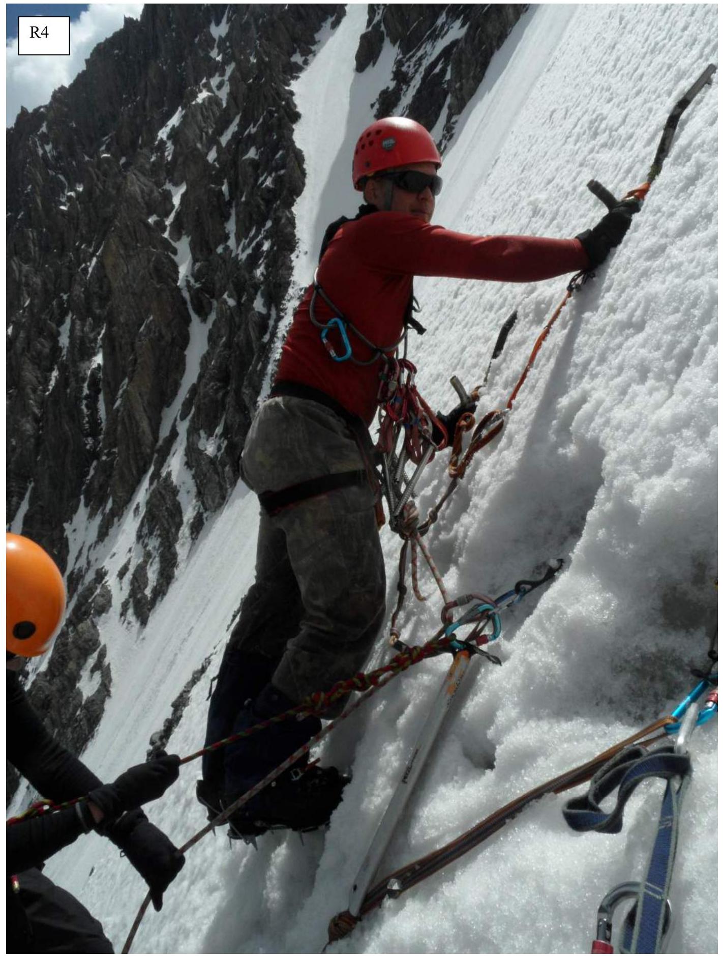
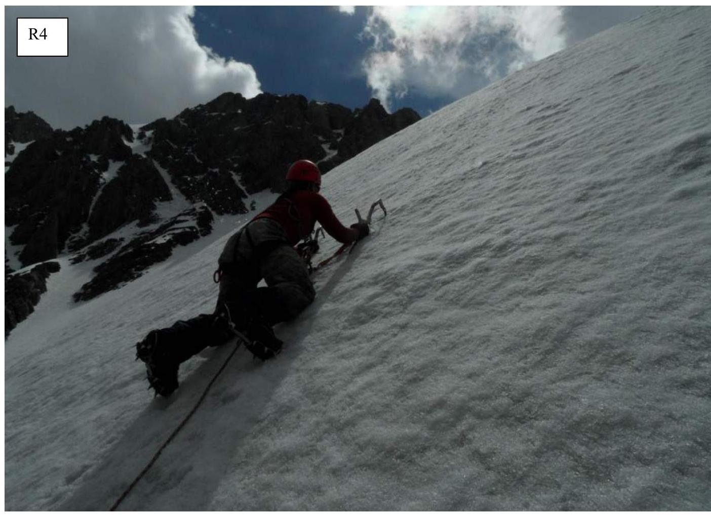
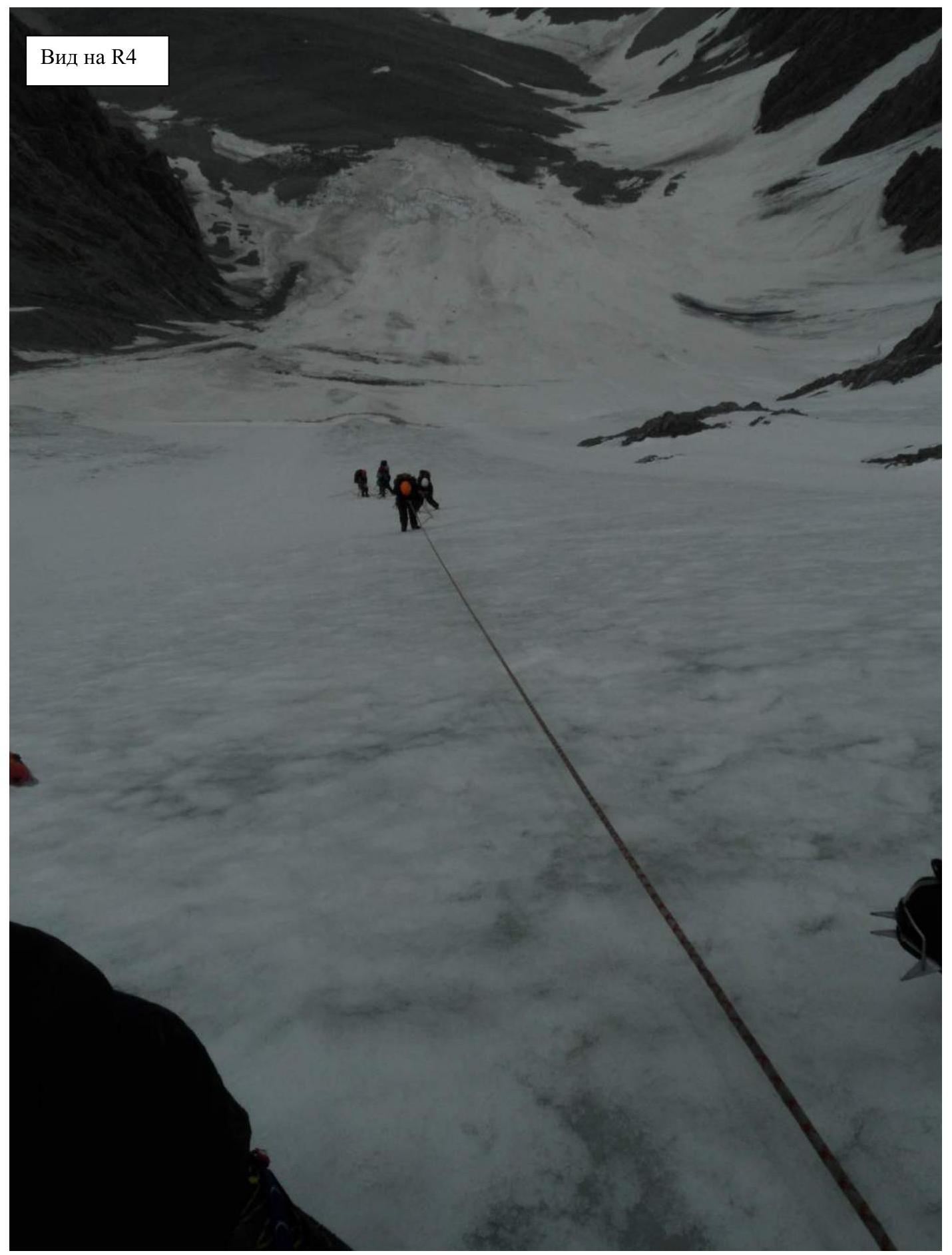
- R4: 60°, 150 m, V, icy slope, fixed ropes.
- R5: 70°, 100 m, V, icy slope, fixed ropes.
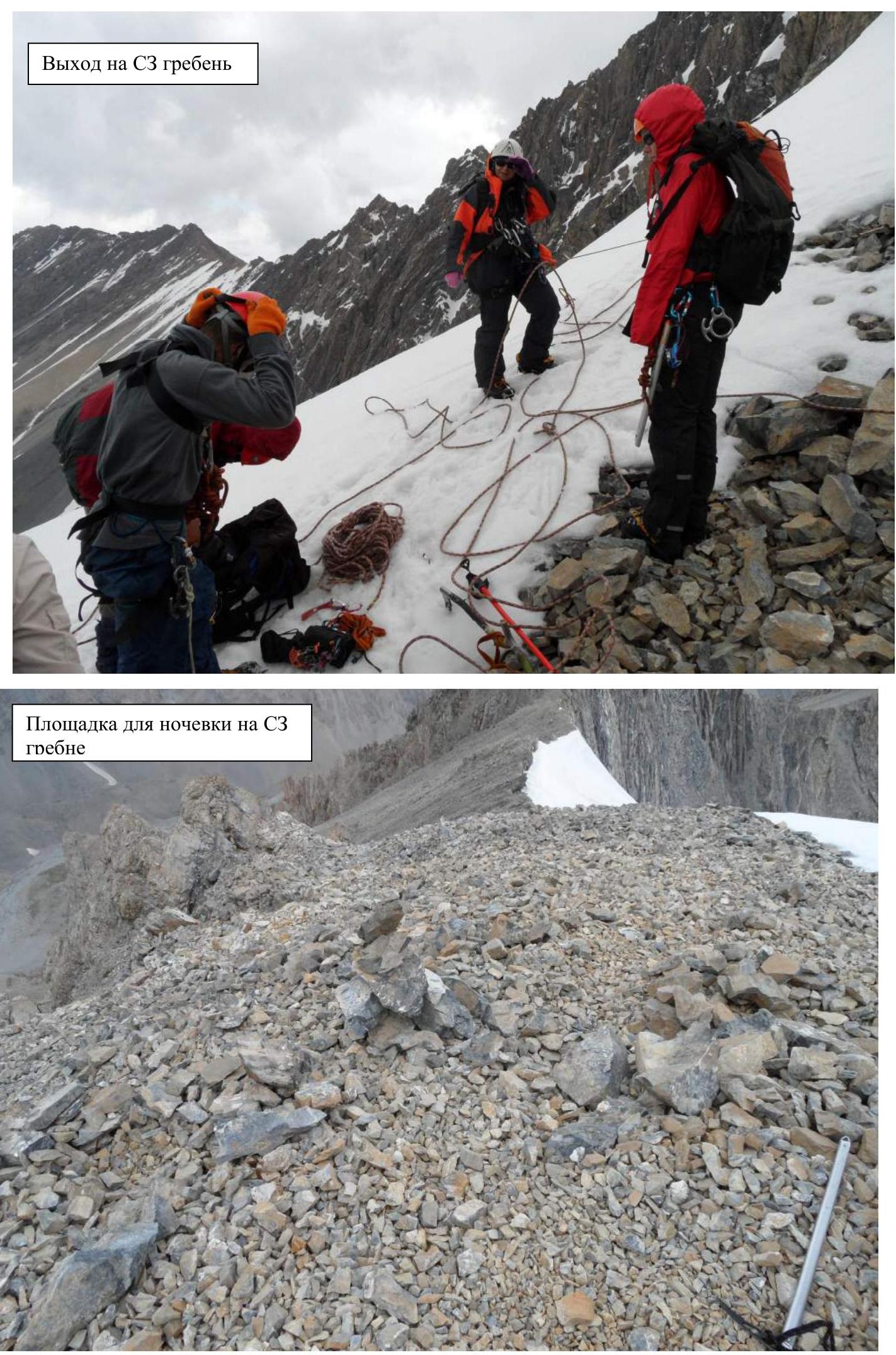
- R6: 40–35°, 100 m, III, snow-ice slope, simultaneously. Exit to the NW ridge. Control cairn and overnight stay site.
- R7: 30°, 200 m, II, scree ridge.
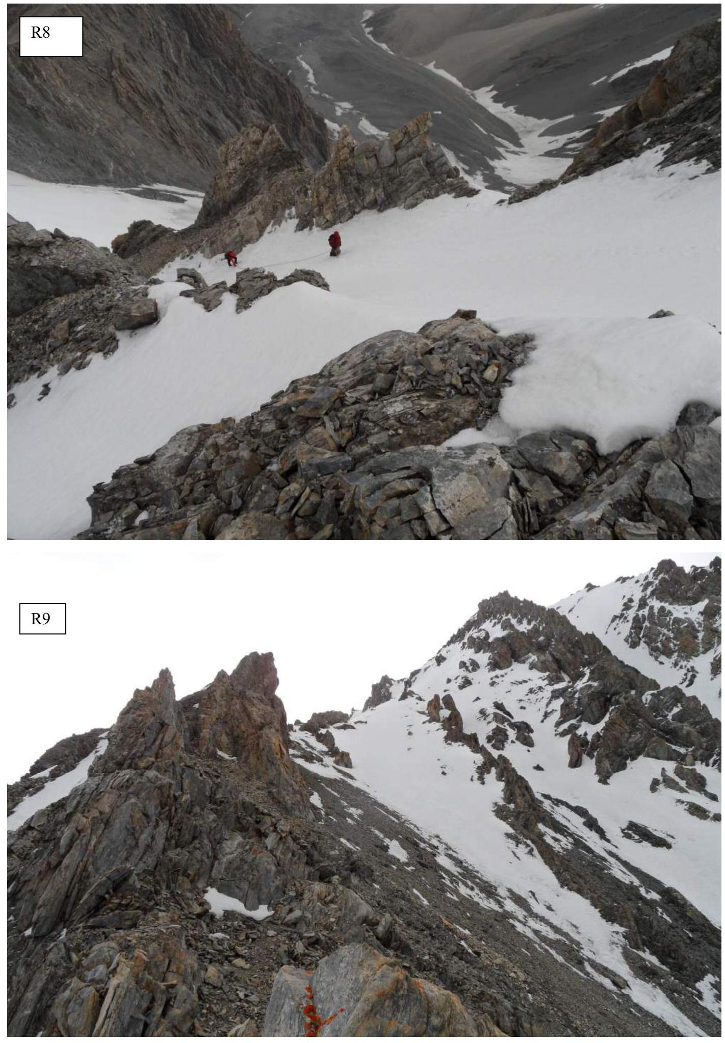
- R8: 60–70°, 150 m, III, snow-ice ridge, simultaneously.
- R9: 30–50°, 300 m, II, simultaneous movement along the rocky ridge along the gendarme.
- R10: 30–20°, 200 m, II, simultaneous movement along the scree ridge.
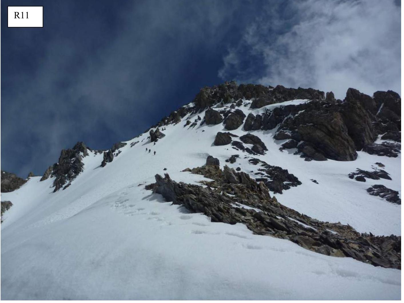
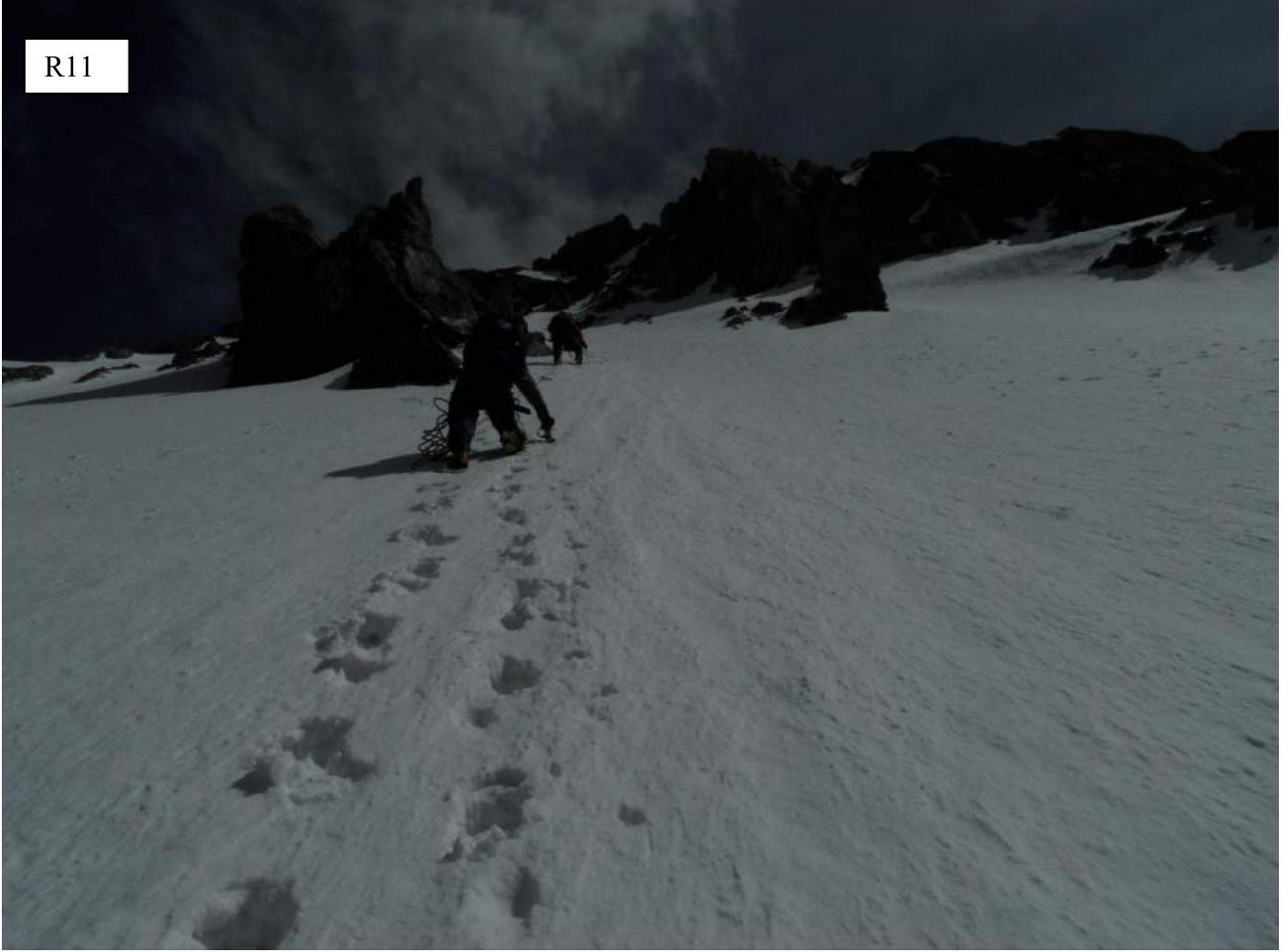
- R11: 45–65°, 300 m, III, snow-ice slope, simultaneously. Exit to the northern ridge.
- R12: 45–90°, 80 m, III, rocky ridge, alternately.
- R13: 15–30°, 100 m, II, snow-ice slope, simultaneously.
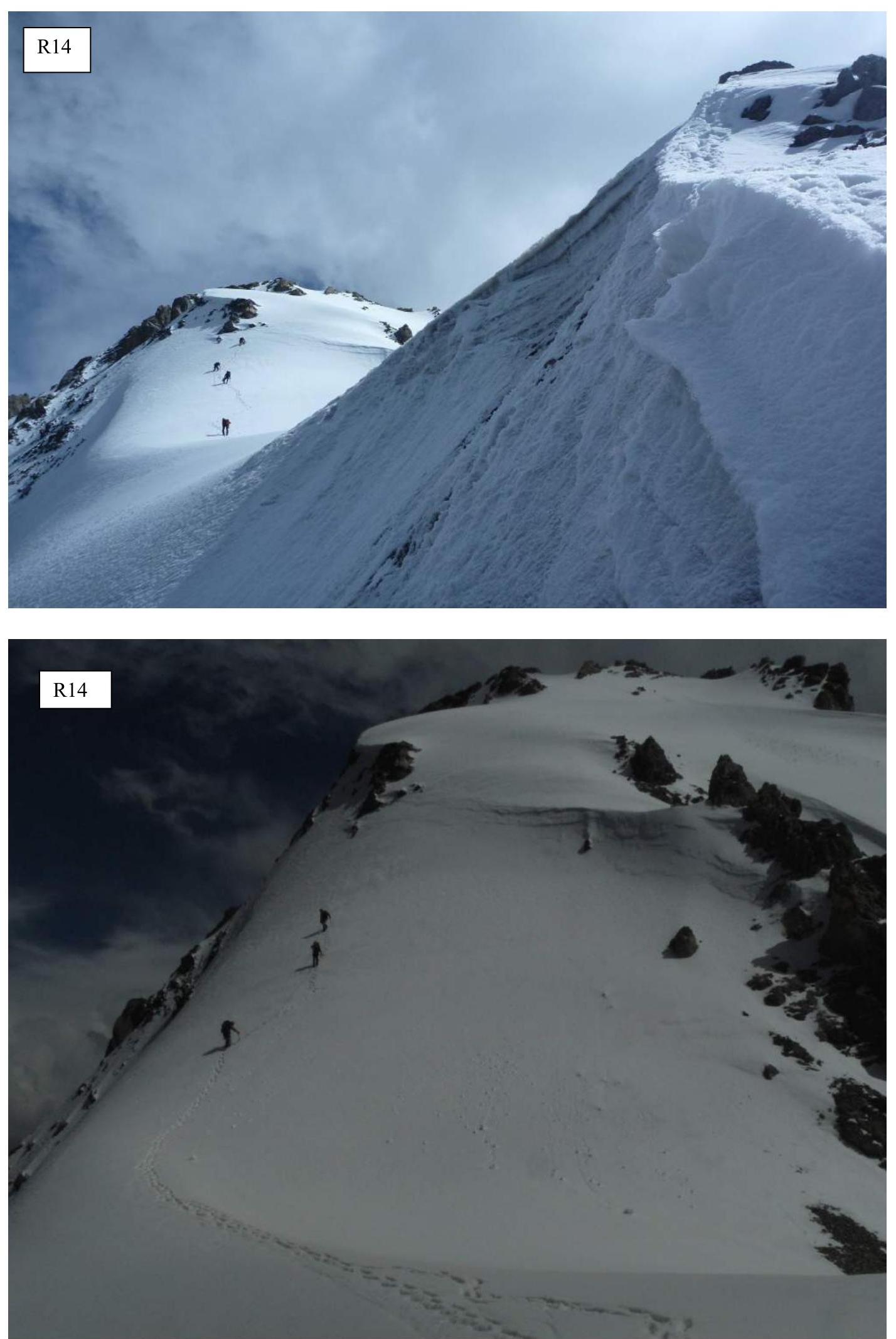
- R14: 70°, 40 m, IV, icy slope, alternately.
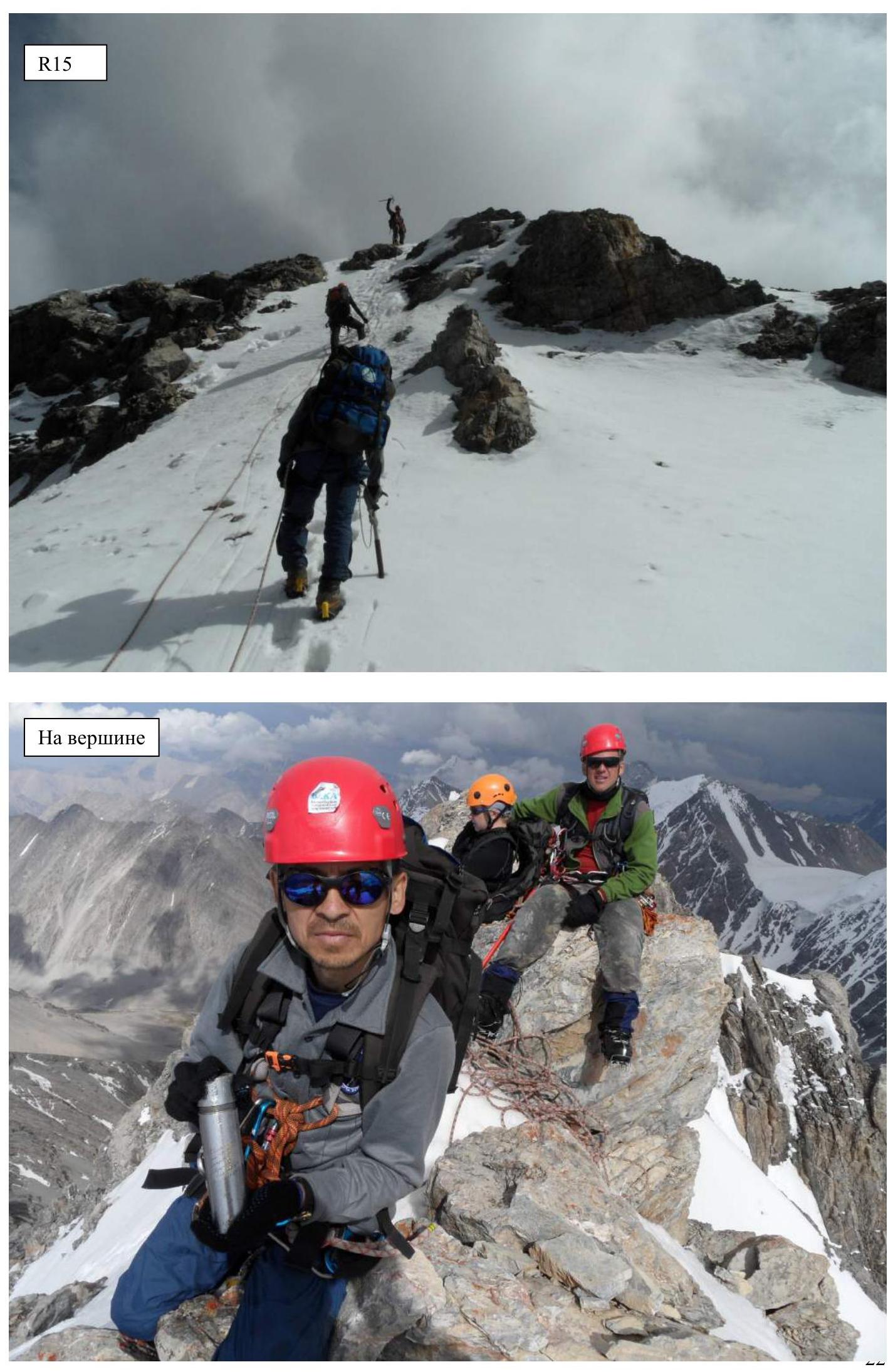
- R15: 30°, 50 m, II, snow-ice slope, simultaneously. Exit to the summit cairn.
Exit to the NW ridge. Control cairn and overnight stay site. Exit to the northern ridge. Exit to the summit cairn.
Photos of route sections
View of the ascent along the valley along the Urtalik glacier.
View of the western wall of the northern ridge and the start of the route along the icy slope.
 R1.
R1.
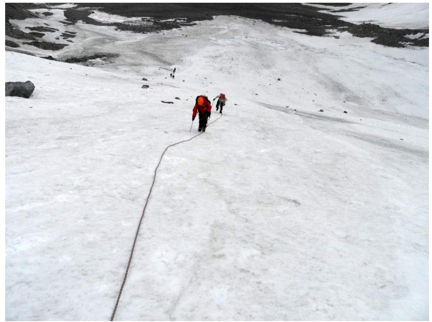
View from R1 to R2.
 R2. Crossing the bergschrund.
R2.
R2. Crossing the bergschrund.
R2.
 R2.
Start of R3.
R2.
Start of R3.
 R3.
R3.
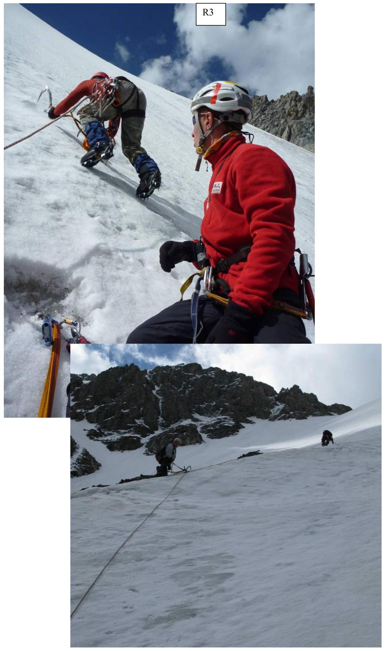
R3.
View of R3.
 R4.
R4.
Exit to the NW ridge.
 Overnight stay site on the NW ridge.
R8.
 R9.
R9.
R11.
R11.
 R14.
R14.
R14.
R14.
R15.
On the summit.
 R15.
On the summit.
R15.
On the summit.
 On the summit.
 Possible descent routes are marked in red. Our group descended along the 3B route.
