
ASCENT DOCUMENT
- Ascent category — technical
- Ascent area — Pamir-Alay, Kollektor Ridge — spur of the Alay Ridge.
- Peak 4450 m. As proposed by the first ascenders, it was named Peak Arzanov in honor of Albert Ishkhanovich Arzanov, the first head of the training department at the "Dugobi" alpine camp. The route follows the right edge of the western slope.
- Proposed category difficulty — 3B
- Route characteristics: Height difference — 950 m Average steepness — 45° Route length — 1200 m
- Total climbing hours — 9430 min
- Pitons hammered: rock 23 (0), chocks 6 (0)
- Number of camps on the route — none
- Ascent participants: Sungurov S.V. — 1st category — Leader Gura Yu.I. — 1st category — member Lebedev O.V. — 2nd category — — « — Kovalenkov N.I. — 2nd category — — « —
- Coach — Altaisky I.P., instructor 2nd cat., Candidate Master of Sports
- Date of departure on the route — Aug 11, 1986 return — Aug 11, 1986
- Organization — Branch of AUSB "Dugoba".
 www.alpfederation.ru↗
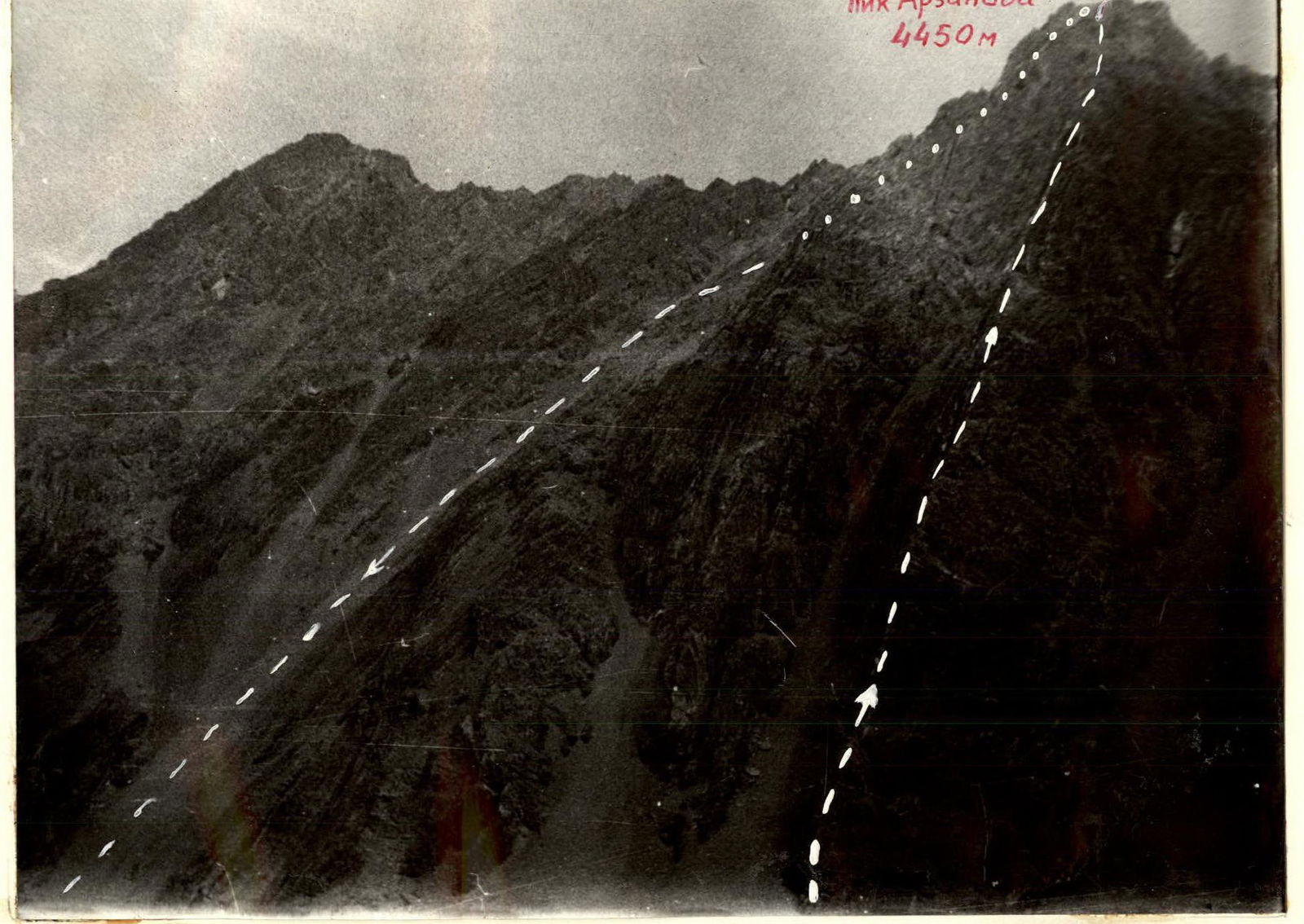
General view of Peak Arzanov 4450 m with the ascent route on the right edge of the western slope.
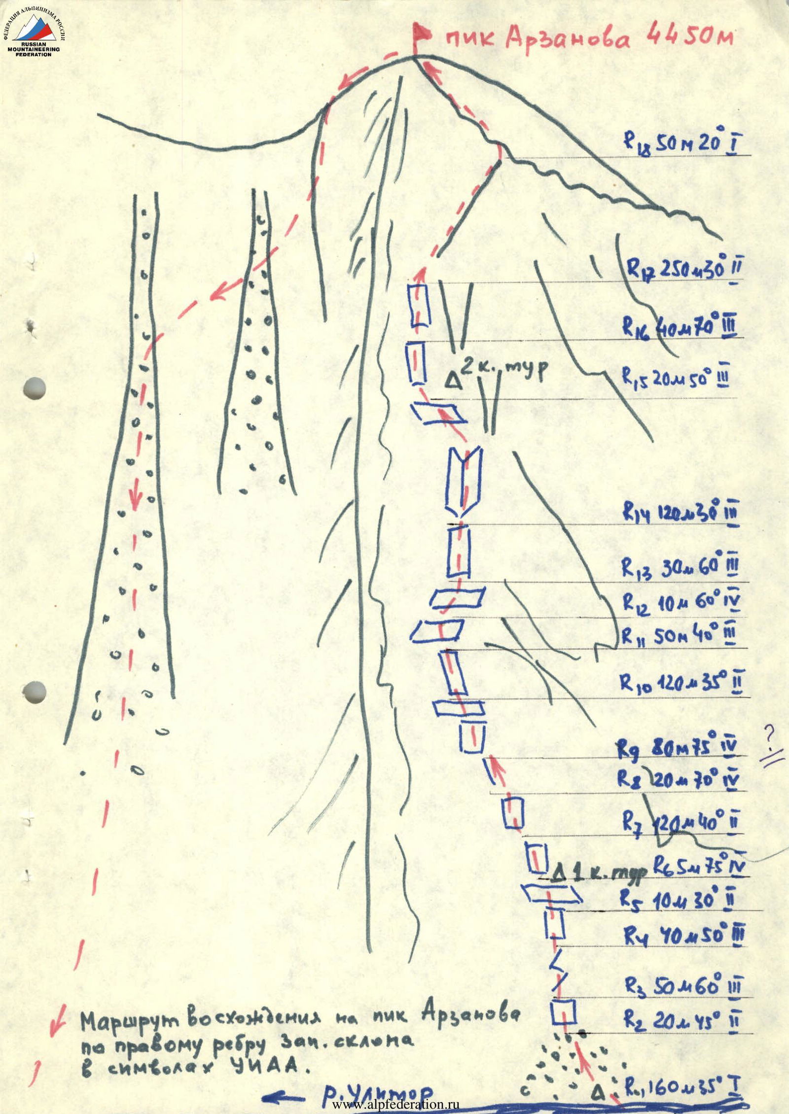
Ascent route to Peak Arzanov via the right edge of the western slope in YUAA symbols.
Brief description of the approach to the route.
From the "Dugoba" alpine base, follow the left orographic side of the Dugoba River to the turn into the Ulytor gorge (to the first confluence) — 2 hours. Cross the bridge and move along the Ulytor gorge on the left orographic side of the Ulytor River to the Edelweiss meadow (1 hour), then up the gorge past the Ganda Kush peak (1.5 hours). Peak Arzanov (4450 m) is located between the Ganda Kush and Geologov peaks. Overnight on the meadow opposite the peak. In the morning, ford the Ulytor River across the stones. The entire approach from the "Dugoba" alpine base takes 4.5 hours.