
REPORT
On the First Ascent of Chongtash East Peak (4553 m)
from the north, 2B category of difficulty
1. Climbing Passport
- Climbing area: Jamantau Ridge, Inner Tien Shan
- Peak name: Chongtash East (4553 m, N 40°54.994′, E 74°5.810′ (WGS 84))
- Route name: "through the Gates", from the north
- Category of difficulty: proposed 2B
- Route nature: snow-ice
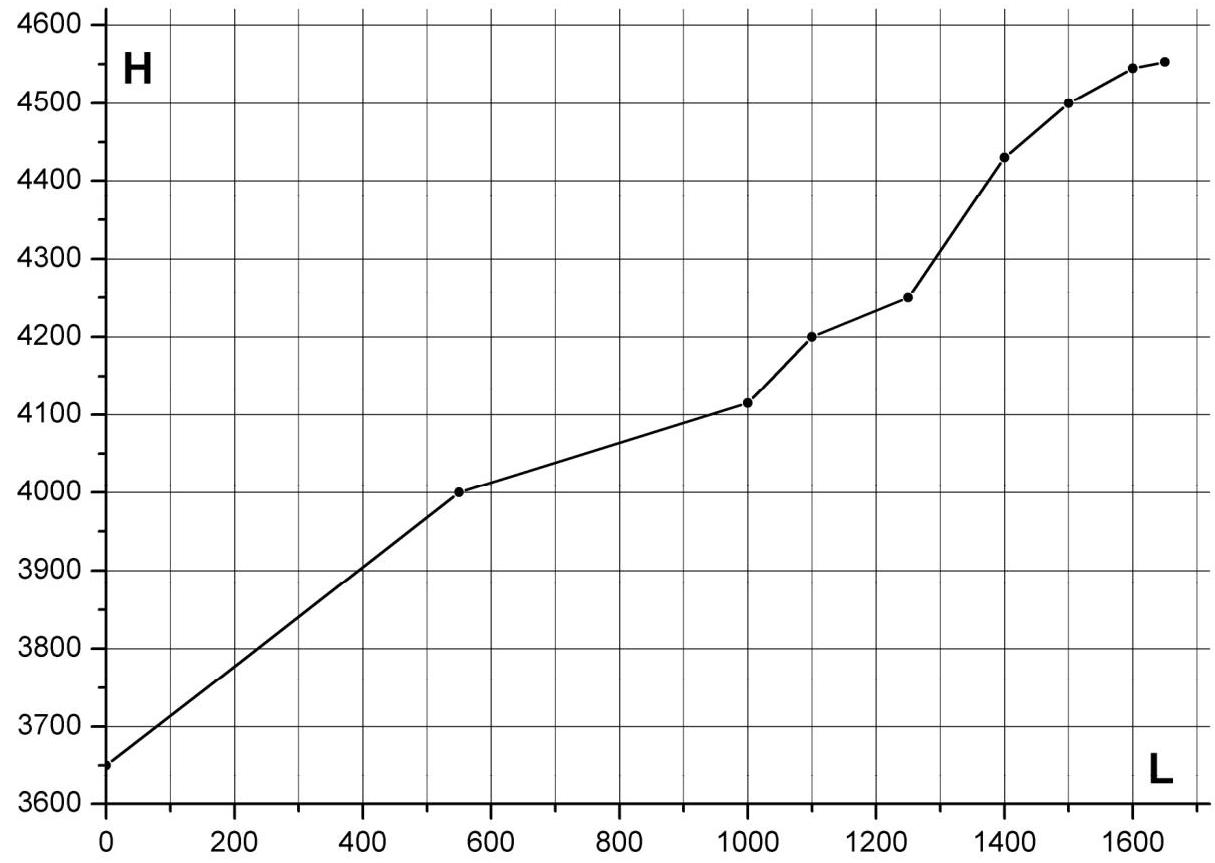
- Route elevation gain: 900 m (according to GPS readings). Route length: 1600 m. Average slope: 30°. Six rope lengths of firn/ice up to 50°, AI1–2.
- Equipment used on the route: Pitons used on the route: rock – 0, ice – 8, including ITO – 0. Drill-in anchors (stationary, removable) were not used. Ice tools: Petzl Arcteryx, Cassin Mirage.
- Approach to the route: at 4:30 am on July 5, 2007. Summit ascent: at 10:00 am on July 5, 2007. Return to camp: at 3:00 pm on July 5, 2007.
- Team's total climbing hours: 10.5 hours.
- Team leader: Dmitry Shapovalov, 1st sports category (sports tourism)
- Team members: Dmitry Martynenko, 2nd sports category (mountaineering), Ekaterina Ananyeva, 2nd sports category (sports tourism)
- Coach: Nikolai Goryunov (Kiev), Master of Sports (mountaineering).
The ascent was carried out without prior route processing
2. Area Description
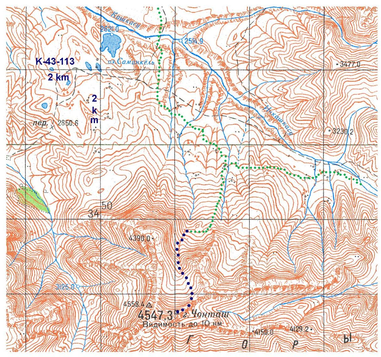
Chongtash peak is located in the western part of the Jamantau Ridge, Inner Tien Shan, in the Kashkasu (Ichkashkasu) river valley, not far from Saman-Kel Lake. The Jamantau Ridge is oriented in a latitudinal direction and is bounded to the west by the Arpa river canyon, to the north by the Ala-Buga river valley, to the east by the Karasu river valley, and to the south by the Arpa depression. The ridge peaks reach 4700 m, while the surrounding valleys are about 3000 m high, and the technical part of the routes usually starts above 3600 m. The ridge is composed of strong Paleozoic sedimentary rocks with a very rough surface. Along with the potential for rock climbing, the northern slopes of Jamantau have significant glaciation, and ice slopes with steepness up to 75° allow reaching the peaks from the north side via routes of moderate complexity. There are virtually no glaciers on the southern side, only rocks and endless scree that spill into the valleys from bank to bank.
The climate of the area is pleasant and not very hot. It is determined by the ridge orientation and the prevailing direction of air mass movement. Moist air from the Fergana Valley moves from west to east, is blocked by the Fergana Ridge mountains, and falls as heavy precipitation on its western slopes. The Arpa depression receives little precipitation, and its climate is very dry. Air masses fly over it without stopping, gathering as they approach the slopes of the Jamantau and At-Bashi ridges. Due to these residual clouds, precipitation is observed on the Jamantau slopes in mid-summer on approximately 30% of days.
One can approach the Jamantau Ridge from either Naryn or Osh (Osh – Jalal-Abad – Kaldzhama Pass – Kazerman). To the north, along the Ala-Buga valley, through the villages of Jergetal and Dürbeljin, there is a good asphalt road from Kazerman to Naryn. From this road, dirt roads lead to the Kashkasu river, and from here, one can approach any peak of West Jamantau within a day, including Chongtash and Kamas peaks. It is also possible to approach the ridge from the east, from the Naryn – Torugart Pass (Chinese border) highway. A dirt road, accessible to Niva and other 4x4 vehicles, branches off this highway and goes through the Turasu Pass to the confluence of the Turasu and Jamandavan rivers. From this road, one can approach any peak of East Jamantau within half a day to a day, including Kremen and Ak-Jaman peaks. It is also possible to reach the Arpa valley from the Naryn – Torugart Pass highway. All these routes are used by the Kyrgyz to reach the pastures surrounding Jamantau. Their yurts are not uncommon in the lower parts of the ridge during the summer season.
The Jamantau Ridge has no climbing history. The first photographs of the ridge were taken during water trips along the Ala-Buga (Arpa) river. The first trip and the first ascents were made by a group of sports tourists from Kiev led by Shapovalov D.S. in the summer of 2007.
The name Jamantau ("Bad Mountains") comes from the actual impossibility of crossing the ridge despite its apparent ease. The valleys, wide at the mouth, lead to wide saddle-shaped passes. However, in the middle of the valley, they typically narrow, becoming steep canyons, and bypassing them on horseback is often simply impossible. This happens on both sides of the ridge. To date, there is only one non-category pass through the ridge – Jamandavan.
3. Area Map
4. Technical and Tactical Actions of the Team
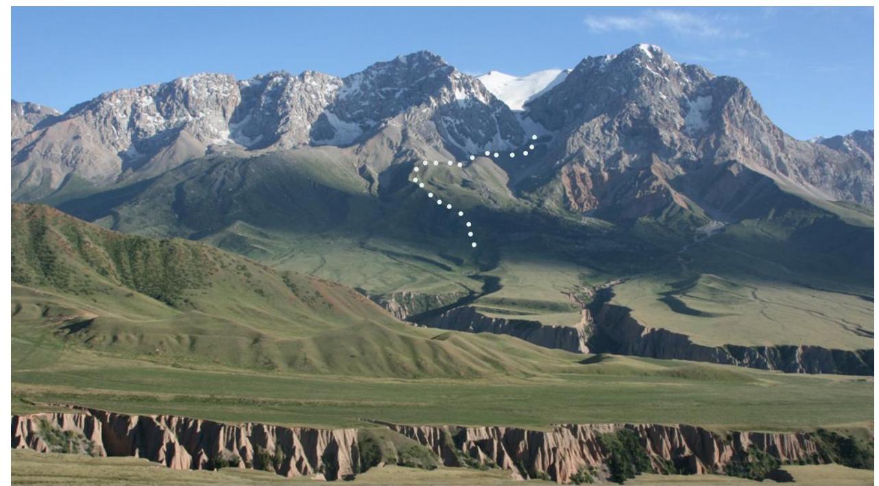
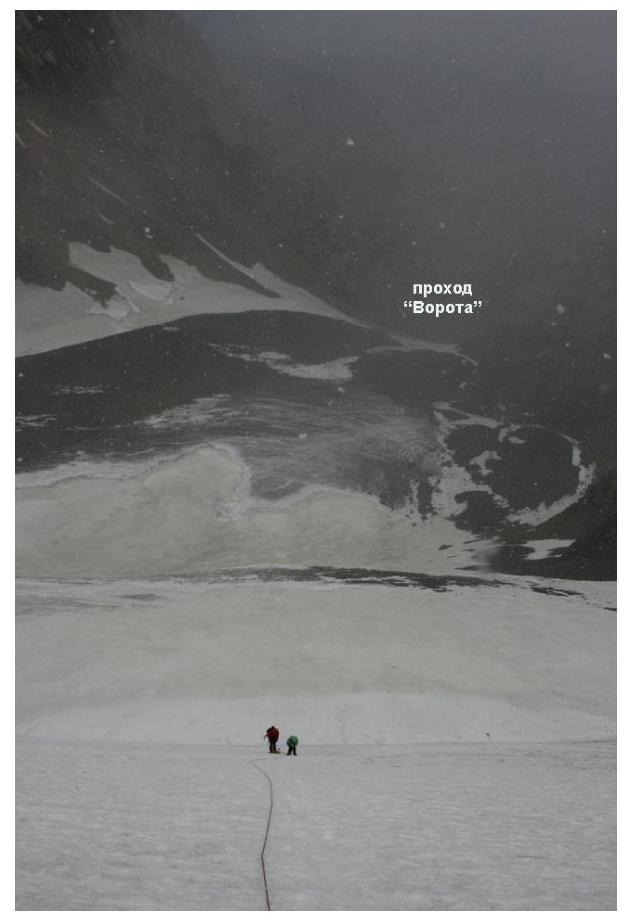
On July 5, 2007, we made an acclimatization ascent to Chongtash East peak. The day before the ascent, the weather was clear. The departure was planned early, as it was not entirely clear what technical obstacles we would face during the ascent. In the morning, the weather was good, but by afternoon, it deteriorated: everything was covered in clouds, and snow began to fall. The technical part of the route can be divided into 2 parts: practically from the camp (N 40°56.033′, E 74°25.853′), a gentle glacier "Gates" began; it is desirable to pass it in the morning to avoid rockfall. We moved simultaneously in crampons and with ice axes. Then there was a horizontal glacier. After it, the second part: a snow-ice ascent up the northern slope of the peak:
- 2 ropes of 40° ice – alternately;
- a gentle section – simultaneously;
- a bergschrund;
- 4 ropes of 50° ice – alternately. Above, the slope becomes snowy and gentler. Then we moved simultaneously along a wide snowy ridge (near the summit – scree), and reached the summit. The descent was via the ascent route.
5. Photopanorama of the Area
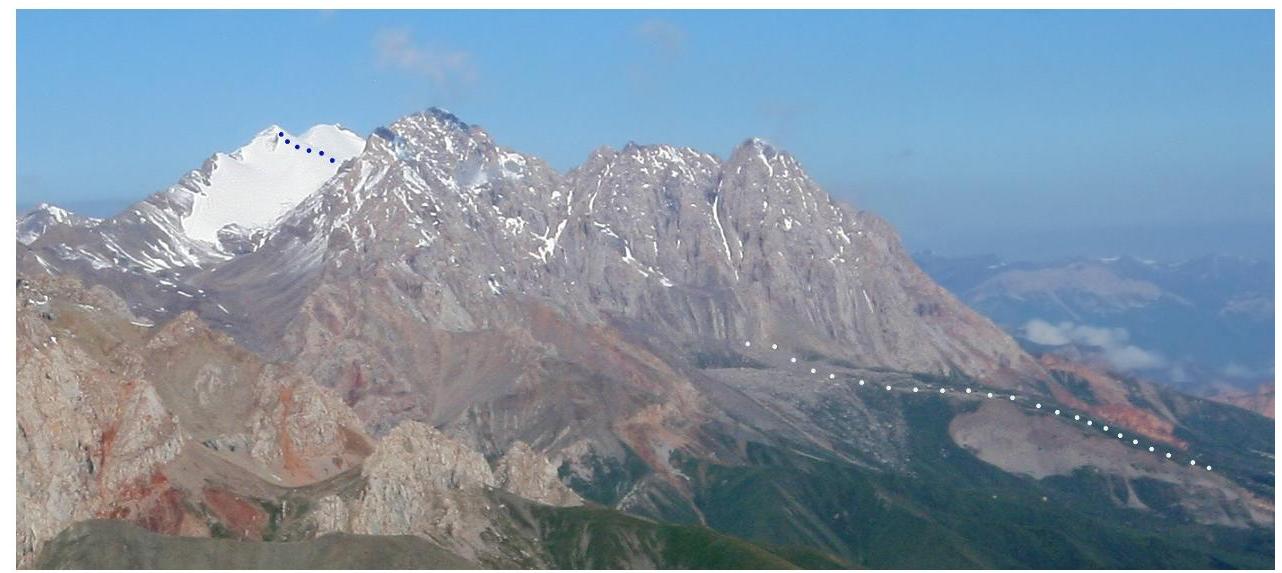
- Chongtash massif, view from the east, from the NPT pass. The snowy peak on the left is Chongtash East. Taken on July 8, 2007.
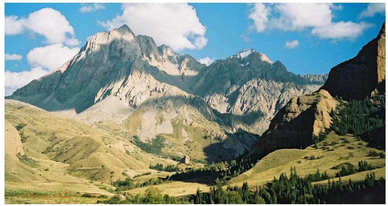
- Chongtash massif, view from the north. The snowy peak in the background (left) is Chongtash East. Taken on July 3, 2007.
- Chongtash massif, view from the northwest, from the Kyz-Korgon stream valley. Taken in September 2005, photo by P. Medvedev
6. Route Photograph
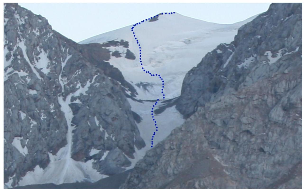
- View from the north. Taken on July 3, 2007.
7. Drawn Route Profile
8. Photo Illustrations
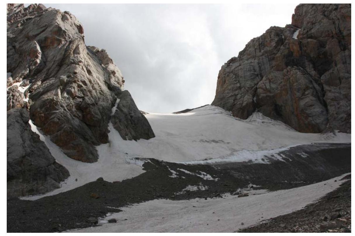
- Lower part: "Gates". Taken on July 4, 2007.

- Snow-ice ascent. Second stage. Taken on July 5, 2007.
- In the upper part of the route
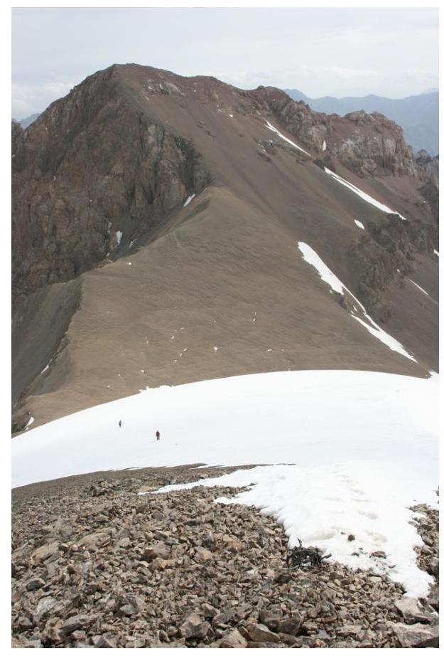
- Pre-summit ridge. Taken on July 5, 2007.

- Summit. To the west (right) – Chongtash West. Taken on July 5, 2007.
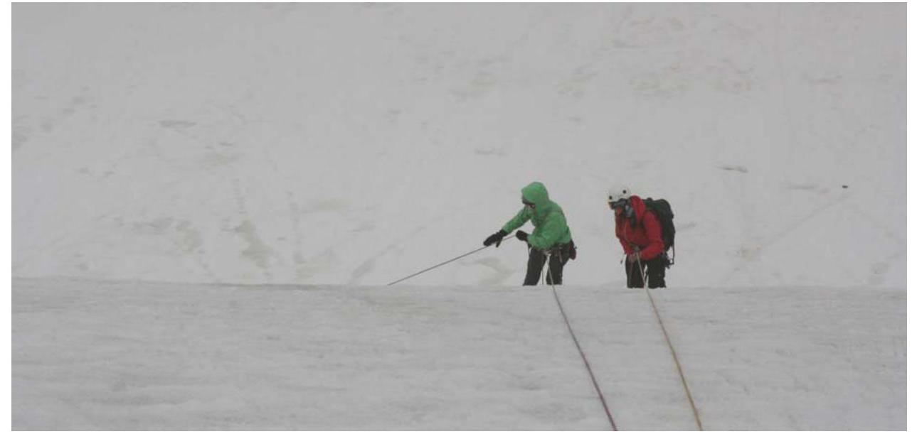
- Rappelling on descent. Taken on July 5, 2007.
10. Links
Report on this trip, passports of the passes and peaks completed: www.tkg.org.ua/node/8888 ↗
Ascents in neighboring ridges:
- Torugart-Too
- At-Bashi
Source: www.alpinist.com/doc/web07f/newswire-kyrghyzstan-exploration-jamantay
Risk Onsite, issue 32. Article by Dmitry Shapovalov. Report compiled by D. Martynenko, photographs by D. Shapovalov
Comments
Sign in to leave a comment